Mount Brice
January 5, 2023
2168m
Skagit River / Manning Park, BC
Mt. Brice is a rather neglected summit even though it’s the tallest in the area, boasting over 800 m prominence. The peak does boast a shear north face but the profile isn’t as iconic as the nearby Shawatum Mountain, and this entire group of peaks are difficult to access and probably see visitors no more than once per several years. The most logical approach is the logging roads system in Shawatum Creek to the south, but those roads were deactivated decades ago and the main Silver-Skagit Road is washed out thank to the apocalyptic storms in November 2021. Rumours had been circulated that the province wouldn’t plan to re-open the road in a couple years. The Silver-Skagit trail from Sumallo Grove was also damaged by the floods that the river channel had shifted away from the bridge, adding a painful river crossing at the start in addition to possibly a million dead-falls. Nobody had hiked that trail since the floods so the condition is unknown. This leaves the northern approach via Eastpoint/Claimstake col to be the only possibility at the moment. This was actually my initial thought about Mt. Brice 7 years ago after snowshoeing Silverdaisy, Claimstake and Hatchethead. Now with the southern access and the west ridge no longer viable options the thoughts went back to this original idea.
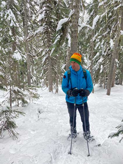
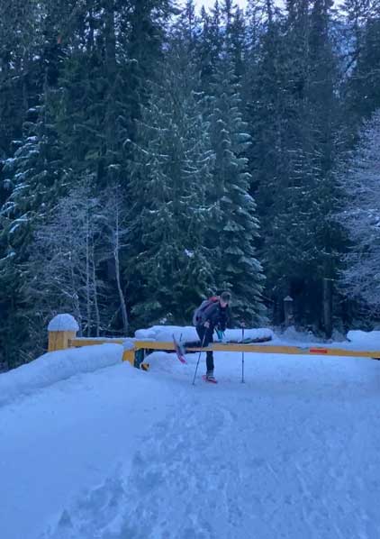
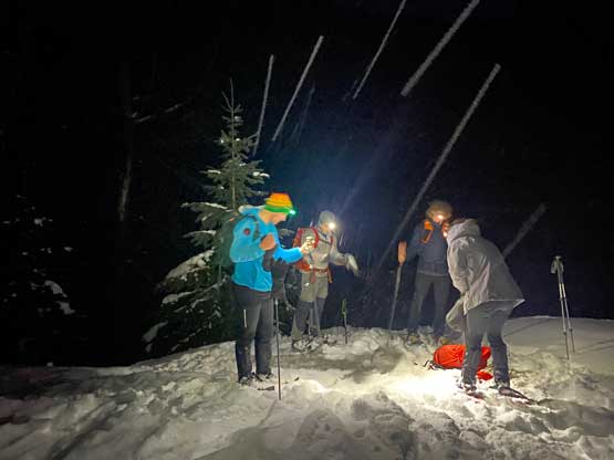
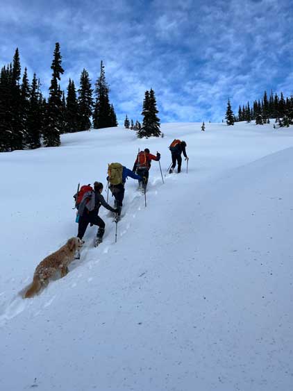
Despite the 500 m elevation loss south of Claimstake/Eastpoint col that must also be regained on the way back, Matt J. had the same idea and recruited a strong group consisted of Elise, Francis and Chris Gulka on Jan. 5th and Elise casually invited me to join. At the moment I was in the transition between two flights on the journey homewards from Ecuador and that was on Jan. 4th. The day before that I was still peak-bagging in Ecuador. It took me an hour or two to determine the feasibility to squeeze all the things that needed to be done in a mere half-day and after making up my mind I pulled the trigger to join. I only had about 2 hours to unpack and repack and I needed to show up at work in the evening, but by 10 pm I did manage to get ready. The 3 hours of jetlag was not on my side as 10 pm in BC meant 1 am Ecuadorian time and I was already exhausted from the lack of sleep in the travelling days. It then took me a while to realize why the alarm went off a couple hours later and that’s why I set 3 separate alarms to make sure I definitely would get up at 3 am. In about 10 minutes I was out and drove eastwards to Abbotsford to meet up with Elise and Francis. Matt and Chris would drive separately and meet us at the Silverdaisy’s trail-head and we all started the plodding at 5:15 am.
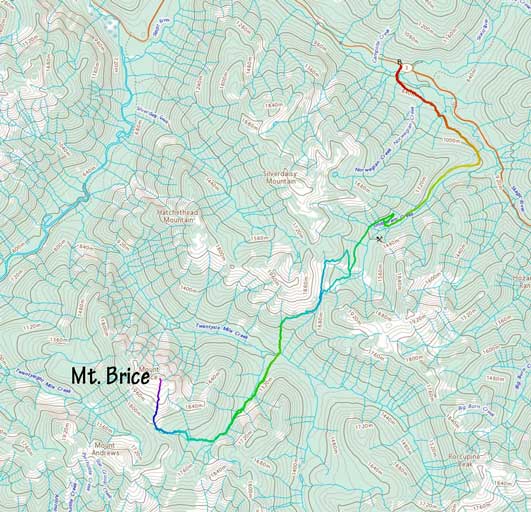
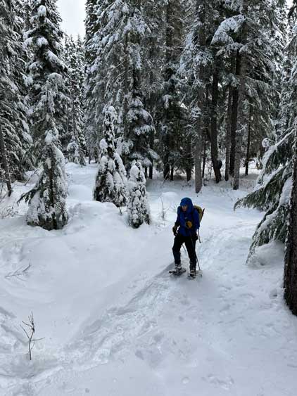
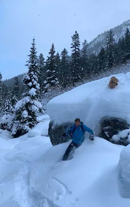
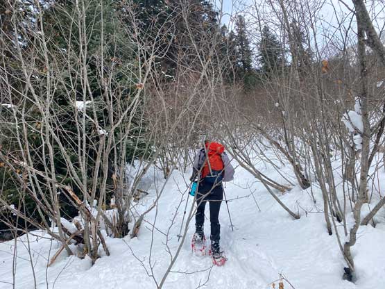
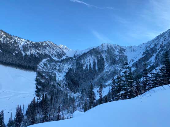
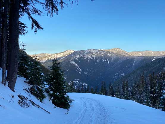
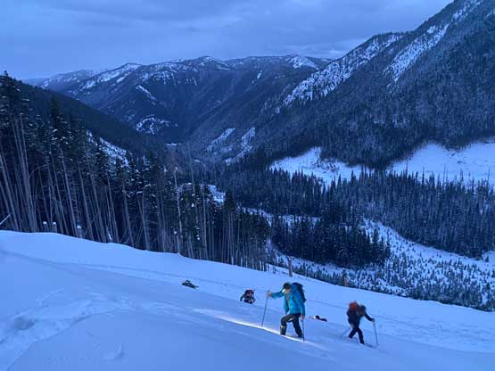
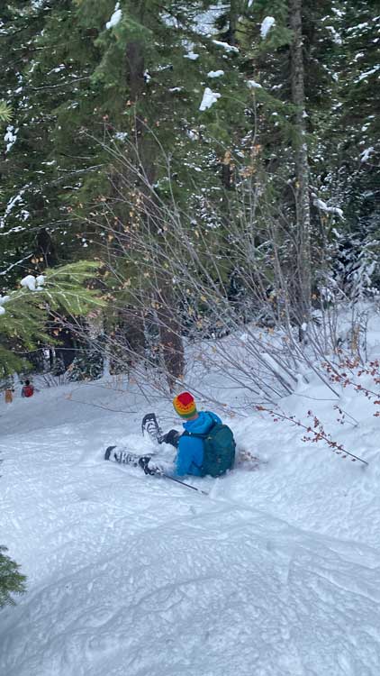
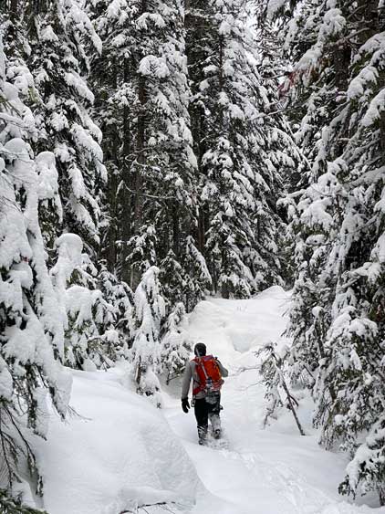
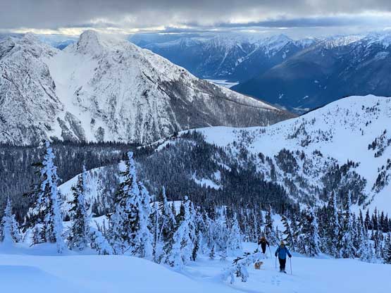
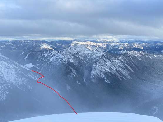
We had just under 10 km of road walking with 900 m elevation gain to Claimstake/Eastpoint col and that’s the first stage of this trip. The plan was to cruise it up in 2 hours with head-lamps on but we were a bit too optimistic. There was no existing snowshoe tracks and the skin tracks were not as supportive such that we actually had to break trail on top of the skin tracks. This significantly slowed down our process. There were two sets of switchbacks on the road and we did take short-cuts on both sections, but we later learnt from the skin tracks that it’s possible to bypass a chuck of the upper roads by shooting straight towards the col. I did not come up with that idea so opted to follow the road and the final 1-2 km was completely trackless. Without doing much lingering at the col we followed Matt’s lead descending the old and deactivated (but snow covered) road due SW wrapping around the south face of Claimstake Mtn. The road came to an abrupt end after losing about 100 m elevation and then we started the straight-down plunge into the depth of Twentysix Mile Creek. The initial stage of the plunge was extremely steep but then we merged into a alder-chocked chute. Chris G. and Matt went far ahead to scout out the route and the rest of us only needed to follow the tracks. The bushwhacking was actually far easier than expected but I opted to play cautiously as I didn’t want to poke some of those alders into my eyes. The 5 of us eventually grouped after hopping across the creek at the bottom, and that’s the end of the second stage of this trip. By this point the biggest unknown (the descent) was over and the mission’s on.


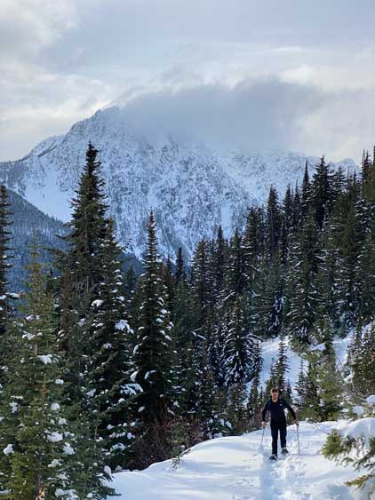
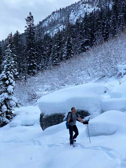
The original plan was to follow the NE-E Ridge system but that required a kilometer-long side-hill traverse from the spot that we crossed Twentysix Mile Creek. None of us realized that so about 10 minutes later we found ourselves deviating from the path we planned, but then I went back to the maps and proposed that we should aim to ascend through the valley/creek instead. The snowpack wasn’t thick at this elevation but seemed to be adequate enough to cover the bushes. After formulating a new plan we began to ascend/traverse the climber’s left (east) side of the creek/valley and didn’t merge into the creek until at least 1 or 2 kilometers later. The travelling was overall fluent without major obstacles. The creek itself did appear to be too open to travel through, so we continued the side-hilling fashion on the climber’s left side for another 1 or 2 kilometers. Eventually the terrain forced us to descend into the creek and we did some back-and-forth traversing on either side but at this point we were already near the tertiary creek where we needed to trend right (west). Matt and I had been altering the lead up to this point so Francis and Chris took over breaking trail up this tertiary creek. We were now back into the higher-elevation zone so this creek was actually adequately covered so we simply plodded up the middle of it, dealing with only occasional open holes.


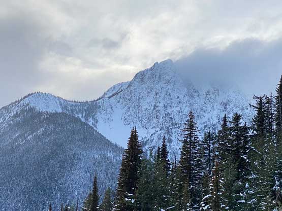
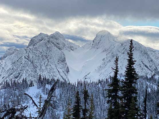
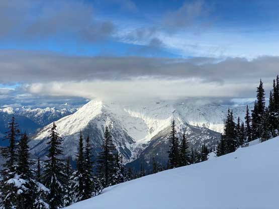
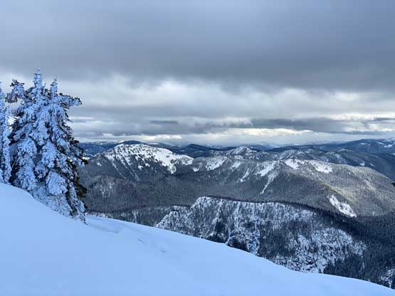
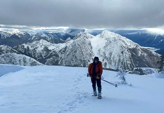
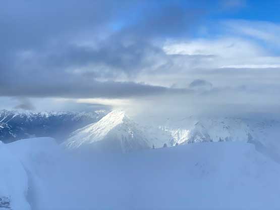
At one point the creek gave way to a forested amphitheatre kind of terrain and that’s where we took a sharp right turn into the forest. A while later we started a diagonal leftwards ascending traverse and this combination successfully bypassed the steep headwall feature. More trail-breaking and one more long-ish steep slope later we were in the treeline zone on Mt. Brice’s gentle south slopes. All we needed now was to simply put one foot in front of another for 300 m more vertical gain. There’s nothing magic about the south slopes as this was the easiest route on Mt. Brice. The original plan of E/NE Ridge system would involve ascending a steep couloir near the top so we somehow ended up bringing ice axes and crampons for mere weight training. This valley/creek approach option actually brought us to the easiest possible route on this peak so all worked out nicely. The only downside was the furious winds in the alpine and an approaching snow storm so we couldn’t linger any longer than absolutely necessary on the summit, despite the gorgeous views.


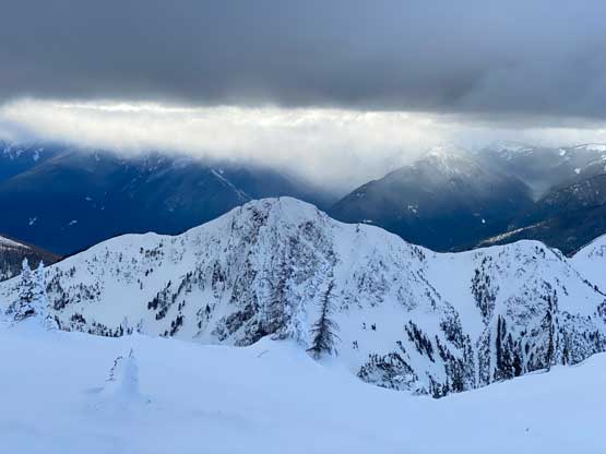


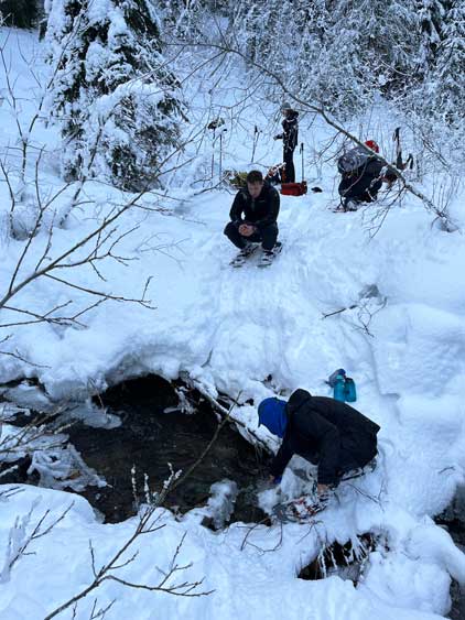
We then immediately plunged down the south slopes in a furious pace following Matt’s lead and the next break was at least 500 vertical meters down in the forest. The snow storm didn’t last long so we could see more and more patches of blue skies above. After re-committing to the descent we plodded all the way back to Twentysix Mile Creek to take the next break. The creek had running water so 4 of us loaded up the water bottles before committing to the 500 m elevation regain up to Eastpoint/Claimstake col. Needed to say, this stretch was the worst of this whole trip as our legs were already exhausted after gaining near 2000 m elevation. I needed one additional break in the middle of this regain but after forcing in some brownies I got a second wind of energy. The rest of the descend plodding that 10-km road was as boring as one could expect but at least we tried really hard to take some short-cuts. We followed a rather obvious set of skin tracks to bypass the entire upper road system and took more short-cuts on that lower set of switchbacks. It seemed like we might need to use head-lamps again, so I sped up on the final 6 km to beat the darkness and we all succeeded on that. Our round trip time was 11 hours 15 minutes covering over 32 km distance and 2300 m elevation gain and we earned ourselves a huge restaurant meal in Hope on the way back home.