Mount Terry Fox
July 14, 2012
2640m
Valemount, BC
Mt. Terry Fox is in the western range of Canadian Rockies near Valemount, about 1 hour drive from Jasper and 3 hours drive from Kamloops. During 2009-2011, I’ve done several lengthy drives back and forth between Vancouver and Edmonton, so Valemount wasn’t new to me. This is a meeting place of three major mountain ranges (Cariboos, Monashees and of course, the Canadian Rockies) and also thank to the proximity to Mt. Robson any “taller” peak nearby would guarantee some great views on a clear day.
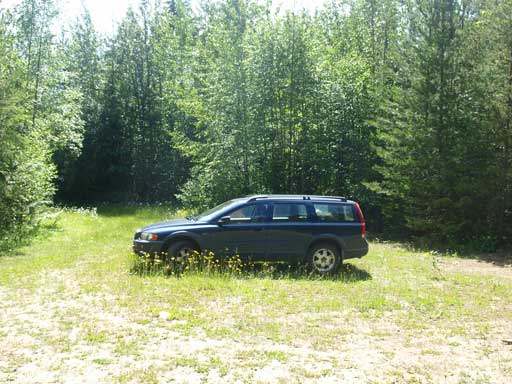
Eric and I had been talking about giving Valemount area a visit for a while and it seemed like the right idea in this past weekend as the weather was good in Valemount, but bad everywhere else. We like the name of Mt. Terry Fox so that’d be our first objective. As for many BC trips, the crux was usually finding trail-head and getting there. The direction is clear: If approaching from Mt. Robson, turn right at Stone Road, and then an immediately left and follow trail signs to the parking lot. However, there were a few other intersections in the maze of logging road system which did not have a trail sign. We just followed the most travelled branch. At the last intersection we took the right fork which was heavily overgrown and ridiculously narrow, but with Eric’s Volvo we did it with no problem.

Mt. Terry Fox standard hiking route
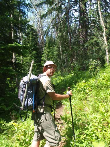
We arrived at trailhead by approximately 11 pm, and slept in car. The mosquitoes were ridiculously crazy. Not exaggerating, you gonna have 100 of them around you if you stop outside your car for 15 seconds… We spent most time of the night swatting mosquitoes, and as a result we probably just slept for 1-2 hours. Horrible… The forecast for Saturday was mostly sunny but the “feels like” temperature was approaching 39 degrees thank to the humidity. That’s terrible for an ascent of 1800 m elevation gain, so we decided to start the ascent by 4 am.
Despite the lack of sleep, we still managed to start with a fast pace. The initial switchback section made me feeling like going back to Vancouver, as the vegetation was pretty much like the coastal region. The trail was a bit overgrown, but generally easy to follow, (though with many deadfalls). Since we started early, we could catch up morning glow on the Cariboos which was a bonus for the trip, but oh man it’s a long grind to eventually get some views, thank to the low elevation starting point in the deep Rocky Mountain Trench.
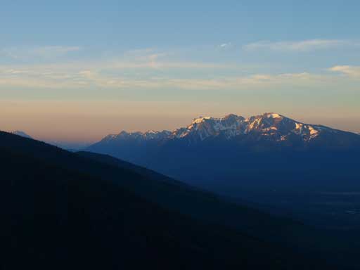
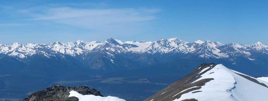
Canoe Mountain and the northern Monashees
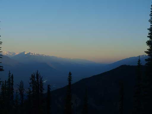
Looking up Rocky Mtn Trench towards McBride
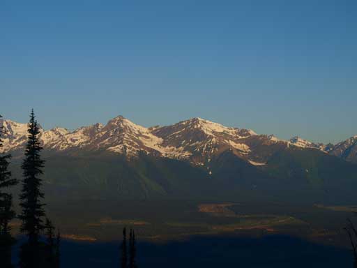
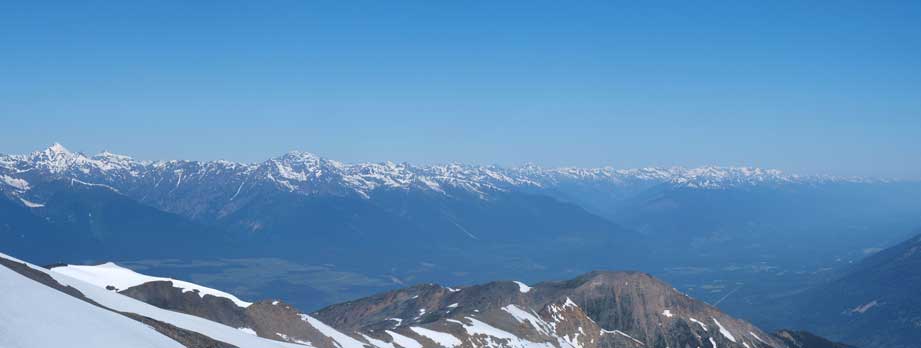
The left peak is higher but unnamed, while the right one is Mica Mountain.
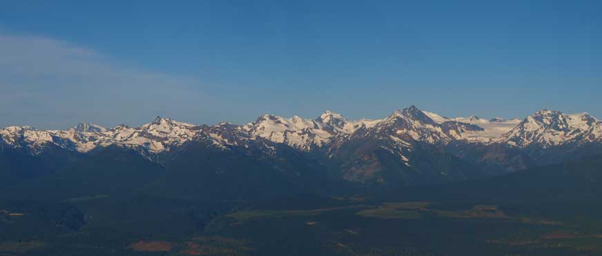
A head-on view of the Cariboos.
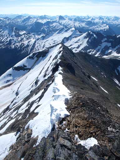
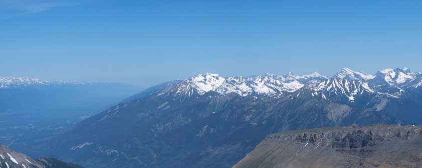
The next section was a tedious, and very foreshortened plod up a forested ridge to treeline.. Again, as we slowly gaining elevation, the view towards the Cariboos got better and better, and at treeline, we could take a full panorama of the Cariboo Mountains. Slogging up a scree slope brought us to a much better viewpoint. From there on, the trail became faint at places. We just pretty much followed the ridge crest to the first false summit.
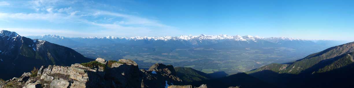
Panorama of Rocky Mountain Trench and Valemount Area.
We had to briefly lose some elevation from the first false summit.
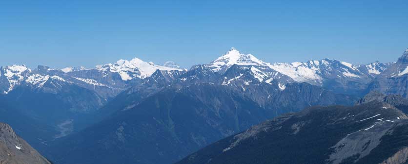
The next thing to do was to slog up a huge grass/talus slope to another false summit where a weather station was built. Really nothing to describe here except for endurance and patience. Once topping out, we were treated with a head-on view of Whitehorn Mountain, Mount Robson and Resplandent Mountain, three 11,000ers. The morning sun was bad for photographing them so I won’t show their photos now. From the weather station, we had to lose about 50 m elevation to a high col before trudging up the next false summit, on talus and boulder fields. Then it was a scenic ridge walk to the true summit. The views were beyond amazing and it was our first time seeing the nearby sea of peaks.
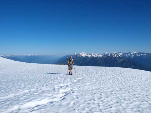
There was still lots of snow on the upper mountain.
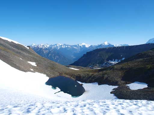
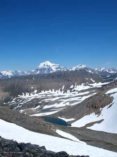
A beautiful alpine tarn
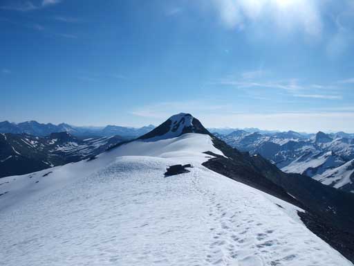
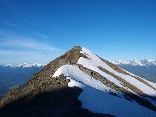
The summit is ahead
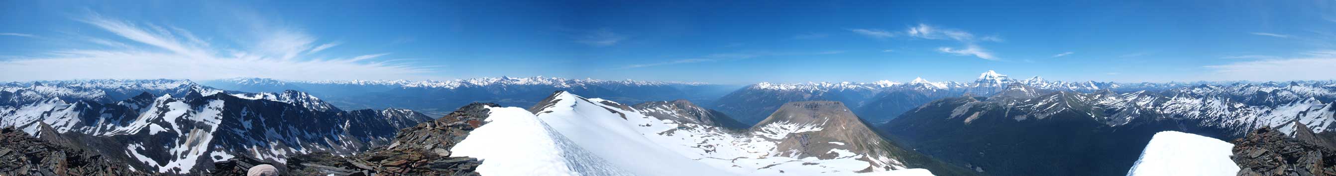
Summit Panorama. Click to view large size.

The distant peaks on the horizon are probably The Ramparts and Mount Hooker.

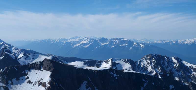
Looking over Selwyn Range towards distant peaks near the Divide
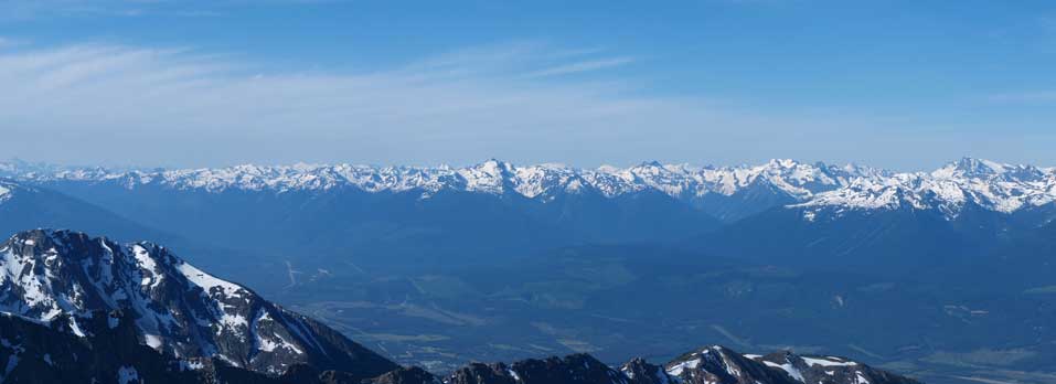
Monashee Mountains
Cariboo Mountains with Mount John Diefenbaker at center
The highest peak in the distance is Mount Sir Wilfred Laurier
More of the Cariboo Mountains
Looking down the other side.
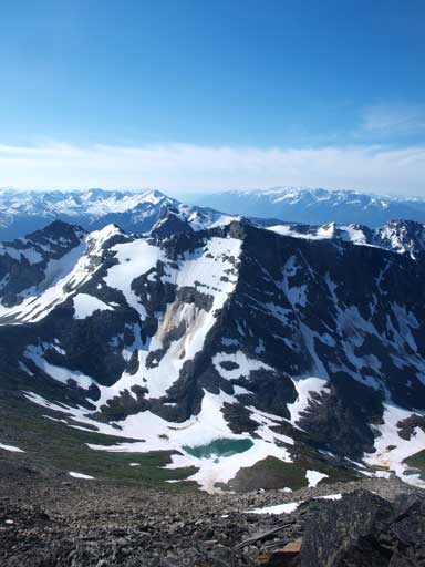
Another beautiful tarn. One of the lower summits in foreground is Swift Mountain.(Not sure which one though)

Summit Register and our entry.
Mount Goslin at center
Mt. Longstaff on left, and Whitehorn Mountain right of center
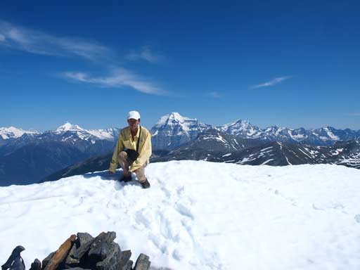
Me on the summit
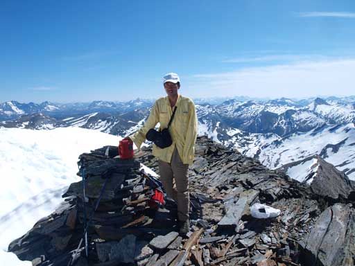
Me on the summit
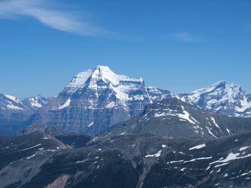
Mount Robson
Due to lack of sleep, we took a nap on the summit. Including the nap, we spend 2 hours on the summit soaking in the views. The descent was far more tedious than anticipated, mainly because there was no loose ground for a scree run. You have to come down step by step, and all on the knees, for a 1800 vertical meters. The heat finally got us after re-entering the trees, as well as the mosquitoes. Terrible… Our descent was actually slower than ascent. By the time we got back to car, it felt like 40 degrees. We soon drove to Valemount for food and cold drink!

The same tarn offers different view than in the morning.
One last look at Mount Robson
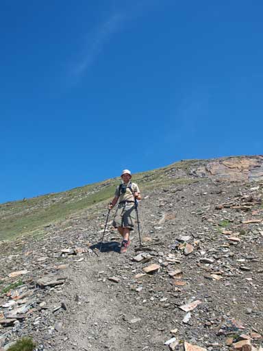
Eric descending the big hill. This part is probably a bit loose for hikers
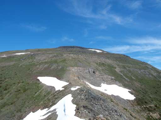
Looking back at this big hill. It’s quite a slog.
Back into the trees. It was a hot day and our progress was slow.
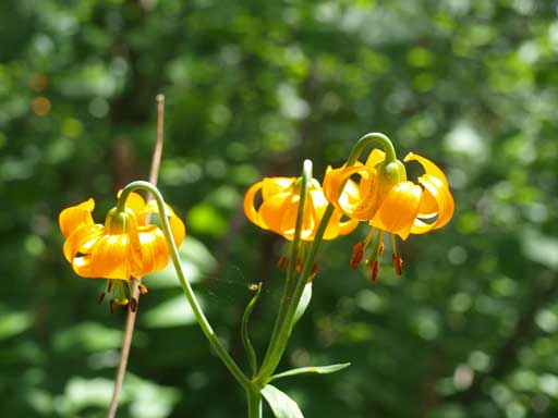
Interesting flowers
Back to parking lot.
At the end of the day, we drove to Kinbasket Lake for quick photos, and then directly to the trail head of Mount Pierre Elliot Trudeau, our objective of Sunday.
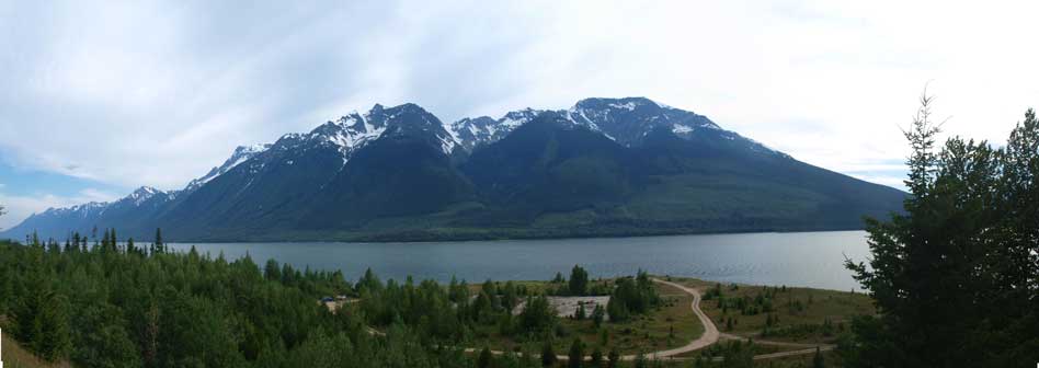
Kinbasket Lake. Canoe Mountain in the background.

Hi. Myself and some friends are planning to hike Terry Fox mid August. Do you recall from your experience, if there is anywhere at the top to comfortably put up a tent? If not, could a bivy scenario work?