Mount Galatea
September 15, 2012
3185m
Kananaskis – Smith Dorrien Valley, AB
While doing the “Big Traverse” one week ago, Neil (Travelin’ Jones) and I were already planning on our next trip, namely Mt. French… However, a snow storm made things questionable. We met at Burstall Pass trail head at 6:45 am and things were far worse than anticipated. Almost all of the 3000+ peaks had snow on especially those around Mt. Sir Douglas. Neil had failed French last year due to verglass, snow, and white-out, and there’s no way to fail it twice. I was not keen on pushing it neither so we finally decided on another nearby high peak, Mt. Galatea – the highest in Kananaskis Range and 8th highest in the entire Kananaskis Country. And if time permitted we had the option to grab Gusty Peak and The Fortress nearby.

Mt. Galatea, Gusty Peak and The Fortress scramble link-up
It was my 3rd time hiking the Chester Lake trail this year and I started to get very familiarize with this area. The hike took about 1 hour and while circumventing the lake on the north side, we paied close attention to a well defined but unmarked trail leading to Three Lakes Valley. Looking back, the morning light shown on Mt. Sir Douglas and Mt. Birdwood was gorgeous but we had to press on.
Morning view of Mount Birdwood
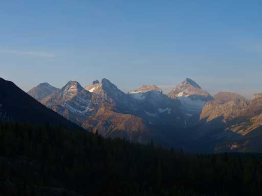
Mt. Sir Douglas et al. in British Military Group
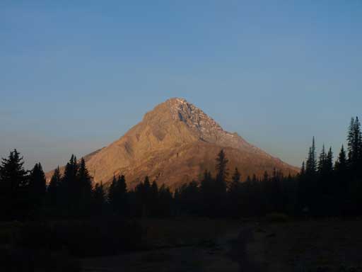
The hike along Three Lakes Valley was scenic but due to the morning sun direction (we were in shade) I didn’t take many pictures. The trail became less and less distinct as we ventured further in the valley, and eventually disappeared in the sea of rubble and boulders. Now we were at the base of our first objective, Mt. Galatea.

Our objective, Mount Galatea

Neil slogging up the lower rubble slope
I would say, following the exact line given by Kane’s book, 90% of the ascent is a rubble slog… I don’t want to describe too much here, as it was all about preserving. We got our first sunlight of the day about half way up the slope, and thus our first break – sunscreen break. After what seemed like eternity, we popped out on the summit ridge. Now, the fun part began. We tried to stick exactly to the ridge crest for as much as we could. The scrambling got very difficult at some places. But the trick is, every “climber’s” section is avoidable on climber’s left side if you don’t mind to side-slope on rubble, so we didn’t had the feeling of doing a serious ascent as all. Soon we made to the summit, 3 hours 20 minutes after leaving our cars. The view would be much better if there was no forest fire on-going… But too bad, we got a smoky summit view.

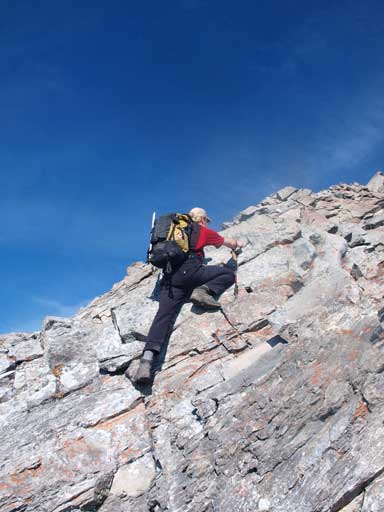
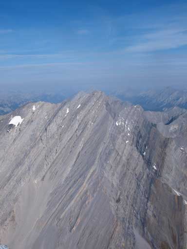
Finally made to the summit ridge, looking towards the summit

The exposure!

Neil ascending an optional challenging step.
More scrambling
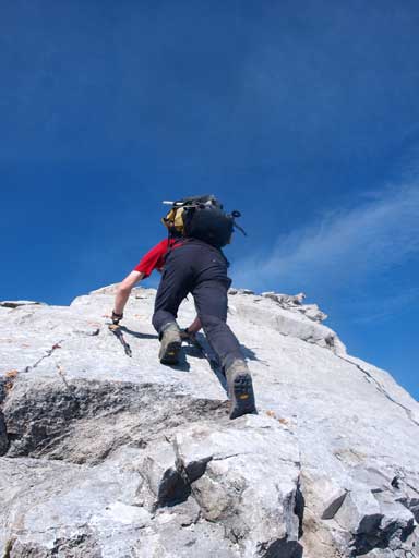
Ascending a slab. This step is very exposed. I didn’t get a photo showing the exposure

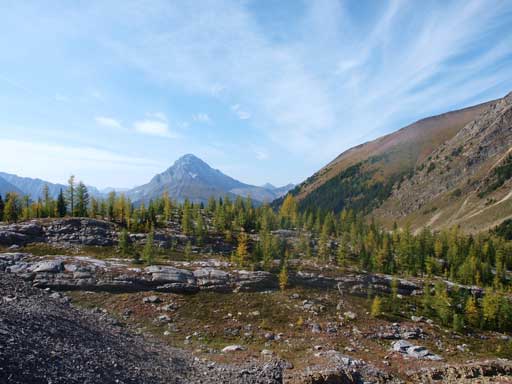
Summit Panorama. Click to view large size
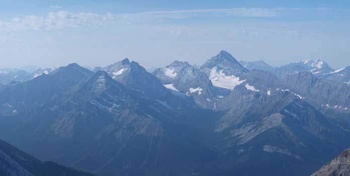
Mount French, Robertson, and Sir Douglas
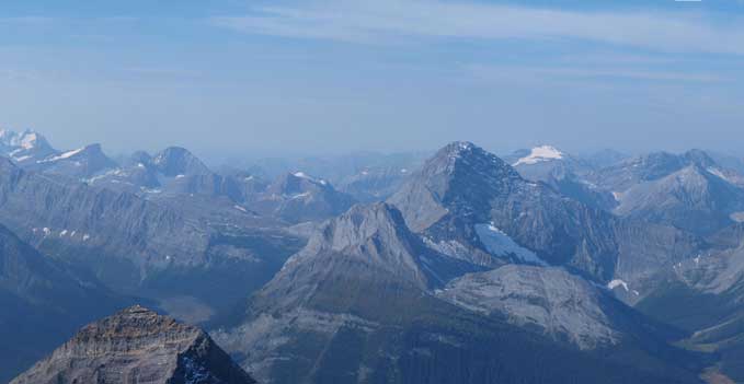
Mount Birdwood
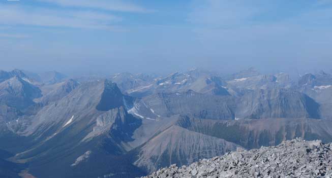
Mount Smuts on left

Mount Assiniboine area
The Tower

Panorama of Lougheed and Bogart area
Summit Register

Me on the summit

Neil on the summit
We did a long summit stay, probably more than half an hour, before heading down. We went around all of the difficulties and simply picked the easiest line on tedious rubble. This way, the mountain is moderate at most. There’s very little scree run so descending was very hard on the knees. After the endless rubble slog, we eventually made back to Three Lakes Valley. Now we could focus on the views.

One of the tarns in Three Lakes Valley
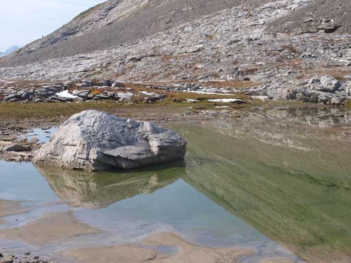
The same tarn as above

Looking back at Galatea
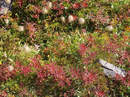
Fall is coming!
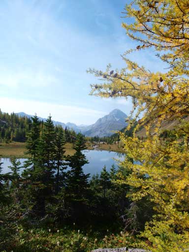
The yellow larches do make scenery more dramatic
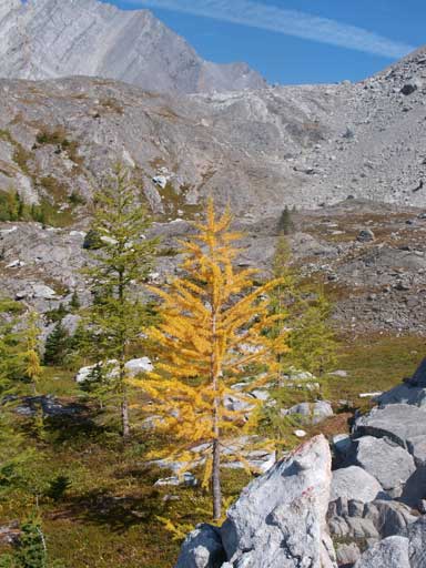
Some larches are turning golden, while some are still green

Another tarn in the Three Lakes Valley

The same tarn
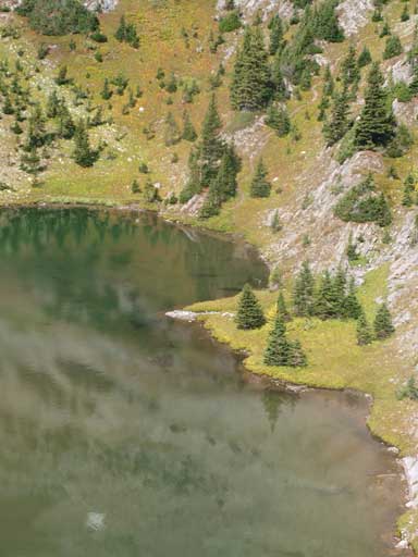
A closer look at this lake/tarn

Another view of this lovely tarn. The peak behind is unnamed.
More of this gorgeous area
We were on schedule of this day and had lots of extra time to kill. The weather was gorgeous and we soon focused on the next objective, Gusty Peak, and then, The Fortress!

it only took you guys 3 and a half hours to summit?! absolute legend, I endured this climb with a layer of fog that seemed to only want to linger on the scramble/summit portion which entailed 5 hours from the parking lot. reading all your logs on the mountains I’ve climbed and want to climb is a huge inspiration to me.