Mount McKirdy
August 24, 2014
2586m
Valemount, BC
Mt. McKirdy is a prominent summit rising more than one vertical mile up from the town of Valemount. It’s not a particularly high summit but does look impressive viewing from the highway below. There’re numerous routes up its summit, all of which are technically easy but physically strenuous. Eric, Ben and I finalized our objective on this one after a successful ascent of Cinnamon Peak. We were looking for an easy outing due to the sore legs and the lack of motivation. We spent the previous night in Cariboo Grill and talked to Patricia (the local mountaineer Reiner Thoni’s mom). She had been up this peak many times and gave us some fresh and very detailed information. Basically she suggested to ignore the “McKirdy summit trail” described in the visitor’s brochure, but rather hiking up the McKirdy Meadoes trail followed by a long and scenic ridgewalk to the summit, overcoming a subsidiary summit locally called “Carson’s Peak”. That sounded perfect for us as we also wanted to have more views.
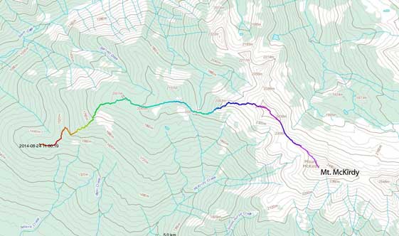
Mt. McKirdy scramble route. GPX DL
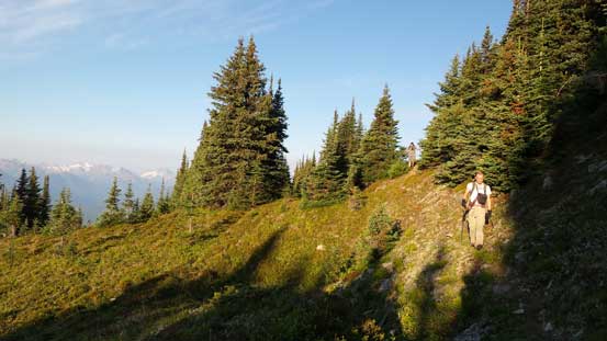
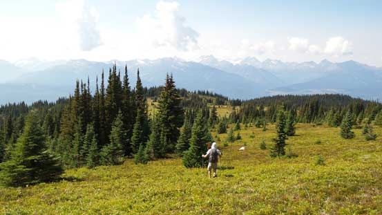
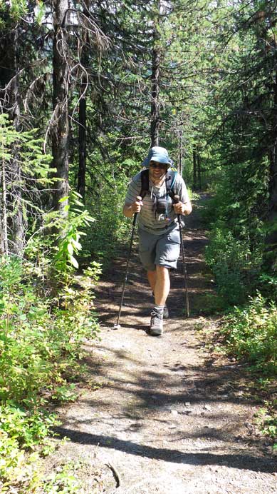
We drove up the approach road, 5 mile road. It’s very steep but not very rough thank to the recent maintenance. It brought us high up the slope above the valley floor, dispatching a great amount of elevation (more than 500 vertical meters) from our summit day. I bivyed outside the car and had a nice sleep. The next morning we woke up at the first light and started shortly after. The hike was on a well defined trail, but instead of going up, we had to lose some elevation first – probably the theme of this route… Once starting going up, we gained elevation steeply up the forested rib. The trail brought us eventually to a junction. The left turn goes towards a YORA lodge and we’d go straight ahead. Upon reaching a hill and meadow area the trail started to peter out and soon disappeared. Thankfully we were able to follow flags and picked up the trail on the opposite side. The view from this meadows was already amazing. Looking back we could see a whole panorama of the Cariboos including the highest – Mt. Sir Wilfred Laurier.
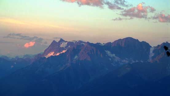
Morning glow on Mt. Thompson in the Monashees
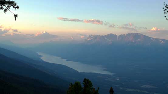
Kinbasket Lake in the morning
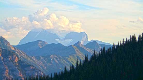
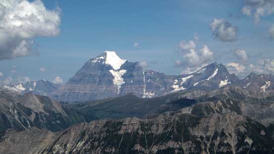
Clouds hovering around Mt. Robson
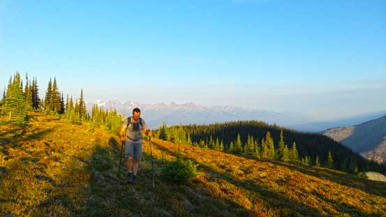
Eric arriving at the meadows
Looking north towards Swift Mountain and Mt. Terry Fox
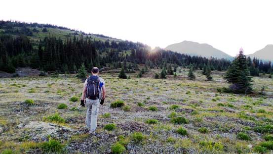
Ben hiking on the meadows

Gorgeous view from here!
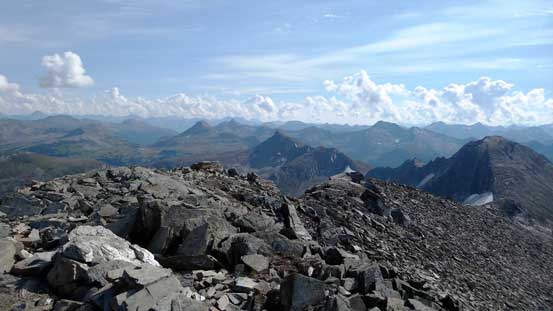
Panorama view of the Cariboos
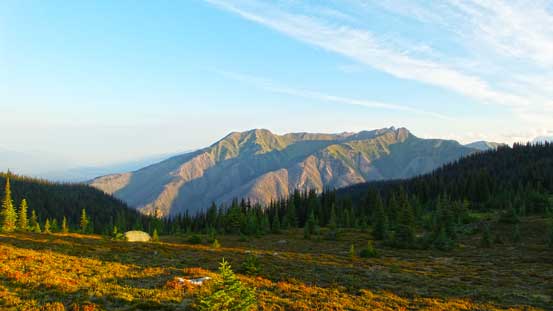
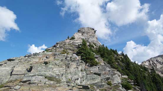
Then there came the next major elevation loss to a saddle. Ahead would be the steep grind towards Carson’s Peak. Here’s the official end of the trail and from now on it was on easy scrambling terrain. The ridgeline narrowed down higher up at an obvious rock outcrop. We circumvented this obstacle on the right side and re-joined the ridge shortly after. Then we stuck on the ridge crest overcoming a few steps. The route up Carson’s Peak was steep and loose. There’s a big cairn on the top but I couldn’t find a register.
Elevation loss from top of a hill

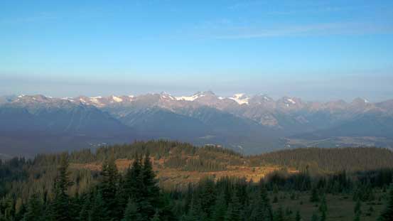
Mt. Robson and Resplendent Mountain free of clouds now

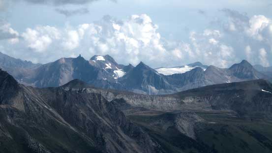
Looking south we could Mt. Albreda in the Monashees
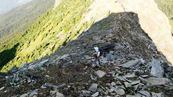
Hiking up towards “Carson’s Peak”

Near the top of Carson’s Peak
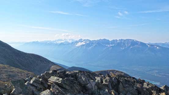
Looking down at the Kinbasket Lake valley

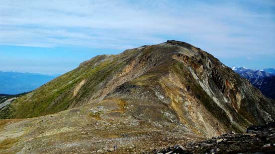
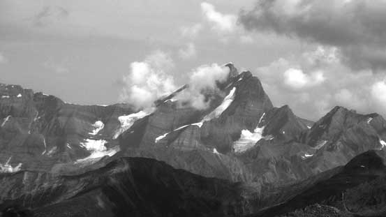
Looking ahead towards Mt. McKirdy

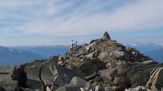
Me with the giant cairn on “Carson’s Peak”

Panorama view from Carson’s Peak. Click to view large size.
Traversing to Mt. McKirdy looked straightforward, but again, involved a big elevation loss down to the col. We ditched backpacks at the col, and up the other side, terrain was again, steep and loose. I already felt quite tired at this point thank to the big day on Cinnamon, but with a bit of perseverance we all made to the top. If not because of the smoke the view from this summit would be fantastic towards each direction. We stayed on the summit for a long time before committing to the descent.

Ben hiking down towards the saddle
Looking back at Carsons Peak
Near the summit of Mt. McKirdy

Summit Panorama. Click to view large size.
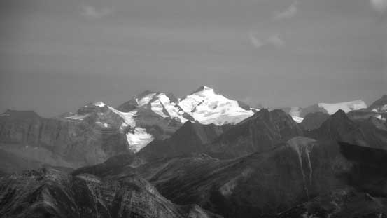
Mt. Sir Wilfred Laurier
Mt. Longstaff
Whitehorn Mountain and Mt. Phillips

The summit mailbox

The summit register

Kinbasket Lake valley. This lake connects Valemount to Golden!

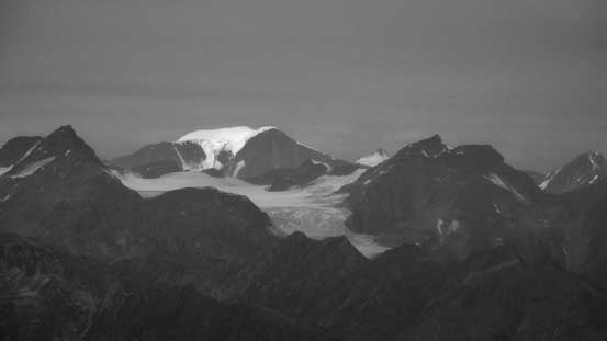
Mt. Robson in black-and-white
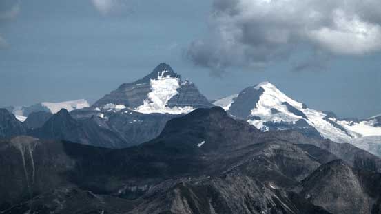
Resplendent Mountain
Mt. Kain must be somewhere there
The Selwyn Range – a range that needs more exploration
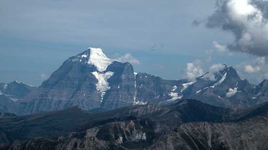
Robson and Resplendent again
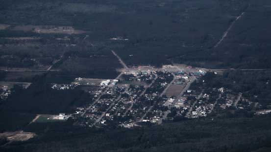
Looking down at the town of Valemount
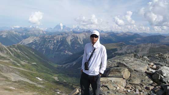
Me on the summit of Mt. McKirdy
We knew the descent would be tedious due to all the uphill sections, but oh well. At least the terrain was generally pleasant, unlike the previous day. Going back up Carson’s Peak was the most significant elevation regain. Back down to the meadows we met Patricia, Rudi and their climbing dog, Pluto on the way up. After thanking them again for the route beta we continued down the trail.

Ben starting the descent

Eric taking a break at Carson’s/McKirdy col

Hiking back up Carson’s Peak

Looking back towards McKirdy

Gorgeous view that accompanied us all along the ridge
Robson and Resplendent

Looking back at Carson’s Peak

Ben negotiating a narrower section on the ridge
Looking back at the rock outcrop that we bypassed on climber’s right

Carson’s and McKirdy from the descent

Eric hiking down the meadows
Ben on the meadows
The last bit of walk on the trail.
I had to say this was a great summit for scenery with minimal scrambling involved. It felt very sloggy to me primarily because we did right after Cinnamon, otherwise I would have enjoyed it more. It wasn’t very late when we got back down so we drove to Jasper for a well deserved dinner at North Face pizza. Then we took turn driving back home, exhausted but satisfied. Unfortunately (or fortunately) for me, I didn’t have much time to rest before the next trip…

How long did it take you to get to Carson’s peak? I can’t find that info anywhere.
Hey James. I don’t remember the time at all as it’s like over 6 years ago… you can download my gpx track and analyze it on your Gaia. All stats can be easily found on the GPX file