Widgeon Peak
March 22, 2020
1436m
Coquitlam / Pitt River, BC
Widgeon Peak is one of those that’s not far from Metro Vancouver but is relatively difficult to access. The Quarry Road on the west side of Pitt River goes to pretty close to the base of this peak but is unfortunately gated not far from the city, meaning a very long bike ride is required. The standard route nowadays traverses over the half-a-dozen bumps on Burke Ridge and involves probably close to 2500 m of cumulative elevation gain. There’s a third option, much shorter but requires a canoe or a kayak. One can paddle across Pitt River and then up Widgeon Slough into Widgeon Valley – a total of 5 km each way of padding on flat water. I do not own a canoe nor a kayak, but I have a packraft. While packrafting on flat water is far from easy or efficient, I figured this would still be the more interesting way to tag this summit than the long slog over Burke Ridge. Another downside is the lack of friends in BC that own a packraft so I’d have to do it solo, but such wouldn’t be a deal for me, anyway.
The decision was made spontaneously in the morning of last Sunday. The weather was partly cloudy but the avalanche condition was L/L/L across all zones. I was still tired from the three trips in a roll that I did in the past week, but with the conditions the lack of work on Sundays I must do something, and preferably interesting. I didn’t have a partner on this day, so pulled the trigger on Widgeon Peak. It took me a while to pack all of the packrafting shits into the truck, but at least the drive was very short. I had a breakfast in the McDonalds in Pitt Meadows before resuming the northwards drive to the boat launch. There were already tens of vehicles parked at the lot and it was a heck lot busier than I thought, but at least an 8 am in the morning there was nobody around. I figured those guys must have been camping. Prior to this trip I had done an 8-day packrafting descent of Koroc River in the Nunavik region of northern Quebec, with a total of five portages so I was pretty efficient on the transitions. It didn’t take me too long to store and strap all of the shits into, or onto the raft and then inflated it. I made a quick walk back to the truck to leave behind gears that I didn’t need, and immediately jumped into the water.
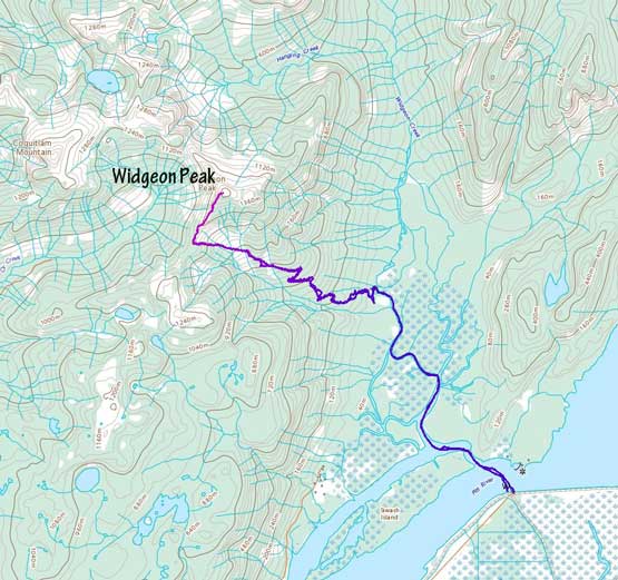
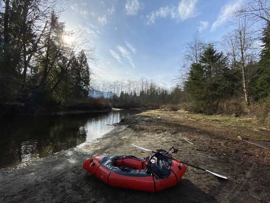
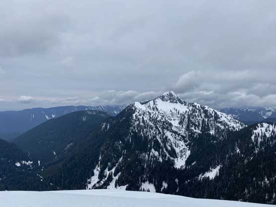
Widgeon Peak from Widgeon Valley. GPX DL
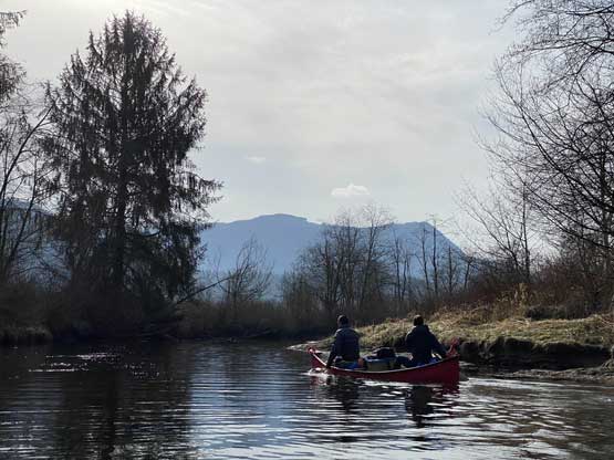
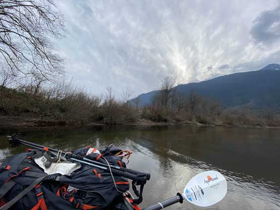
The paddle across Pitt River was a little bit harder than I thought as I had to fight against some current that drifted me northwards (back into the Pitt Lake). I took a picture stop midway across and my GPS track showed that I got drifted at least 20 m backwards… Once into the Widgeon Slough the current stopped, but the effort required to paddle on flat water was still more difficult than I thought. I also had to pick the route carefully as there were a lot of shallow areas. I thought about just hauling across one but as soon as I stepped off the boat I sank knee deep into the mud. I quickly jumped back into the boat and then picked a roundabout line that worked around the mud. The next while was uneventful and upon reaching a junction I picked the narrower, left branch towards Widgeon Valley camp. There were a couple more shallow spots and once of which required to me get off the boat and haul, but this time the ground was solid sand rather than mud, so such wasn’t a problem. It took me a total of 1 hour 20 min to paddle the 5 km from the boat launch to the campsite, so wasn’t too bad.

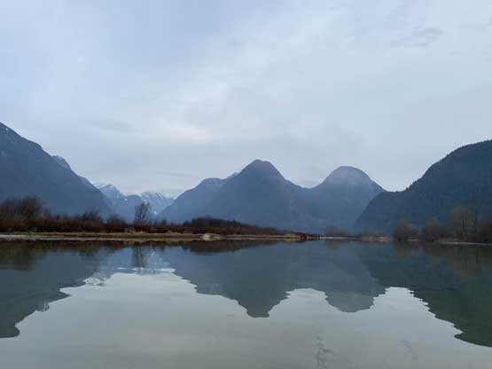
Widgeon Peak in the morning

Golden Ears behind the boat launch

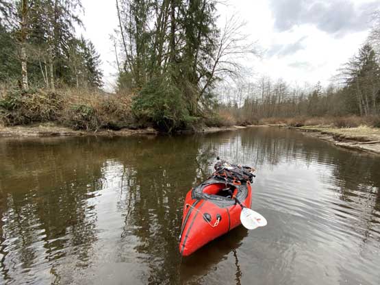
My packraft’s ready to rock n roll

Padding across Pitt River

Into the Widgeon Slough now
Some remote but unnamed peaks to the north

This is one stretch that I had to get out of the boat and haul
A section of deep water here

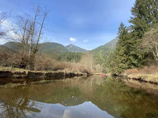
A canoe travelling on the opposite direction

The same canoe. They were camping
After saying hello to them I resumed the tiring paddling
Finally made to the campsite.
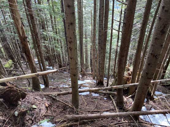
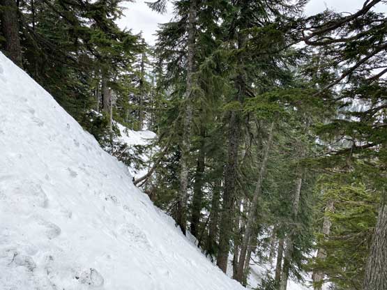
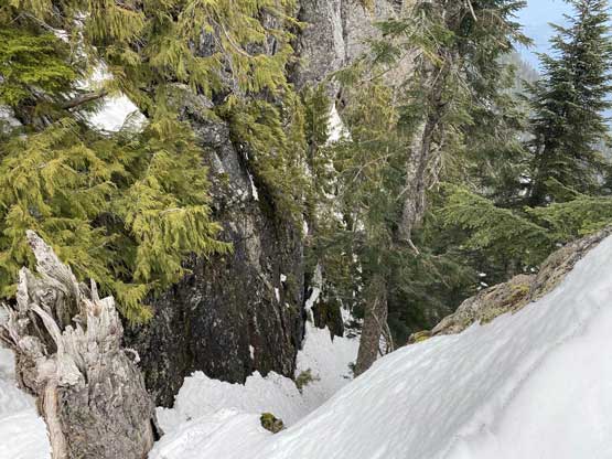
I had concerns of leaving my packraft at the camp but there seemed no better choice. There were three bear-proof boxes so I left all of the shits into one of them, and then went on the hike following the GPS track made by Jeff and Vlad a couple years ago. The start of the trail wasn’t obvious that I missed it but quickly found it upon some searching. The quality of this trail was shitty from the start with very faint track and some dead-falls and brushes. Ten minutes into the hike it seemed like the trail was gone so I started bushwhacking. I veered left and right multiple times and the conclusion was the track I followed wasn’t on the trail at all, but rather bushwhacking. A while later I reached an old logging road and the path reappeared, albeit in worse quality than I would classify as a “trail”. I did come across flagging here and there so I wasn’t off track. There was another long stretch of bushwhacking that I figured by going straight up it’s probably more efficient than walking the overgrown road. The road’s end was reached at elevation of 650 m and it’s there that I started to encounter snow as well. I took a break swapping trail-runners for mountaineering boots and then went into the bush again. The terrain was steep for a while but then I came across the flagging and the trail again. The trail led me into a huge avalanche path and bowl at 750 m and I strapped the snowshoes on.
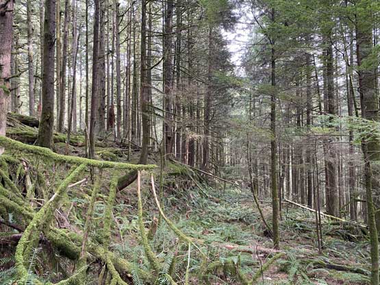
As much as the trail on the old road
There were a lot of bushwhacking
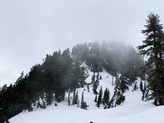
The snow became deep and continuous in no time that snowshoes were certainly required. The snow condition was also quite soft but nothing was moving. In conditions like this I did not have to follow the trail anymore and instead, I decided to ascend straight up the left edge of the slide path and didn’t bail into the forest until much higher up. The grade wasn’t as steep as I thought but definitely more than 35 degrees especially on the upper reach. With snowshoes the going was pretty easy and it didn’t take me long to reach the SW Ridge of Widgeon Peak. Not doing any unnecessary lingering I soon started the ridge and soon encountered multiple steep and interesting steps on the ridge. The condition was pretty good and I managed to climb up all of the troublesome steps without having to take the snowshoes off, but it certainly required some concentration. The summit block appeared steep and daunting but as I approached the base, the angle seemed to ease so I again decided to just snowshoe up the slopes. The grade was 40 degrees or more but the snow offered good grip. I made some tight switchbacks and also used some vege belays to haul myself onto the left side of the summit. The final 20 m gain to the summit was done by boot-packing as the exposure seemed real.

Snowshoeing up the obvious path.
Looking back from partway up this path.

Entering the forest now. As you can see, the terrain’s steep
Onto the ridge now. To my surprise, I had to deal with more steeps
This is the typical travel on the ridge. Kinda no mistake allowed

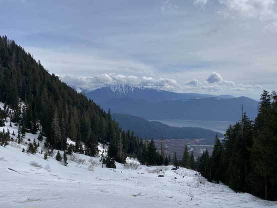
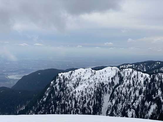
A section of opening revealed views down Pitt River valley

A closer look at Pitt River and Widgeon Slough where I paddled from
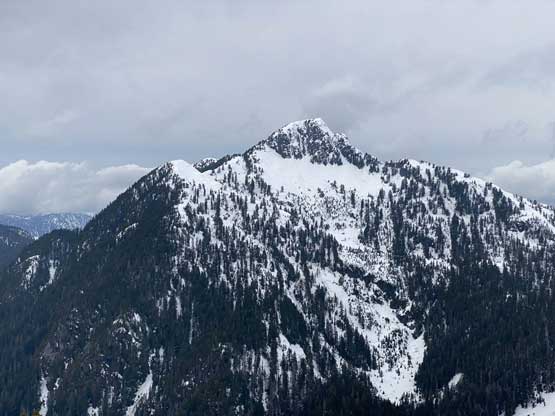
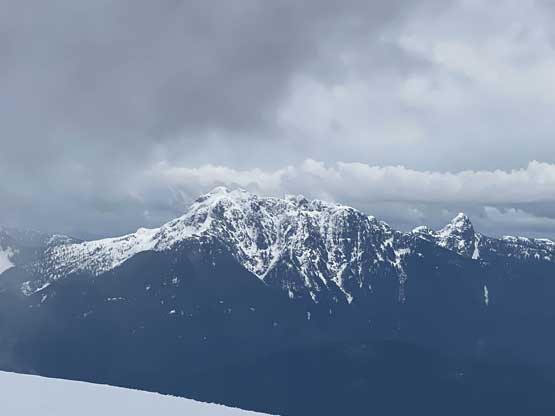
A closer look at Coquitlam Mountain
This is the summit block. My attack was the obvious snow ramp

Looking north past a pointy sub-summit
Coquitlam Mountain that I bagged two years ago via Orr Creek
This is looking back at the summits on Burke Ridge

Gabbro Mountain to the north is very obscured…
Golden Ears Group

Me on the summit of Widgeon Peak
The weather was cloudy and cold so I didn’t linger long up there. I made some updates to reconnect with the city and then retraced my steps down to the snowshoes. The post-holing was way worse than I thought without the snowshoes so I strapped them back on, even though the terrain was kind of too steep for comfortable snowshoeing. I took out the ice axe just in case and stored one pole into my backpack. The ice axe did come handy as I made some careful work down the 40-degree zones on snowshoes, but 200 vertical meters down I noticed the pole had fallen off. After some debating I ditched the backpack and went back to grab the pole. It was still new and in good conditions, and I also think finding a replacement pole in the middle of this stupid pandemic wouldn’t be easy. It turned out that I had to climb all the way back to within 30 m from the summit. That was stupid and I swore a ton. I normally don’t make mistakes like this so whenever I left shits behind I would get mad on myself. Back to the backpacks I made a long break for food and energy, and then took off down the ridge (very carefully). This time I opted to just use poles as I didn’t want to lose them again. The descent into the avalanche bowl wasn’t easy thank to the wet snow conditions, but at least went by fast. Into the forest I more or less retraced my tracks. I didn’t bother to swap footwear back to the runners as down-hill bushwhacking was easier and safer on mountaineering boots.

The forested descent…

Sections were actually pretty nice

Sections weren’t nearly as nice…
Back to the campsite I made the transition stage as fast as possible but I also had to eat some food. I figured the paddle would be 1.5 hours and that’s assuming I could paddle on full force with minimal resting, so I needed to be fresh. To make the end of this trip worse I had to fight against a constant head wind whenever I paddled southwards, which made for some tedious progress. Crossing Pitt River I also had to fight what seemed like a stronger current than in the morning. My arms and shoulders were pretty numb, but I did make back in a timely manner.
The packraft’s ready again
Padding back across Widgeon Slough

Widgeon Slough and the view towards north into some remote country
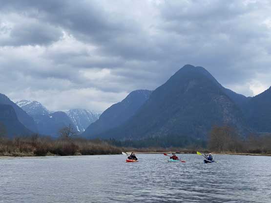
A group of kayakers followed me behind
Overall this was a high quality trip mixing up a lot of things to bag a peak. I was glad I did Widgeon Peak this way. I parked my packraft at the boat lunch and then went to grab my truck and drove it to the launch. I again, made the transition as fast as I could and then immediately started the driving. My next destination was Burnaby as I still had 3 hours of work that evening. I barely made there on time for the work.
