Congregational Peak
July 27, 2015
2490m
McBride, BC
The name of “Congregational Peak” is obtained from bivouac.com – not the most reliable source but better than a GR in my book… It’s a relatively prominent peak buried behind McBride Peak and Mt. Teare near McBride, BC, about 85 km north-west of Valemount. This is an obscured corner of the Canadian Rockies and needless to say, when Mike and I decided to give Congregational Peak a try we had no route information at all. It just simply looked scramble-able via the connecting ridge from McBride Peak so off we went, with the entire afternoon ahead of schedule.
The traverse route from McBride Peak to Congregational Peak. GPX DL
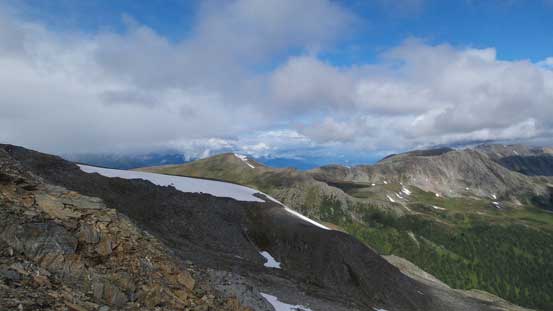
The route-finding was simple as we just had to stay on or near the ridge crest for as much as we could. After going up and over a couple minor bumps the terrain started to get trickier with increasing exposure and difficulty. We had to detour slightly to the left or right occasionally and on top of that there were at least 2 exposed sections to overcome with some awkward scrambling. There’s also a massive elevation loss down to a saddle just before the final ascent of this peak. That part was easy and fast on the way in, but we knew it’d be tedious in a few hours.

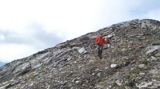
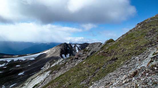
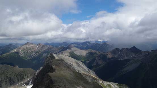
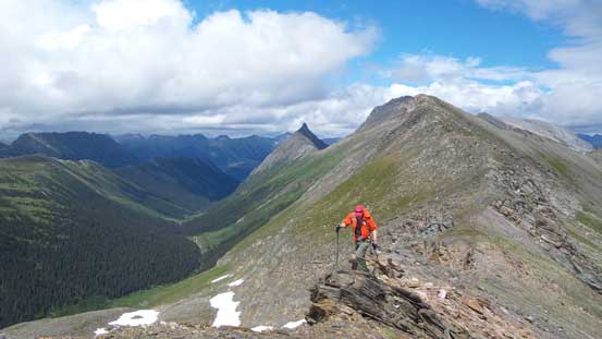
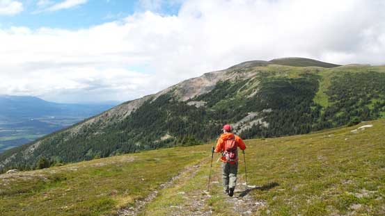
Looking ahead along the connecting ridge towards our objective
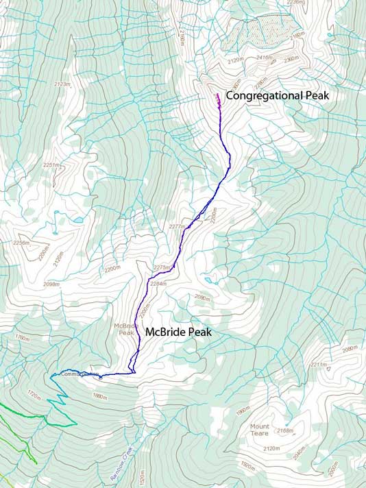
This is the typical view in this area
Mike hiking down from one of the many bumps

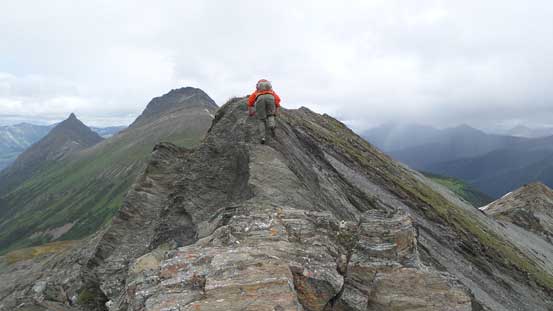
And then, negotiating a tricky section

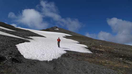
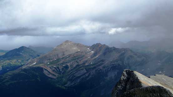
Further along the connecting ridge, our objective starts to look bigger
Oh here’s a massive elevation drop down to the saddle
Great views though…
We utilized snow to give our knees some relief

Still a bit of ways to descend

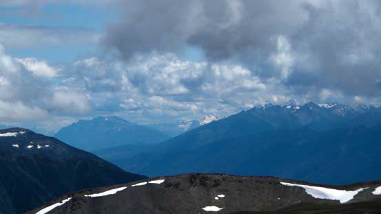
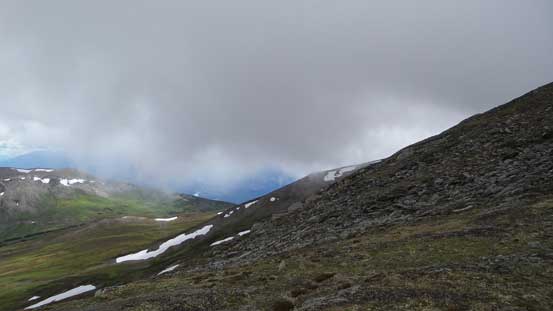
Some weathers around us…
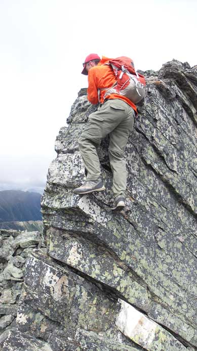
The ascent of Congregational Peak started easily but got trickier near the end. Based on our earlier observation we knew there’s probably an easier route if we didn’t mind some elevation loss/regain and side-hilling on steep grass by contouring way to the climber’s right, but given the unstable weather we just wanted to get up (and down) this peak as fast as possible. Attacking directly up the ridge/face didn’t look terribly hard and we figured it’d probably go as a Class 4 scramble on broken quartzite rock. In fact it’s indeed mostly just a difficult scramble but with a few trickier and exposed moves along the final summit ridge traverse.

From the saddle, looking up. We went up and over the bump to the right
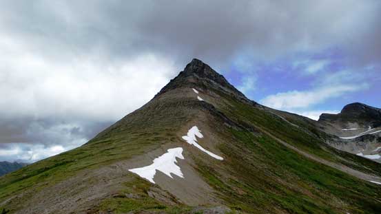
Our objective ahead.
Mike starting the summit block scramble
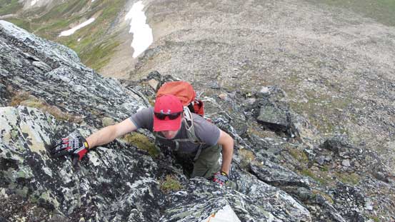
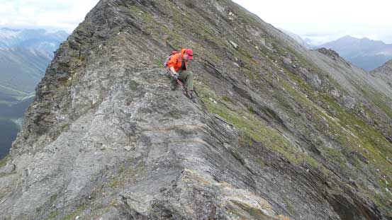
One of the few trickier moves

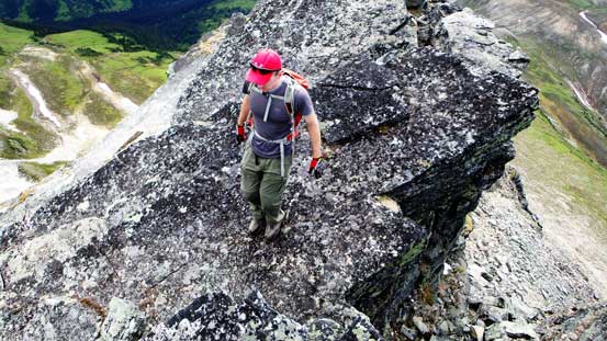
Almost on the summit ridge now
The summit is not far away!
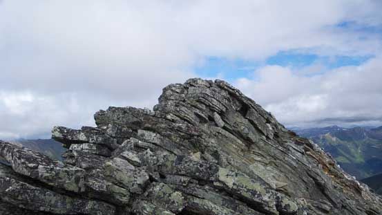
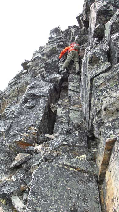
A few slabby sections along the summit ridge
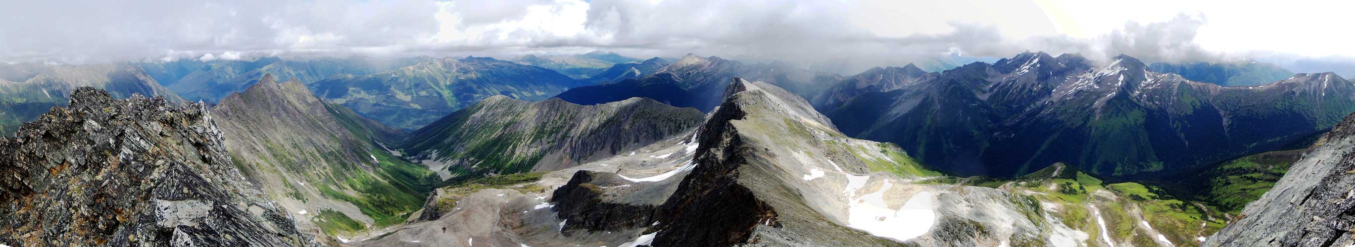
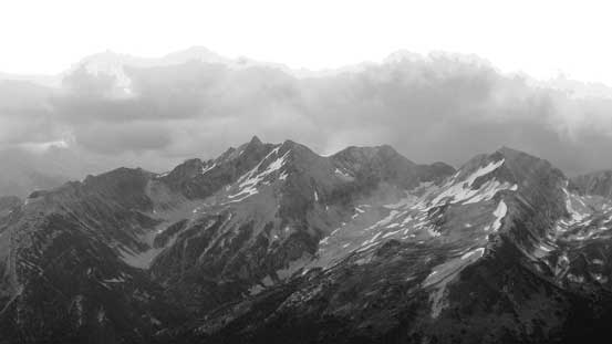
Partial summit panorama. Click to view large size.

Partial summit panorama. Click to view large size.
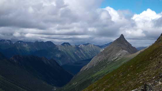
Puritan Peak further into the mountains.
The peak in the foreground is The Blackwater Tusk.

Looking back towards McBride Peak – now looks like a bump

And, Mt. Teare which is another bump
McKale Peak
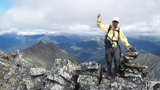
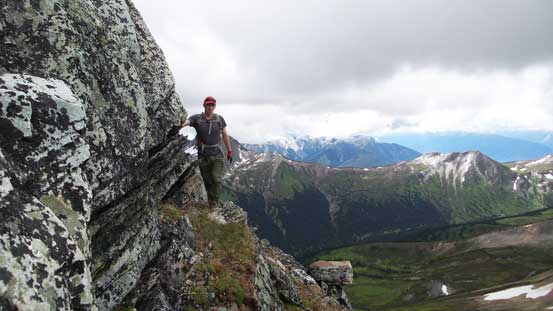
Me on the summit of Congregational Peak
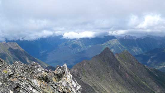
Another view of this rarely-seen area
While the weather still held we took a short break on the summit. Mike went further along the ridge to check out some possible alternative descent routes, but eventually we just decided to down-scramble the way we came up. Some cautions were required but nothing terribly tricky. Soon we were off the difficult terrain and then down to the saddle. It’s now that the weather finally started to collapse. We got hit by a few rain storms (windy and chilly) in the next hour or so traversing back along the connecting ridge towards McBride Peak, but in between the storms we got some good views with occasional patches of blue sky.
Down-climbing a short, but exposed move along the summit ridge
Down-climbing the summit block
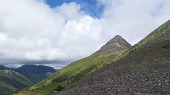
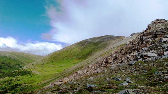
Looking back at our objective

Now, time to focus on the long slog ahead, all the way up that bump..

More weather moving in, looking back towards our objective
Descending a tricky section on the connecting ridge

Another scrambly part
One more exposed ridge section

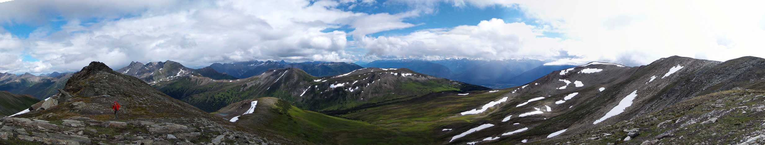
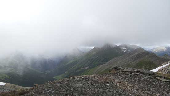
A panorama view towards north
The Blackwater Tusk.
The typical view
Mike traversing back along the ridge crest
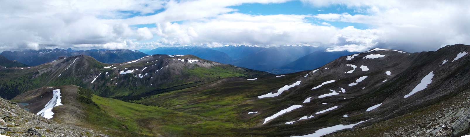
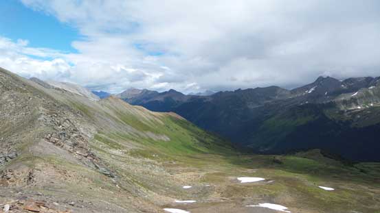
A panorama view of the broad meadows between McBride and Teare
Another (wider) panorama of this area. Click to view large size.

Almost back to McBride Peak now
Zooming far in down south along Rocky Mountain Trench
Too bad another storm moved in
In a few seconds we were in a blizzard…
Down from McBride Peak we tried to short-cut the route by staying on the direct ridge crest but soon entered a field of quartzite boulders. With the rain/sleet those boulders were slick so we bailed back to the trail, and then followed it easily down to the shelter. We took a necessary break in the shelter and while the weather improved we got out and hiked the rest of the way back to Mike’s SUV along the ATV trail and then the forestry road.
Looking back towards McBride Peak
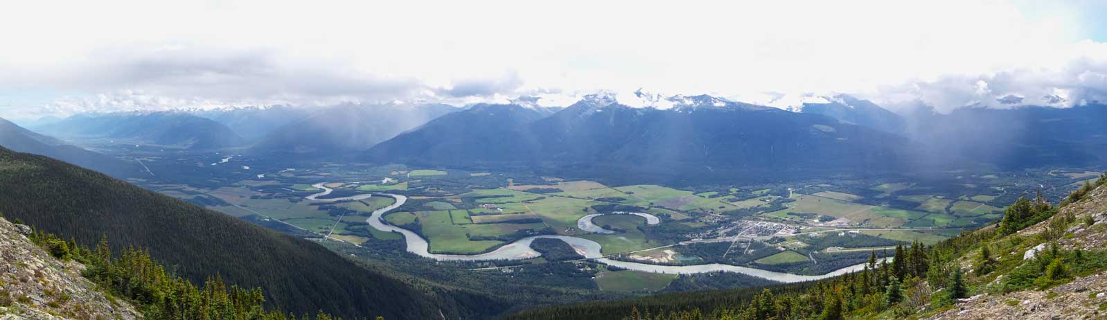
Panorama of the Trench, also Fraser River Valley
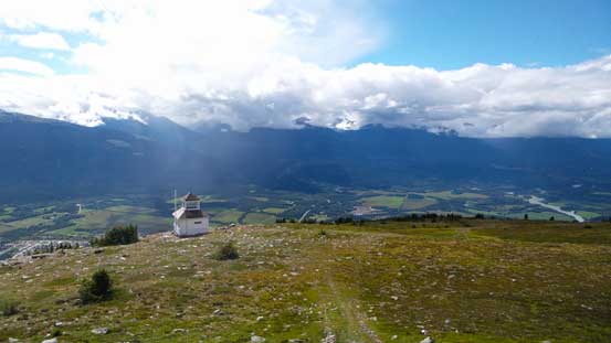
Down to the shelter now
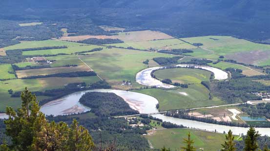
Fraser River and some interesting river valley scenery
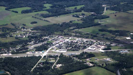
The small town of McBride
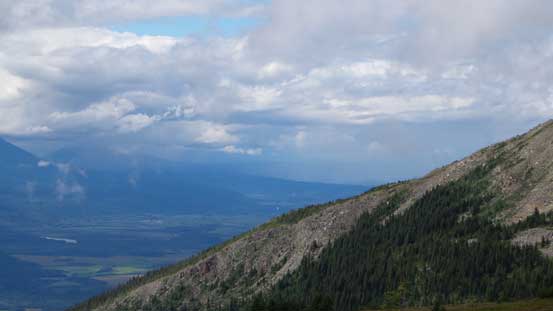
There’s more weather coming in from Prince George direction
Hiking down the ATV road

And then, the forestry service road…
It’s only about 5 pm in the afternoon but we still had a long drive back to Edmonton (tedious and tiring!)… In the end the Rocky Mountains around McBride are as expected, less impressive compared to the main ranges, but it’s a good trip scouting out a new area. Too bad the weather didn’t cooperate otherwise we probably could have seen peaks around Mt. Chown somewhere 40 km away to the east.
