Mount Triumph
July 30-August 1, 2022
2207m
North Cascades Highway, WA
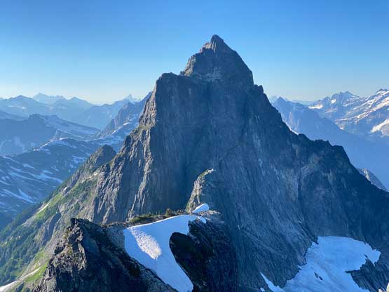
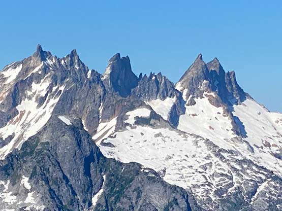
Mt. Triumph is an uber iconic peak in the North Cascades with shear walls on all sides and no “easy” way to the summit whatsoever. There’s pretty much only one published route, the NE Ridge, which goes at alpine grade III and rock grade 5.7. Most of the climb is on 4th and low 5th class terrain, but the crux is a proper 5.7 pitch and there are also a few mid-5th pitches on the upper route. The rock quality isn’t terrible, but is also not the beautiful granite in Washington Pass and the route-finding and the approach isn’t that straightforward neither. One needs to be both a good climber and a good mountaineer to tackle the challenge. The descent has to be done via the same route with complicated ridge rappelling. Mt. Triumph is considerably lower than the Bulgers or even the “Top 200s”. This is fortunate or unfortunate depends on who you are talking to, as in my opinion Mt. Triumph is just as important of a peak as Forbidden Peak. Because of the lowered elevation peak-baggers do not need to climb this tough peak to finish their respective lists but I choose mountains mostly by how aesthetic they are, and this one stands far above many, if not most of the Bulgers. When I saw Mt. Triumph the first time from Oakes Peak in April 2018 I knew instantly that this peak had to be done at some point. The commitment sounded daunting but teaming up with a rock climber I would have a chance.
Lily and I were planning to climb something cool over the August long weekend and my suggestion was Mt. Triumph as I absolutely needed someone with much better rock skills than myself to tackle this summit with. The climb could be much shorter or longer than expected as it all depends on how much of the “low 5th class terrain” one’s willing to solo, simul or properly pitch out. Our decision was to properly pitch out everything from the notch to the summit and that further meant we would need 3 days to complete this trip. These days I’m all in to make a trip more relaxed than rushed, especially since I was still exhausted from the recent death-march into the central Pickets. My feet were still in the recovery stage with multiple blisters still feeling the pain. In fact, I was seriously considering to cancel the trip but doing so I would totally screw up Lily’s weekend. At the last minute I decided to endure the pain for a few more days and stick to the plan. The weather forecast was promising so I really couldn’t find another excuse to bail the trip.
Another major uncertainty presented as we realized this peak locates in a popular zone in the national park, so to obtain a camping permit on August long weekend all the sudden sounded like an daunting task. We decided to try and make a gamble nonetheless. Lily picked me up from White Rock at 5 am and with two Nexus cards we made quick work into Washington state and then to Marblemount’s ranger station only minutes after they opened. The queue of climbers and backpackers was beyond my imagination as coming from Canada this is not something I’m familiar with. The first group I talked to while waiting in the line was also planning to climb Mt. Triumph but they had reserved the permit a few weeks prior on the internet. About half an hour later I was called in and to my complete surprise the permits were still available and another half an hour later I came out of the station with the bureaucracy path cleared. The forestry road to Thornton Lakes trail-head was steep and rough so it was a good call to take Lily’s Highlander instead of my Toyota Corolla. Minutes after parking the vehicle a park ranger showed up and checked our permit. The ranger explained that a group-of-17 was camping randomly up there the night before without permit so he was here to ticket their vehicles. I guess the Americans do enforce their rules much more strictly than us Canadians, as literally 1 out of 10 people I know would actually bother to obtain such camping permits in Canadian parks, national or provincial.
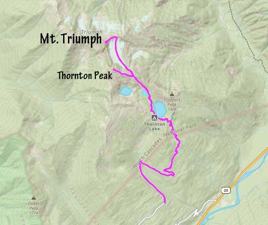
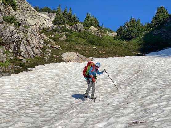
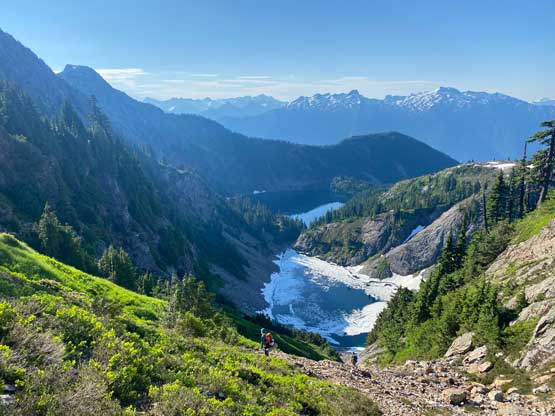
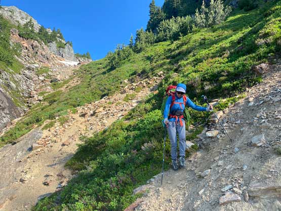
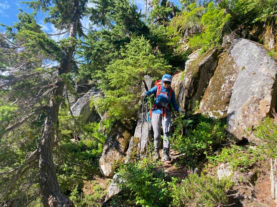
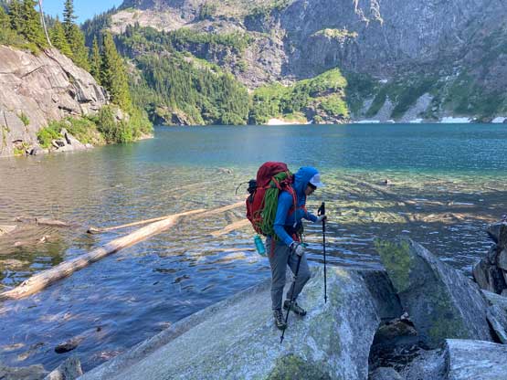
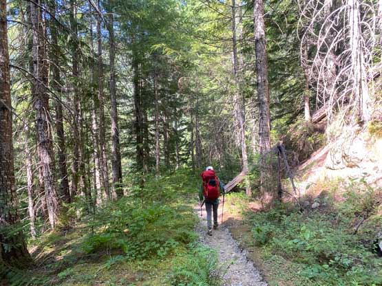
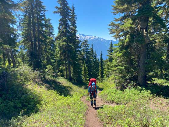
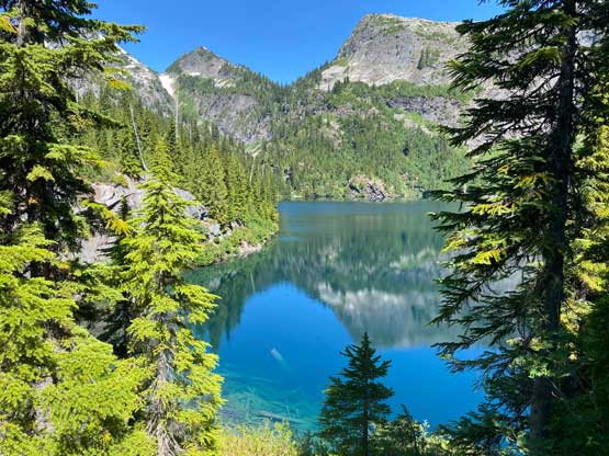
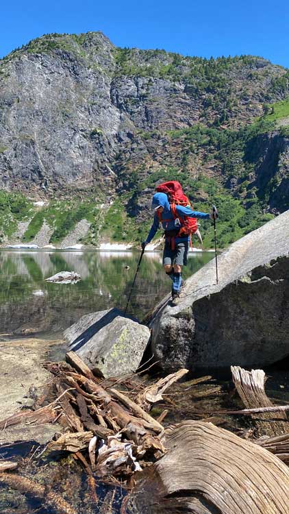
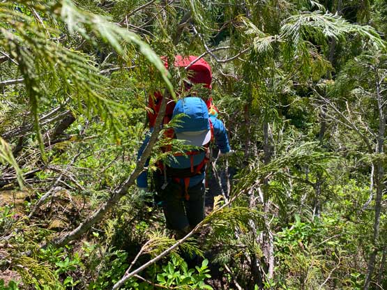
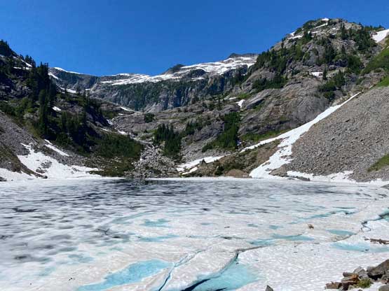
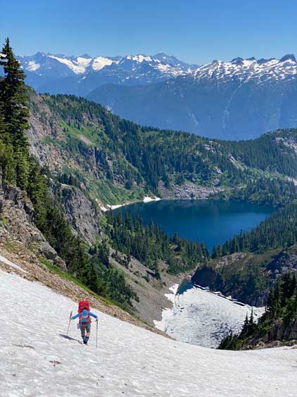
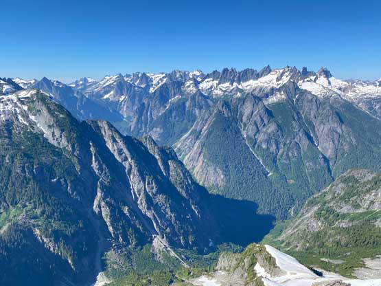
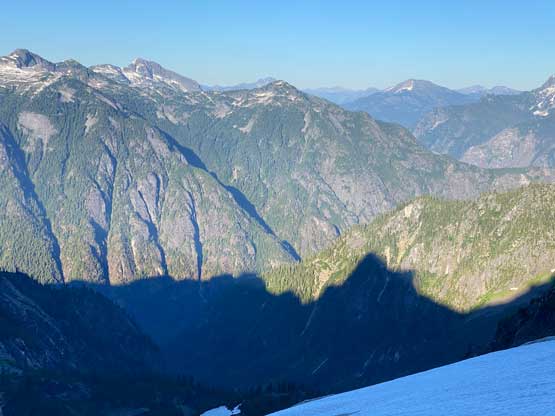
We had decided to haul more gears (both camping and climbing) than absolutely needed as this approach was overall not a difficult one. After shouldering the heavy 105L pack I led us plodding up the trail at maximum 60% of my normal pace. I explained my feet issues and Lily understood. Lily actually said that we could go even slower if needed… I was still trying to not go too slow as the slower we plodded the longer I would have to carry that pack. I had done this approach years ago en route to Trappers Peak and “X Mountain” and I knew it was boring albeit not terribly long. After about 3 km with one creek crossing the trail started to finally gain elevation, from 800 m to over 1500 m on Trappers Peak’s shoulder. From there we descended 150 m elevation to the outflow of the lower Thornton Lake. We took a long break there and then committed to the 3rd class boulder/log hopping to cross the lake’s outflow. We then picked up a climber’s trail contouring around the lake with lots of micro-terrain and up-and-downs. The path was overall easy to follow to the outflow of the middle lake (still partially frozen), which we again hopped across on rocks and logs.


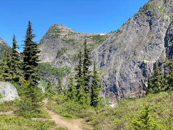

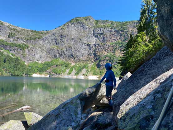
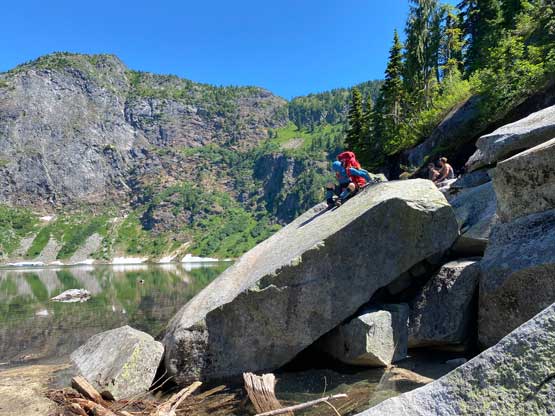

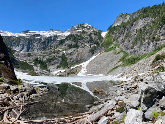
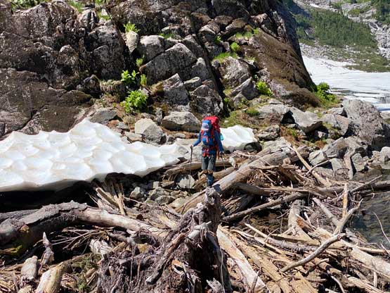
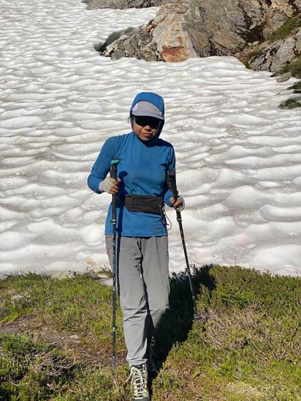
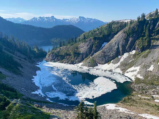
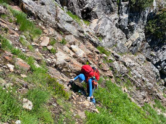
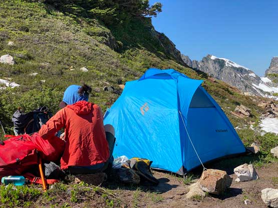
There’s apparently a slightly defined climber’s path traversing across the talus and boulders above the middle lake but we traversed too low and missed it. We ended up completely picking our own path until intersecting the climber’s trail about 1/3 of the way up the foreshortened gully towards “Thornton col”. Prior to finding the path we had to scramble and traverse across some steep grassy slopes and I had to switch footwear from trail-runners to mountaineering boots as I couldn’t do the slippery terrain in the trail shoes. Higher up we merged climber’s left onto a snow field. The snow slope was not as steep as appeared so we easily boot-packed without donning crampons. At the col we immediately found a good spot to fit my BD Hilight 2-person tent on grass/dirt while the other group-of-4 apparently hadn’t decided their camping spot yet. They later decided to camp on the far side of the col a little bit closer to Mt. Triumph but I suspected there’s no running water near that site. The water source was abundant near our camp, but the problem was the horrendous mosquitoes. The mosquitoes in this trip were literally the worst I’ve seen in PNW in the past 5-6 years. Two of the other team immediately decided to scramble up Thornton Peak. I was planning to do so as well and briefly contemplated to join them, but it was only 3 pm and the air was smoking hot. I needed to take a much-needed break inside the tent although it wasn’t very comfortable in the tent neither with two persons and the heat. The other two showed up about 2 hours later and I eventually decided to start my ascent of Thornton Peak at 5:30 pm. I came back in under 2 hours and I did not regret this short diversion even though my feet weren’t particularly happy about my decision. Meanwhile Lily had been having the 2-person tent to herself, as she’s here only for the NE Ridge.


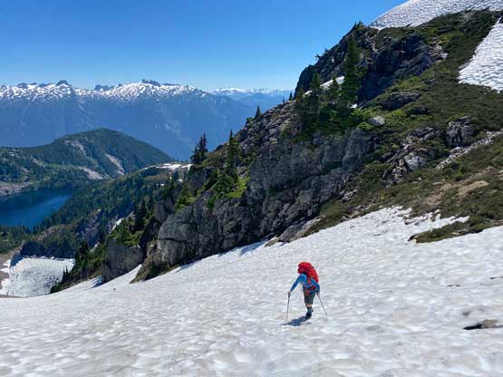


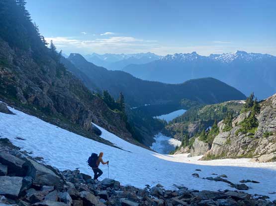
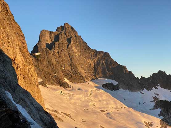
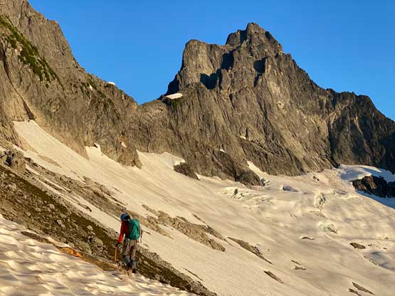
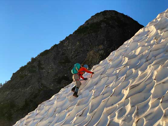
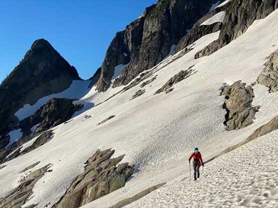
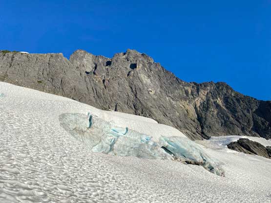
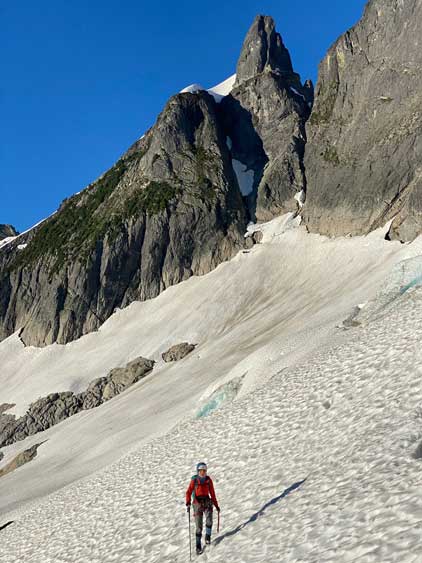
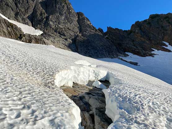
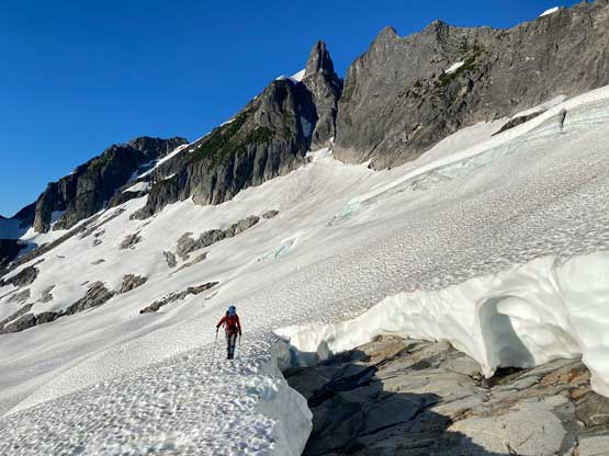
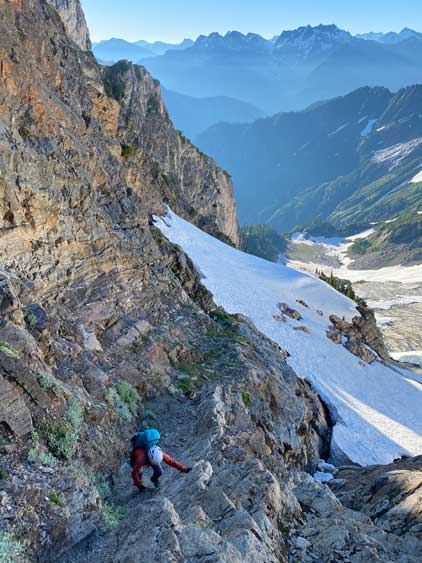
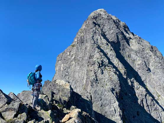
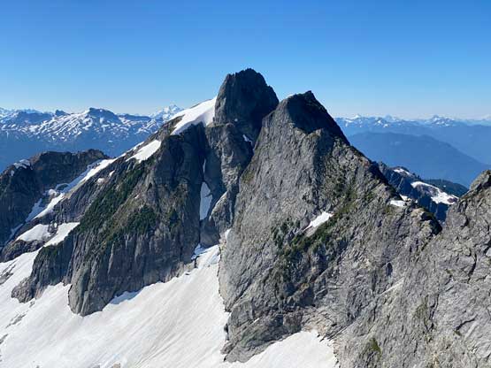
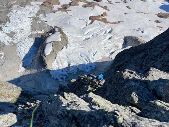
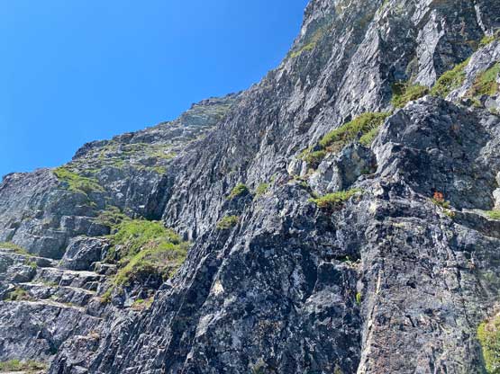
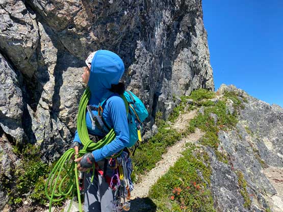
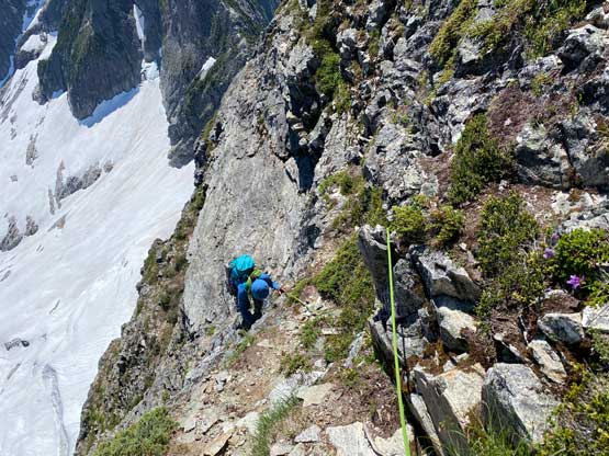
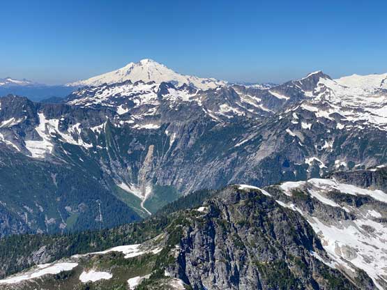
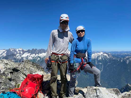
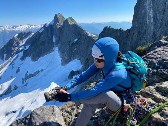
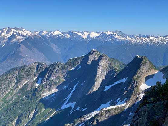
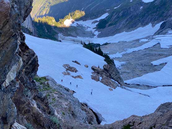
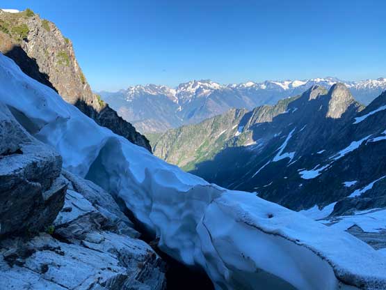
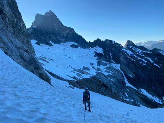
The plan for the other group was to climb, descend and hike out on the same day so we figured they would start very early and possibly simul-climb most of the route. We then decided to sleep in and get out of the tent when head-lamps were already not required, to give them ample time to put some height in. Lily and I eventually started the day at around 6:30 am after sharing breakfast with mosquitoes. The traverse of the glacier (or should I say just snowfields on slabs) towards the obvious notch on Mt. Triumph’s NE Ridge was a bit more involved than expected. In particular there’s one roll we had to gingerly down-climb and traverse across. There’s also one patch of dry ground that forced us to take crampons off briefly. The rest of the traverse went by uneventfully although the line we eventually took was slightly higher than the one I planned to use. The transition from snow onto rock was easy and all 6 of us ditched crampons, ice axes and bunch of other stuffs at the same spot. We then scrambled the 3rd class ramp/ledge to the notch with lots of loose rocks to content with. The upper parts of the ramp was awkward so we decided to rappel that stretch at the end of the day as well. At the notch we both ditched mountaineering boots and donned rock shoes.

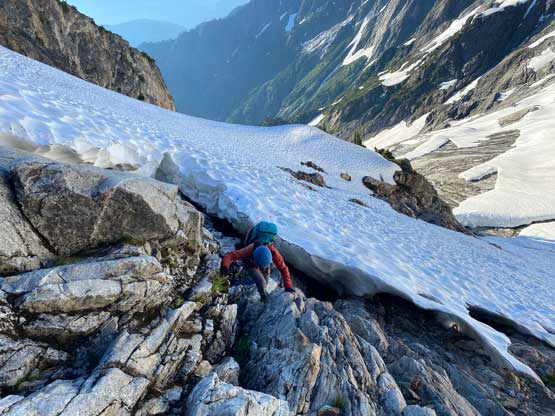

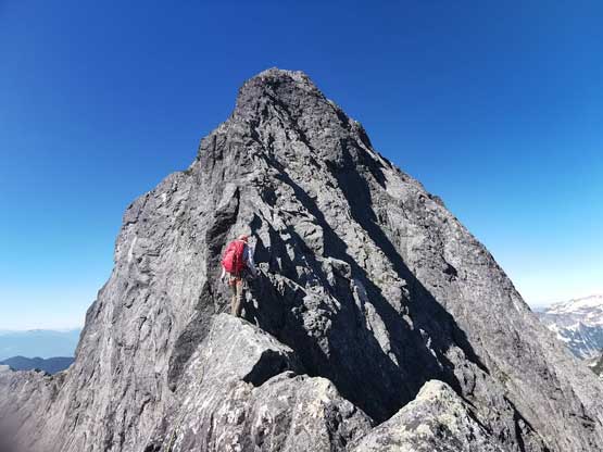
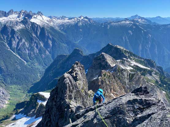
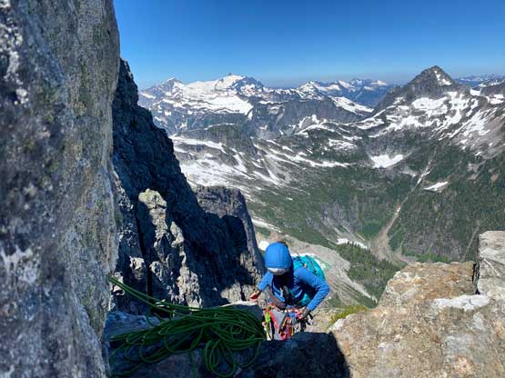
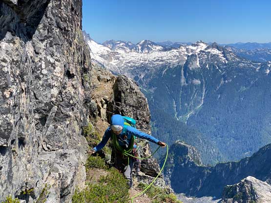
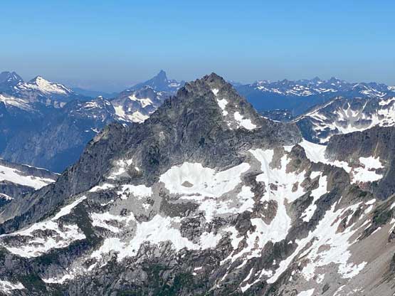
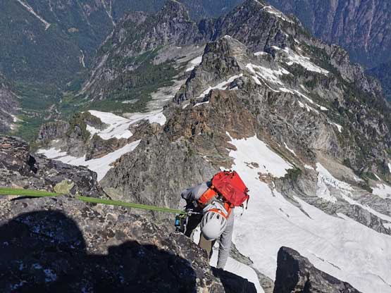
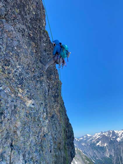
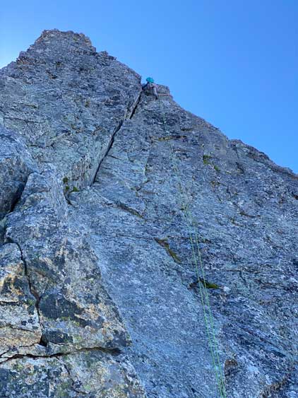
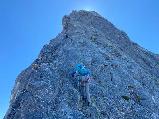
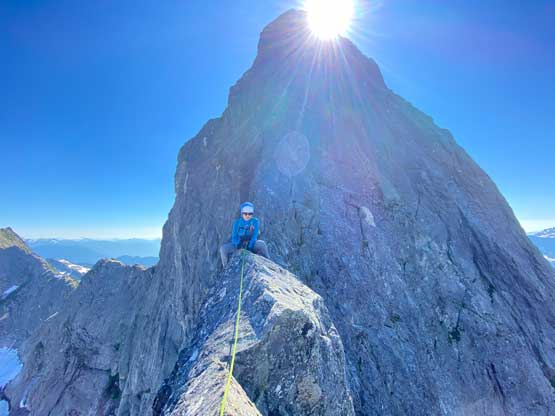
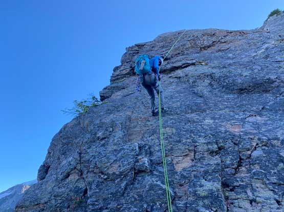
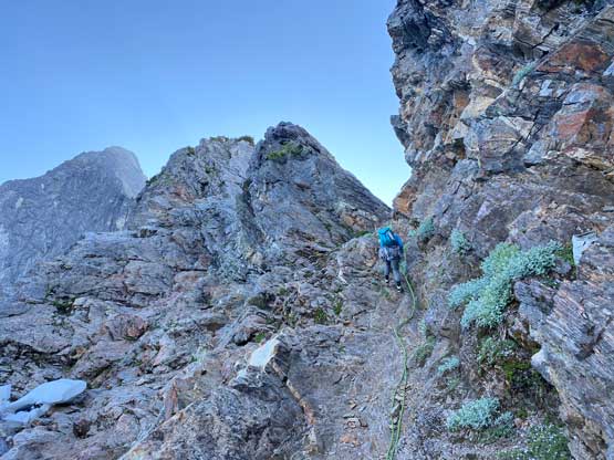
I led the first (short) pitch with a few tricky 5th class moves placing only one small cam to the top of the pinnacle immediately above us. Lily then dragged the rope to the base of the next wall and connected the next two pitches into one lead. The climbing here felt most 4th class and so was the next pitch which I led out climber’s left onto a dirty ramp feature. I traversed more climber’s left than needed and eventually had to build my own anchor as the rope-drag was getting frustrating. We then faced a long section of scrambling, passing the “bivy ledge” to the base of the next wall. Here the climbing looked steeper but there’s still lots of features on the wall. I led a full 60 m pitch (sustained low 5th) passing a rappel station in the middle and that positioned us not too far from the infamous knife edge traverse. There were a few more 5th class steps with lots of scrambling in between, so we did some short pitches. The rope management was not easy on this peak with so many transitions between pitches and later, between rappels so that’s why I did this peak with Lily who has much more rope management experience than me.


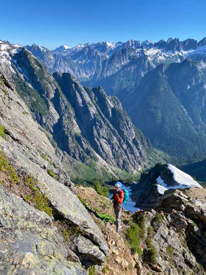


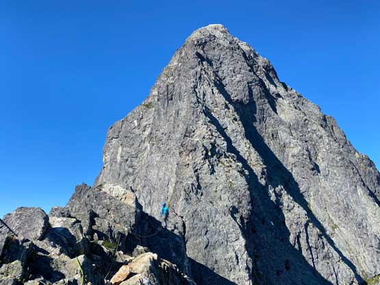

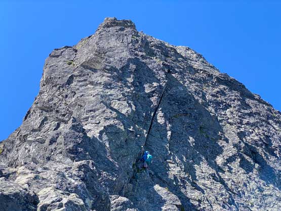
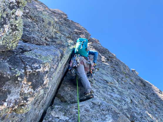
I then led across the knife edge traverse (class 4) placing more gears than I normally do and continued up a low 5th class wall to the next belay/rappel station. I sensed that the crux pitch would come right after the next pitch, so I led again, running a full 60m pitch climber’s right of the ridge crest. I climbed a small chimney feature in the middle of this pitch with some mid 5th class moves. After coming to the belay station Lily saw another station halfway up the crux pitch and decided to break it into two smaller pitches. After climbing to the next station Lily announced that the position was a bit awkward. I then called that we should take a break with me sitting on the lower belay ledge and Lily on the upper station. After forcing in some food I easily followed to the 2-nut station backed up with a cam. Lily then led the crux 5.7 pitch like a champ. The pitch appeared like an off-width crack but in fact the climbing was very much not crack-like. The hardest moves were near the top where we must overcome a vertical step with virtually no feet placements. I think I ended up using more of upper body’s blunt forces to pull myself up the step and then the crux’s over. There’s no way could I offer this pitch’s lead and even following was very challenging and at times I felt like I was nearly falling. I then wasted no time to start the next pitch, which also felt like mid 5th class but I might not have picked the best line. I went climber’s right of the ridge crest and eventually rope-drag forced me to build a 2-cam station to belay Lily up.
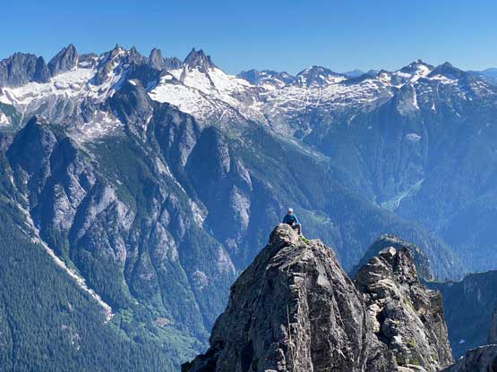

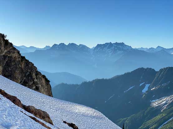
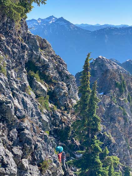
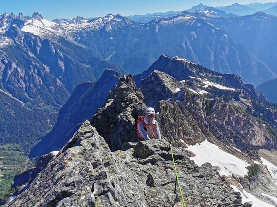
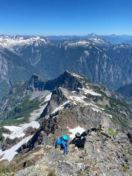
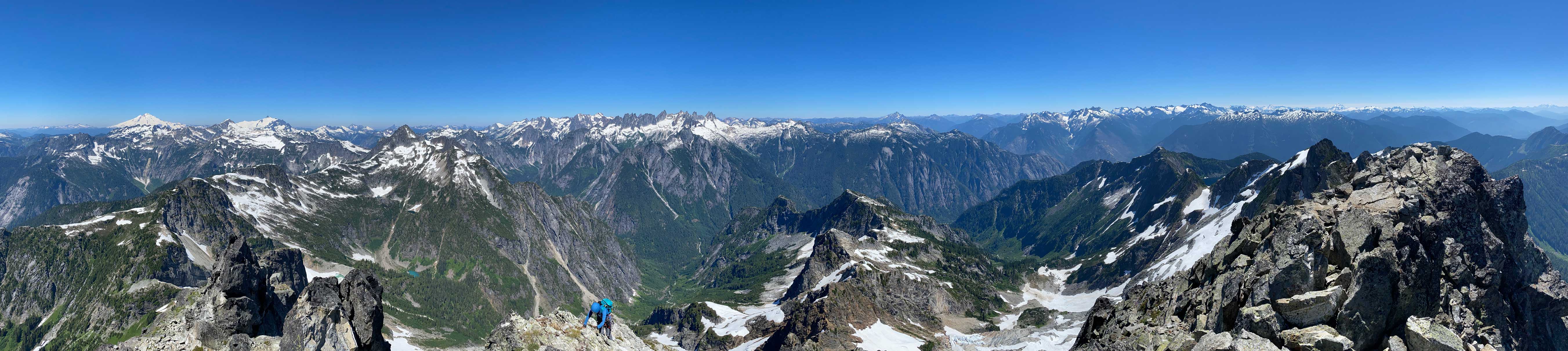
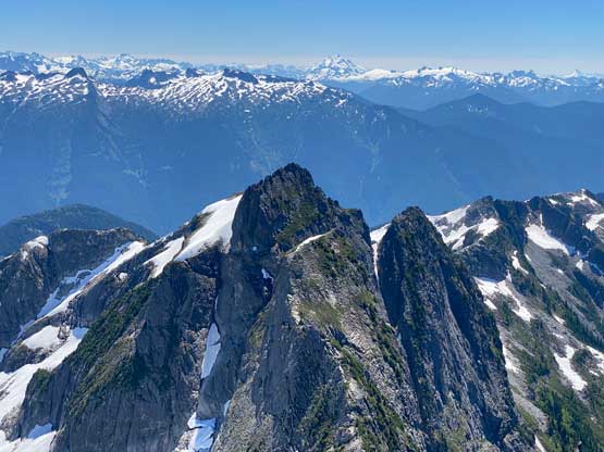
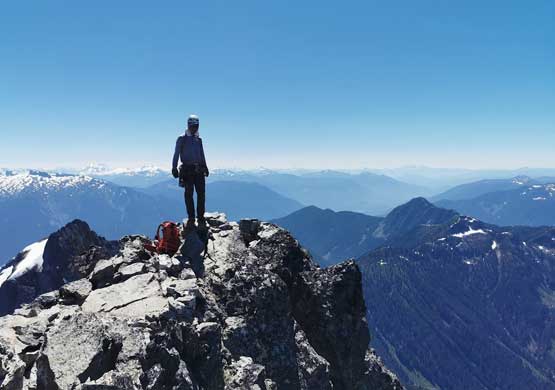
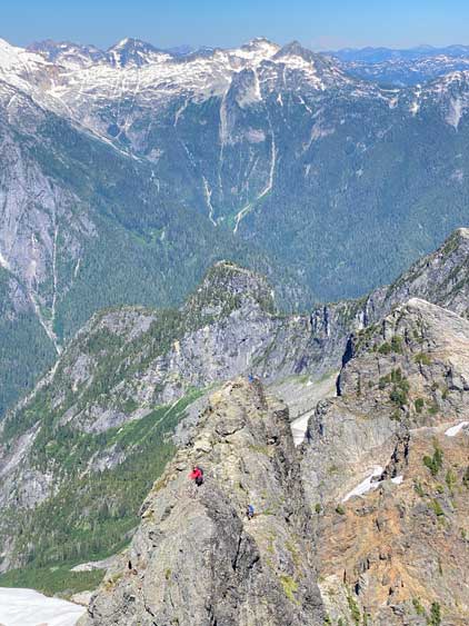
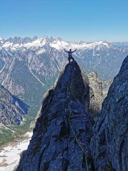
By this point the technical climbing was pretty much over as we arrived at the upper notch feature. We pulled the beta out to double-check our position and indeed, after traversing across the notch to climber’s left we found the “3rd class heather ledges” as documented in other sources. We decided to short-rope to the summit to add a bit of safety than plainly soloing. There’s still one stiff step at the start of the ledges but after that we were mostly on class 3 and at times, class 4 terrain. The rocks were a bit loose here and the dirt/grass was definitely slippery on rock shoes. I also did not pay too much attention to find the easiest path as ascending straight-up worked for us, so why not. We crossed path with the other group at the uppermost rappel station and easily continued onto the very summit. The views were ass-kicking but we didn’t linger too long with a complicated descent ahead.

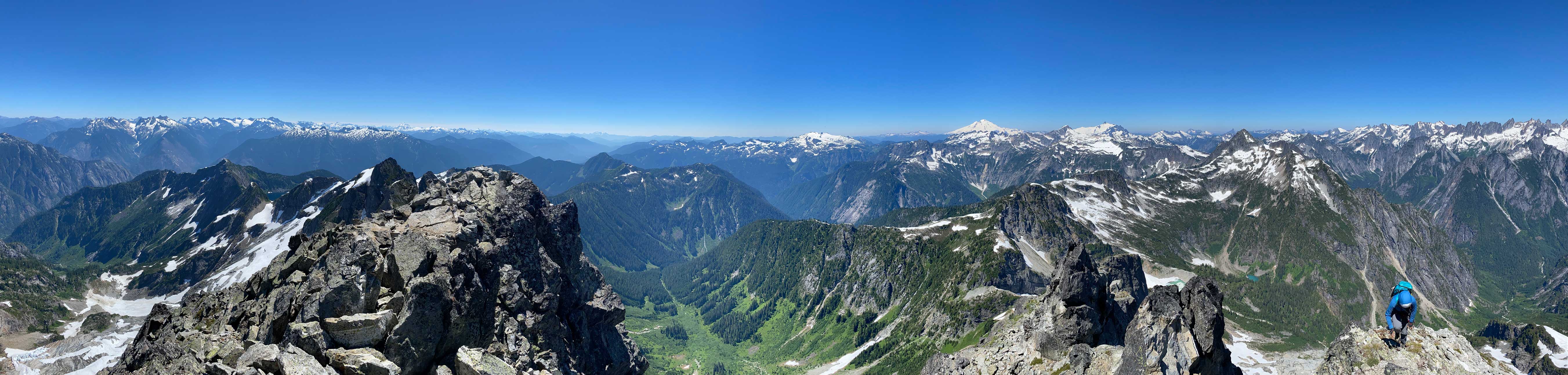


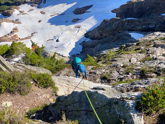
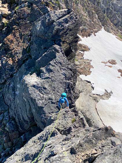
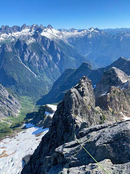
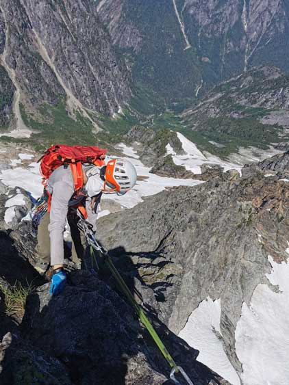
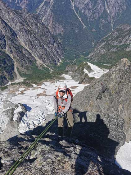
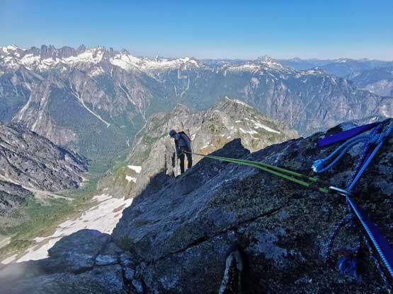
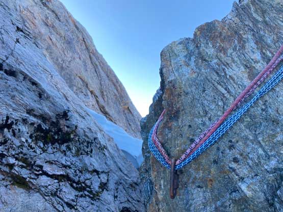
The decision was made for me to lead all of the rappels while Lily leading the rope management as well as the transitions between rappels. We used the other group’s beta to do two rappels off the heather ledges by sticking rather close to the NE Ridge crest, away from our climbing line. Not to my surprise the one 60m rope wouldn’t get us exactly from one station to the next so we had to down-scramble some 3rd class but exposed terrain. The second rappel into the notch was fun and exhilarating as it’s vertical to slighlyt overhanging with hundreds of meters of exposure. The rope reached the bottom with not a single meter of spare. When Lily rappelled I informed her to traverse slightly to the south to not descend too far into the notch. We then pitched out a traverse with Lily leading in front to reach the next station. The descent would then very much like that with lots of scrambling or proper pitching between rappels. Very few times we could rappel exactly from one station to the next. The process was definitely slow and tedious but it also seemed like the other group (much stronger climbers) weren’t much faster neither, so there’s really not a better way to get off this peak. A few more hours elapsed and a total of 13 rappels later we were finally down to the notch and the other group had just transitioned back onto snow. Lily and I put our boots on, did one optional rappel off the 3rd class chossy ramp and short-roped all the way back across the glacier to camp. I think this summit day took us 12-13 hours. We were slow because we were roped up ALL the time and properly belayed the entire climb but asides that we were quite efficient to have finished the climb as well as cooking etc. without needing to use head-lamps.


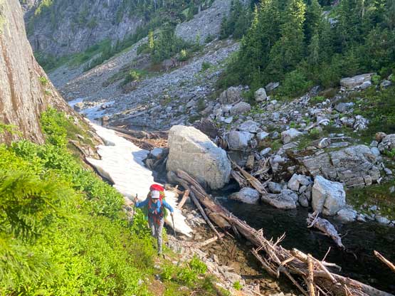
On the 3rd day we again, woke up with hundreds of mosquitoes outside the tent but we had to force ourselves to get out and get going. There’s another team camping with us but they bailed the climb. One of them decided to scramble Thornton Peak while the other was suffering in the mosquitoes (they only had bivy sacks). I inquired the latest forecast from the other team and they said the forecasted rain had shifted and now we no longer needed to rush anymore. But still, it would be nicer to get home earlier. The descent of the gully underneath our camp was not very pleasant and neither was the traverse around the middle lake on talus. At least we more or less stayed on the climber’s path this time (much closer to the rock face than I thought). We then picked up the trail we used and descended the undulating terrain back to the first lake and the rest of the descent to the trail-head was boring but without event. I swapped footwear back to trail-runners at Trappers Peak’s saddle and the blisters were finally healing at this point so I could walk a little bit faster. We then drove back to Sedro-Woolley for a Mexican lunch and eventually got back home in the mid afternoon.
Gear note: 60m single rope. Single rack of cams up to #3, doubled 0.5, 0.75 and 3. A set of small nuts. Used all cams and two nuts. Used two size 3 on the crux pitch. A size 4 or 5 instead of a 3 could protect the crux better.