Mount Ellinor
May 9, 2017
1814m
Hoodsport / Olympic National Park, WA
Mt. Ellinor in the southern Olympic Peninsula is well considered as a local classic that boasts a somewhat short approach in all seasons, and a fine 360-degree panorama when weather clears up. While the peak is more often ascended in summer via a well-maintained trail system, a winter/spring climb up the south face avalanche chute is reported to be more fun and memorable. For obvious reasons this would require stable conditions and a cold, clear morning in May seemed like the prime time. The weather was still decent after my Whitehorse Mountain trip so to make use of it I knew I just had to ascend another peak. I wasn’t particularly keen on anything strenuous but checking out an area that I’d never visited before seemed motivating enough.
At the last minute that’s pretty much 9 pm on Monday evening I finally made the spontaneous decision which meant I did not have time to plan anything in depth. This was alright as the “Mt. Ellinor lower trail-head” was searchable on my iPhone’s apps so I just had to follow the instructions to get there. And then I also managed to find, and download a winter route GPS track. These modern tools were all I needed and another hour later saw me driving out in my Toyota Tacoma. The drive took about 4.5 hours and I did make a good call to use the truck (as opposed to my small, but fuel-efficient car) as the first 2 miles down that logging road (FS 24) was heavily pot-holed.
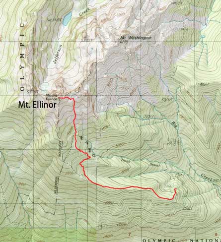
Mt. Ellinor winter ascent route. GPX DL
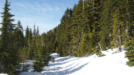
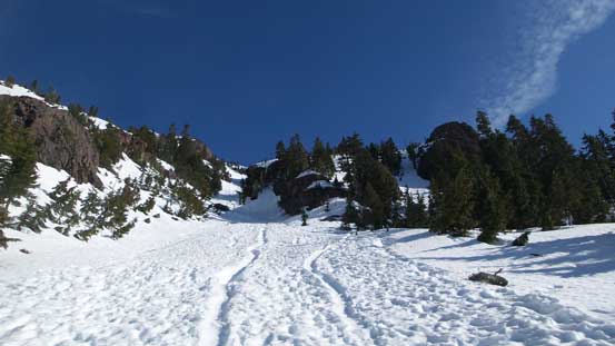
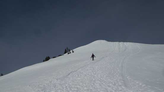
The next morning I woke up at round 6:30 am when two other trucks came by. One of them actually tried driving further towards the upper trail-head but had to turn around very soon. Soon enough there were 4 or 5 cars parked already and there’s no way I could sleep anymore, so off I went after a quick breakfast. The lower portion of this trail was bone dry and I did not hit snow until the trail made a gradual turn towards climber’s right into the north fork Big Creek. There’s a heavily-trafficked footpath so route-finding was essentially non-existent and shortly after a few steeper stretches I passed everyone in front and arrived at the basin below the south face chute.
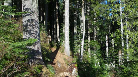
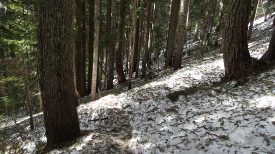
The lower reach of this trail was dry

From one of the openings, I could see Mt. Washington
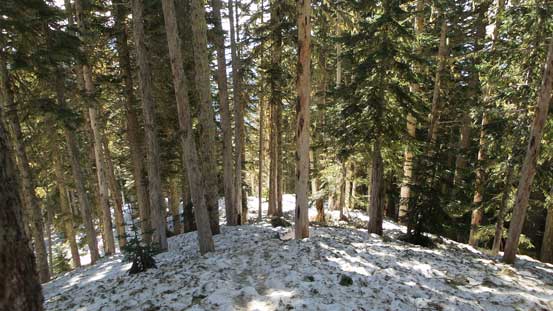
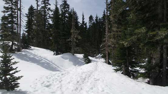
The snow soon became continuous
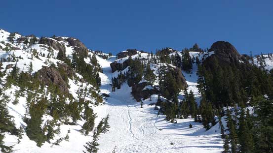
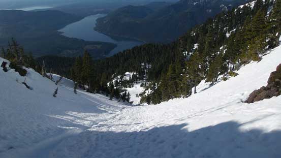
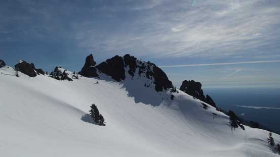
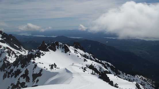
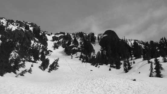
The first view of the south face chute.
Arriving at this basin below the chute. Perfect place to take the first break.
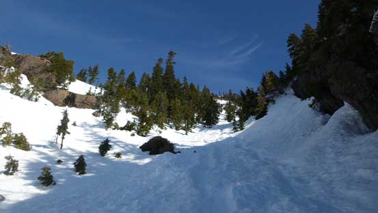
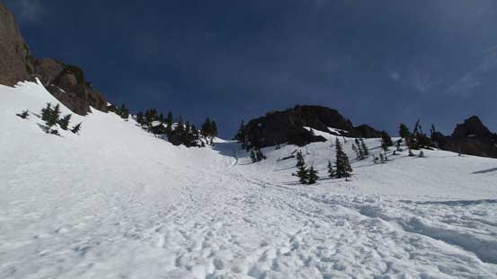
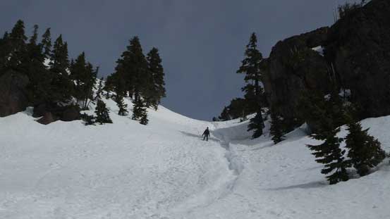
The route looked big from afar but once getting into it the grade was never steep. The condition was firm and a little bit icy at spots so I did spend a couple minutes swapping a pole for an ice axe and crampons but other than that this was a very fluent process, especially considering the “highway” of footsteps. The grunt was long though with a couple rises intermittent by some mellower sections and seemed like quite a drag.
Starting the ascent
Partway up. The shaded area was firm and icy.
A sideways view from the lower reach of this couloir
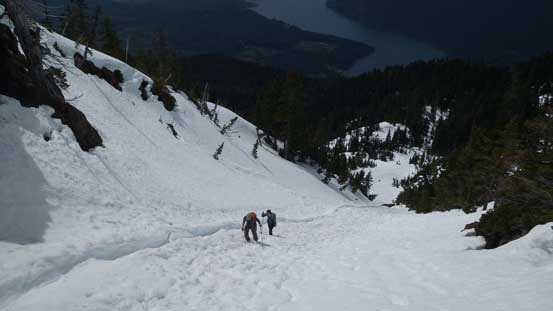
About halfway up.
The terrain mellows out a bit at this stage.
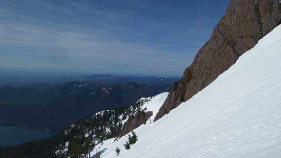
Another sideways view. This time from a much-higher position.

Almost topping out, looking down.
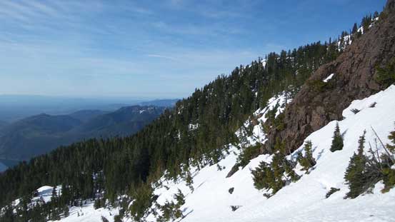
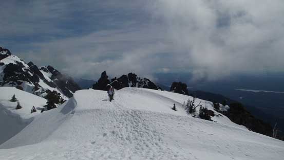
Turning left after topping out there were still two more rises to overcome before the summit but nothing’s steep anymore, although the morning sun did start softening the surfaces making some post-holing in the process. I took a very long break on the summit and chatted with the next climber arriving who’s also a member of that “Washington Hikers and Climbers” Facebook group. I have to say that this group has some very valuable discussions and beta and if not because of people’s recent posts I’d never know this little gem called Mt. Ellinor.

Turning left after topping out the couloir
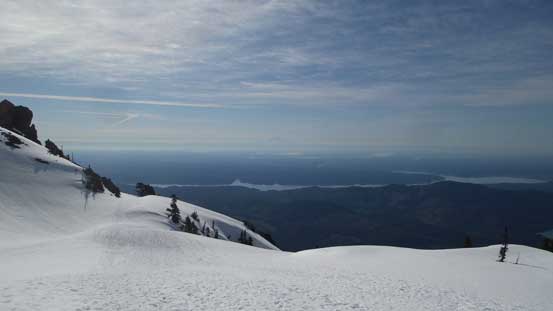
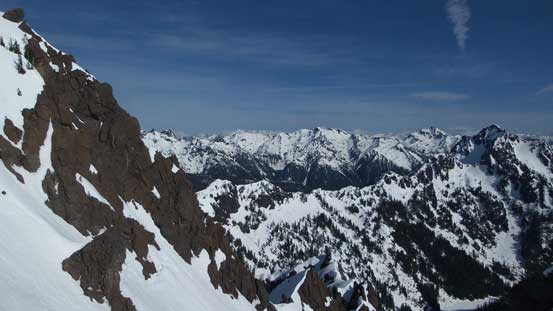
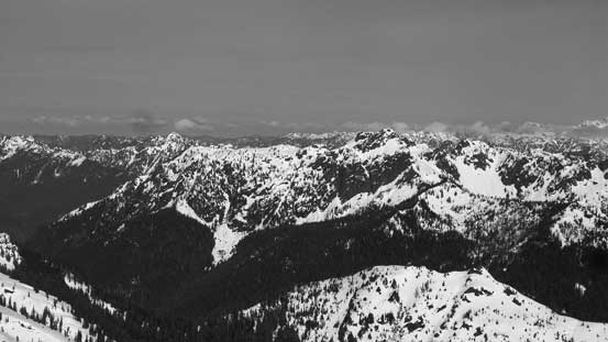
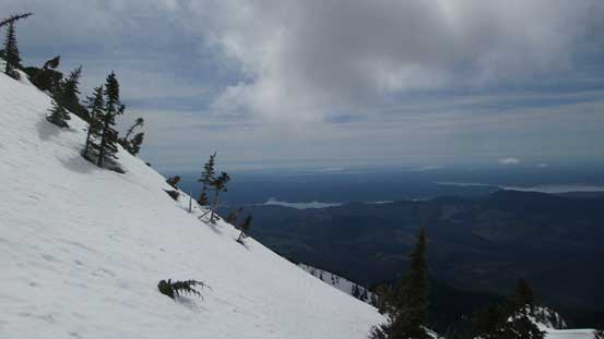
Almost expansive vistas now. Hood Canal is that strip of water.
One of the many jagged outliers nearby.
Could see into the Olympics now! My first time ever.
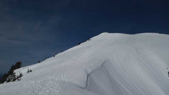
The final push to the true summit.
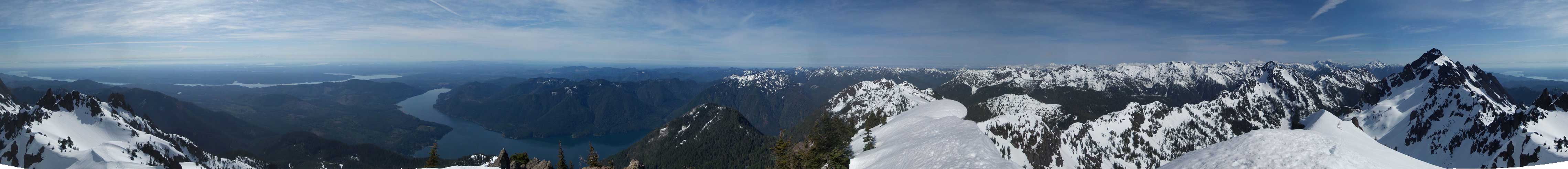
Summit Panorama from Mt. Ellinor. Click to view large size.
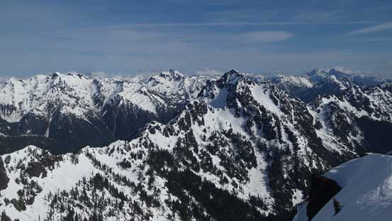
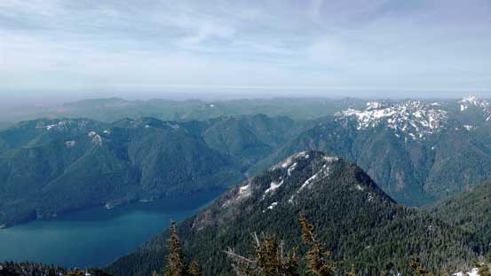
Looking over Copper Mountain into the SW Olympics
Mt. Lincoln in the foreground.
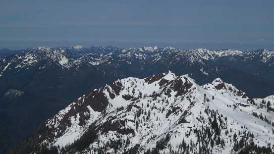
Looking over the rugged Mt. Cruiser towards the distant Mt. Olympus
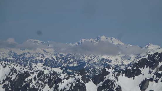
Mt. Olympus massif – the highest in Olympic Peninsula
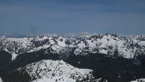
A northwards view – Mt. Pershing in the foreground
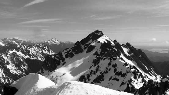
Mt. Washington is a taller neighbour which boasts a couple 4th class routes.
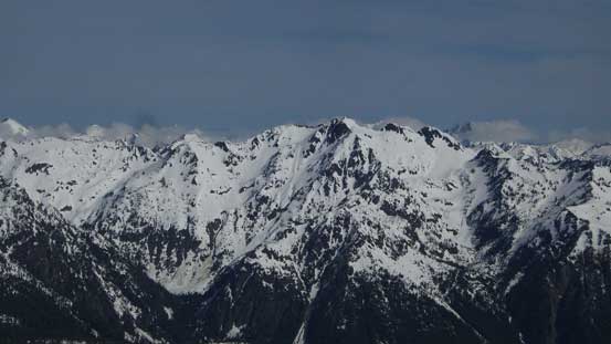
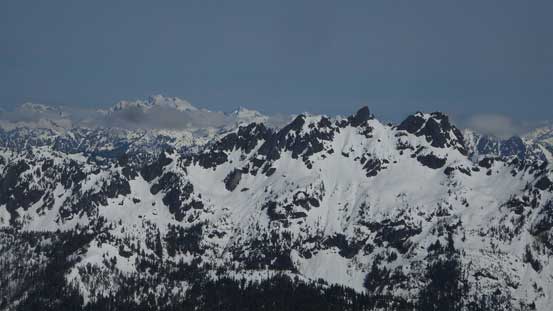
The south face of Mt. Skokomish
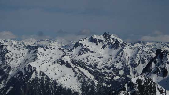
Mt. Stone
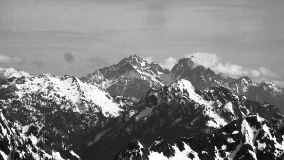
A zoomed-in view towards Mt. Constance

The Brothers
A wider view to show Mt. Lincoln, Mt. Cruiser with Mt. Olympus behind
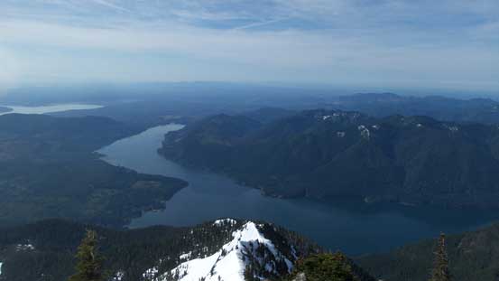
The entire stretch of Lake Cushman to the south
Mt. Rose is that low bump in the foreground

Another look at Mt. Washington
Can’t stop taking pictures!
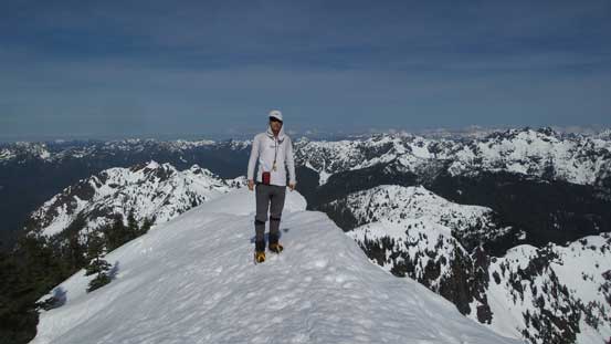
Me on the summit of Mt. Ellinor
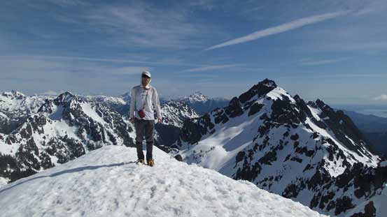
Another photo to show me on the summit.
The snow became sloppy on the descent and it felt like being drunk walking down on those tracks. I did try walking down beside the tracks but the post-holing was a bit too much, so went back onto the tracks. The top part of the chute was still firm which required some care (the crampons were off on the descent). Lower down I did not bother with a glissade as I’m not a fan of that kind of thing, even though it seemed like everyone else glissades this mountain. The rest of the return back to the truck was uneventful..
Time to head down.
Descending from the summit.
A sidways view towards Hood Channel and the urban areas
Getting into the upper portion of this chute
Another group was still going up.
Done the chute descent.
Into the forest…
As far as the views from below treeline…
Back to the parking lot it’s not even noon and my round trip time was under 5 hours. Little did I think about what to do next but now I had to make a decision. Had I gone driving back via the cities of Olympia, Tacoma and then Seattle I would for sure get caught in the afternoon rush hour traffics, so not wanting to waste time on the roads I started driving northwards along SR 101. At this point I wanted to hike up Mt. Storm King as weather seemed to hold pretty well, but after checking the Port Townsend ferry’s schedule I had to abandon that idea. The latest ride was 8:30 pm and it didn’t seem like I’d have enough time to complete another hike, so I went to Port Townsend and took the 5:15 pm ferry ride to Whidbey Island, and then got back home before 8:30 pm which wasn’t bad.
