Mount Olds
October 30, 2021
2542m
Pemberton, BC
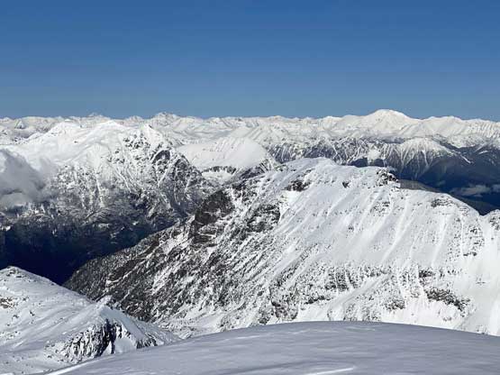
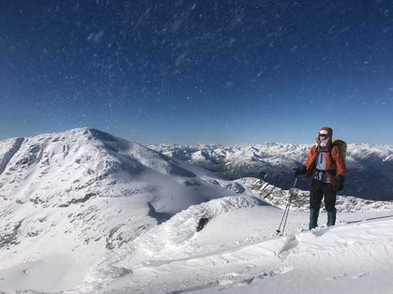
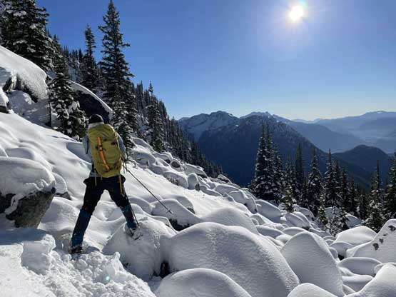
Mt. Olds is one of the taller summits in the Place Glacier Group not far from Pemberton. This peak is a bit overshadowed as it locates right next to the highest peak in this area – the unofficially named “Mt. Oleg”. Mt. Olds is difficult to access and because of that, it’s rarely done as a stand-alone objective. Mel, Ben, Elise and I did this peak as a side product of Mt. Oleg’s ascent. The two peaks are too close to each other such that not bagging them in the same trip would be a real shame for someone like me aiming to bag all of the named summits. We approached Mt. Oleg via a new route and although short, it was not the most pleasant. We encountered hours and hours of bushwhacking in dead-falls and consistent route-finding and scrambling through snow-covered bluffs. From Oleg/Olds col we also noticed the west ridge of Mt. Olds was too snowy to attempt. The alternative plan was the south ridge, but to get there we had to continuously lose elevation for another 150 meters.
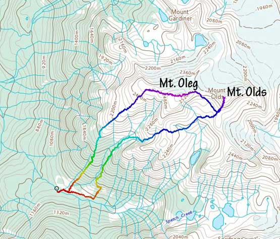
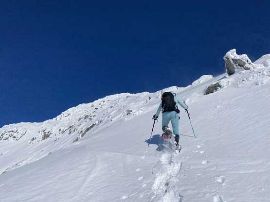
The steep slope immediately under Oleg/Olds col was a bit shallow but we all managed to descend with snowshoes attached to our feet. Mel and I then plodded ahead to firstly descend into a bowl then cut a side-hill traversing line to access Olds/White col. From the col the ascent of Mt. Olds was nothing but a steep grunt on snowshoes. The winds were hammering the slope and the condition was decently firm to allow fast travel on snowshoes. The slope was considerably steeper than the ones on Mt. Oleg.
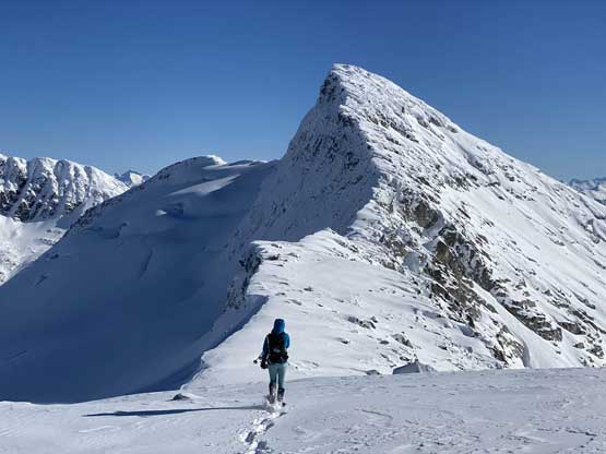


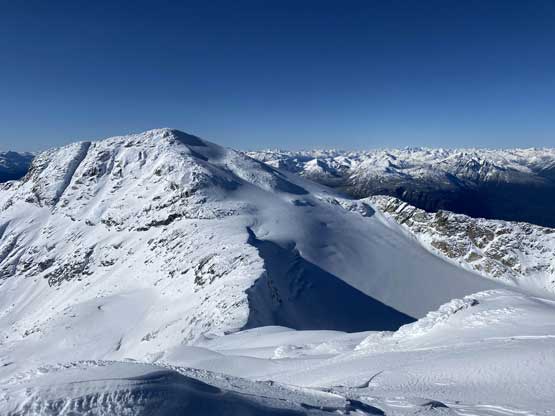
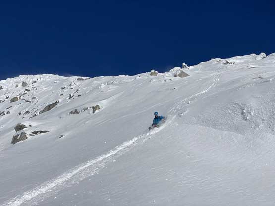
On the descent I took the snowshoes off and went for a long glissade, losing over 100 m down the south slopes to below Olds/White col. The others kept their snowshoes on and also glissaded here and there. I thought about to tag “White Peak” as it’s right there, but I do not like unofficial names especially the ones given by bivouac.com. We faced a major decision at this point because the most obvious way was to plod back up and over Mt. Oleg and that involved about 300 m of elevation regain. I did have another route in mind but such was unknown. I’m never a fan of trying an unknown descent route just for the sake of making a loop, but this time I convinced myself that was okay because I too was tired of thinking to re-ascend Mt. Oleg. We then descended further down into the bowl under Mt. Oleg and Mt. Olds and then re-ascended about 100 m to the “south col” of Mt. Oleg. To continue descending all the way down from our bowl would be ideal on paper, but that was the route Simon and Vlad took in 2018. I knew their trip report and I certainly did not want to taste the worst devil’s club bushwhacking on this particular day. Our planned route likely also involved a hell deal of pick-up-sticks but I preferred that over the thorny stuffs.
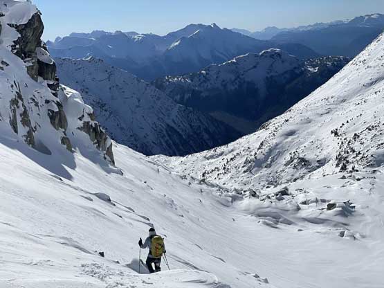


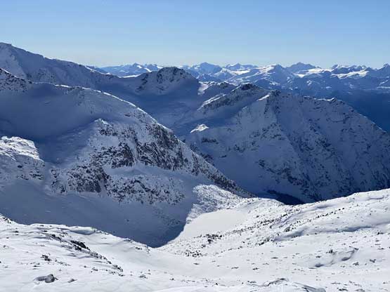
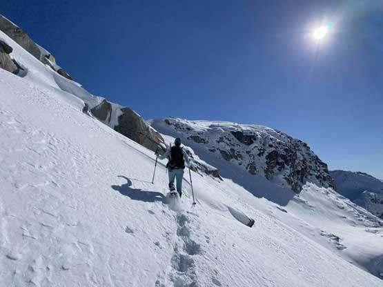
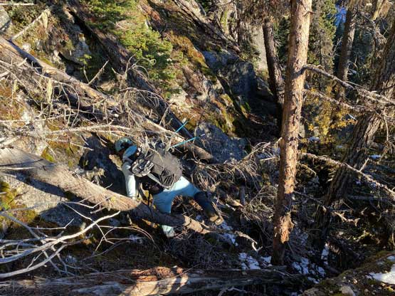
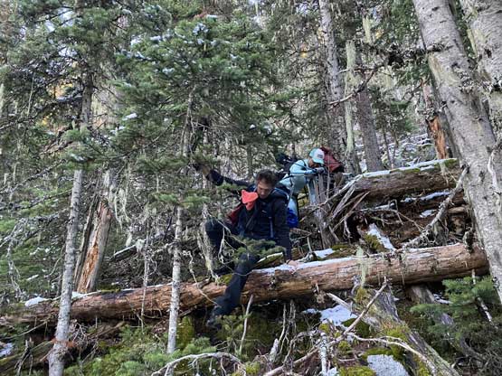
Descending west of Mt. Oleg’s south col we had a zone of cruising. The closer contour lines on the map suggested a possible cliff but luckily we found the far skier’s left offering a trouble-free passage. The next long plunge got us to below 2000 m and the snowpack had thinned enough that the boulders started to reveal from underneath. For the next few hundred meters of descent we had no choice but to snowshoe on thinly covered boulders. That was a tad sketchy to say the least, but thankfully I did have fair amount of experience of this. At times I led us bailing into the forest on skier’s right side and the going was sometimes better. We kept the snowshoes all the way down to around 1800 m, lower than where we strapped them on in the morning. We mostly followed the course of the creek at this point. The forest had moderate underbrush but mostly free of pick-up-sticks.


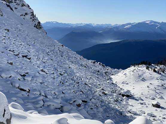

I thought about to just bash out of this creek but following a creek usually turned out to be a disastrous idea in the Coast Ranges so I quickly abandoned that thought. At about 1700 m I found a reasonable spot to cross the creek (side-hill bash through snow-covered alders) then tried really hard to maintain a descending traverse out towards down-climber’s left. The terrain always wanted to suck us rightward into the creek and every time I checked the GPS I told myself to traverse farther left. Unfortunately we never did traverse far enough such that we got sucked into some insanely steep slopes around 1500 m. We must traverse hard left across some no-fall zones with lots of pick-up-sticks to negotiate. We then did manage to find some cruising in the forest with much better pick-up-sticks situation than the forested rib we used in the morning, but at 1350 m we encountered a bluff that was impossible to descend without a rope. We were forced to traverse about 200 meters farther to the down-climber’s left (east) until finding a reasonable spot to descend through that bluff. At this point we were only 100 vertical meters above the logging cut-block but this 100 m involved a greater deal of pick-up-sticks that even downhill direction did not help much. We had to keep our spirit high and maintain the perseverance and eventually we got out of the trees and down to the road. The rest of the road-slog was such a refreshment and we got back to the truck just moments before sunset.


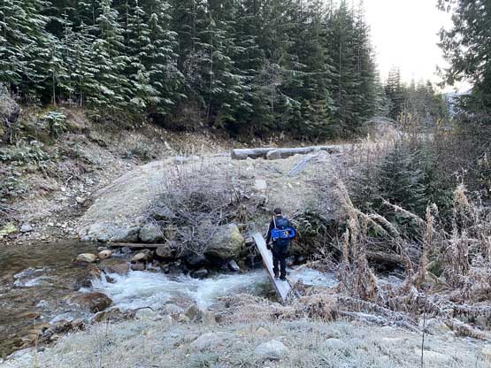
The windshield was full of frost by the time we got back, so took our time to let it defrost. The drive down and out of Spetch Creek FSR was not bad but did require some careful work. Back into Pemberton we dropped Elise off and then drove south into Whistler for a nice dinner at the Splitz Grilled. I somehow managed to stay awake for the rest of the drive back home and eventually got home at 10 pm.
