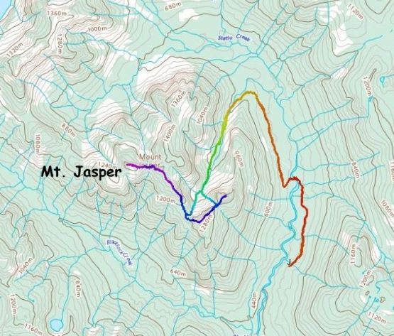
Mount Jasper
December 17, 2023
1433m
Statlu Creek / Harrison West, BC
Despite the official name Mt. Jasper is extremely obscured such that an ascent of the true summit is rarely heard. There are only a few “accounts” out there on the internet and the routes were never clearly understood. To further complicate things the peak is buried deeply in the woods behind Mission and the only logical access is from Statlu Creek FSR. This road is usually gated, adding about 10 km of biking (each way) and the complication of trespassing. As a result this peak had been eluding me for years until Caro Coco published a detailed trip report a couple months earlier. The most important message was the gate had been opened. Caro did not make Mt. Jasper sound like a pleasant outing with a round trip time of 20.5 hours (including “Flinch Peak”), but I was never expecting a “pleasant trip” from this objective anyway. A few weeks earlier I ascended “Flinch Peak” together with Blinch Peak and that trip provided a good taste of what’s coming up next on Mt. Jasper. A high pressure system finally returned to SW BC on the 3rd weekend in December. I made the last minute decision as usual, but this time only Kate managed to join.
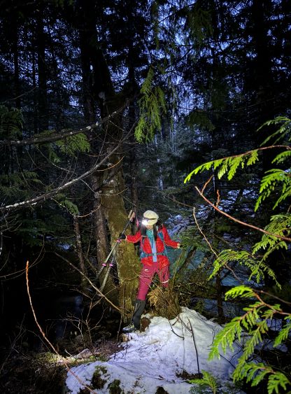
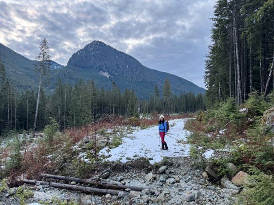
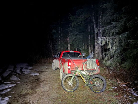
I wasn’t sure how far could we push the Tacoma up the Statlu Creek FSR given the snow and the various degrees of unknowns at this time of a year but based on a recent report I knew we could at least drive to the junction with “South Statlu FSR”. This meant we could possibly have to walk an additional 3-4 km each way. The final decision was then made to bring bikes. I picked up Kate at 4:30 am and we made to the “South Statlu FSR” junction two hours later. It was still in the pitch dark, and the tire tracks did not continue further. All of the previous traffics went straight across the bridge onto the other road, but thankfully the snow wasn’t very deep at this elevation. There’s one small downed tree but I just drove over it and then I had to put in fresh tire tracks on some snowy sections. I eventually parked at the exact same spot where Caro parked. I briefly inspected the washout but the decision was obvious. The washout was worse than stated in Caro’s trip report such that one needs a narrow and lifted 4×4 or an ATV to go through. I nevertheless was happy to have made this far. Kate was not particularly confident about biking especially on snow, so I was the only one unloading the bike. Having driven this far up the FSR the biking was more for “fun” than needed.
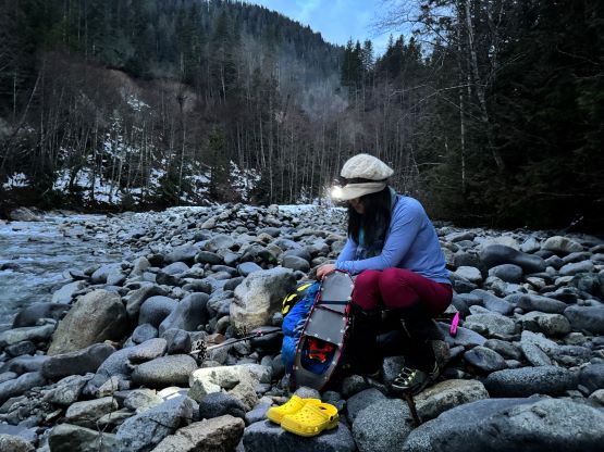
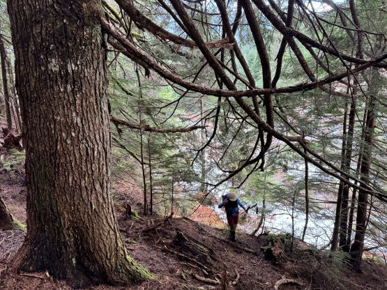
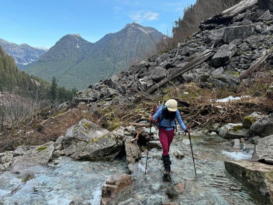
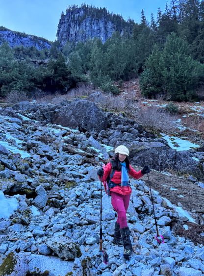
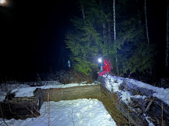
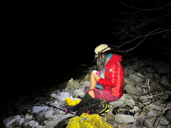
The snow was unfortunately not very supportive so the “fatbiking” only worked on the downhill sections. Thankfully there were plenty of dry stretches to justify pushing the bikes further and further. I eventually called it and parked the bike in less than 2 km from the truck, not far from the crossing of Statlu Creek. I was a few minutes faster than Kate so the biking still made sense in my opinion. The creek crossing appeared intimidating and we knew from Caro’s trip report that the direct crossing could be up to our waist. Thankfully Caro had found a better way on her return. We bushwhacked north (upstream) for a few minutes and found that shallower crossing that was knee deep at the most. We both had brought river crossing footwear. Kate brought a pair of socks that I had never seen for extra warmth whereas I brought the paddling shoes for extra traction. The river was overall bigger than I thought. After this bit of excitement we ditched the river crossing gears and dashed up the remaining few kilometers of the FSR to the road’s end. The going was mostly smooth but we hardly gained any elevation up to this point.


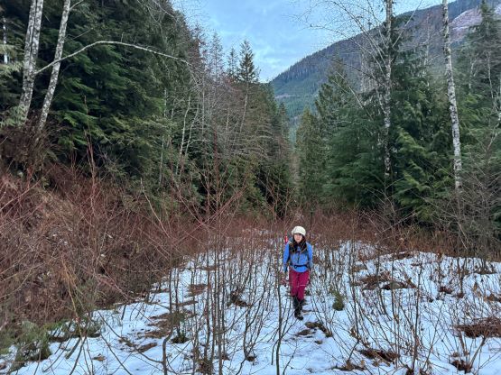
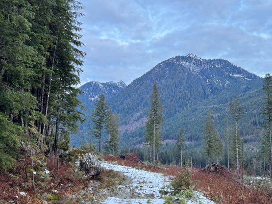
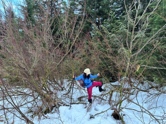
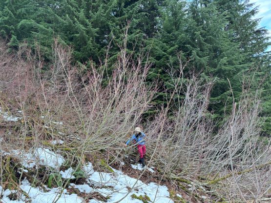
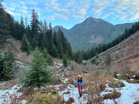
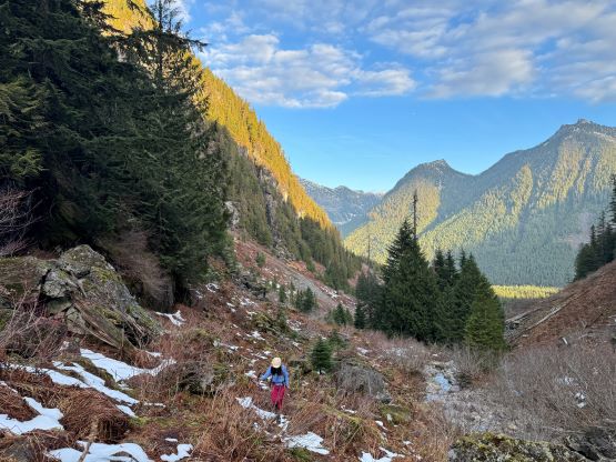
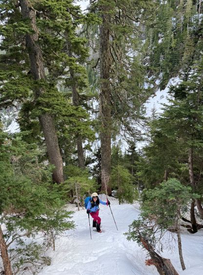
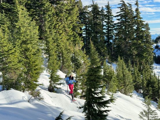
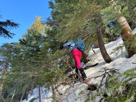
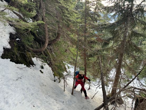
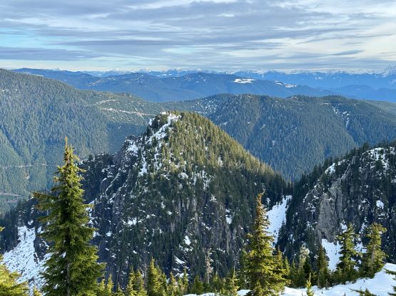
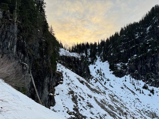
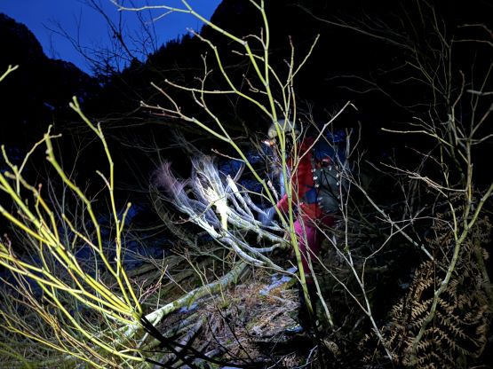
Beyond what appeared as the road’s end we found an old and overgrown road and consulting with Caro’s GPX we knew she was also more or less following this old road. The forest beside the road appeared rather open and it was very tempting to go into the forest, but I was keen to see how bad this road could be. We did bail into the forest at one particular section but otherwise mostly stayed on this road. There was some thrashing but nothing severe. Our route (the old road) and Caro’s (open forest) merged at around 600 m elevation at the entrance of the long valley heading up towards a saddle on the undulating SE Ridge of Mt. Jasper. This saddle separates the main/east summits with the two unnamed P100m summits farther to the east. I eventually added those two peaks into the trip as they appeared rather interesting and mysterious. I was anticipating some trouble-free plodding in this valley but I was being too optimistic. The going was slow and tedious. There was enough snow to make the boulders slippery but not enough to cover up the boulders and and bushes. The snow depth was actually the “worst case” that we had to be diligent for every step forward. This complicated the route-finding. At one point I decided to cross the creek to the climber’s left side but this proved to be a mistake. Some bushwhacking in brambles punished us. Caro’s track on climber’s right side was proven to be the better way on the return a few hours later. The worst stretch was the few kilometers of thin-covered boulder fields until the snow was finally deep enough to strap the snowshoes on. This was at 850 m elevation.
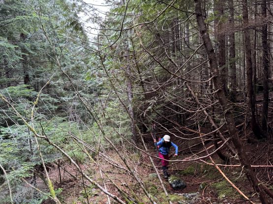

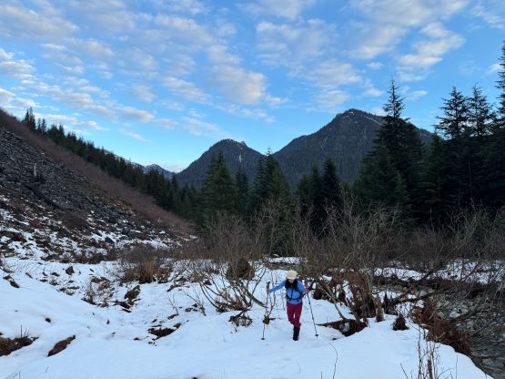


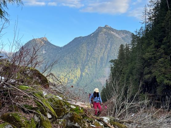
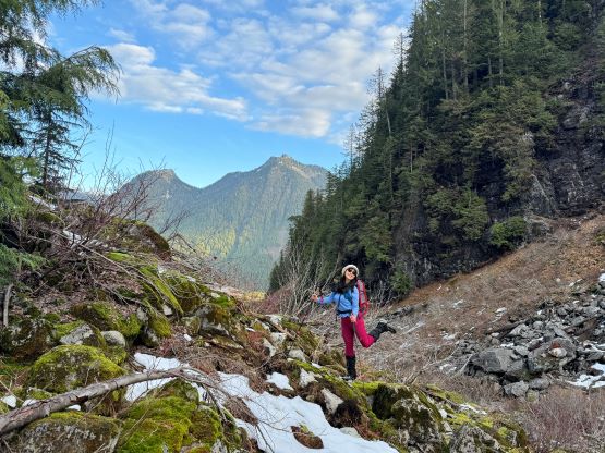


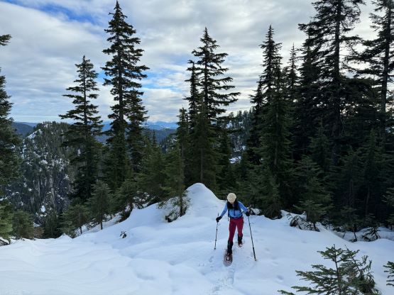
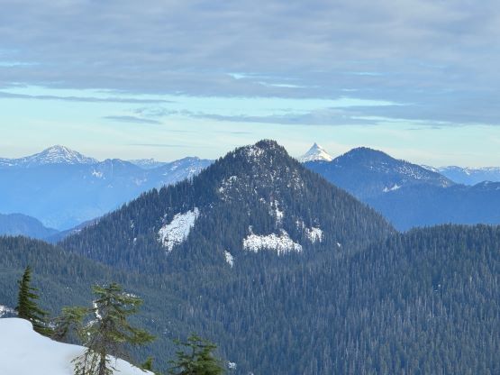
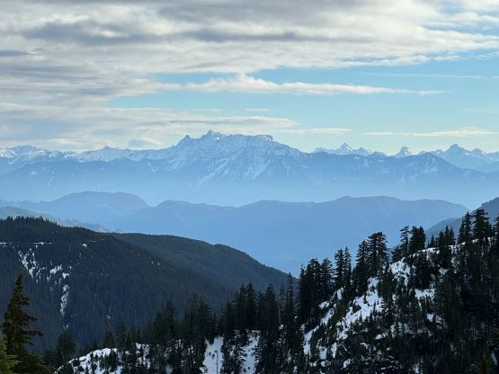
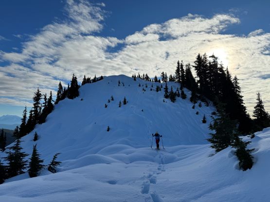
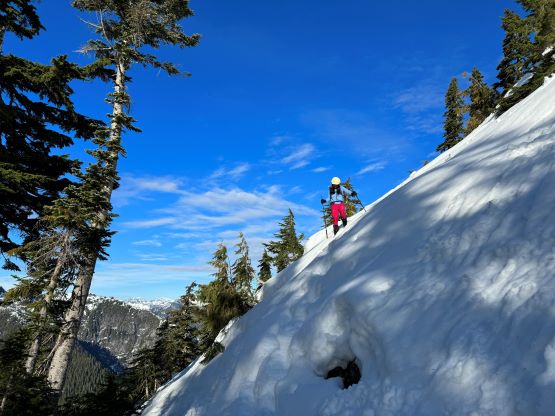
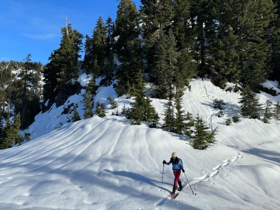
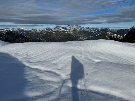
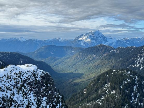
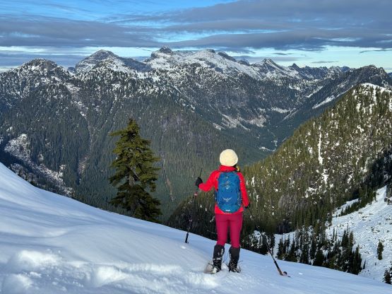
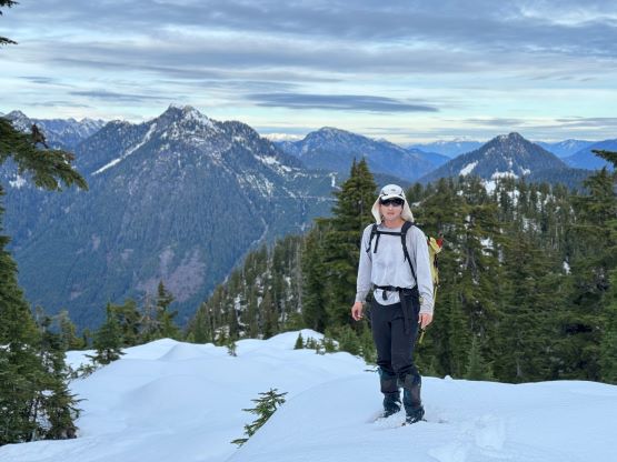
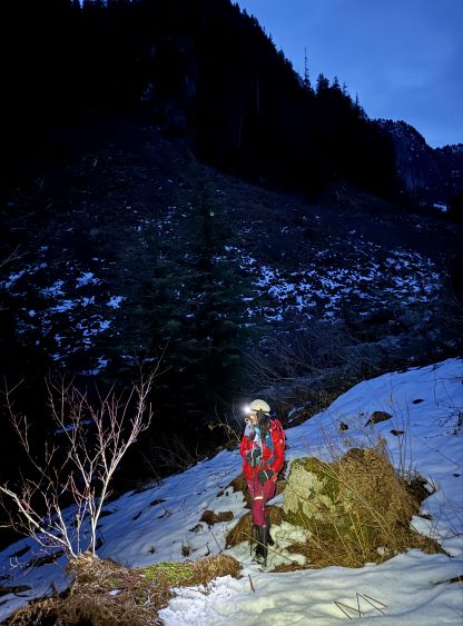
The snow was just deep enough to warrant the use of snowshoes but we still had to be diligent about the “holes”. I on purposely slowed down but still discovered a few holes. At around 1000 m elevation the snow finally became continuous and then it was a steep, but otherwise straightforward plod to near the aforementioned saddle. I decided spontaneously to ascend the steep forested slope on climber’s right side to take a short-cut. This actually helped us bypassing some of the worst bushes near that saddle. The only reason we were able to put the snowshoes on at such a lower elevation was because of the terrain being a “bowl”. The SE Ridge of Mt. Jasper was rather dry on the other hand, that we encountered quite a few dry stretches until 1250 m elevation. We nevertheless managed to keep the snowshoes on, but the terrain was not as “easy going” as I was hoping for. We were over 4 hours into the trip and this was shaping up to be a dark-to-dark kind of outing. I told Kate that I still had an hour of work booked in the evening and we must speed up somehow, so there was no more break all the way until the summit. The views eventually opened up not far from the false summit of Mt. Jasper’s east peak. We plodded up and over this false summit as there’s no obvious bypass, but then we bypassed the actual east peak by traversing across the south slopes.


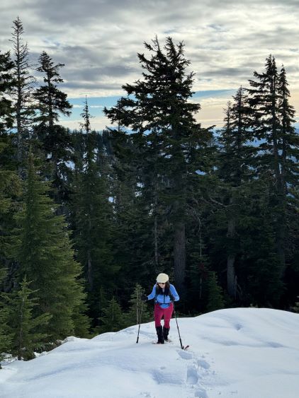

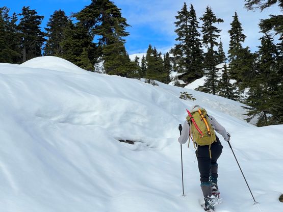


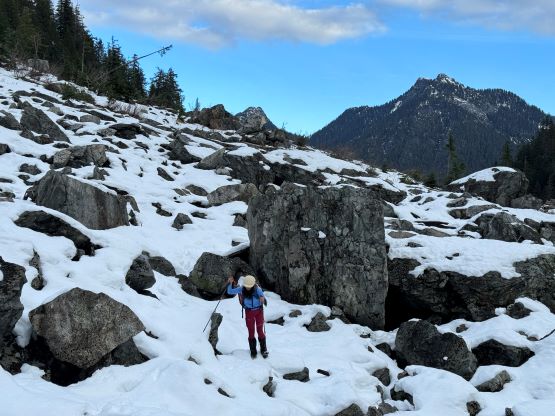
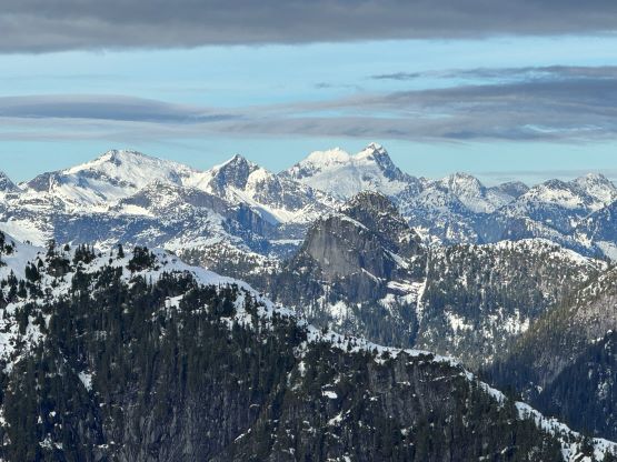
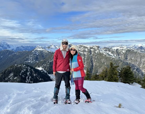
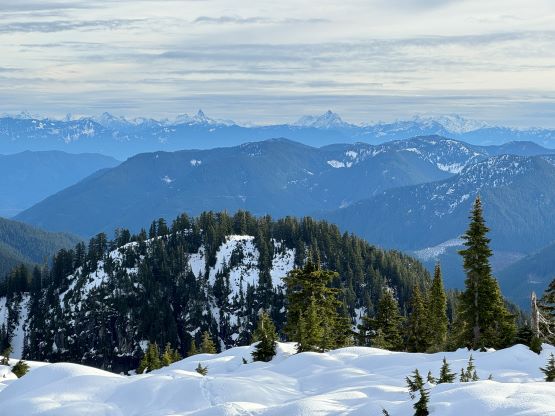
The crux of the ascent of Mt. Jasper was actually the descent off the east peak into the east/true saddle, while losing over 50 m elevation. This descent was steep and and route-finding was not obvious. I was experienced in this type of terrain and managed to nail the route-finding in one shot, but at times even I was doubting the feasibility after encountering some seemingly steep drop-offs. We eventually found a line and managed to keep the snowshoes on by some tight zig-zagging. The final ascent of the true summit from the saddle was not difficult, but long and tedious. There’s one more false summit to plod over and our ascent time was almost 6 hours. I caught some cell reception and texted back to the city that I might be late for work. We nevertheless spent about half an hour on the summit to soak in the views and the experience as very few had made this far on this peak.


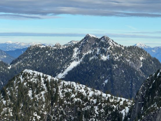


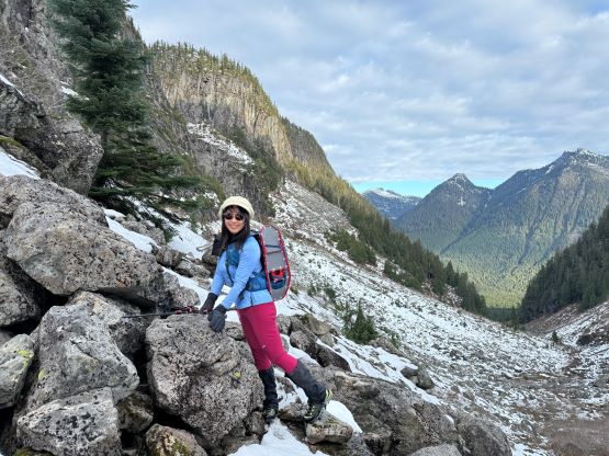
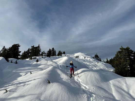
On the descent we mostly retraced our steps until nearing that saddle. I was contemplating about the two bonus P100m objectives and made the final decision to bag them. Kate was tired and wanted to just go home, so the decision was made for her to descend solo while following our tracks. I would make a loop by descending a different route, and we would meet up again somewhere below where we donned snowshoes. The ascent of the first peak (Peak 1320) was rather trivial but the descent into the Peak 1320/Peak 1300 saddle was very steep and tricky. Some “technical” snowshoeing was needed. The snow condition was also soft, thin and slippery and the slope angle was at least 45 degrees with numerous bluffs to circumvent. I nevertheless managed to keep the snowshoes on but I don’t think many people could. Adding transitions switching between snowshoes and crampons could easily eat up time so I tried really hard to avoid doing so. Most would need at least twice as long to move through this type of terrain, so I was glad that Kate did not come along. The ascent of Peak 1300 was also not as straightforward as I thought, with more “steep snowshoeing” on thin and crappy kind of snow.


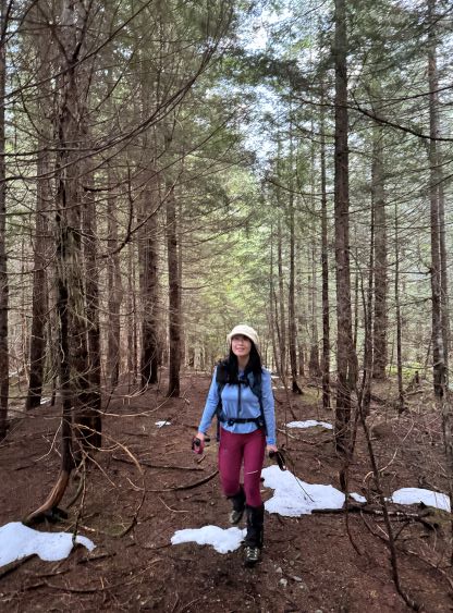
Not doing any lingering I immediately followed my own steps back down to the Peak 1300/Peak 1320 saddle and then descended that steep NW facing chute that I previously spotted on the way in. This chute was thankfully as straightforward as I was hoping for, that in no time I was back to our tracks. I was relieved to see Kate’s descending set of snowshoe tracks as I couldn’t see her from above. I told her to roughly wait at 950 m elevation and I also told her my intended route, but there’s some misunderstanding. Kate thought I would be joining her at a much lower point at around 750 m so she kept descending following our foot prints. This eventually turned out to be a great decision because I caught up to her before that spot, so grabbing the two bonus peaks did not cost additional time, after all. I then led us descending a variation by staying on Caro’s track entirely on the west side of the creek, and proved this to be the better way. Darkness fell before we exited this valley, but we were not far from the old road at this point. The rest of the return was mostly uneventful. Both of us was tempting to wade across the creek in boots as our boots were already soaked, but I told Kate that being “waterlogged” would still be quite different than being “soaked”, so we took our time donning river crossing footwear. The bike ride back to the truck was not as enjoyable as I essentially had to push the bike across all the snowy stretches, but I was still a few minutes faster than Kate. Our round trip time was under 11.5 hours which was a tad longer than I thought, but we only took three breaks of the entire day sans the transition points, and we were not moving particularly slow. The terrain on this mountain was just rough and inefficient no matter what. One might think it’s better to do with a shit ton load more snow, but then the road would get snowed in, and one needs to start walking from much farther back. As stated on bivoauc.com, this peak is obscured for a reason.


It was 7 pm when we finally drove out of the Chehalis Main back to Lougheed Highway so I texted back to the city that I would be almost 2 hours late for work. To my surprise they still wanted me to work, so I had no other choice. We eventually got back at 8:30 pm. I took a shower while Kate made me a dinner. I eventually showed up at work at 9:45 pm, and did not get back home until 11:30 pm.
