Mount Gardner
December 30, 2016
727m
Bowen Island / Sunshine Coast, BC
The lowly elevation suggests that Mt. Gardner should be a fairly easy outing at any time of a year and being the highest peak on Bowen Island a variety of trails have been developed leading hordes and hordes of hikers to its summit. There’s a clearing area near the summit (heli-pad and microwave tower) that offers great views towards the Lower Mainland as well as peaks surrounding Howe Sound on a clear day. To get to Bowen Island one has to take a ferry ride and the tradition of tagging Mt. Gardner is by parking one’s car in Horseshoe Bay and taking the ferry on foot. There’s about 3 km (one way) of additional walking from Snug Cove to the actual trail-head.
Towards the end of last year weather seemed like “half decent” on Friday. I wanted to take one last advantage of the sunshine and being right in the middle of a holiday season meant I could shift things around fairly easily so did manage to get that day off. Mt. Gardner seemed like the right idea. The downside was the recent dumps and cold temperature as practically going anywhere would require snowshoes, but how much could I complain about that.. Waking up at 5:30 am I did manage to get things going quickly. Within an hour I had picked up Cynthia from Burnaby and then up the Trans-Canada Highway we went. The traffics were non-existent but unfortunately we missed the 7 am ferry ride by just a few minutes. Thankfully there’s a coffee shop nearby for us to kill some time.
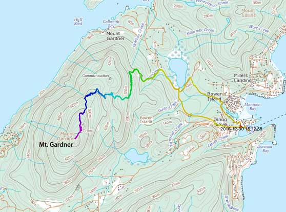
Mt. Gardner via the “north peak trail” from Snug Cove. GPX DL
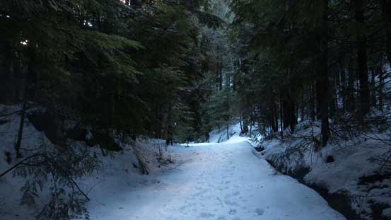
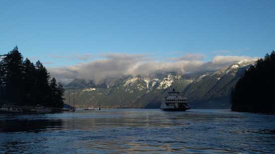
The 8 am ferry ride was perfectly timed for the morning glows but unfortunately the weather was mostly overcast as opposed to be the “sunny” in the forecast. Twenty minutes later the ferry parked in Snug Cove. Walking to the trail-head has many ways to accomplish and the fastest option is no doubt taking the road. We opted to take the Killarney Lake Trail on the north side of Killarney Creek as suggested in Zeljkok’s trip report on ClubTread. The trail turned out to be undulating and very icy and the views were very limited to just a few spots. Frankly speaking it didn’t really impress me by much so we decided to just take the road on the way back.
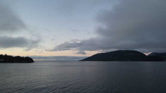
A view from the morning ferry ride

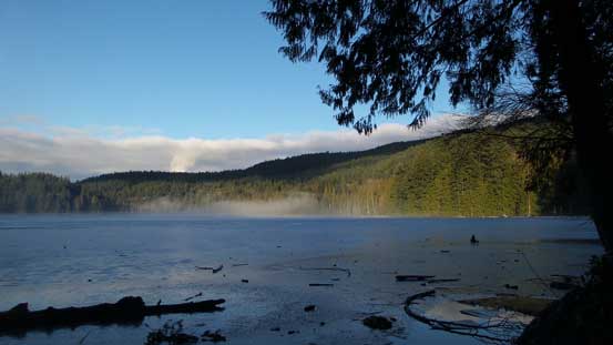
As much as the view from Killarney Lake Trail
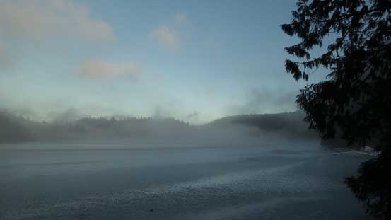
It’s amazing to see Killarney Lake was frozen…
The first portion of the trail followed a well graded logging road steeply up until to a locked gate. Minutes beyond the gate it diverged with the left branch following “Skid Trail” while the right branch would do a longer tour up the broad NW Ridge. In the snowy conditions we decided to just follow the main set of tracks up the north route and the next long while was essentially plodding up the rest of this logging road. I spent a few minutes changing footwear from hiking shoes to mountaineering boots and then once the snow became continuous we all strapped the snowshoes on. Eventually about halfway up this peak the road terminated at a forested saddle. The set of tracks continued beyond following the clearly marked “North Peak trail” and essentially there wasn’t much route-finding left for us to do. Our next stop was a viewpoint and from which we could get a good perspective of the Sunshine Coast area.

As much as the plod up the logging road goes

Cynthia working her way up..
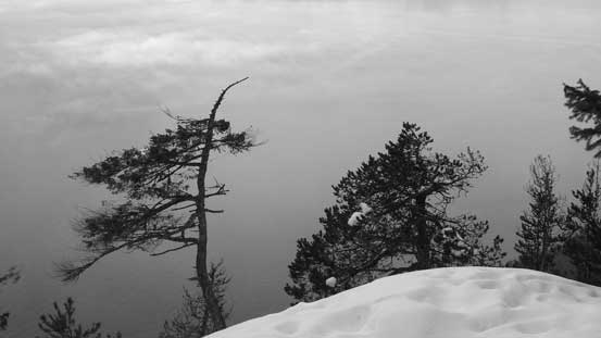
Arriving at the view point, looking down at two interesting trees.
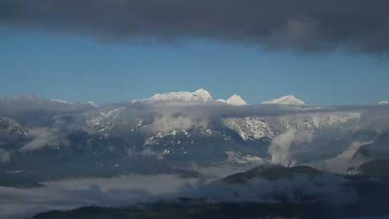
A look at some big peaks along Sunshine Coast – Panther, Tetrahedron and Rainy
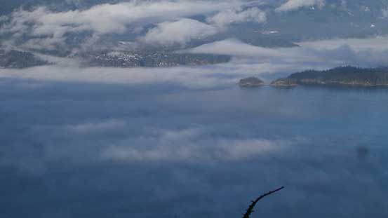
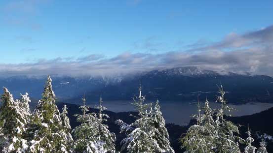
Low clouds hovering above Howe Sound
Keats Island and Howe Sound from that viewpoint
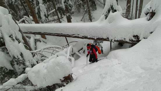
Beyond the viewpoint the snow had become deeper and deeper, the terrain had become increasingly steep and a few annoying deadfalls presented themselves that we had to duck underneath to get around. The final push before the heli-pad was also steep and a bit firm and icy, but our Lightnight Ascents did great on biting on the surface. Unfortunately we entered the cloud layer and there’s nothing to see other than the microwave tower. We waited for a while but there’s no sign of improvement so I made the call to keep traversing to the true summit first. The true summit is heavily forested so there’s no views whatsoever and after putting a “check mark” on this peak we went back to the heli-pad, hoping the forecasted sunny weather would eventually come true. It did… About half an hour later the sky had gradually cleared up from the north and then we spent another half an hour soaking in the views.

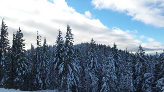
Starting to get frosty as approaching elevation of 600 m

The first major dead-fall
This is the first steep section.
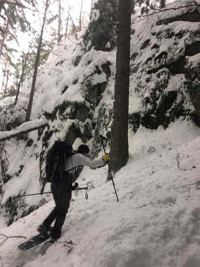
Me grunting my way up
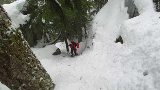
Cynthia ascending the steep gully just before the heli-pad false summit
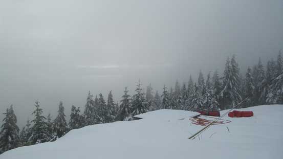
Arriving at the heli-pad, with no views whatsoever…
We turned our attention to the true summit instead.

Cynthia and I on the true summit

Seems like there’s some sort of industry going on…

Sneaking in to get a view of the mighty Mt. Garibaldi
Looking back at the forested true summit

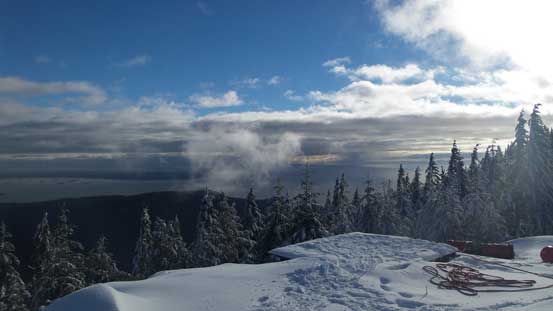
It’s finally clearing up!
The peaks along Howe Sound Crest Trail were still engulfed in clouds though
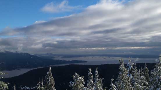
A view looking at Lower Mainland

One of the many man-made structures up there

This is one of the two heli-pads
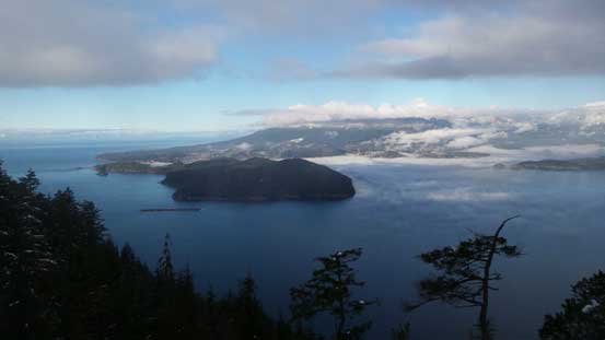
Straight of Georgia looking south

More about Howe Sound and Sunshine Coast
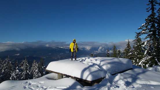
Me on the heli-pad
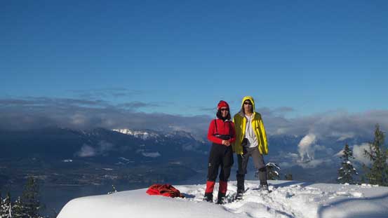
Our group shot before starting the descent
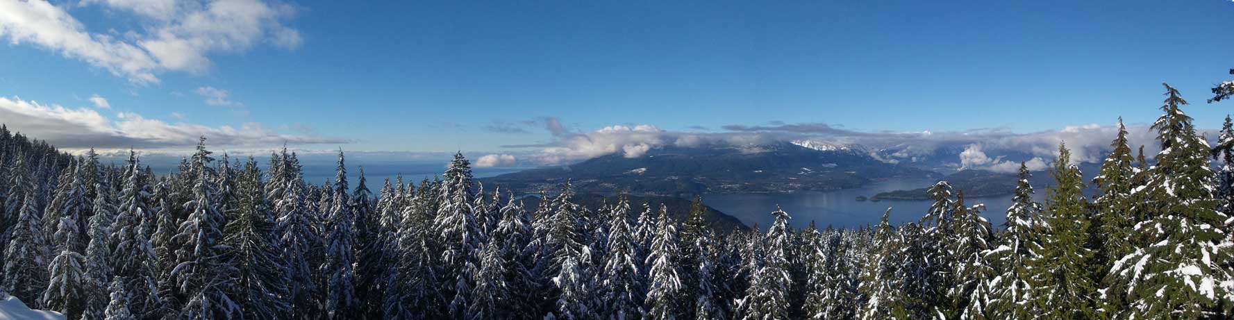
A panorama view from the false summit. Click to view large size.
For the steep and icy gully below the heli-pad we decided to take the snowshoes off. I led the way, down-climbing facing inwards and kicked in some steps and Cynthia had no problem following. After that it was a cruise sailing back down the route. We also spent a few minutes at the lower viewpoint, and near the end I spent another few minutes swapping footwear. Walking back along the road felt tedious, but at least easy going as we no longer had to deal with that icy trail. But on the other hand we had to pay more attention to the incoming traffics. Racing against time we sped up towards the end but still, missed the 3:15 pm ferry by literally just a few seconds…
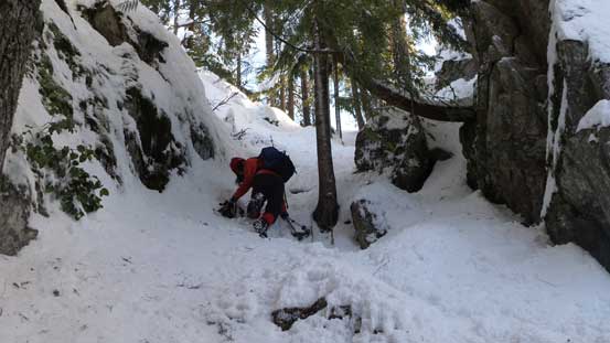
Down-climbing the steep couloir below the false summit

Howe Sound from the lower view point
The typical slog down that logging road
Killarney Lake
Back to Snug Cove, but we missed that ferry by just a few seconds…
After spending about an hour in a nearby restaurant we caught up the 4:15 pm ferry ride, and just like in the morning the timing was perfect for picturing the colour changes. This time the weather was on our side and the views greatly justified spending an extra hour on the island.

Getting onto the 4:15 pm ferry now
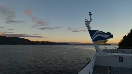
It’s perfectly timed for the sunset views!

The last beams of sunlight shone on Black Mountain by Cypress Bowl
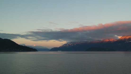
Looking up the Howe Sound with some incredible lighting
Once the ferry parked at Horseshoe Bay we followed the clear instruction back to the parking lot, and then half an hour later we got stuck in the horrible North Vancouver’s traffics. It literally took about 1 hour to squeeze through the corridor but once crossing the bridge it’s no longer that bad. That concluded another great year in the mountains. 77 peaks in total with lots of memorable ascents such as Atwell, Shuksan, Fee and Rainier. Not bad, not bad…
