Burstall Pass Peak
February 12, 2012
2615m
Kananaskis – Smith Dorrien Valley, AB
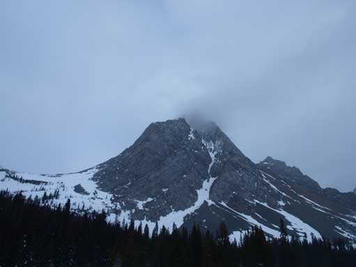
“Burstall Pass Peak” is a very unofficial name of the ridge between Burstall Pass and South Burstall Pass. It’s not an impressive summit speaking for its mountaineering interest, but given its location one would expect some incredible views on a clear day. Andrew Nugara pointed out that the round trip time would be about 10-12 hours in his Snowshoeing in the Canadian Rockies. However, I think he was referring if you have to break trail all the way up. I managed to finish this trip in 5 hours 50 minutes and I was not in a rush.

Burstall Pass Peak snowshoe/ski ascent route
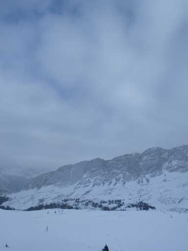
From the parking lot I tried to follow an official snowshoe trail, which led to wrong direction. Well, I forgot Burstall Pass trail is not an official snowshoe trail, so if there existed one, it must not be the one I wanted. However, this trail led me to a steep canyon, which looks somehow similar to the approach canyon to Bow Hut. The steep cliffs on both side are pretty impressive. So this “wrong turn” did get me some extra views in retrospect. I managed to regain the main trail by turning sharply to the left and the trail was more like a highway of tracks. The weather was moving in quickly, and then it started snowing. Ohh NOOOOO!!! After crossing one marsh/swamp area, it’s the first significant elevation gain to a narrow area. After that, Burstall Pass was in sight. Thankfully Burstall Pass Peak was not covered in clouds so that kept me motivated for at least seeing something from the summit. Near the steep climbing towards Burstall Pass, I began to post-hole, so I finally strapped my snowshoes on.
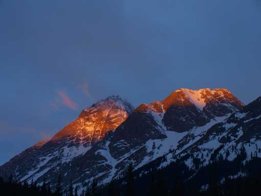
Alpenglow on Birdwood and Commonwealth
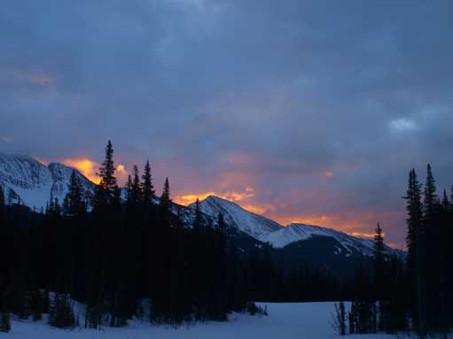
Glow over unnamed peaks
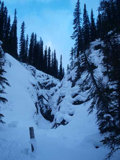
The wrong trail led to this canyon. I had to break my own trail steeply up the left bank

And here is the correct trail!

Mount Birdwood

Snow Peak

Birdwood again!

Oh no.. I started to lose blue sky
The East side of Whistling Rock Ridge. Robertson col on left
Mount Birdwood, now with come clouds obscuring the summit.
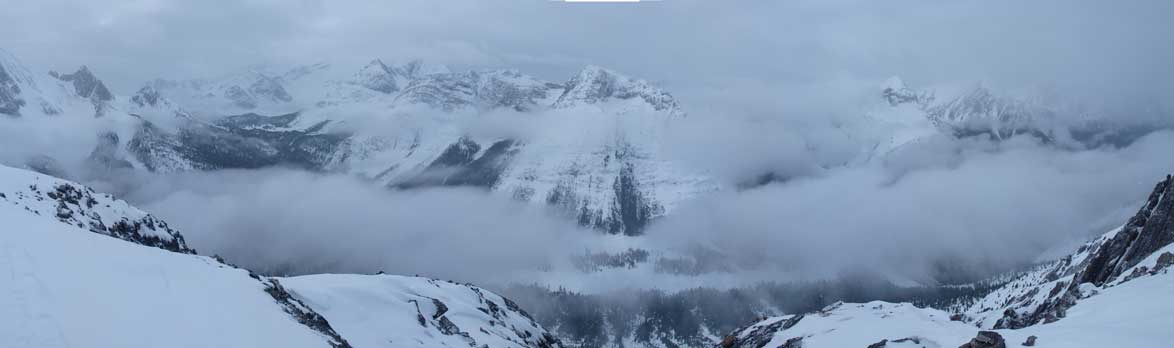
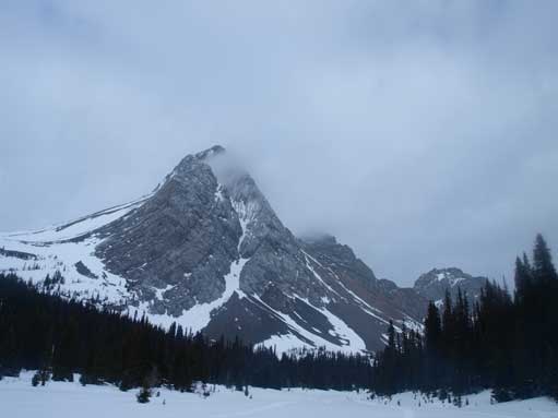
My ascent route was to traverse to South Burstall Pass first, then ascend the not-too-steep slope right towards the summit. Mt. Sir Douglas did clear up for about 3 minutes. Together with Mt. Birdwood, they are the most eye catching giants nearby. Once on the ridge, it was only about 5 minutes to the summit. The view towards BC side fully opened up. Despite the not-so-good weather, the low clouds on the other side added to variety. There are three summits on this peak that are 3-5 minutes apart from each other. I don’t know which one is the highest so I traversed all of them to make sure I did summit this mountain.
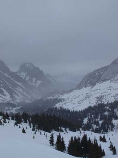
Once above treeline, weather got nasty

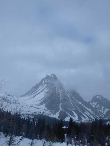
Could barely see Mount Sir Douglas

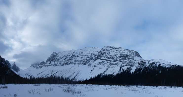
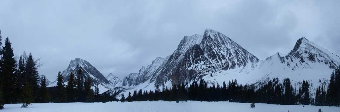
Whistling Rock Ridge
The other side, Palliser River Valley
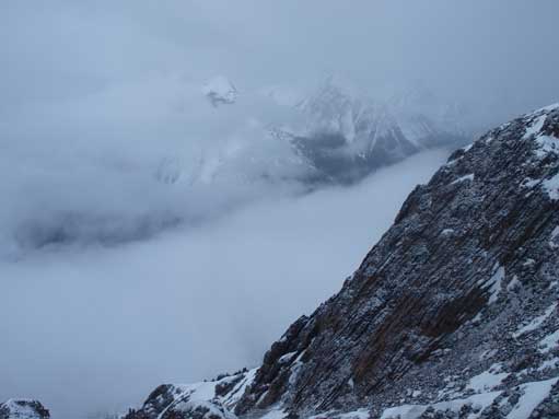
Surprisingly interesting summit view!

Summit view again
I traversed further north before descending and the route I took on the descent was considerably steeper and more avalanche prone. On the way back, I saw at least 15 skiers and 3 snowshoe-ers in several groups trudging up the pass, some of them were going for the peak. I was quite surprised about my speed on this peak. So after estimating my round trip time would be somewhat about 6 hours, I decided to speed up, to save more daylight time. In that pace, I would still have 3.5 hours of daylight time, which meant, I could definitely go check out Chester Lake. Overall, Burstall Pass Peak is definitely one of the highlights of winter travel in K-Country, and as a peak bagger, you should try it.
Some blue colours, but they didn’t last long

This area has some huge cornices. These are on the shoulder of Snow Peak
Mount Birdwood
Mount Birdwood

A group was studying winter travel essentials near the parking lot.
Similar to Burstall Pass Trail, Chester Lake Trail is well packed down so I didn’t need to snowshoe-up. I carried my snowshoes pretty much all the way to the lake. The difference is, this trail is quite steep compared with the much gentler grade of Burstall Pass Trail. My mom couldn’t catch up my pace as long as the trail gets steep. There’s a large meadow area before the lake. It’s hard to distinguish them in winter if you hadn’t been to this area before. The lake is right at the base of Mt. Chester’s cliff. I saw a little bump at the other end of the lake, which looks about 50-80m? or so higher than the lake. It’s quite doable since I’ve brought my snowshoes up. On the bump, the view to the other direction (towards highway) opens up, and I could see Mt. Birdwood and Mt. Smuts rise behind Chester Lake. It’s my first time seeing Mt. Smuts, the hardest scramble in Kane’s book. From this angle, Chester Lake is finally distinguisable from the meadow area. The “summit” cairn is quite small, (smaller than my snowshoe). After a quick panorama, I headed down to re-join my mom at the lake shore. After completing Burstall Pass Peak + Chester Lake, I covered 30km distance with 1100m elevation gain.

Me on Chester Lake Trail
A panorama of Chester Lake area in winter.
