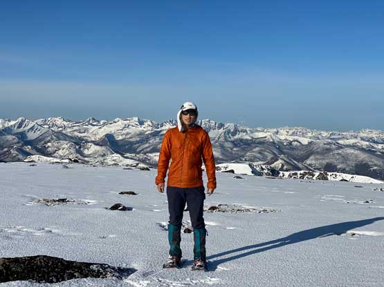
Sheep Mountain (Pasayten, WA)
June 1, 2022
2522m
Pasayten Wilderness, WA
The name of “Sheep Mountain” is rather boring, but the presence in both “Washington Peaks with 2000 ft/600 m prominence” and “Washington Top200” lists means this peak does catch attention from peak-baggers. This is quite an interesting objective buried deeply in Pasayten Wilderness at least 1-2 days of trekking from any access point in Washington, but this peak locates only a few kilometers from U.S./Canada border and logging roads extend reasonably close to the border from the B.C. side. There weren’t much information about these logging roads that seemed to ran ~40 km from Manning Park’s Eastgate down south and then east along Pasayten River but the satellite images made a few of us believe it’s possible to drive to, or close to the very end making Sheep Mountain a mere half-day assault from B.C. side instead of the usual, 3-5 days trek from Washington side. A few Washingtonian veteran peak-baggers had finally started to think outside the box in the past two years and asked me if I knew anything about these roads. Unfortunately my reply had to be “no” especially considering we just had an apocalyptic flood in Nov. 2021, but I did have a plan to go check things out myself to resolve the mystery. Thankfully I actually did not have to go there myself to play the game of gambling as Matt J. went in a week prior, drove to near the end of the road only stopped by snow and made a brief report on peakbagger.com.
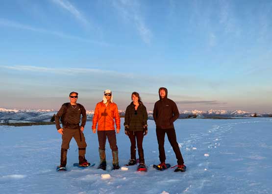
I immediately formulated a plan to follow Matt’s footsteps on the next weather window and that happened to be exactly a week later on Wednesday. My objective was absolutely dead set on Sheep Mtn. what no flexibility whatsoever as who knows how long this road will be maintained. There were already rumours that the government is trying to deactivate the logging roads in the areas around Ashnola River and this one is located in the broader vicinity. I managed to recruit a team-of-four, Elise, Phil, Francis and myself at the last minute. I did have to be back home no later than 5 pm for work, so the plan was to drive out after work on Tuesday to car-camp at the end of the logging roads to allow a proper pre-dawn start. Francis had to be in Kelowna after this trip so opted to drive out separately, which I did not mind as having two Tacos is a whole lot safer to venture that deep on backroads.
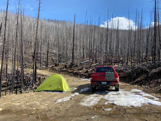
I did not finish work until 9 pm on Tuesday night so we did not make to Eastgate until almost midnight. The area had been, and was still being hammered by rain and the logging roads were mostly obscured by a thick layer of fog making some extra exciting time. Thankfully the rain stopped and the fog lifted after about 15 km into Pasayten River FSR. The road was in a decent shape, but very muddy and slippery at places. We also drove past at least 30-50 logs that had been recently cut, as well as numerous narrow stretches with rocks on the road. The road did not seem to be maintained for industrial activities at least not in the recent days, but there’s substantial evidence of user-maintenance by the local hunting and 4×4 communities. The last stretches started to become quite steep and muddy but having a Tacoma with all terrain tires made this an easy fair. We eventually drove past Matt’s starting point and parked right at the spot where Matt bailed into the forest. This was already 1 am so the drive was indeed a long one.

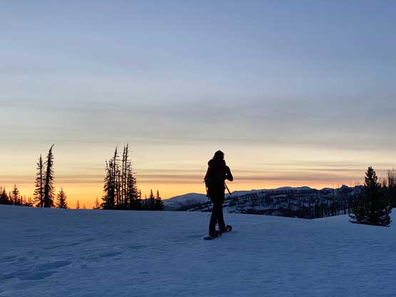
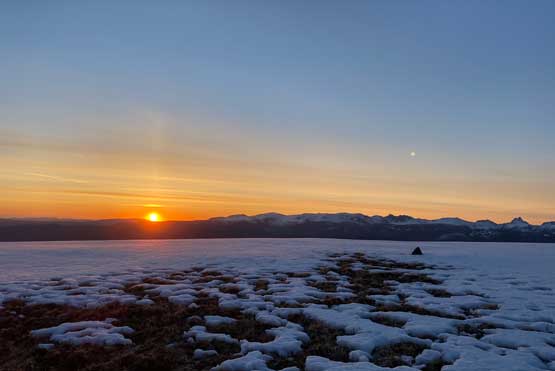
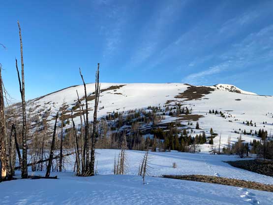
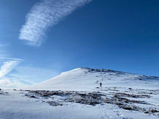
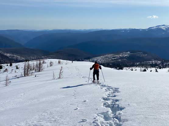
The road system was not labelled in Gaia’s topo map, but is correctly labelled in the Backroad Mapbook layer of Gaia GPS. To use this layer one has to pay some subscription but compared to the just the gas $$ to drive this far this additional cost is literally nothing, so don’t ask me about the driving portion. Buy your subscription and do your own navigation. I did not even track the FSR anyway. The place where we parked was very wet and muddy such that nobody beside Phil was keen to set up the tents. Elise and I simply just slept on the truck’s driver and passenger seats and that actually worked out decently. The alarm was set at 3:30 am so needless to say that was quite a push. Francis and Phil didn’t sleep much at all but Elise and I did catch at least 1 hour of intermittent sleep. The condition was already much less snowy than a week prior but we could still see the faint ski tracks left by Matt’s party. We had to carry the snowshoes for about 10 minutes before reaching continuous snow. The snow condition was horrible as expected. Even at 4:30 am in the dark we were sinking through the breakable crust and at times, pure slush. The radiation freeze at night (thank to clear skies) was not enough to form a supportive crust to hold our weight. As a result the progress was slower than expected. I was hoping to watch sunrise on the summit of “Border Lake Peak” but ended up having to watch sunrise on its broad north ridge, which was still very impressive. This was just after 5 am in the morning.


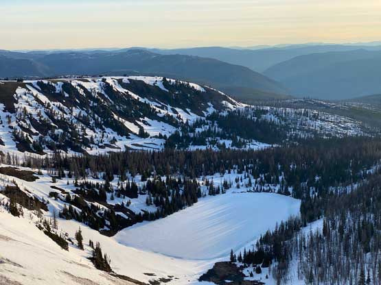
After the sunrise show we resumed the straightforward plod up the north ridge of “Border Lake Peak”. The snow condition was still mostly breakable crust on top of slush such that at times we were sinking knee+ deep and were constantly tripped by the crust layer that caught our snowshoes’ tips. Nobody was actually complaining as the horrendous conditions had been the theme of this season on basically every single damn trip we ventured onto snow. This substantial peak immediately north of the border with over 200 m prominence is right next to the officially-named Border Lake, so on peakbagger.com it’s named “Border Lake Peak”. However, the Canadian mountaineering encyclopedia bivouac.com named it as “Lamb Mountain”. I absolutely hate it when these two sites give separate unofficial name and I usually prefer the ones given by bivouac.com, but in this particular case I think the peakbagger’s name is more legit.


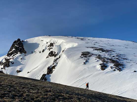
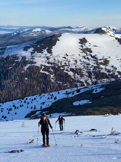
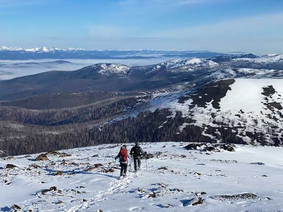
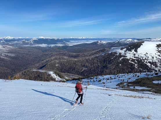
After a brief break on the summit of this rather sub-peak we continued southwards crossing into Washington’s Pasayten Wilderness. There’s an unavoidable 200+ meters of descent into Park Pass. We carried the snowshoes for much of the upper half but the bottom zones were on continuous snow. Again, the conditions were very shitty. Each of us was post-holing on top of the previous person’s tracks. Elise was the only one able to mostly float on top of the crust and Francis was sinking thigh deep. I was fine with the added post-holing, but my MSR Lightning Ascents had too many crampons and they relentlessly caught the crust. That was fine on the uphill stretches, but became really frustrating when the orientation went downhill. The moment I didn’t pay attention or I wanted to go a little bit faster I would trip and fall. The snow on Sheep Mountain’s lower north ridge was a little bit more supportive, thankfully.

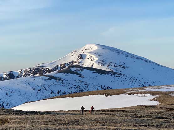


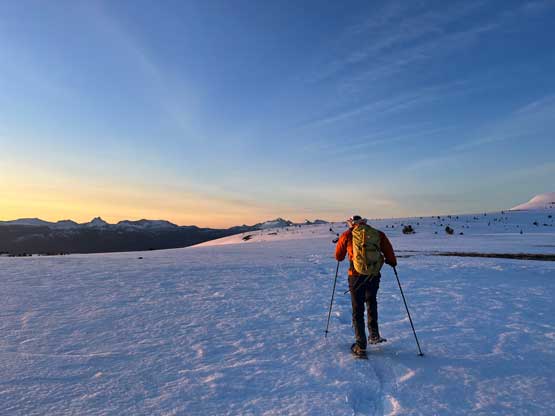
There’s one substantial bump on the north ridge of Sheep Mountain that’s not so obvious while ascending. I noticed that beforehand by studying the maps so started a traversing bypass roughly from 50 m under the bump. The others mostly went up and over the bump, so even though I was the 4th in the line struggling to keep up I ended up being 2nd in the line after this bump. We then had a stretch of steep snowshoeing to ascend out of this broad-ish notch onto the uppermost north ridge. The rest of the ascent was easy and uneventful, but seemed to drag on for a long time. Our ascent time was over 3 hours.


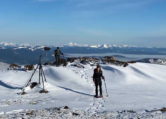


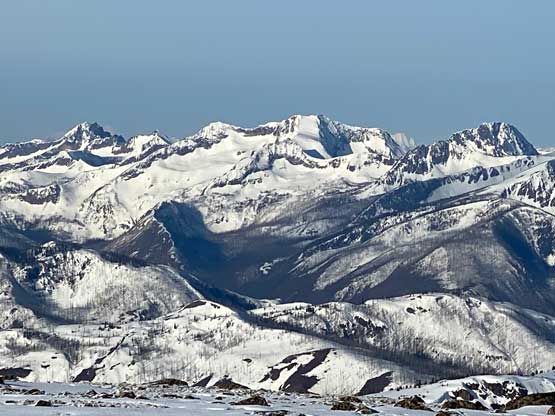


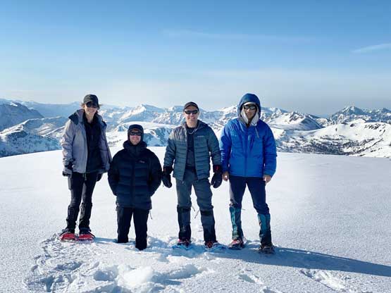
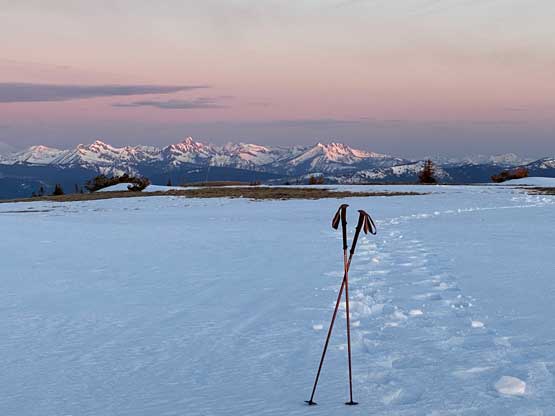
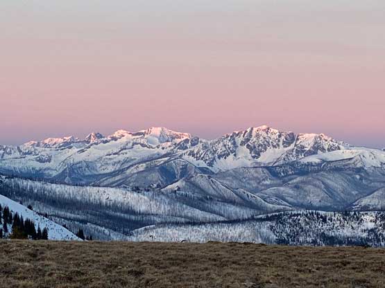
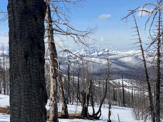
The views had been amazing so we lingered on the summit for at least half an hour before the coldness forced us to retreat. Thankfully the crust had started to break down so the tips of my snowshoes didn’t catch that relentlessly on the descent. In short time we all plunged down to Park Pass and now we had to face that 250-m elevation gain back up the south-east side of “Border Lake Peak”. The lower 200 m regain was unavoidable and then we opted to bypass the very summit by contouring on the west side. This saved us a little bit of work. I then led a downwards traversing line post-holing every single step forward (at times, thigh deep) to re-join our own tracks. Once onto the morning tracks the post-holing situation improved. We then had a cruise sailing down the north flanks of “Border Lake Peak” into the forest. To navigate the open, burnt forest we had to consult with the GPS numerous times to make sure we stayed on our route, as the snow wasn’t continuous so we couldn’t just blindly follow our own foot prints. In total we had practiced the snowshoes-to-foot and foot-to-snowshoes transitions at least 20 times on this day, so everybody was becoming faster in the end, which was good.


Our round trip time was exactly 6 hours which was pretty much as expected despite the post-holing. Not wasting much time we soon turned around the trucks and started the long drive homewards. I was able to keep myself awake for the next 1-2 hours to navigate us out of the FSR and then Elise took over the drive back to Abbotsford. Meanwhile I took a much-needed nap as I needed to sleep as much as possible in the next couple hours to make my evening work less miserable. I eventually got back home at 2:30 pm, made some Social Media updates and caught another 2 hours ish of sleep. I did not finish work until 10:30 pm at night which still felt exhausting. I then drove straight south across the border to get some cheap Washington gas to take advantage of the low traffic volume at this time of a day.
