Outrigger Peak
July 26-27, 2020
2181m
Squamish / Elaho River Valley, BC
“Outrigger Peak” is the unofficial name of a rounded and glaciated summit that rises almost 2000 vertical meters above the confluence of Sims Creek and Elaho River in a remote area of South Coast. This peak doesn’t boast much mountaineering potential but offers really nice views and exploring. I’ve heard parties ascending this peak as a bushwhack from logging roads in Sims Creek valley in a day. For Alex, Vlad and myself this was done as part of the 10-day traverse from Clendinning Range to Elaho/Jervis divide and Outrigger Peak was ascended on Day 9. Earlier in this day we had ascended the uber-obscured Mt. Pearkes that overlooks Jervis Inlet.

The section from Loquilts Peak to Deserted N1.
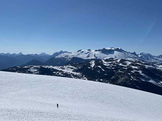
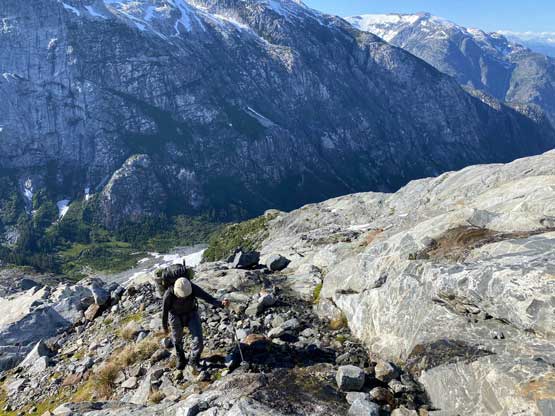
We packed up the camp and carried on the very long and undulating ridge system towards Outrigger Peak. The plan was to get as close to the summit as possible and watch sunset from the top. Right off the bat we faced a pinnacle that must be bypassed on the west side, which involved a bit of side-hilling on steep snow. After that we had a trouble-free slog to the top of a subsidiary summit on the connecting ridge that boasts more than 200 meters of prominence.

The double summits of Mt. John Clarke from our camp

Vlad taking a rest break…

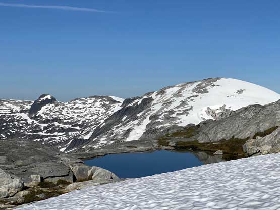
Cool tarns in the valley between Mt. John Clarke and Outrigger Peak
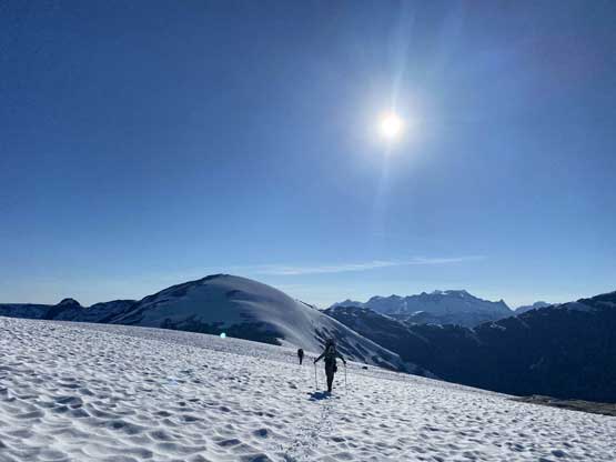
Vlad plodding the never-ending snow to the subsidiary sub-summit

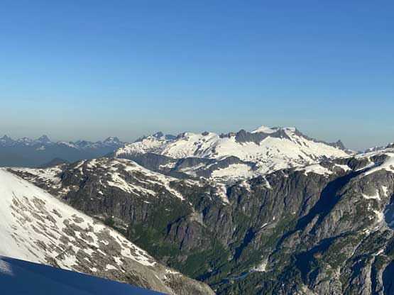
Another photo of Mt. John Clarke aka. Sun Peak
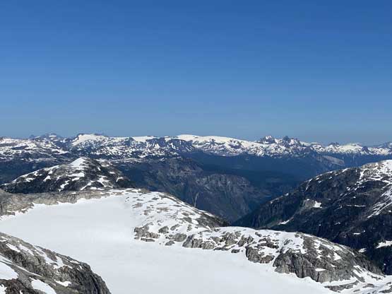
Looking over Outrigger’s south glacier towards Powdercap Traverse
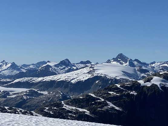
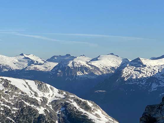
Mt. Tinniswood and Mt. Casement from the subsidiary summit
It’s sad that we had to lose all of the hard-won elevation, dropping 300 vertical meters to a deep notch separating that subsidiary summit with Outrigger Peak. At least this whole stretch was done on some soft snow that offered fun boot-skiing and glissading. In no time we were down into the “Outrigger notch” wondering how to ascend out of it on the opposite side. The direct attack was possible but we didn’t like the steep terrain in this afternoon heat, so I opted to lead a line further to the climber’s left losing some additional elevation. The route involved a short stretch of 3rd class scrambling followed by a long plod on 35 degree snow and finally, the broad and boring SW ridge. We did not ascend the summit via the SW ridge and instead, we aimed for a shoulder on the uppermost NE Ridge and set up camp. I managed to pitch my BD Hilight on a rock slab (slightly slanted) but Alex and Vlad had to pitch their tent on snow, with some tiring digging to flat things out. It had been an exhausting day but we still had to bag the summit…
Me heading down the subsidiary summit with Outrigger Peak in front

The valley that drains between Mt. John Clarke and Outrigger Peak

The last bits of descent into the deep col
Vlad scrambling out of the col

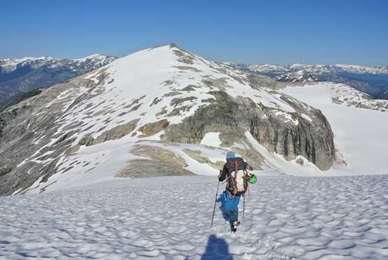
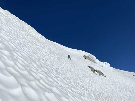
Alex and Vlad now ascending the exhaustingly long snow slope
The terrain finally flats out a little bit. That sub-summit is behind
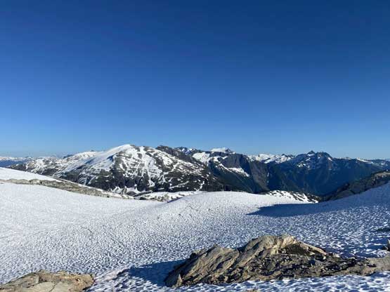
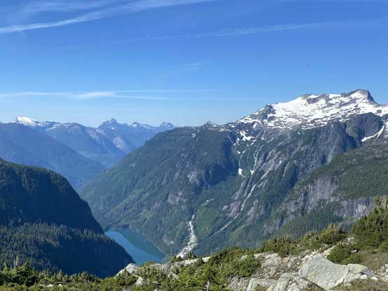
A wide view towards Deserted Peak, our final objective

Vlad plodding up.

There’s a minor drop near the summit block

My tent pitched on the granite slabs.
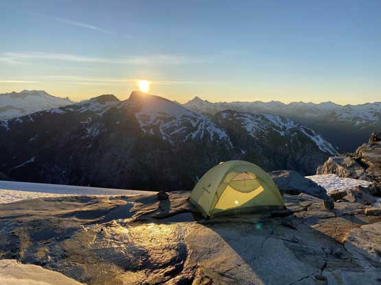
My tent and the sunset after dinner.
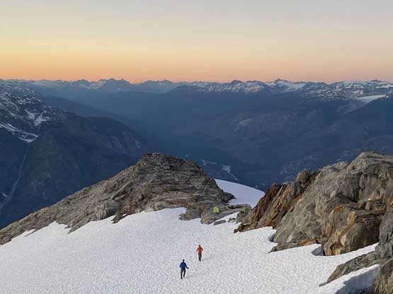
We then ascended the fun NE Ridge to the summit with some exposed 3rd class scrambling to watch sunset. The views were incredible to say the least and we stayed well after the show’s over. There’s also cell service that we could use to reconnect to the society. For the most important we did one last check with the pilot about the pick-up on Deserted Peak the following day. We then descended easy snow back to camp avoiding the exposed scrambling parts.

Alex starting up the uppermost NE Ridge towards the summit
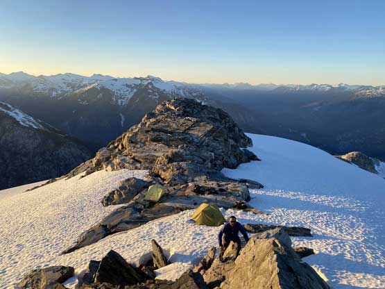
Vlad just started the scramble with our camp behind

Vlad partway up the NE Ridge

Alex on some exposed 3rd class terrain

Vlad approaching the summit of Outrigger Peak

Partial Summit Panorama from Outrigger Peak. Click to view large size.
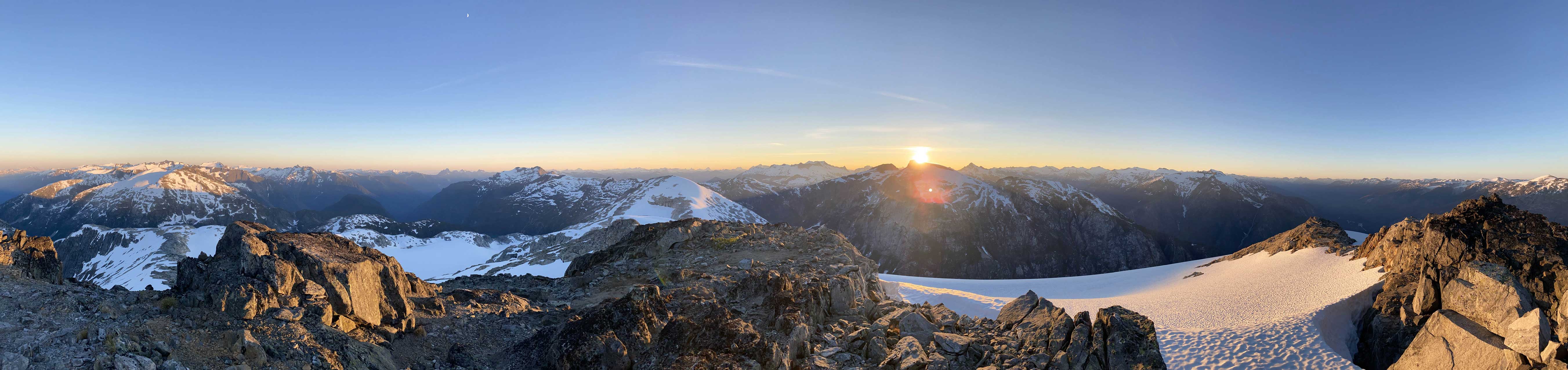
Partial Summit Panorama from Outrigger Peak. Click to view large size.

Deserted Peak in the foreground

A very zoomed-in view of Ponor Peak

The shadow of Outrigger Peak with the Garibaldi skyline behind

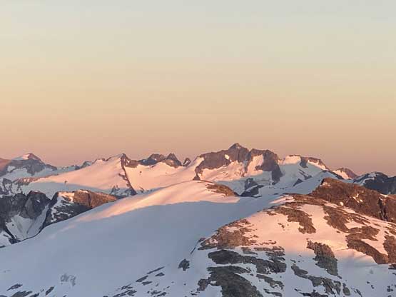
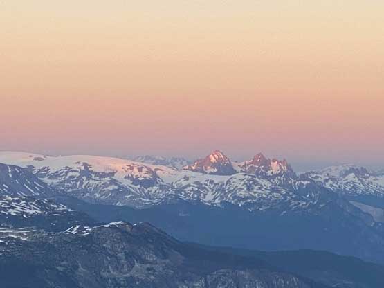
Sunset behind Mt. John Clarke
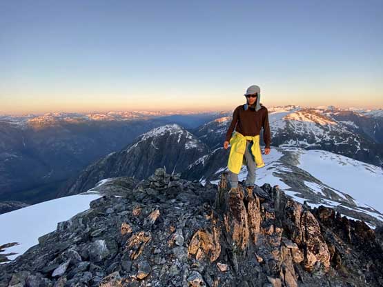
Me on the summit of Outrigger Peak

The rarely-heard Mt. Crerar at the head of Ashlu Creek

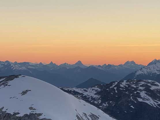
The sunset and Mt. Tinniswood
Ashlu Mountain pokes behind the ridge of Limelight Peak

Ashlu Mountain and Limelight Peak basically blend together
The tip of Mt. Cayley, Pyroclastic Peak and Vulcan’s Thumb catching glow

Mt. Albert at dusk

This is looking at the elusive Mt. Churchill and areas around lower Jervis Inlet
The Powell River classics – Beartooth, Baldy, Slide etc.
Alex and Vlad heading back to camp after the sunset show
The next morning we did not bother to wake up too early but given that it’s in the middle of a heat wave we kind of wished to start a wee bit earlier to avoid the heat. The objective of the last day was to get to Deserted Peak but first of all we had to lose over 500 m elevation down to the deep and bushy saddle. The first section was descending the SE Ridge and even this stretch wasn’t as easy as expected. We faced a series of obstacles that required at least some detouring and route-finding effort. Alex and I were more comfortable on steep snow while Vlad opted to stay on Class 3/4 rock and all lines worked. Towards the broad SE shoulder we skirted around some unnecessary elevation regain and then faced more confusing micro-terrain dropping southwards. After another bump or two we started encountering bush. It’s apparent that the traverse to Deserted N1 summit wouldn’t be as easy as we were hoping for…

Mt. John Clarke from our camp in the morning of Day 10
One last look at Mt. Albert
Mt. Perkins et al. in the heart of Clendinning Range

Heading down the SE Ridge now

Deserted Peak ahead

Alex descending the upper SE Ridge with incredible scenery behind

Utilizing granite slabs..
The ridge boasts many small tarns

Yet another tarn on the ridge, with Deserted Peak ahead
Alex down-climbing a steep snow slope

Yep, there’s another tarn…

Mt. Crerar behind the complicated ridge down to Outrigger/Deserted col

Looking back at Mt. Pearkes, our objective on the day before

One of the many glacial fed lakes
The deep Deserted River valley with Mt. Pearkes to the right

Almost time to enter the bush. Zero beta. Let’s figure it out…
