Haddo Peak
March 8, 2015
3070m
Lake Louise, AB
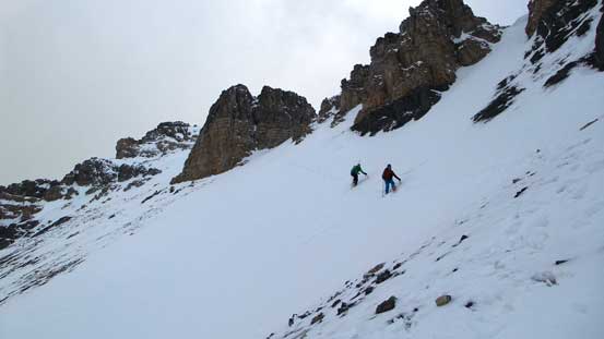
Haddo Peak is simply a minor summit attached to its bigger neighbour, Mt. Aberdeen. Many climbers don’t even bother to tag its summit even though it’s only a 20-minute side trip from Aberdeen’s ascent (assuming you come up via the N. Glacier route). Vern, Ben and I ascended Mt. Aberdeen via the S. Face so it’s a longer side-trip to tag Haddo Peak. But since we are hardcore peak-baggers we had no excuse to leave it behind. So despite it was already getting late and weather was already deteriorating we still pushed for the traverse.
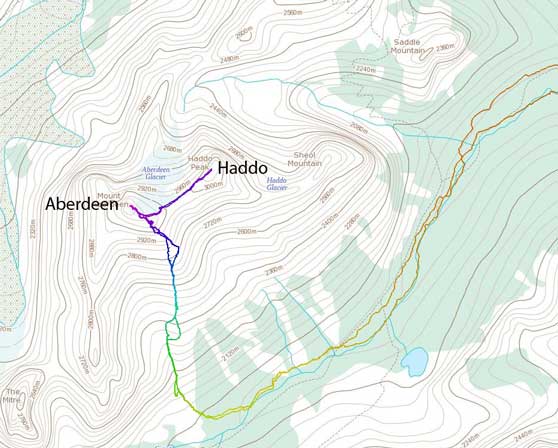
Ascent route for Aberdeen and Haddo via S. Face/S. Slopes. GPX DL
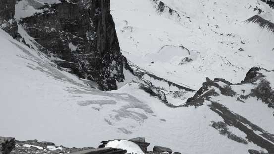
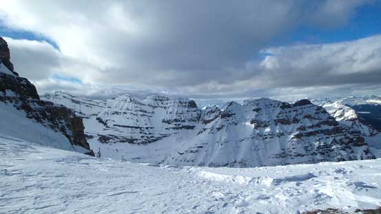
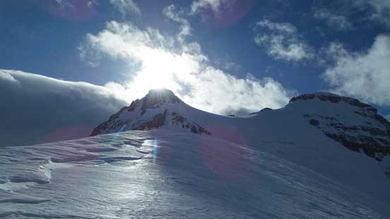
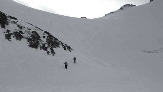
Getting down to Haddo/Aberdeen col involved about 100 m of elevation loss on glaciated terrain. The snow coverage on this small glacier was quite thin (not surprising though given the strong wind this area gets) but still, we didn’t observe any sign of crevasse. Based on the summer picture we knew there’s at least a bergschrund but apparently it’s very filled in. Ascending Haddo was nothing more than a hike but the wind was pushing us around.
Ben walking down towards Haddo/Aberdeen col

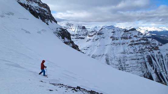
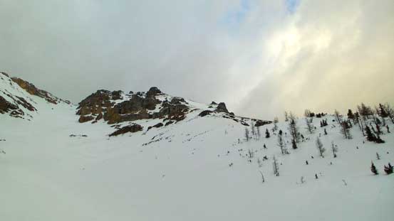
The very easy-looking Haddo’s ascending slope

Ben with Aberdeen behind
At Haddo/Aberdeen col now, looking ahead
The mighty Mt. Temple from Haddo/Aberdeen col
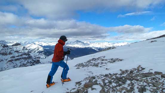
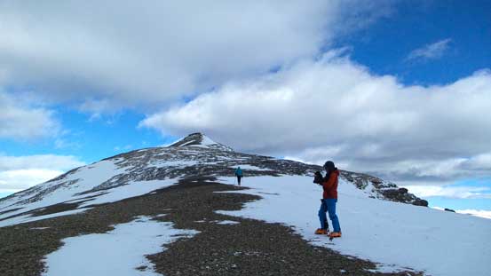
Ben ascending Haddo Peak
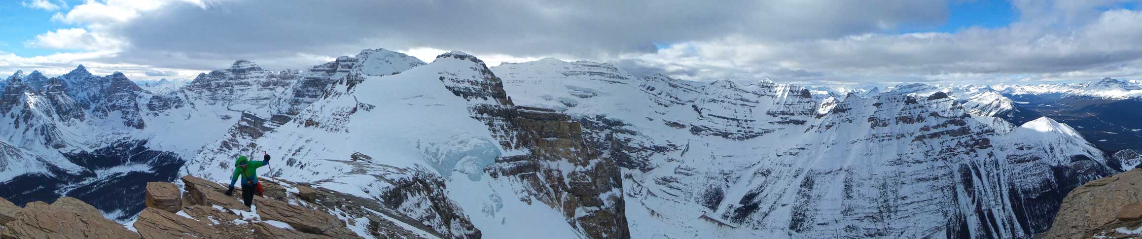
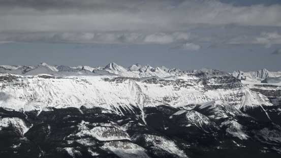
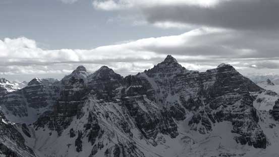
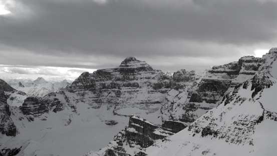
Partial Summit Panorama. Click to view large size.
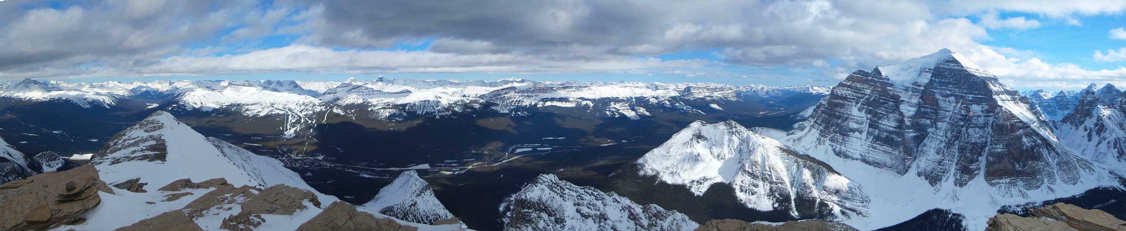
Partial Summit Panorama. Click to view large size.
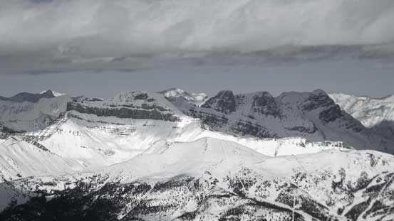
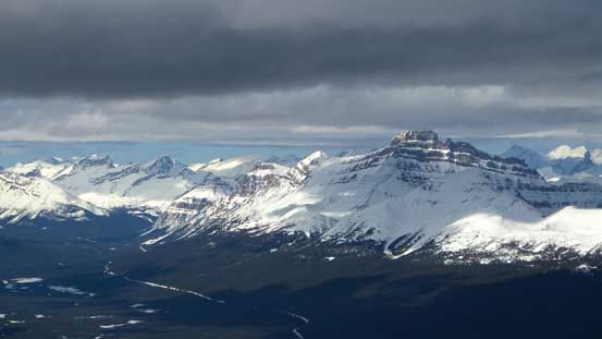
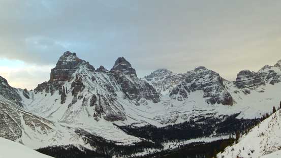
The Skoki’s Trio – Richardson, Pika, Ptarmigan
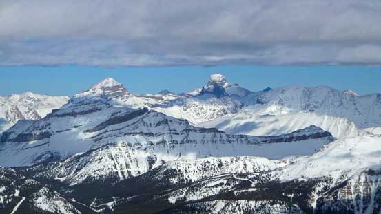
The giants – Douglas and St. Bride
Protection Mountain with some front-range peaks poking behind
The lowly Little Temple

Hard to believe this is Sheol Mountain

Mt. Victoria the icon of Lake Louise
Popes Peak is a bit mysterious to me. I’m still not sure about its best route
Mt. Hector

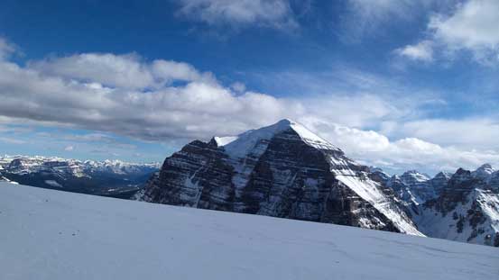
Mt. Temple
Deltaform Mountain
Hungabee Mountain
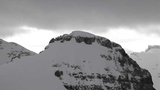
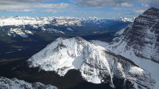
A zoomed-in view of Aberdeen’s summit block
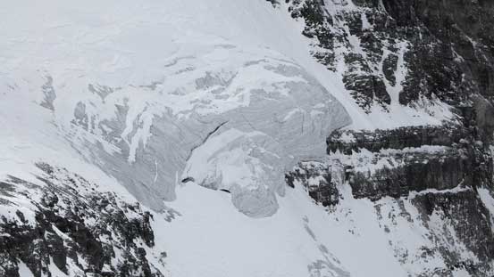
The steep Aberdeen Glacier
That’s a steep way up. Hard to believe this route also got ski’d…
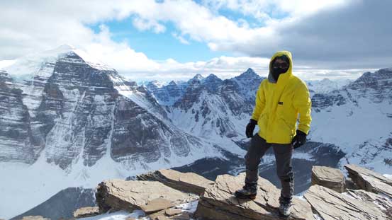
Me on the summit of Haddo Peak
Looking towards Mt. Aberdeen
After a short summit stay we immediately focused on the long descent. We took a lunch break once getting back to where we ditched backpacks on Aberdeen’s SE Ridge before dropping down the 1000-m south face. Retracing our steps down or across one obstacle after another surely felt easier and much faster than wallowing our way up earlier in the day. The weather was really moving in at this point and wind was really picking up making some miserable travelling condition. But it did help to re-lock up the snowpack making the condition safer on the return. Of course this would not help the ski condition though. There was a very hard crust forming on the surface.
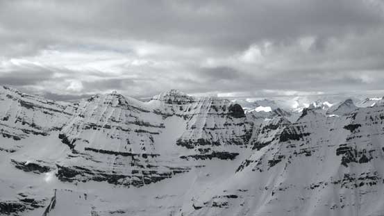
Collier Peak, Popes Peak, Mt. Whyte and Mt. Niblock from the col

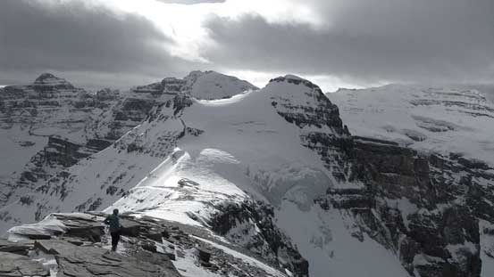
Looking back towards the summit
Now we had to re-slog back to Aberdeen’s shoulder

Mt. Temple from the col
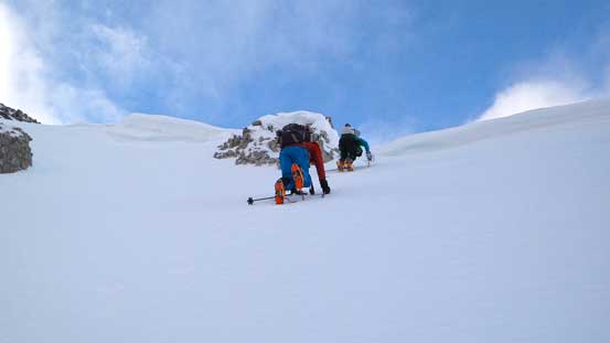
Ben and Vern ascending back
Now, time to drop down the south face. Steep snow climb initially
Down the dicey traverse
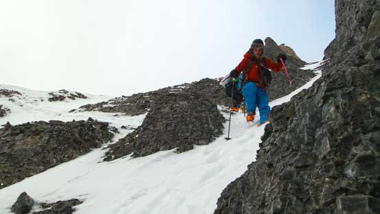
Descending the thin and steep ledges
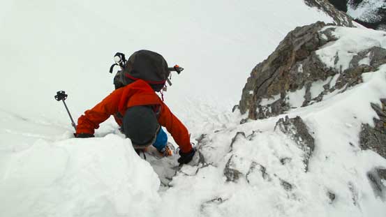
Down-climbing another step
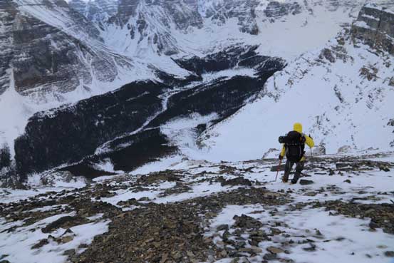
Onto the wind-blown broad ridge, but more post-holing following. Photo by Ben
The descent was fast but still took us fairly long to get down to where Vern and Ben ditched their skis. I immediately strap’d my snowshoes on and started descending. I was expecting the skiers to be faster so I went down fairly fast. The snow was stupidly ugly for snowshoeing though thank to the breakable crust but oh well. Once I got down to the terrain trap I took off my ‘shoes, took out my axe and started glissading. It worked actually well. Lower down I re-strapped the ‘shoes on and got to watch Vern and Ben working their way down the shitty snow.
Looking back towards the mid and upper mountain
Pinnacle Mountain and Eiffel Peak start to look big again

Vern skiing down the terrain trap

These trees are not the greatest place to ski…
The next section down the trail was faster on skis though. Too bad I ditched my skis earlier in the day and had to walk about 2 extra kilometers, but that was still okay as snowshoeing and skiing worked different muscle groups. So once I got back to my skis and put them on I didn’t feel overly tired. Of course skiing down an icy trail on mountaineering boots was interesting. The boots gave me virtually no ankle support and I could not make a turn nor side slipping. Thankfully the trail was fairly flat but I still couldn’t go as aggressively as Vern and Ben.
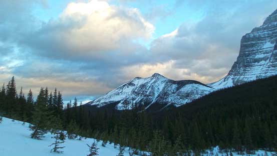
Almost dusk now. We still had a long way back home.
It was really getting dark at this point but too bad I didn’t pack my super-bright head-lamp. My small head-lamp worked but skiing down with only 10-meter visibility was quite scary especially on the steep and super icy x-country trails towards the end. The final ski back along Moraine Lake Road was very fast and fun though. Our round trip time was 13.5 hours which was much longer than anticipated, but it was an awesome and very successful day out in the mountains. The satisfaction I got from the winter ascent of Haddo/Aberdeen is more than some of the 11,000ers. But on the other hand, I probably won’t recommend them as winter objective. You want to be in an experienced winter mountaineering group, have the best stability of the season and even that you can’t be afraid of taking risks. Otherwise consider easier objectives like White Pyramid or Cathedral Mountain…

As usual, an awesome narrative and a good, informative set of pictures.
I have wondered what climbing Mt. Aberdeen would be like – and it seems quite tough. You’re an experienced guy and still rated it as ‘4th class’ if dry, or a mixed climb, near the top, in these snowy conditions. That means most scramblers will find it to be solidly into the mountaineering territory…is that a fair assessment?
In the past, I had done part of the opposite trip: up Sheol Mtn and then across partway to Haddo Peak. For me, no way I’d manage it to Haddo without some roping up. But the Aberdeen-Haddo traverse looks like an easy and fun trip, with great views.