Mount Caspar
February 16, 2020
2402m
Caspar Creek / Duffey Lake Road, BC
Mt. Caspar forms a long ridge that runs north-south on the Caspar-Van Horlick Divide just to the east of the Joffre Group – the mountaineering central of the Duffey zone near Pemberton, B.C. Mt. Caspar itself seldom draws attention from the mountaineers as the routes are dull and the approach involves a long walk on a logging road as well as fair amount of bushwhacking in summer. There are several routes recommended for ski ascents but one still needs to face that long approach on logging road as well as the steep forest. My plan was to ascend the ski route on snowshoes but given the steep grunt in the woods I wanted to have partners sharing the suffering.
A couple days before the weekend my friends Al and Mel had just packed down a set of tracks on snowshoes, along with Nathan on skis. I unfortunately could not join their trip due to work, but the weather had been relatively stable with only inches of new snow on Saturday, so it made perfect for me to take advantage of their work on Sunday. It took me a while to find partners but eventually Jake and Selena decided to join, coming all the way from Seattle. The weather forecast was worse in the Cascades and they wanted to seek sunshine. They would stay till Monday (which had the better weather forecast) but I again, could not take the day off due to work. In the morning I woke up at 5 am and met Jake and Selena in Pemberton’s McDonalds at around 8:30 am. This was their first time ever visiting Pemberton. We all piled into my truck for the short ride up the Duffey Lake Road. The small parking lot at the start of Caspar Creek FSR was completely jammed so we had to park about 100 m downhill on another pull-out.
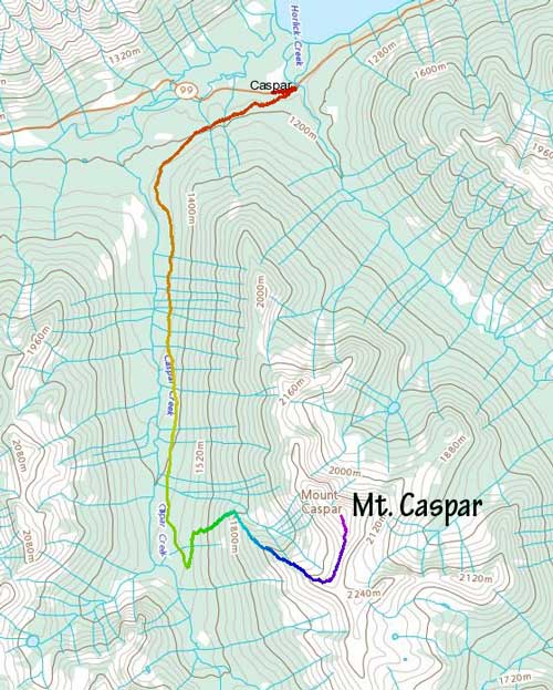
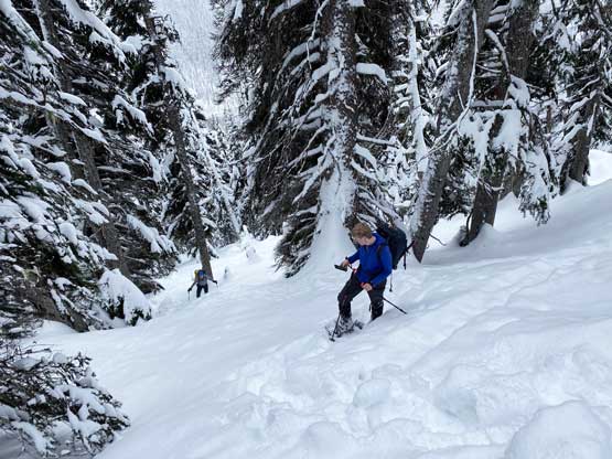
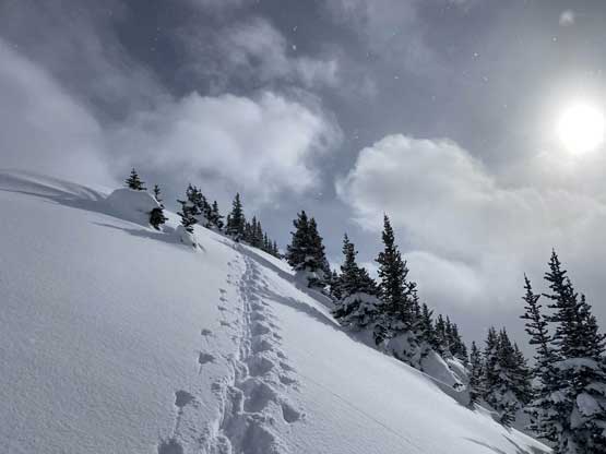
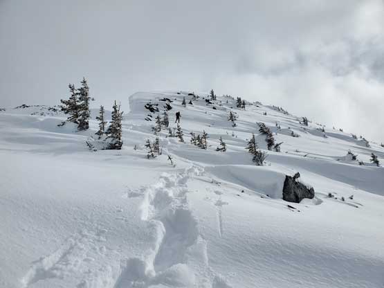
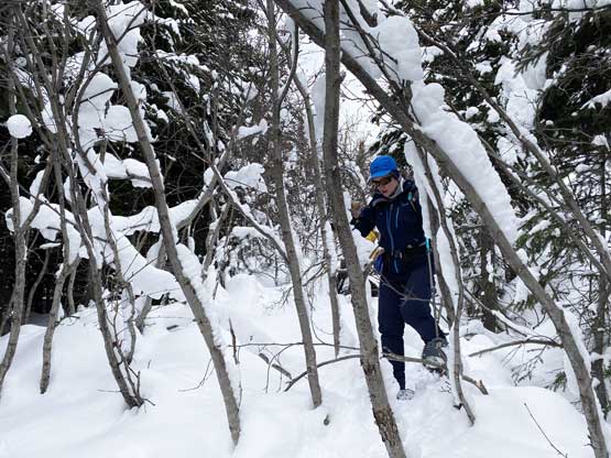
Thank to the previous party’s tracks I decided to use light gears, wearing only “winter hiking boots” and the women’s 25′ snowshoes. I briefly considered short-cutting to hit the logging road but opted to just walk to the standard parking lot. The snowshoes had to be strapped on almost immediately after getting onto the logging road, even though it had seen fair frequent snowmobile and skier’s traffic. For the next 1 hour and 40 minutes we plodded at a fast pace, covering 8 km distance and around 450 m elevation gain. We correctly located the “old logging road” that Al mentioned to me on our Facebook chat, and followed their tracks into the brushes. There was some degree of bushwhacking in alders, but with the tracks nothing was too outrageous, although the fresh snow on the alders did make the going a bit annoying. It seemed to me that Al’s group was confused about where exactly to leave the road judging by the meandering tracks they made. For us however, all we needed was to just follow. There’s no need to add more confusion by finding our own route. The next 400 vertical meters in the forest was as steep as I was expecting, but again due to the tracks our task was easy. We gained elevation on a rapid pace and in short time we arrived at the treeline and decided to take our first, and the only break of the ascent.

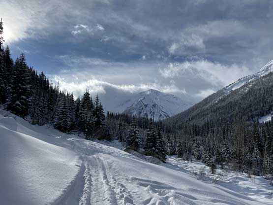

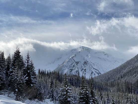


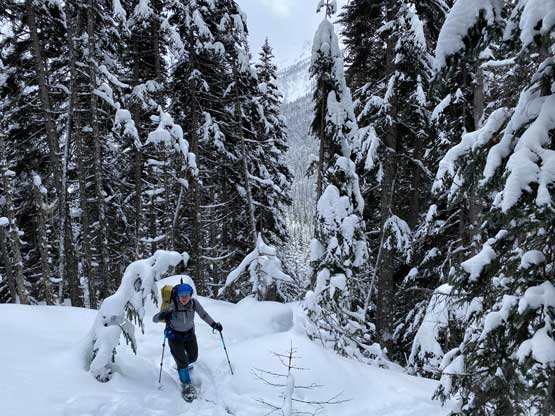
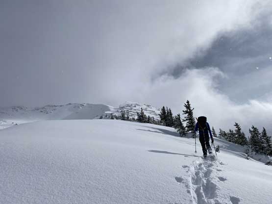
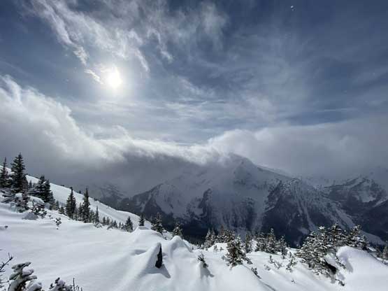
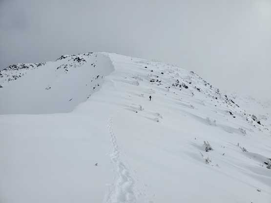
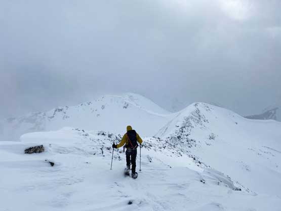
Jake went ahead breaking more trail while Selena and I opted to force in more donuts and water. A while later we caught up to Jake and suddenly bumped into a group-of-three snowshoeers coming up from a different way, possibly via or near Al’s group’s descent route. We chatted briefly and then we went ahead. They had been breaking trail the whole way up from Caspar Creek and it seemed like our ascent route was the easier choice. As we ascended higher and higher towards the summit ridge the weather deteriorated and the wind picked up. There were a few steep steps that needed to be bypassed on the climber’s right side but there’s nothing exposed nor difficult. The traverse across the summit ridge was windy and very cold making me regretting for not bringing goggles nor the balaclava. I had to cover my face using my gloves for most of the time and needless to say, the going was pretty miserable. We also had zero view from the summit thank to the blizzard conditions.


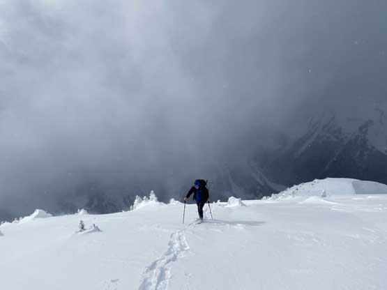

After snapping a few obligatory victory shots we soon headed down, passing the other team on the summit ridge. We wished them luck and continued our descent in the flat light conditions. Once dropping down from the summit ridge the wind died down and it’s time to enjoy the fast plunge on powder. I was very experienced in downhill snowshoeing on powder and was able to make use of all of the soft stuffs. I had a shit ton loads of fun in the forest plunging and jumping the pillows. Having two partners meant I could go more aggressively than soloing. Had I come up here alone I would have to mostly just retrace the tracks to minimize the risk of falling into a weak spot or the consequences of an injury. In about half an hour we had cleared the forest. The plod back across that old road was no fun, nor was the final 8 km numbing plod back to the truck. We all wanted to put our cardio in test and crushed the 8 km hike-out in just over 1 hour and 10 minutes, capping the round trip time in exactly 7 hours.


I dropped Jake and Selena off in Pemberton and we all went to the McDonalds for a well-deserved dinner. Based on the conditions I suggested them to do Mt. Rohr on Monday and then went home. I have to thank Al and Mel again for breaking trail and publishing their trip reports on Facebook, on time. Mt. Caspar has been one peak that I thought for sure I would suffer a lot from the trail-breaking in the steep forest but thank to the social media and the technology in this modern era, the difficulty of this ascent had been significantly reduced, for me.
