Mount Edith Cavell
August 5, 2013
3363m
Jasper, AB
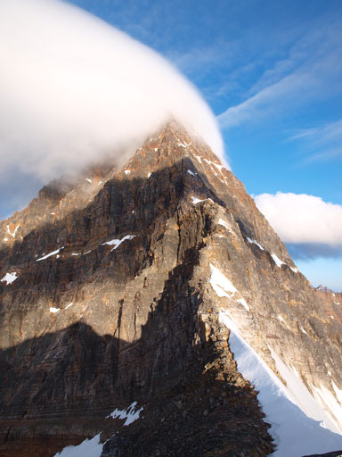
Mt. Edith Cavell is the icon in Jasper area that I probably don’t need to do much introduction. It’s probably the most photographed mountain in this area, and visible from miles and miles away. A photo of Mt. Edith Cavell is almost mandatory for everyone visiting Jasper. For scramblers and climbers, this mountain offers two straightforward routes, the east ridge rated at Alpine III, 5.3, and the west ridge, a “moderate scramble” in dry condition. Usually I go up a mountain via the least technical way, but this is one of the few exceptions. The east ridge offers probably the best rock quality in the Rockies. After reading a lot of threads I was committed to do it as a free solo ascent.
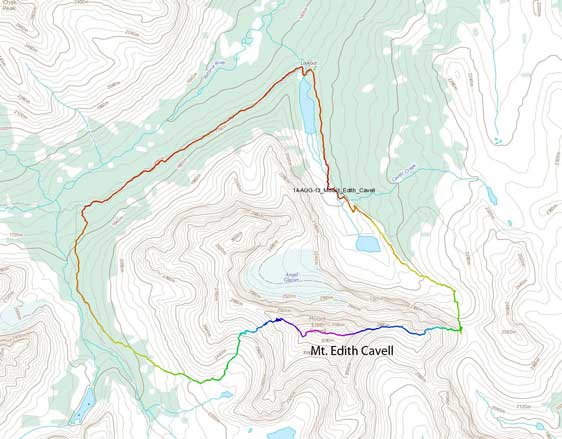
Mt. Edith Cavell traverse route (up E. Ridge down W. Ridge). GPX DL
This route usually comes in shape by mid to late August, but due to the dryness in spring, we get a longer climbing season this year. I wouldn’t mind climbing this route by myself, but I was glad to have two scramblers joining, Mike and Grant. We knew we’d be dealing with the most severe exposure in our climbing career to date. The forecast wasn’t bad, but wasn’t the greatest neither. I figured we’d be down the mountain already by the time afternoon thunderstorms come given an alpine start at about 3:20am.
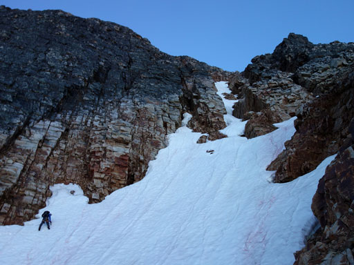
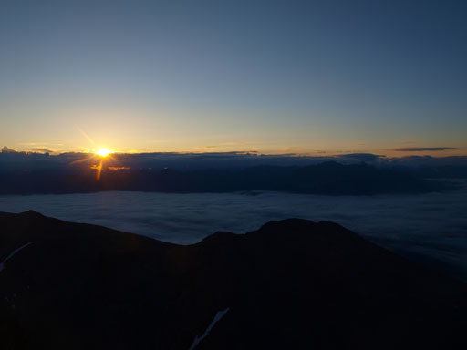
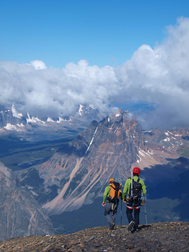
The description of the approach was a bit vague and after following the trail for a few hundred meters we got lost in a boulder field. After negotiating the unpleasant terrain for quite a while we eventually rejoined the trail on our left side. This trail went on for a long distance before merging to a snow field. We soon caught up with the group ahead, but since they were kicking step up the snow slope we decided to stay behind so we could use their fresh tracks. We were too lazy to take out the ice axe and all 6 of us (two groups) arrived at the high col in about 1.5 hours after starting. It was still dark now but there was some brightness showing up on the horizon.
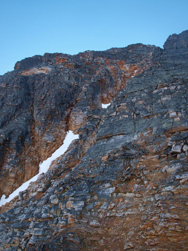
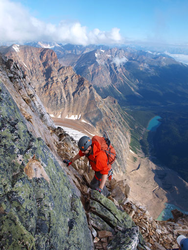
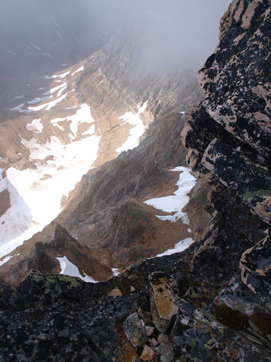
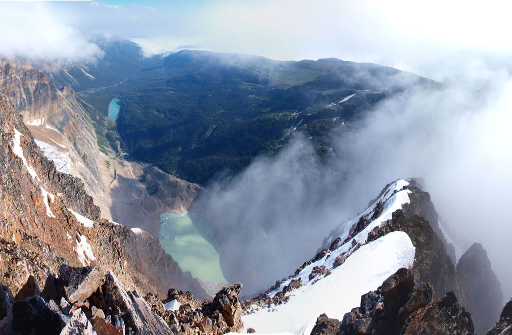
After taking a necessary break we started the next step, the lower part of East Ridge. This section was foreshortened and we’d gain about 500 vertical meters. It’s a moderate scramble with some difficult steps to go over. The route is basically staying on climber’s right of the obvious snow gully for the entire way up. There’re some sources mentioning traversing left at one point but that’s after gaining the high bench. At one point I thought we had to traverse left so cut over the snow gully but I only found more difficult terrain and had to back track. This wasted us about half an hour. By the time we got back on track, both the two groups got ahead of us already. We watched sunrise over Maligne Range on the horizon, as well as the Athabasca River Valley covered by low clouds. It was a spectacular morning.
Don’t do what I did here. You should never be on the opposite side of this snow gully. I had to backtrack and must have wasted half an hour here. Photo by Mike Mitchell

Zooming-in towards Jasper. Click to view large size.

Part of Athabasca River Valley. Mt. Fryatt on right.
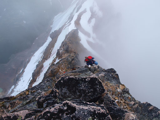
The route goes up right of center. Mod to diff scrambling
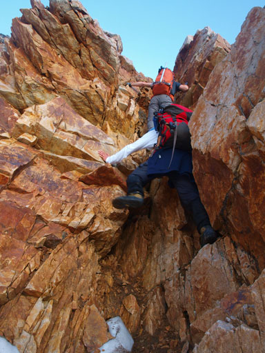
Mike and Grant scrambling up a difficult step
It’s sunrise time!
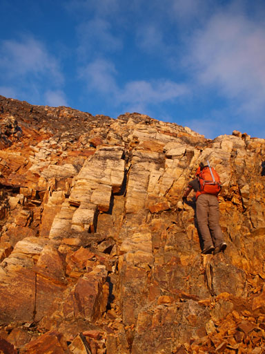
Mike on the typical terrain up the lower ridge
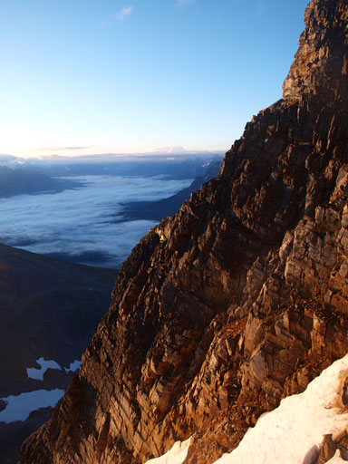
One of my favourite views from the lower ridge
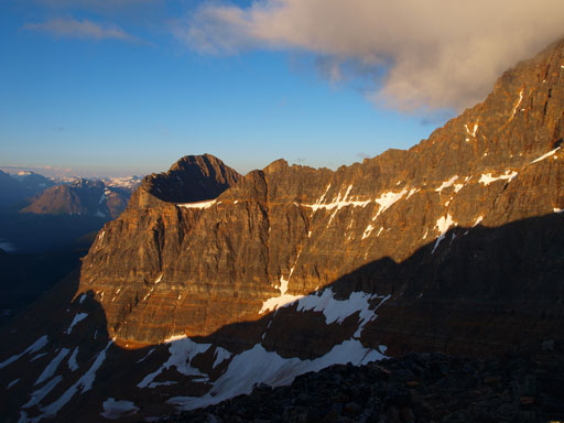
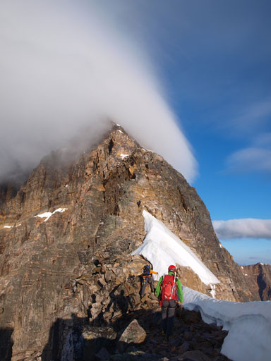
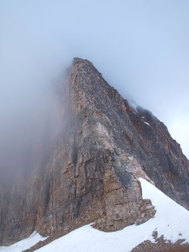
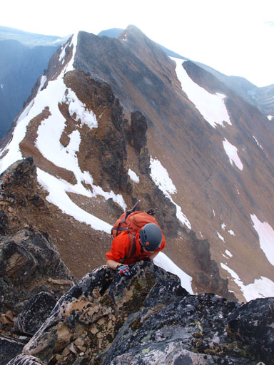
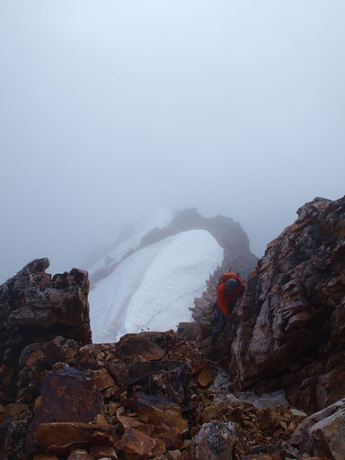
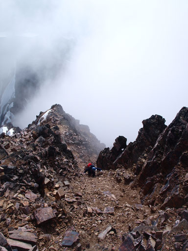
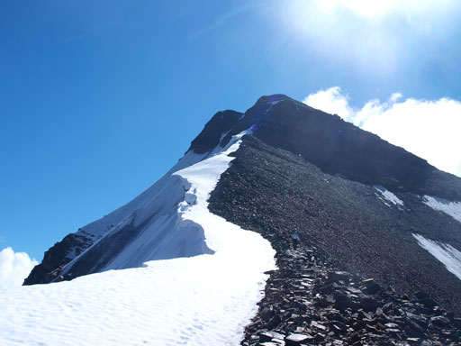
The real start of this day was at the point where we topped out on the infamous “bench”, where we got a our first view of the real game, the upper ridge. It looked to be very intimidating but also very exciting. There were some clouds rolling in and out on the ridge creating some dramatic views. There is a bump between us and the upper ridge and we traversed on its left side on a path. This is the part mentioned on that source (I forgot which trip report I was referring to). You can go up and over it but that adds some extra elevation gain. This part of the route was also wet probably due to the fact it’s flat so holds more water. The wetness made the quartz rocks awful. Thankfully this part was flat.

Another view from the lower ridge.
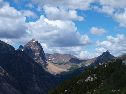
Near the bench, spectacular peaks came into view. Can you spot Mount Hooker?
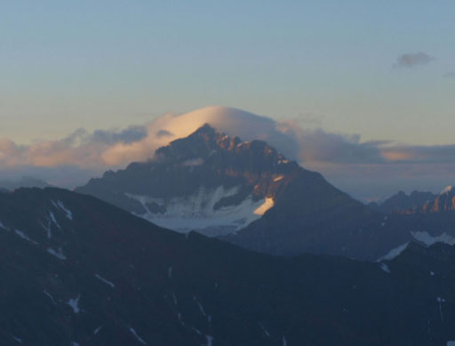
Don’t need to introduce this much I guess. Fryatt…
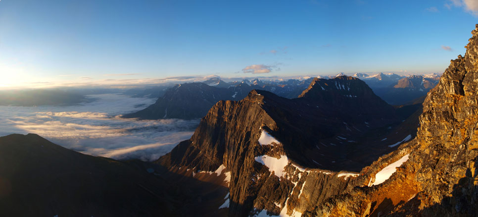
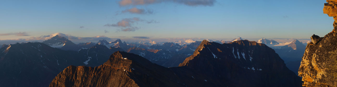
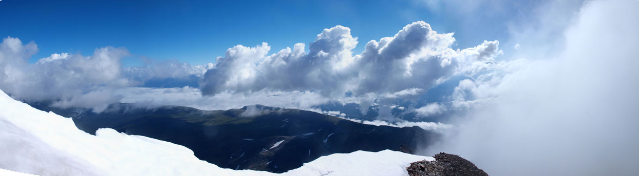
Panorama view again.
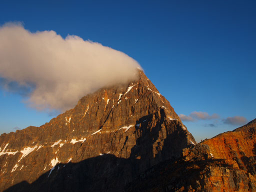
Finally, the upper ridge came into view
Can’t get rid of Edith Cavell’s guarding walls

A zooming-in view of the summit
Really to rock n’ roll?!
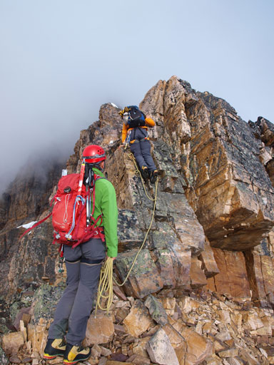
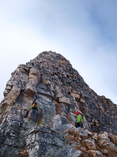
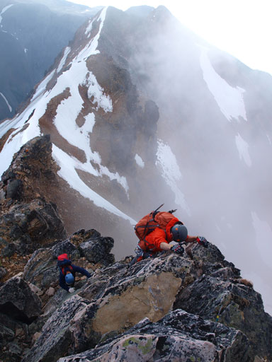
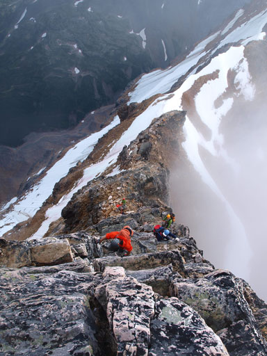
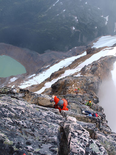
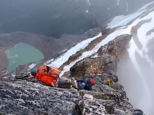
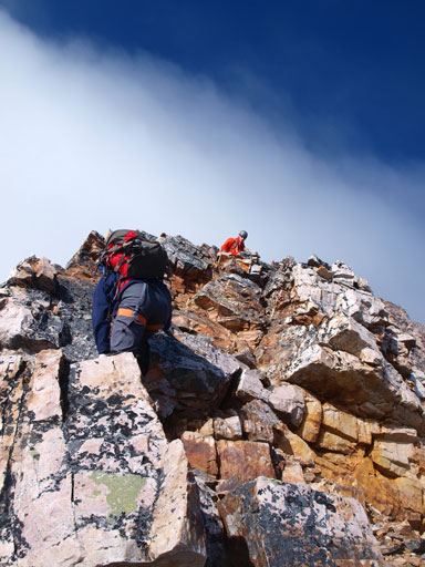
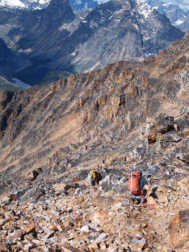
We caught up with the other two groups at the base of upper ridge. After some sections of difficult scrambling we suddenly saw two men hanging on an exposed face.. “Yikes… That gotta be the crux!” Well, we were only half right as that’s gonna be the first crux, the shorter 5.3 pitch. At the base of this lower pitch I led up the way, overcoming an overhanging move initially and up the face. At this point the group of 3 Calgarians decided to let us pass as they would pitch it out but we would solo it. I would soon traverse climber’s left to gain a chimney. Mike and Grant kept climbing up the face, and we soon cleared the first crux.
Getting closer. We were following a group of 3 Calgarians at this point
Looking back at a bump and the bench
This short step is exposed.
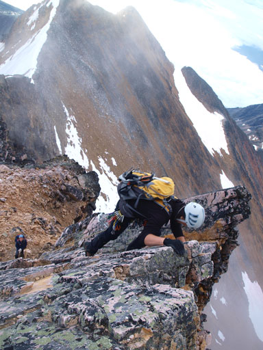
They let us pass eventually. I led up the 1st crux. This is one of these Calgarians climbing up.
Mike climbing up the 1st crux.
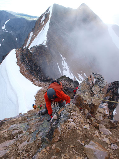
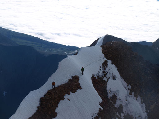
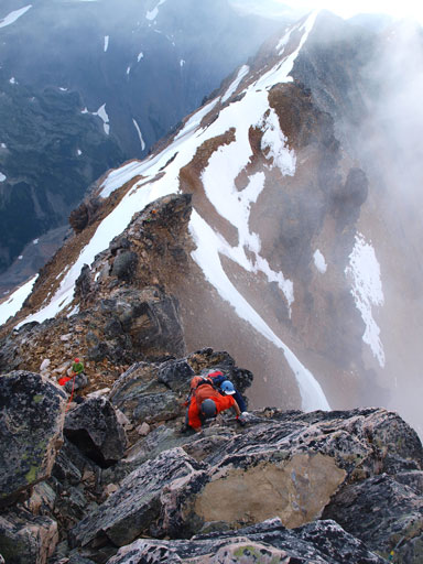
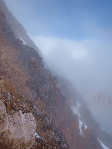
By now the clouds finally rolled in but it wasn’t a white-out. We still had very good visibility on the route and the clouds were not very thick. We knew it was mostly clear on other areas but Mount Edith Cavell is such a big ass mountain that attracts its own weather. Continuing up the ridge we would soon take out our axe to traverse an exposed snow slope. It’s a cornice so we had to stay away from the edge. There were old tracks to follow probably created by Vern and Scott Berry a couple days earlier, and after this bit we were getting close to the 2nd crux, the upper and longer 5.3 pitch.
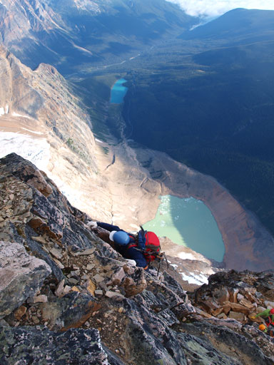
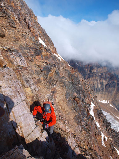
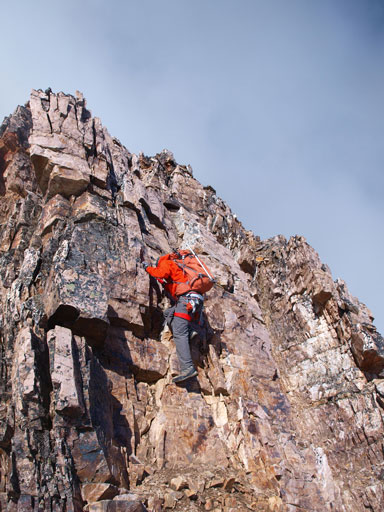
The two Jasper climbers led the way up the lower part of 2nd crux. They firstly traversed climber’s left and then regained the ridge crest by climbing up a chimney. That was exactly what we would do, and we caught up these two climbers at the base of the technical section. They were sorting the rope and kindly enough to let us pass. The next 30 meter or so would be the real game, a sustained 5.3 pitch with severe exposure. If you only do scrambles then I’m sure you will see the most severe exposure that you’d ever seen! A fall to either side of the ridge would mean dropping straight down the north or south face. The climb itself is more a near-vertical face climb than ridge climb here so keep this in mind. There’s one spot I was forced to traverse climber’s left onto the south face briefly on not-so-big holds. Mike followed me up exactly but Grant found another line that exposed him to the entire north face drop-off. Continuing up the 2nd crux, the face got a bit more vertical. There was one very awkward move but generally, we could always find good holds on left or right if not going straight up. We were very pleased to eventually clear this pitch, and then, time to relax, a little bit though. Take a note that we all soloed up both 1st and 2nd pitch on our mountaineering boots. I brought my rock shoes up didn’t use them. I didn’t even bother to put my big camera away so I got plenty of photos.
Looking ahead to the second crux. The top 2/3 of this photo is a single pitch of 5.3 climb.

At this point we were left of the ridge. We had to climb up a steep gully to regain the ridge crest.

Looking ahead to the two Jasper climbers in this gully
I climbed up the gully, and looking up. Can you see the two Jasper guys?

Mike following up the gully
Mike ascending to the technical pitch

Me ascending the last few “easy” steps just below the 2nd crux. Photo by Mike Mitchell
Looking back at the 3 Calgarians traversing the exposed snow
The two Jasper guys would let us pass here. Ahead is the real game
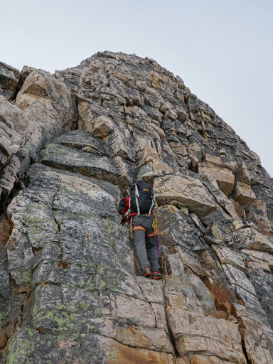
Me starting the 2nd crux. Photo by Mike Mitchell
The drop-off down the south face. I had to expose myself to this for a couple moves.
Mike traversing a corner.
Grant picking another line. This line is exposed to the entire north face drop-off.
Climbing continues
Exposed, and fun..
Mike and Grant
I found the move just ahead of Mike being the crux of the entire ascent
Mike finishing the hardest move

What Mike had to do was traversing climber’s left on ledges before climbing up to where I was standing
Grant clearing the 2nd crux.
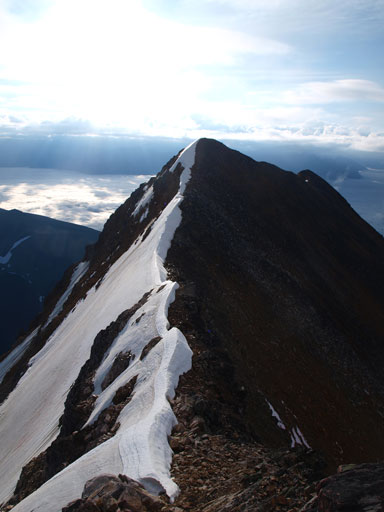
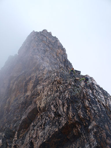
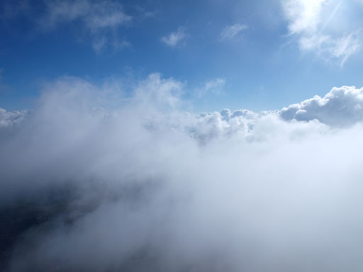
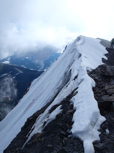
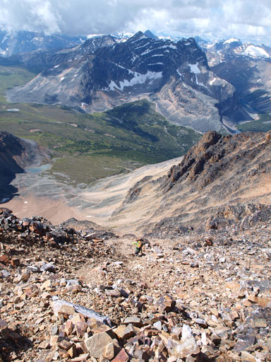
After the cruxes there was no real technical difficulty until near the summit. Well, I’m saying this because by now you just finished the hardest part of the climb. The upper ridge would still be a sustained difficult scramble with short 5th class steps here and there. There would no longer be sustained 5th class climbing but if putting just a short piece of this upper section to a Kane’s scramble then it will for sure become the crux of that day. Therefore again, we had to concentrate as a mistake will still send us down the north or south face! The rock also got much looser higher up. Weather started to clear up by now and we kind of broke through the 2nd layer of clouds.
Continuing up step terrain in a near white-out condition
Thankfully the clouds cleared up soon
Mike ascending the typical terrain on the upper upper ridge
The views started to open up!
Another photo looking up.
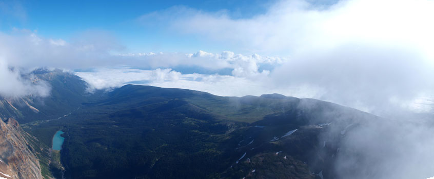
Athabasca River Valley
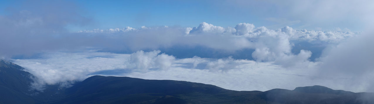
Spectacular inversion scenery!
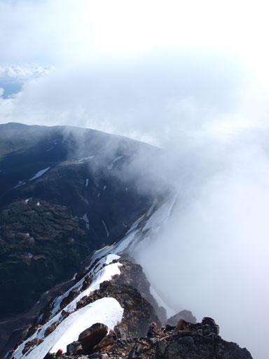
Even more spectacular, half of the ridge in fog, half clear.
Mike tackling one of the many many hard steps
Topping above the 2nd layer of clouds?! WOW.
Grant ascending a loose gully after just stepping over an icy spot

Mike leading up this gully
The last technical challenge of this day is a short ice pitch for maybe 5 horizontal meters. We took a break and the two Jasper climbers took over the lead. By following their steps it was no longer “that” difficult as described on other sites, but still, we were front-pointing on the slope, traversing exposed ice on the edge of a cornice that’s exposed to the entire north face. Crampons and ice axe are a must here. I brought my ice tool up but didn’t find the need to use it, but if I was leading I’ll take the tool out.
Gorgeous views from near the true summit

More gorgeous views
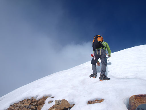
One of the Jasper climbers leading the ice pitch. I couldn’t get a photo showing the exposure since I wouldn’t want to stand on a cornice…
Shortly after this bit of snow and ice we were standing on the true summit. We didn’t find a cairn or anything like that so we thought the next highpoint being the summit so we kept going. We continued to the 3rd summit which had a register. Looking back we realized the first summit was the real one. Therefore if you go up the west ridge then you need to traverse all the way over to the point where the east ridge tops out. We took a long break on the summit waiting the weather to clear up. It did! We got treated by spectacular views. It took us almost 7 hours from car to summit with one big detour and a ton of time waiting for another party sorting the rope (near first crux).

Looking back to the true summit from near the second summit

Looking ahead to the 3rd summit which has a register

Angel Glacier
The tourist’s pond, where we started our day.
The steep north face
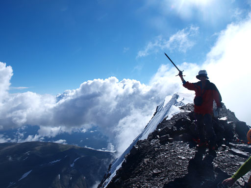
Me on the summit
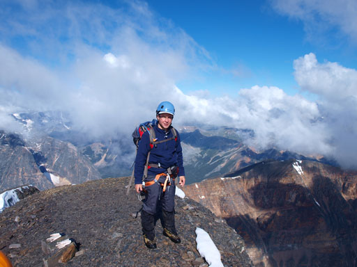
Grant on the summit
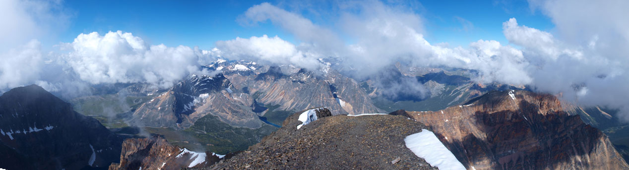
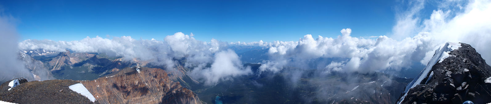
Panorama view. Click to view large size.
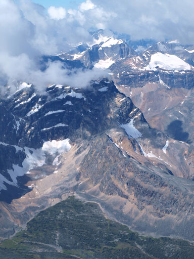
Chevron Mountain is impressive
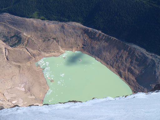
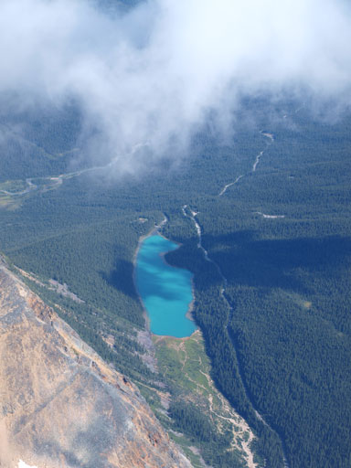
Another spectacular lake

Summit register. Too bad it was wet
Another panorama view. Click to view large size.

Clouds were rolling in and out
One more panorama view
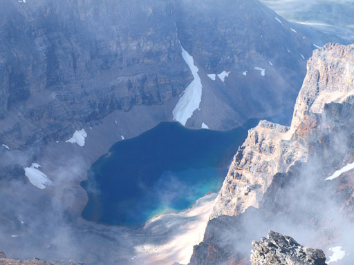
Cavell Lake. We would finish out day at its lower end.
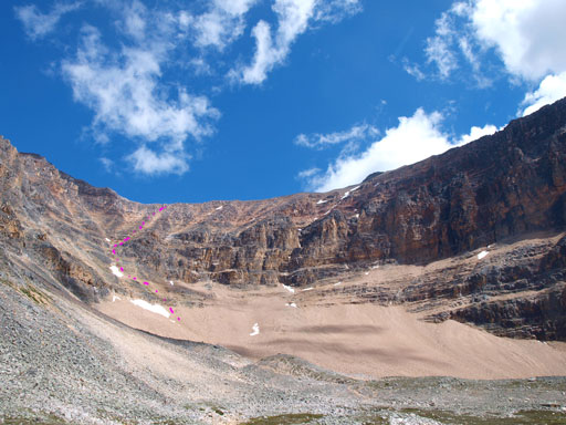
Due to the concern with afternoon thunderstorms we decided to head down soon. The direction was easy to follow. At one point we were facing a drop-off so bailed the west ridge proper to skier’s left side on scree paths. As soon as we descended down enough we cut skier’s right over some loose moderate steps back to the west ridge. This part would be the crux of west ridge route if icy. I knew another group having to take out their ice tool for this pitch, in late July last year so you shouldn’t underestimate it if not dry. The second thing to take note of is you must descend all the way to Edith Cavell/Sorrow col, otherwise you will get cliffed out. It looked like we might can go grab Mount Sorrow but we weren’t in that mood. The initial rock band might involve 5th class climbing but we wouldn’t know unless we gave it a real try. We were too tired to bother with such a bump so we bailed the west ridge down the gigantic gully/slope that would go on forever. I don’t want to describe this part too much except for loose scree and rock fall hazard. It felt like eternity to descend, and I couldn’t imagine slogging up this route. Oh well, what a slog that would be…
The two Jasper guys starting the descent

Grant and Mike

Scree…

Panorama view from the descent

The Ramparts were too shy to show up
Looking back
The long long rockfall zone
Lower down.
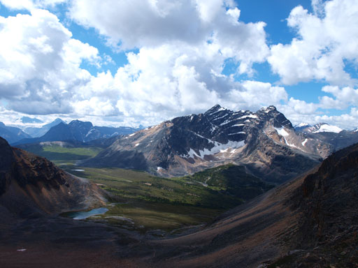
We took another necessary break at the tundra field in this bowl before continuing down Verdant Pass trail. The trail, though not signed nor marked on any map, was in a very good shape. It’s in better shape than some popular hiking trails in the park even. This trail, again, kept descending forever. We must have lost more than 500 vertical meters on this trail. By the time we eventually joined Astoria River Trail we were left to another 4.5km uphill hike. I don’t know why this trail was designed this way but the majority part of this last 4.5km was going up… Grant took a blistering pace down both trails and he got back about 40 minutes before Mike and I. He still had the energy to slog another 2km back to the upper parking lot so he would give us a ride. A big thank to Grant!
Chevron Mountain

Blackhorn Peak
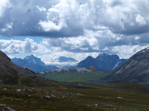
Looking over Vendant Pass towards Hooker Icefield
Looking back towards the west ridge scramble route
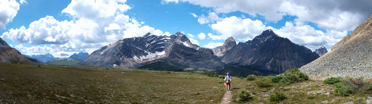
Panorama from the alpine meadow
Oldhorn Mountain

Throne Mountain
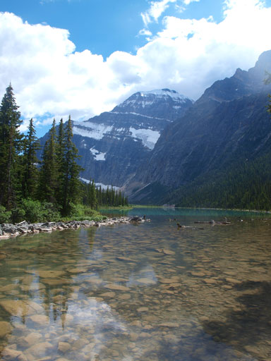
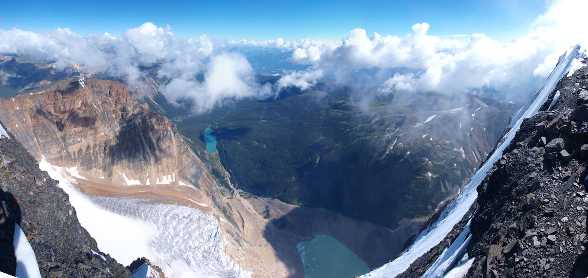
Cavell Lake, with our objective behind. It’s huge…
The East Ridge is the best climb I’ve ever done to date, and the views were one of the most spectacular I’ve ever seen! For those of you having the ability to climb the east ridge, I’ll highly suggest taking the challenge. The west ridge is only reserved for descent. Whether roping up or not is your own choice. My photos show the route and the climb clearly so it’s up to you figuring out if you’re comfortable enough. If it rains or snows then it will be a suicidal thing to free-solo attempt this route. That being said, for scramblers not being comfortable enough with exposure, the west ridge offers an easy way up this huge mountain in dry condition. In my opinion, though sloggy, the west ridge is easier than Mount Temple’s scramble route so Mount Edith Cavell can qualify the easiest 11,000er.

Wow………it’s on my list now. I think I could do east ridge……….I am pretty good scrambler but have never used ropes
Great pics BTW.
I just want to say your web site is amazing. Lots of great info and beta.
Great job!
Amazing pictures and climb. If i wanted to climb via the west ridge where would I have to start and which trail would I have to follow to get to the scree cone on EC?
Super 👍, the best scramble aaI have evere seen. I stopped my breathing