The Brothers
May 12, 2019
2085m
Olympic National Park, WA
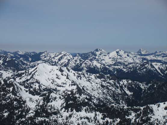
The Brothers is one of the more recognizable summits that forms the “Olympics skyline” viewing from Seattle and for the sake of this reason The Brothers is also one of the more popular objectives on the peninsula. There are two summits on the massif. The easier, south summit is the true highest point while the traverse of the two summits offers a moderately technical climb. The standard route on the south summit involves snow climbing up to 40-45 degrees and short sections of 3rd class scrambling but the approach is long and tedious. Most people opt to break the ascent into two days but in this internet era, the standard for those considering themselves as “fit parties” is to push in a single day, and that’s exactly how I would do… I had done four summits in the Olympics in the past two years – Ellinor, Olympus, Washington and Angeles. The best season for The Brothers is May when avalanche danger decreases but spring snow still offers easy passages on the upper route, but this peak is also a popular chossy scramble in summer.
About two weeks ago McKenzie Johnson from “Washington Hikers and Climbers” Facebook group asked me if I was interested in The Brothers on Sunday, May 12th. My reply was of course “yes” but I needed to wait until seeing a reliable weather forecast to commit. The mother nature was on our side this time and a huge Omega block of high pressure system kicked in providing about 10 straight days of sunshine. The downside was the accompanied record-breaking heat but I had gathered enough fresh beta from recent trip reports in the Olympics that I determined it’s already too late in the season for avalanche to be a concern in that part of the state. I was very excited about this trip not because of how glamorous The Brothers is, but rather because I’d been talking to McKenzie for over two years on Facebook and finally managed to put together a trip. Mel Olson joined to team from Vancouver side and Chris was also invited by McKenzie to show up for the party. Mel picked me up after work on Sunday evening in her rental vehicle and we made quick work down south through the familiar I-5 corridor. We decided to drive all the way around to Olympia rather than dealing with the logistics of ferry rides. There’s a major accident on I-5 that costed half an hour but nonetheless we made to Lena Lake’s parking lot just after midnight. At least 15 cars were parked there….
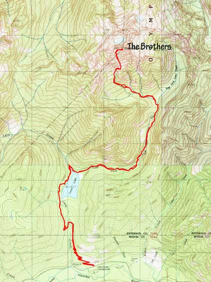
The Brothers standard route. GPX DL
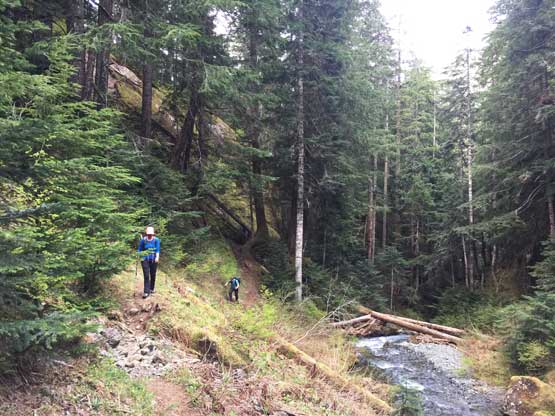
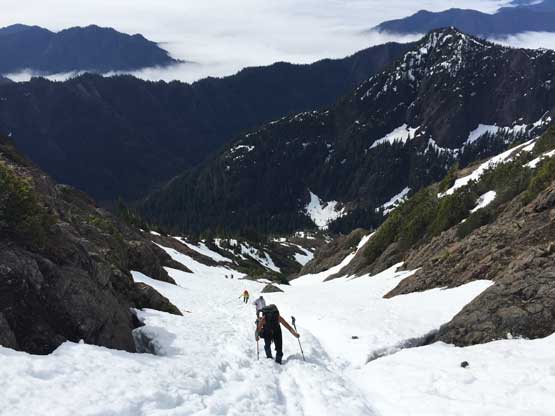
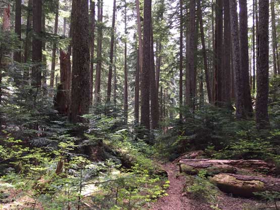
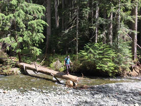
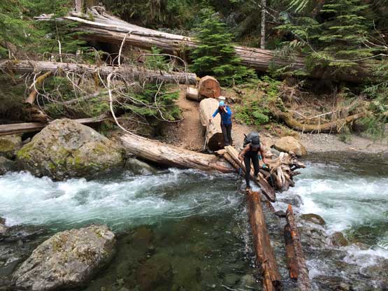
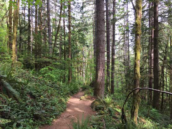
We managed to get less than 2 hours of sleep and then the alarm went off at 2:30 am. McKenzie and Chris showed up at around 3 am and we were soon on the endless switchbacks of Lena Lake trail. This is a very well-maintained trail and we made to Lena Lake in just over an hour, covering good amount of distance. The sky was getting slightly brighter now and we were facing the first challenge – the crossing of Lena Creek. I did not do much of research and was expecting at least a foot bridge given the popularity of this trail, but apparently that wasn’t the case. We even backtracked several times to search for a bridge but there’s none. It wasn’t very clear how the crossing was with headlamps on, that I simply took the shoes off and forded it. The others managed to tip-toe across a slippery log which was actually easier than appeared. A short bushwhack brought us back on the (now unofficially maintained) climber’s trail that followed East Fork of Lena Creek into “Valley of the Silent Men”. The quality of this trail was much better than expected but we still got totally lost in one zone. The GPS tracks didn’t help much neither as it seemed like people had all picked their own way. About 20 minutes of frustrating bushwhacking later we got back onto the trail, and had no further issue making to the climber’s camp, although the constant up-and-downs on this approach were annoying to say the least.

One of the many log crossings.
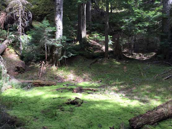
Valley of the Silent Men…

This is the “climber’s camp”.
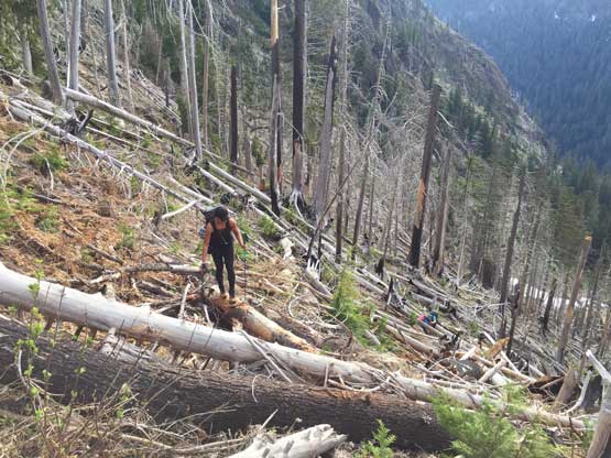
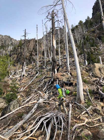
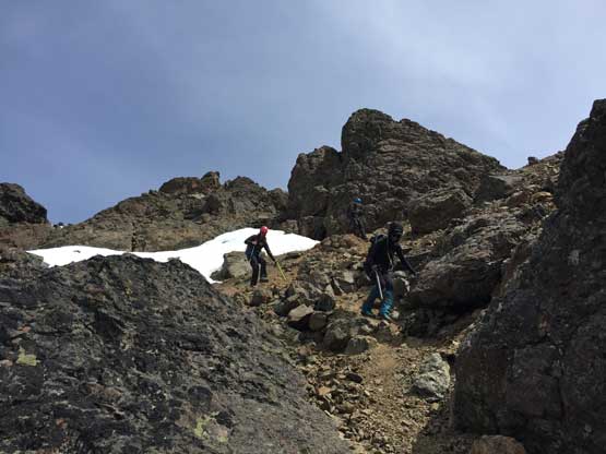
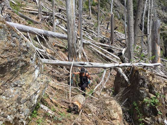
The climber’s trail beyond the camp was still in a decent shape. A few small creeks offered easy places to load up the water bottles (I carried no more than 200 mL of water on the entire approach because water’s everywhere). A while later we finally exited the woods but soon entered a burnt zone. The trail became confusing again and not to our surprise we completely lost it again and had to climb up and over many dead-falls to find it much higher up and way on climber’s left. Not much farther from here we hit snow and the snow soon became continuous. Mel and I found a dry rock island to finally ditch trail-runners and put the mountaineering boots on.

The first time in this trip we managed to get some sort of views…
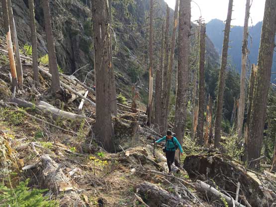
Into the burnt forest…

Me heading into the confusion. Photo by Mel O.

Chris and McKenzie hopping over endless logs
Off route again. It’s impossible to stay on trail here.
Me trying to find a trail. Photo by Mel O.
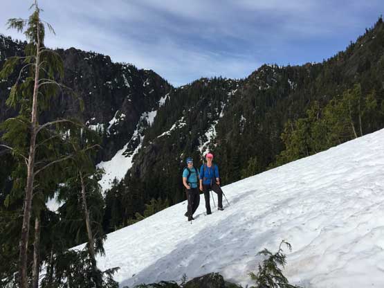
McKenzie and Chris merging onto snow at last
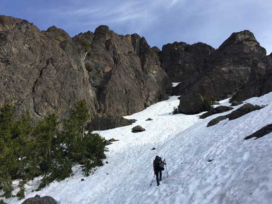
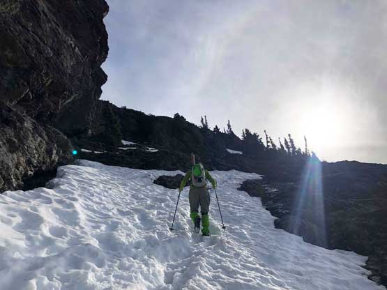
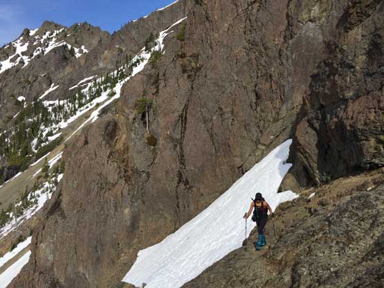
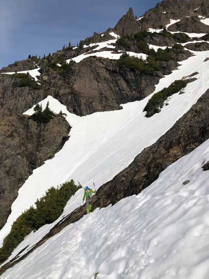
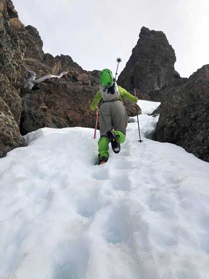
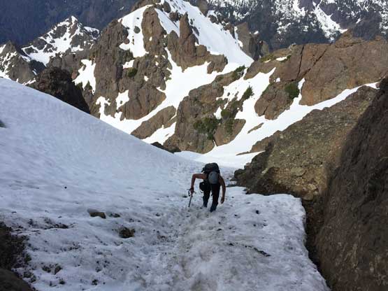
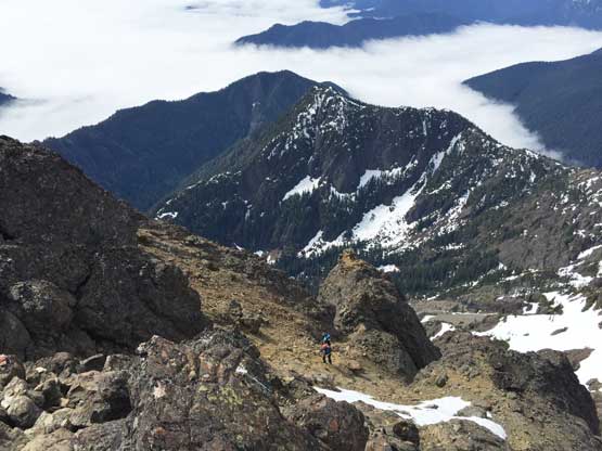
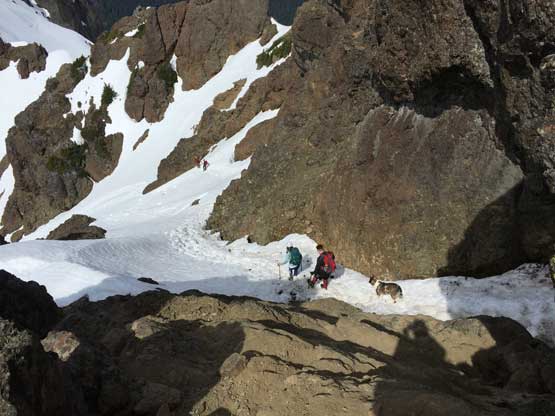
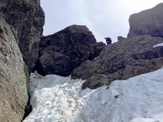
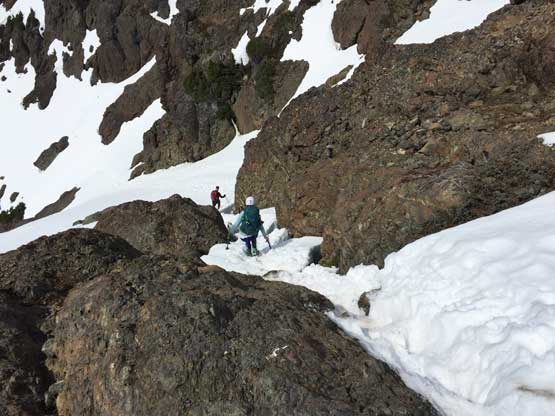
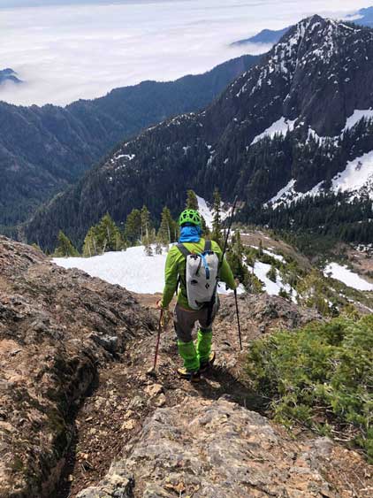
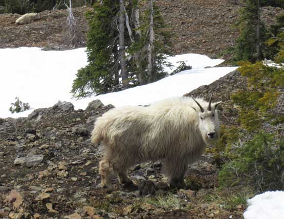
The view was foreshortened as we still had over 600 vertical meters to ascend, and mostly on snow. The biggest hazard here was the risk of falling through a snow bridge into the creek, as we could here water running underneath. The snow was soft that the crampons weren’t needed on the entire ascent including the 45-degree sections. There were a “highway” of boot tracks in the snow gully but no defined up-track that we still had to do our own step-kicking. At least 10 climbers were on their way down and they had ruined the up-tracks. Two of them warned us there’s a big billy “somewhere up there over a roll” and there sure was… He’s gigantic but thankfully not aggressive. We had to push quite close towards his path in order to merge into the upper snow chute. The snow chute was a bit steeper than it looked that we decided to finally take the ice axes out about halfway through the bottleneck. The slope was about 45 degrees for a while but tamed out higher up. We followed the previous climbers’ path on a rising diagonal traverse due climber’s right (east) towards the summit block. This part wasn’t steep but slightly exposed and involved a few sketchy moves on thinly covered rocks. I was surprised that the snow surface had actually undergone a bit of freeze last night, but thank to the deep boot tracks we still didn’t need crampons.
Mel starting up the snow ascent.

Me with a sub-summit behind. Photo by Mel O.
Me heading for a snow-to-rock transition, Photo by Mel O.
Mel getting onto rock.

After a while we hit snow again. Photo by Mel O.

Billy goat sighting!

The goat walked away from us.
Me merging into the upper chute. Photo by Mel O.

Me boot-packing up the steep snow.
Mel starting the bottleneck

Mel above the bottleneck now. 45-degree easy climbing.
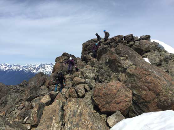
The snow became steep again near the summit block and the final obstacle was a short, but wet and down-sloping 3rd class rock scramble to get onto the “summit platform”. Once above the crux the summit was only 5 minutes away. It’s as busy as I was expecting but the stoke level was high among every one of us.
Me ascending through a thin spot.
Almost at the summit block scramble
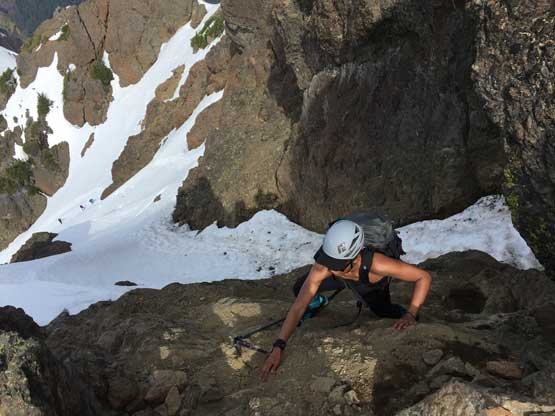
Mel negotiating a 3rd class move on the slabs

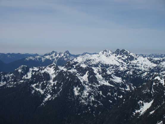
Summit Panorama from The Brothers. Click to view large size.
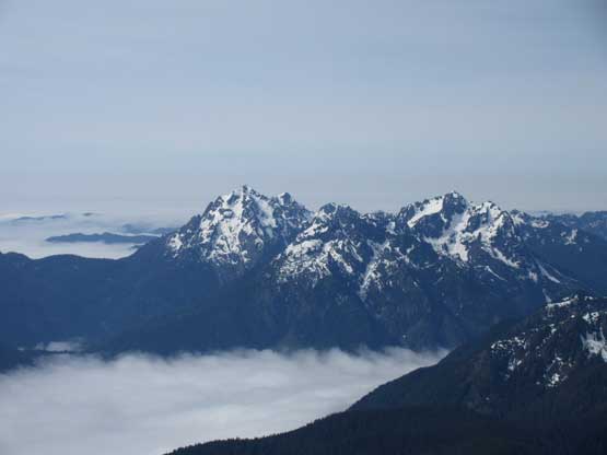
Mt. Washington and Mt. Ellinor
Mt. Lincoln, Mt. Cruiser, Mt. Skokomish and Mt. Stone in one shot
More Olympics summits to the west. Too lazy to figure out the names

Mt. Lincoln and Mt. Cruiser
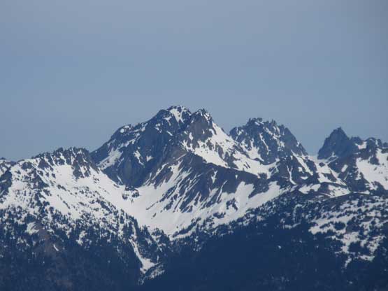
The massif of Mt. Deception with Mt. Mystery blended in front
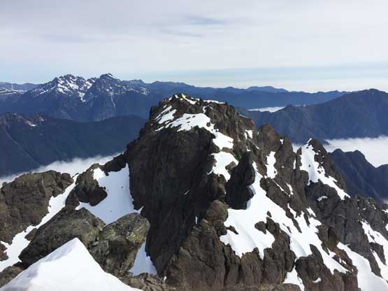
This is the north summit of The Brothers.

Me on the summit of The Brothers
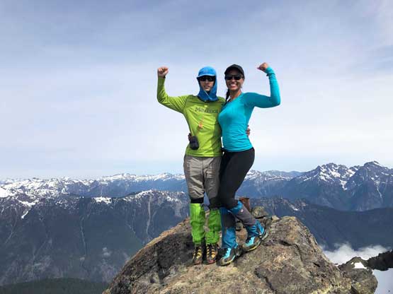
Mel and I on the summit of The Brothers
McKenzie and Chris approaching the summit

Izzy (from another group) made the summit too!

McKenzie and I on the summit of The Brothers
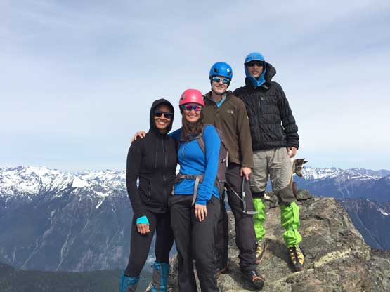
Our group shot on the summit of The Brothers
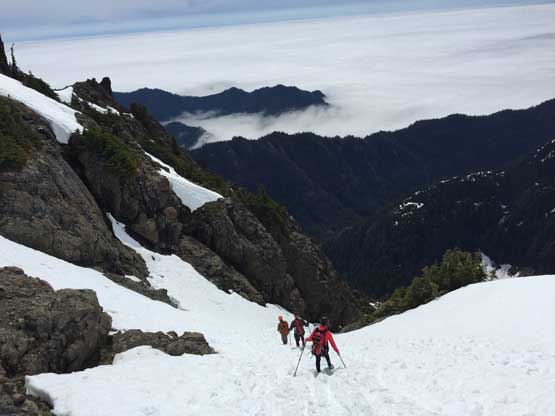
After staying for almost an hour on the summit we had to face the descent. Down-scrambling the crux was easy and then we got to enjoy a very fast plunge/boot-ski down the upper chute. We snapped some photos of the billy goats before going for another run down the lower snow gully. Once running out of snow Mel and I took another break transitioning gears. We unfortunately lost the trail again in that burnt forest and this time the punishment was bushwhacking in brambles. Lower down on the climber’s trail we paid close attention not to lose the trail again. We did manage to stay entirely on the “trail” through that confusing zone but had to climb up and over gigantic dead-falls which was probably just as painful as bushwhacking on the east side.. The rest of the hike-out was boring as fuck…
Time to head down…
The other group descending a steep zone near the summit block
Mel and McKenzie descending from the summit
Down-climbing the crux
Another thin spot. It was a bit sketchy here

Me posing above the chute. Photo by McKenzie J.
The other group starting down the chute

Fast forward. Mel finishing the chute now
Onto dry ground briefly. Photo by Mel O.
Billy goat again. Not sure if he’s happy to see us getting close or not

The goat walked away again…
Mel bushwhacking in brambles…

McKenzie one of the many log crossings
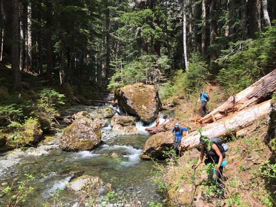
Trail beside East Fork Lena Creek
Neat colours in the woods
Valley of the Silent Men

Mel on another log crossing.
Chris crossing the same log

Believe or not we were on the right path here…
Mel crossing Lena Creek

It’s McKenzie’s turn to cross Lena Creek

My only photo of Lena Lake. It’s not exciting…
As much as the last leg of the plod went…
Our round trip time was 12.5 hours on a non-rushing pace. The near sea-level start meant that for the most of the time we were in the forest. This is a trip that you really want to find a way to enjoy hiking in the woods. The snow ascent on the upper mountain was fun, but too easy and not worthy to travel that far, for those seeking classic mountaineering. The view was good, but not nearly as spectacular as the North Cascades. Overall this is a classic Type II fun outing but the company made the physical suffering less painful. This was a very successful firs trip with McKenzie and I certainly am looking forward for more with her, and I’m glad to meet Chris as well. Chris got huge blisters on his feet earlier in the trip but managed to tough it out. The drive for Mel and I back to Vancouver was fairly uneventful sans the long delay waiting for the ferry. The scheduled ride was full and we had to wait for the next ride. We thought about getting a pizza but the lineup was beyond brutal. We eventually went for some ice cream and eventually had a dinner in a Subway somewhere in Everett. The rest of the drive back home was fluent including the border crossing.
