Elkhorn Mountain
July 1-2, 2021
2194m
Vancouver Island, BC
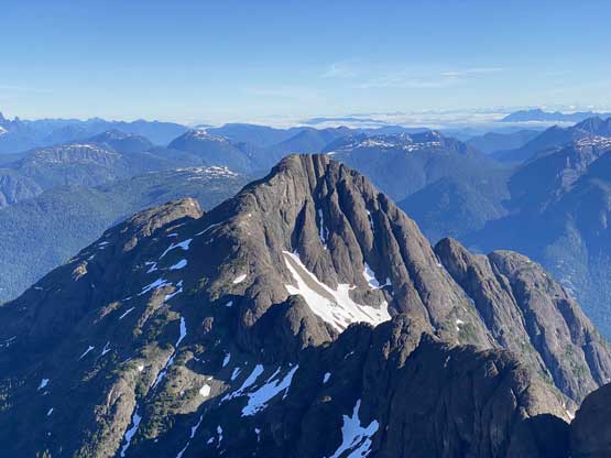
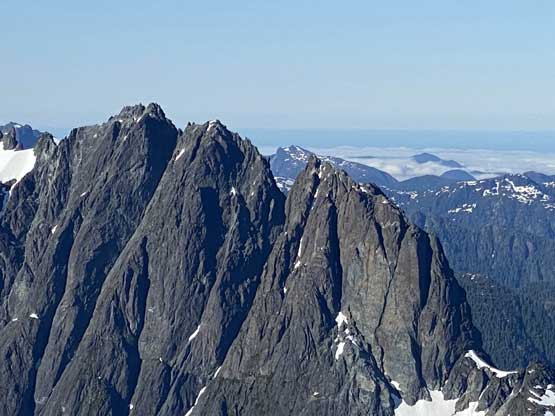
Elkhorn Mountain is the second highest peak on Vancouver Island towered by Golden Hinde by probably only 1 meter, and boasts a very iconic profile that almost makes it super attractive to peak-baggers like myself. This peak also presents on the “Island Qualifiers” as well as the “SWBC Ribus/P1000m”, two of the lists that I’m currently working on. There’s no “walk up” route on Elkhorn Mtn. with the least technical route (West Gullies) having a grade of 4th to low 5th class with challenging route-finding, although after extensive research I determined that the second easiest (NW Ridge) is actually the route that provides the highest chance of success, providing that the party will not have a problem to climb a short pitch of 5.4 layback corner. The NW Ridge is also the most classic one on this peak because of its superb position and the more direct attack.
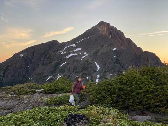
I had a few partners in mind to knock off Elkhorn Mtn. with and in the end Winnie M. decided to join me. Winnie had more ambitious ideas that involved more climbing and less walking but the lack of partner(s) made her committing to my trip. Ideally I would want to team up with her for an ascent of Mt. Colonel Foster, the hardest of the “Island Qualifiers” but the combined factors of the lack of snow in the Great Western Couloir and the lack of time to thoroughly research made me deciding on this easier option. To climb Elkhorn Mtn. via the NW Ridge would be a very chill trip for the two of us over two days, from both technical and physical perspectives and I was pretty happy with the pick. I did, however, have concerns about the ferries and the traffic of the long weekend and I thought the crux was to actually hop onto the ferry. I had been watching closely for the ferry’s status and all the sudden at 10 am Wednesday they decided to add an additional sail at 7:20 pm. I instantly booked it so we were set. However, the travel from White Rock to Vancouver was such a horror show that took me 1 hour 40 minutes. Thankfully we had planned about 2 hours of time contingency so we eventually did manage to hop onto that ride.
The ferry did not manage to sail until well after 8 pm making a late arrival on the island. The drive from Nanaimo to Elk River Trail-head would take roughly 3 hours. I thought about to car-camp somewhere near Campbell River but in the end I managed to drive us all the way to the trail-head. That was a busy spots with at least 10 vehicles parked so we didn’t bother to set up the tent and just slept in the truck. The next morning we woke up at 6 am with at least 10 additional vehicles arriving (including a park ranger). I have no damn idea about the rules in Strathcona Park but in the Rockies, car-camping at trail-heads isn’t allowed and bivying without a permit can also be easily caught and ticketed. That ranger parked right beside our vehicle but didn’t bother to fuss with us as we geared up, so maybe those aren’t problems here on the island. The morning did take us a while as we had to decide on a number of things.

The start of this approach was the first few kilometers on the well-engineered Elk River Trail. The quality of this trail did not let us down but there’s one major up-and-down that sure would prove to be frustrating on the return. The turn-off for Elkhorn’s NW approach was well marked with a sign, and then we were at the crossing of Elk River. I was aware that the easiest option was to find some logs to walk across but upon arriving I decided to just wade it for some refreshment. The crossing turned out harder than it looked and a few spots were pushing onto my thighs. I had my phone in the pant’s pocket and the pocket got soaked. Thankfully it wasn’t soaked for too long and the phone itself only got damped. Winnie picked a line that had slower current speed but deeper water and that was pushing the limit a little bit. About halfway across I had to drop back into the water to help her and even for me that water was waist deep and all of our clothing got wet from that. We spent the next 40 minutes or so to dry things off and to recollect.
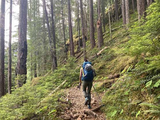
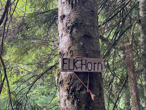


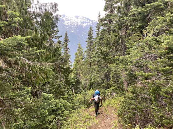
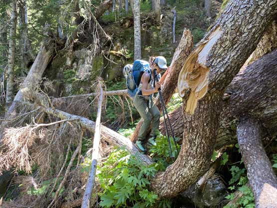
The start of the climber’s trail was not very well-marked but we had come prepared with two sets of GPX tracks, so we did manage to follow the trail. Once the trail ascended above the immediate vicinity of Elk River the following became easy, although the grade picked up significantly. The next few hours were spent grunting up this relentlessly steep trail with numerous zones of dead-falls that required either short or long detours. Once the trail finally made a turn to shoot straight up towards “North Col” at 1300 m the going became insanely steep. Two batman ropes to start it off and then some mandatory tree-root scrambling. Eventually we arrived at that infamous water slab pitch where the only possible method was to batman up the rope. Before doing that we spent some minutes to load up the water bottles as this was also the only water source from Elk River all the way to where we hit patches of snow on the ridge.
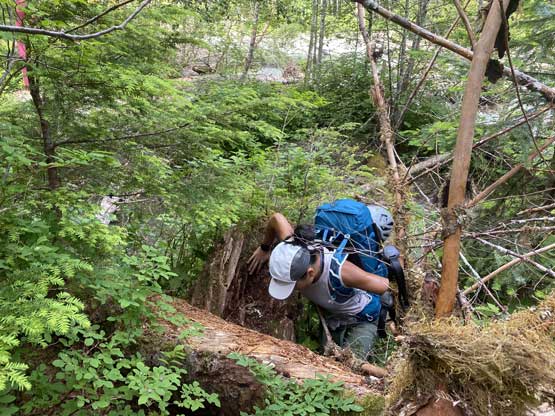
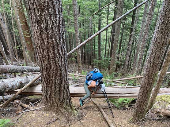


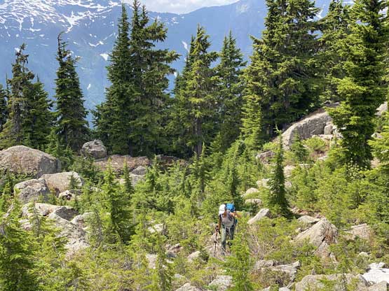
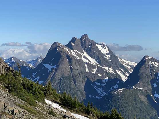
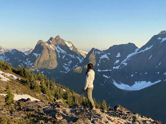
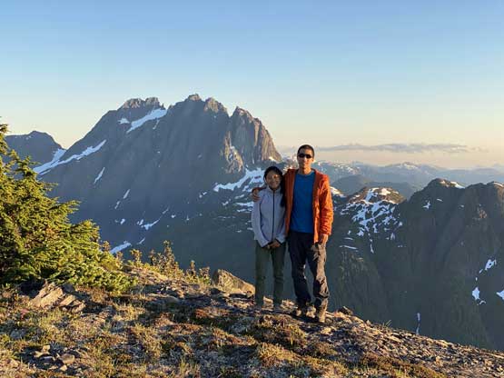
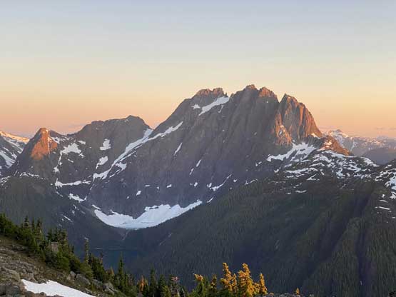
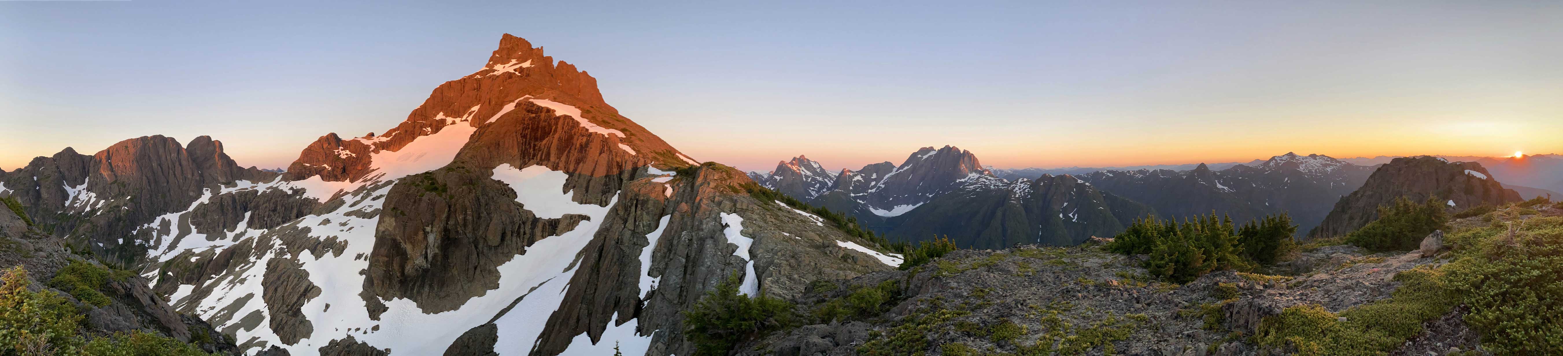
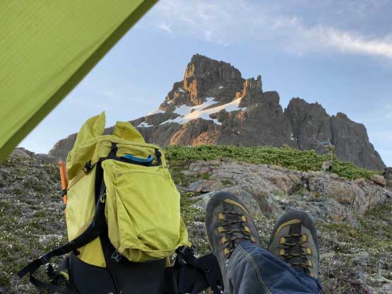
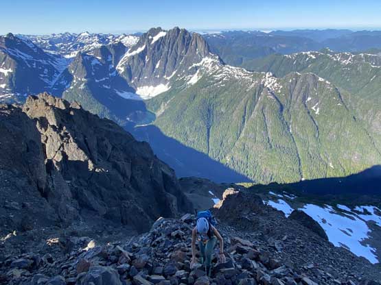
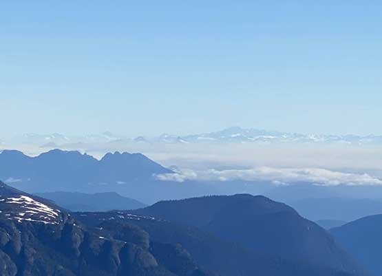
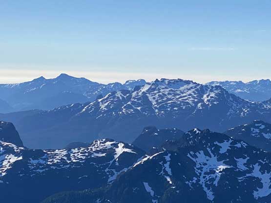
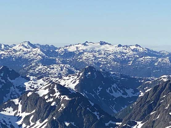
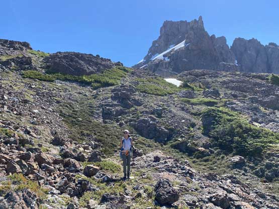
From the “North Col” the trail traversed on the south side of the ridge for a short bits before ascending steeply for another 200 m or so to get onto the ridge, where we finally got some views. However, the weather was mostly overcast on this day so our moods didn’t really get a boost. The trail was also undefined and difficult to follow wherever it’s right on the ridge crest and we also had to deal with boulders and snow. Upon reaching the next bump/rise we followed the trail traversing climber’s right again before picking a steep line to get back onto the crest. We had passed several prime camping spots in this stage but the plan was to push all the way to the base of the route to set up camp. We pressed on, up and over a major bump on the ridge and camped between 1700 and 1750 m elevation. In retrospect we should have camped one bump earlier as that one had the most unobstructed vistas. The one we camped on wasn’t bad, but a bit too close to Elkhorn Mtn. such that the view of this peak itself wasn’t as impressive. We got here after almost 7 hours on the go, so decided to just set up camp and chill for the sunset. I thought we did have enough time to grab the peak in the evening but the weather was questionable and we were tired. After napping for an hour I woke up under clearing skies and in the next two hours we got some incredible views.


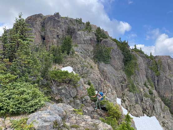


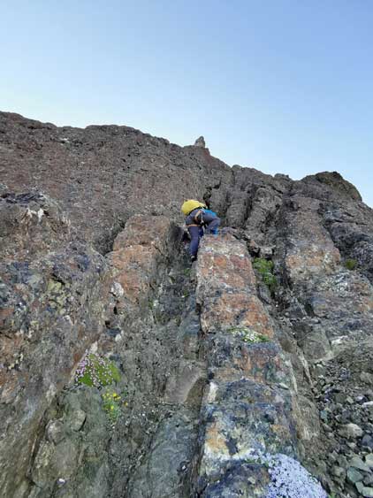
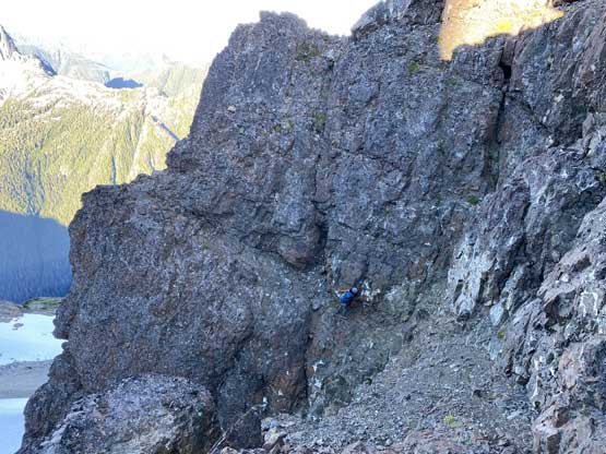
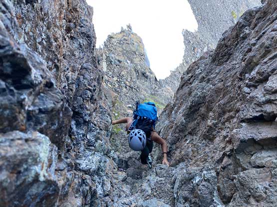
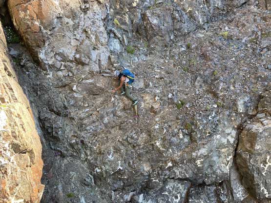
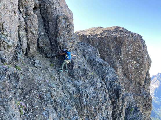
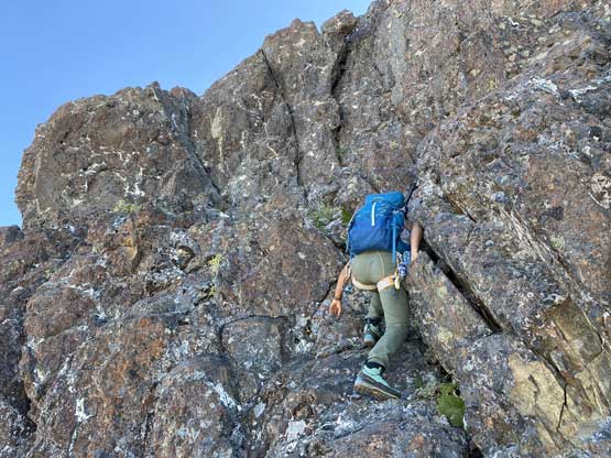
The next day we decided to wake up at 5 am when it’s just bright enough to see but we were too tired for that. We ended up sleeping in till sunrise but that’s still okay. I had worried about having to share this route with multiple parties but nobody ended up showing up. From the camp we traversed on some undulating terrain and slogged another 200 m or so to the start of the route where we each ditched one trekking pole. I carried one pole higher because that’s useful for the easier, 3rd class terrain on the upper route. The start of this NW Ridge had a series of 3rd to 4th class gullies and ledges and to link them up required route-finding skills in Rockies-like terrain. Other than one minor mistake I did think we nail the route-finding here. We also passed one long and juicy batman rope on 3rd class terrain but we didn’t use it. Upon reaching the base of that 5.4 layback corner Winnie decided to just solo it. After watching her trying a few techniques to make those moves and struggling to even just get it started myself I decided to ask for a belay. There were only a few tricky moves but to climb them on mountaineering boots was not easy and I also didn’t find the exposure that easy to deal with. With a belay, I then climbed it without a problem.


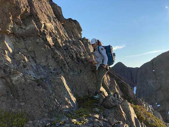


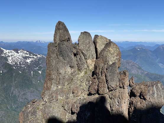
Now we were at the base of the gendarme. We had brought ice axe, crampons and worn mountaineering boots because we had to climb steep snow to bypass the gendarme on climber’s left side. The steep snow route however, did not look steep enough to be exciting/challenging so Winnie’s pick was to traverse the late-season ledge option on climber’s right. I knew that option and thought that was definitely harder than the snow route, but then I also knew that I would not have a problem on that route neither, so reluctantly agreed. It turned out to be actually quite fun except for a few spots that required significant care. The ledge was one feet wide, down-sloping with loose pebbles and exposure to death. However, as a mountaineer from the Canadian Rockies this had been the exact terrain I had dealt with for years, so not a problem. Winnie, being a rock climber, traversed it across with ease using some very different techniques.

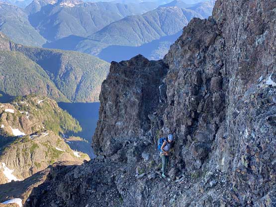


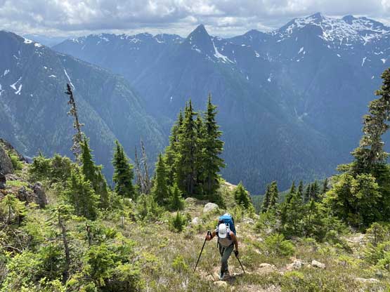
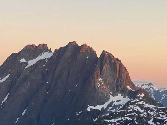
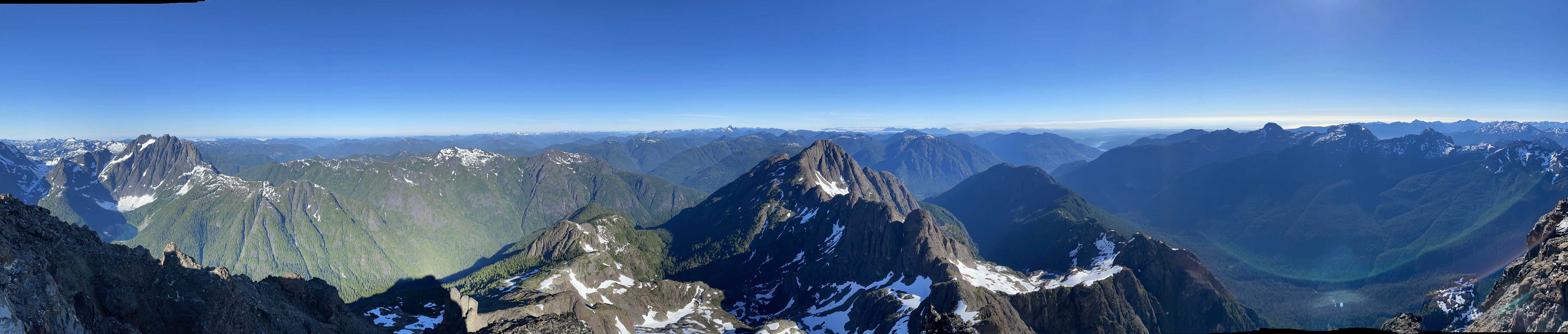
Beyond that gendarme section we ascended more 3rd class terrain with exposure along a rising traverse line out climber’s right into that’s so called the “upper amphitheatre”. There we also faced route options. After some discussion we decided to veer climber’s left back towards the NW Ridge proper and the sole reason was to challenge ourselves. We climbed a few 4th class chimneys but then one difficult wall forced us to traverse climber’s right along a ledge back into that amphitheatre, just much higher up. Once rounding the corner to the south side of the summit area the rest of the ascent was easy, albeit on very loose blocks. The views were as expected, awesome, but I preferred the views from Golden Hinde over this one.


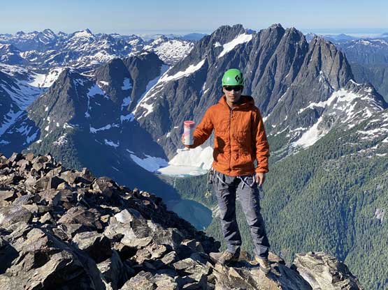
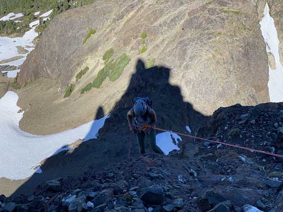
We lingered for almost an hour on the summit as we also got cell services to reconnect back into the world. For the upper route I led us down taking the line of the least resistance so we didn’t have to down-climb those upper 4th class stretches. We then reversed the ledge traverse back around the gendarme because we felt that wasn’t a big deal and nobody wanted to make a gear transition to strap crampons on. We then made one short rappel off the crux pitch, down-climbed a series of class 3 and 4 chimneys and made a long rappel off that juicy batman rope. I thought about to down-climb beside it but with that rope dangling there it’s difficult to not use it. The rest of the descent back to camp was rather uneventful and we earned ourselves another long ass break at camp to pack things up. While packing we also melted more snow for water.


We knew the descent from camp to Elk River would not be enjoyable so our solution was to take numerous breaks and to not rush it. I felt the upper part before “North Col” was actually enjoyable because we had views that we missed on the approach day. From “North Col” to Elk River was indeed a soul-crushing slog but at least we were constantly doing different things so it wasn’t that mind-numbing. We tied our two 30 m ropes together to make one long rappel off that water slab pitch and used all other batman ropes to assist our descent. We also met one group-of-three from Victoria on their way up and that was it for the traffic on this peak over a bluebird long weekend window. That was surprising to say the least. To cross Elk River I said to walk across that massive log upstream but in the end we decided to take dip. This time I was smart enough to put the phone in the pack (no photo then) but then the crossing again, turned out harder than I thought. The water again, waist deep for me. Winnie managed to cross it with the assist of that massive log. After the crossing I walked back and forth on that log on sandals just to illustrate that’s the easiest option (for parties that do not want to get wet). For us, getting wet was cool because we were tired and wanted some refreshment. We spent at least another 40 minutes drying things off at this spot, then leisurely plodded out back to the truck.


We had numerous discussions about the next objective and the general idea was to head back onto the mainland because none of us wanted to deal with the Sunday’s ferry line-ups. We managed to get back to Nanaimo by 9 pm and caught the 10:40 pm ride back onto the mainland. I eventually got back to White Rock at 1:30 am, exhausted but happy to have my own bed to sleep on. And the next day we would drive to Chilliwack for an ascent of Crossover Peak.
