Enchantment Peak (WA)
October 7, 2018
2597m
Leavenworth / Enchantments Core Area, WA
The fabled “Enchantments” near the small town of Leavenworth of Washington state does not need a lot of introductory. Hordes and hordes of hikers, scramblers and climbers gun for the core zone every weekend in the prime time. There gotta be some reasons for that. I had been bombarded by a lot of pictures of the area from various sources of the internet. Asides the world-class scenery there are five Bulgers on the plateau along with the uber-classic Prusik Peak attracting peak-baggers like myself. Two years ago I had scrambled the highest in this range – Mt. Stuart but I was long due for a visit to the “core Enchantments”. Upon the kicking-in of 2018’s larch hunting season Lily suggested we should go for a hike in the Enchantments and I agreed. To get a permit to camp in this zone one needs to bid on a lottery system so to avoid complication with logistics our plan was to day-hike.
I knew from the recent condition updates that it had snowed in the range but unsure what exactly to expect. The itinerary was to at least ascend Little Annapurna but the plan would be subjected to change. We would hike up onto the plateau via Colchuck Lake and Aasgard and once there we would make some spontaneous decisions. As mentioned there are five Bulgers on the plateau. Among which Little Annapurna is the easiest followed by Enchantment Peak. I was confident that at least these two would go even with fair amount of fresh snow. Much of the trip involves plodding on a well-defined trail so my choice in footwear was trail-runners with microspikes. This decision was risky in some ways but on a long slog like this I really value the benefits of going light.
Enchantment Peak via Aasgard Pass. GPX DL
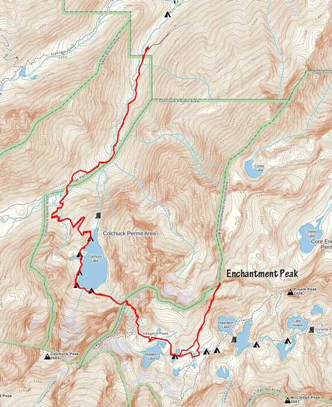
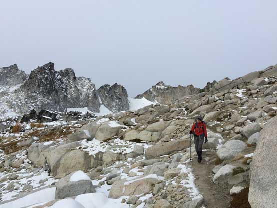
Lily and I left Vancouver on Saturday evening at around 8 pm. The border crossing took a while thank to the long weekend traffics but the cruise down I-5 and US-20 was very fluent. The logging road heading up to Colchuck Lake trail-head was also better than expected. The night was rough because we could only sleep for about 2 hours. The main reason was to take advantage of the morning weather window as precipitation was supposed to start at around noon. Getting up proved to be the crux of this trip but we did find a way to get going. Once hitting the trail I led a blistering pace crushing the Colchuck Lake trail in under 2 hours. Not wasting any time we picked up the undulating trail contouring around the west side of Colchuck Lake onto a boulder field on its south shore. There’s already enough snow and ice making this stretch sketchy as fuck. Our pace had slowed down significantly but with determination we managed to crawl across onto the steeper, but easier terrain starting up the Aasgard. There came the first time in history that I donned microspikes and meanwhile the skyline’s finally getting bright, slowly but steadily. We could now see the surrounding and I instantly knew the slog up Aasgard would take a good while, despite having a broken set of tracks.
It was still very dark as we traversed around Colchuck Lake

Alpenglow on Colchuck Peak

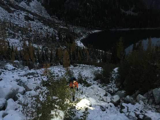
Starting up the long plod up Aasgard. Looking back at Colchuck Lake.

Me labouring my way up. Photo by Lily Q.
Lily on the lower half of Aasgard
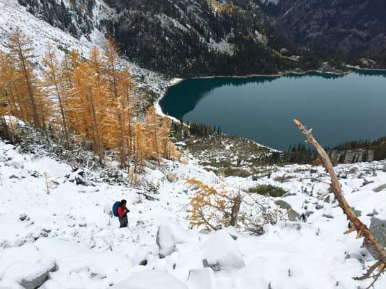
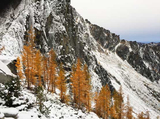
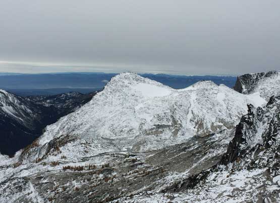
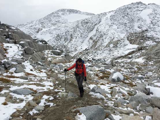
The trail traverses climber’s left ascending steeply up a constraint onto the upper half of Aasgard. The condition wasn’t as treacherous and the view was even more motivating. It had been ages since I went for a larch-hunting trip and needless to say I was pretty damn excited to see the yellows for once again. The slog seemed to drag on forever though but remind yourself that the ascend of Aasgard involves over 700 m elevation gain and the view’s very foreshortening. There were a few additional rises near the top but once there we were greeted by some drastic changes in scenery. The trail condition started to get better but the north aspects were plastered with snow. As we slowly descending to the shore of Isolation Lake I started to wonder about some other plans. The standard route on Little Annapurna appeared like a full on slick-fest with boulders and slabs covered in fresh snow, but the southern slopes of Enchantment Peak were next to “bone dry”. The problem was that it often makes sense to bag Enchantment Peak together with Cannon Mountain but given the conditions I wouldn’t expect the latter went. But that’s the shoulder season game…
The larches are on glow…
The larges and the impressive NF of Dragontail Peak
Lily at about halfway up the Aasgard…

There are several scrambling steps.
Dragontail Peak

The larches and part of Enchantment Peak behind
Lily working her way up another scrambling step

Almost at the pass now. It’s a long grunt…

Dragontail Peak from Aasgard Pass

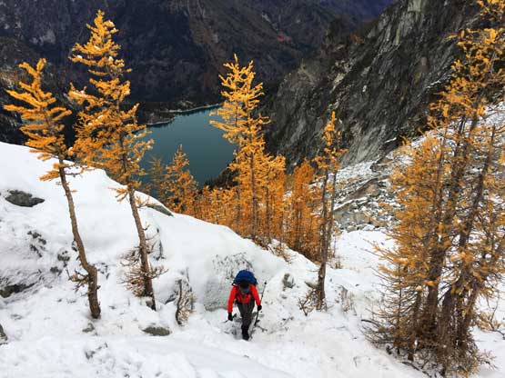
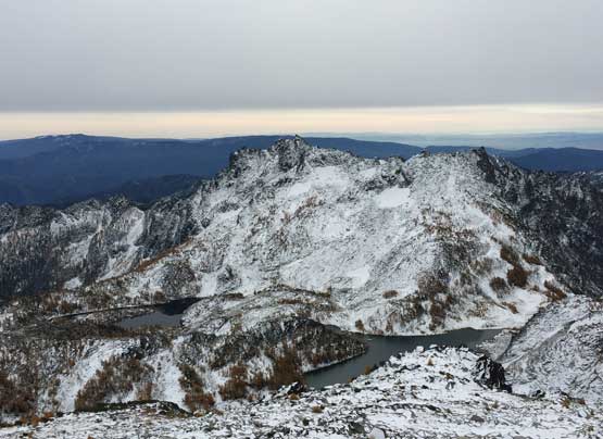
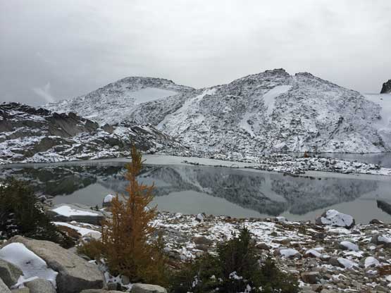
Isolation Lake with Little Annapurna behind
The trail suddenly became drier
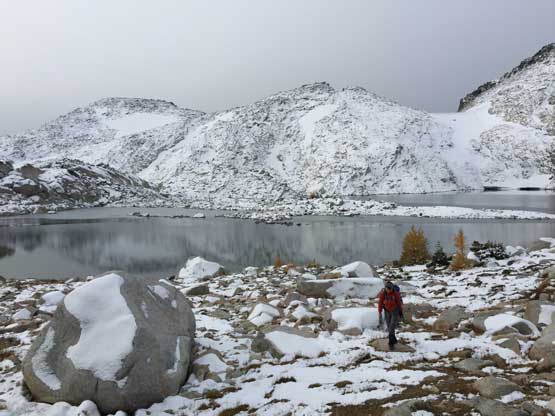
Another shot of Isolation lake
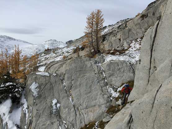
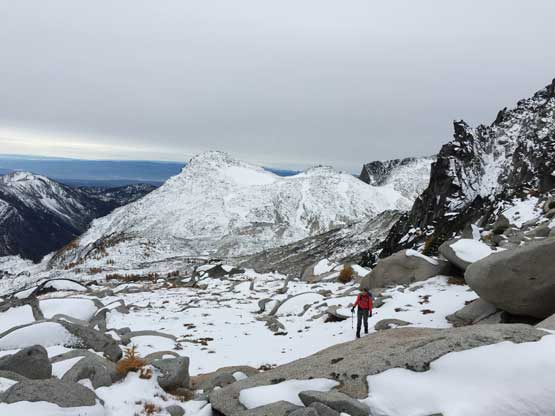
While descending onto the next plateau we made the final decision to abandon Little Annapurna and go for Enchantment Peak. This peak is labelled “Enchantment Peaks” on the topographic maps and there’s a reason for it. This isn’t a dramatic or iconic summit by any measure and if not because of the inclusion in that fabled Bulger list I wouldn’t even notice it. There appears to have several highpoints roughly sharing equal height along the mile-long plateau. Most “listers” would call it by ascending the technically-easiest NE highpoint. It is difficult to tell whether the SW spire is higher but given that most do not bother with that pinnacle I wouldn’t bother neither, nor could I given the amount of fresh snow. The standard for the NE summit is the east ridge from Prusik Pass but there are several short-cut options for those coming from the Aasgard side. I did come prepared with all of the beta and upon examining the conditions we decided to use the 3rd class south-face couloir to minimize off-trail travelling on snow.

My first time seeing Prusik Peak

Traversing a fairly obvious bench on the south side of Enchantment Peak
Much of the ascent of Enchantment Peak was on open country and the scenery was absolutely mind-blowing. I especially liked the view looking back down into the Enchantment core area. The gully was steep but not difficult, however we had to deal with a few somewhat exposed 3rd class moves on the summit nipple. Thankfully the summit block was south-facing hence dry. The actual summit wasn’t very spacious to linger around.

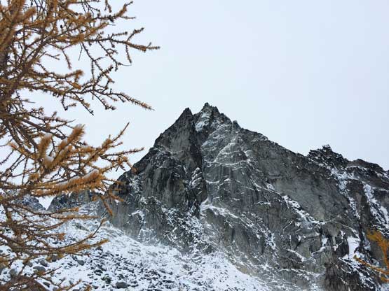
The larches and the typical terrain on Enchantment Peak
Still along that bench traverse. This is one step to work around

Inspiration Lake and McClellan Peak behind
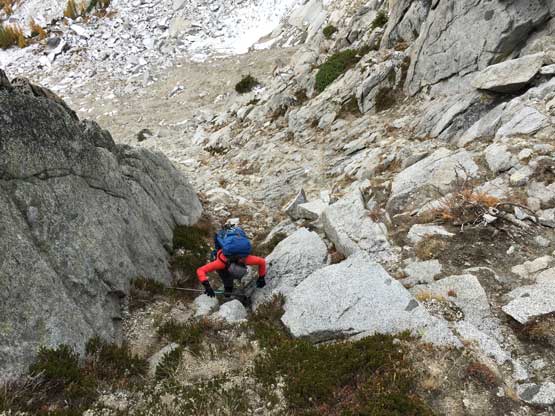
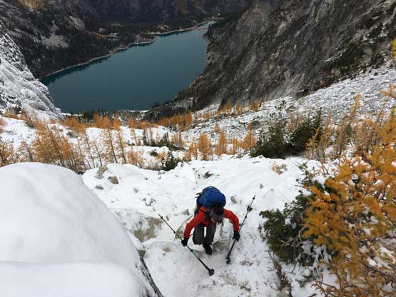
Lily scrambling up the south-face couloir.
Arriving at the upper plateau now, with Little Annapurna behind

Shields Lake and the plateau that seldom sees hikers

Me tackling the 3rd class summit block. Photo by Lily Q.

Partial Summit Panorama from Enchantment Peak. Click to view large size.
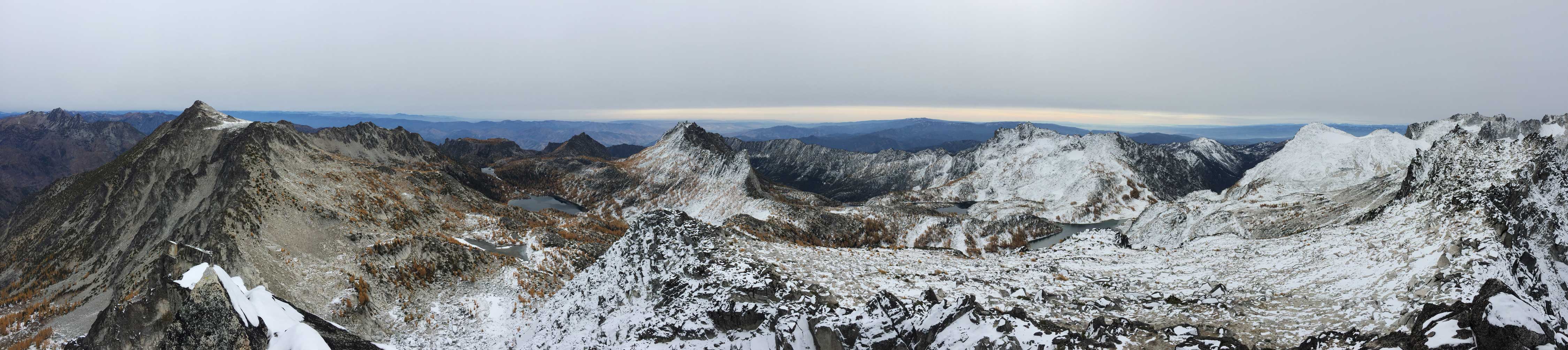
Partial Summit Panorama from Enchantment Peak. Click to view large size.

Lily starting the summit block climb
Mt. Stuart and the other few Bulgers along that line
Little Annapurna
McClellan Peak

Shields Lake with the rarely-ascended Edwards Peak behind

The Temple and the tiny Prusik Peak to its right

Lily on the summit of Enchantment Peak

Me working around a slippery zone. Photo by Lily Q.

Me on the summit with Cannon Mtn. behind. Photo by Lily Q.
Before it got too cold we gingerly down-climbed the tricky moves and then followed our own tracks across several snow patches to the top of that south-face couloir. At this point we had abandoned making any other ascent and instead of making a through-hike we also decided to return the same way over Aasgard. Descending the couloir required a bit of careful work especially wearing trail-runners but not a huge deal. In no time we were back across the open country traverse in order to rejoin the main trail. The trail was chocked with hordes of tourists.

Looking back at the summit nipple Another hiker just arrived

Descending that south-face couloir

One last look at Inspiration Lake and McClellan Peak
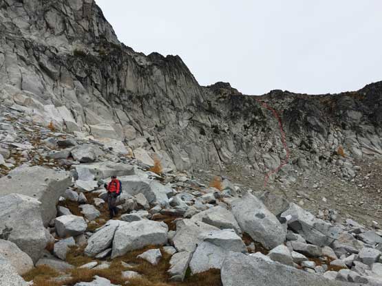
A review shot of the south side couloir right of center shot

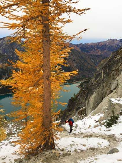
The larches are the main reason why we picked this objective

Just the tip of Prusik Peak showed up behind a tarn

Another tarn on this plateau.
The elevation regain up to Aasgard Pass was annoying but the real “fun” was descending that 700 m slippery zone down to the shore of Colchuck Lake. It wasn’t too bad though as I didn’t even bother to don microspikes. The boulder fields on Colchuck Lake’s south shore had turned bone dry which was a bonus. Instead of crawling across we could make some large leaps that greatly sped things up. The trail traversing around Colchuck Lake had several annoying up-and-downs. That’s the theme though… The rest of the descent was uneventful but very mind-numbing.
Lily hiking back towards Aasgard Pass.
Isolation Lake and Little Annapurna

Arriving at the pass now looking down at Colchuck Lake

Me with a bunch of larches. Photo by Lily Q.
Other hikers working their way down the slick zone.
Almost done the steep stuffs.

Cashmere Mountain and its reflection in Colchuck Lake

Another view of Colchuck Lake

Amazing fall colours here

The last photo of this trip… This is still Colchuck Lake
Our round trip time was around 13 hours and that’s a tad slower than anticipated. The round trip distance was around 25 km with cumulative elevation gain around 1800 m and considering the less-than-ideal conditions I think we did reasonably well. I would unfortunately have to return here several times for the other few Bulgers along with Prusik Peak but this is a decent zone that I wouldn’t mind to repeat the long plods.
