Volcán Guagua Pichincha
December 14, 2022
4784m
Lloa, Ecuador
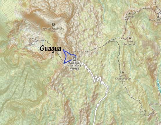
The massive of Volcán Pichincha is the most accessible ultra-prominent peak in Ecuador as it rises directly to the west of Quito. There are many summits on the massif. The highest is Guagua but the most popular is Rucu as Rucu is directly accessed via the TelefériQo (gondola). The two peaks can be linked together as per several trip reports on peakbagger.com but the connection is lengthy and contrived. The gondola’s service doesn’t start until 9:30 am on weekdays and aiming to summit a high peak in the afternoon is rather stupid given the weather pattern in Ecuador. The more logical way to ascend Guagua Pichincha is from the small village of Lloa to the south. With a reliable 4×4 vehicle one can drive to the refugio (hut) at 4557 m making the summit bid a very short one.
Adam and I were originally planning the link-up from Rucu but none of us did our homework until the last minute. We learnt the operation hours of the TelefériQo and the not-so-great weather forecast and thought the idea was very stupid. The weather forecast in this country, as we learnt gradually throughout this trip, is extremely unreliable to the point that we shouldn’t even bother to check, but this ascent was done in the earlier stage so we still had fate on the forecast. Thankfully I had my Gaia maps handy and found another road coming from the south with the end marked “Refugio Guagua Pichincha”. A quick research showed that this was actually the way a lot of climbers came up from. The reason we didn’t discover it earlier was that all of the recent peakbagger trip reports came from the east via Rucu, likely all under the influence of just one or two trip reports. If you date back to circa 2013 the majority of the ascents on peakbagger.com were also done from the Refugio. Adam texted the head person of our guiding company, Edgar and learnt that the road access from Lloa indeed required a 4×4 vehicle but Edgar was able to arrange a driver and a vehicle for us for only 90 dollars, even at the very last minute. We thought this was a great deal and we were happy to change a supposed “long day” into a short morning stroll.
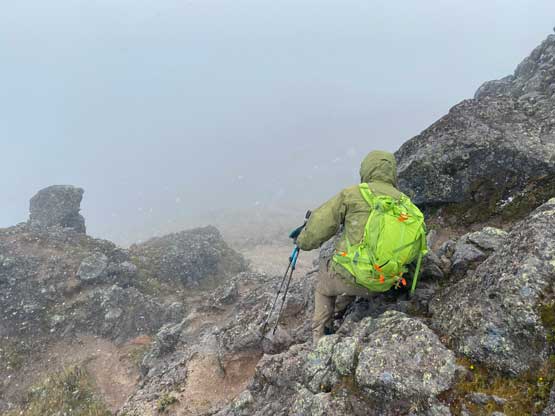
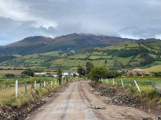
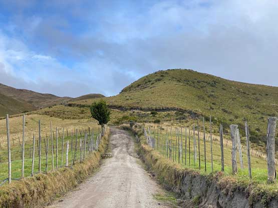
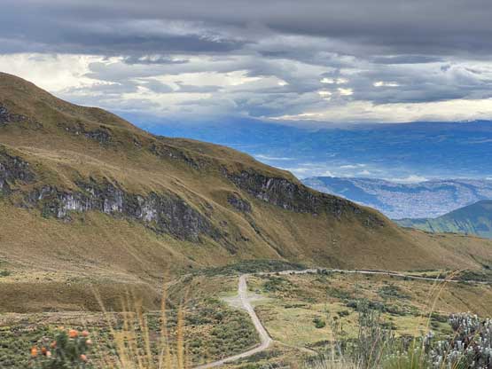
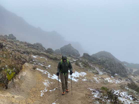
Edgar’s brother came to pick us up at 7:00 am and we made quick work southwards to Lloa in his truck. The road was muddy and rough such that our previous taxi driver, Jorge would definitely have no chance in making it. There were a few rough spots down low right after the road becomes unpaved so it’s not like we could have arranged a taxi to get us to within a “walkable range” neither. With Edgar’s trusty 4×4 vehicle we had little issue driving all the way to the refugio. Unfortunately the weather was really not on our side and the only view we got was from the drive-up. By the time we parked at the hut we were already in a drizzling white-out and the drizzle quickly changed to wet snow.


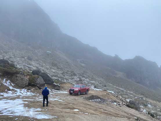
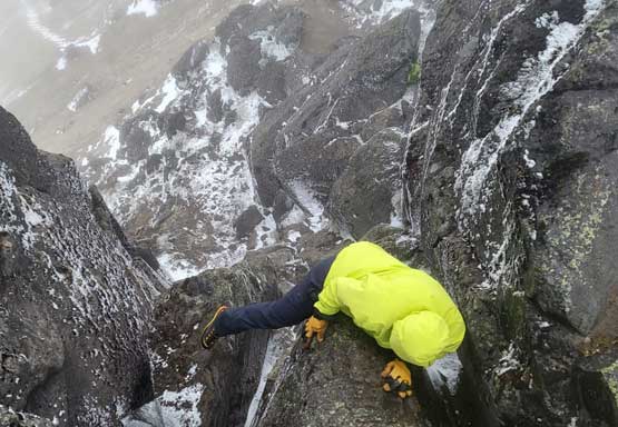
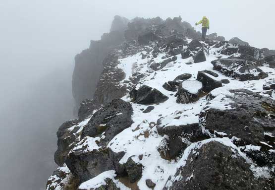
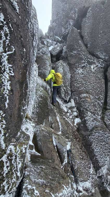
I had hoped to just wear the trail-runners to the summit but the weather made me to change the plan. I had left the high altitude boots in the Air B&B so my only choice now was the brand new La Sportiva Trango Tech mountaineering boots. I really didn’t want to wear that pair on these volcanoes as a few days on this type of terrain would completely destroy the otherwise, brand new boots, but I really didn’t have a choice. There were two routes illustrated on my map as we opted to take the southern approach on the ascent and the other one on the descent. This is the common way as the descent route is extremely sandy with nothing but scree. The trail brought us onto the south ridge and by now the weather had completely turned into a blizzard. I had to stop to put on all layers and I was still cold and miserable. Too bad I had left the parka, the goggle and the balaclave all in the Air B&B. It’s here that we also learnt the contour lines on Gaia’s topo map was completely wrong but but “trails” shown on that map were actually correct. While traversing the south ridge we dealt with a few 3rd class steps with minor route-finding, but the actual challenge was the summit block. The class 3+ terrain felt like low 5th for us given the snow and ice on the route, but after a while we both figured out the sequence and made it work. There’s a tight chimney to stem through.


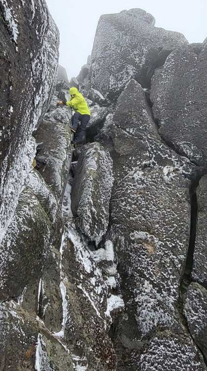

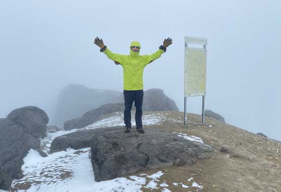
The summit stay was short due to the weather and we wanted to finish the down-climbing while the memory about those moves was still fresh. The down-climb felt considerably harder as by now there had been more snow accumulation on the rocks. Had we shown up here a few hours later we probably couldn’t have made the summit without crampons and a rope. We then picked up the descent trails in the white-outs and made our way down while traversing skier’s right. There were multiple sets of trails so the navigation was a little bit confusing, but with the GPS technology these days the navigation overall wouldn’t be too problematic. We got back to the truck completely soaked so we quickly drove down. Edgar’s brother informed us that he had been communicating with the other guides while we were climbing, and all parties on Cayambe and Chimborazo had turned around, so it’s a good thing we weren’t on a bigger peak in this morning. Since the ascent turned out to become another short one we got to spend more time in the neighbourhood in Quito to explore the city. We also made a decision to use the supposed rest day for Rucu Pichincha tomorrow, as we needed to spend more time at the higher altitude.