Sigurd Peak
October 27, 2019
1939m
Squamish / Squamish Valley, BC
The unofficially named “Sigurd Peak” is the northernmost summit of Tantalus Range at the headwaters of Sigurd Creek. This peak is by no mean a “major summit” in the rugged Tantalus Range but does boast fairly significant topographic prominence, as well as some of the nicest views in Squamish vicinity on a clear day. An unmaintained trail runs up the steep forested east ridge from pretty much sea level near the confluence of Ashlu and Squamish Rivers and reports indicated horrible hiking conditions in recent years. And because of the sea-level start to attain the summit of Sigurd Peak one needs to ascend almost 2000 vertical meters, making a tiring fest even for seasoned peak-baggers. This is not a significant summit, but does require a lot of work.
For most hikers Sigurd Peak is the first, and probably the only summit they do in the Tantalus Range because it’s overall still the easiest in the area, but for me it turned out to be the last one I did. In July 2017 I soloed Coin Peak and Mt. Jimmy Jimmy not too far up the Ashlu Main Road and then in August 2018 I successfully climbed Mt. Tantalus along with Zenith, Pelion and Ossa, that started with a helicopter drop and finished by hiking out of Sigurd Creek trail. The last 500 m elevation loss was on the exact trail that I would use to ascend Sigurd Peak. Probably because I had perfect weather on that trip I never felt the rush to slog 2000 m up Sigurd Peak anytime soon. That changed in 2019 because Mel really wanted a redemption on this summit. I was still not very motivated but the last weekend of this October did offer a perfect window. At first I thought we had to haul snowshoes but last minute reports from the same area indicated bullet-proof rain crust up to 2000 m so the snowshoes were left behind. In the early morning I picked up Gur from Surrey and then Mel from North Vancouver, and made to Squamish still in pitch dark. We had some food in McDonalds and half an hour later, parked before the bridge crossing Ashlu River as if we only had a 2WD vehicle.
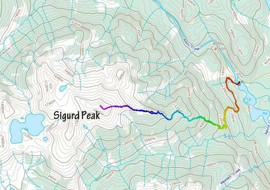
Sigurd Peak hiking route. GPX DL
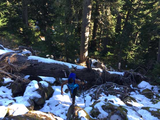
The rocky spur road at the start would be drivable in my Tacoma but from the previous trip I had made a mental note of not attempting to drive that road in any future trip(s). The starting stretch of steep, loose boulders would be too abusing for my stock truck with stock tires. In fact, it was almost a running course of stream in this morning. The headlamps were turned off not far after we passed the actual trail-head. The next point of note was the Crooked Falls junction after a few more hundred meters of elevation gain, and soon after that we reached the Sigurd Peak trail (Rose Trail) junction. We turned right, and I immediately called for a break to swap my footwear from trail runners to mountaineering boots. I came here mentally prepared for more of a “route” than a trail and in such a steep forest I would not want to be on trail runners. It turned out that the trail had undergone some recent maintenance such that we only had to duck under 3 or 4 logs and that’s about it. The grade was unrelentingly steep though but we did make steady progress.

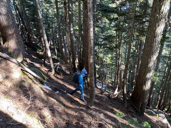
Mel ascending some of the typical steep west coast rainforest…

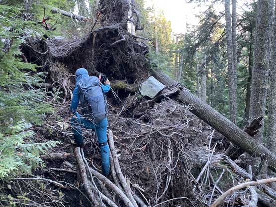
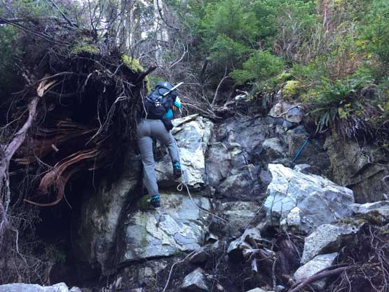
Gur on one of the worst spots. There aren’t much like this though.
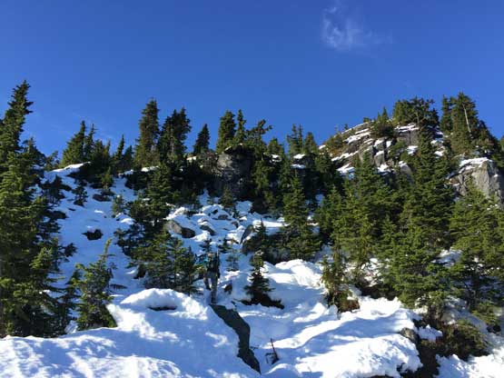
The next 600 or so vertical meters were some unrelentingly steep slog but as mentioned above, the trail condition was nowhere as bad as some recent reports made it sound like. The crux spot had two batman ropes to assist. At around 1100 m the trail did the first leftward traverse and at 1300 m the trail did the second leftward traverse and then ascended a small boulder fields. We encountered patchy snow here and there and the snow didn’t become continuous until above 1500 m elevation, and at this point we were pretty close to the top of “Rose Trail” overlooking the rest of the east ridge leading to the summit of Sigurd Peak. There seemed to have at least one party up there on the previous day packing down the trail for us, so no post-holing whatsoever.
Gur just went under a giant log, at the small boulder field
Mel picking the way up around 1400 m elevation zone

This is looking north towards Mt. Wood on Ashlu-Elaho Divide

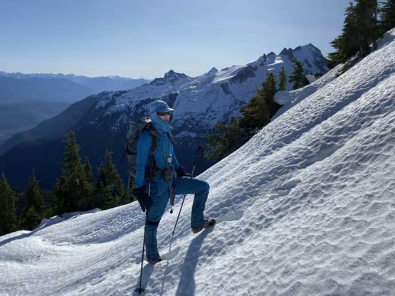
Me ascending onto continuous snow around 1400 m. Photo by Mel O.

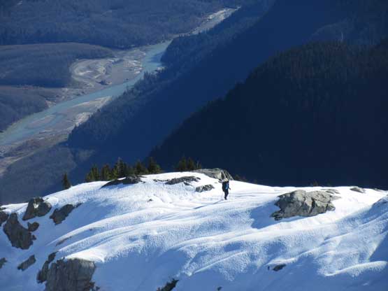
Mel on her last few steps to the lookout on the ridge

Gur and I with Pelion and Ossa behind. Photo by Mel O.

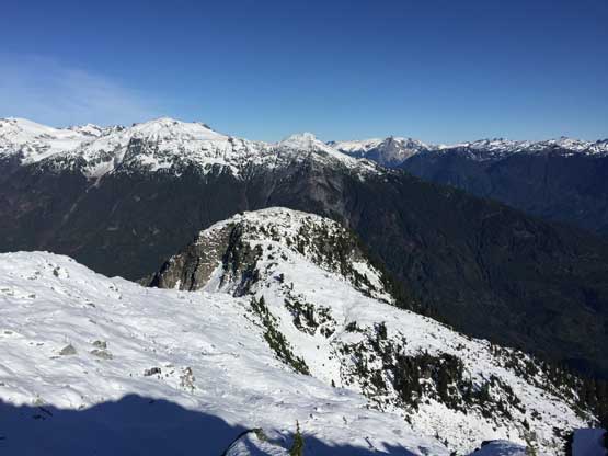
A frozen tarn with the rest of Sigurd Peak’s E. Ridge behind

The same frozen tarn.
After taking a lengthy break on the ridge we resumed the ascent. The first business was losing around 30 m elevation down to a broad saddle. The previous party’s tracks seemed to continue towards the summit so all we needed was to follow their path. It also appeared that they did more post-holing than we did, because the snow was firmer on this day. The snow was in the perfect condition – no post-holing and yet, not icy enough to need crampons. The upper ridge appeared steep and exposed from afar, but turned out to be trivial. We did have to be careful on a couple short stretches but never felt the need to even take the ice axes out.

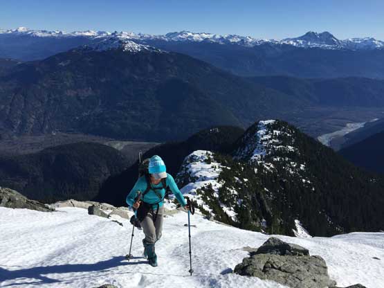
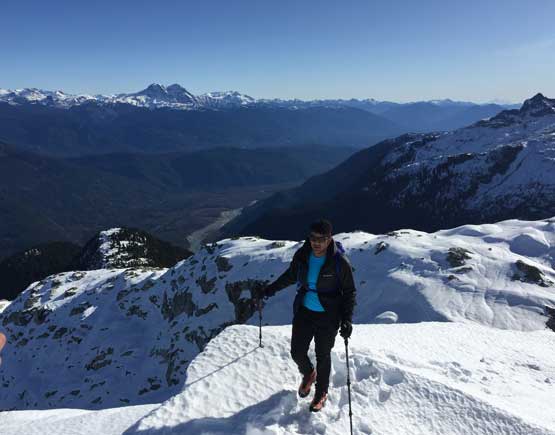
Me ascending onto the upper Sigurd’s ridge. Photo by Mel O.

Me taking my turn to lead on the upper ridge. Photo by Mel O.
Looking over a sub-summit on the north flanks of Sigurd Peak
Me ascending. Photo by Mel O.

Yet another photo of me plodding up the never-ending snow slopes.
Mel high up on the east ridge of Sigurd Peak.
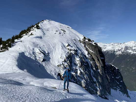
The elevation gain started to take its toll on us as we slowly but steadily approaching the false summit. There’s still the true summit to overcome but the views had fully expanded at this point, so the stoke level was high. The ascent onto the true summit didn’t take long, but then we spent well more than 1 hour to soak in the views. It had taken us only 4 hours 40 minutes to reach the summit which was significantly faster than expected.

The true summit ahead.

This is a northern view onto the Ashlu-Elaho Divide

Ascending the last bits towards the true summit now, looking back
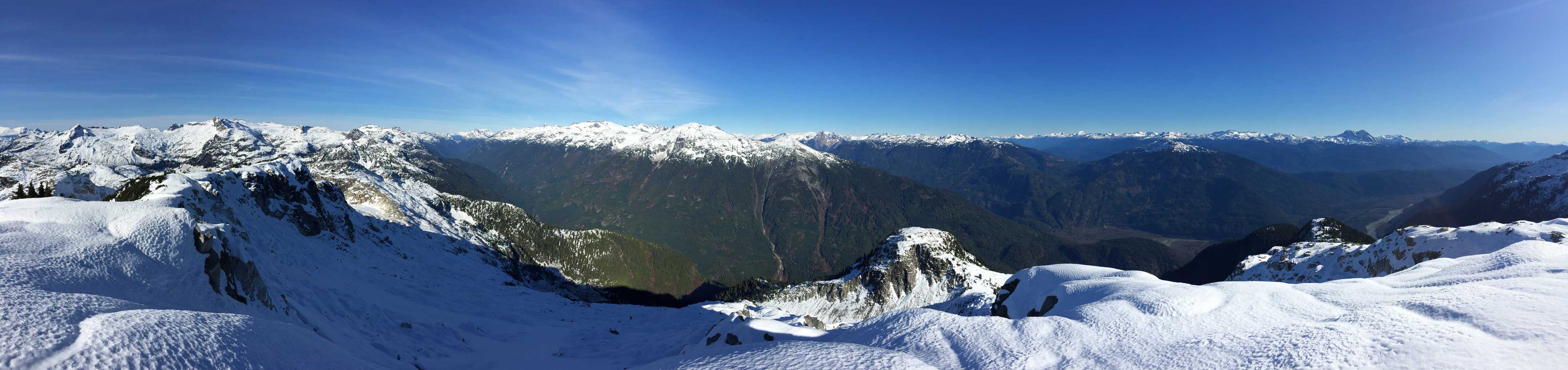
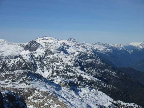
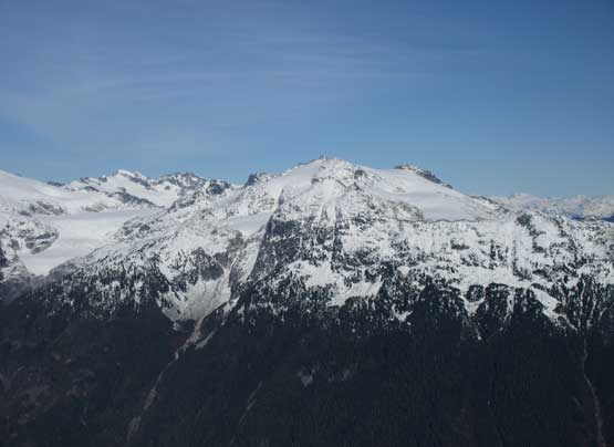
Partial Summit Panorama from Sigurd Peak. Click to view large size.
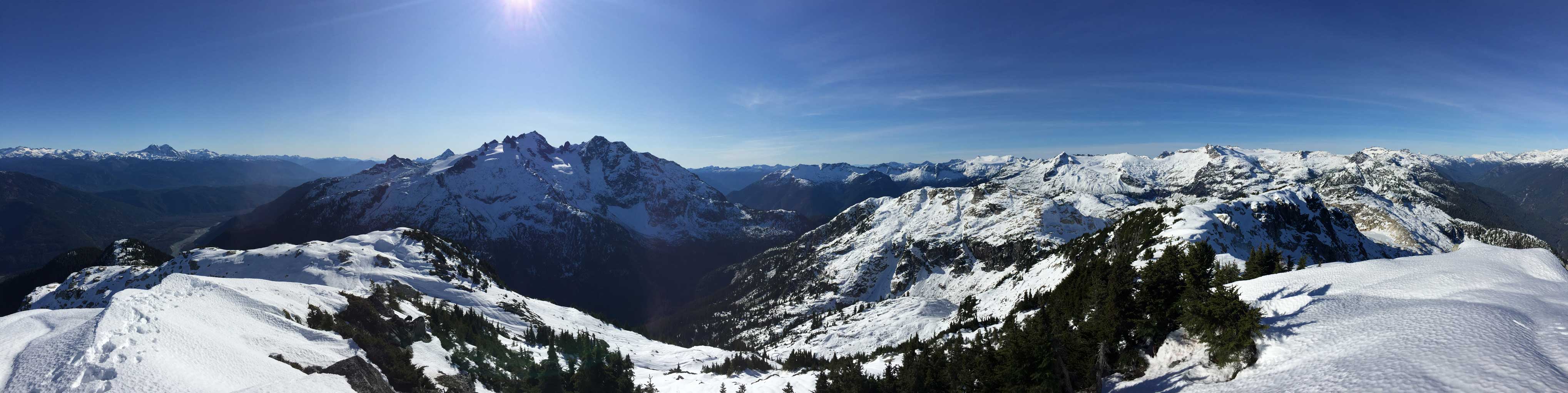
Partial Summit Panorama from Sigurd Peak. Click to view large size.
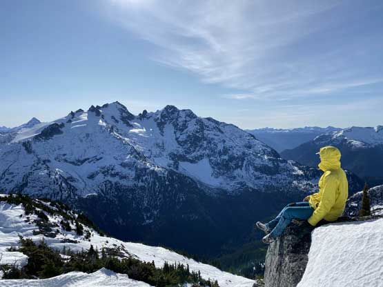
Me posing on the summit with Pelion and Ossa behind. Photo by Mel O.

Mel on the summit of Sigurd Peak

This is looking towards the very remote Tzoonie Mtn. area
The biggest peak left of center is Chimai Mountain
Mt. Wood on Ashlu-Elaho Divide
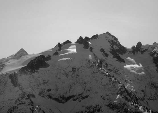
A zoomed-in shot of Pelion Mountain

A very zoomed-in shot of the north face of Ossa Mountain
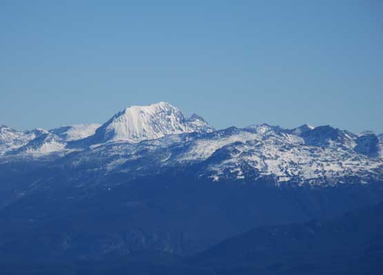
Wedge Moutnain’s SW flanks in the distance
Mt. Weart in the distance in the northern Garibaldi Provincial Park
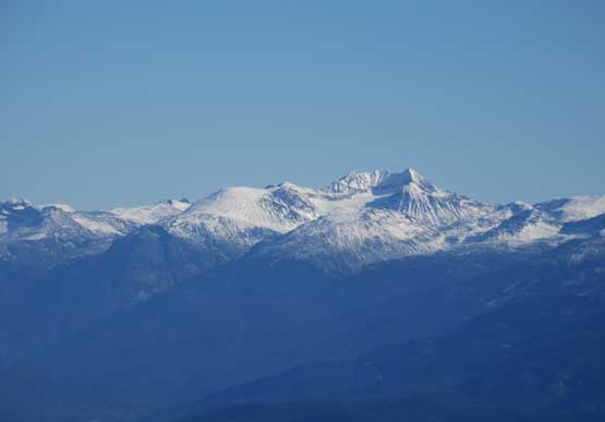
Tricouni Peak close-up shot

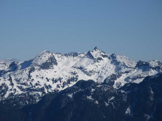
Mt. Cayley with the unclimbed Volcan’s Thumb
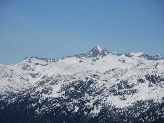
The very tip top of Ashlu Mountain pokes behind the divide

The massif of Mt. Jimmy Jimmy to the west

“Clowhom Horn” is that peak on the left, south of Mt. Jimmy Jimmy
A very zoomed-in shot of Gur slogging up towards the false summit

The Table in front of the Garibaldi Park peaks

Mt. Garibaldi and Atwell Peak
Gur approaching the summit of Sigurd Peak

Our group shot on the summit of Sigurd Peak

Me on the summit of Sigurd Peak, my 900th summit..
After having enough of resting we decided to started the descent. Plunging down the upper ridge was fast and furious because of the good snow conditions. It was inevitably much faster than the summer time because the terrain was probably be some tedious boulders and bushes. For us it was just easy plunging on snow, all the way down past the “lookout” into the forest. We did take another long break at the “lookout” before bailing into the forest, to take in more views. The forested descent was not nearly as bad as expected. We made pretty steady progress for 1000 vertical meters down to where the “Ross Trail” joined the main Sigurd Creek trail. Here I took another long break swapping footwear back to trail runners. The final stretch down to the parking lot at Ashlu River bridge was uneventful. For some reasons I didn’t really feel tired at all until the soreness kicked in on the following day, at home.

Mel and Gur taking a slightly different line down
Me posing with the true summit behind. Photo by Mel O.

That rain crust is pretty under the afternoon sun.
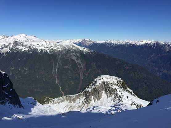
That sub-summit on the north slopes again.

One last look at Pelion Mountain and Ossa Mountain

Mel plodding down the steeper sections

Mel and Gur descending. Photo by Mel O.
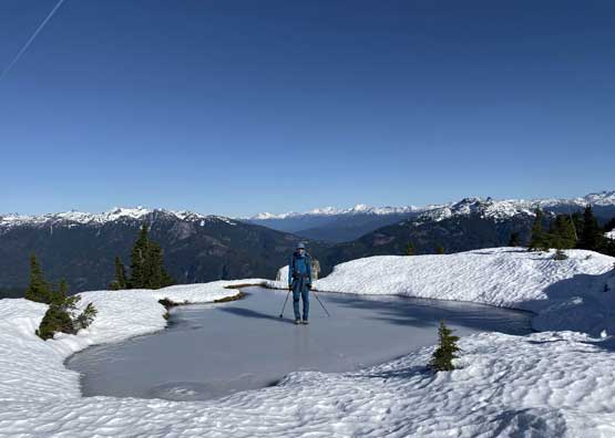
Me decided to test the ice strength on that frozen tarn. Photo by Mel O.
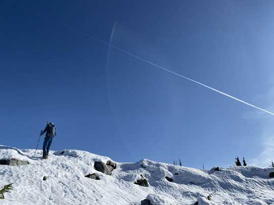
Me re-ascending back onto that lookout. Photo by Mel O.

The Black Tusk is one of the greatest icons of Sea to Sky Corridor

One last look at Mt. Garibaldi massif
Me descending into the dry forest. Photo by Mel O.
Me tackling one of the shittest stretches. Photo by Mel O.

Me batman down the upper fixed rope. Photo by Mel O.
Mel batman down the same rope.

Fast forward… Down to the old logging road now..
Overall this was a highly recommended ascent despite the whooping 2000 m elevation gain. The views were well worth the spent, and the hike was not nearly as tough as we thought. We also proved that Sigurd Peak could make a descent shoulder season objective if one doesn’t mind to hike on snow.
