Resplendent Mountain
August 26-28, 2015
3426m
Mt. Robson Provincial Park, BC
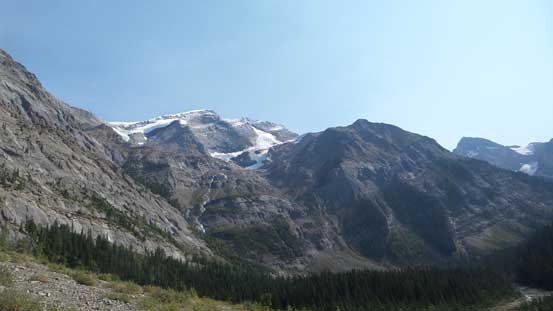
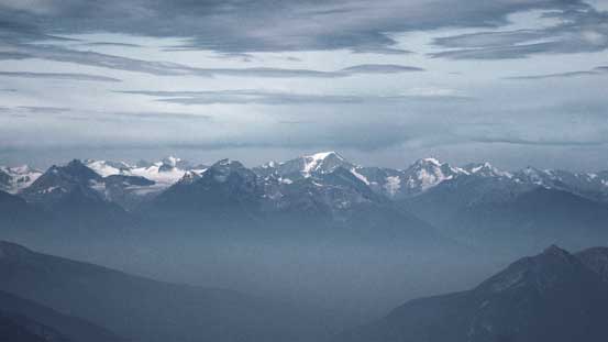
Over the past few years of exploring and peak-bagging in the Canadian Rockies I always had a wish to get as close to the mighty Mt. Robson as possible (or even standing on its top for that matter)… Climbing Mt. Robson itself requires the absolutely perfect combination of weather, condition, time off work, partners and luck that rarely happens (and apparently didn’t happen for me in this summer), but making an ascent of the nearby Resplendent Mountain is a much-simpler deal. This is the easiest of the 4 11,000ers by Robson area but probably the best viewpoint. The traditional way to ascend Resplendent Mountain is by a long march around the backside of Mt. Robson to Berg Lake, then up Robson Glacier to R/R Col followed by a simple trudge up the NW Ridge, either on foot or on skis. But thank to the exploration (and publication) by a local mountaineering legend, Reiner Thoni, a “newly discovered” route that goes up the South Face Patterson’s Spur essentially provides a direct line from parking lot to R/R col avoiding going all the way around the mighty Robson, and goes at a mere Class 4 scramble when dry.
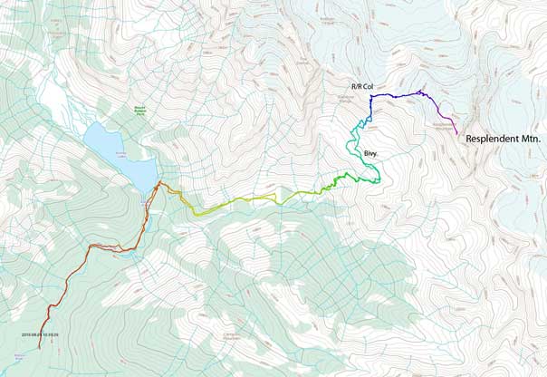
Resplendent Mountain via Patterson’s Spur. GPX DL
After completing an ascent of Elpoca Mountain in Kananaskis’ Opal Range we realized the weather would still hold for at least the following 2 days. Robb Schnell was keen to tag one more 11,000er in this year if possible (he only had 7 left before this trip), and the only one that made sense was Resplendent Mountain, so that’s it. After dropping Maury at his home in Calgary, I quickly drove back to Canmore, and due to the very last-minute decision I was struggling to get things organized. Thankfully Robb offered me a stay in his home again, and after a few hours sleep by 5 am in the morning we found ourselves driving back to Mt. Robson Park again. One bonus for us was that we successfully escaped from the thick layer of smoke that had been obscuring Bow Valley for the previous few days.
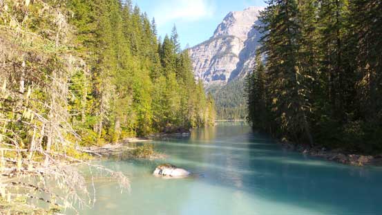
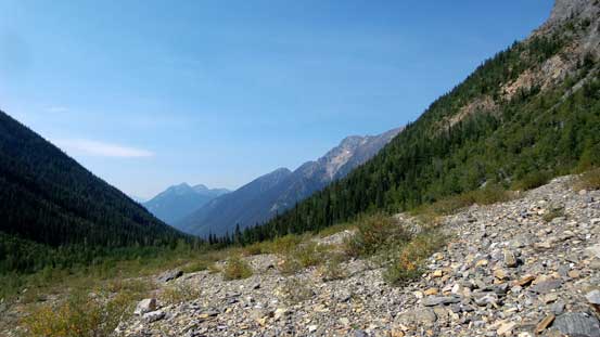
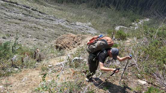
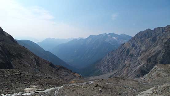
Robb was smart to bring a bike for the initial slog to Kinney Lake. I didn’t (and couldn’t) so opted to hike that part. Robb ended up waiting 20 minutes for me at the switchbacks by Kinney Lake so that’s still alright. It’s just 1 hours hike anyway but if feasible I’d say biking make a lot more sense as the trail is essentially wheelchair accessible. I took advantage of the morning hours and did a short detour to the shoreline of Kinney Lake and got some pictures of Whitehorn Mountain and its reflection. Then up the switchbacks we were at the “experimental” section of this approach. We were surprised to see a cairn, a path and a few flaggings leading towards the way we wanted to travel. We followed it “half-hearted” for a while and it’s apparent that it’s actually the trail that we wanted. Oh WOW… I think the guides must have been impressed by this short-cut approach and decided to cut a trail for their future use. That was a big bonus and the trail brought us initially straight up the slopes then contouring to the right, and in another hour or so we were out of the trees looking straight towards the South Face’s Patterson Spur route.

The mighty Mt. Robson seen from Kinney Lake Trail

Hiking up the trail
At the bridge crossing Robson River

Whitehorn Mountain and its reflection in Kinney Lake
A closer look at Whitehorn Mountain

We were surprised to see a flagged path
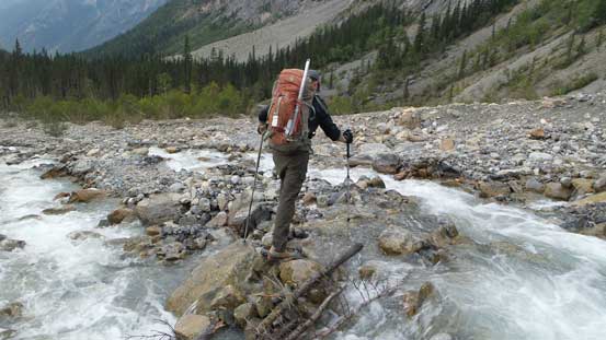
Crossing a mud creek

Finally have our objective in sight
Out of the trees, looking ahead to the route
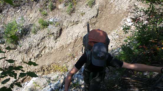
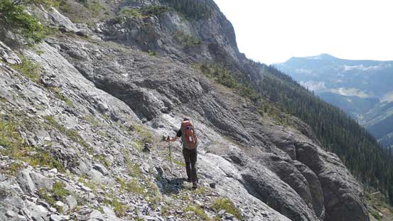
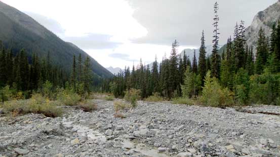
The next section was hiking along the gravel platform. We stayed a bit too high on the slope and did some unnecessary up-and-downs in order to regain the flagged path, and the correct way was to drop some height initially and follow the creek up. The creek wasn’t following high so it was easy going once regaining the proper route. There were 2-3 creeks to hop across and one of them was particularly tricky – a long stretch on slippery boulders, a jump or taking your boots off… And then the major bulk of elevation gain finally started. Thank to the flaggings and cairns made by previous parties we had little issue route-finding through the maze of zig-zagging and traverses. The next bushy section also got cleared, but it was on a steep krumholtz field, so even with the “trail” we still had to swim up the slope (miserable)… There’s a key ledge traverse towards climber’s right (again, well marked) after the bushwhacking section, and then we trended back towards climber’s left. To our surprise there were 3 other parties on this route on the same day (one of them was a guided team by Crosby Johnston that you saw from the MCR Reports).
On the gravel platform, looking back

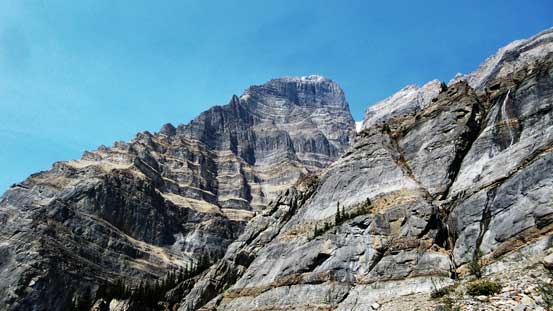
Through a gap we could see the upper S. Face of Mt. Robson way up high
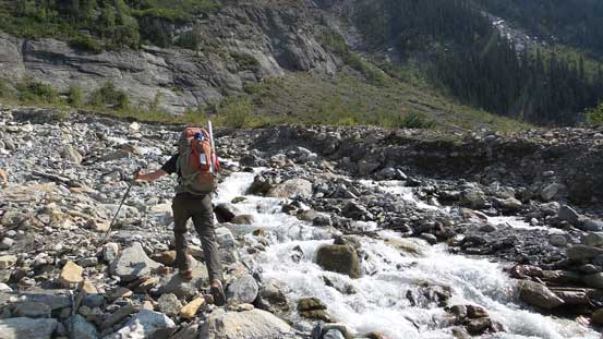
Robb at one of the few creek crossings
Our route goes up climber’s right out of sight of this picture
Starting to gain height
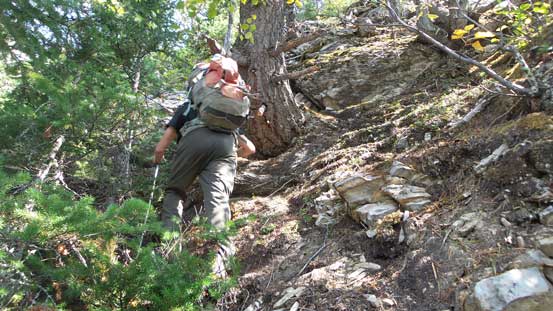
Entering a bushy section. It’s bushwhacking on a trail. Fun time…
Zig-zagging following cairns/flags was the key
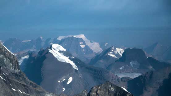
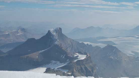
Looking across the massive S. Face of Mt. Robson

Typical, typical…
More zig-zagging
This tower is actually just a low shoulder on the massive Robson
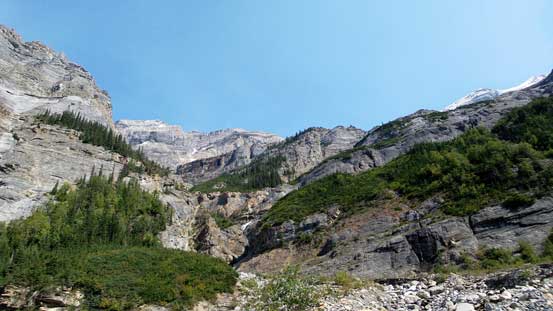
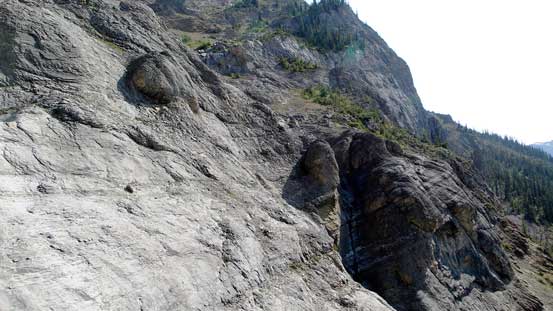
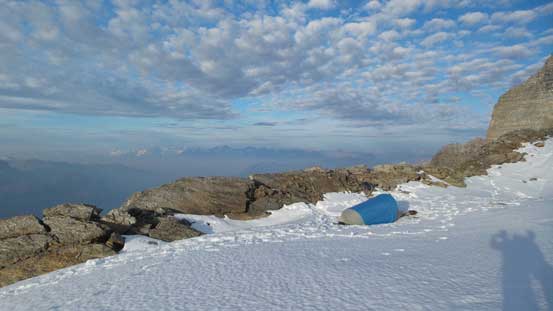
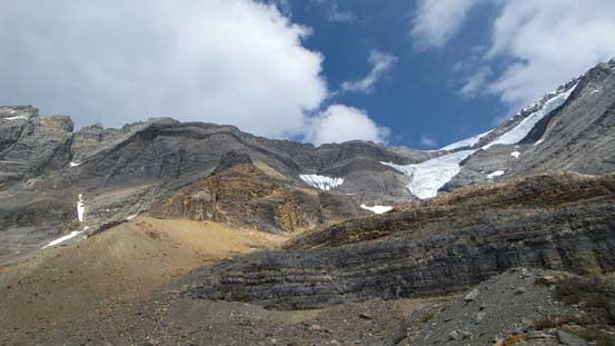
It’s pointless to go through the details of this route section by section as I’d say it’s fairly straightforward by following the cairns, flaggings and paths. Without them I can see the route-finding being a major issue but it’s no longer a problem as for now. And as a result I didn’t remember much about the approach other than it’s not as difficult as I thought. The majority was easy and moderate scrambling only with maybe a few steps of difficult scrambling. We came to a wide ledge system with waterfalls cascading down from above and a running stream paralleling the ledge. Here we followed the creek sharply turning climber’s right for a long while, crossed the creek on a snow field, ascended the next weakness on the far right side (plodding up scree mostly) and then we arrived at the widest ledge/platform at roughly 2200 m elevation. We followed it sharply back towards climber’s left overcome a few moraine fields and made to a nice bivy spot. The water was a bit muddy (glacial melt) but other than that it’s a true 5-star bivy site. Since we were only climbing Resplendent Mountain it made perfect sense to “get lazy” and stop here for Day 1. It’s only mid-afternoon so we had plenty of time to take a nap, cook some food, etc.

Robb arriving at the first flat bench. Here we go all the way to the right

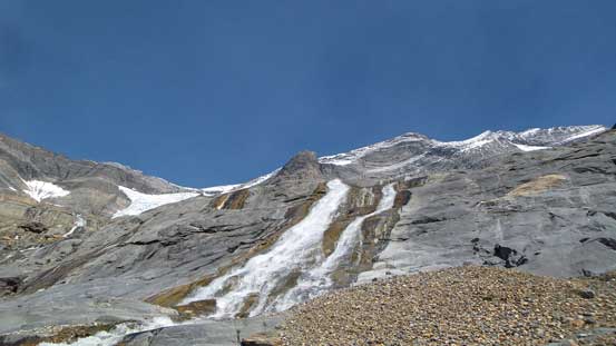
Waterfall cascading down from the ramp above
Inspecting one of the waterfalls up-close

Breaking through the next cliff band on climber’s right
On the final bench now, time to traverse all the way back left
Looking back down the valley
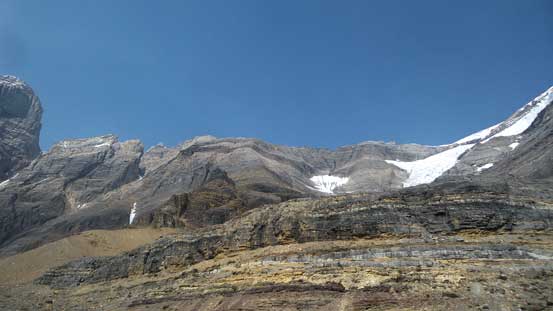
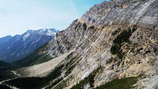
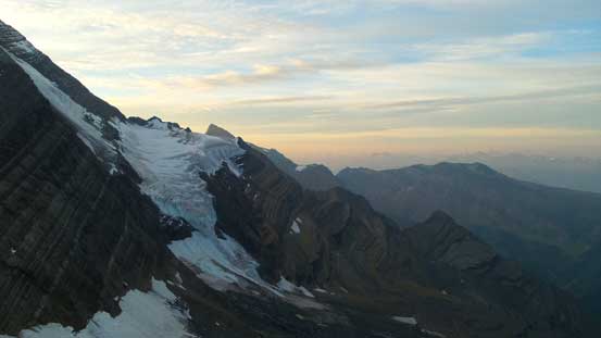
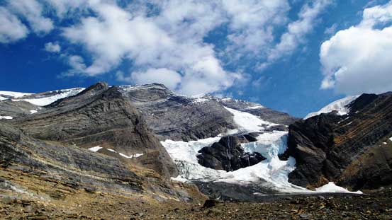
The Patterson Spur ahead, left of center in this picture
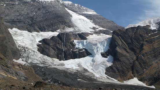
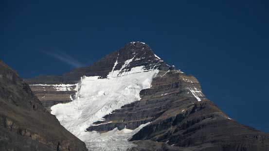
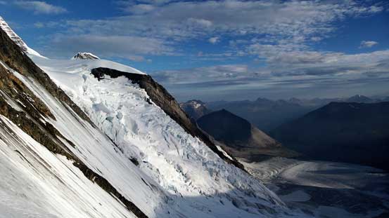
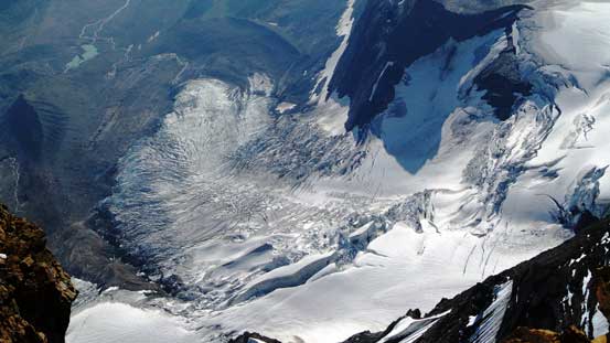
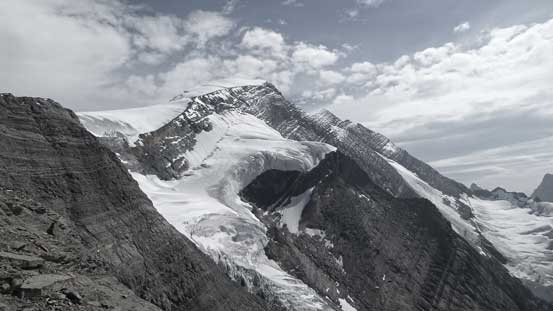
Icefalls on Resplendent Mountain’s South Face
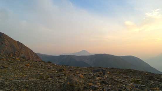
Almost sunset time. Looking towards our objective
Looking across the Fraser River Valley towards the tip of Overlander Mountain
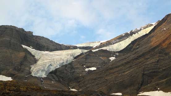
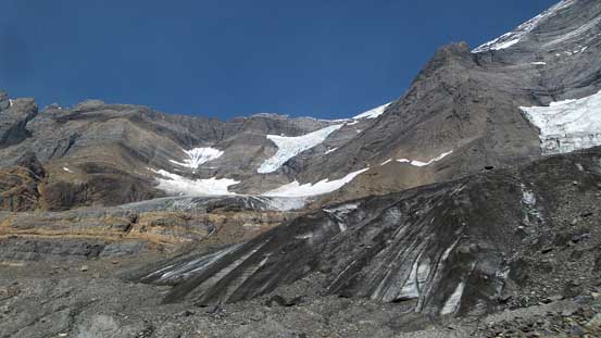
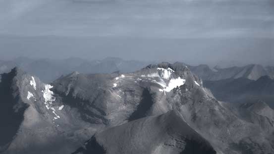
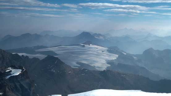
Another hanging glacier on Resplendent Mountain
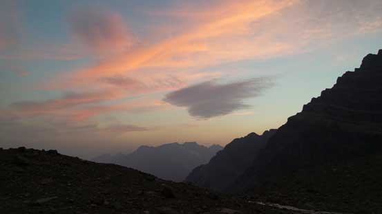
Sunset time!!

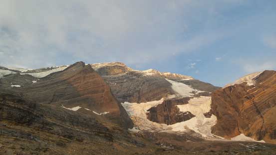
Another picture of our objective, at dusk
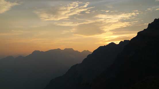
Dusk colours
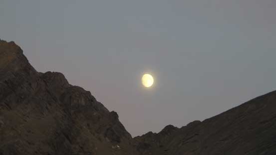
Now, moonrise time!
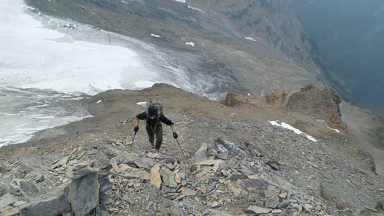
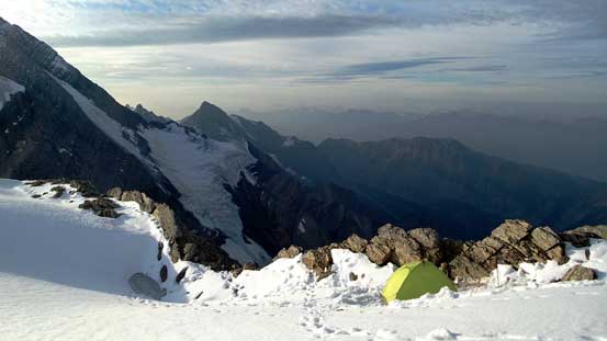
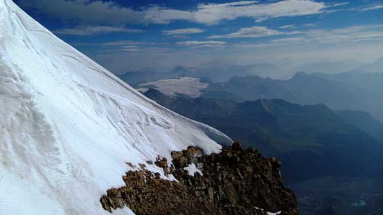
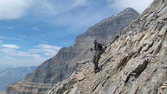
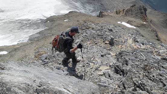
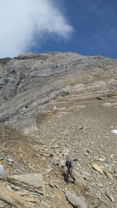
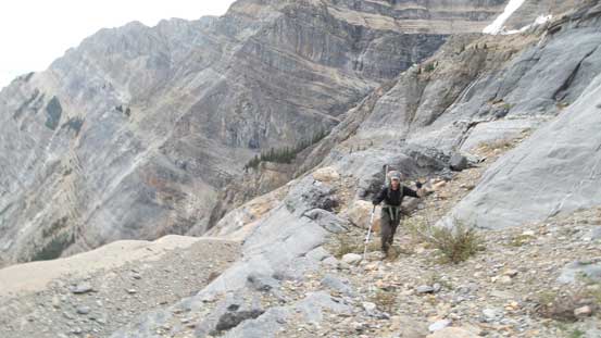
Between us and R/R Col there’s still 800 meters of height gain up the Patterson’s Spur. We woke up at around 5 am and started our summit day with headlamps on. The initial section of this Spur was following the crest of a moraine slope up which was ugly and exposed. I hate moraine and concrete-hard dirt as I could never feel secure on those types of terrain, and this one was not an exception. From the top of this moraine we trended climber’s left to get around the obvious gendarme ahead. We got confused a bit as we couldn’t see the cairns nor flaggings in dark, but it all worked out. We went fairly to the left and then bashed up a loose scree gully and that dumped us right on the Patterson’s Spur just above the gendarme. From here on the route became very obvious – just follow the crest of Patterson’s Spur up. About halfway up the terrain started to get harder and harder with lots of short, but tricky, loose and down-sloping steps with a bit of run-out. I would probably agree with the overall Class 4 rating but we certainly did a few harder moves (but we might not have picked the easiest lines).
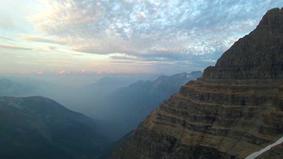
Morning colours on the horizon, looking across the S. Face of Mt. Robson

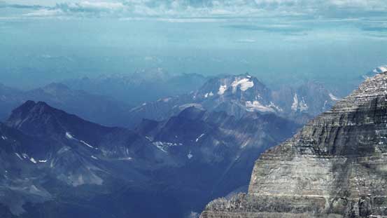
Mt. Sir Wilfred Laurier and Mt. Sir John Abbot – 2 11,000ers in the Cariboos
Robb slogging up the Rockies’ typical choss

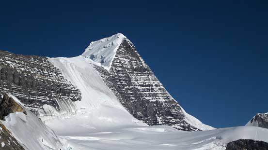
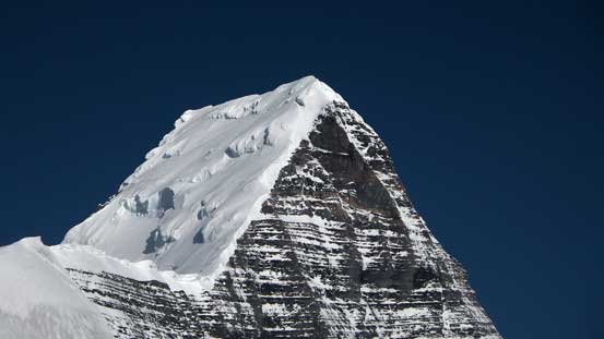
Our objective
More slog
Another view of the morning colours, looking across the S. Face of Resplendent
Starting to get higher than most of the nearby summits
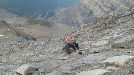
One of the trickier slabby sections
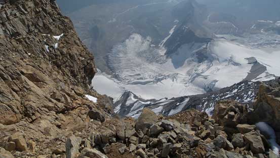
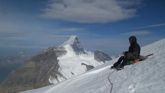
I kept checking my GPS to see how much height we still had to gain to crest the col. I’d never been so close to Mt. Robson before so I was excited to see the views. And sure enough, the mighty Robson’s Kain Face suddenly showed up as we poked ourselves out of the R/R col. It looked like in the perfect conditions and there were 2 tents around. One group just completed the climb the day before and the other team was somewhere on the mountain. We were the least ambitious group so turned right instead of left aiming at the “small R”… There’s a bit of rolling terrain to cross over to Resplendent’s side. We roped up and the glacier travel was a bit of an issue on this day thank to the 30 cm of fresh snow dumped a couple days ago (post-holing at sections). Most of the new snow hadn’t melted yet hiding some crevasses. We probed carefully and did find quite a few holes that got covered. The lower slope was actually the most crevassed but once through the maze the travelling started to get faster and faster.

Cresting R/R col, looking towards Mt. Robson
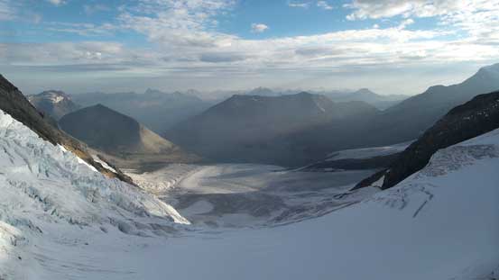
Looking down the Robson’s cirque.
This team just finished their climb of Robson the day before
This is that guided group’s tent. They were somewhere on Robson now

Looking ahead to our objective, the “small R”
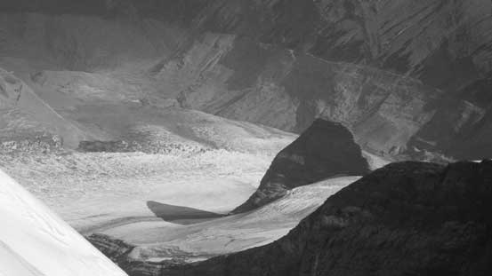
This icefall is the notorious “Mouse Trap” that some climbers used to access The Dome
Ascending those serac mazes is quite nuts…

Robb on R/R col

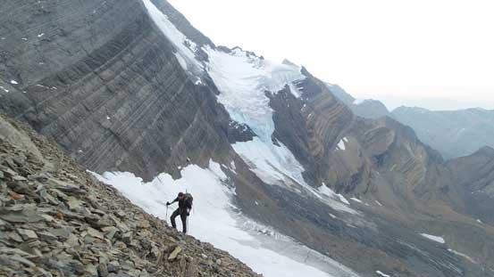
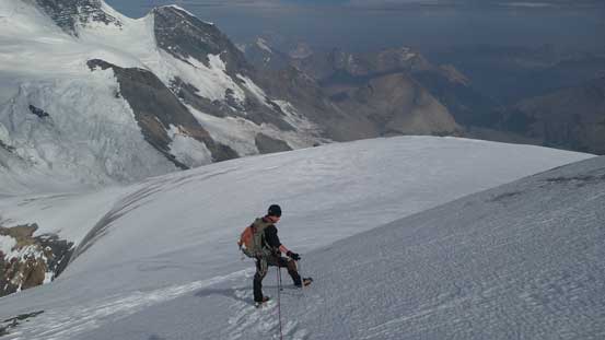
Ascending the lower NW slopes of our objective
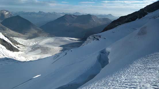
Lots of big crevasses down by the Robson Cirque
The Kain Face of Mt. Robson was apparently in a great shape
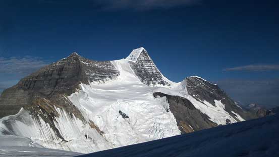
Mt. Robson and its satellite peaks
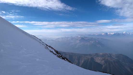
Looking across the shoulder of Resplendent
A zoomed-in shot of the upper SE Ridge of Mt. Robson
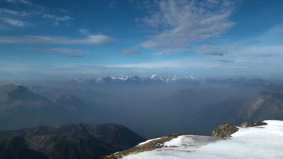
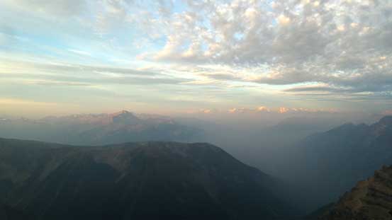
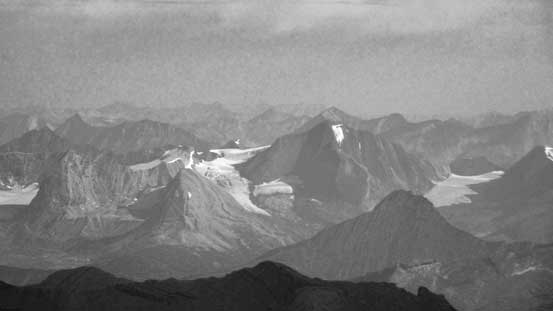
The Cariboos poking above the smoke layer
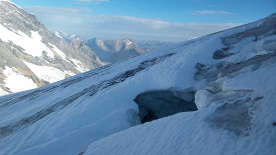
Lots of crevasses to negotiate on this route

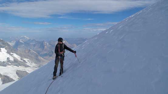
Robb ascending the glacier
The Helmet
Way in the distance is Mt. Chown
This is Mumm Peak – apparently not easy to ascend neither…
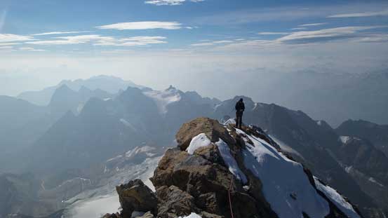
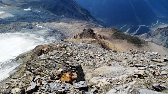
The upper mountain was in the perfect snow-climbing conditions and we were gaining height fast. Near the summit the terrain started to get steeper again and we could see a crevasse spanning from top left to bottom right. Thankfully we picked up a set of tracks from previous parties and they crossed it on a snow bridge by trending towards climber’s right. We followed their tracks and crossed it with no issue. Then up a steeper roll we could finally see the apex. I knew there’s a big cornice on the final summit ridge so stayed fairly low to the right to cross a steep slope, and shortly after we made to the top. We went down the far side of the ridge for a bit to check more views out.

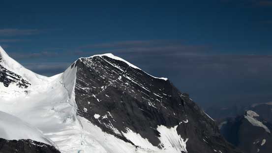
The upper NW Ridge of Resplendent
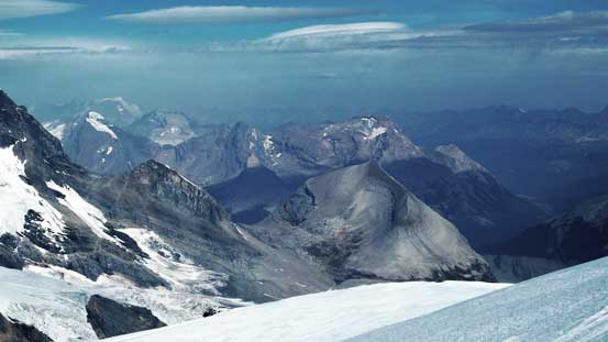
Starting to see a sea of peaks now!!
Robb on the final summit ridge traverse

Summit Panorama from Resplendent Mountain. Click to view large size.
Lynx Peak is quite a high peak too
The Reef Icefield – rarely seen
This is Calumet Peak somewhere by the N. Boundary Trail

Another shot of the mighty Mt. Robson
Peaks by Rainbow Range just to the West of Robson Group.
Mt. Sir Wilfred Laurier et al.

An icefield in the Cariboo Mountains

An ocean of peaks looking south

I’m fairly sure this is Mt. Kain and its north glacier
Extinguisher Tower and the lower Robson Glacier
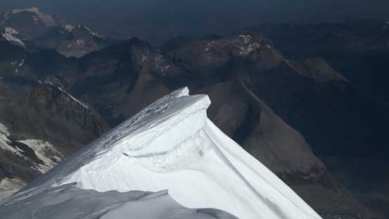
This is the cornice that we avoided on the summit ridge
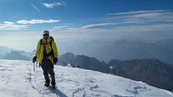
Me on the summit of Resplendent Mountain, my 36th 11,000er!

Robb on the summit. This is his 48th 11,000er (only 6 more to go)!!
We descended towards the other side for a bit
Looking straight down the East Face
Glaciers way down below

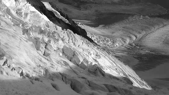
Another broken glacier. This is looking down the S. Face
Robb checking out from an even-better viewpoint down the ridge
Back to the snowy summit, time to take a short break.
On the descent we discovered a few more crevasses. One of them gave us a good surprise as we were following our up tracks, but well, the snow was getting softer so we had to probe more. Thankfully no further surprise as we descended back through the crevasse field to R/R col. Then down the Patterson’s Spur still required some extra caution on the upper sections but overall easier and much faster than ascending it. Lower down we picked a different line that’s a bit more contouring and involved a bit more height gain/loss but managed to avoid that exposed moraine crest.
Another view from the descent. Rearguard Mountain at center foreground
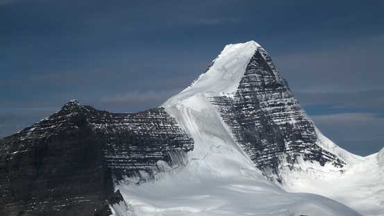
One last view of the King
Robb descending the glacier
Crevasses…
Looking back towards our objective
Descending the Patterson’s Spur
Looking down the Spur
Lots of Rockies’ choss to negotiate

More choss
And, more choss….

Great view looking across the S. Face of Robson. It’s such a massive mountain…
Looking back at the Patterson’s Spur

Slogging on moraine and glacial debris wasn’t fun
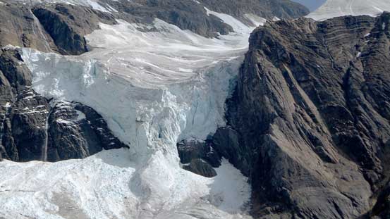
Incredible ice fall on Resplendent
Another view of Resplendent
Back to camp it’s only 2 pm or so. I did a quick weather check using my Delorme inReach and Friday morning was still good. We certainly had the time and energy to hike out on Thursday but we were both less motivated for that. So we played lazy again and took a (longer) nap. I think we slept roughly 12 hours each day on this trip and that’s very, very well rested. I rarely do trips this way especially when climbing the 11,000ers but among the two that I climbed “lazily” (Brazeau and Resplendent) I thoroughly enjoyed them.
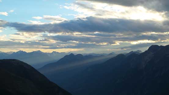
Interesting ray of sunlight at evening
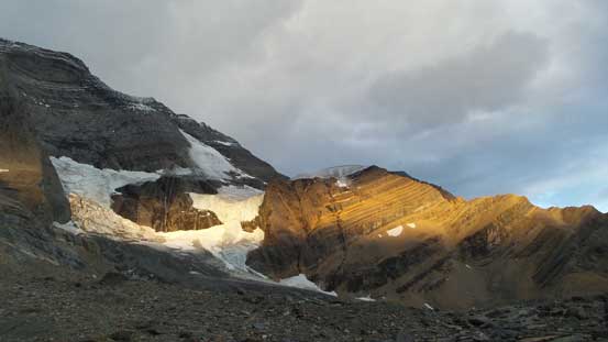
Evening colours on Resplendent’s icefalls
In the morning of Day 3 we could see some clouds building up, but we got lazy again and didn’t get up until almost 8 am. There’s not too much to document about the descent other than it’s a lot faster than on the way up… I think it took us a couple hours to get back to the main Kinney Lake Trail, then Robb took off on this bike and I hiked out. This time Robb spent just over half an hour waiting for me at the trail-head. And then it’s the lengthy drive back to Canmore passing millions of tourists along the way, only to get back into the smoke again once entering the Bow Valley…

Very red alpenglow in the morning of Day 3

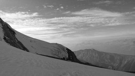
Looking down our descent valley
Time to head home…

Lots of zig-zagging again

Into the upper bushy section
Crossing the creek
Onto the gravel flats
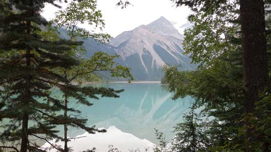
And finally, made to Kinney Lake..
For climbing Resplendent Mountain only, if you approach via the South Face Patterson’s Spur then it can be done fairly easily in 1.5 days for a fit party. From the backside via Robson Glacier it’ll take at least 3 days, either on foot or on skis. It’s fairly obvious why the lower bushwhacking section got cleared (by guides likely) as it’s simple Math. I myself wouldn’t say this Patterson’s Spur is a classic climb, but comparing to other routes on Robson/Resplendent I’ll recommend this one for sure. After saying Goodbye to Robb it’s time to think about what I gonna do next.
