Sugarloaf Lookout
May 11, 2013
2516m
Oldman River (Crowsnest), AB
After finishing Thunder Mountain, Andrea and I were looking for a second objective simply because we still had lots of time to kill, even though it was a hot afternoon. Skimming through the Fire Lookout Hikes in the Canadian Rockies, we decided to give Sugarloaf Lookout a try. This would involve almost 1000 m elevation gain… Andrea had attempt it but failed due to the more-than-expected snow. Guess we should have learnt from that experience. It appeared to be dry seen from Thunder Mountain, so we decided to leave snowshoes behind.
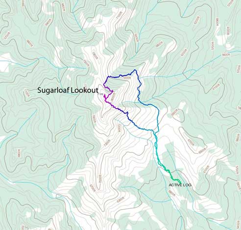
Sugarloaf Lookout standard hiking route
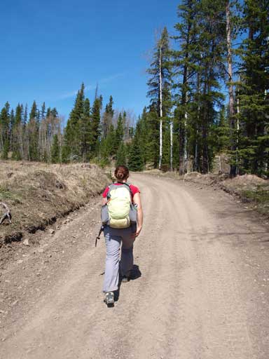
To get there involves driving 8 km up Dulce Creek forestry service road, and the road condition was better than I thought it’d be. As the guidebook suggests, we parked at the start of a 4WD road branching off to the right side. If dry this mountain is nothing but a boring hike up this road, but for us, we had to deal with some unexpected situations that I’ll introduce soon. It was in the afternoon and needless to say, very hot. We must be high on energy since we didn’t slow down at all, and soon we were getting much closer to the objective, and we could spot a direct line straight up an open slope towards the summit that was snow free. We figured that following such a nice “trail” was so pleasant that we didn’t want to leave it. What a bad call that was…
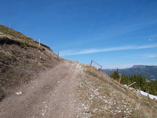
Typical road hike
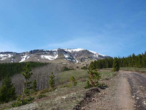
Our objective is getting closer. Note the obvious route up avoiding snow.
Andrea turned around here on her first try due to snow.
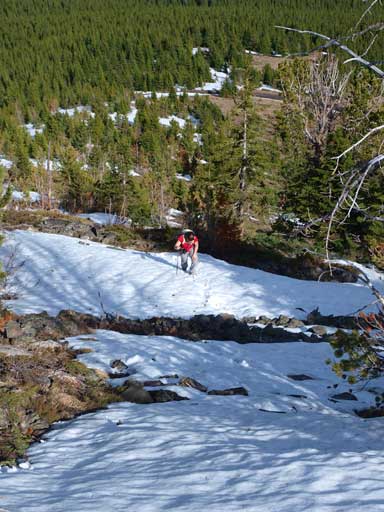
The road/trail contoured around the mountain to its north side, and soon we were dealing with snow. Needless to say, the snowpack was completely isothermal and we postholed to its bottom. We should have realized our mistake and turn around to use the line we spotted earlier, but we were too stubborn to do that, so we continued up the knee to waist deep snow hoping it would come to an end soon. It did (sort of), and we were walking on a nice road up for another few hundreds of meters. The pleasure was short lived though, and we soon re-entered waist deep snow. This time, looking around, we realized that we were completely surrounded by snowy forested terrain. We kept following the road for another few hundred of meters post-holing waist deep, before making the call of turning around. We decided to use the relatively open slope that we’d seen between the first and second post-holing sections. We could have retraced all the way back to the first big open slope but that would involve too much elevation loss and we weren’t in the mood for that. In retrospect we should have either lost all the elevation to the first open slope, or continued up the road for another few hundred meters to escape the snow. We made the worst call.. The “open” slope we’d been following soon gave way to waist deep isothermal snow higher up.
If not because I was super high on energy on this day, I definitely wouldn’t make it through. The next 200 vertical meters was probably the worst experience I’d ever had with snow. It was way worse than my miserable solo winter ascent of Hawk Mountain without snowshoes. The slope was steep and terrain beneath was bouldery and rocky. There were quite a few chest deep sections that I had no way to lift my legs up. The snow in front of me kept collapsing and prevented me making any progress. I basically pulled myself up using whatever I could grab, wacking a route through the snowpack. I don’t know why I was still that strong after gaining 1800 m elevation in this day. Probably because I only did a day-trip last weekend, and I had the entire week to recover. Andrea was struggling behind me, and I could see she was keen to turn around, even though she didn’t say that.
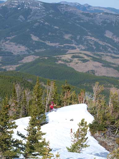
I estimated that we wouldn’t be too far away from treeline, and I expected the snow would be gone once we hit treeline. I knew there would be a snow free line down the mountain via a route that we’d observed earlier in the day, and retracing would mean going down all of these waist to chest deep crap. Even though that would be much easier but still, not something I was looking for. I thought the best way would be sucking it up and making to the top, and descend the other route. Guess I was right. After what seemed like eternity we wacked through the treed section and made to the open scree slope, which we followed to the summit. The best view from this peak, the highest active lookout in the Rockies, was towards the High Rock Range on continental divide. However the afternoon sun was in a bad angle for shooting these peaks, but oh well, since we got clear sky, I wouldn’t complain. The big peak right in front of us was Tornado Mountain. Towards south was the iconic Crowsnest Mountain.

This is the easy part, trust me..
The open slope would soon disappear.

Eventually we came out of the trees, and the alpine area was thankfully, snow free
Andrea coming out of the last bit of suffering.
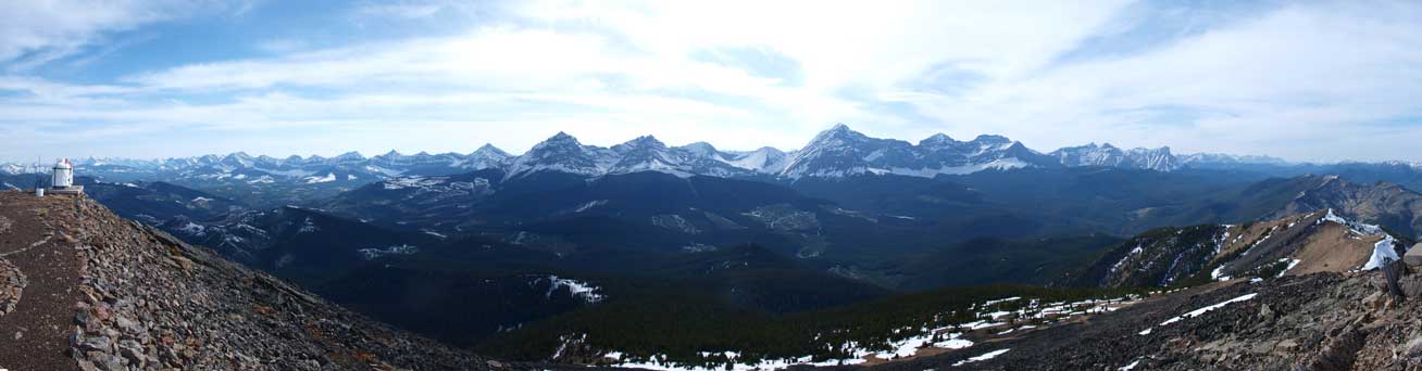
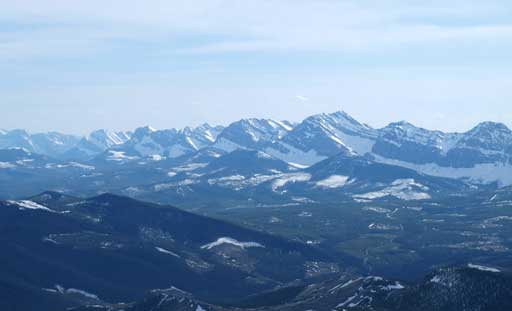
Summit panorama looking towards High Rock Range
Gould Dome
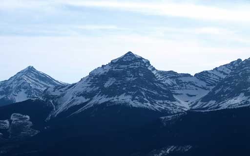
Tornado Mountain is the highest in High Rock Range

Beehive Mountain

Andrea coming up the summit lookout
The southern High Rock Range
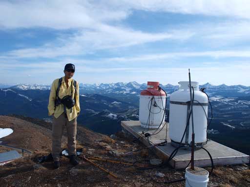
Me on the summit
After cleaning up our boots we quickly went down the previously spotted route. Luckily for us it was indeed almost snow free. The only snow we’d encountered was near the top. However since we were going down, we could dimply glissade it rather than post-holing knee deep. The next 500 vertical meters or so was a steep descent on grassy slope. It was hard on the knees considering we just did almost 2000 vertical meters gain in this day.

We glissade down the only bit of snow on our descent route
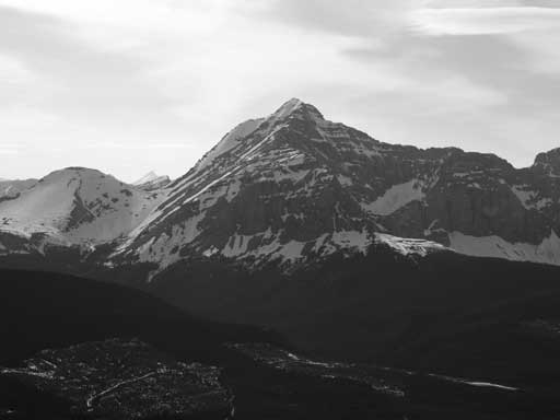
Thunder Mountain in Livingstone Range, our previous objective

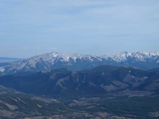
Zooming-in towards the iconic Crowsnest Mountain
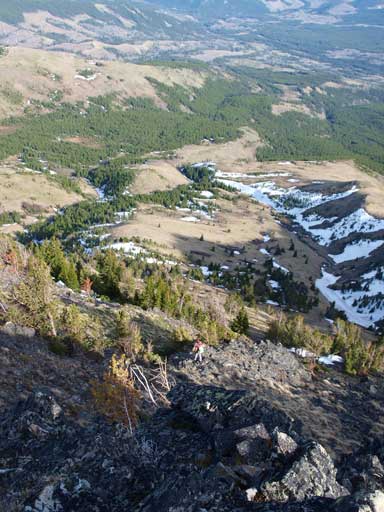
Andrea descending steep terrain. It’s definitely not a pleasurable highway walk, but on this day, this was the best way to go.
I wasn’t too tired though honestly. After a long time we made back to the 4WD road and then it was hike back to Andreas’ SUV. Driving back to Okotoks was long but scenic. I had a quick dinner in MacDonald, and went to sleep, hoping I would still have enough energy for the next day.
