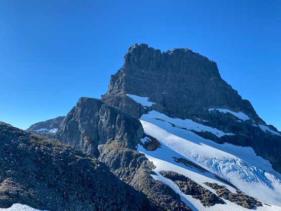
Warden Peak
August 23, 2022
1975m
Vancouver Island, BC
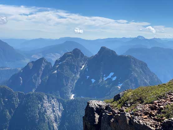
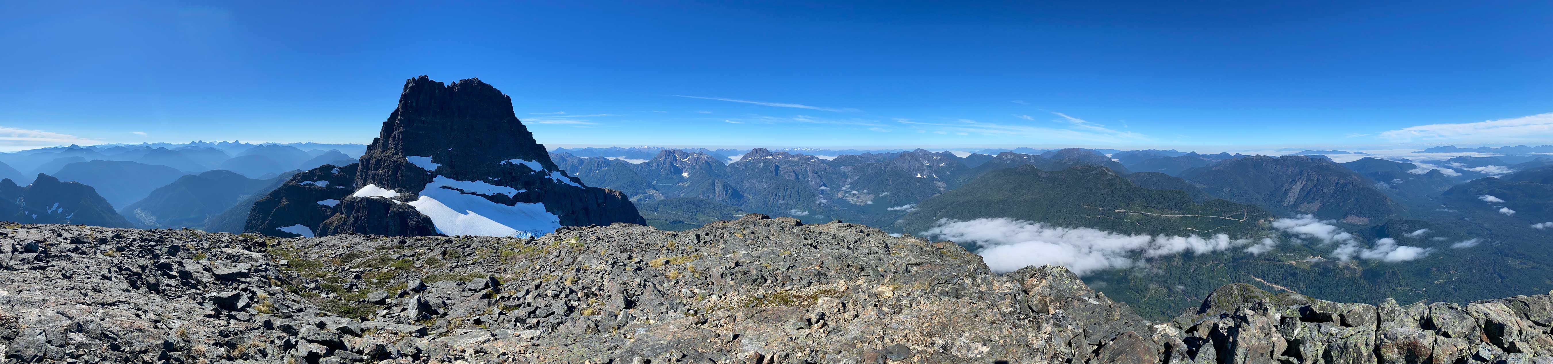
Warden Peak is a smaller, but equally iconic rock tower attached to the much-bigger Victoria Peak, the 3rd highest and 2nd most prominent peak on Vancouver Island. Warden Peak is also included in the fabled “Island Qualifiers” list and hence has started to see increasing traffics over the past several years. The approach is however on a completely different side than Victoria Peak’s standard route so most would do these two peaks in two separate trips. These two peaks can be combined into one trip but I don’t think it’s really worth it. The standard route (PG Route) on Warden Peak is a 4th to low 5th class scramble and thank to the logging activities in White River valley this peak can easily be done in a day from the driveable end. There are other routes to make Warden Peak a real alpine climb but I’m not interested in that. Ever since I saw this peak from Victoria Peak in 2020 I had wanted to climb it, but finding partner(s) was tricky. I wanted to team up with a climber but most climbers aren’t interested in driving that far for a “borderline scramble”. Eventually I convinced Matt Lemke to join. I don’t think Matt was extremely keen about this objective but he had never done anything on the island so this would be a cool trip to explore a new area. In addition to Warden Peak we also wanted to climb Triple Peak, again only by the standard route.
At the last minute I managed to make a reservation of the 5:30 pm ferry ride from Tsawwassen to Nanaimo and that at least saved us one sailing’s wait. We each had a massive dinner on the ferry and then went to the sun deck for views. We arrived on the island about 2 hours later and immediately started the long ass drive northwards to Sayward. That took several hours as we also had to stop a few times for gas and grocery. The drive southwards up White River Main was smooth but long (over 30 km). My friends from the island had sent me GPX files for the driving portion so all we needed was to follow the line. The roads are all correctly mapped on the Gaia app anyway but the GPX file definitely helped the navigation efficiency. Eventually we turned onto a spur road that was steep and overgrown. The overgrown stretch didn’t last too long and the road never became too rough and we made to the driveable end at 12:30 am past midnight. We then did the car-camping routine and went to bed. I opted to sleep inside the truck to not fuss around with the tent for simplicity. This turned out to be a good call as the dew situation in the morning was bad.


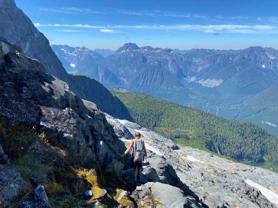
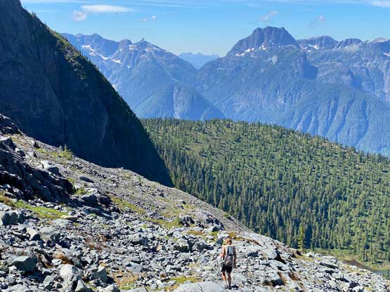
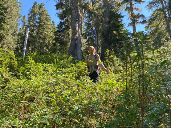
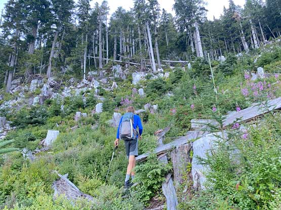
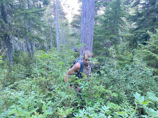
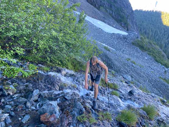
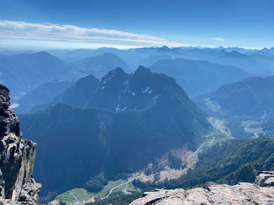
We woke up at 6 am and started about an hour later. Most of the ascent was on the NW side of Victoria Peak so we wouldn’t get any sunshine until arriving at Victoria/Warden col several hours later. I was anticipating a climber’s trail through the bushes but I was mostly wrong. There were flagging and some paths but nothing’s continuous and the path was very difficult to follow. Once above the initial logging clear-cut we had to deal with level-3 bushwhacking through underbrush. The bushwhacking was quite sustained even with the flags we found and the bushes were wet from the dew. Thankfully we found plenty of blueberries so we ate like bears. The 4-letter words were definitely flying around but I also knew this wasn’t nearly the worst approach on Vancouver Island. Eventually the bushwhacking gave way to a meadow area on a broad knoll. The grass were all wet and my boots got soaked through in no time. The next stage was a slippery traverse due NE while losing over 50 m elevation. This traverse started out pretty shitty on nothing but slippery vegetation but after halfway across we emerged onto some boulders and openings, but that’s also where the elevation loss began. The boulders were also wet and slippery so we had to be extremely careful.


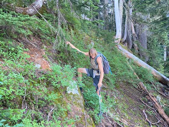
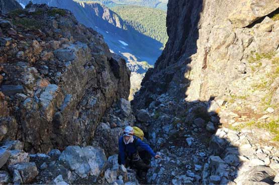
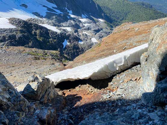
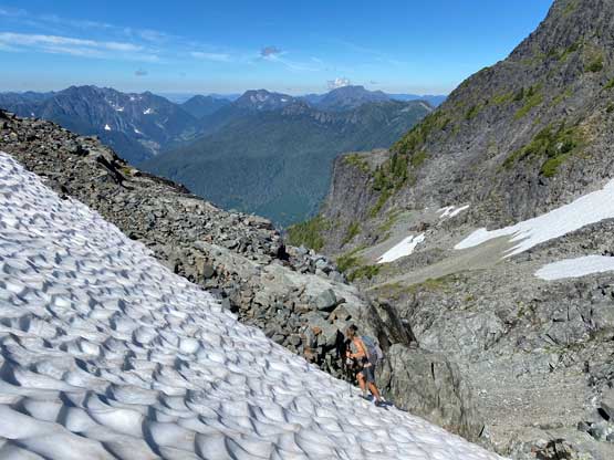
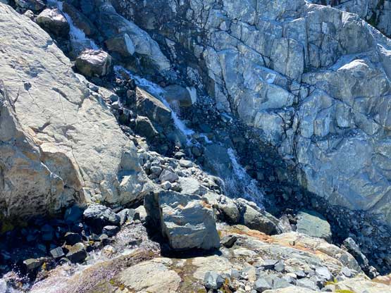
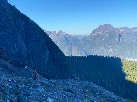
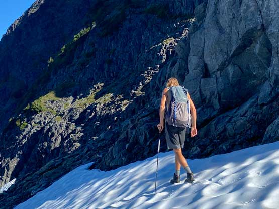
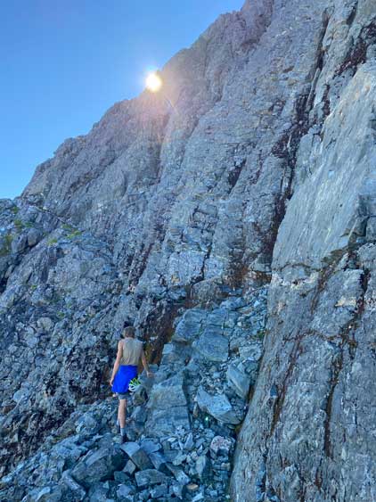
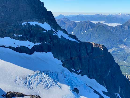
We then ascended a stretch of tedious rubble and hopped across several streams. We followed the GPS track scrambling up some 3rd class wet and mossy terrain but later found an easier alternative on the return. We then began a long traversing ascent due climber’s left aiming at Victoria/Warden col. This section had consistent route-finding challenge in the micro-terrain. We more or less followed the GPS track given by friends and that included scrambling up a loose gully with water running right beside us. There were some 4th class moves on wet rocks in this gully. I checked the GPS multiple times and we were still “on route” but I started to wonder if they ever took the path with the least resistance. I looked around and found some potentially-easier alternatives for the return. Higher up we encountered more scrambling and more route-finding as well as several patches of snow to cross. We had brought crampons but the snow was just flat enough that crampons weren’t particularly needed.


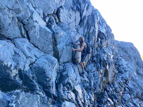
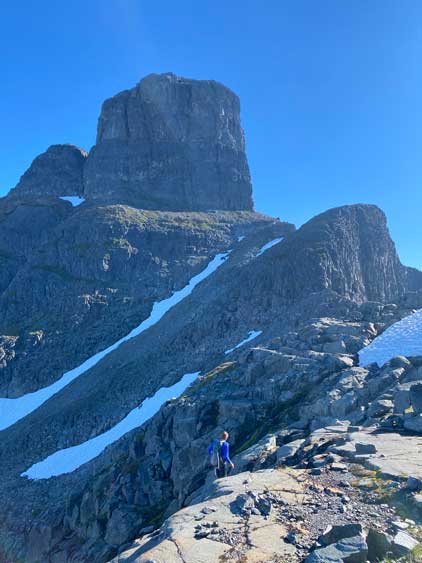


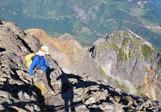
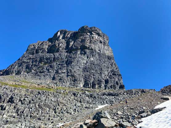
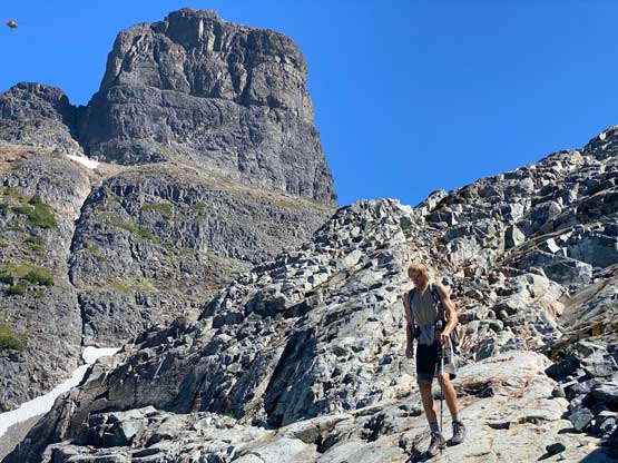
We then ditched the sharp gears as well as one backpack and continued onto Warden Peak’s side of the col. After plodding up a tedious slope of treadmill scree we merged leftwards onto the obvious bench traverse on Warden Peak’s SW Face. This traverse ended at the PG Route’s gully. There were a few stiff moves in the gully but we both managed to just scramble it up. I wore mountaineering boots in this section but figured if we decided to down-climb I would opt for rock shoes. There were abundant rappel slings in the gully for those that needed to pull the ropes out.


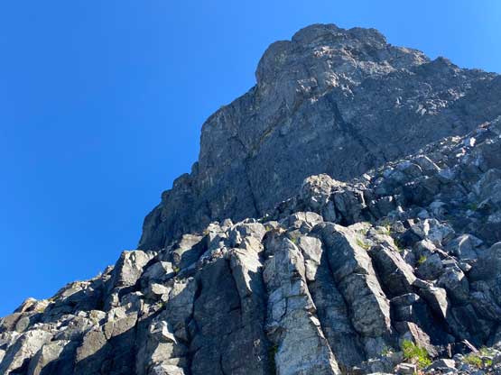


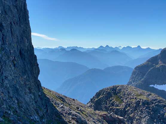

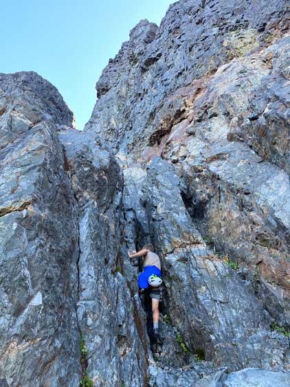


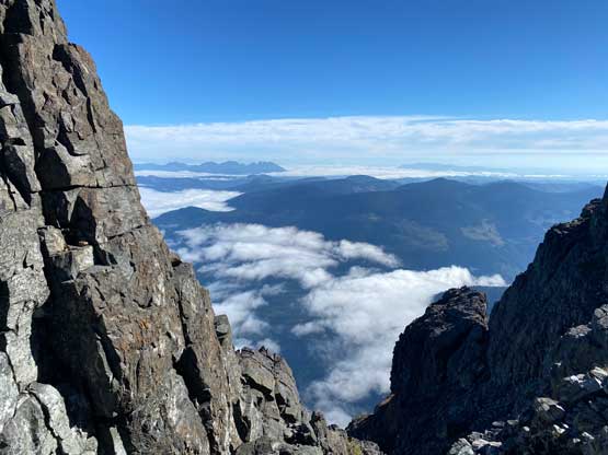
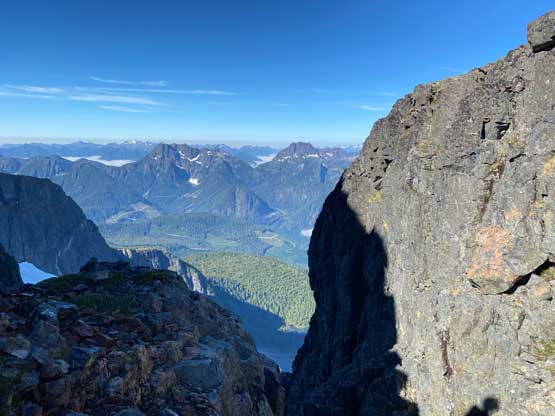
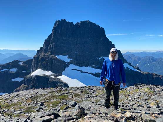
The real climbing was supposed to start on the other side of the face above the gully but the terrain looked more like broken 4th class than sustained 5th class. I finally switched footwear to rock shoes and followed Matt up. The rocks were mossy and wet at places and the exposure was real, but I never felt the need to use a rope in this entire climb so after passing several more anchors we arrived at the summit ridge. The summit was rather anticlimactic as it’s very broad and dome-shaped. We actually had to walk around the plateau to get better views. There was surprising cell reception up there so we spent at least an hour reconnecting with the world that we live in… It had taken us under 4 hours from truck to the summit so we did not need to rush.


Eventually we had to descend and we decided to down-climb instead of rappelling. I felt confident to down-climb sustained 4th class terrain on rock shoes and it never felt difficult at all. Once back to the top of the gully we packed up the first pile of ditched gears and continued down-climbing. Both Matt and I felt the gully actually had some harder climbing to bypass a few chockstones and/or vertical steps. In the end we carried a 60 m rope along with a full rack of cams for no use but training weight. I then spent a few minutes switching footwear back to mountaineering boots and easily plunged down the scree and snow back to that second pile of ditched gears. After picking up more weight I led us descending an easier route through the slabs and waterfalls to avoid going down that loose and wet gully. There was a bit of gambling involved as I didn’t know whether the route would work out or not, but the result was winning. We also decided to challenge the GPS track at the end of this traversing descent to avoid that wet 3rd class scrambling section and we found an easier, albeit more meandering path. The vegetation had thankfully dried themselves out at this time of a day but the bushwhacking descent back to the truck was still annoying and unpleasant. We then took turn driving out of the White River logging roads system (I was too tired), had a proper restaurant dinner in Campbell River and continued driving southwards for a long ass ways towards our next objective, Triple Peak.