Newman Peak (AZ)
March 18, 2023
1366m
Phoenix / I-10 Corridor, AZ
Newman Peak is one of Arizona’s P600m objectives right next to I-10 between Phoenix and Tucson but the access isn’t as straightforward as one might expect. This peak was used to be approached from the SE but the standard route seems to have shifted to the west side in recent years thank to some detailed beta on peakbagger.com. Either side requires driving on sandy roads such that a vehicle with decent clearance and/or AWD is recommended. The exact starting point on the west side access is largely determined by the current road conditions and the capability of the vehicle.
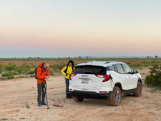
Nikita, Raphael and I decided to escape the BC’s dreary weather by flying to Arizona for a few days. In retrospect we actually did the opposite. The weather turned out to be downright gorgeous in BC but stormy in Arizona with high winds, but we couldn’t do anything about it as we had booked the flights a few weeks prior. The main objectives in this trip were the few ultra-prominent peaks to the south and east of Tucson but we also wanted to scramble Newman Peak. The proximity of Newman Peak with respect to Phoenix means we would be doing it on the first day. The three of us arrived in Phoenix at 8 pm the night before and went straight to Avis to obtain our rental vehicle. We opted for an AWD SUV for more contingency. Raphael had some deals so it wasn’t too expensive.
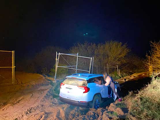
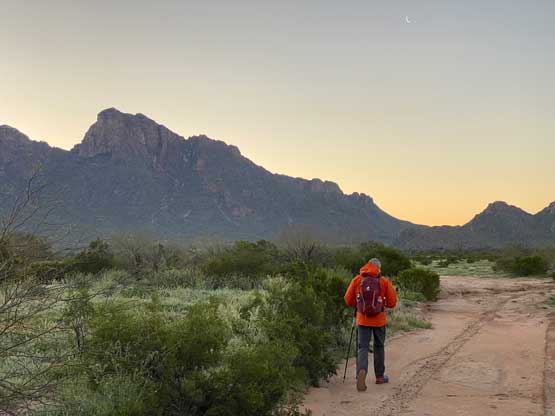
At least one peak-bagger had driven to within a stone’s throw to the actual trail-head on Newman Peak’s west side so I had some high hopes given the beefy vehicle we just rented. However, the reality was rather cruel. We dashed eastwards down “East Milligan Road” to the unpaved sections and then turned south following a set of power lines. After passing what seemed like a “roundabout” intersection the road condition deteriorated rapidly. We foolishly decided to drive through a puddle of mud and immediately got our vehicle stuck. I got out to inspect and post-holed calf deep in the mud. I determined the chance of self-rescue to be essentially zero and Raphael then called in a local towing company for help. The communication was difficult but they eventually understood our location and arrived half an hour later at midnight. The cost was only 200 dollars, thankfully. This location was a few kilometers short from the driveable end so we decided to wake up at 5:30 am for the long day ahead. Nikita simply decided to sleep in the vehicle while Raphael and I set up our own respective tents. Raphael wasn’t too keen about the early start but reluctantly agreed.
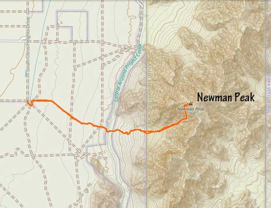
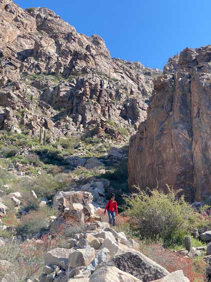
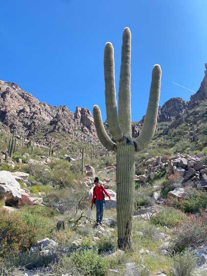
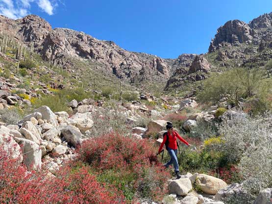
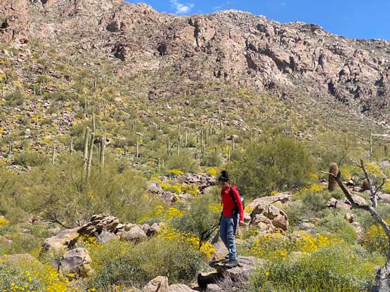
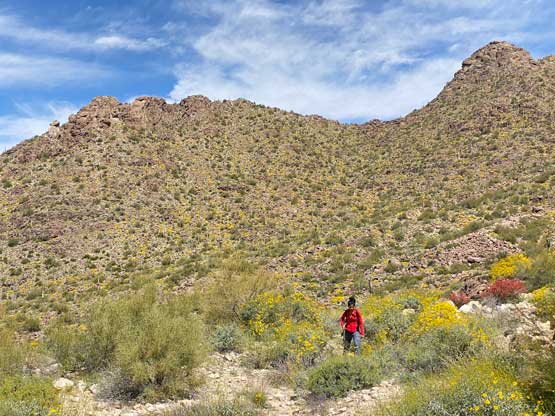
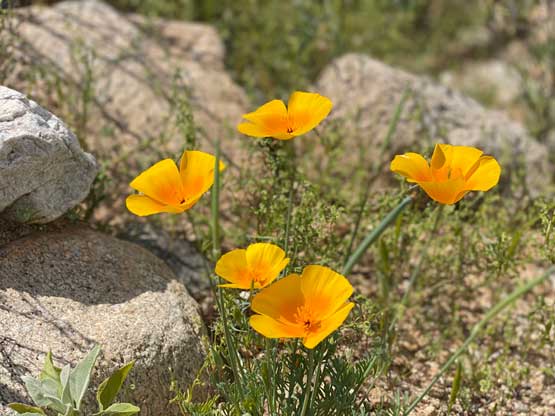
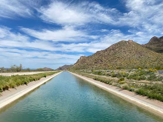
We took a more direct, but lesser defined road to the start of the climber’s “trail” which was on the east side of a canal. This road would not be suitable for any vehicle even if the puddle of mud wasn’t there at the start. There’s a foot bridge crossing the canal and then we picked up some cairns here and there. The path was difficult to follow as a trail, but with the GPX tracks, the cairns and our general sense of direction it wasn’t difficult to stay on track. There was more boulder-hopping and bushwhacking than anticipated and most of the bushes here are the thorny cacti.


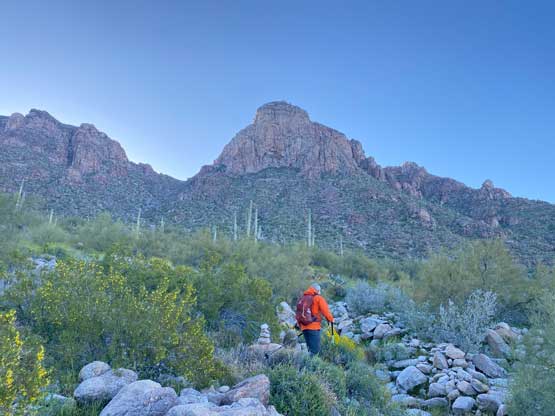


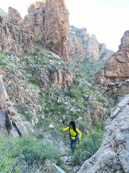
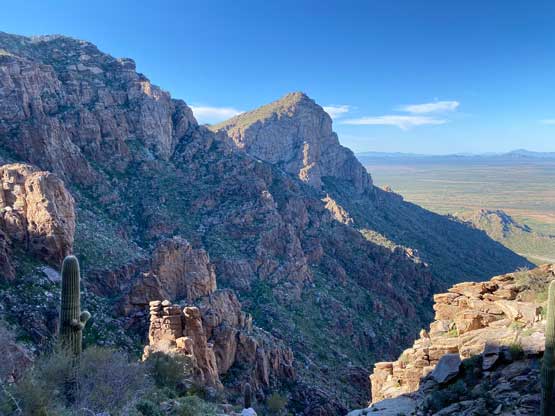
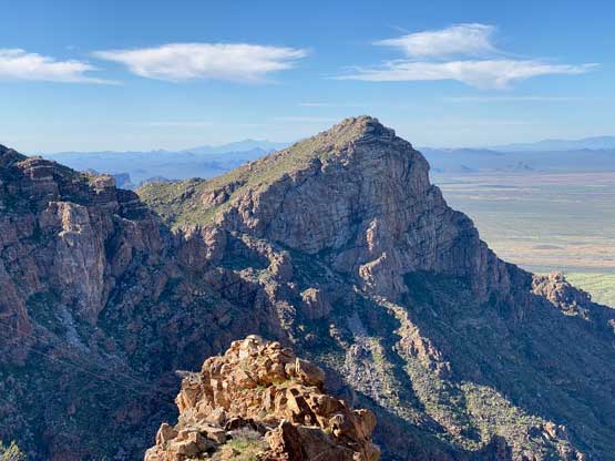
A long while later we were at the upper end of this long west-facing valley and turned climber’s left into a steeper and narrower gully. This gully would provide the essential access to the upper mountain. The scrambling was straightforward but again, the bushwhacking was annoying. All of us ended up getting some cactus thorns. I also on purposely did some optional class 3-4 scrambling for fun since the ascent was rather monotonous. We finally ascended into the sunshine after topping out onto the “upper plateau”. The path was more defined there so we easily followed to the summit which was occupied by some large communication structures.


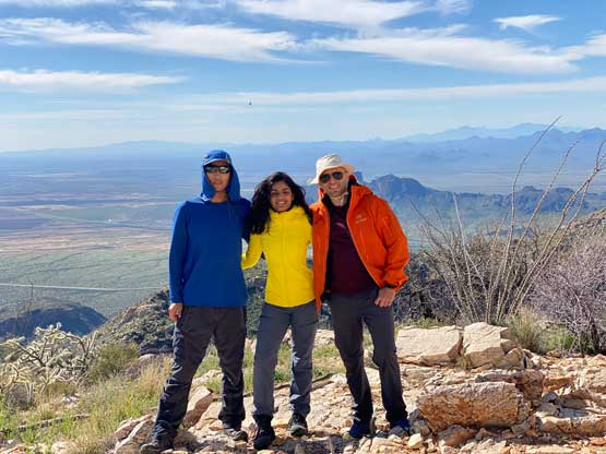
After a lengthy break on the summit updating our socials we decided to descend, following the exact same route we took. The descent was rather tedious and slow because of the bushy and scrambly nature of this route. I also down-climbed the class 3-4 optional steps for fun. The rest of the descent was very boring. Nikita and I stayed more in the wash/gully and probably did more bushwhacking and boulder-hopping than needed. I was too tired to bother checking the GPS frequently so we lost the path a few times. This was supposedly the only “great weather” day in this entire trip but this also meant it’s going to be very hot. We were overall in the Sonoran Desert in the middle of a sunny day. After finishing the descent we drove out of the dirt roads and then southwards into Tucson. Raphael made the suggestion to shop in REI and it wasn’t a bad call. We all got some new cloths. The rest of the day was spent driving farther south towards Miller Peak which would be our next objective.