Mount Tupper
July 10-11, 2020
2804m
Rogers Pass, BC
Mt. Tupper is one of the classic climbs of Rogers Pass area in the heart of British Columbia’s Selkirk Mountains, highly visible from Highway 1 and attracts climbers from all over the province. It’s not as iconic as the biggest neighbour, Mt. Sir Donald but offers equally high-quality climbing on blocky quartzite. The standard route, West Ridge also generally comes in shape earlier in the season and it’s not uncommon to have more than a dozen climbers sharing the route on the same day. The route goes at an old school grade of 5.3 or a modern grade of 5.6 and involves at least one pitch of real rock climbing, if the crux is climbed by the classic “corner variation”. It’s a shorter climb, but more technical than the NW Ridge of Mt. Sir Donald and deserves respect.
For me an ascent of Mt. Tupper had always been on my mind ever since I climbed Mt. Sir Donald six years ago but stars never aligned due to partners and the long drives. This area is no short of quality alpine climbing, but involves 7.5 hours of driving from either Edmonton or Vancouver. Lily Q. and I had been talking about this peak for a while and we made a rough commitment to pull the trigger as soon as the route’s confirmed to be in shape. This had been a big snow year so the ACMG report didn’t pop up until the first weekend of July. A brief window appeared on the following weekend. We spent a few days watching the weather and researching. The weather window narrowed a bit but Saturday morning still looked fine. To make the full use of the weather and to make sure we wouldn’t get stuck in a Conga line we would drive out on Friday and approach to Hermit Campground right away in the evening. The drive out of Vancouver was rough as usual but thankfully we didn’t encounter major traffic delays. We got out of Vancouver at around 1 pm and made to Rogers Pass at 8 pm, eating both lunch and dinner in the car.

Mt. Tupper via west ridge. GPX DL
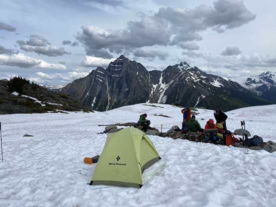
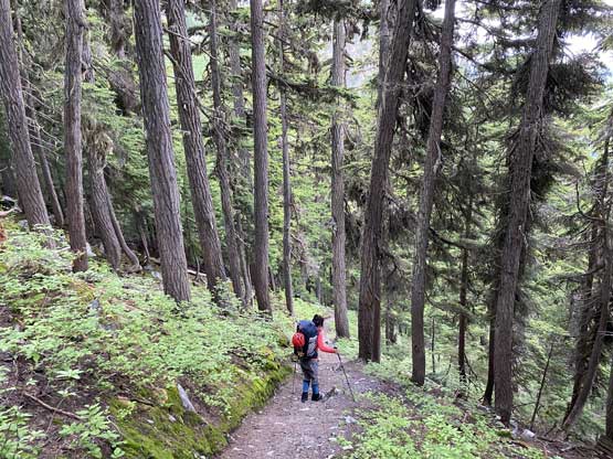
We started the hike with just over an hour’s daylight time but since I had done this approach (to climb Mt. Rogers) I knew it’s totally doable even in a pitch dark. We did not rush the hike and actually enjoyed it. The quality of this trail was such a luxurious change after climbing in the west coast for a couple months. We encountered patchy snow at around 2000m elevation and the campground was fully covered in snow. We had to share the site with two parties-of-four as expected. I was hoping for some less traffic but with that ACMG report and the fact this was the only peak in Rogers Pass coming in shape, I wouldn’t be surprised. One of the parties was a group of local climbers from Revelstoke and everyone seemed to be experienced. We spent the next hour or so setting up the camp and chill. I went back down a bit to grab some running water as I was too lazy to melt snow.

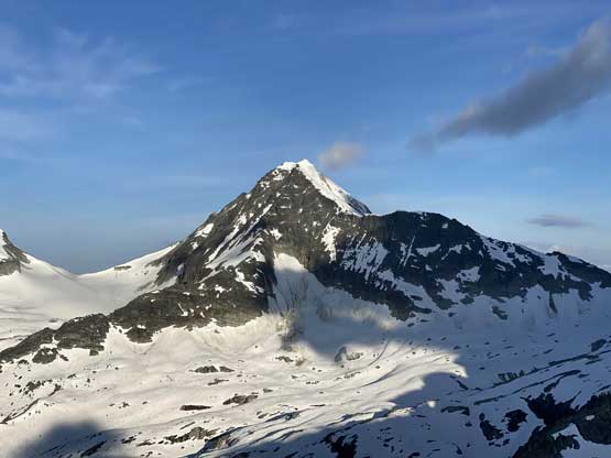
The north face of Mt. MacDonald from the parking lot
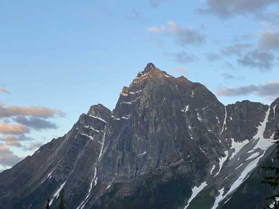
The last rays of sunlight on the summit of Mt. MacDonald

Lily on the steep approach trail
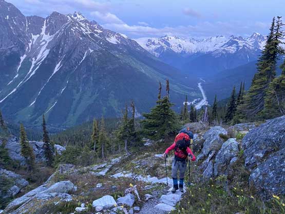
Much higher now, probably 75% of the way to the camp
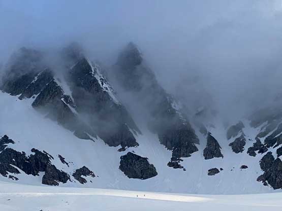
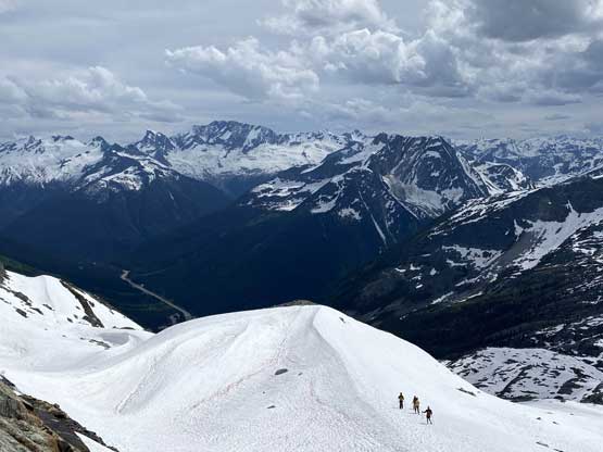
We agreed to wake up before everyone else so the alarm was set at 4 am. An hour later we had started the plod. The section right after the campground was confusing with micro-terrain and sure we screwed ourselves up even though I had been up there in the past. We wasted a bit of time trying to following a set of footprints until realizing they weren’t going anywhere. There was one dip with a bit of down-climbing and then we had to hop across a stream. To get out of this dip we also had to ascend a bit of steep snow with trees around. And after that, we had a cruise sail, albeit a foreshortened plod to the west ridge of Mt. Tupper. We stayed entirely on snow except for one short rock band at mid slope. The last few meters under the ridge involved some loose rocks.

Negotiating a section of rolling and confusing terrain

We had to hop across this stream of water

A zoomed-in view of Asulkan Valley to the south
Cheops Mountain looks steep here but is one of the easiest summits here
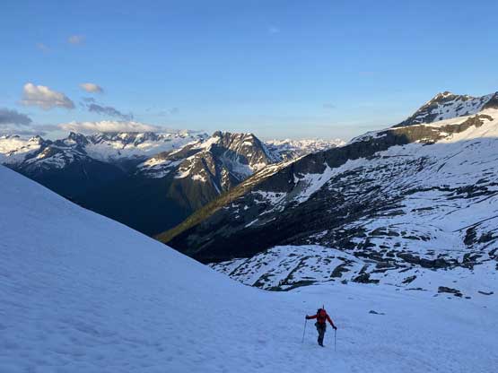
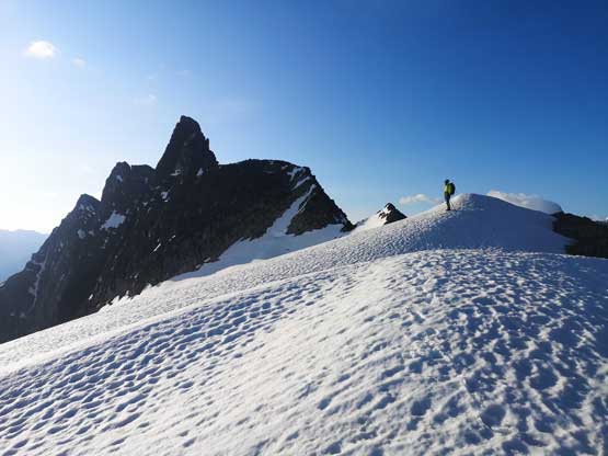
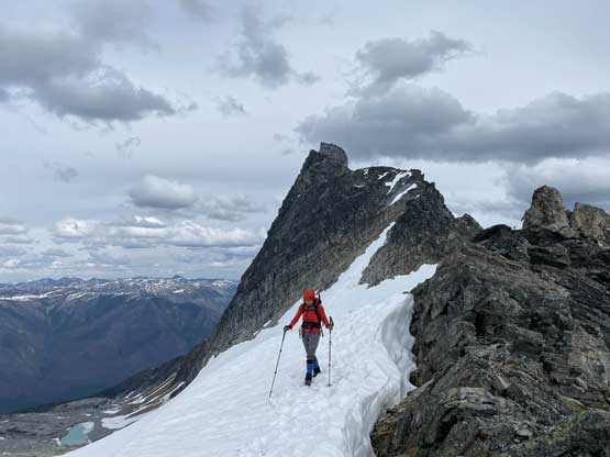
Lily plodding up the foreshortened snow slope onto Tupper’s west ridge
Two skiers approaching Swiss Peaks. They looked exceptionally small
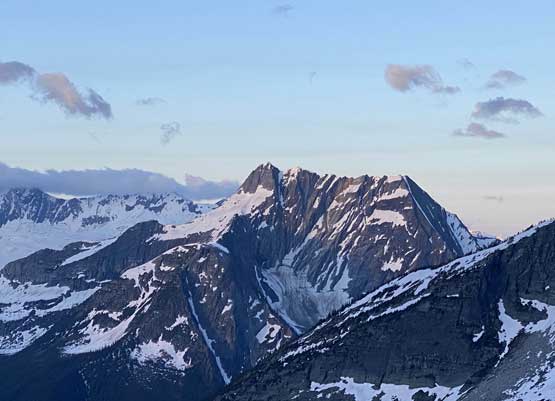
Looking back at Mt. Sifton, another objective worth to come back for
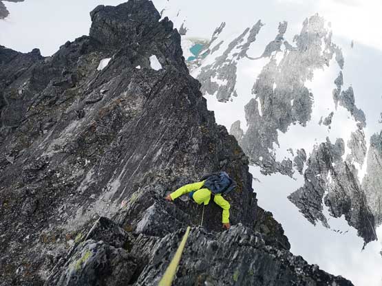
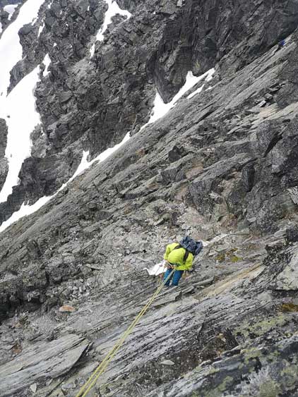
The ridge was a scenic spot to take a sunscreen break and the next stretch was also a scenic plod with Mt. Rogers massif looming behind. The west ridge of Mt. Tupper looked intimidating as hell. The hiking slowly transitioned into “easy scrambling” and then there came a short but awkward descent followed by a long stretch of class 3 on blocky quartzite. This section looked steep from afar, but wasn’t difficult if one pays attention to route-finding. This long stretch of class 3 led to a plateau feature on the ridge but to plod across this plateau we had to deal with mostly boulder-hopping. And then the real fun part began. A steepening ridge section had us swapping to rock shoes and taking the rope out but we were still one pitch away from the “au cheval” that everyone talked about. There was a few 4th class moves including an awkward down-climb and the rope drag was really annoying and the communication was nearly impossible in the wind. We ended up breaking this section down into two smaller pitches and over half an hour later we were down at the au-cheval. I went across first and found the slab to be slippery but there were a few foot ledges on the down-climber’s left side to use. I then climbed a narrow ridge on the opposite side and belayed Lily across.
Me approaching the west ridge of Mt. Tupper. Photo by Lily Q.

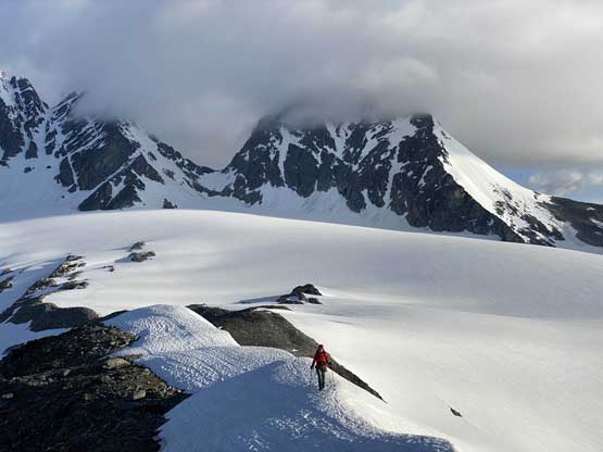
Lily plodding on snow with Mt. Rogers/Swiss Peak massif behind
Lily with Hermit Mountain behind

The north face of Mt. MacDonald

Highway 1 and Rogers Pass

Mt. Sifton and the very snowy Hermit Meadows
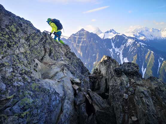
Me scrambling on the access ridge. Photo by Lily Q.
Lily down-scrambling into a low point

Me with the long section of class 3 ahead. Photo by Lily Q.

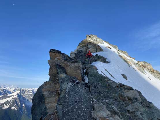
After a while this is Lily checking the down-climb into the au-cheval
Lily ready for this slippery au-cheval pitch
The other party picking a harder line down that stiff 4th class step
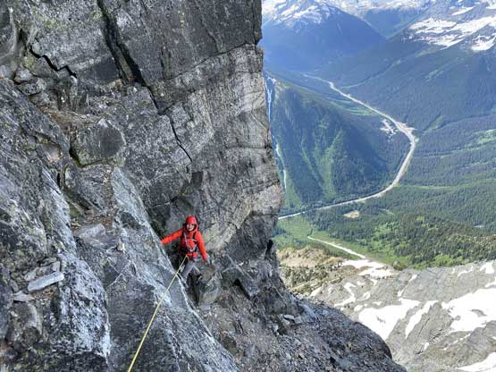
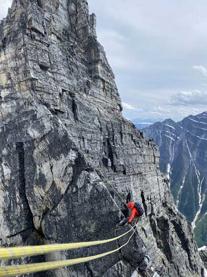
The next stretch leading to the base of The Hermit gendarme had some confusing route-finding. I had done enough research but all reports were vague so that I wasn’t quite sure where to go. In retrospect I should have stayed lower but I opted to stay higher. The punishment was one stiff pull-up step that felt at least 5.4 but probably would be just rated “4th class” as it’s short and not exposed. To bypass the Hermit gendarme I led the next pitch traversing out climber’s right on some ledges but went off-route again with one mid 5th class step. I should have gone straight up the middle of that zone but went too far climber’s right, but all route eventually worked. The corner variation didn’t look too scary so I continued leading. This pitch was certainly “real rock climbing” with a crack to start with and a super awkward chimney feature to finish. I ended up pulling on a cam midway and had to take my backpack off to fit into that chimney. I dragged the pack on the hardness and ripped off the top of it. This pitch felt very sketchy and I placed at least 6 or 7 pros and certainly would say it’s sustained 5.6 climbing. If I were to do it again I would lead it without a pack and pull up both of our packs on the clean wall next to the corner.

This section had some confusing route-finding

Me and the Hermit gendarme
Lily on our off-route pitch.

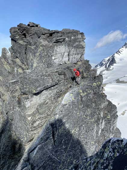
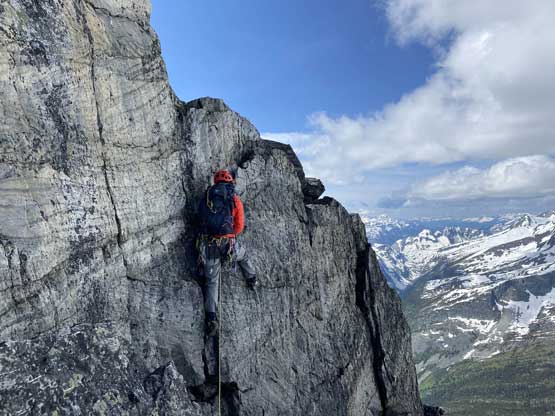
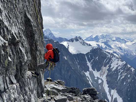
Me leading to the base of the 5.6 crux corner

Lily climbing up the 5.6 corner crux
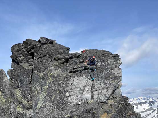
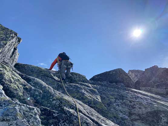
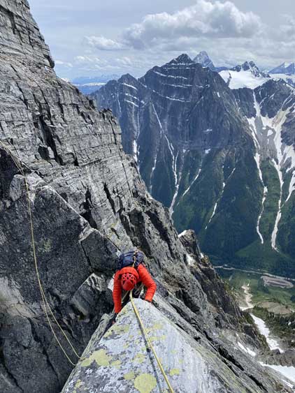
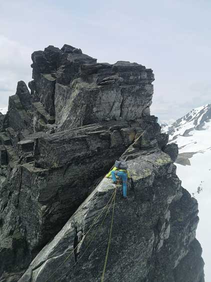
Beyond the crux pitch Lily took over the lead for the upper route, soloing the three short but technical steps in the next zone. I struggled to get up the first step until Lily taught me some crack techniques. The second step was a airy hand traverse out to climber’s right and the third step, I don’t remember much but certainly wasn’t easy neither. All three steps were “mid 5th class” in terms of the technical difficulties but were rated “4th class” because again, they are short and not exposed. Above that, we had a stretch of class 3 scrambling to the base of the summit block pitch. The other party from Vernon had passed us at this point soloing most of the route. We took our time, with Lily leading the fun and aesthetic arete on blocky, positive holds. I followed up with no problem and this final section felt very much similar to the position of Mt. Sir Donald and in short time we arrived at the flat summit.
Lily leading after the crux wall.
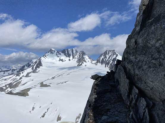
A sideways view towards Mt. Rogers massif from above the crux

Lily leading the first of the three awkward steps above the crux
Lily on the second step which turned out to be a hand traverse

Exposed class 3 scrambling for a while

Me approaching the summit block. Photo by Lily Q.

Lily leading the summit block pitch.
Me following with severe exposure but superb position. Photo by Lily Q.

Lily continuing the lead on the summit block

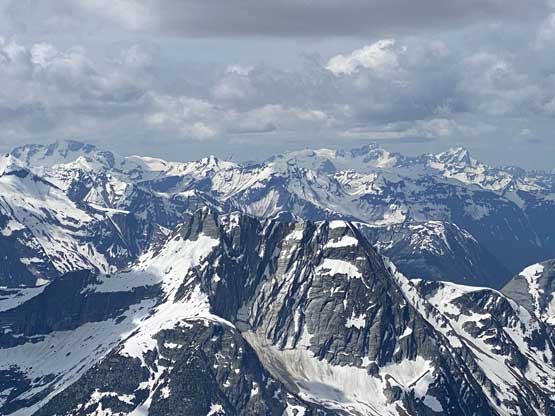
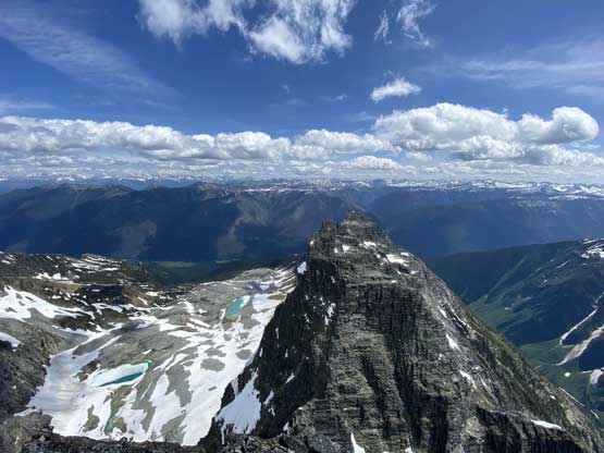
Partial Summit Panorama from Mt. Tupper. Click to view large size.

Partial Summit Panorama from Mt. Tupper. Click to view large size.
Another photo of Mt. Sifton
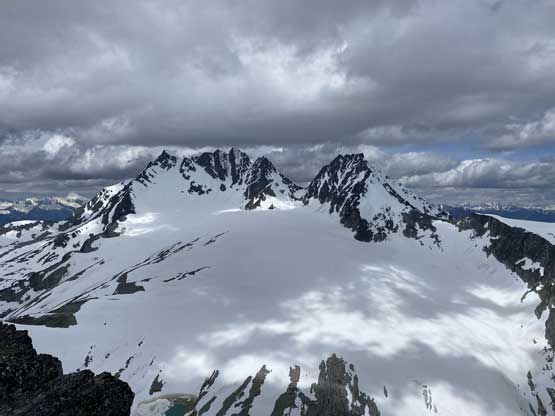
Mt. Rogers massif and Hermit Mountain

The north face of Mt. MacDonald now looks smaller
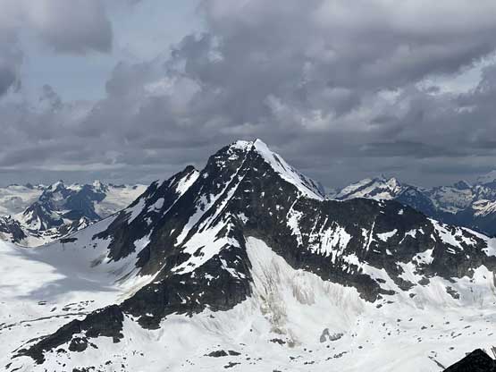
The massif of Mt. Dawson looms behind, the second highest in Selkirks
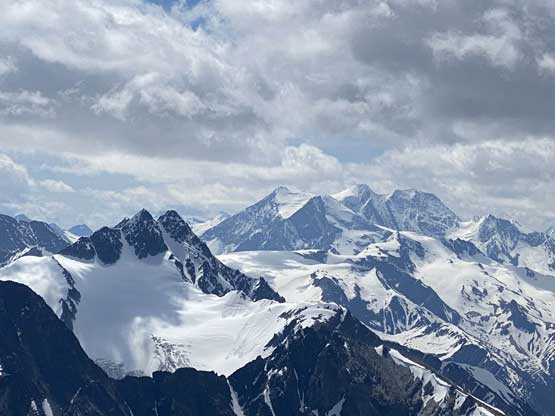
More remote Selkirk summits behind Cheops Mountain

Mt. Sir Donald pokes behind Mt. MacDonald
“The Camels” in foreground, a very technical sub-summit of Mt. Tupper
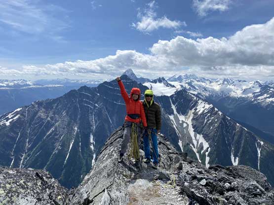
Lily and I on the summit of Mt. Tupper
The descent would be just as long as the ascent but we were in no hurry. We easily rapped off the summit block pitch and then used a single bolt to rappel off that “3 awkward steps” zone. The next rappel got us down the crux wall and then we did two additional rappels for simple reasons of why-not. We then easily traversed to near that au-cheval and did some rope work to get back across, but unfortunately the rope got stuck. I had to re-downclimb that section to free the rope and we wasted at least half an hour there. We then did more rope work to get back across a section of exposed ridge. We opted to continue descending the tricky scrambling sections on rock shoes until at the very bottom of the west ridge, where we did one last break swapping footwear back to mountaineering boots. The plunge on snow back to camp was fast and fun.

Me leading down the first rappel. Photo by Lily Q.

Lily rappelling off the summit block
Lily finishing the same rappel

Lily on the second rappel to get off those awkward steps

The third rappel got us down the crux wall

Lily on the 4th rappel to descend the steep terrain under the crux
Me on one of those rappels. Photo by Lily Q.

One more rappel for why-not…
Lily rappelling the ridge to get into that slippery notch
Re-ascending that au-cheval step
This is Lily’s photo of me climbing up the au-cheval step

I had to down-climb back there to deal with a stuck rope…

Me freeing the rope. Photo by Lily Q.

Lots of scrambling still awaits

One last photo of Hermit Mountain
Back onto easy terrain now

A review shot of Mt. Tupper’s west ridge

Boot skiing time!

The group from Revelstoke
The other group with Mt. Bonney behind

Lily carefully descending a rock step on the return hike

This section needed extra care.

A bit of down-climbing on snow

Hopping back across the stream. Hard to not get our boots wet…
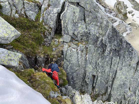
Then we scrambled a wet and mossy chimney
Back to camp but with deteriorating weather we had to be quick
At the cap we took down the tent for as fast as we could and then took a long break regathering some strength. I took off the mountaineering boots and swapped for trail runners for the hike-out. It wasn’t difficult but definitely felt tedious and never-ending, but thankfully the trail conditions were first class. Our time of the second day was 14 hours and the round trip was 16 hours (excluding the camping time).

Mt. MacDonald from the return hike
The tedious and boring hike-out.
We got back to the car 10 minutes before it started to rain, and in short time it was pouring. Given the weather forecast we directed our bearing into the Okanagan area hoping for some sunshine on Sunday. For some reasons I was still excited and able to keep awake driving all the way past Kelowna into Peachland past midnight. We were exhausted so we wanted to do something easy… Our next objective would be Pincushion Mountain.
