Mount King George
August 8-10, 2014
3422m
Height of the Rockies Provincial Park, BC
Those who have visited the classic Northover Ridge in the core area of Peter Lougheed Provincial Park must have been impressed by a group of isolated peaks somewhere 10 km to the west. That’s the Royal Group, with Mount King George being the highest. It’s massive East face is visible from many scrambles in Kananaskis. If not because of the complicated approach including lengthy drive on logging roads, this beautiful and prominent 11,000er must have seen a greater amount of traffic.
With sunshine in the forecast for this past weekend, Vern, Eric, Ben and I were game for something big. Since not everyone could take 3 full days we picked Mt. King George. Regarding the ascent route we’d use neither of the described ones in Bill Corbett’s 11,000ers book. Instead, we’d use the same route as what’s currently accepted by the guides. It still goes up the southwest face, but has two major variations which significantly simplify this objective to merely a steep 40-degree snow ascent under ideal condition. Instead of gaining King George/Princess Mary col from the east side via a steep couloir (usually has a waterfall running in it), we’d hike up the upper left branch of Fynn Creek, around the south and west sides of Princess Mary before slogging up scree to the col, and instead of gaining the lower heavily crevassed glacier on the southwest face, we’d slog up a long pile of scree before traversing a not-so-obvious ledge system to access the south glacier way up high.
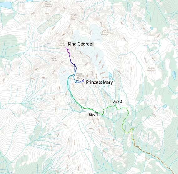
Ascent routes for Mt. King George and Mt. Princess Mary. GPX DL
[Update in 2025 – the log crossing of the Palliser River that my group used had long gone. But thank to Foresty Forest and friends’ trail work they were able to find a better spot to cross the river and then build a fairly good trail through the forest. I’m attaching Kelly Wilson’s GPX track here which I downloaded from peakbagger.com, so please follow this new route nowadays. Many groups had followed my old track and got into misery.]
Our plan was to approach to the bivy site at upper left branch of Fynn Creek on Friday evening and this would give us two windows to attempt King George – the mornings of Saturday and Sunday before heading out and driving back home. If we managed to get King George on the first try then we’d use the rest of this trip to bag other smaller peaks in this area. In order to do so we had to leave Calgary by 1:30 pm the latest. The driving direction is well documented in the 11,000ers book and it follows Settlers Road, Kootenay-Palliser FSR and then Palliser River FSR for a total of 59.7 km to a small pull out by Fynn Creek. Vern did a great job driving and we arrived at the parking area at a reasonable time.
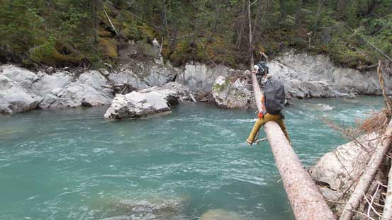
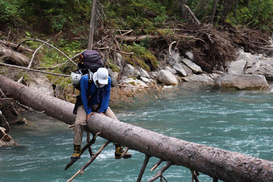
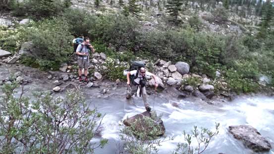
Thank to the flood in 2013 the bridge across Palliser River no longer exists. We briefly discussed about wading this raging torrent but doing so would be troublesome without doing lengthy detours. We weren’t even know what to expect further upstream or downstream. There’s a fallen log which didn’t look too bad so that’s the way to go. It was quite sketchy as we had to shuffle across with heavy backpack and fallen into the river was not an option… It was a time consuming process but we all managed to shuffle across safely. The trail up Fynn Creek was also hard to follow, again, thank to the flood. The creek looked like a mess and the first few kilometers of this trail was largely destroyed by washouts. We had to do quite some bushwhacking dealing with endless deadfalls. And thank to the thunderstorms in recent hours the bushes were wet and our pants got soaked in no time… Pretty miserable but on the other hand the wetness and the clouds kept us cool especially once starting the headwall steeply up climber’s right. I can’t imaging doing so under 30 degree sun… Above the headwall the trail got quite confusing but by following flags we managed to stay on trail for most of the time to the first bivy site (bivy site for East Face of KG or Prince Albert/Prince George). For our route choice on King George we had to push further for another hour. Darkness was falling in no time and after jumping across a creek we had to start using head lamps, and at the meantime we lost the trail. The last hour of this lengthy approach involved a lot of miserable bushwhacking with some elevation loss and regain around an imposing rock band, navigated mainly by GPS. We eventually made to our destination by about 11 pm and after quickly setting up camp we went to bed.
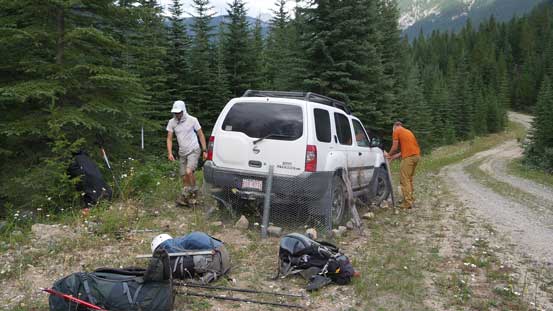
We bought brand new chicken wires. There’s no wire at the parking lot so bring your own!
Vern crossing the sketchy log
Me au-chevalling across the log. Photo by Ben
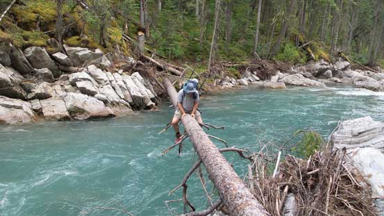
Eric shaffling across the log

Typical dead falls on the approach…

And, wet vegetation. The trail was very easy to lose if not paying attention to the flaggings
The not-so-often seen west side of Mt. Joffre
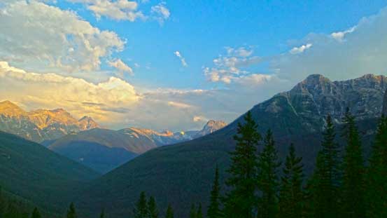
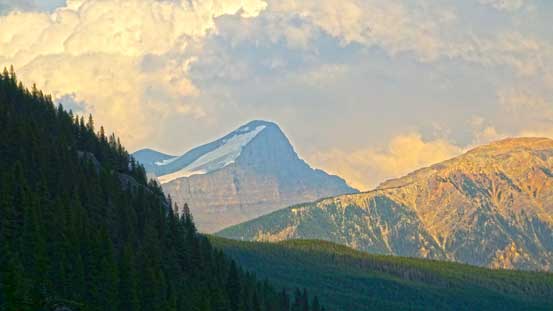
Evening colours

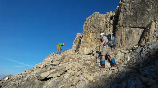
Eric grinding up the trail.
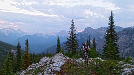
This is somewhere near the first bivy spot. We were losing daylight fast.
We had to search around to cross this creek without wetting our feet.
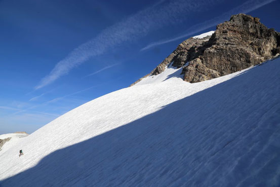
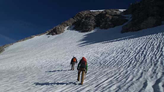
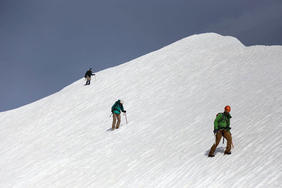
The next morning we woke up by about 4:30 am under clear sky and started shortly after. Navigating the long hanging valley by head lamps was a little bit interesting on some micro terrain but we generally followed the GPS track or stayed close to it. We had the options to stay on moraine crest or below but it didn’t really matter as higher up we’d merge to the lower south glacier (more like a permanent snow/ice patch). We stayed on the right side of this glacier and just below King George/Princess Mary col we picked a scree line steeply up. Vern and Eric took a line further left while Ben and I went straight up. We did so to minimize rock fall danger as the scree was horribly loose.
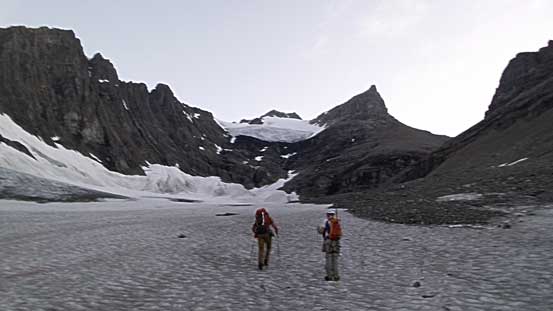
Hiking up the lower south glacier in the morning. King George straight ahead.

Morning colours on the horizon

Ben hiking up a small snow patch, with more morning colours behind
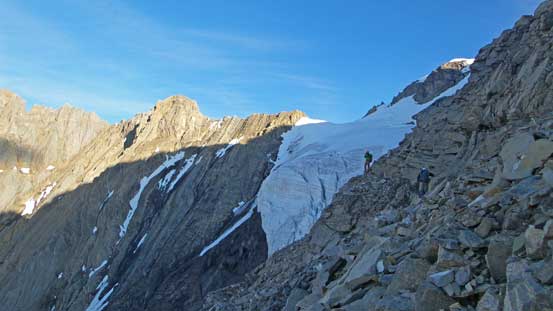
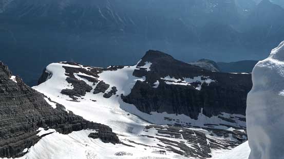
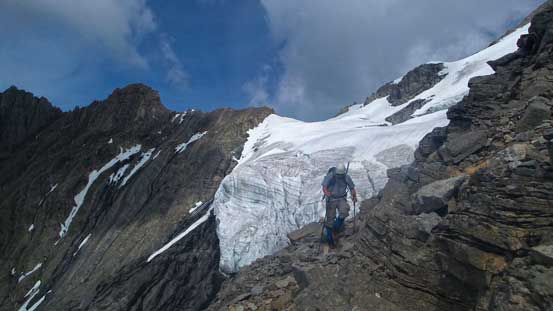
The next step was grinding up a huge pile of scree for at least an hour. This part was probably the least favourite for the entire trip other than the hike-out and I didn’t want to describe much apart from being extremely patient. To access the key ledge systems we had to slog all the way up this scree cone to its end. The ledge was not as exposed as we thought and surprisingly easy to follow. There’s even paths and cairns leading the way. It’s a pretty short traverse and soon we were on the edge of the south glacier.

Looking up the long scree slog. We had to grind all the way to the base of this triangular face
Already getting higher than most peaks!
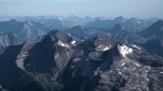
Looking deeply south towards Mt. Harrison.
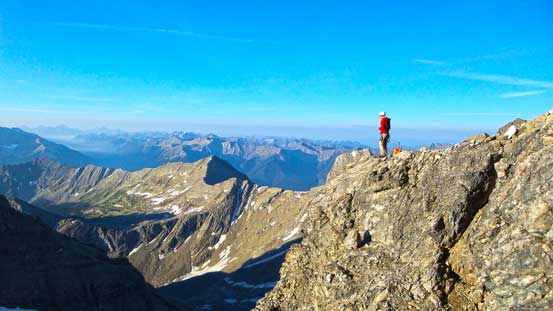
Ben checking out the views. We took a short break here before traversing the ledge system
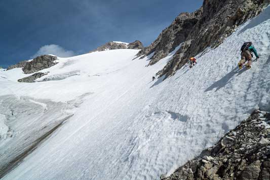
Vern and Eric starting the ledge traverse – wide and easy, not as bad as it looks from afar

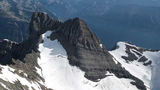
This striking peak is Mt. Princess Mary, our next objective!

Another photo looking towards Harrison. Note the smoke in valley floor…
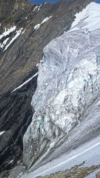
Near the end of this ledge traverse. By doing so we gained the glacier above these seracs.
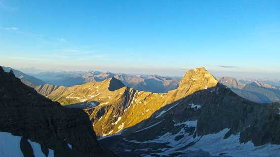
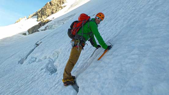
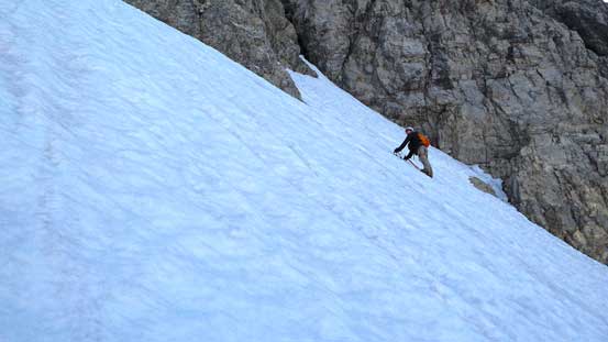
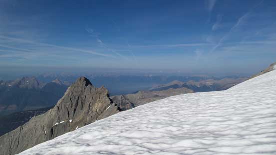
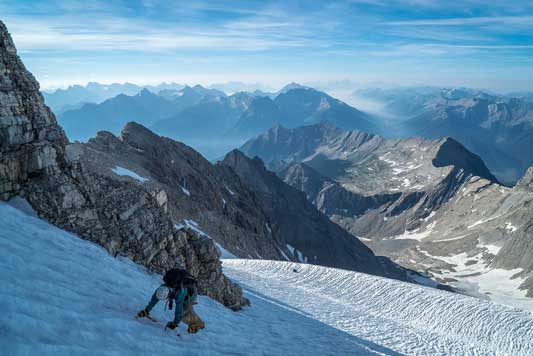
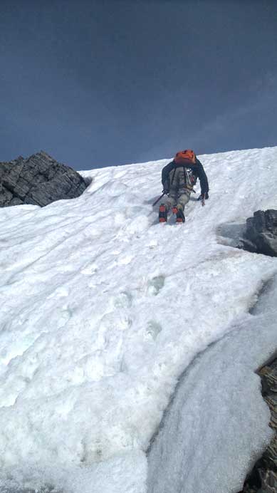
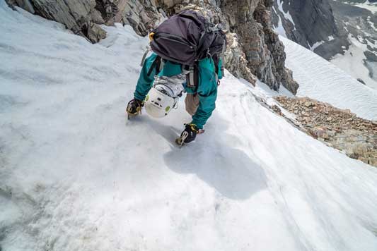
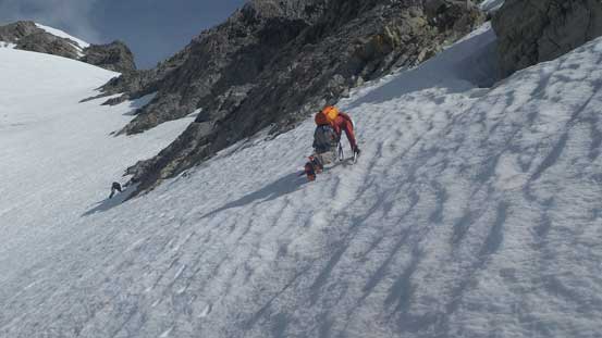
The glacier was steeper than expected and due to the good overnight freeze we had to front point while facing inwards for a long section. The steepest part was right at the start as we must traverse across a 45 degree section. Slipping here would send us down to huge seracs, rock bands and waterfalls and self arresting on such a steep slope was impossible. We were all glad to have brought up the ice tool. Higher up the angle eased a bit, but still pretty steep. It’s also pretty foreshortened and seemed to drag on forever. There’s a short flat bench just below the final 40 degree couloir. The snow in this couloir looked discontinuous and I even briefly thought about ascending the rock on the left side. But we eventually decided to just go up the couloir which proved to be the right choice. There wasn’t much of ice nor rock sections and the snow climb was pretty fun. A short traverse towards climber’s left after exiting this couloir brought us to the summit, my 14th 11,000er. The view was great despite the forest fire smoke and we could see oceans of peaks with big ones like Assiniboine, Sir Douglas and Joffre poking through.

Looking down at Eric starting the traverse
Vern crossing a bergschrund. Staying on climber’s right could avoid it entirely.
Ben’s route would avoid the ‘schrund, but has more side-hill traverse
Me ascending the glacier. Photo by Ben
On the flat bench just below the final couloir
Ben and Vern ascending towards the couloir (right of center in the shades)
Me starting the final steep snow climb. Photo by Vern
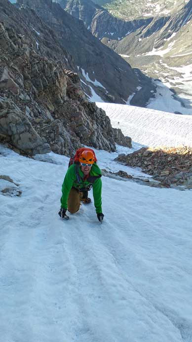
Vern climbing up the 40 degree couloir

Ben negotiating a rock step in this couloir

On the summit ridge now.

The last bit!

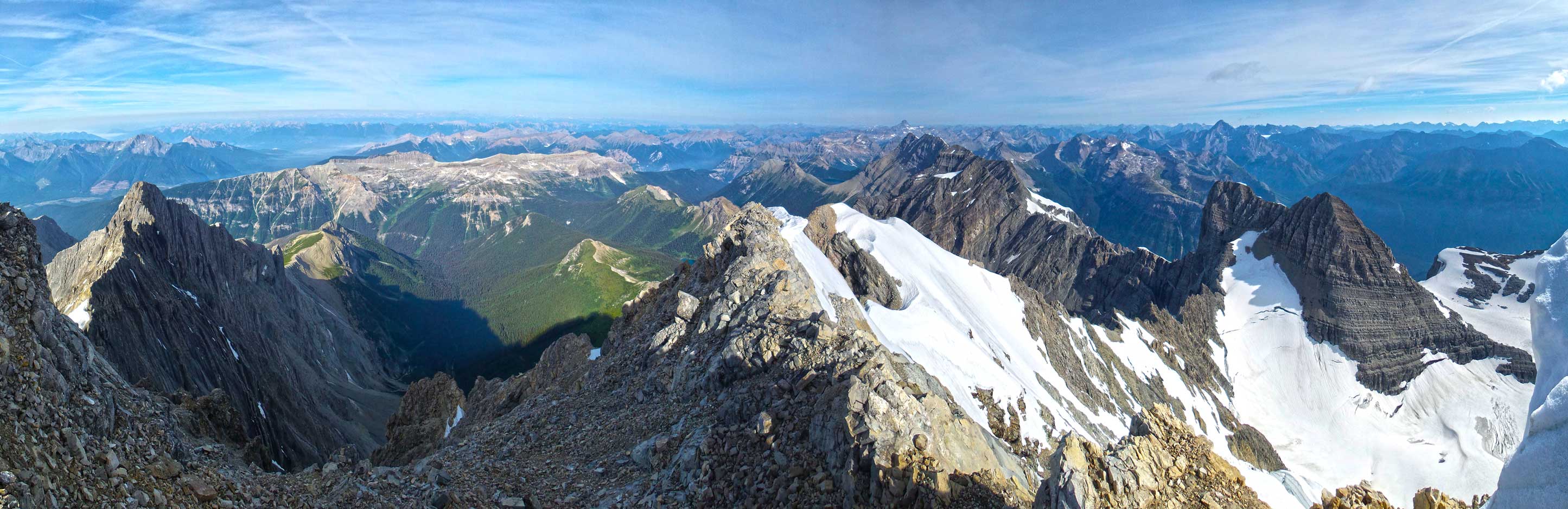
Summit Panorama from Mt. King George. Click to view large size.
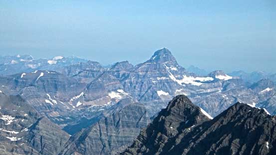
Mt. Assiniboine – one of my favourite climbs for sure
Mt. Sir Douglas is on my to-do list
Looking down at Mt. Prince Albert.
And, Mt. Prince George
Vern, Ben and I snowshoe’d up Mt. Joffre earlier in this year.
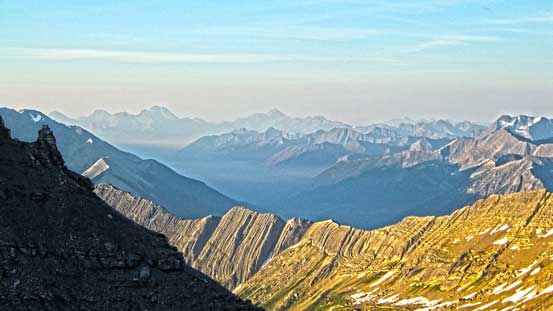
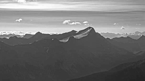
Mt. Sarrail and Mt. Foch in the distance
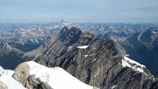
Looking down the rest of Royal Group – Prince John et al.
Towards west we could see the distant Purcell giants like Jumbo Mountain
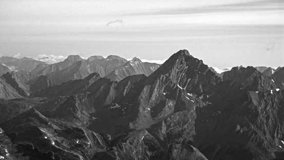
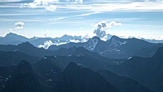
A sea of peaks that I’m not very familiar with the names
Another sea of peaks. This is looking south

This is probably Queen Mary Lake
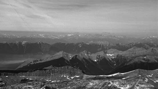
Another panorama from the summit. Click to view large size.
To optimize the snow condition we didn’t stay long on the top as the sun already started to shine on the south facing slopes. Down-climbing the couloir was fun and fast. Snow had already softened a bit so we even managed to walk facing outwards down most of the glacier. Towards the end we still had to traverse facing inwards though for 20 m or so. Traversing back across the ledges went without incidence and descending the big pile of scree was fast fun and we were back at King George/Princess Mary col in short time.
Descending from the summit. Photo by Ben
Ben climbing down a steep step

Ready to drop down the couloir
Me down-climbing the couloir. Photo by Vern

Eric and Ben down-climbing
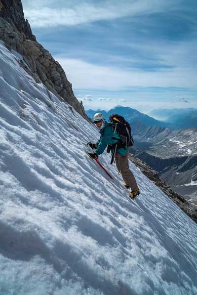
Me traversing the steep snow. Photo by Vern
Ben traversing the steep snow
This photo shows me, Ben and Eric on the slope. Photo by Vern
You certainly can’t afford a slip on this steep glacier…
Traversing back across the ledge system

Vern and Ben on the ledge

Eric descending the loooong scree slope.
It was still very early in the day and it made no sense to just go back to camp, sit around and doing nothing. The nearby Mt. Princess Mary didn’t look very scrambler friendly but we knew Rick Collier scramble’d it so there must be a way. So we decided to try it out, and the day continued with an successful ascent of Mt. Princess Mary.
(Make sure to take a look at Vern’s excellent short video).

Why the chicken wire? Around the Car?