West Lion
September 5, 2015
1654m
North Shore Mountains, BC
Upon settling in my new home in the lower mainland of British Columbia I had to pick an introductory objective to the Coast Mountains adventures. I wanted something not trivial, but the stormy weather in the previous week had dumped fair a bit of fresh snow on the alpine, and on top of that it seemed like there’s only 1 day of guaranteed good weather in this Labour Day long weekend. Furthermore I was not familiar with the Coast Mountains at all except I had some limited memories from the few hikes I did 5 or 6 years ago. Something closer to home would make the most sense and after some basic Google searches I decided on West Lion and East Lion.
The Lions are needless to say, the icons of Vancouver’s North Shore Mountains. They aren’t the highest out there but certainly among the most striking ones. The West Lion has become a Vancouver’s classic nowadays and despite the fact it’s a difficult and exposed one (Class 3-4) hordes of scramblers and tourists attempt it everyday. The East Lion is considerably harder and more exposed but I figured I should have no problem soloing 4th class terrain. I’d bring my ropes for rappelling just in case it’s more difficult than I thought. So by 4:30 am I woke up in my home, had some quick breakfast then drove to Lions Bay and started the trek by 6:20 am. The parking lot was only available for roughly 5 cars so that’s why I made an early start. There were already two cars parking there and another car arrived roughly 10 minutes after, not to my surprise actually given it’s a sunny day in the long weekend.
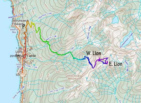
West Lion and East Lion standard route from Lions Bay. GPX DL
As a scrambler and mountaineer coming from the Canadian Rockies I had quite a few things to get used to here. First obvious one was the huge amount of height gain just to see something (reaching treeline), and The Lions really got me introduced to that. With the trail-head elevation of a mere 250 m I really had to work my way up these mountains. Thankfully there’s no bushwhacking involved (yet) as the Lions trail is fairly popular. I followed the abandoned logging road up a few switchbacks and gained elevation fairly quickly. Before I realized I already passed the turn-off to Brunswick, then Harway, and then the road became more like a trail skirting around the SW flanks of Mt. Harvey. In another half an hour or so I correctly picked the well-signed Lions Trail, down and across Harvey Creek on a good bridge, then steeply up the other side. By now I’d gained 600 vertical meters (Yay!!).
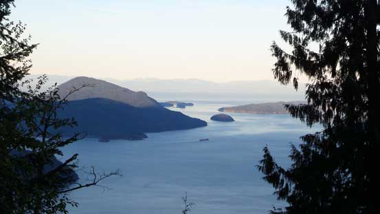
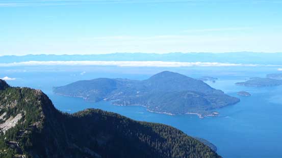
A glimpse of Howe Sound from the approach
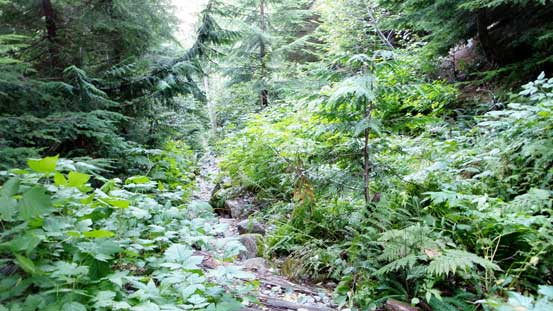
Hiking up the abandoned logging road in the coastal rainforest

The Lions Trail is hard to miss
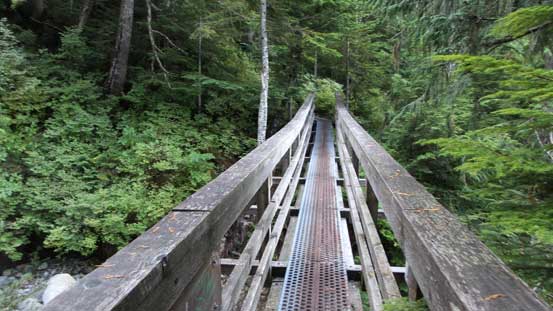
A very good bridge crossing Harvey Creek
But… There’s another 600 vertical meters or so to hit the ridge crest to join the Howe Sound Crest Trail (HSCT) that leads to the base of West Lion. This section of the trail was much steeper and considerably rougher with lots of roots, boulders and some really big fallen trees. My sneakers felt a bit undertooled here so I quickly switched my footwear to mountaineering boots. Upwards and onwards I eventually made to a rocky shoulder and got my first glimpse of W. Lion, then the faintly-marked trail turned sharply climber’s right up some rocky terrain, and not long after it’s the HSCT junction. From here on the views completely opened up and the enjoyable part finally began.
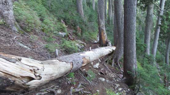
There’s some big fallen trees like this
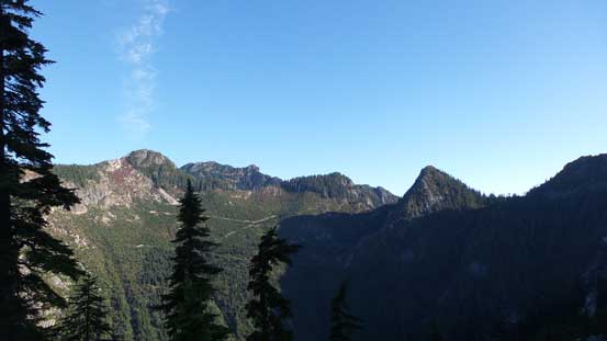
Started to see more of the North Shore Mountains
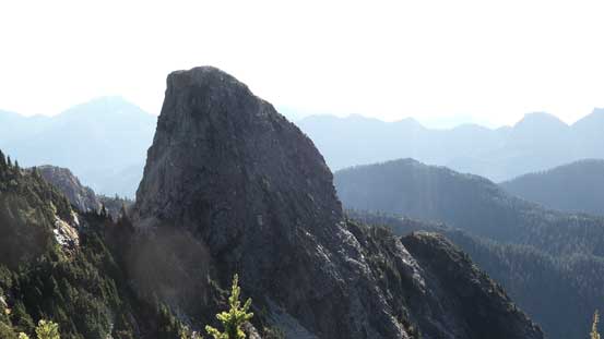
Finally had my eyes on my first objective – West Lion on left

View down towards Howe Sound. It’s been a long time since I saw the Ocean
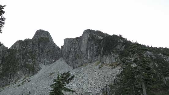
I followed the HSCT upwards along the ridge crest towards the broad bump just before the notch on W. Lion. I met two campers along the way and I think they certainly picked a great spot to watch sunset! At this point I was still thinking about climbing East Lion first as it’s the harder one and I liked the idea to knock down the hard one first, but looking across I could see the upper slabs had some water on, probably due to the extensive rain in the previous few days. I wanted to give it a bit more time to dry off but there’s another reason to scramble West Lion first – to beat the hordes of people thus avoid getting traffic’d on the descent… So down the notch I went. What I saw was a fixed rope, and a 3-meter vertical step with no obvious “scramble” sequence… I went down anyway since it’s supposed to be just a scramble and I had to say there’s quite a few tricky moves involved (I tried not to use that rope)…
Looking back towards Unnecessary Mountain. More than 5 years ago I hiked up there from Cypress
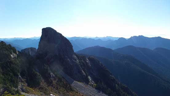
Looking across the gap towards East Lion
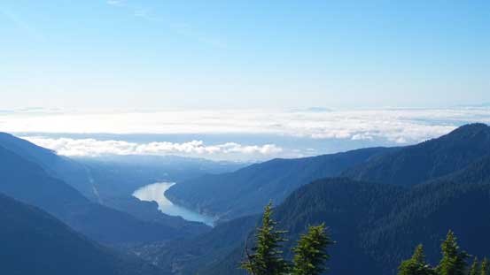
The lower mainland was covered by low clouds. Capilano Lake in front
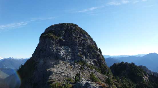
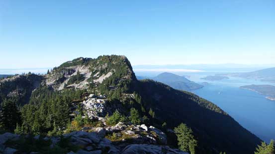
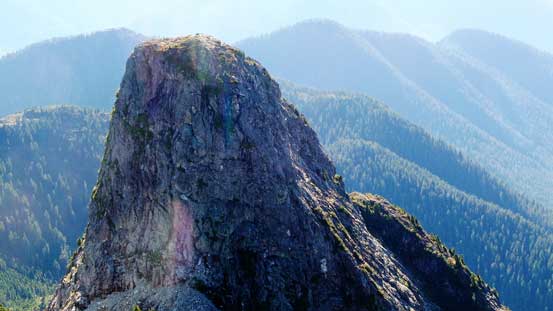
The summit buttress of West Lion
Another look at East Lion
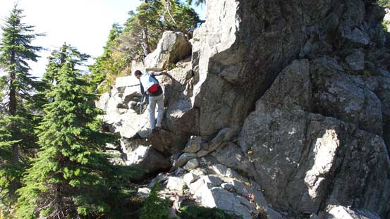
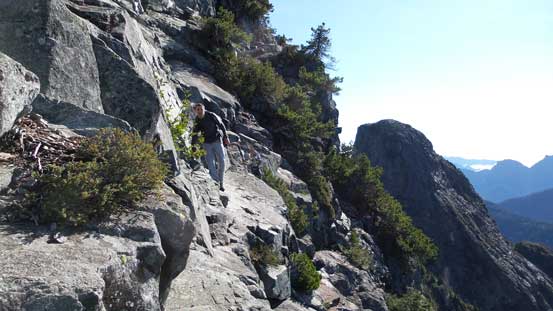
Vlad down-climbing into the notch
I ditched my backpack at the notch and picked up the infamous ramp that led a rising traverse line towards climber’s right. Looking back I saw another solo scrambler catching up from behind. I waited for him a bit then we did the rest of W. Lion together. After some chatting we started to recognize each other from a local forum – ClubTread. He’s Vlad (Culator) and I’d read quite a few trip reports from him. Small world indeed and I’m very happy to meet a hardcore local scrambler. The traverse wasn’t super narrow but down-sloping and fairly exposed. Once around the far corner we pretty much scrambled straight up. The rocks here are granite and considerably more solid than the Rockies’ choss and it’s a very enjoyable scramble.
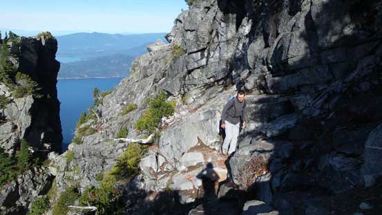
Vlad traversing the exposed ledge
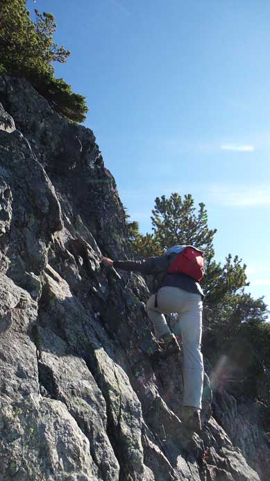
Then, the typical scrambling
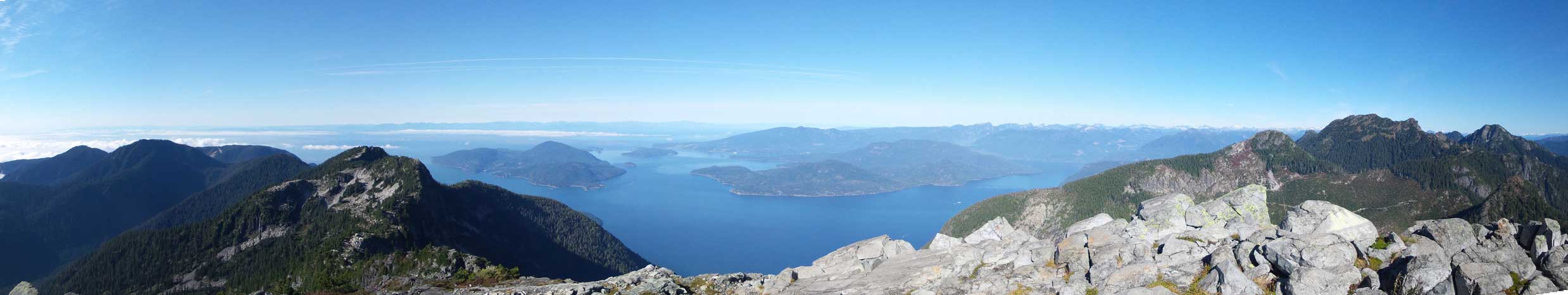
Partial summit panorama. Click to view large size.

Partial summit panorama. Click to view large size.
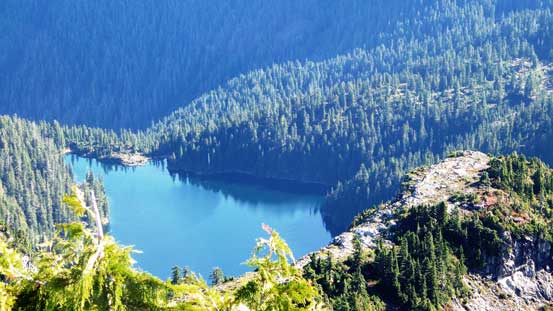
Looking down at Enchantment Lake
East Lion looks intimidating from here. Our route goes up the RHS Face
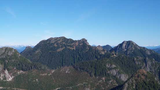
Brunswick Mountain (L) is the highest in this area. Mt. Hanover on right
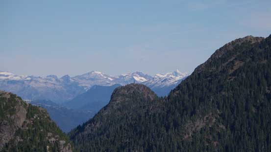
Looking over the summit of Mt. Harvey
Bowen Island – its high point is Mt. Gardner
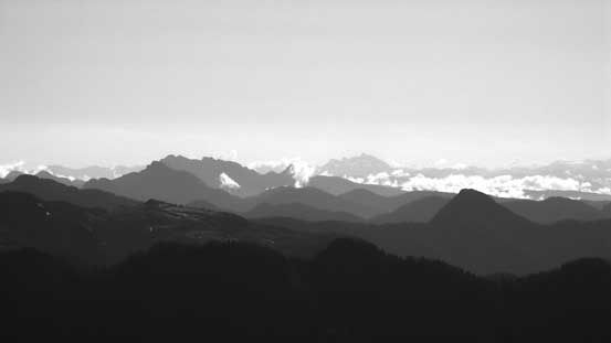
Some big peaks showed up behind the shoulder of Brunswick
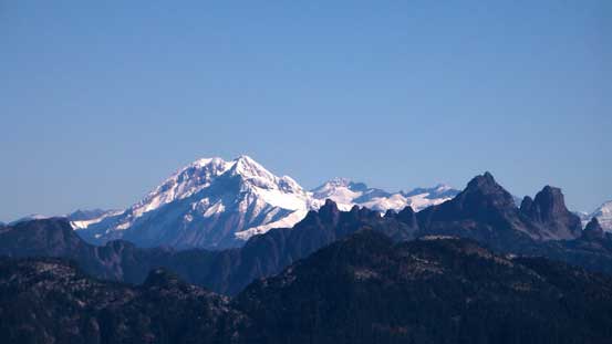
The mighty Mt. Garibaldi, with the striking Sky Pilot Mountain in front on right

Mamquam Mountain is another massive one
Mt. Robie Reid is the big one behind
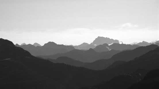
More big peaks on the Eastern horizon – Golden Ears (fg L) and the Cheam Group (bg C)

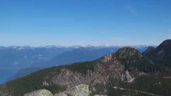
Looking over the summit of Crown Mountain towards the massive Mt. Baker
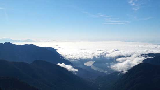
Another picture showing the low clouds obscuring the city of Vancouver

Can’t stop taking picture of the Ocean!!
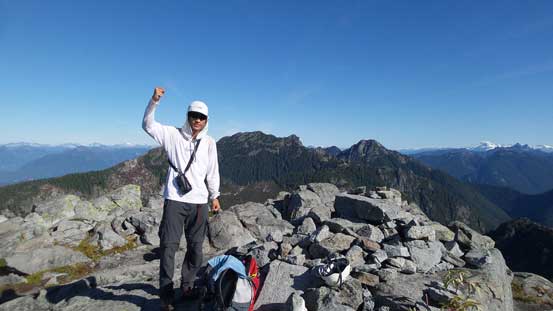
Me on the summit of West Lion
We could see more people coming up so didn’t stay too long on the summit. Probably because I chatted too much on the way up I didn’t pay attention to the route. We ended up getting a bit too far downclimber’s right and had to backtrack slightly. Then we had no further problem reaching the ledge below. Descending back along the ledge was pretty quick and then climbing back up the notch felt definitely easier than down-climbing it.
The typical terrain on W. Lion

Vlad on an exposed bit

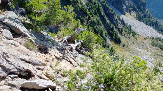
Down-scrambling while grabbing tree roots.

More down-scrambling
Traversing back across the ledge/ramp
The notch ahead.
The original plan for Vlad was making an ascent of the obscured Enchantment Peak behind the Lions, but after a bit of discussing he agreed to join me on the climb of East Lion, my primary objective in this trip.
