Mount Oppenheimer
May 1, 2020
660m
Yale / Fraser Canyon, BC
Mt. Oppenheimer is officially-named, but rather a “dumpster-diving” objective about 5 km to the south of Yale in Fraser Canyon. The entire area is heavily logged and the summit can be attained by driving and/or walking up logging roads from Emory Creek drainage. One spur road goes to within 50 horizontal meters from the summit. The summit is heavily wooded with absolutely zero view, but the roads leading to the summit offer some nice views to the south. I had noticed this peak on the map for a while, but it’s probably too small and shitty to draw attention from peak-baggers that despite the lack of challenge I could find zero information online. I thought it’d be an ideal objective for a quick before-work grab. Earlier in the day Alex and I had ascended Laluwissen Mountain north of Lytton. We finished the hike at 8 am and made to the start of Mt. Oppenheimer two hours later. We anticipated mostly a drive-up but after two kilometers up the smooth logging road we were stopped by a locked gate with clear languages of “active logging” and “no entry”. It appeared that nobody was patrolling the gate but there had no obvious place to leave the vehicle behind the gate so we opted to drive 500 m down the road to a nice turnaround spot.
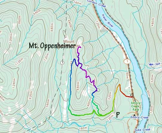
Mt. Oppenheimer via SE Ridge. GPX DL
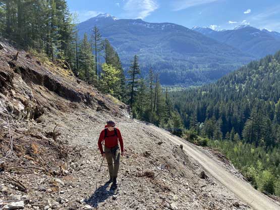
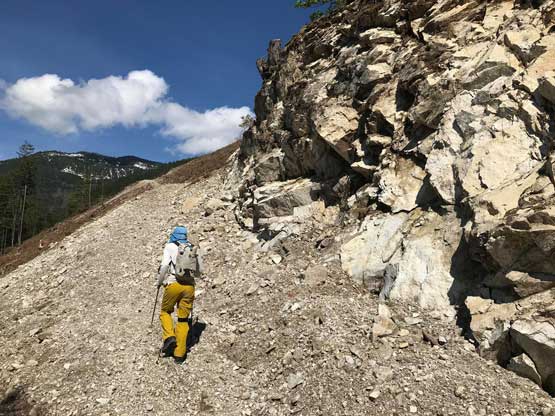
We had some discussion about the routes. The most obvious option was to walk up the road but I reasoned that if we got caught by the loggers then we might have to turn around and we did not know where they were actively logging. We did however, spot some clear-cuts and roads that were not visible from the satellite images that seemed to go pretty high up on the south-east flanks of the wooded plateau. The new plan was to ascend to the end of these cuts and bushwhack up the south-east ridge to join the criss-cross of spur roads on the upper plateau. While walking on the main road we were passed by one logging truck and several ATVs that apparently had the access key. Soon after that we bailed the main road and went up a narrow spur road into the aforementioned cut block. This spur road started off nicely but soon ended in a mess of logging cut. We were forced to ascend straight up through the clear-cut and then bushwhack into the forest, for over 200 vertical meters to join the SE Ridge. The bushwhack wasn’t too bad but very steep. We then bypassed a minor bump by side-hilling and ascended open terrain to the next bump where the old spur roads were located. The south side of this second bump offered the best view of this entire hike.
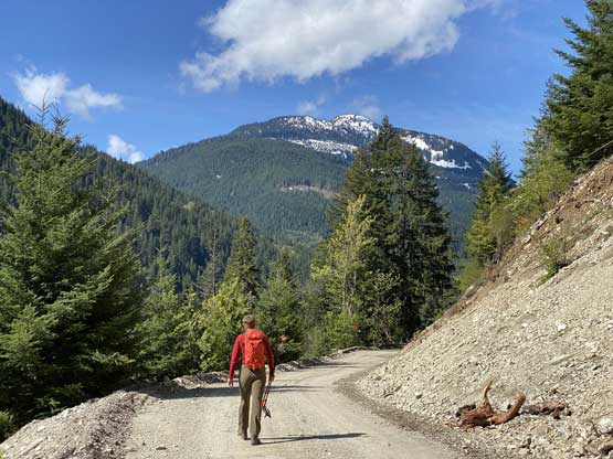
Alex walking up the main road with Zofka Ridge in front
Taking this narrow spur “road” into the cut block
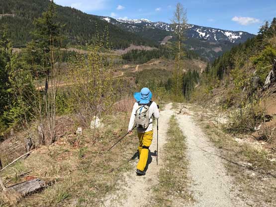
Me plodding up this spur road. Photo by Alex R.
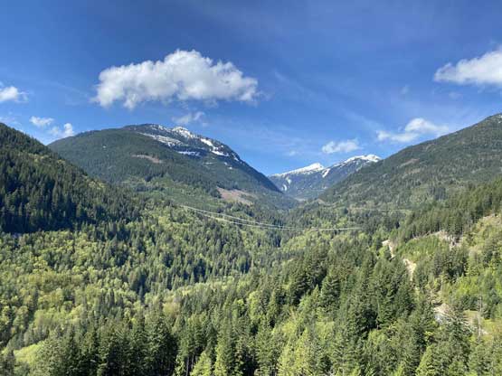
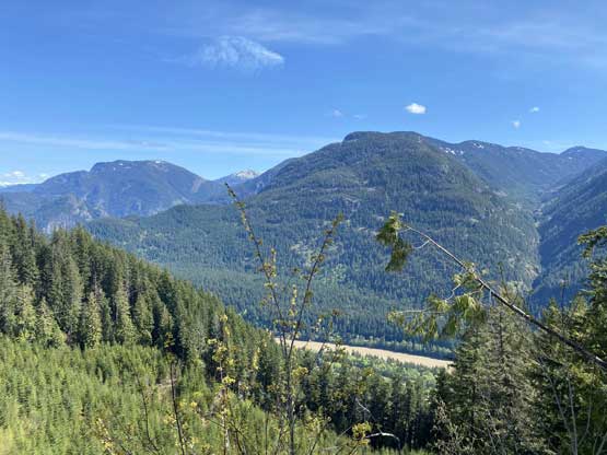
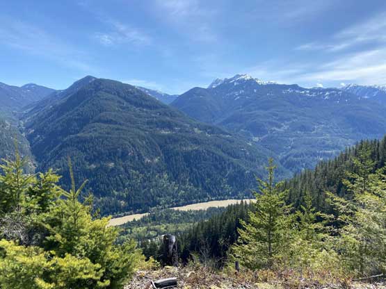
Looking into the Emory Creek drainage. Zofka Ridge on left
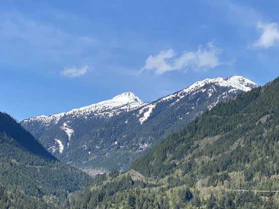
A zoomed-in view of Mt. Baird
The spur road soon ended in a tangled mess of clear cut…
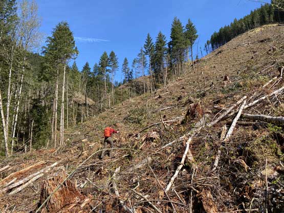
Me ascending the clear cut. Photo by Alex R.
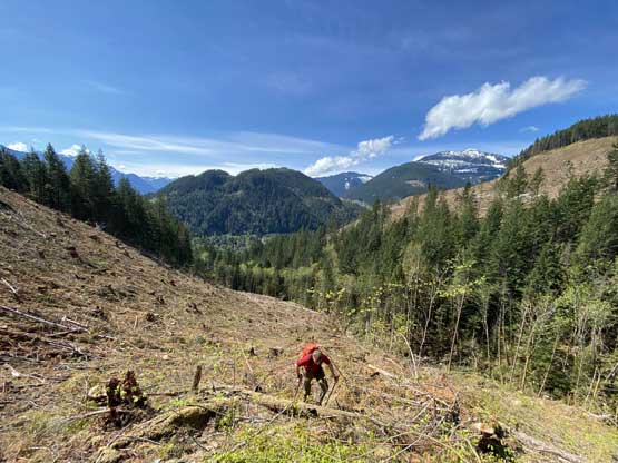
Alex grunting up the clear cut.
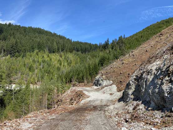
After a while we came to a (much better) road…
Zofka Ridge across Emory Creek
But soon we’d bail the road up another stretch of clear cut…
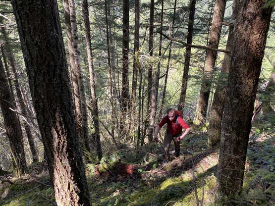
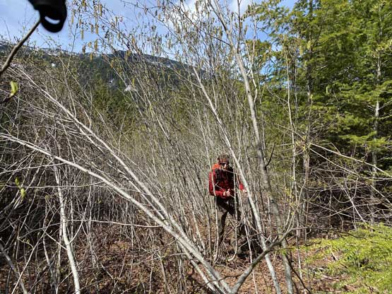
And then, steep bushwhack to gain the SE Ridge
Could see Fraser River now. Mt. Allard at center; Saddle Peak on left
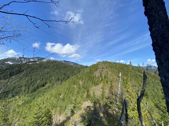
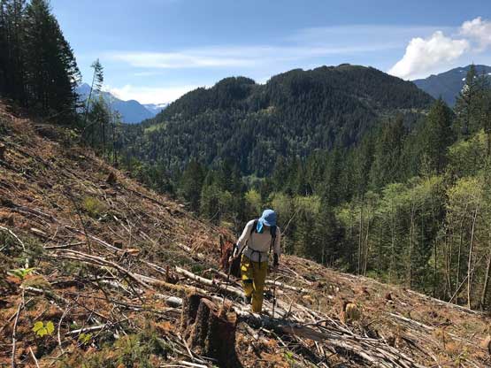
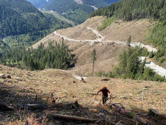
Looking ahead to the SE Ridge route.
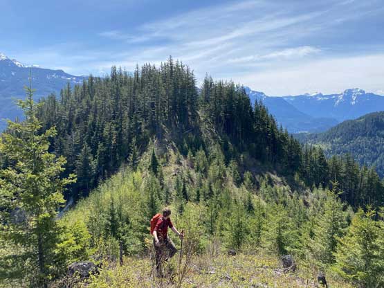
Alex ascending the second bump.
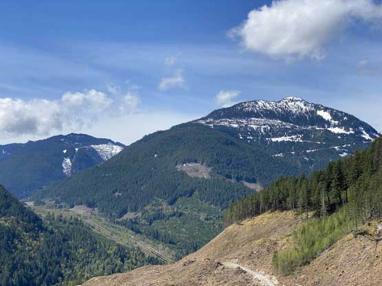
Looking back at the north face of Hope Mountain
Fraser Canyon and the sub-peaks of Squeah Mountain
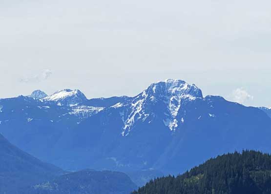
Ibex Peak and Chamois Peak in Anderson River Group
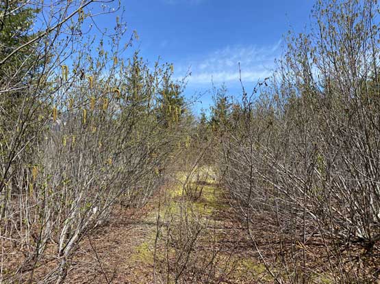
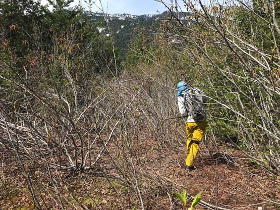
The spur roads appeared to be in some good shape but did have several stretches chocked with alders. But generally speaking we could maintain a reasonably fast walking pace. After some up-and-downs we came to the junction with the roads coming up from the active logging area, turned right and then turned left again to access another spur road. This road would eventually lead us to within 50 meters from the summit and soon became overgrown. The alders were never too bad so the next thing we were at the point where we supposed to leave the road for the summit. The final 50 m was surprisingly also on a road, but too overgrown to be seen on the satellite images. This stretch had some real bushwhacking but at least short-lived. And not to our surprise, the view from the summit was nothing but trees. It might be possible there’s some viewpoints below the summit on the east and north side but we weren’t in the mood to explore plus I had to be back home before 3 pm for work.
The road wasn’t as smooth as we were hoping for..
Typical conditions on the last stretch
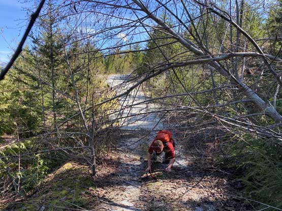
Heavy bushwhacking to the summit
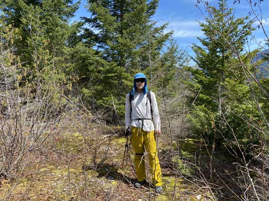
Me on the summit of Mt. Oppenheimer
After snapping several obligatory “victory shots” we soon started the descent. We decided to walk down the main road instead of going back the same way for a faster egress. There’s a risk of getting caught by the logging company but we could play dumb and say we were totally lost and confused. And in case they insisted we couldn’t walk on the road then it’s at least on the descent with the summit already bagged, so who would care then. We might even be able to hitch a ride with a logging truck. It turned out that the active logging site was on the other side of the valley and the road was pretty washed out for a long while until it joins the main one in Emory Creek drainage. For the last 2 km walk down the main road we met nobody coming up, but there was a helicopter making circles around us that we had absolutely no idea what it was doing.
Me bushwhacking down from the summit. Photo by Alex R.
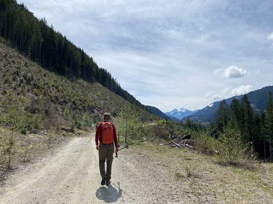
Walking down the main road. Photo by Alex R.
Alex on the road.
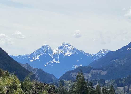
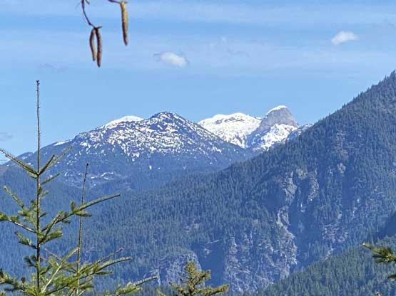
Isolillock Peak and Silver Peak

More about the road walk, for quite a few kilometers…
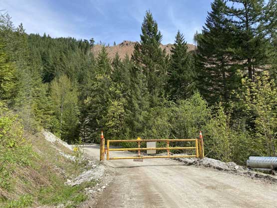
As you can see, the road was gated at only 2 km from the highway.
The round trip time was about 2.5 hours, longer than expected that we definitely didn’t have too much extra time to kill. Alex made some speedy progress down the Fraser Canyon to Hope, and I slept for most of the way back home. I did get back home before work with even extra time to take a shower and cook a (late) lunch.
