Mount Neal
May 8, 2020
2552m
Whistler / Garibaldi Provincial Park, BC
Mt. Neal has some classic characteristics of being in the Coast Mountains – remote, heavily glaciated but non-technical and dome-shaped with multiple sub-summits. The massif boasts Needles Glacier on the west side which joins Weart Glacier at Eureka/Peggy col, and Carter Glacier on the east side which hardly sees any human traffic. The standard approach is a multi-day trek from Wedgemount Lake trail to the west, but ski parties have also ventured into this remote corner of Garibaldi Provincial Park via Blackcomb Peak, Wedge Pass and then around Mt. James Turner. In addition to the remoteness, the presence of bigger mountaineering prizes, namely Wedge NE Arete and Mt. James Turner in the immediate vicinity means Mt. Neal is very much overlooked. This is unfortunate as an ascent of Mt. Neal is definitely worthwhile in its own, and offers some of the coolest scenery the South Coast can offer. The standard route is via a hidden and somewhat exposed snow ramp on the west face but the easiest route goes around the southeast side of the massif and is mostly just a plod, albeit contrived.

Mt. Neal to Ure Peak peak-bagging slam.
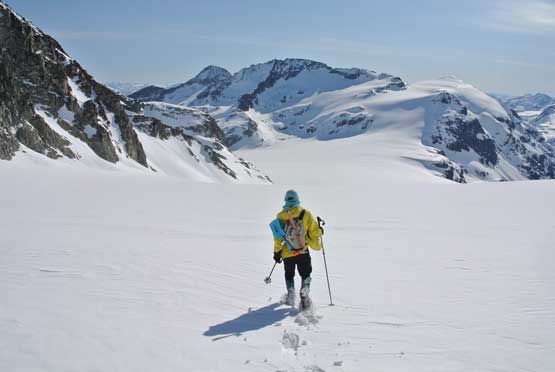
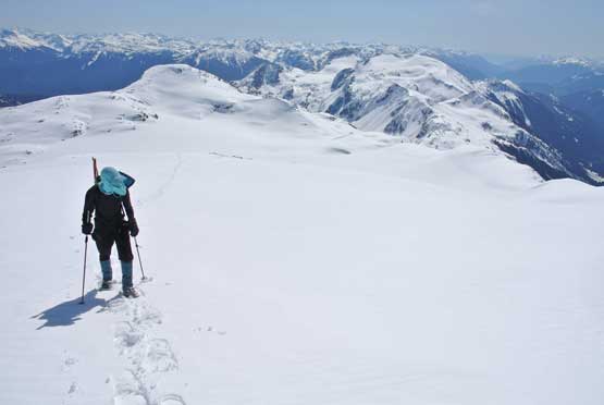
The ideal time is April and May when thick snowpack covers the crevasses of these glaciers. Alex and I camped at Eureka/Peggy col and from there we firstly had to lose about 200 m elevation down Needles Glacier to the broad pass west of Mt. Neal. I had seen some crevasses on this glacier in the summer photos but in spring time the travel was pretty much no-brainer. From the bottom of Needles Glacier we ascended a diagonal traverse on snowshoes on a steep roll (35+ degrees) working our way towards left (north) and then back to the right on gentler slope to the broad shoulder south of Mt. Neal.

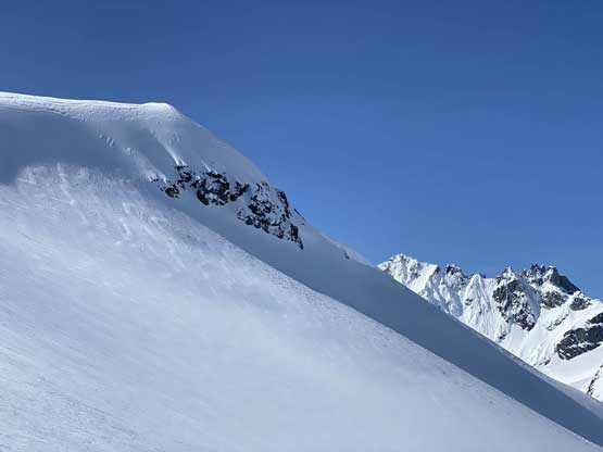
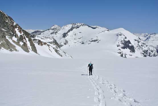
Wedge Mountain and Lesser Wedge from Eureka/Peggy col
Me plodding down Needles Glacier. Photo by Alex R.
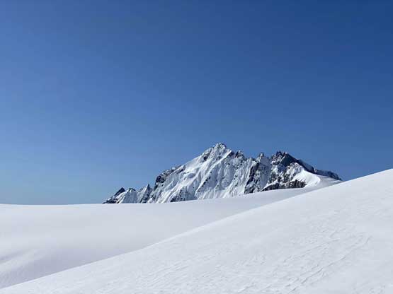
Starting to see the tip of Mt. James Turner.
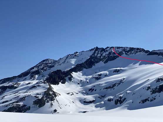
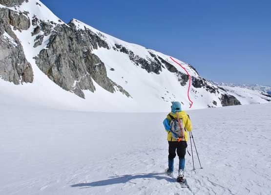
The west face of Mt. Neal and our descent route shown
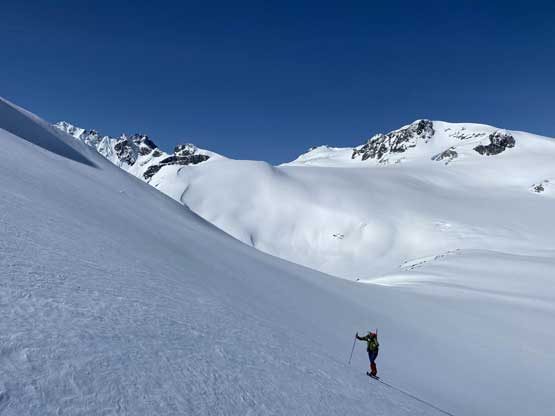
Alex snowshoeing up a steep roll.
The same steep roll on Mt. Neal’s SW flanks.
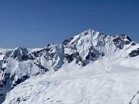
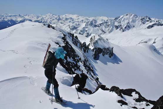
The north face of Mt. James Turner from the south shoulder of Mt. Neal

That pointy peak is “Flood Peak” that Alex and I bagged in 2017
The north face of Mt. James Turner again…
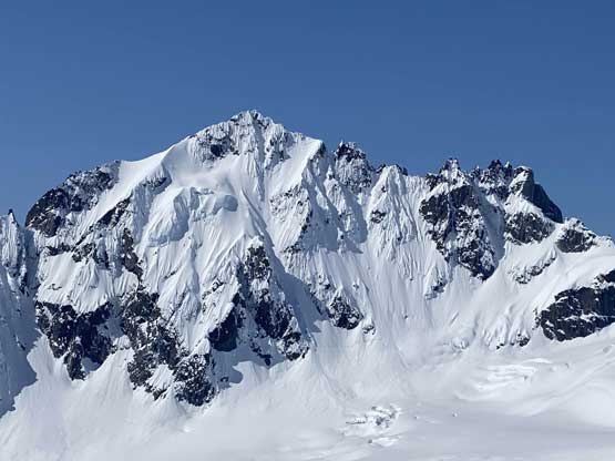
Another closer look at the ruggedness of Mt. James Turner…
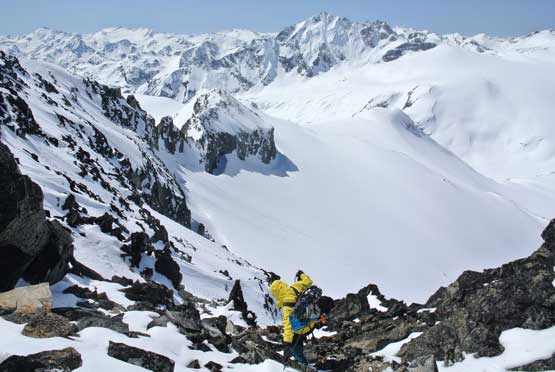
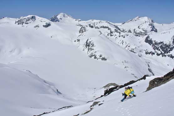
Our plan was to ascend the easiest route on the south-east side of the peak so we dropped a short ways down the uppermost Carter Glacier. The elevation loss required here was more than I thought and after some discussion we decided to ascend a steep chute to short-cut the roundabout. The snow surface was softening up as expected but the condition was still locked down pretty well. I thought we might need to use crampons but the slope turned out to be gentler than appeared. It was probably around 35-40 degrees at the steepest and we didn’t even need to take the snowshoes off. Around the corner to the east side of the summit the rest was just a plod.
Me heading down Carter Glacier with our route ahead shown
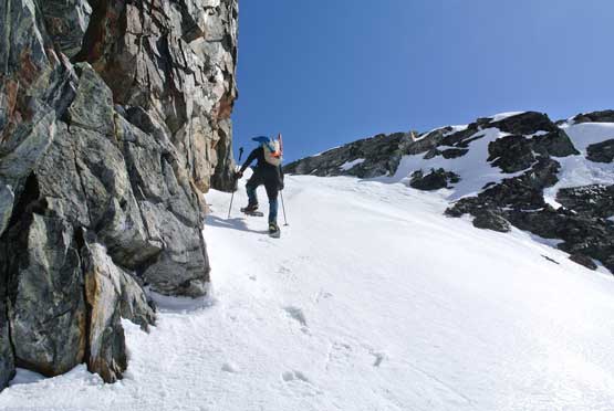
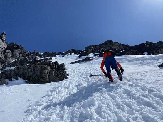
Me snowshoeing up the steep couloir. Photo by Alex R.
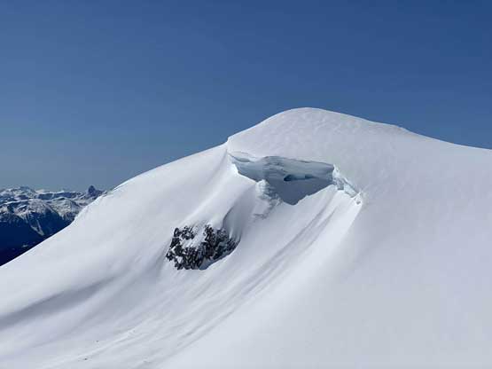
One of the cool cornices on the uppermost Carter Glacier
Alex finishing the couloir short-cut now onto east flanks

The uber remote Chaos Creek valley
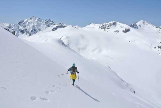
Me snowshoeing up the east slopes of Mt. Neal. Photo by Alex R.
Me approaching the summit of Mt. Neal. Photo by Alex R.

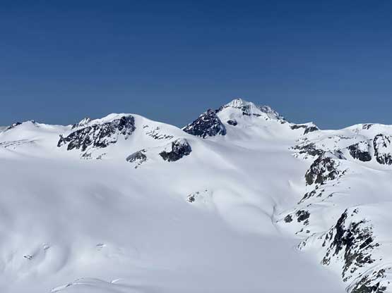
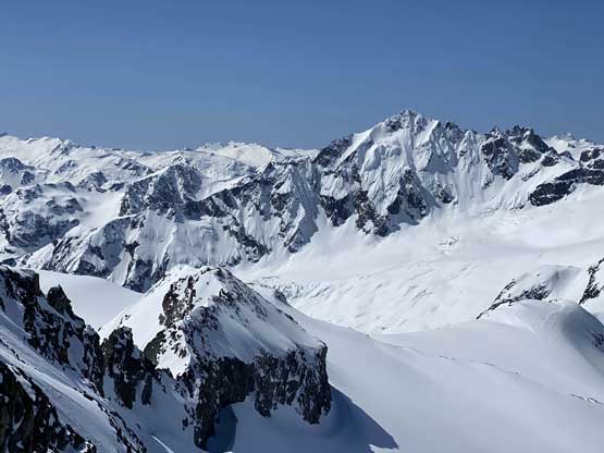
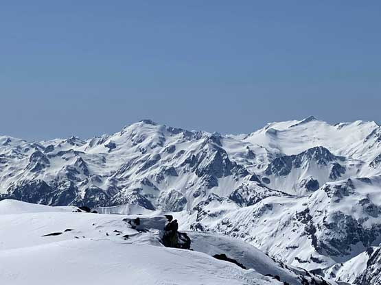
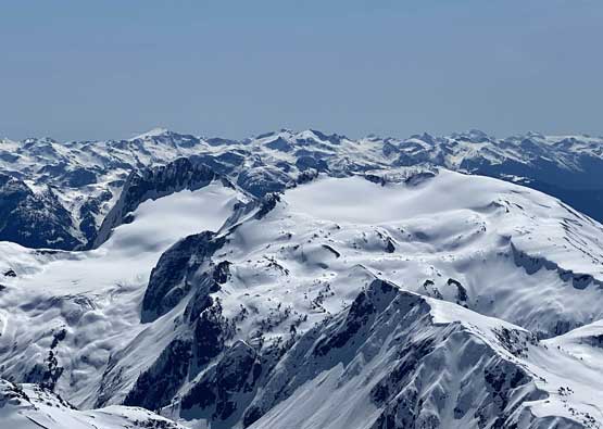
Partial Summit Panorama from Mt. Neal. Click to view large size.

Partial Summit Panorama from Mt. Neal. Click to view large size.
Mt. Weart with Mt. Moe to its right
Wedge Mountain rises behind “Peggy Peak”
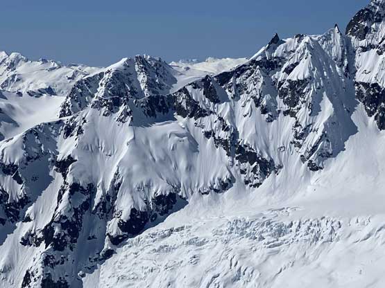
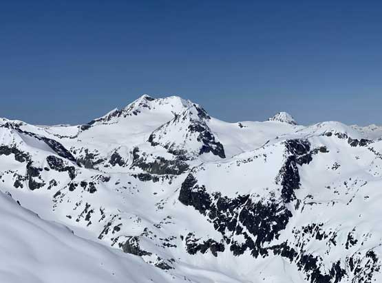
The north face of Mt. James Turner
Nivalis Mountain and Mt. Sir Richard that I climbed in 2017
In the foreground on left is “Gunsight Peak” aka. In-SHUCK-ch Mountain

Mt. Skook Jim and the Stein Divide in the distance

The Joffre Group – Mt. Matier et al. behind Bastion Peak in foreground

Me on the summit of Mt. Neal
The summit was cold and windy so we couldn’t linger too long up there. To further short-cut the route we decided to down-climb the steep west face as the condition was a whole lot better than we thought. The down-climb was a little bit exposed and required some careful footwork. Once at the bottom of the steep ramp we traversed a long ways due south on steep-ish slope to rejoin our uptracks. The traverse was a bit tedious with a breakable crust. For that 35-degree steep roll the condition still held nicely that we just boot-packed down. At the bottom of Needles Glacier we strapped snowshoes on and the next hour was a mind-numbing slog back to camp at Eureka/Peggy col.
Me scrambling down loose rocks on the upper west face

Me down-climbing the upper snowfield of west face
Alex down-climbing the upper snowfield

Alex now traversing into the snow ramp
Me continuing down-climbing. Photo by Alex R.

Alex finishing the snow ramp down-climbing
We still had to traverse a long ways to join our ascent route.
Another photo of Mt. James Turner

Alex on the long traverse. The obvious snow ramp behind
Me plodding back up Needles Glacier. Photo by Alex R.

Alex back at camp…
We had been evaluating the conditions throughout the trip and opted to take an 1-hour break and then go for Eureka Mountain right away in the afternoon. We thought Eureka Mountain might be the most difficult in this trip and wanted to save it for the morning when the snow was firm, but it appeared that the south ridge was almost free of snow already, so why not do the dry scramble when the temperature was warm…
