Boulder Mountain (Tulameen)
September 28, 2021
1516m
Tulameen, BC
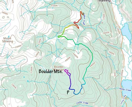
Not to be confused with the “Boulder Mountain” on the Lillooet side of Duffey Lake Road that I ascended in December 2019, this one locates to the NW of Tulameen and is much smaller. The only reason that I would ever notice this highpoint was because of the official status of the name. Earlier in the day Brandon and I had ascended Grasshopper Mountain, Mt. Rabbitt and Mt. Riddell. We had thought about to drive towards Boulder Mountain from the Coquihalla-Tulameen connector FSR system but upon closer examining the maps we realized the roads do not connect. A foray onto Boulder Mountain from the SW side involved bushwhacking into and out of Lockie Creek. The only other option was to drive north from Tulameen and take the road system on the northern and eastern flanks, which is considerably longer but goes much closer to the summit.
By the time we turned onto the aforementioned logging road we realized it’s actually named “Boulder Mountain FSR”. The road condition was rougher than the major Coquihalla-Tulameen FSR that we drove a couple hours earlier, but did not impose any problem to my trusty Taco. There were a lot of confusing junctions and upon arriving at each I would consult with the GPS. The most ideal plan was to drive around the east side of the peak to the south side roads that would go very close to the summit. The drive was pretty much as planned but the last few kilometers were getting rougher and rougher. After crawling across a few deep water bars I eventually had to park one spur road shorter from the road’s end and that put us about 700 horizontal meters from the summit.
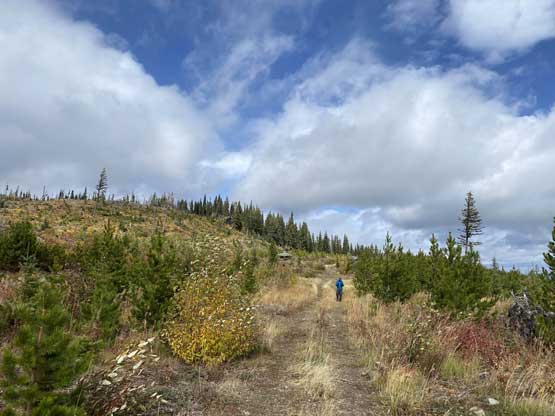
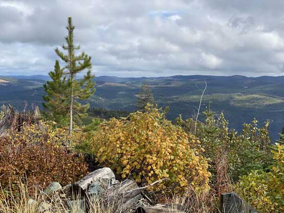
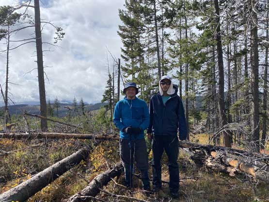
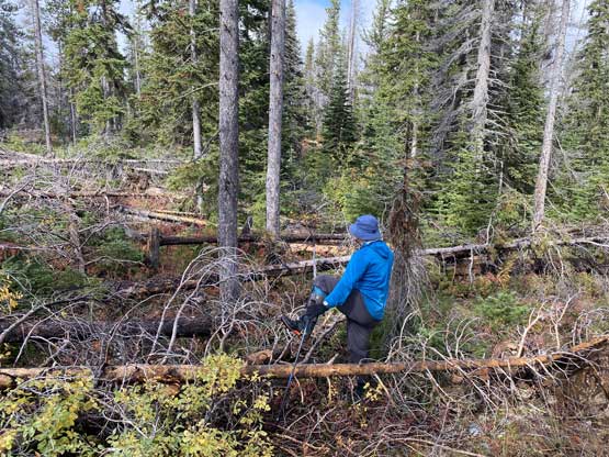
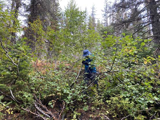
The drive had taken forever but the ascent was shaping up to be another no-brainer one, which both of us were happy about. The weather was also clearing revealing some patches of blue skies. After walking along the deactivated spur to the end we took thrashed a short ways across a cut-block to what we thought was the highest point. We took some victory photos but the map showed the peak was located a few hundred meters to the west. We bashed our ways there across some unpleasant dead-falls fields because we really had no other choice. Once there we were disappointed that the “summit” was definitely lower than the one we were standing on, so this time the map was wrong.


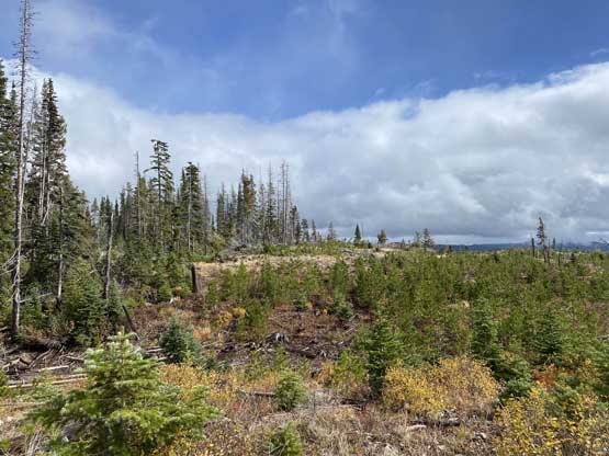


On the descent I led us taking a direct route down towards the highest spur roads and successfully bypassed the dead-fall fields. We then easily walked back to the truck. After a lunch break we carefully drove about halfway down the Boulder Mountain FSR system and took a left turn upon reaching a critical junction as that would put us closer to the summit of Mt. Spearing, the highest peak we bagged in this trip.