Mount Shasta
May 19, 2017
4322m
Mount Shasta, CA
There isn’t much need to introduce Mt. Shasta as this monarch of the northern California is one of the most sought-after peaks in North America. It’s also the second highest Cascade volcano towered only (marginally) by Mt. Rainier to the north. There is no other peak to match the majesty of Mt. Shasta in its close proximity and an ascent should be on every climber’s list on this continent. However, this mountain sits in the relatively dry and hot climate region so despite the height, Mt. Shasta doesn’t boast many glaciers and as a result, the standard route via Avalanche Gulch is technically nothing harder than a snow stroll in spring, or a scree/rubble slog in the summer. With some physical training Mt. Shasta should be within the league for most, if not all who are interested in.
Despite the lack of technical difficulty only one third of the attempts are successful. The challenges come mostly from weather and for a guaranteed summit bid none of the following three should be even remotely possible on all the forecast models – white-outs (clouds), high winds and extreme temperatures. This seems like quite a luxurious requirement considering the isolated 14,000-foot status relatively close to the Pacific Ocean so “timing is everything” still applies. The plan of mine was to join the hordes and ascend Mt. Shasta via Avalanche Gulch, descend via Whitney Glacier, bag Shastina which is the largest subordinate peak and exit via Cascade Gulch/Hidden Valley to make a loop. This would push the trip into the “Alpine II” mountaineering category and adding the very long drive (one full day) I really needed that guaranteed weather window. To further make worth the drive I had to tag Lassen Peak which is the southernmost volcano and then visit Crater Lake on the way back, making it a full 4-day assault.
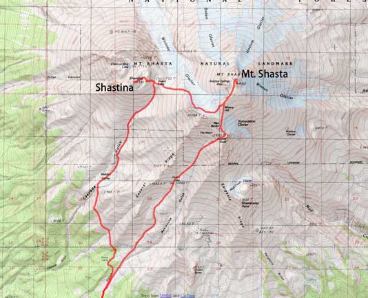
Mt. Shasta and Shastina via A. Gulch and down C. Gulch. GPX DL
After a long season of dreary weather with isolated and brief windows of sunshine, a dominator high pressure ridge finally kicked in towards this May long weekend. The downside was the accompanied high temperature and adding to the recent dump of snow I figured the safest bids would be on the high Cascade volcanoes. The forecasts held nicely and on Thursday morning I started the long drive down I-5. I did not start the day very early and had no issue driving through the urban areas of Seattle and then Portland. I stopped in Medford to grab some food and a dinner and then continued down south into the state of California. The timing was right at sunset when I came to that famous vista point which was a great bonus, and then another hour or two later I was parked on Bunny Flats joining the hordes of party. Thankfully the party stopped soon and I got a reasonably good sleep.
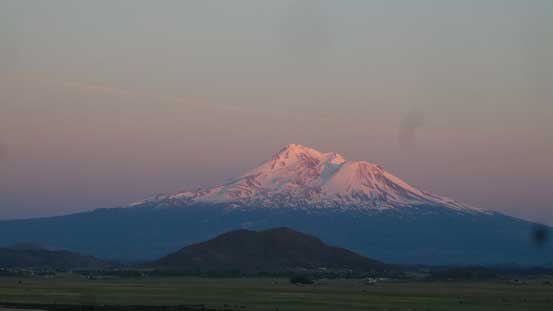
Evening glow on Mt. Shasta from the famed vista point on I-5 southbound

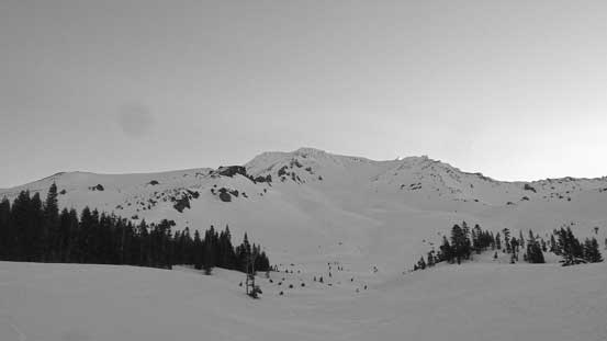
Mt. Shasta and Shastina two days later.
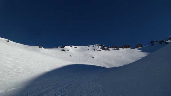
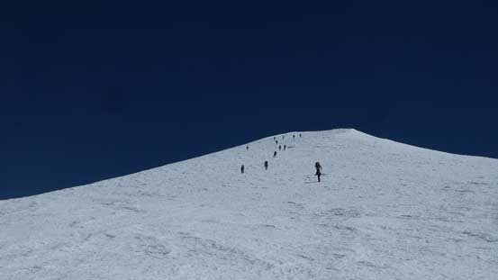
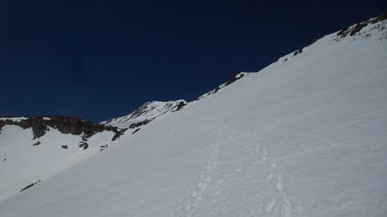
The tradition for these volcanoes is to start at 2 am or even earlier but with experience on alpine snow ascents I figured there’s no point in skipping the valuable hours of sleep. Last year I did get Mt. Rainier in one day without even one minute of sleep but significant pushing-through like that isn’t something I’d like to do again, at least not on a regular basis as for obvious reasons it’s not good for my health. For Mt. Shasta I did not even bother to set an alarm and with the sounds of engine and the brightness of the sky I woke up at around 5:30 am. It was a pain in the ass to sign the permit and I did not start the day until 6:15 am. Plenty of snow so it made no sense to carry the snowshoes. The crampon system would help greatly on the traction and it’s much faster to plod with the ‘shoes on, and before realizing I was already at the start of Avalanche Gulch staring at the long haul ahead. There were a line of climbers ascending into “The Heart” already but a couple hours later I’d pass most, if not all of them.
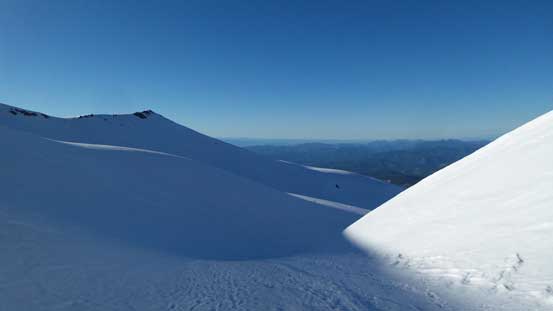
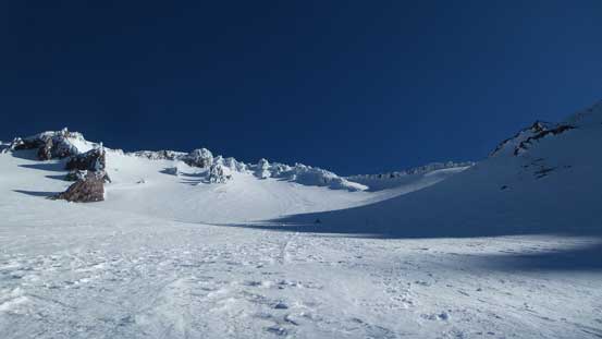
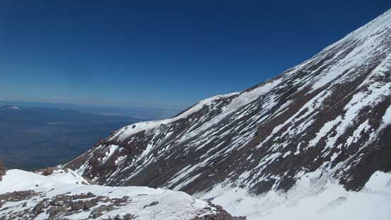
The entire stretch of Avalanche Gulch displayed in front.
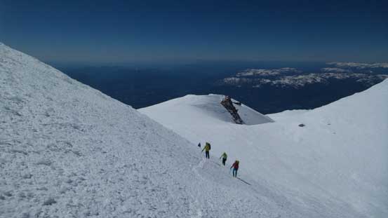
With the view ahead I did no stop and continued onwards towards treeline, and before realizing the Horse Camp was already passed on my left. The route I took stayed in the middle of the gulch so bypassed Horse Camp entirely, and then the grade steepened, so heel-lift on and let the long haul begin. At one point the route curves a bit to the left into the first “bowl” feature and it was here that I did the first stop for some sun protection, and right after that I passed the first group of skiers. Upwards after overcoming another steeper roll I arrived at Lake Helen (the “advanced base camp”) where I passed the second group of skiers. Still not doing any lingering I resumed the ascent upwards into “The Heart”. At about 12,000 feet I passed the 3rd and 4th group of skiers and then it’s the “Red Banks” ahead. The route trends a bit to the climber’s right and it’s just an easy plod to the high shoulder.
Just a matter of putting one foot in front of another.
Ascending onto the first level area in the gulch.

Route ahead. As typical as the slog goes
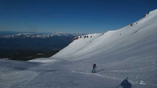
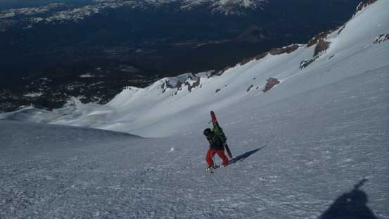
Passing the group of skiers in front one by one.
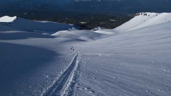
As you can see, the other group was far behind now.
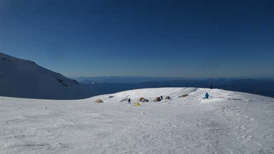
Lake Helen and a whole bunch of tents.
Continuing upwards into “The Heart”
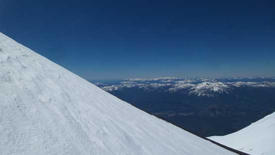
Just a view looking back
The rimed terrain made it look like a Himalayan giant…
Passed the 4th group of skiers now. “Red Banks” not far ahead.

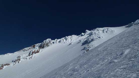
Cresting the top of Avalanche Gulch now. This is looking at Thumb Rock
I did not feel the need to take a break but here had a really good spot sheltered from the wind, so might as well as by this pace I surely hauled too much food up. Before getting too cold I was done with the sandwich so upwards I went again. The next section traversing above Avalanche Gulch’s crest was quite scenic but soon enough I got to see the next stage of slog ahead – the Misery Hill. This part is very aptly named but having about a dozen climbers/skiers lining up in sight ahead certainly helped me on the pace. I set the next goal as to pass most of them and I surely did, and after topping above Misery Hill there were only three of them in front.

This is from the leftwards traverse after topping above Avalanche Gulch
The Misery Hill in front. Would soon pass all but three of them in front.

Some climbers do know how to dress properly for pictures.
Above the Misery Hill now.

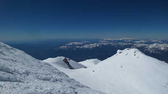
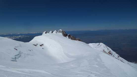
Shastina would be my second objective on this day.
There’s a short section of ridge traverse right after Misery Hill and this was the only section that I would call a bit “windy” although the air was warm so the wind was only served to cool me down from overheating, which was good. The summit block looked steep from afar and I finally did the first gear transition from snowshoes to crampons. I took out the ice axe too as I hauled it up this far anyway but it really wasn’t needed on this day.. The attack was on climber’s left and the final pinnacle was actually tame and easy despite the fearsome looking of it, so after 4 hours 40 minutes from the car I was standing on the summit of Mt. Shasta which is apparently not a bad pace..
Upwards into the uppermost draw
Approaching the summit block.
Partway up the final stretch, looking back down.

The summit block.

Summit of Mt. Shasta, my 2nd 14er after Rainier.
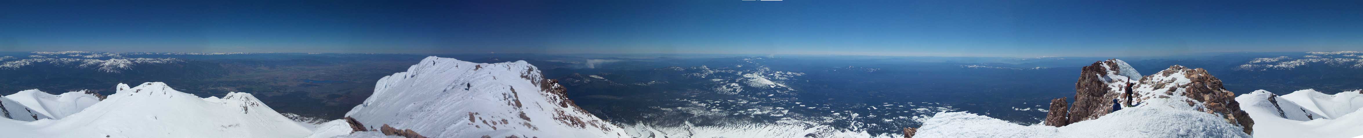
Summit Panorama from Mt. Shasta. Click to view large size.
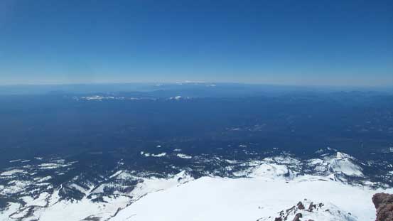
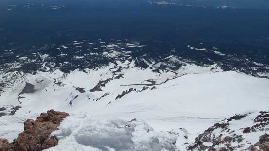
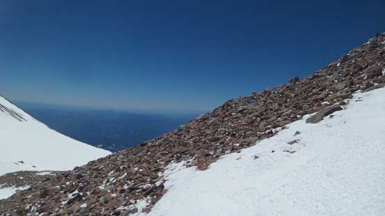
There’s not much to see from these volcanoes.
Everything was below me.
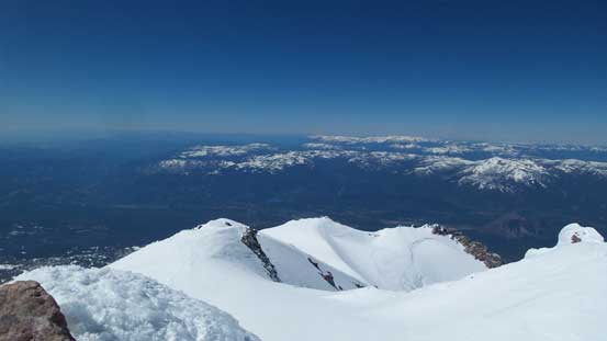
The south side of the volcano

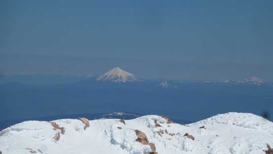
Lassen Peak to the south
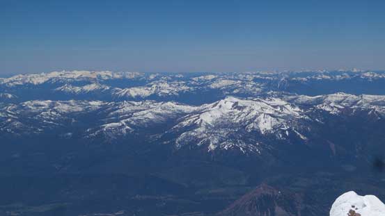
Mt. Eddy et al. just across I-5 on the west side
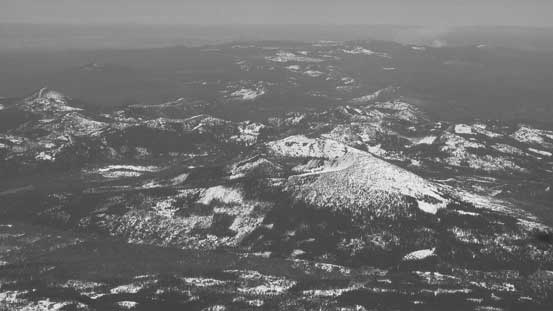
A whole lot of hills that I’m not gonna bother to figure out the names

Another skiers arriving at the summit
Mt. McLoughlin the volcano of southern Oregon
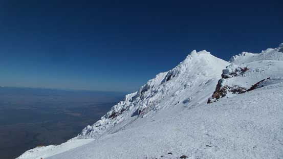
After a quick bite of eat I soon started the descent. It was getting a little bit cold and I did not feel like to dig my jacket out, so had to keep moving. I checked out a false summit too but the views weren’t really worth the extra effort, so then down the mountain I went. I picked up the ditched snowshoes, swapped the ice axe for the ditched pole, and continued down on foot. The descent of Misery Hill was also quite misery thank to the wind-affected snow surfaces, but at least went by fast, and then up and over some rolling terrain I got to stare at the bergschrund on Whitney Glacier. The skier’s right was well bridged but also exposed to bare glacial ice and considering I only had aluminum crampons and was lazy to take the axe out again the better attack would be by a piece of snow bridge in the middle of the crevasse. The bridge was easily crossed but man that crack was deep..
Time to go down.

Descending towards Shastina

Looking back at the summit block

Down the Misery Hill now, looking back
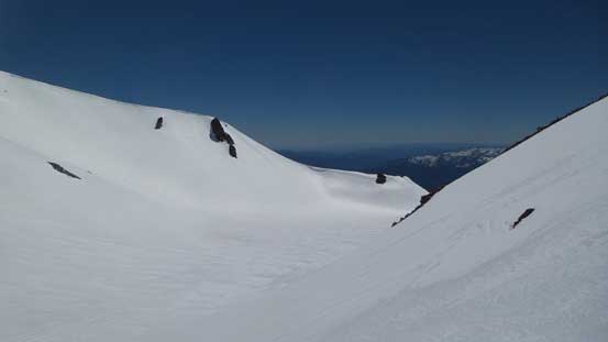
Traversing some undulating terrain towards Whitney Glacier
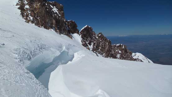
Finding a way to cross this bergschrund on Whitney Glacier

It’s a huge one…

Looking down at the rest of Whitney Glacier descent
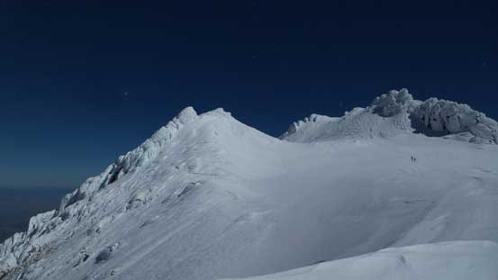
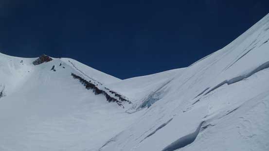
I continued booting down the glacier, skier’s left side. The original plan was to descend a depression zone right by the rock but I could see at least 4 or 5 open crevasses that way, so the safer option was to descend a snow arete which gradually steepened towards the bottom. This section was a no-fall zone so some care had to be taken, and once the arete was over I ascended a small rise to intersect the rock ridge that I’d been paralleling for a while. The next couple hundred meters was another miserable slog down wind-affected snow to Shasta/Shastina col.
Looking back towards the upper section of Whitney Glacier
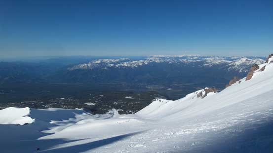
The west side of Mt. Shasta was already free of snow..
Just a view from the long descent to Shasta/Shastina col
At Shasta/Shastina col now
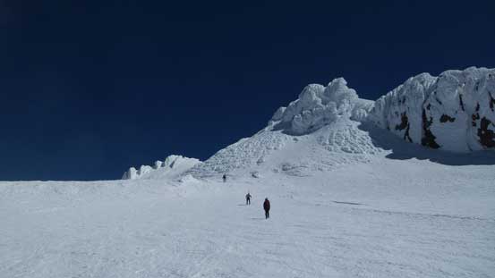
The ascent of Shastina is written is a separate report as it’s a different peak. The views weren’t really that inspiring but this alternate descent down Cascade Gulch is a very interesting variation and got me out of the crowds too. At about 100 m below Shastina/Shasta col I did the second gear transition and removed the crampons. The plunge on foot was very fast and enjoyable on the softening snow and in no time I was down in Hidden Valley. There’s one guy approaching with a heavy pack but other than him I got this entire route to myself.

Descending Cascade Gulch
Down towards Hidden Valley
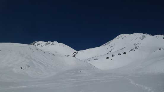
A view looking back at Shastina (L) and Shasta (R) from Hidden Valley
The exit of Hidden Valley was more challenging than I thought and in particular there’s a big slope that must be traversed. Not wanting to start an involuntary glissade I opted to do the 3rd gear transition to strap the crampons on. The ice axe still stayed in my pack as I figured the poles (with snow basket) would offers better balance and support. After a long while I cleared this long diagonal traverse but then there were a few more to come. I continued plunging/post-holing until all the traverses were done which meant I was not far from Horse Camp before doing the last gear transition from crampons to snowshoes. The rest of the descent back to car was easier with the flotation device on as the snow was getting very slushy. There were heavily-overgeared groups going up and they certainly made Mt. Shasta as serious as an Alaskan expedition, but in fact it’s just a moderate day-trip..
Finishing the long traverse exiting Hidden Valley
More traverses to come. This section was complicated
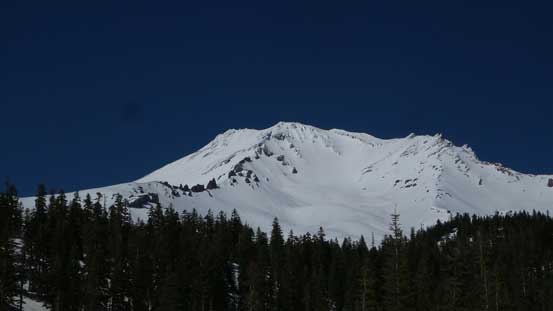
A view of Mt. Shasta from the parking lot. Done!
My round trip time for Shasta/Shastina was just over 9.5 hours on a pretty damn fast pace and pushing it this way is a really good test on what I’m currently capable. This earned me not just extra hours of sleep in the morning, but also a couple hours of rest in the sun to dry my boots out. That also meant I’d have plenty of time driving to Redding, CA to prepare for an ascent of Lassen Peak the following day. After some evening routines I drove out of Redding at about 9:30 pm and got to the parking lot by Devastated Area around 11 pm. As expected there were already hordes partying and the next day would be as busy as usual for an American volcano.
