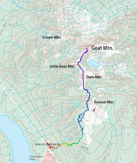
Goat Mountain
December 13, 2016
1401m
North Shore Mountains, BC
It seemed like the arctic air mass would linger for a couple more days but with a high pressure system bringing in a couple days of sunshine I was still keen to get out. Meanwhile avalanche condition had dropped to M/L/L for most regions so I knew I would eventually push for something more interesting. Right in the first day I’d like to go for a smaller ascent, partially because I had to be back home by 3 pm for work, and partially because I wanted to firstly see what others were up for. Some usual last minute planning saw me eyeing on a group of insignificant peaks buried behind the overly-populated Grouse Mountain resort in our local North Shore Mountains.
Goat Mountain is merely just a forested bump in front of the local classic Crown Mountain and sits right beside its standard scramble route. In fact, most folks going for Crown Mountain won’t even bother for that little detour, but in winter conditions Goat Mountain itself does make a worthwhile destination. With a pre-dawn start planned I left home by around midnight, made to the parking lot in less than an hour and caught up a couple hours sleep in my car. My alarm went off at 5 am and within half an hour I had made my way to the trail-head. I had previously done the nearby Grouse Grind more than 6 years ago and this was my first time hiking the BCMC trail.
Ascent route for Dam, Little Goat and Goat Mountain. GPX DL
There are two junctions at the bottom of this trail and both are well signed. For the first one I took the right fork which follows the Baden Powell and then upon arriving at the second junction I turned left heading uphill and that’s the start of the BCMC trail. Hundreds of hikers had helped packing down the trail and adding to the more-than-needed orange markers there’s no route-finding whatsoever. It’s a simple work of putting one foot in front of another, although for a total elevation gain of more than 800 m. The grade significantly eased on the upper 1/3 and the snow had become fairly deep, but with the trench made by hikers there’s no need to don snowshoes yet. And then the next thing I had made to the Grouse Mountain’s upper gondola station (took me about 1.5 hours from the parking lot). The restaurant was open and I spent some time inside, while the outside was still pitch dark.
Ten minutes later I went out again. Donning my 30′ Lightning Ascents I soon started the plod northwards, but the section behind the Grouse Mountain Chalet was downright confusing for someone coming here for the first time in winter. After failing to find the proper snowshoe trail I just aimed for the open terrain in the ski hills, and then took a straight beeline towards the base of the upper Grouse Mountain, and at one point I managed to find some orange diamonds with sign of “SSG”. I remember reading this sign somewhere on the internet but still, it took me a while to guess what the heck that meant. With a well-defined snowshoe track underneath I eventually guessed that “SSG” must mean “SnowShoe Grind”… It seemed like I’d found the correct trail and this led me to what-seemed-like a logging road traversing the left side of Grouse Mountain towards the base of Dam Mountain.
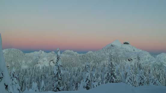
Branching off the logging road from Grouse/Dam col the trail has become very well defined now. This section was as expected, nothing more than just a plod on snowshoes, although a bit foreshortened and took me a bit longer than anticipated. I managed to arrive at the summit of Dam Mountain before sunrise and the horizon had already turned pink. This was perfect for photographing but I still had two more peaks to ascend, so not doing any lingering I soon dropped down the north side. The official snowshoe trail came to an end in no time and then I entered some deep powder, breaking my own trail down towards Dam/Little Goat col.
Near the summit of Dam Mountain
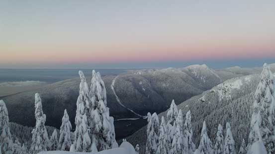
Pink horizon over the skyline of Cypress Provincial Park
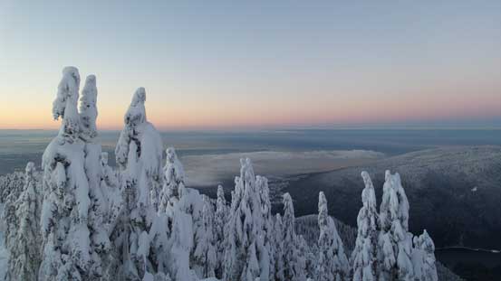
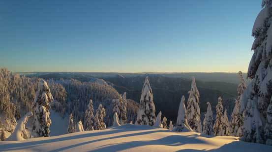
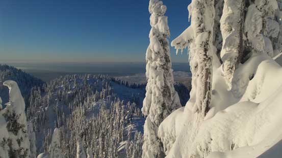
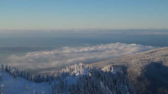
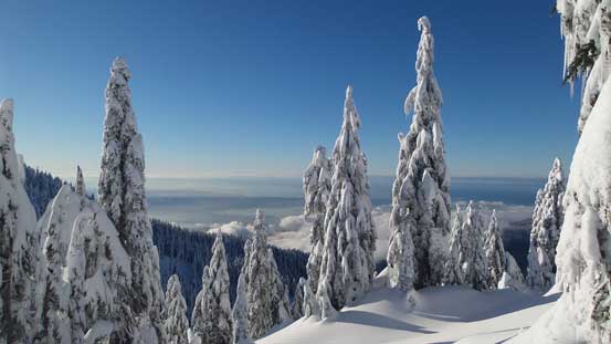
The skyline looking southwards. Burrard Inlet covered by a layer of low clouds
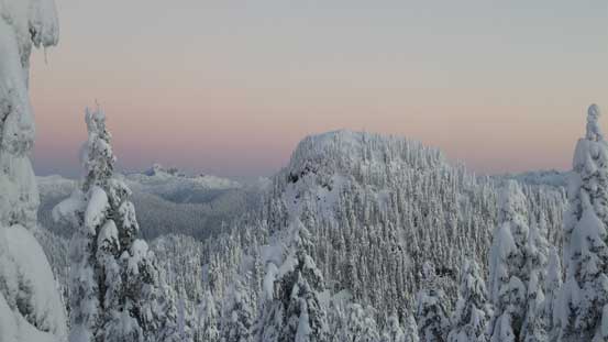
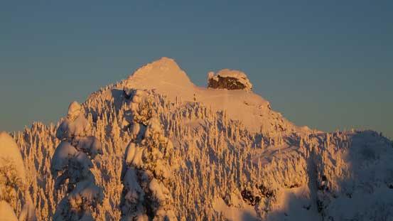
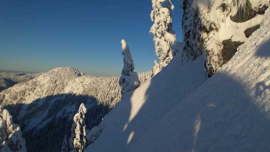
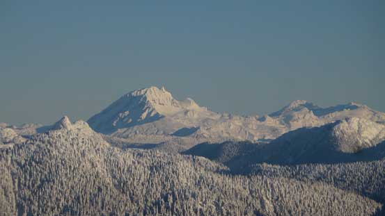
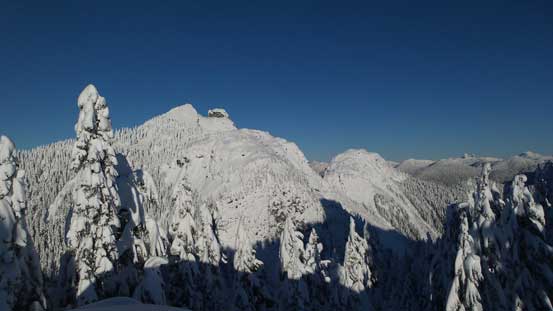
This is my objective – Goat Mountain
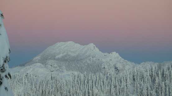
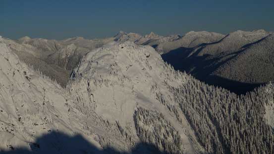
Just before the glow. Crown Mountain dominates the skyline looking northwards
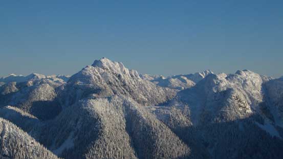
Brunswick Mountain is the highest in the North Shore
Upwards again the trail-breaking wasn’t too bad and it didn’t take me long to reach the summit of Little Goat Mountain, perfectly timed for some incredible alpenglow views and sunrise. And then I followed the broad, forested ridge dropping down the north side into Goat/Little Goat col. The ascent of Goat Mountain from the SW Ridge was a bit more involved than what the topographic map might suggest, with a couple steep sections to deal with. The ridge also narrowed down significantly at one point, followed by a steep rise that I attacked head-on.
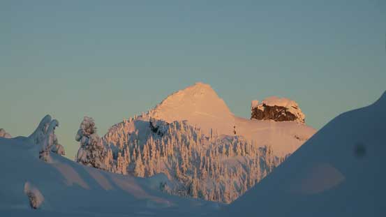
Alpenglow on Crown Mountain and the attached The Camel
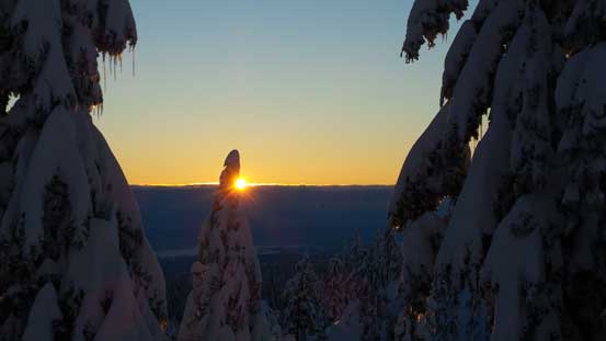
It’s sunrise time!
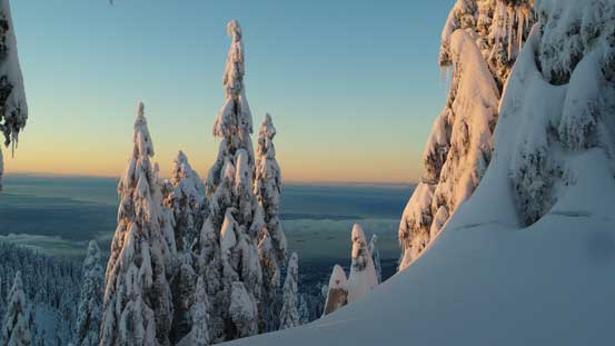
On the summit of Little Goat Mountain, observing some neat morning colours
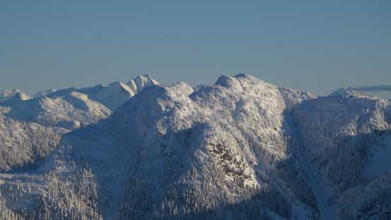
Looking ahead towards Goat Mountain

Another wider view from the summit of Little Goat Mountain
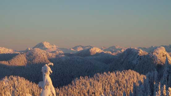
Looking way up north towards Mt. Garibaldi and other peaks in Garibaldi Provincial Park
Another look at Crown/Camel

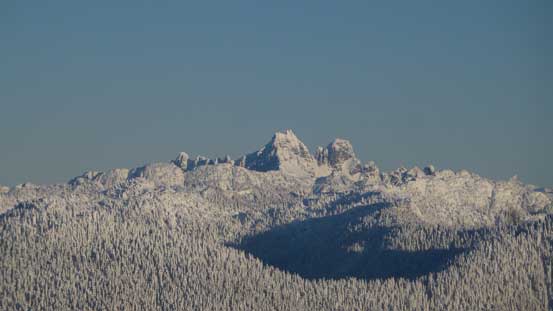
A not-so-usual view of the Lions – West Lion behind and East Lion in front
As I gradually approached the base of the summit block I had to come up with a solution as how to attack it. Apparently the direct finish wouldn’t go thank to the steepness but traversing way over to the climber’s right side would lead me into some increasingly steep forested terrain. I opted for a line somewhat in between, ascending initially more-or-less straight up, picking up a mini-couloir feature (35-40 degrees, attacked on snowshoes), before making a side-hill cut towards climber’s right side. And then I did a couple switchbacks on mellower ground back left and the next thing I was standing on the summit, soaking in amazing views towards all directions.
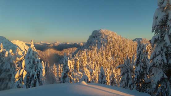
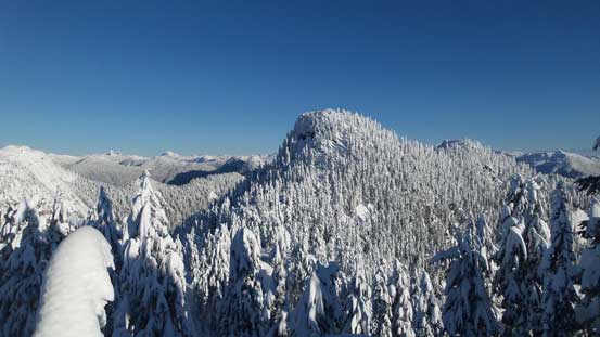
Gorgeous morning view from the ridge leading towards the base of Goat’s summit block
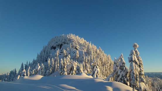
This is the summit block of Goat Mountain
I opted to ascend this gully feature
It gets steep in no time…
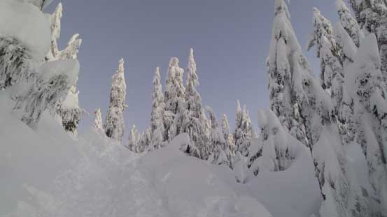
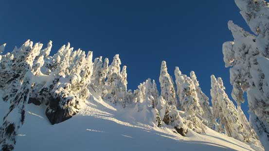
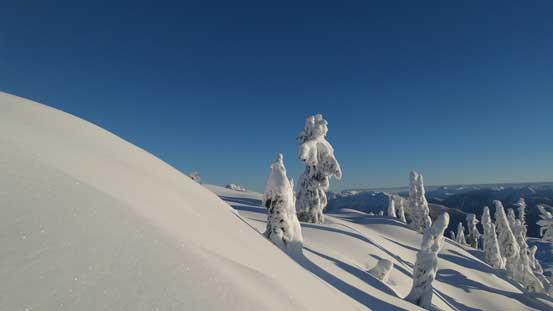
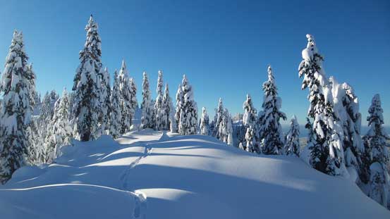
I like the tree sculptures around thank to the frigid temperature
Almost there!
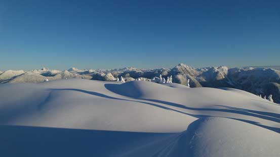
The pristine snowfield on the summit of Goat Mountain

Summit Panorama from Goat Mountain. Click to view large size.
The low clouds lying on Burrard Inlet

Crown Mountain with the classic “Crown Couloir” partially visible
Looking over Godmother Peak (Crown N1) towards the distant giants
Cathedral Mountain looms impressively

The rugged Dione/Tantalus, Serratus and Alpha in Tantalus Range
The trio in Sky Pilot Group – Copilot, Sky Pilot and Ledge
Atwell Peak/Mt. Garibaldi massif

Mamquam Mountain
The tip of Meslilloet Mountain pokes behind the shoulder of Mt. Burwell
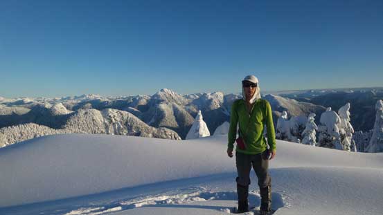
Me on the summit of Goat Mountain
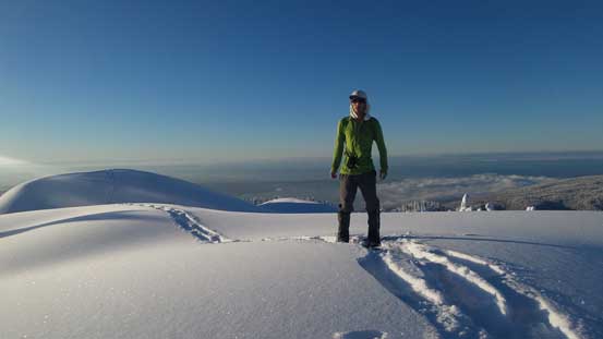
Another picture of me on the summit
I spent about half an hour on the summit taking a well-deserved break, but it was getting cold and I still had the deadline to get back home before 3 pm, so I couldn’t linger too long. Down I went I initially followed my tracks but I wasn’t too keen on descending that couloir on snowshoes. I was also too lazy to spend those extra few minutes switching gears for crampons, so looking around I decided to go down further to the skier’s left and making a long side-hill cut lower down. This proved to be an easier option with only one short stretch of exposed traverse. This route joined my ascent route at just below the couloir, and now all I had to do was just plodding back across that undulating ridge following my tracks. I did two short breaks on the summit of Little Goat Mountain and Dam Mountain, respectively, for more pictures as overall those are considered as separate peaks.

Time to head down. That forested summit behind is Dam Mountain

I took a lower route instead of the gully and this is the traverse that I had to cut across

Looking down at the connecting ridge between Goat and Little Goat

The steep traverse
One last look at Crown Mountain
Plodding back across the forested ridge

Back at the summit of Little Goat Mountain now
Looking back towards Goat Mountain
Back at the summit of Dam Mountain now

Onto the south side of Dam Mountain, aka. the “front country”
Now onto the south side of Dam Mountain it was quite a zoo. It felt like suddenly going back into civilisation after spending a couple hours in the wilderness. Once around Grouse Mountain I tried my best to follow the “SSG” trail but somehow got myself disoriented again near the chalet. After crossing a bridge in a “light show garden” I went too low and ended up below the chalet. The trail kept descending. Not bothering to figure out what actually happened I strapped the ‘shoes on again and bushwhacked a short distance uphill and that dumped me right by the upper gondola station. I went into the chalet and asked around how to obtain a downloading ticket and apparently that only costed 10 bucks. That’s quite cheap and the lining up was non-existing at this time of a day. The gondola ride surely provided a scenic way to finish once again, a great day in the mountains.
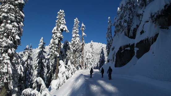
This is that logging road section traversing beside Grouse Mountain
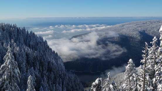
A neat viewpoint along that road
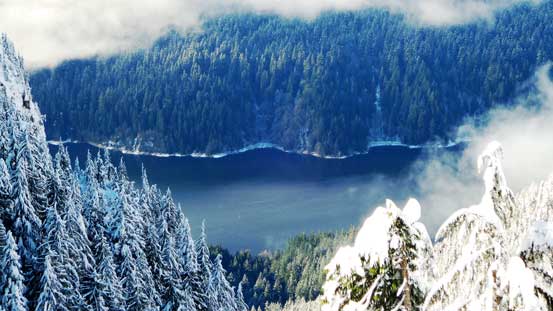
Could see Capilano Lake way down there

A view of the Lions and the HSCT leading towards their base

The fast journey down…
The driving back home through Highway 1 and then Pattulo Bridge was relatively free of traffics and I earned myself an extra hour of sleep before going to work, and I surely appreciated that. Overall I’d say Goat Mountain (plus Dam Mountain and Little Goat Mountain) makes both a decent work-out and a scenic traverse in winter, but the ascent of Goat Mountain is quite steep and should only be attempted in stable conditions (ie. M or L).
