Mount Gordon
April 8, 2012
3203m
Wapta Icefield, BC
This was the primary objective in the Easter long weekend of 2012. I’d never been to the Wapta before and I was keen to give it a visit. We picked a day with gorgeous weather and good stability (moderate/low/low) and it was the time to push things a bit harder. Andrew Nugara’s Snowshoeing in the Canadian Rockies‘ suggesting time is too pessimistic. Considering my mom’s age and the fact I bagged both Mt. Gordon and St. Nicolas Peak, we still finishied in less than 12 hours. If I were going solo I could probably be back in 10 hours. Speaking my first objective, Mt. Gordon is the second highest on the entire Wapta Icefield but is one of the easiest as it’s a mere plod.
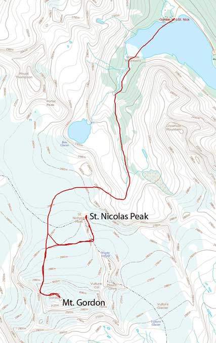
Mt. Gordon and St. Nicolas Peak snowshoe/ski ascent route
The temperature dropped to -21 degrees at the parking lot in the morning and that was even colder than the previous day. It was even harder to get everything started. However, the weather was way much better than the previous day. We had fresh memories of the approach from our Crowfoot Mountain’s ascent. The difference was that we’d go straight into the alpine bowl after exiting the second canyon terrain trap. Towards the end of the alpine bowl we made a right turn and the sun started to show up at this stage! According to Vern Dewit’s trip report, Bow Hut is an energy sucker… So, we didn’t venture into the Hut, instead we continued straight towards the Wapta Icefield.
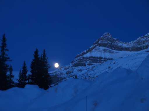
We got a full moon and a crystal clear sky.
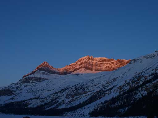
Nice alpenglow on Thompson
Now we were out of the second canyon, and we were on our way towards Bow Hut

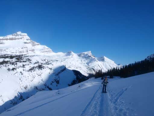
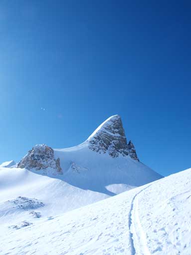
Going towards this alpine bowl. St. Nick is the pointy peak.
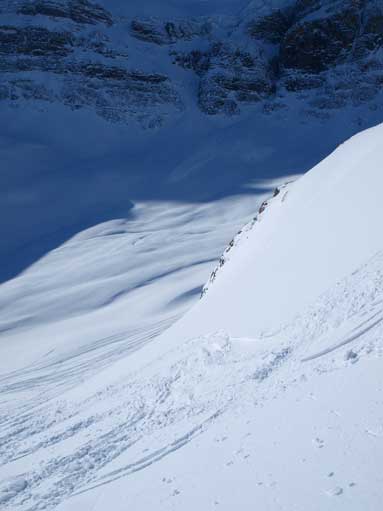
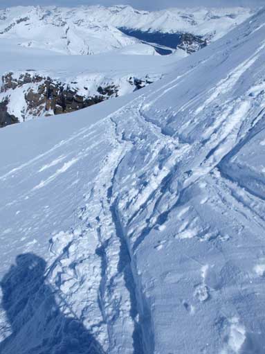
We went climber’s right too early and ended up on this steep slope.
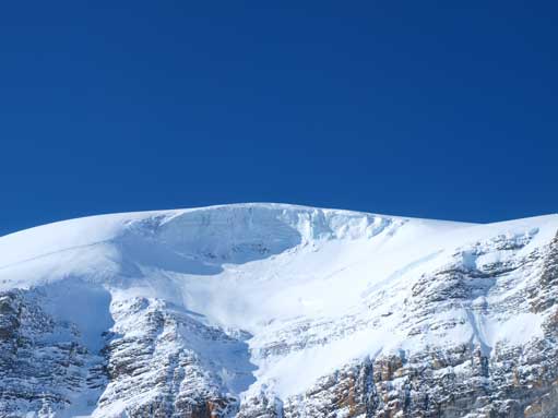
Nice view of Vulture Glacier.
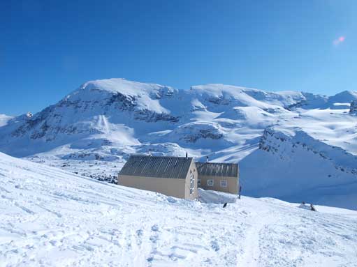
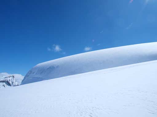
Bow Hut, with Crowfoot Mountain behind. We didn’t go into it.
The ascent was very straightforward, but yet very foreshortened. It took us forever to get up the big hill behind Bow Hut. We slowly worked our way up the glacier below the north face of St. Nicolas Peak, during which we met a group of skiers coming down. Gordon looked to be very close but actually far away. It has 3203 m elevation and St. Nicolas Peak only has elevation of 2970 m. You gonna be higher than all the Wapta mountains except for Balfour (which you won’t see until you’re on the top) when you reach the summit, so don’t be fooled by the foreshortened view. One thing about the Icefield peaks is, they all look much closer than the really are. I like to trust the map rather than my eyes.
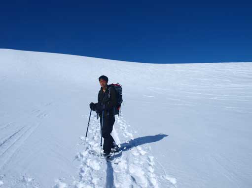
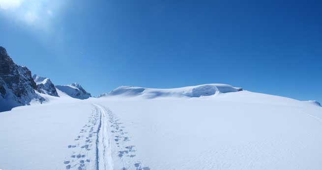
Me on the icefield just about to ascend the head-wall
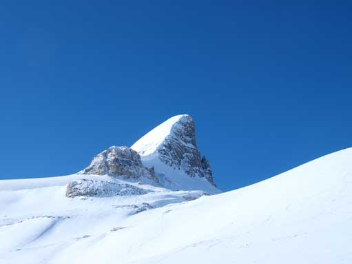
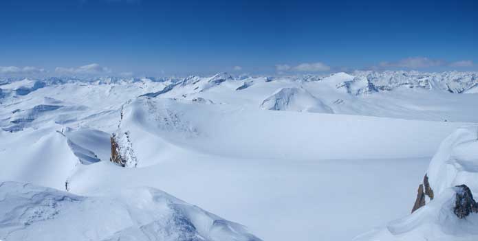
The classic shot of St. Nicolas Peak
More about St. Nick
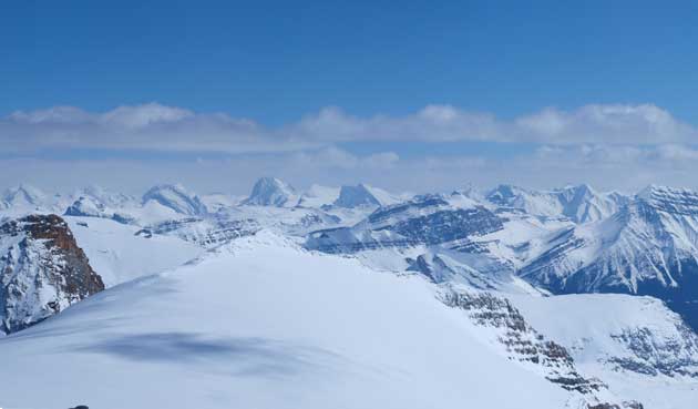
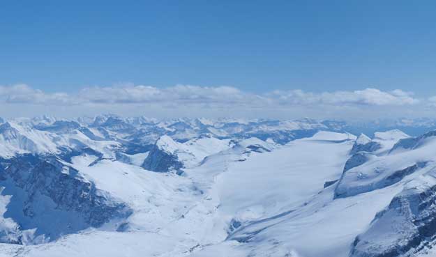
Too bad mom was exhausted after topping out on Wapta Icefield. I slowed down the pace significantly but she still couldn’t catch up. I also saw some clouds starting to form so I needed to be quick. The decision was made that mom would wait for me on the icefield and I’d go tag the summit Mt. Gordon by myself. There was a good set of tracks branching towards the direction I wanted so it was quite easy actually.The summit offers the best view that I’ve ever seen in the Rockies. The wintery condition makes the scenery even better. Take a look at my photos and you gonna have an idea. Bring a map and try to identify as many peaks as you can! I didn’t stay too long on the summit because I was also planing to do St. Nicolas Peak the same day.
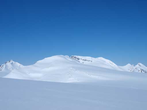
Here is where we got separated. Gordon on right. It looks much closer than it really is.
Rhondda and Habel

Thompson and Portal

Collie and Ayesha

The two peaks of Olive. True summit on right.

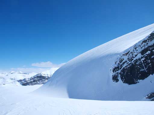
Impressive icefall on Gordon
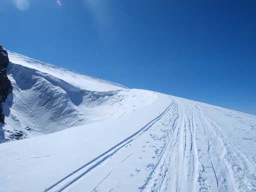
Going up this wind scoop / ramp
This ramp bypasses the icefall that I just saw earlier.

Looking back from this ramp.
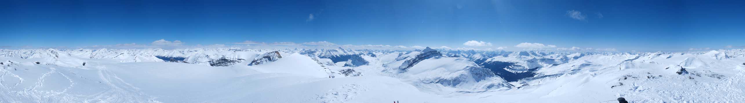
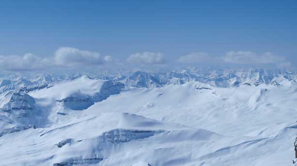
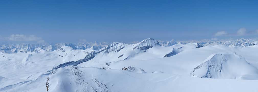
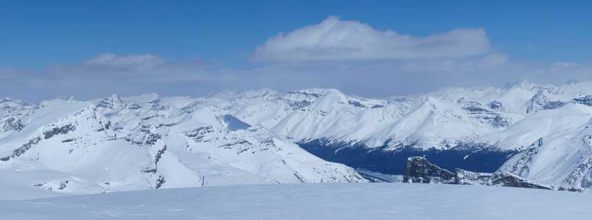
Summit Panorama. Click to view large size.
The view towards west. Wow! Big scenery
Mount Balfour
Mount Hector
Cathedral, Stephen, Vaux
Presidents
McArthur on left
Des Poilus at center
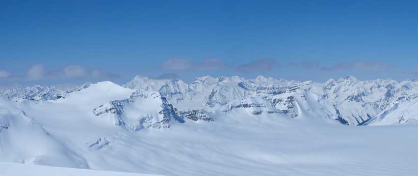
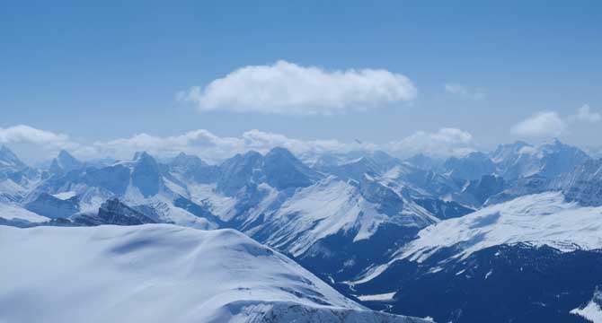
Collie on left, Mummery behind. Freshfield Icefield right of center in the background.

Rhondda/Habel/Baker on left. White Pyramid/Hawse/Chephren at center in background. Patterson on right.
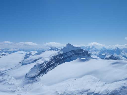
Jimmy Simpson left of center in foreground. Observation Peak at center in background. St. Nicolas Peak on bottom right conner (tiny).
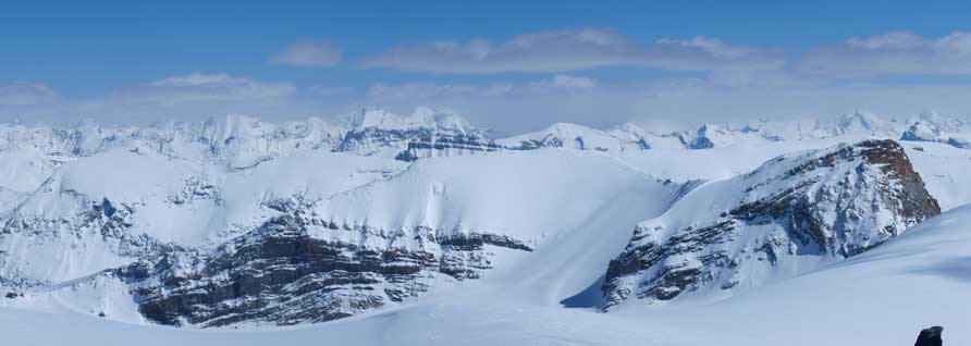
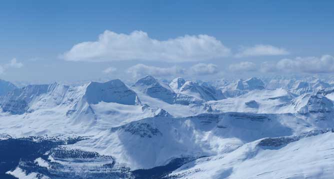
The three peaks of Willingdon in background, left of center. Olive in foreground. Dolomite is also visible.
The big peak is Cataract Peak
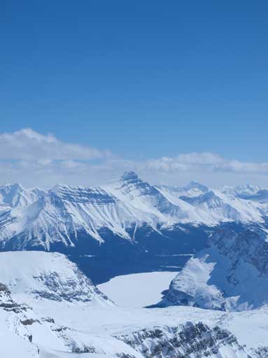
Balfour Glacier on right. Peaks in Skoki/Pipestone area in the background

A self-portrait shot of myself since I was the only one on the summit.
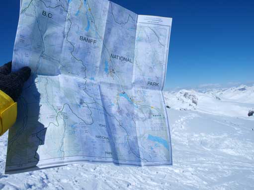
Time to identify peaks!
Descending the steep slope at the top of the ramp/wind scoop
Looking back at Gordon.
Descending this peak was much faster. It would be much much faster if I was on skis though. Anyway, I soon re-joined mom and we regrouped together towards my second objective, St. Nicolas Peak.
