Clinker Peak
March 10, 2019
1992m
Garibaldi Provincial Park, BC
Clinker Peak is the westernmost of the two sub-summits of Mt. Price right next to Garibaldi Lake. This peak has a sharper profile than the taller neighbour and sees considerably less amount of traffic. This is especially true in winter. Most skiers have absolutely no desire to ascend Clinker Peak and those who actually pay the effort to climb Clinker Peak are no doubt the stubborn peak-baggers. The ascent of Clinker Peak from Mt. Price’s standard route is more involved than one might expect with several huge avalanche-prone slopes to traverse across. This was the secondary objective after Mt. Price and not to my surprise this little summit of Clinker Peak didn’t generate enough interest among the group. Tiger and Milan decided to start the long ass hike-out ahead but Mel and I opted to push on.

Mt. Price and Clinker Peak winter route. GPX DL
First of all Mel and I had to ascend the unnamed ridge/bump between Mt. Price and Clinker Peak and that was easy peasy, but soon the adventure began. Once the other (west) side came in view we saw no obvious line down to the unnamed/Clinker col other than a steep snow chute. I thought about doing a roundabout route bypassing the unnamed bump entirely but decided to take the direct line given the L/L/L avalanche forecast. The chute was awkward to descend on snowshoes. Once below the constraint I went for a long and steep side-hill traverse over to the col. This traverse crossed variable snow surfaces from knee-deep powder to icy crust and required expert snowshoeing experiences. Mel simply took the snowshoes off and went for a bootpack, slower but safer.
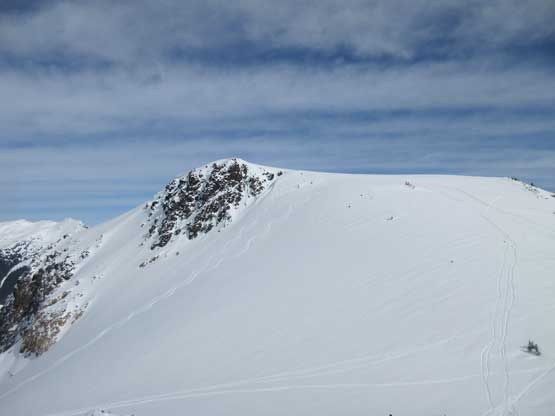
Looking back towards Mt. Price from the unnamed ridge
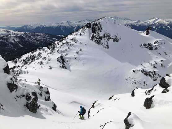
Me starting down the steep chute. Clinker Peak behind. Photo by Mel O.

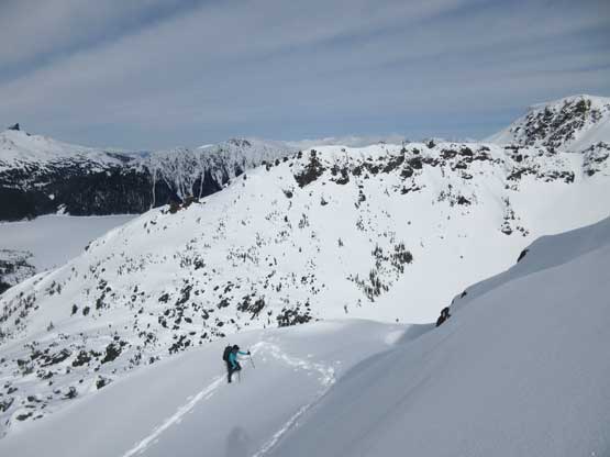
Mel boot-pack traversing the steep slope under that unnamed ridge

Another photo of Mel traversing to show the scale of this terrain
As you can see the slope was icy at places…
From the bottom of the unnamed/Clinker col there seemed to have several route options. My original plan was to attack the south, wooded ridge but decided against that. The ridge looked no fun at all. After evaluating the situation I decided to cut another long, but not-so-steep traverse to intersect the north ridge of Clinker Peak and this worked out well. The post-holing was reasonable and the route certainly ascends more variable terrain than the south ridge. We had to ascend several steep rolls but soon enough we reached the summit.

Starting up Clinker Peak now, looking at The Table
Virgin snow on the north slopes of Clinker Peak
Mel making her way up Clinker Peak
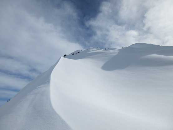
Mel almost arriving at the summit
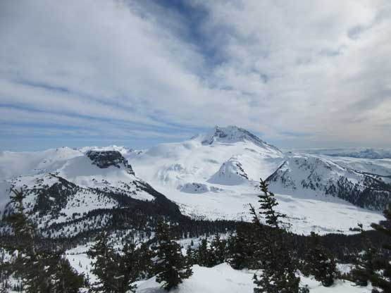
Mt. Garibaldi and The Table

A closer look at The Table
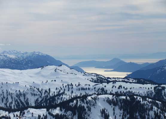
Howe Sound behind part of Brohm Ridge
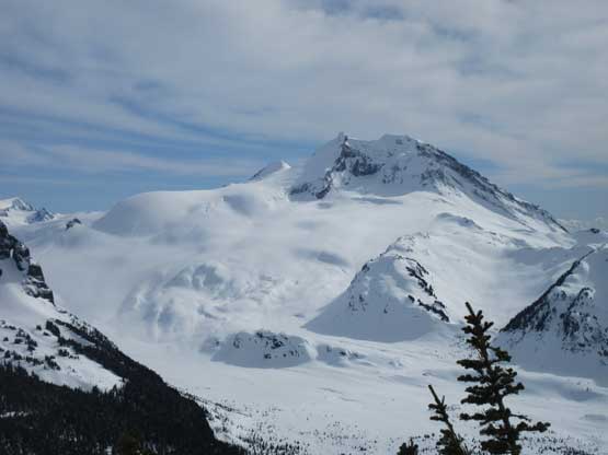
A closer look at Mt. Garibaldi

The Black Tusk and part of Garibaldi Lake
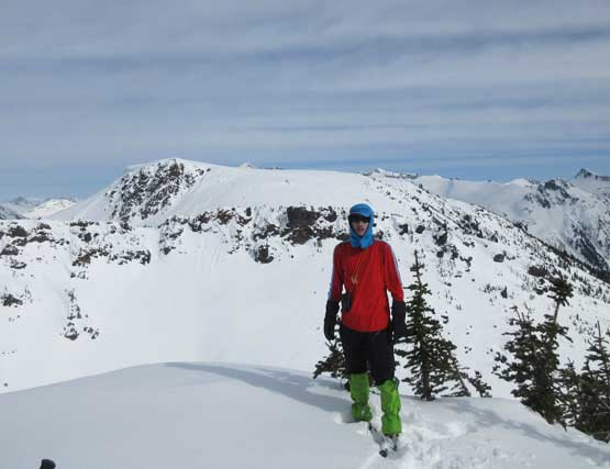
Me on the summit of Clinker Peak
Knowing that Tiger and Milan were far ahead of us on the descent Mel and I didn’t linger any longer than necessary. After consulting with the Gaia GPS map I made the call to descend the NW Ridge all the way to treeline before making a side-hill traverse to rejoin our tracks on Mt. Price. The main reason was to avoid re-ascending that steep and awkward slope to get back onto the unnamed peak. Descending the NW Ridge was not as easy as I thought and we had to make constant route-finding decisions. The traverse to get back onto Mt. Price’s NW ridge involved crossing a long stretch of steep slopes and once there we had to plunge down another steep slope to rejoin the tracks. The rest of the descent to, and across Garibaldi Lake was uneventful. We utilized soft powder for as much as possible.

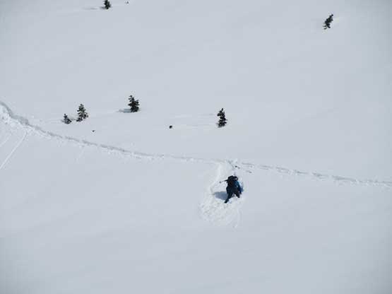
Me plunging down the NW Ridge of Clinker Peak. Photo by Mel O.
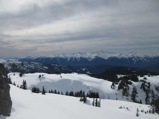
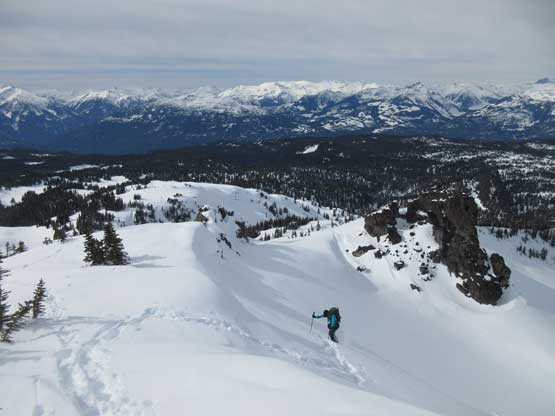
High clouds rolling in from the west. This is looking at Tantalus Range

Mel having lots of fun on the snow

This was about the place where we started traversing back towards Mt. Price’s route

Down to the lake now. Looking back at Mt. Price’s winter route

Just have to take a shot of the classic Garibaldi Lake view

It’s a long way back. Trust me… It’s brutal…
Once back to the main Garibaldi Lake trail we spent another lengthy break swapping footwear from snowshoes/boots to trail-runners. Thankfully nobody stole our stashed shoes. In the morning we were too lazy to ditch them elsewhere but rather dumped them right beside the trail. Once the footwear was swapped we started the trail running mode maintaining an average speed of over 6 km per hour. We caught up with Milan and Tiger at the switchbacks beneath “6 km Junction”. The last several switchbacks were down-sloping, exposed and very icy that I ended up having to borrow one microspike from Mel. I did bring my own microspikes but those were buried in the bottom of my backpack and I was certainly too lazy to dig them out. Mel and I had no issue descending the rest with just one microspike. Needless to say the long plod back across this trail and the Rubble Creek road was boring and tedious as fuck.
Our round trip time was just over 10 hours covering 33 km distance and 1800 m elevation gain and my legs were sore even two days after the trip. It’s been a while since I pushed for such a long horizontal trip. Overall I would recommend Mt. Price to winter enthusiasts but be mentally and physically prepared for a long ass day.
