Chief Mountain (GNP, MT)
August 18, 2015
2768m
Glacier National Park, MT
Over the past 4 years of exploring and peak-bagging in the Canadian Rockies I’ve pretty much visited all the major easy-to-access areas, with one exception to the far south and that’s Glacier National Park (GNP), Montana. Despite the fact it’s in the United States, this is still part of the Canadian Rockies speaking geologically. Indeed, the landscape in GNP, MT is very similar to the nearby Waterton Lakes but with taller and more spectacular peaks. With some sunshine in the forecast towards the middle of this week Mike and I finally decided to make a visit to GNP, MT.
Tuesday saw some mixed weather forecast and a short scramble up Chief Mountain was in order for an introductory. Although not nearly the highest in its vicinity, Chief Mountain is a truly recognizable and unique peak standing out from the surroundings (similar to Devil’s Head for those familiar with the Ghost area). There’re numerous approach and ascent routes for this objective and the one we chose was via Humble Oil road from the north – the easiest and shortest way. Ironically the entire trip with the exception of the summit was actually in the Blackfeet Tribe land thus outside the park. To legally hike in the Tribe’s land one has to obtain a permit that’s 10 dollars per person (useable for 1 year).
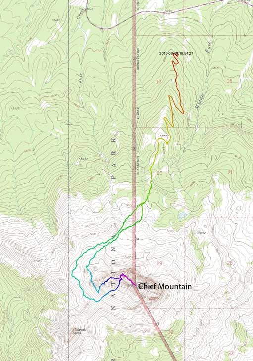
Chief Mountain scramble route from the North side. GPX DL
As we drove down to St. Mary in the morning the weather was much worse than anticipated. A quick check for weather updates reviewed not much good news as the day was downgraded to mostly overcast with chances of rain, but with the hope of a clearing trend towards late afternoon. We made the decision to set up camp first before making an attempt so drove up and over Logan Pass along Going-to-the-Sun Highway all the way to West Glacier (the St. Mary’s campsite was full so we had to book the one on the far side). Despite the cloudy sky the drive was still scenic, but the traffic was horrible and the whole process took us more than 2 hours. By the time we got back to St. Mary it’s already passing 2 pm. A quick grab for the permit then up the steep and rough Humble Oil Road which branches off the Chief Mountain Road we didn’t start the trek until 3:30 pm and that’s a very un-alpine start…

Chief Mountain seen from the highway
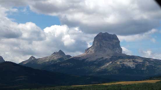
Another view of Chief Mountain from the highway.
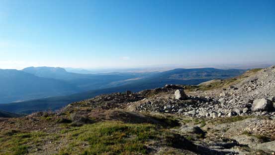
Thankfully this rough road did bring us up high to almost treeline making Chief Mountain a mere half-day outing. The weather was also as predicted, clearing up and our mood was high. From the large clearing area we hiked up the remaining 100 meters or so of this road (would require 4×4 and high clearance) to the official start of this trail. The trail was not signed but easy to follow as we slowly worked our way through the scrubby forest and into the alpine.
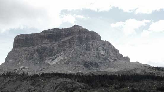
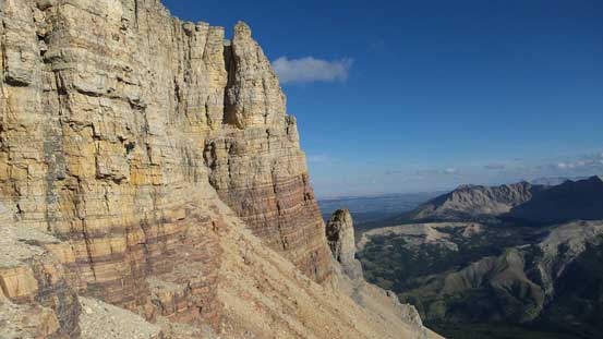
The impressive N. Face of Chief Mountain

Mike working his way up
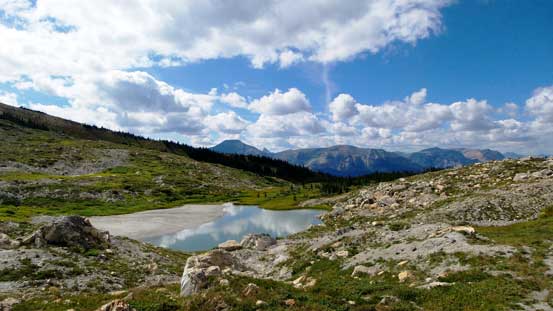
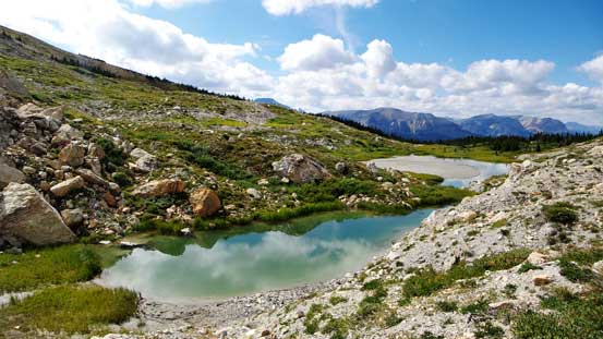
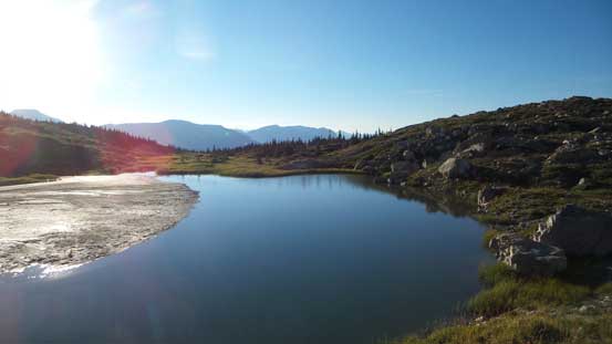
A beautiful tarn at just above treeline
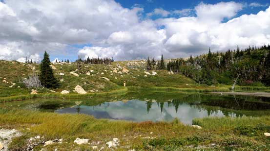
Another tarn
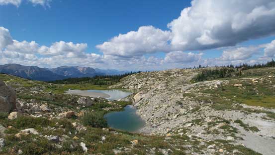
One more tarn
Looking back at the first two tarns
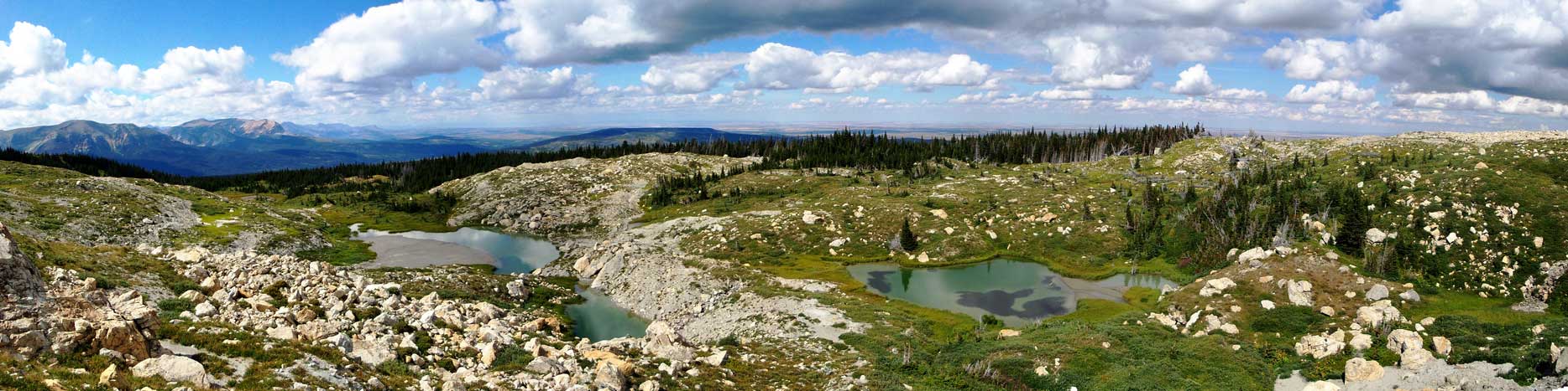
Panorama from this pristine area. Click to view large size.
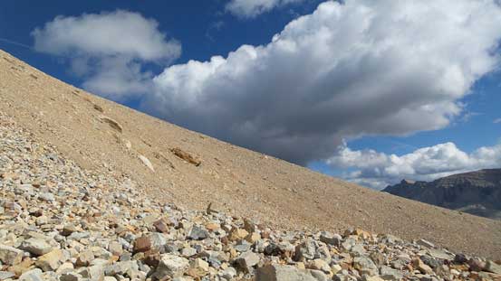
The rectangular face of Chief Mountain’s north face was super impressive from our approach. That’s great for the views but that also meant we’d have to circumvent this peak for 180 degrees to the more-broken SW slopes. This process involved some rather tedious scree bashing and boulder hoping. We tried to follow a trail/path but it’s intermittent and easy to lose. Eventually we just picked our own route up through a few boulder fields (very loose), over a notch-like terrain feature and onto the SW Face.

Beautiful afternoon
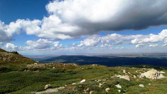
The broad meadows at above treeline. Travelling would soon get tedious
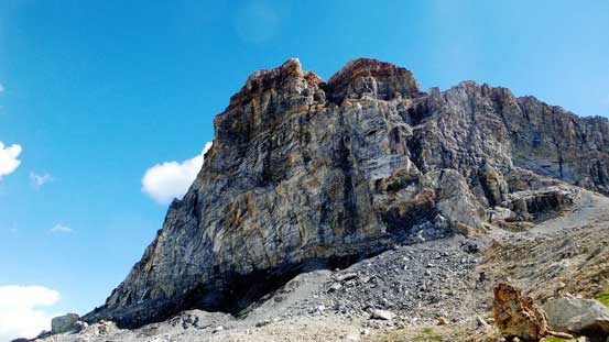
Beneath the N. Face of our objective
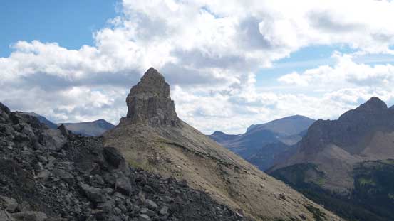
This peak is officially known as Ninaki, but I’ve also seen the name of “Squaw Mountain”
Up and over a notch, there’s a lot of unstable boulders around

Mike working his way through this boulder field
Onto the SW Face. Oh the treadmill scree…..
From here we ascended some treadmill scree up the slopes towards the distant “notch” described in Sonny Bou’s trip report. The scree was horrible to ascend and we ended up using some solid(ish) rock ribs on climber’s left, ascended a fairly long ways before doing a horizontal side-hilling traverse to get back on route. We picked up a path of well-travelled scree path and it led us through that “notch” with no route-finding issue. From here on there were abundance of cairns leading us more-or-less up the Ridge on climber’s left with some detours to the left, and soon we stood on the false summit.
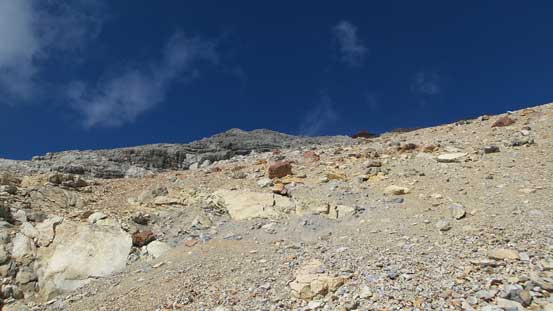
Looking up the treadmill scree
Mike slogging up…

At least the views were improving
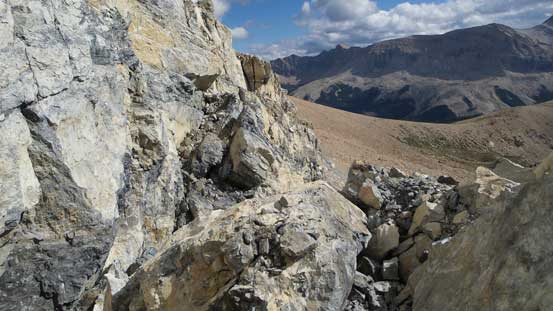
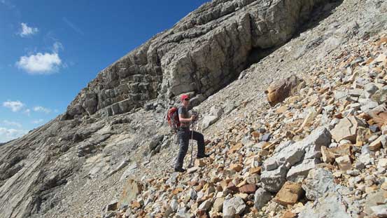
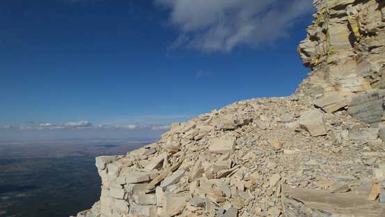
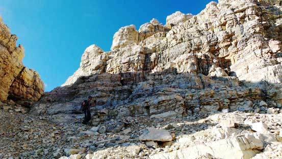
The cliffs on the upper mountain that we had to work our way through

Mike stopping to take a picture of the cliffs
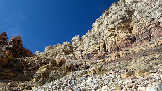
The break is on climber’s left side

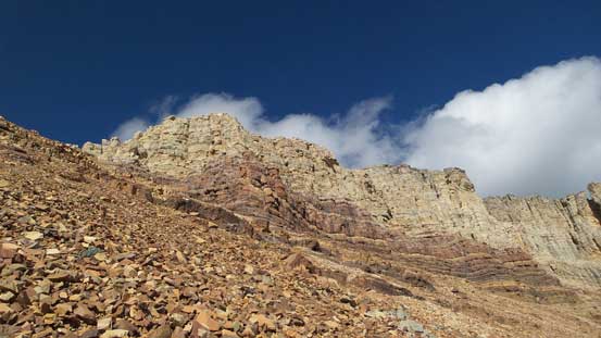
The cliffs guarding the summit block
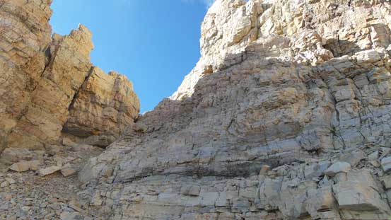
A critical notch to access the scramble route
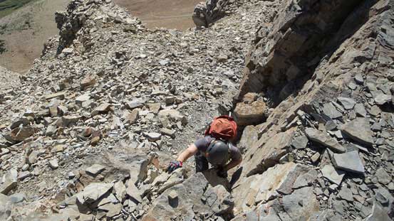
Mike scrambling up the notch
Another notch behind Mike
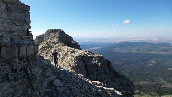
Around a corner
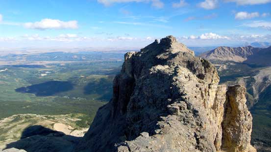
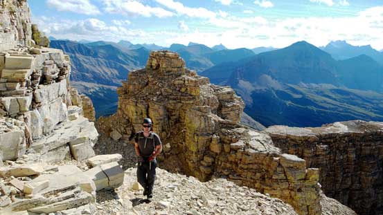
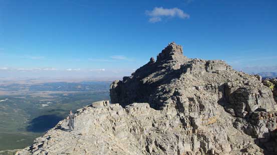
And now we were on the false summit, looking towards the true one
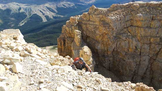
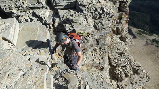
The traverse to the true summit was scenic but does involve two trickier notches. The first one was the crux in my mind and required a rather awkward down-climb especially for folks without long legs.. The second notch was relatively straightforward but loose so caution was still required. And on the summit block there’s one short rock band to scramble through which was again, Class 3 scrambling in my mind.
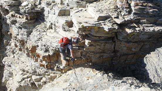
Mike negotiating a tricky notch
Traversing towards the true summit

True summit ahead
Mike scrambling through the final cliff band

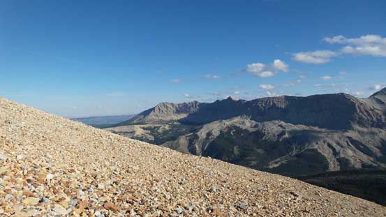
Summit Panorama. Click to view large size.
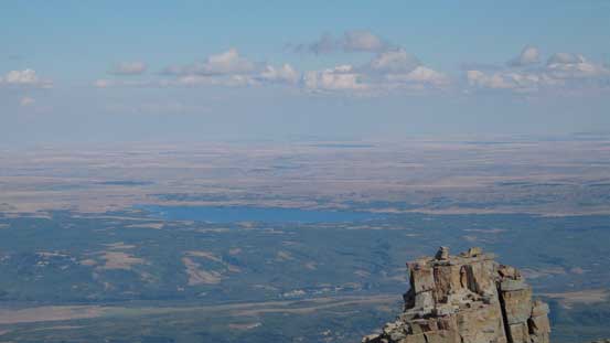
Oh the exciting prairie…
Looking south towards Sherburne Peak
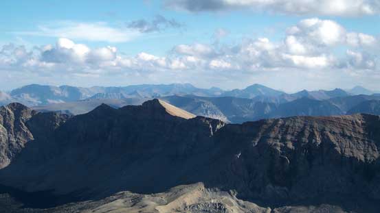
Looking over the summit of Yellow Mountain

These peaks are probably Divide Mountain and Curly Bear Mountain

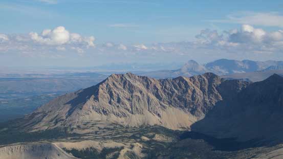
Mt. Merritt one of the 6 10,000ers in GNP, MT
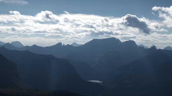
Mt. Cleveland the highest in GNP, MT
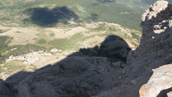
The shadow of Chief Mountain looking down the steep N. Face
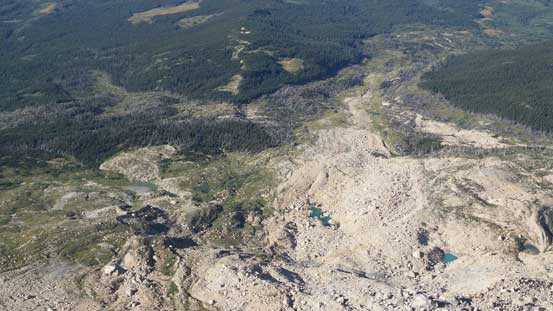
Looking straight down to the rock slide area
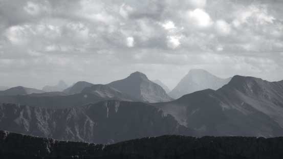
The big peak way in the distance is Mt. Jackson – another 10,000er
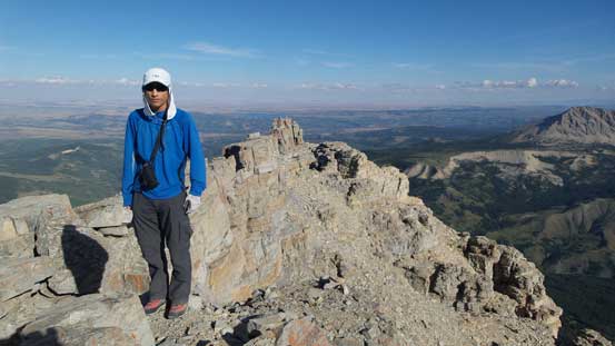
Me on the summit of Chief Mountain
It took us 2.5 hours to ascend but due to the lateness of the day we didn’t linger any longer than necessary before starting the descent. For the scrambling section we reversed our footprints and it went by easily. Lower down onto the SW slopes we picked the scree path and easily skied and surfed straight down to the saddle between Chief and Squaw Mountains. We knew this would give us some elevation regain while circumventing our objective back across but we were hoping for less boulder hopping by traversing at treeline. Our plan worked pretty much as expected. And once rejoining the trail we had no further issue to get back to the car.
A review shot of the summit ridge traverse
Mike coming up the crux notch
Scrambling down the typical Class 3 terrain
I like the colours on this mountain
Down the last notch

And time for a long scree run!!

Mike and Chief’s cliffs
Down the scree. Yellow Mountain behind

Looking back at the cliffs

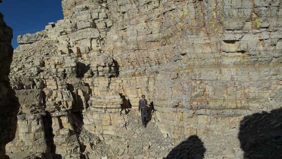
Traversing on this grassy bench
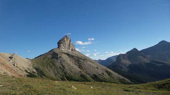
Squaw Mountain looks fairly intimidating from all angles
The grassy bench traverse. We had to contour around for quite a ways

Our objective looming above

The prairie in the distance
Back to those tarns

Very glad to have a trail/path through this section of the bush…
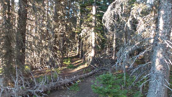
Lower down in the forest
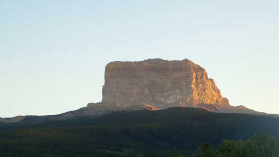
Evening glow on Chief Mountain
Our round trip time was 4.5 hours which was a bit faster than expected. We still had some daylight time to drive down the Humble Oil Road and then to St. Mary before it’s getting pitch dark. Due to the concern with the traffic (and the road construction) we chose to drive all the way around Glacier National Park along Highways 89, 49 and finally 2 and that took us roughly 1.5 hours. Overall I’d recommend Chief Mountain for folks looking for a short day. Our route is definitely the way to go. The permit can be obtained on the same day as your trip so that’s rather logically easy.
