Mount Henry
June 23, 2013
2629m
Jasper, AB
Not to be confused with Mt. Henry McLeod on the Brazeau Icefield, Mount Henry is located in Victoria Cross Range, on the north bank of Miette River Valley, northwest of Jasper townsite. Eric, Ben and I did it as the last summit of our Victoria Cross Range Traverse.

Pyramid to Cairngorm to Kerr to Henry traverse route. GPX DL
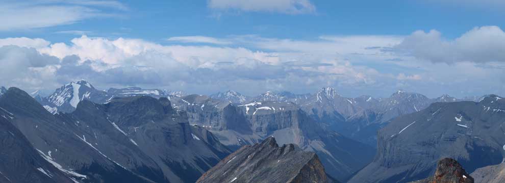
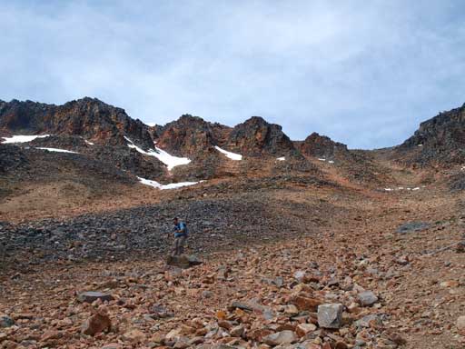
From the summit of Mount Kerr, we started the search for an alternate descent line that could bring us closer to Mount Henry. The west slope looked to be not too bad and we just picked it down. We also tried to maintain elevation and cut south to see if we could bypass the obvious rockwall that we saw earlier in this day. The boulders immediately down from the summit was loose and crappy. We had to be extra carefully with each footing. And thankfully, the rock band no longer exists on this side of the mountain, and after bypassing it we made to call of slogging back to ridge crest (south ridge), and followed it over another smaller bump, down a whole lot more boulders to Kerr/Henry col.
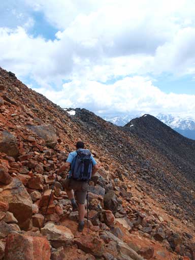
Eric side-hilling on loose terrain

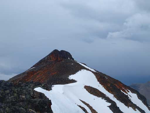
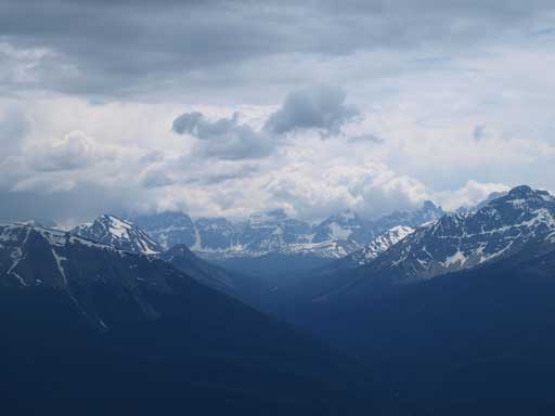
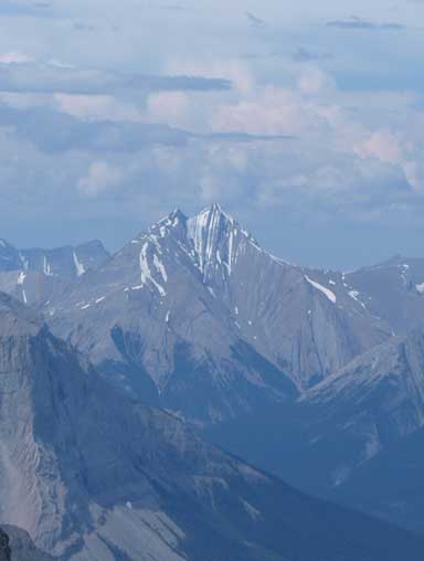
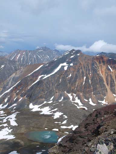
Mount Henry seen from near the summit of Kerr

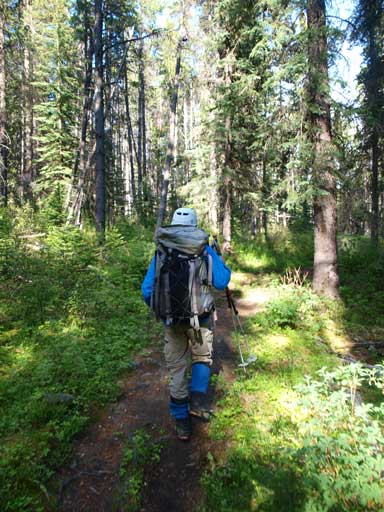
Ben traversing around a corner
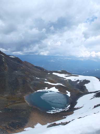
An alpine tarn
Looking back towards Mount Kerr
Down to Kerr/Henry col. Note the never-ending boulders
Now we still could see the peaks in Tonquin Valley
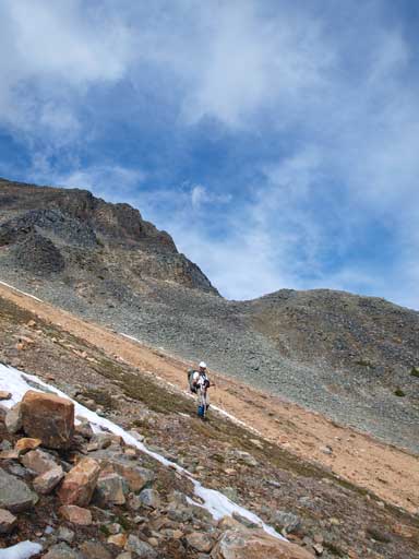
It was now that we saw another intense thunderstorm building up over Jasper townsite. It was moving south and southwest. We figured that it probably would miss us so why not give Mount Henry a go since it was right there. In case of getting caught, we could immediately bail down the south face. This mountain has probably the easiest bailing line among the four that we bagged on this day. We took another necessary break at the col, and once started gaining elevation on the other side, the theme continued, more and more boulders. We pretty much went up for as fast as we could (at least I did) to try beating this thunderstorm. Thankfully it indeed didn’t come our way, instead it hit Tonquin area.
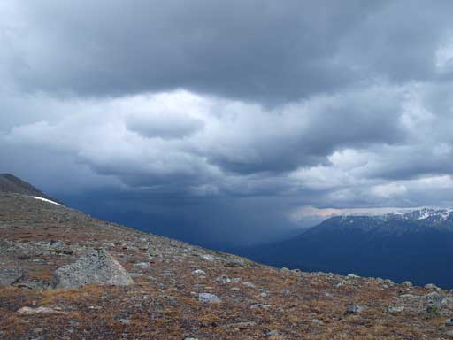
Stormy weather over Jasper townsite
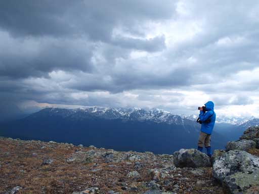
Ben taking photos of this intense thunderstorm
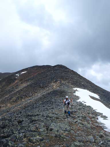
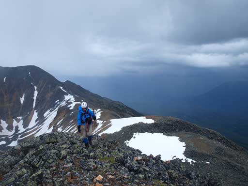
Going up Mount Henry
Ben with the t-storm behind

Ben near the summit
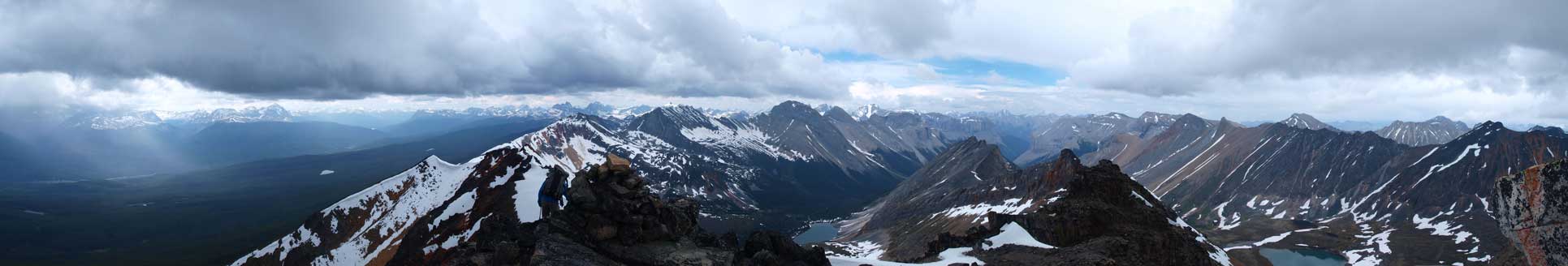
Partial Summit Panorama from when we just hit the top

Looking towards Yellowhead Pass
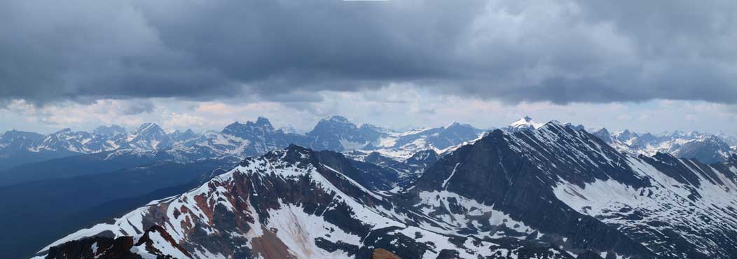
Mount Bridgeland and Derr Peak look impressive
Mount McKean
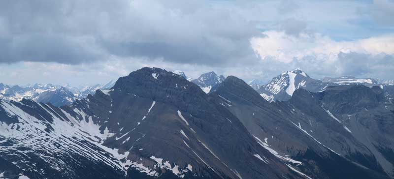
Looking north. You can see the big Snaring Mountain on left skyline
Zooming-in towards Whitecap Mountain
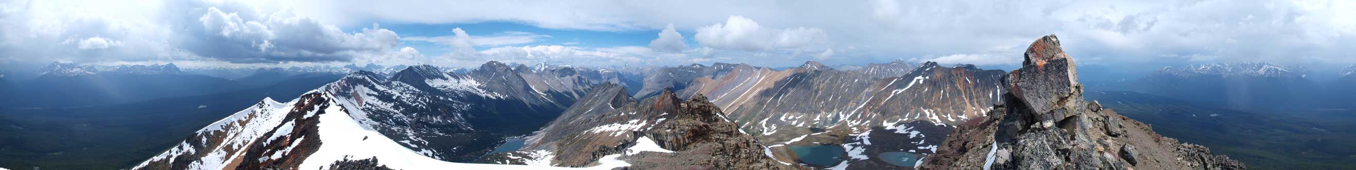
Summit Panorama. Click to view large size.

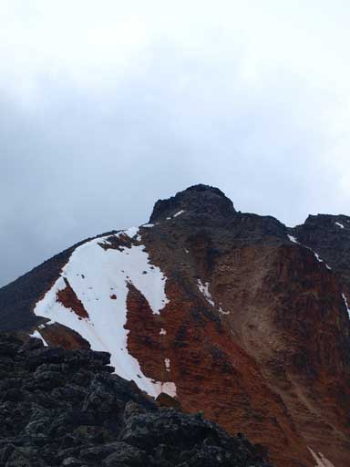
This is the true summit pinnacle.
The true summit of Henry is a separate rock pinnacle that requires 1 or 2 technical moves. I thought we could just claim this peak without climbing it since it looked more like “summit boulder”. It’s a big boulder on top of the summit. However, once the sky finally decided to clear up, Ben and I took turn climbing up this pinnacle. It was easier than I thought. But climbing back down it made me feeling one long reach being a bit tricky. At least the holds were very solid.

Ben challenging up the true summit
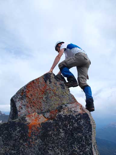
Ben climbing up the last step

Me on the false summit. Photo by Ben N

Me standing on the true summit pinnacle. Photo by Ben N

Panorama looking north. Click to view large size.

Another alpine tarn, and note the reddish/orange colour rocks
Looking back towards Mount Kerr

Bridgeland and Derr again.
We had to make an important decision here that should we keep traversing towards Elysium Pass. The next peak in unnamed, and the next one, Emigrants Mountain, looked to be very scrambly and might require a long time to search for routes. At this point I was okay for whatever we do since we already got the proposed peaks finished. I kinda want to keep traversing honestly since I knew that, if we bailed down the ridge right now, I might never come back for the ridge pack between Emigrants and Henry. But we eventually made the call of bailing down directly towards Saturday Night Lake Trail. There was a huge gully that pretty much would send us directly down, but the rock was very loose and we must stick closer to each other. The gully took us forever to descend.

Ben descending the big gully
Looking back

We got good view of Miette River Valley from the descent
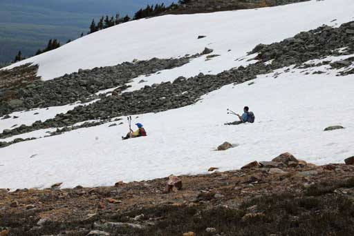
We found occasional glissading. Photo by Ben N
Ben

Back to treeline

Panorama of Miette River Valley
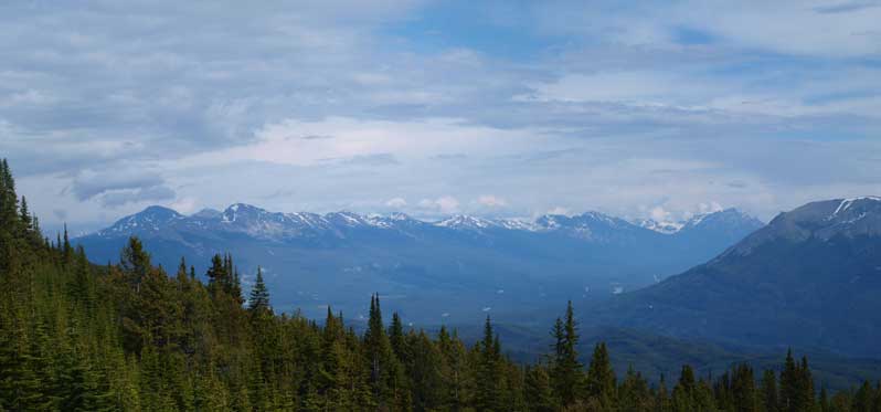
Zooming-in towards Skyline area
Eventually we made back into the trees. At now it had already passed the 16 hour mark of our insanely long day, and we still had a ton of bushwhack plus another 11km or so deproach trail to go… Oh well, what we could do was just keeping one feet ahead of the other. Ben set up a blistering pace down the bush and I felt very hard to catch him up, but I still could. Eric followed us behind. The bush went smoothly initially but after the terrain leveled out we started to encounter deadfalls, and, the most miserable, the mosquitoes. It was now that once we stopped for 5 seconds, there would be 50 mosquitoes bugging around. We yelled to each other making sure nobody got lost. Ben, with his GPS, made the call of cutting left. At this point Eric was on our right. We should have stopped and regrouped together, but for some reason that I think was the mosquitoes, Ben and I kept going left and we would soon hit a stream. There was a hill ahead of us, but we kept traversing left following the creek around the hill. It was now that we completely lost Eric’s sound. We soon found a faint trail and followed it for quite a while, but it eventually disappeared. But thankfully it didn’t take us too long to finally find the correct Saturday Night Lake Trail. We went back along the trail hoping to find Eric for another kilometer or two, but we failed. At this point we couldn’t do anything more so we turned back. Now there were a couple fierce blisters developing on my right feet and I couldn’t go as fast, and I soon lost Ben, and from here on, all three of us went down on our own. But at least, I’d already found the trail. The trail went on forever and after eternity I came to a trailmap sign. Oh god, I still had 5.5km to go to reach Cabin Lake. Another 20 minutes or so a cyclist came up telling me Ben was halfway down at Cabin Lake. Oh well, so I slowed down and went on my own pace, since I figured there was no way I could catch up.
Back to Saturday Night Lake Trail
At the Cabin Lake, it was almost sunset time, but I didn’t have the mood to enjoy the scenery. One reason was, I’d lost both of my partners, and the other reason was the mosquitoes. Oh by the way, I’d already put my jacket and hood on, sprayed a ton of bug repellent. It was obviously very hot but I’d rather not getting 50 mosquito bites. Once hitting the lower end of Cabin Lake, I didn’t see Ben which really worried me since there’s an important intersection. According to my map, the left branch goes toward Patricia Lake which would bring us much closer to my car, while the right branch is wider and goes into Jasper. I figured that since Ben didn’t have the Gem Trek map, he might not even know the left branch so I correctly guessed the right trail. Another 2km or so, Ben came up the trail and met me. He didn’t find Eric and he came up to make sure we were not all got separated. My round trip time was 20.5 hours, which is definitely the longest day-trip ever. But on the other hand, I was still not overly exhausted so I knew what I actually can do in one day, not to mention the zero sleep on Saturday night.

The Whistlers and its reflection in Cabin Lake
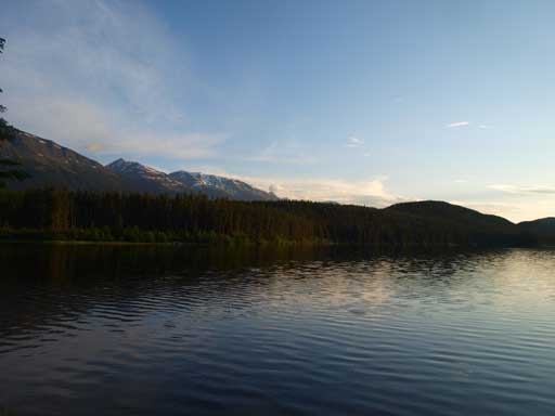
Cabin Lake

Sunset time!

Mount Tekarra
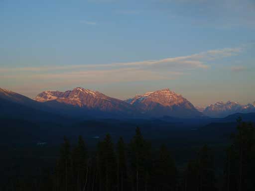
Kerkeslin
Something you don’t always see in Edmonton..
Ben and I kept walking on the road and called a taxi. It wasn’t cheap to get back to Pyramid Lake trail-head though. After examining carefully the map, we figured that there’re at least 4 possible exiting points for Eric, from near Patricia Lake to Elysium Pass TH. For the next 3 hours we kept driving between these trail-heads and eventually Ben got a message saying Eric was at Cabin Lake TH. Oh man, it was a 23 hour day for him, and he was seriously dehydrated, and thankfully I still had some water left.
Now came the driving part. I had a group meeting at lab at 10:00am in the next morning so I was keen on getting back at least by 9:30. After a quick dinner at 1:30am, I slowly drove to Hinton where I was forced to stop due to the tiredness. We took maybe 2hr nap, waking up in morning light. I drove to Edson while Ben took the turn driving back to Edmonton. It was 9:45 and I didn’t even go into my home but immediately drove to University, and thankfully I wasn’t late.
