Wilson Mountain (Sedona, AZ)
March 15, 2017
2171m
Sedona, AZ
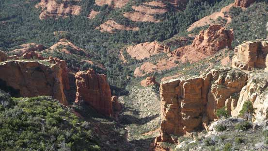
Wilson Mountain is well known as a huge massif overlooking the core of Sedona and forming the west side of Oak Creek Canyon. It’s also the tallest peak in this entire area. Geologically it’s just a large mesa sticking out of the desert floor with the plateau largely forested, but for the sake of reason “it’s the highest out there” I knew I had to bag it. The standard route from the south side is technically nothing fancier than a “hike” but with substantial elevation gain as far as the Sedona standard goes. In terms of the views, the lower portion has some of the classic Sedona red/yellow sandstone formation while the upper plateau gives a birdeye view of the region.

Wilson Mountain hiking route. GPX DL
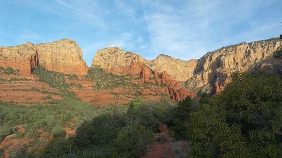
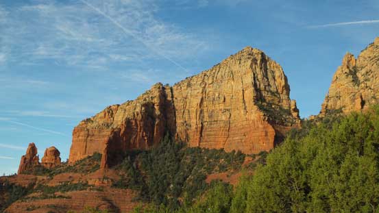
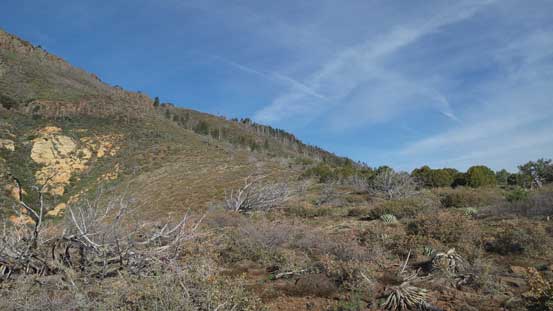
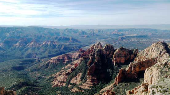
The parking lot is at Midgley Bridge a couple miles east of the town along SR 89A. There was already one car parked and another group had just arrived. The starting time was a bit later than what I hoped for so after some quick tourism thing at the bridge I wasted no time and started the hike. I wanted to get rid of as much as elevation gain as possible before that blistering Sun caught up on me. The initial hike along the side of Wilson Canyon went by fast and then the trail made a gradual ascent due north towards the “First Bench”. In my opinion this stage has the best views of the entire ascent so if you have to turn around here don’t feel too bad.
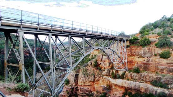
Midgley Bridge at the start

I’ll be surprised if they don’t have name(s) but I’m too lazy to search.
From the lower portion of this trail, looking up
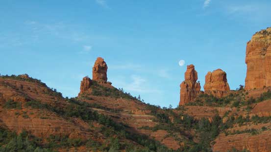
Steamboat Rock (L) and the unnamed spires on right

Upwards and onwards. Note the red ground
Nice and gentle plod.
This peak also doesn’t have a name. At least not an official name.
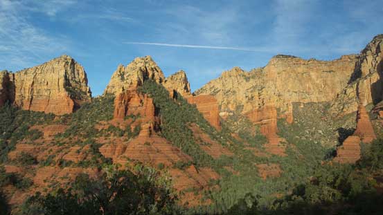
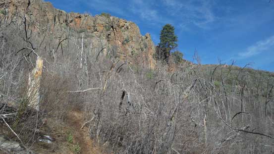
Wall of Wilson Mountain showing the typical Sedona landscape

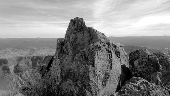
The three spires (all unnamed).

It’s hard to beat the morning views at this place
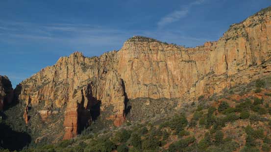
A zoomed-in view of a section of the south wall on Wilson Mountain

Another picture of the three spires

Getting higher than Steamboat Rock now.
The next stage was a long grunt up some switchbacks to gain the “First Bench of Wilson Mountain”. The trail was built in the depression zone shielded by the ridge on climber’s right (east) side. It appeared that the shade would no longer be there given another hour so I bolted up on a fairly fast pace. I really wanted to beat the Sun and I did manage to succeed. Once the slope angle eased towards the top I finally had to broke out the hat and don sunscreen. The views from the “First Bench” was not very spectacular so I continued up without too much of a pause.

Grunt up the switchbacks. I was very glad to be in the shade here.
Getting higher than the three spires now.
Arriving at the First Bench.
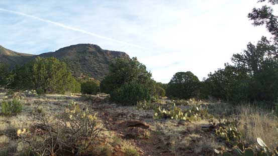
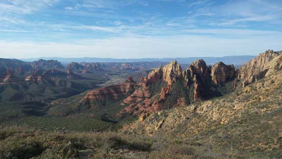
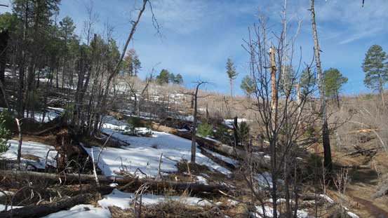
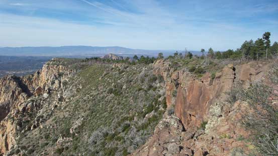
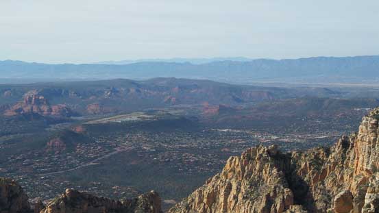
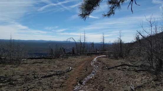
Upwards and onwards the trail soon became muddy and entered some dense vegetation. I could imagine it must have been pretty rough to cut this trail at a few sections as the bushwhacking would have been next to impossible. Higher up I slowly arrived at the mesa plateau. The true summit would be on the right hand side but I decided to firstly check out the “Sedona outlook” on the left. There was still some remnant snow and the associated muddy trail but the views from the outlook was really good.

Resuming the ascent. Note the bush around this trail.

The typical view in this section. Not very inspiring…
Another view from this section of the slog
Remnant snow patches. All isothermal crap and you don’t want to touch them.
Going towards the outlook.
A birdeye view of Sedona area.
Looking sideways across the southern plateau.
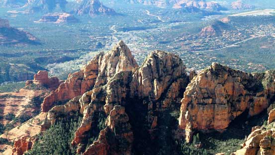
The three spires look very differently from here.
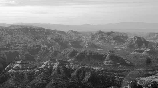
A black-and-white shot showing some of the low buttes and towers

Capitol Butte in the foreground with the Cottonwood area behind.
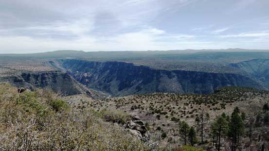
Looking deeply into the canyon below. This is also the typical Sedona landscape
Another shot showing the southern view.
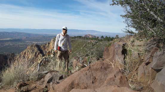
Me on the overlook.
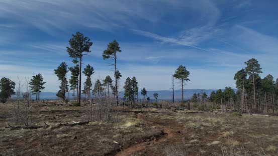
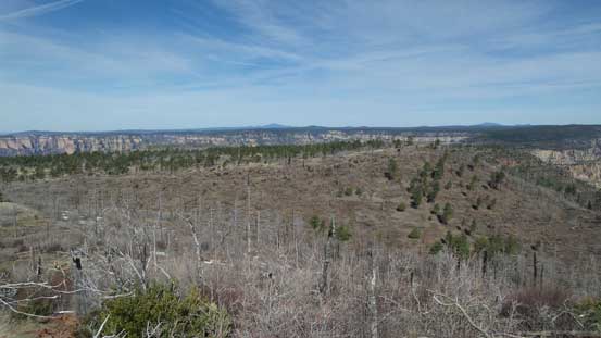
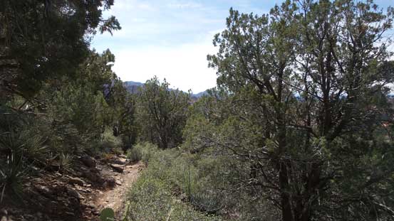
Back to the trail junction I continued onwards onto the plateau. The trail would keep going for another 2 miles or so to the far northern edge but I didn’t particularly feel like going that far. The views from this high up did not quite impress me so I settled on the true summit which required only a short diversion, albeit not on a trail. There’s no bushwhacking required and the highest point required a few scrambling moves to reach.

The typical off-trail travel to tag the true summit.
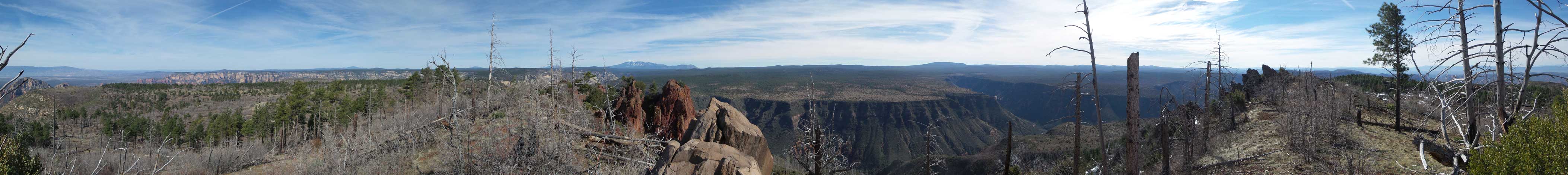
Summit Panorama from Wilson Mountain. Click to view large size.
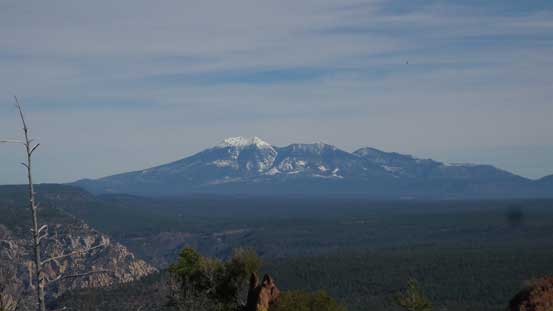
A zoomed-in view towards San Francisco Peaks (Humphreys, Agassiz, etc.)

Capitol Butte in the foreground.
The whole stretch of Wilson Mountain’s plateau. No more motivation to explore further.
A birdeye view of Oak Creek Canyon which SR 89A travels through.

Another view showing the Oak Creek Canyon

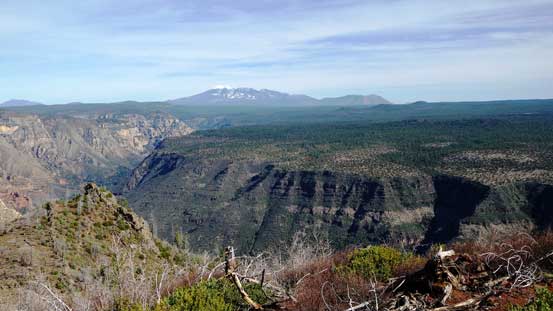
Another wide shot from the summit showing that it’s indeed the highest peak out there.
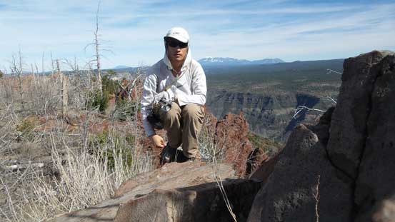
Me on the summit of Wilson Mountain
The true summit requires a few scrambling moves. Nothing difficult.
I settled on a lengthy summit break but eventually it’s time to head down. The views were quite a bit disappointing considering the fame of this objective so I didn’t bother to do any further lingering. I pushed to finish the entire descent in one shot with only a short break at about 2/3 of the way down. I also did not bother to check out Midgley Bridge anymore thank to the amount of tourists and the fact it really isn’t that impressive.
Time to head down.
Oak Creek Canyon from partway down towards the First Bench.

It’s those spires again.

Partway down the switchbacks, looking up. It’s very hot now.
Into the woods (and the much needed shades).

Almost done.
I thought about having lunch in the town of Sedona again but the traffic was terrible. That literally drove me crazy so once through a couple roundabouts all I wanted was to drive through this gong show for as quickly as possible. Instead of having lunch I drove straight down south. Nothing looked too inviting in Village of Oak Creek so I continued down south and the next stop would be the city of Phoenix. I left I-17 at one of the earlier exits and found a Subway for a (very late) lunch. At the same time I did some quick research about what should I do next.
It would be great to hike up Camelback Mountain but I wasn’t so sure whether or not I had enough energy to manage 400 m elevation gain in this temperature. Well, 33 degrees might not seem like much for the locals but as someone coming from Canada this is brutally hot. There were still a few hours till sunset though so I had to do something. Eventually after some debating I settled on a shorter alternative namely North Mountain.
