Mount Pearkes
July 26, 2020
2162m
Jervis Inlet, BC
Mt. Pearkes is a fairly sizeable summit overlooking the Queens Reach of Jervis Inlet that also boasts a fairly interesting and iconic profile, especially viewing from the north. This peak is however, very rarely ascended as far as I know due to the access logistics. It seems like a ferry ride up the Jervis Inlet followed by a sea-level-bushwhack would be the most logical way, but attempts are rarely heard and in fact, a simple Google search leads to zero information and the local encyclopedia bivouac.com also states zero route information. The north side of this peak might be easier to access as it connects to Mt. John Clarke area via some ridge systems but the non-technical side is from the south.
This peak was not part of the agenda when Alex, Vlad and I planned the 10-day traverse from Clendinning Range towards Jervis/Elaho divide but after summitting Mt. John Clarke on Day 8 we changed the plan. We abandoned the original plan to traverse to Ashlu Mountain and opted to spend an extra day exploring Mt. Pearkes. None of us had done any research and in retrospect, an internet research of this peak would returned nothing useful so we might as well skip that part. I did however, downloaded and saved the satellite images of this peak onto my Gaia GPS app. I also took several photos of the east side of Mt. Pearkes on our flight to Mt. Willson so combining what we had and our experience in mapping a route out based on solely satellite images and topographic maps we did manage to propose a roundabout route that might work as a walk-up on mostly snow. The proposed route is accessed from the north side as we came from Mt. John Clarke, and traverses across the east, south and then west faces on low-angled snow or rock/heather ledges to the very top part of the NW Ridge, which is then followed to the summit.

The section from Loquilts Peak to Deserted N1.
On Day 9 we woke up early but didn’t get going until way past sunrise. We were in a period of a record-breaking heat wave so even in the early morning hours we felt extremely hot and demotivating. From camp we walked several kilometers on easy terrain to the base of the NE Ridge. It’s clearly one could not find a non-technical route from this side so we resumed our proposed plan. We had some trouble finding a way dropping down to the east side of Mt. Pearkes but after backtracking 50 meters we found a nice class-2 ramp that led down. Most of the traverse across the east face of Mt. Pearkes was done on snow, but some parts had already melted out down to grass and rocks, but the angle was low enough that the scrambling was easy. There were plenty of water sources so we all drank a lot. The east face traversing section felt never-ending and super tedious with lots of up-and-downs in the micro-terrain.
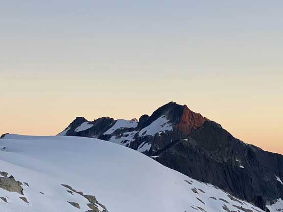
Mt. Pearkes from the camp in the previous evening

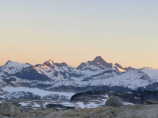
Morning alpenglow on Mt. Pearkes on our summit day

Alpenglow on Mt. Albert massif

Mt. Alfred the giant on South Powell Divide on alpenglow
This is looking at Mt. Tinniswood, also at alpenglow time

Beartooth, Baldy, Slide and Alfred from L to R in Powell River area

Another photo of Mt. Albert

A very zoomed-in shot of Mt. Tinniswood that we climbed a few days earlier
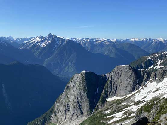
Some classic but rarely-seen coastal granite in the foreground
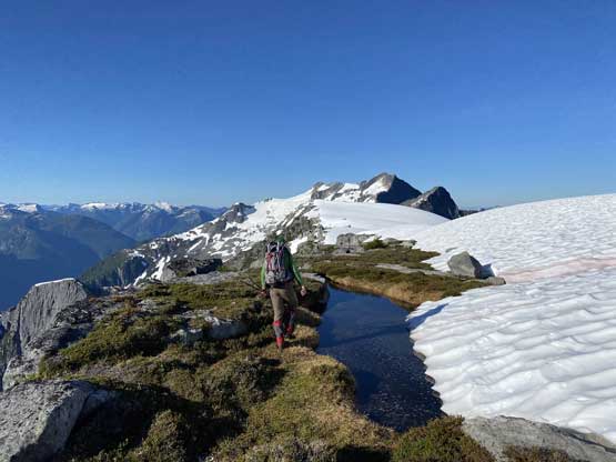
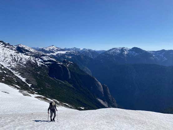
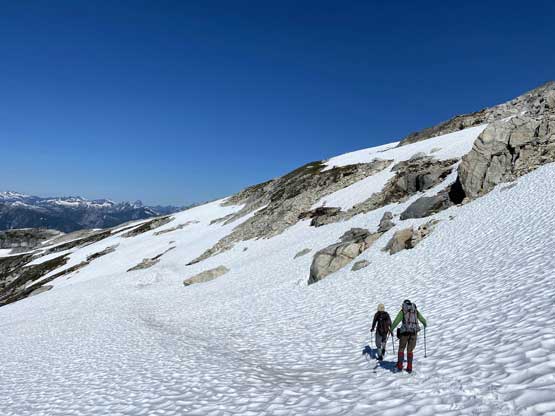
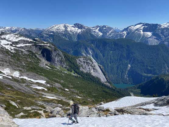
Alex walking down the ridge towards our objective

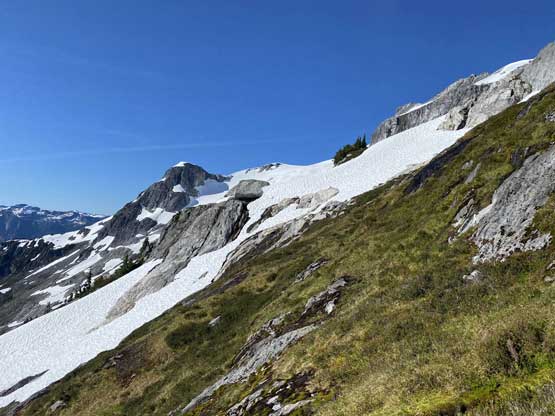
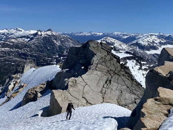
An impressive sub-summit that we must bypass

We found the correct ledge/ramp to get down onto the east face

Alex and Vlad boot-ski down the ramp
Sections of the east face traverse was already snow-free

Vlad traversing across some heather ledges, his favourate terrain
Vlad merging back onto snow.

Vlad ascending steeply up towards the notch on SE Ridge

Alex leading the way up onto SE Ridge

Vlad traversing the typical snow
Eventually we reached a notch/col on the SE Ridge and easily hopped over to the south side overlooking Jervis Inlet. We spent half an hour admiring this rarely, if ever seen view of the inlet and the north face of Mt. Churchill before resuming the traverse across the short south face. This section had no difficulty but did require some route-finding. In short time we had hopped over the SW Ridge onto the upper west face of Mt. Pearkes. The traverse across the west face towards the NW Ridge was mostly easy and low-angled snow such that we managed to cover the terrain in a timely manner.
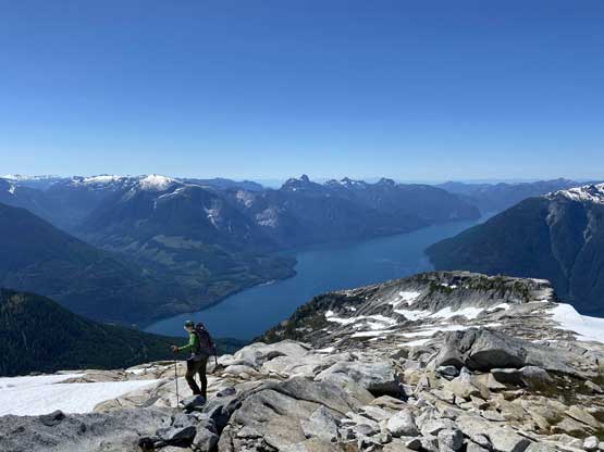
Alex taking in the views of Jervis Inlet from south side of Mt. Pearkes

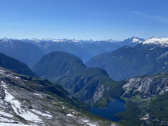
Mt. Churchill and Marlborough Heights rise above Jervis Inlet
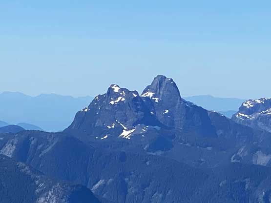
The north face of Mt. Churchill, along with Mt. Spencer
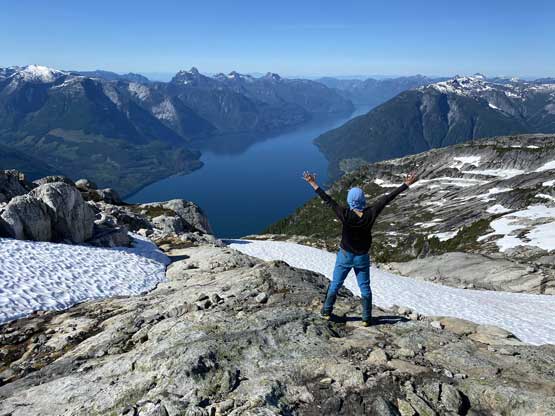
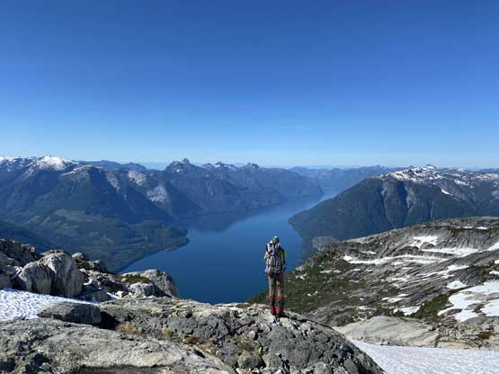
Me doing my Instagram thing with Jervis Inlet behind

A full view of Jervis Inlet without any of us in the frame
The easy traverse across the short section on the south side

The South Powell Divide behind the Queens Reach of Jervis Inlet
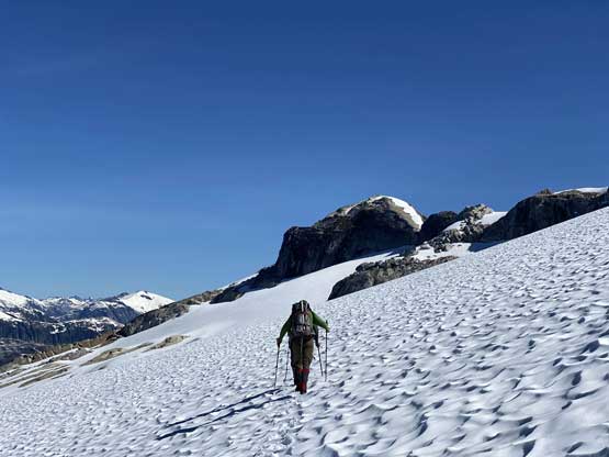
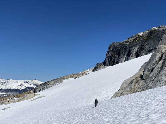
Traversing across the west face now
The uppermost NW Ridge had a little bit of steep snow but otherwise offered zero technical difficulty. We all managed to ascend this peak without the need to take out an ice axe. I was hoping to find a very old register but we could not even find a summit cairn. We again, took a very long break on the summit as we needed not to rush.

Alex and Vlad traversing onto the NW Ridge of Mt. Pearkes
Vlad ascending the last few meters to the summit
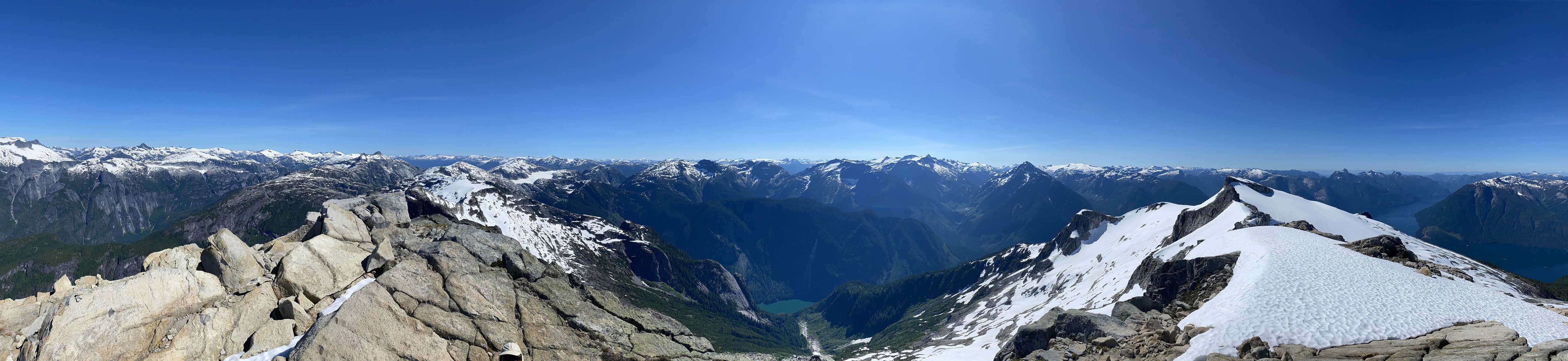
Partial Summit Panorama from Mt. Pearkes. Click to view large size.
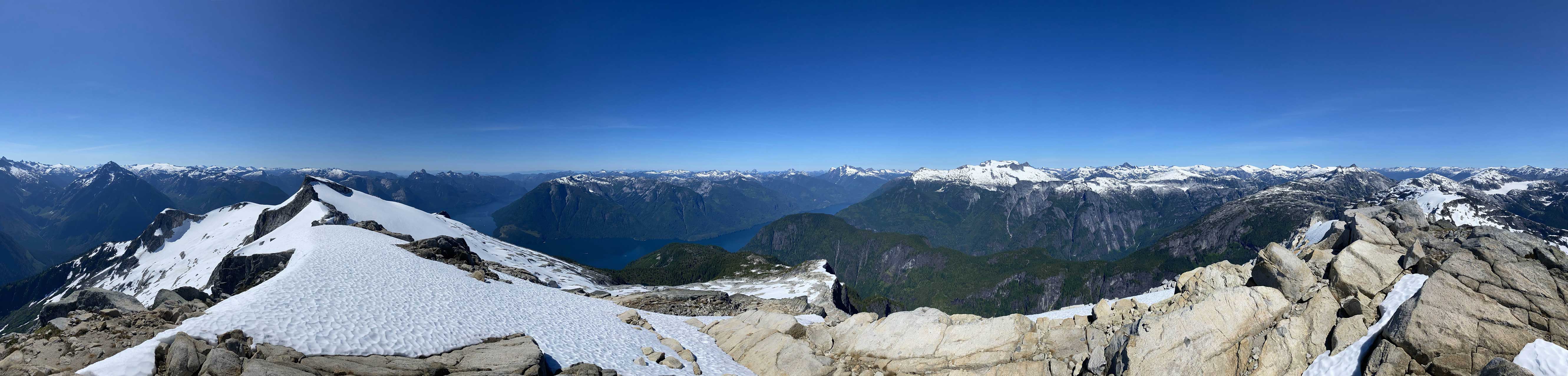
Partial Summit Panorama from Mt. Pearkes. Click to view large size.

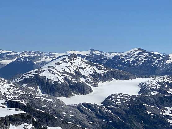
This is looking back towards Mt. John Clarke in the foreground
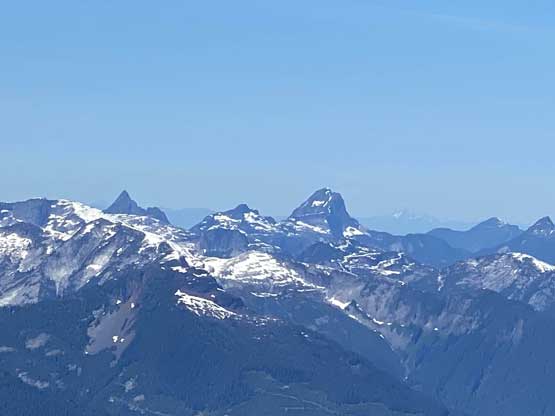
Outrigger Peak in foreground with Torah Peak and Exodus Peak behind

Mt. Albert

Mt. Tinniswood behind some steep granite above Princess Louisa Inlet

One of the many unnamed lakes nearby. This one is in Deserted Creek
Beartooth Mountain and Mt. Baldy are classics in Powell River area

Vlad on the summit of Mt. Pearkes
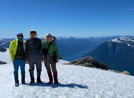
Our group shot on the summit of Mt. Pearkes
On the descent we just retraced our own footprints back across the upper mountain and then back to camp. It was tempting to take some short-cuts but the earlier observation told us there was no easy way to get off this peak other than reversing the route we took. I think the round trip of this ascent was around 7 hours from camp, which was pretty much as expected. We rested a bit, broke camp and carried on towards Outrigger Peak.

A wider view looking north from just below the summit
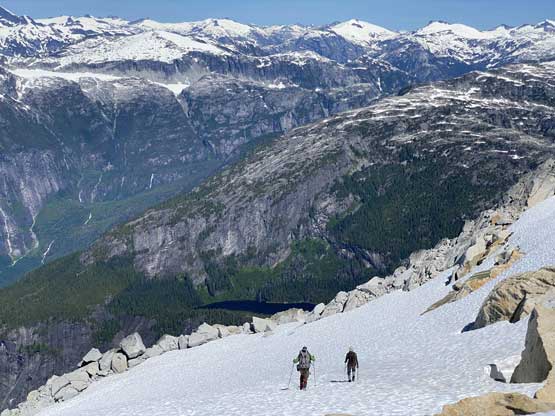
Alex and Vlad heading down now

Around the NW Ridge onto the long west face traverse
Vlad finishing his west face plod back-across
Alex traversing easy terrain high above Jervis Inlet

Back onto the east face traverses now
Vlad traversing high above Deserted Creek drainage

Back onto Pearkes-Outrigger ridge system
Back to our camp, looking down towards Jervis Inlet and Powell Divide
