Mount Phillips
August 23, 2019
2894m
Glacier National Park, MT
Mt. Phillips is a “P3K” (peak with 3000 feet of prominence) objective in the southern part of Glacier National Park, buried deeply in the Coal-Nyack backcountry with no more than a few ascents per year. This peak is listed in the “Top 400 in Contiguous US by Prominence” and catches some attention from peak-baggers, but because of the close proximity to the much-bigger Mt. Stimson this peak is seldom ascended as a primary objective, other than by the locals. Adam, Connor and I ascended it as a byproduct in addition to Mt. Stimson, which was no doubt the primary objective.
There wasn’t much beta about Mt. Phillips on the internet other than “it can be ascended via the west ridge”. I purchased a climber’s guidebook of Glacier National Park a day prior to the trip and took a photo of the relevant page. There still wasn’t much useful details other than “bushwhacking south from Surprise Pass and taking the west ridge”. The book did mention an avalanche path with easier travel but we ended up not finding it at all.
Mt. Phillips and Mt. Stimson via Coal Creek approach. GPX DL
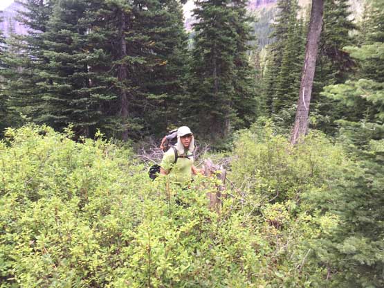
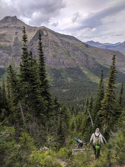
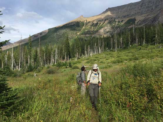
From the trail junction with Beaver Woman Lake the three of us left the group and hiked an additional mile to Surprise Pass but struggled to find a suitable spot to bail into the bush. It appeared that bushwhacking anywhere near the pass would end up in some terrible country right at the start. The weather had turned overcast and we were late in the day (1:30 pm). We discussed about bailing Mt. Phillips but I said we should do it, so into the bush we went. I led in front crawling over dense brushes immediately after leaving the trail and the brushes never became thinner in the next few hours. The brushes were also wet from the residual morning dew. This slope was north-facing and never dried off. The three of us were all die-hard peak-baggers in such way that once making the commitment we were in for it. There’s no turning around. The bushwhacking was perhaps some of the worst any of us had done in a while, but we just kept crawling up grabbing whatever we could grab. The terrain finally became steep and we finally started to make some upward progress, and thankfully the brushes did become a little bit thinner.. The brushes had transitioned from berry bushes / slide alders to steep Christmas trees and krummhotz intermittent by short cliff bands of scrambling. It was downright awfully miserable, but we powered through them all and made to treeline, at last…
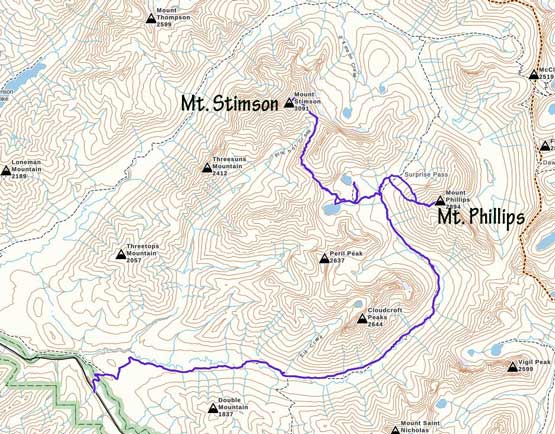
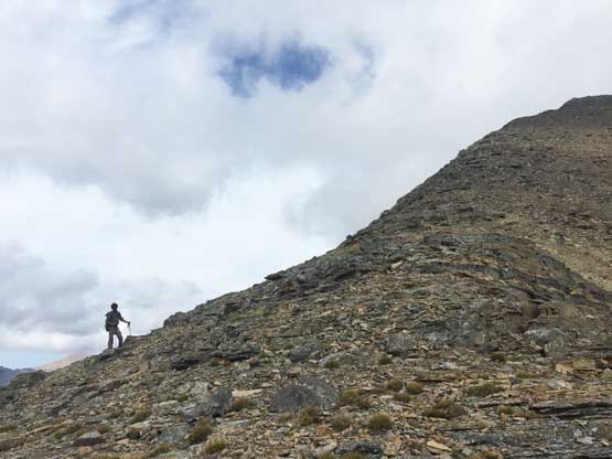
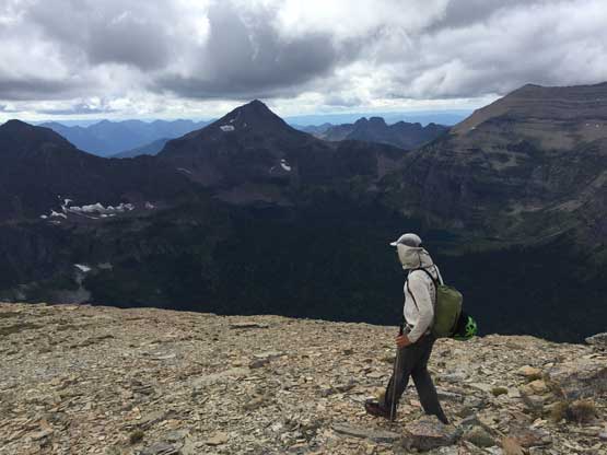
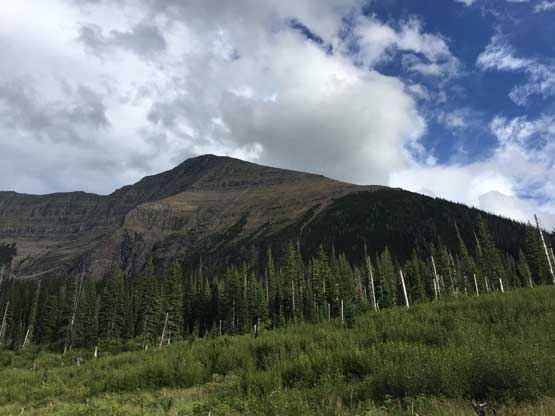
A look at Mt. Phillips from Surprise Pass trail
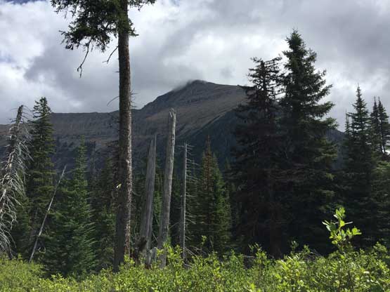
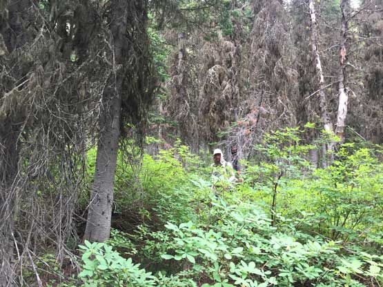
Adam on a stretch of easier bush (that I didn’t mind to take the phone out)…
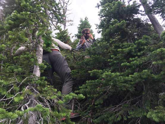
Me coming out of the forest. Photo by Connor M.
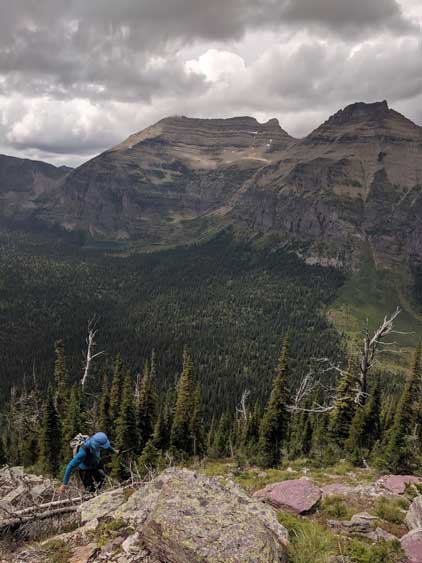
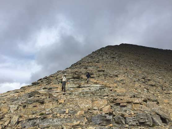
The ascent wasn’t over yet as we still had about 600 vertical meters of scree slog to reach the summit. The weather was still somewhat threatening to rain, but we were doing a bit better on time than estimated. The wind had picked up, unfortunately but at this point we just had to suck them all up and make to the summit. We ditched some unnecessary stuffs and went for a peak-bagger’s race. We crushed the 600 vertical meters of scree in less than an hour and the summit views weren’t disappointing, despite the overcast sky.
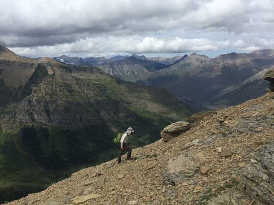
Adam ascending onto the scree fest. Upper Nyack Creek valley behind
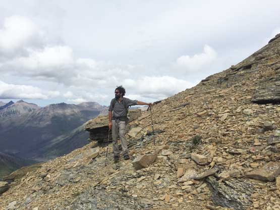
Connor taking a rest break
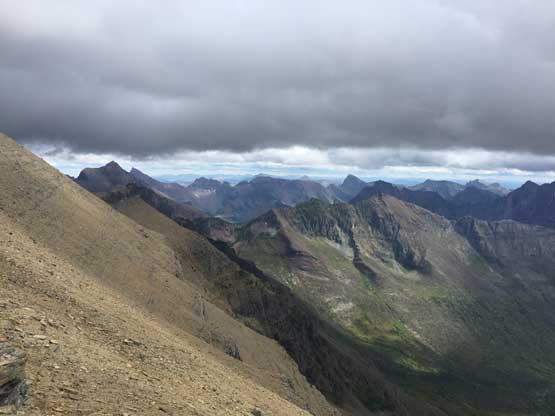
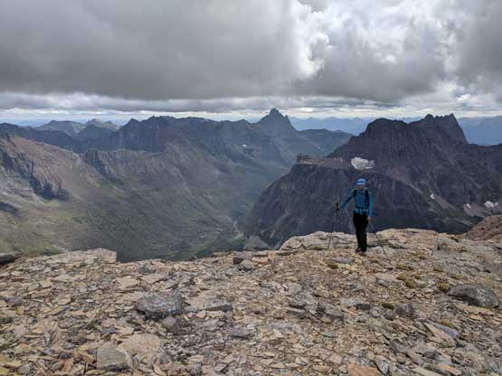
Onto the upper west ridge now. This is looking across the SW Face

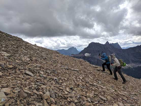
Me and Connor slogging up the upper west ridge. Photo by Adam W.
Adam and I racing up. Photo by Connor M.
Connor near the summit
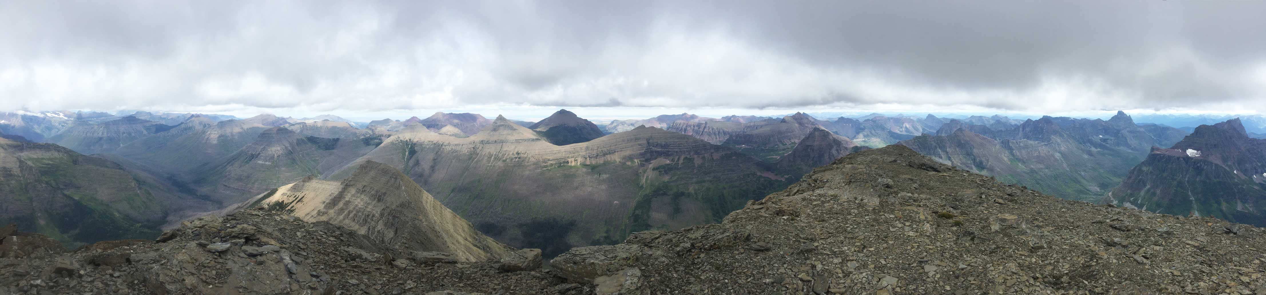
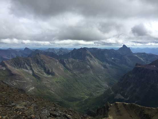
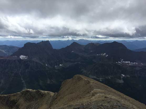
Partial Summit Panorama from Mt. Phillips. Click to view large size.
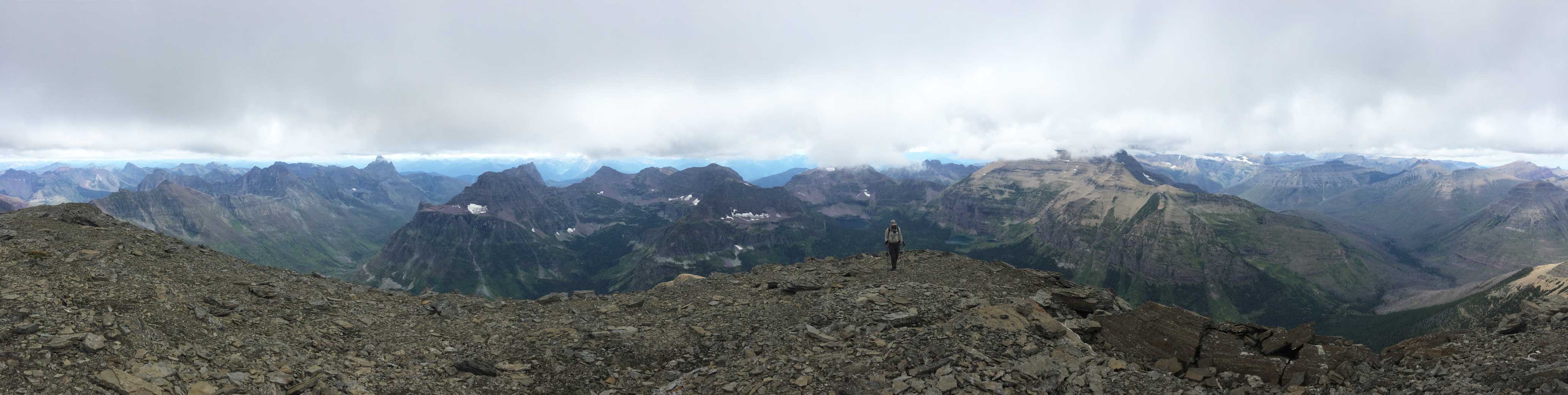
Partial Summit Panorama from Mt. Phillips. Click to view large size.
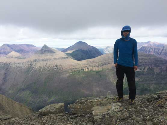
Me on the summit of Mt. Phillips
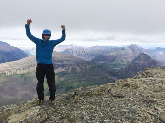
Another photo of me on the summit of Mt. Phillips
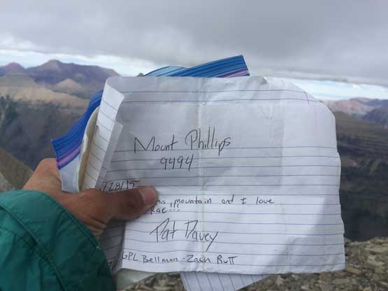
The summit register of Mt. Phillips
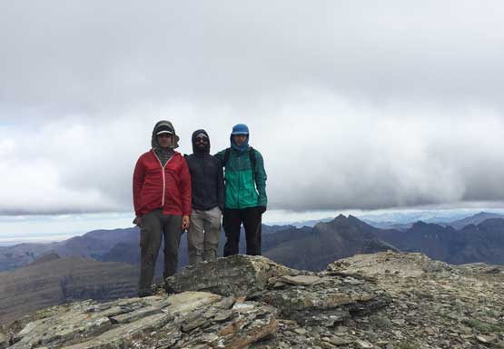
Adam, Connor and I on the summit of Mt. Phillips
This is looking down the Coal Creek valley towards Mt. St. Nicholas
Cloudcroft Peaks and Peril Peak

The massif of Mt. Stimson was engulfed in clouds
Not doing much of lingering we soon started the descent. The scree was annoying but easy, and then we agreed to explore around trying to find a better line through the green zone. We still couldn’t figure out where the heck that “avalanche path” was and anything that looked like an avalanche path would definitely turn into an alder nightmare, so we totally abandoned the book’s beta and went for our own. It appeared that the worst of bushwhacking we just did might be able to avoid on the skier’s right side. The price we paid was lots of route-finding through cliffs and lots of vege-belays. It was a slow show, but I do think our descent route was a little bit better than the ascent, but not by a great margin. No matter what, this peak requires sustained BW4 bushwhacking and is a true test for one’s determination. In my opinion it’s a harder objective than Mt. Stimson.
Adam and Connor descending the uppermost west ridge
Me posing on a flat spot on the west ridge. Photo by Connor M.
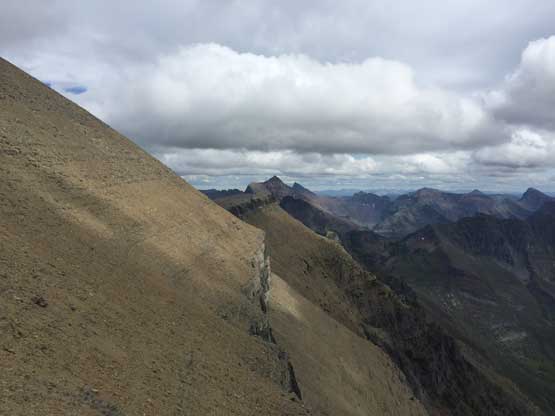
One last look across the SW Face of Mt. Phillips towards south
Adam descending with Eaglehead Mountain behind
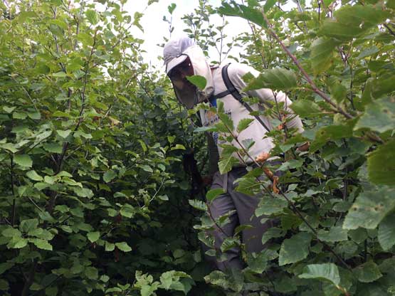
Committing to the bush. Photo by Connor M.
The typical bushwhacking on the upper slopes…
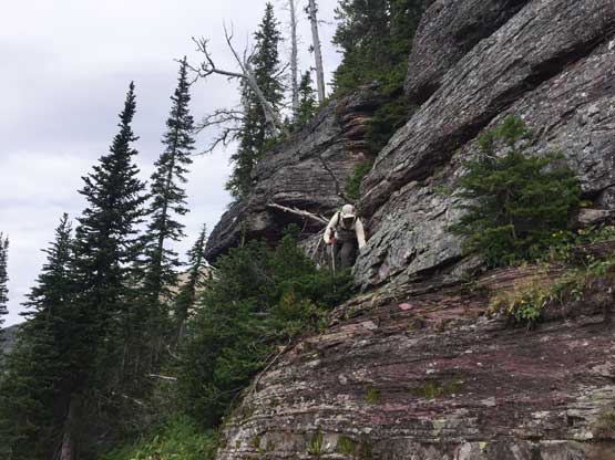
Adam route-finding through a “3rd class” cliff band.
Bushwhacking….
As typical as it was on the lower slopes…
A review shot of Mt. Phillips from Surprise Pass
Finally back onto Surprise Pass trail…
In the end for a full story you should read my Mt. Stimson trip report. I would not recommend an ascent of Mt. Phillips unless one likes to bushwhack. I personally find bushwhacking “fun” at times so don’t mind such an ordeal, although dry brushes would definitely be much more appealing than the wet shit we dealt with…
