Yellow Aster Butte
November 21, 2019
1902m
Mount Baker Highway, WA
Yellow Aster Butte is one of the lesser summits along Mt. Baker Highway that offer some of the highest view-to-effort ratio, and because of that, this is also one of the more popular hikes in the Bellingham vicinity. Most peak-baggers would prefer to combine Tomyhoi Peak with Yellow Aster Butte to make a single outing but a separate trip to Yellow Aster Butte itself is still worth the spent even just for the views. The scramble of Tomyhoi Peak needs snow-free conditions but Yellow Aster Butte does not. However, this also cannot be easily done in the old man winter due to the access and the fact the standard route traverses across significant avalanche terrain. The access is at ~1100 m elevation level on Twin Lakes Road and this spur road is rough and not maintained in winter. The better bet is to hike this is what’s so called the “shoulder season” when there’s snow, but not enough snow to accumulate.
To hike just Yellow Aster Butte I would not want to donate a full day because I could easily squeeze this hike as a “before work exercise”. A round trip of 5 hours should be plenty enough at a moderate pace. The November of this year have been sunnier than usual and another high pressure system kicked in towards the middle of last week. I made a very spontaneous decision at Wednesday night at around 10 pm, drove out of White Rock at 11 pm and made to the trail-head at around 1 am and then slept in my truck. I debated about getting up early to watch sunrise on the summit but opted to play this laziness game. I set my alarm at 6 am and went to bed.

Yellow Aster Butte hiking route. GPX DL
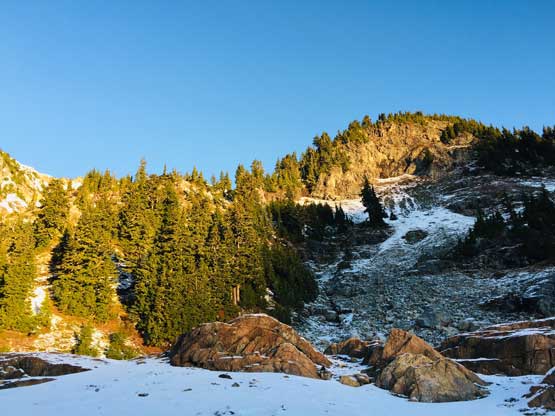
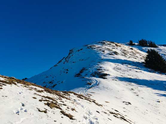
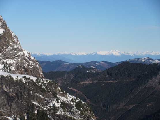
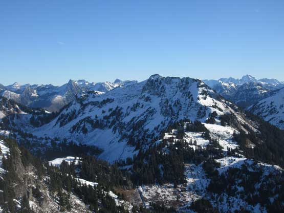
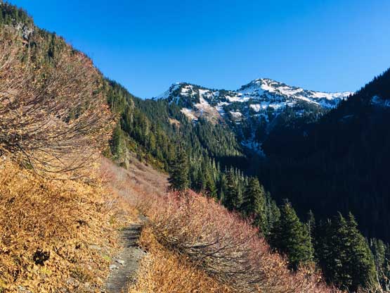
The following morning saw some chilly temperatures and frosts everywhere but after 10 minutes into the hike I started to get toasty. There’s apparently some temperature inversion and the higher slopes were very warm. The trail did a few long switchbacks in the forest before making a long rising-traverse towards Gold Run Pass. That’s the access to Tomyhoi Lake which was not where I headed for, and instead I took the next left-turn. This next stage traverses about 2 horizontal kilometers without significant elevation gain, from the east side of Yellow Aster Peak around the south side, to the south-west corner. The snow had becoming increasingly steep but previous parties had broken a set of tracks so I just needed to follow. The snow was deeper than I thought but not enough for snowshoes.
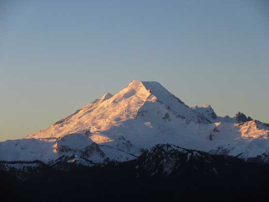
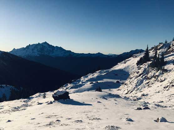
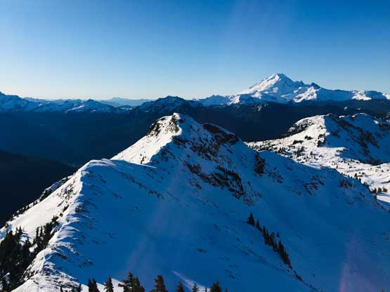
Morning alpenglow on Mt. Baker
This is already partway across the 2-km horizontal traverse
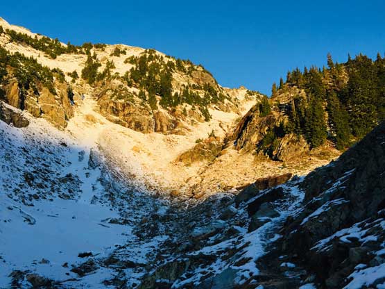
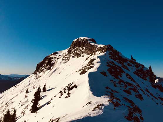
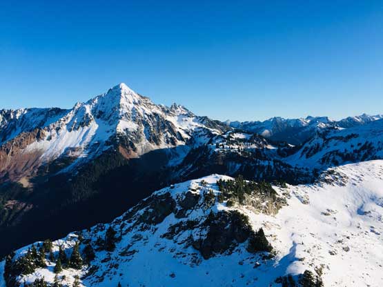
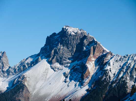
The steep east face of Yellow Aster Butte catching sun beams
Hiking into the warm sunshine

Sunrise behind Goat Mountain
Mt. Shuksan and the morning light
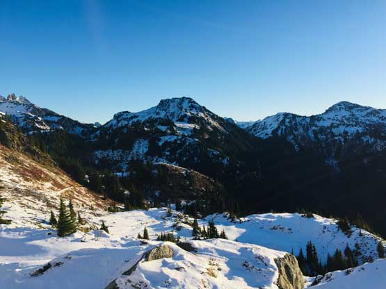
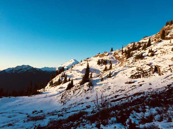
Looking back towards Winchester Mountain
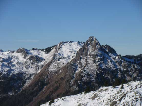
Hiking around another corner. Ahead is just a sub-summit
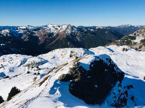
The south-west corner is where the hike to Yellow Aster Butte splits from the scramble of Tomyhoi Peak. It’s apparent that the previous party also went here for the butte so I followed their tracks turning east up the west ridge of the south summit. The previous party used snowshoes here. Snowshoes would help but not totally required and I ascended their tracks with minimal post-holing. It didn’t take me long to reach the south summit.

Starting to gain elevation rapidly now
This spot marked the junction with Tomyhoi Peak’s scramble route

Plodding up the foreshortened west slopes of the south summit
Onto the upper, drier ridge

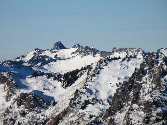
On the top of the south summit looking ahead to the traverse
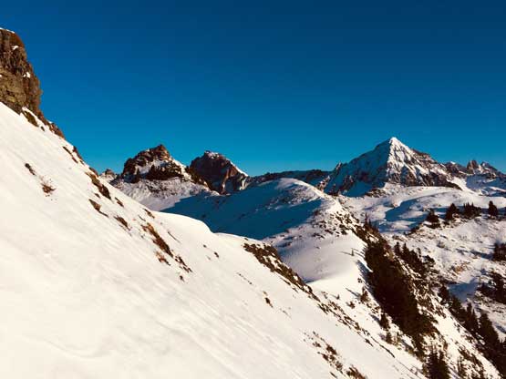
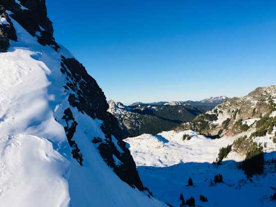
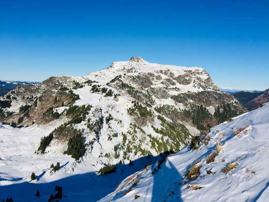
I didn’t do much homework about the technical difficulties in attaining the true (north) summit, which appeared rockier than what’s suggested on the topo maps. The other party’s tracks stopped on the south summit and that’s not to my surprise. The traverse involved descending ~30 m to the saddle and right off the bat I encountered some exposure. After trying to kick some steps with my soft hiking boots I opted to don (aluminum) crampons. I also didn’t come here with an ice axe so I had to be extra cautious about the footwork. There’s one spot that required detouring down and traversing across the exposed east face and that stretch was certainly a no-mistake zone without an ice axe. After that I easily post-holed down to the saddle, and then up the south ridge of the north summit. The scramble to the summit was easier than appeared. I took the crampons off because they were aluminum and in short time I was on the not-so-spacious summit soaking in the views. The Border Peaks and Mt. Larabee definitely stole the show.
This is that short but steep east face traverse section.
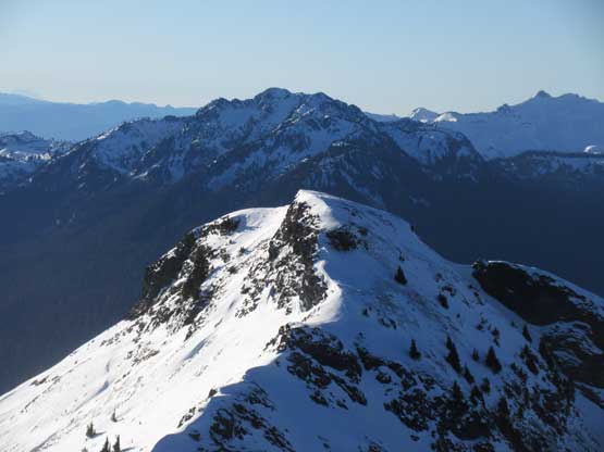
Back onto the north ridge of the south summit
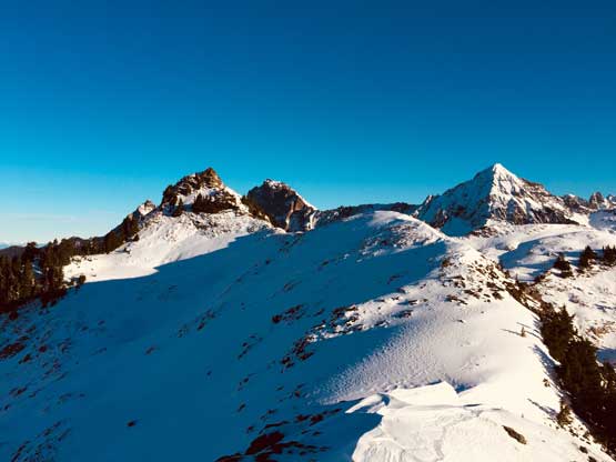
The route ahead traversing to the north summit
Looking back at the north ridge of the south summit that I just descended
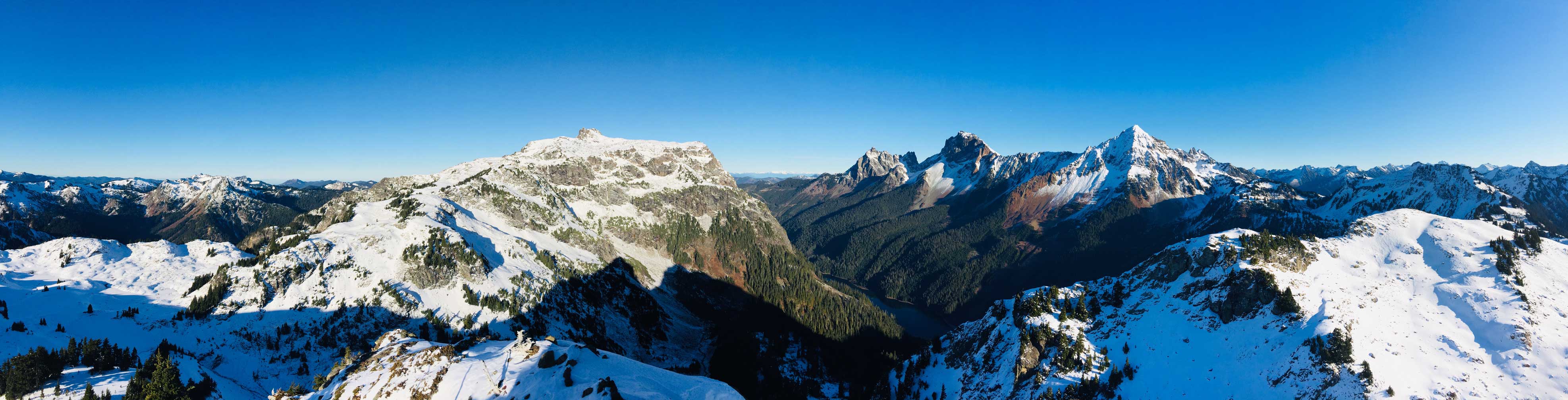
Partial Summit Panorama from Yellow Aster Butte. Click to view large size.
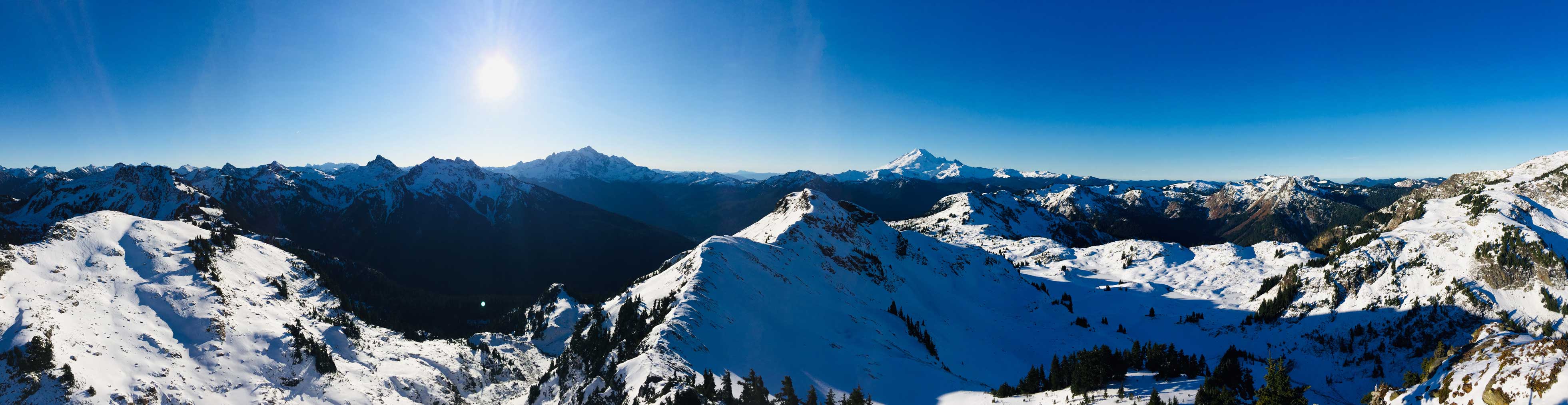
Partial Summit Panorama from Yellow Aster Butte. Click to view large size.
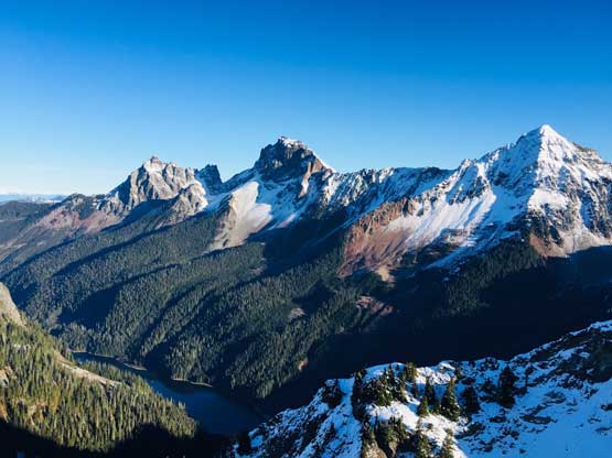
The Border Peaks and Mt. Larabee
The mighty Mt. Larabee
Looking back across the summit ridge traverse
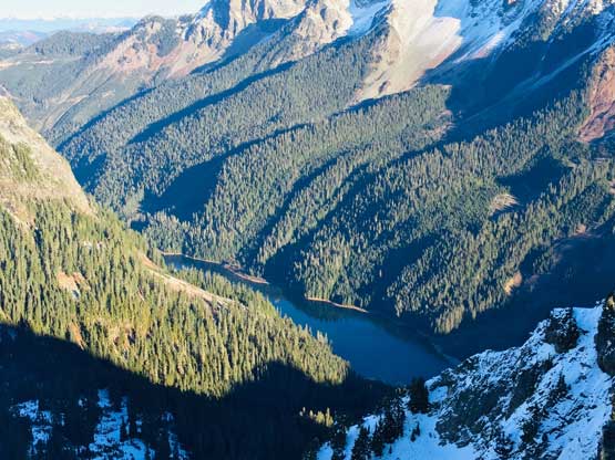
Tomyhoi Lake
Canadian Border Peak (L) and American Border Peak (R)
Zoomed-in towards the Coast Mountains of BC
Church Mountain pokes behind in the distance
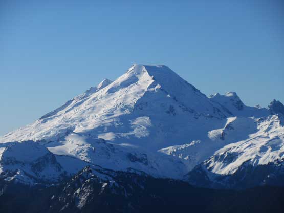
Obviously I need on shot of Mt. Baker
Behind the lower south summit is Mt. Herman
A closer look at Mt. Larabee
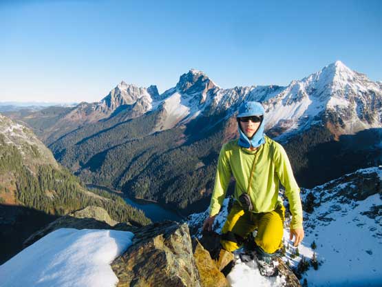
Me on the summit of Yellow Aster Butte
After taking enough photos I had to hurry up to get home as I didn’t do particularly good on time. Reversing the summit ridge traverse was fun and I made the gear transitions particularly efficient. Once back to the south summit I removed crampons and plunged down the west slopes to rejoin the main trail. The rest of the descent was done on my normal pace. I met one large group of hikers going up struggling on the icy trail even with microspikes which I mostly just jogged down without any traction device.

Looking back towards the true (north) summit from the saddle

Ahead is that short traverse on the east face to bypass a rock band
Looking back at my tracks on the virgin snow
One last look at Mt. Larabee
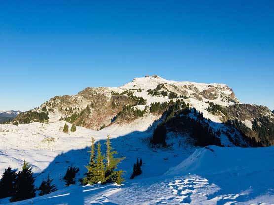
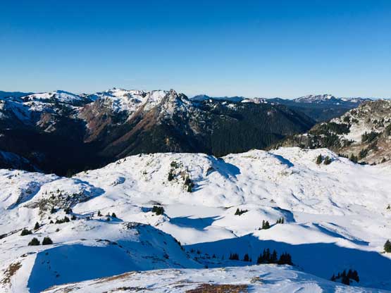
Winchester Mountain from the south summit
Descending the west ridge of the south summit now
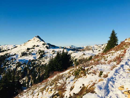
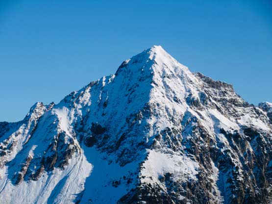
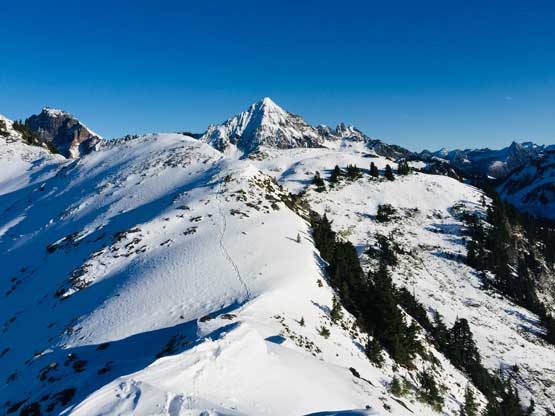
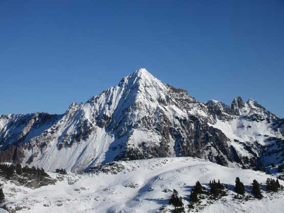
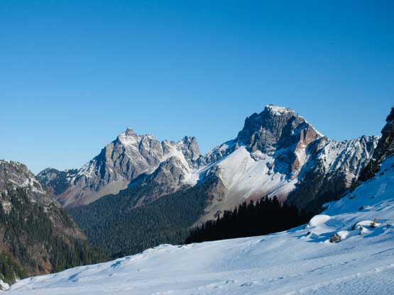
Tomyhoi Peak
In the foreground is the plateau leading towards Tomyhoi Peak

Border Peaks and tracks on the snow

A closer look at Canadian Border Peak – climbed in July 2017
American Border Peak – climbed in September 2019
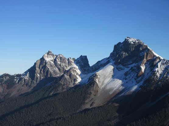
The two Border Peaks together
The unofficially-named “Damfino Peak”
Heading down now
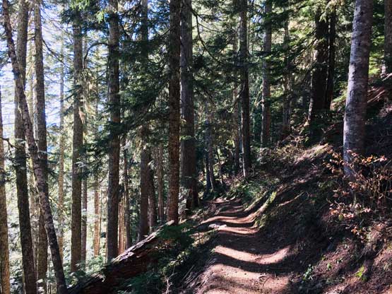
Into the forest…
Almost at the end
I immediately turned on the engine and started the relatively short drive back home. I was pretty tired driving back into Bellingham but somehow got by without having to take a nap. The border crossing was eventful and I earned about 40 minutes of napping time before work. Not a bad day again.
