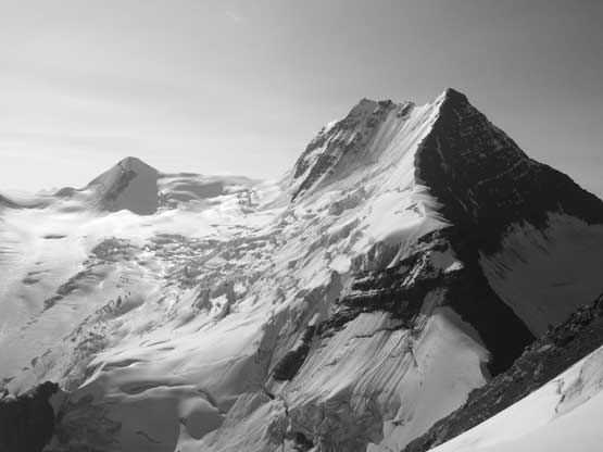
Tusk Peak
August 5-9, 2019
3360m
Clemenceau Icefield, BC
Tusk Peak barely pokes above 11,000 feet to make into that fabled Canadian Rockies list that everybody knows nowadays, and is significantly overshadowed by the gigantic neighbour – the 4th highest in the range, Mt. Clemenceau. The primary objective for anyone going into this area is no doubt Mt. Clemenceau, but Tusk Peak does boast one of the coolest profiles in the Rockies and the climb itself is worthwhile in its own. The major downside of this area is the extreme remoteness that a lift by helicopter is the most realistic way to get into. The flight takes more than 100 km one way from one of the nearest three bases: Golden, Valemount and Abraham Lake and is an expensive ride costing over 6000 dollars round trip. Earlier in this year Oakley W. from Fortress Lake fisherman’s camp contacted me to climb Mt. Clemenceau and Tusk Peak as he found a much better deal for the helicopter rides. The round trip cost would not exceed 500 dollars per person and we just had to find a right week to fly into.
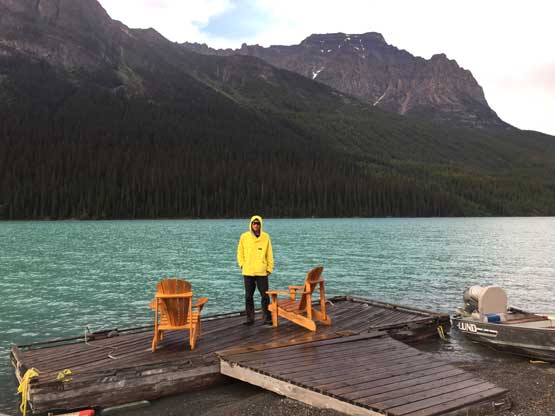
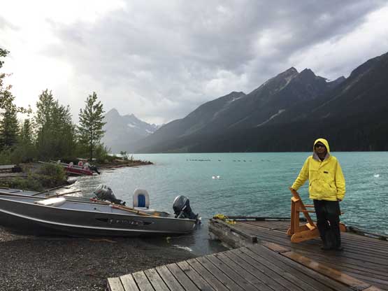
We picked the first week of August with some reliable weather forecast but less-than-ideal freezing level figuring this might actually be as good as we could get in this year. We landed on the basecamp underneath Tusk Peak’s NW Ridge at 11:30 am and summitted Mt. Clemenceau at 9:30 pm on the evening, then descended to a high bivy in dark. The next day we descended back to basecamp and rode out storms after storms. It must have poured over 20 mm of rain on us and we wondered how would that affect our climb of Tusk Peak the following day…
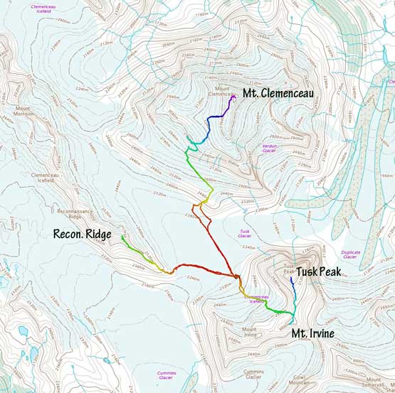
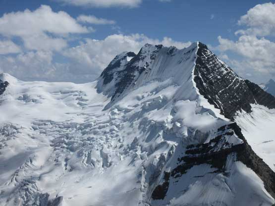
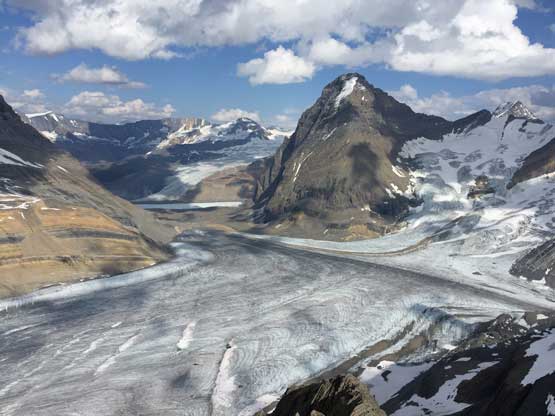
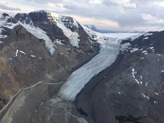
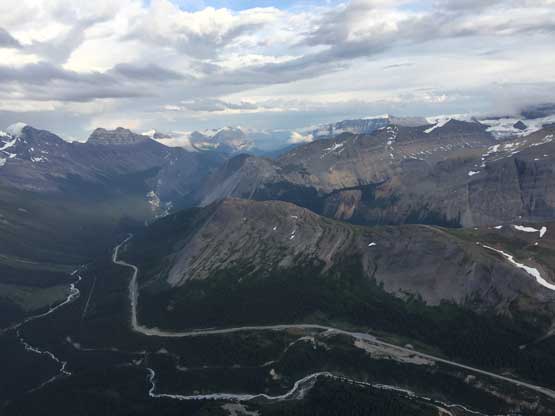
Ascent routes for Clemenceau, Tusk, Irvine and Reconnaissance Ridge. GPX DL
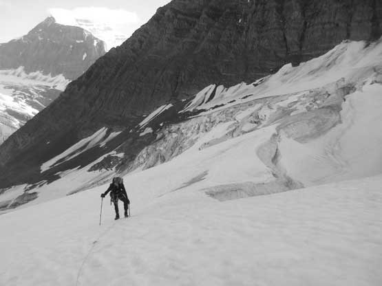
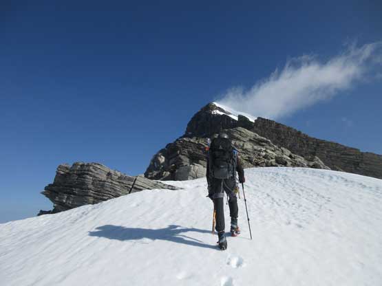
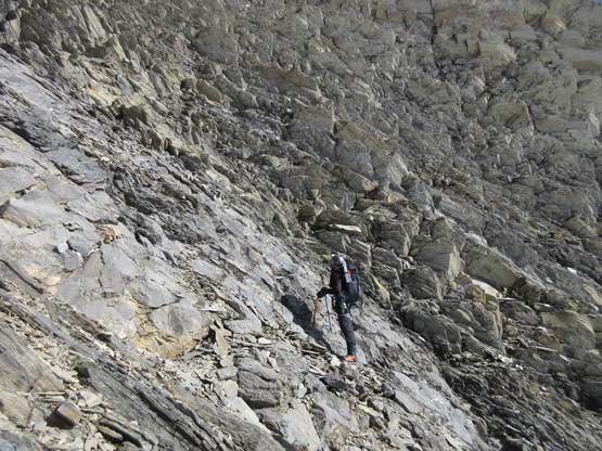
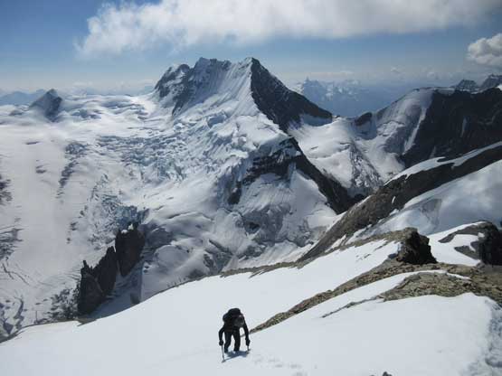
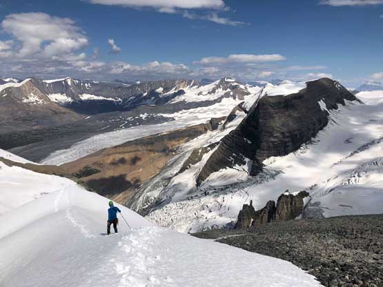
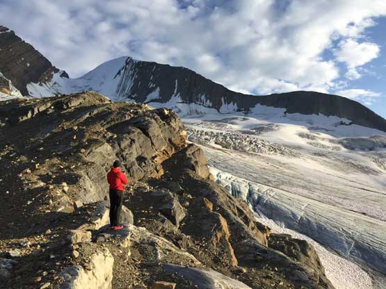
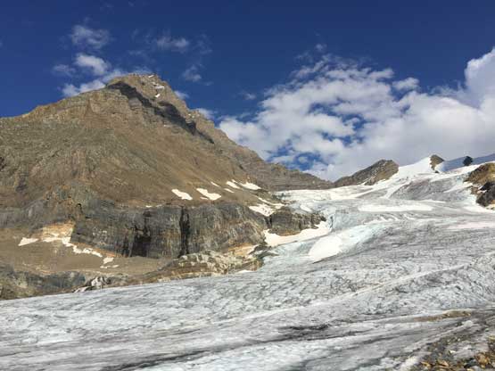
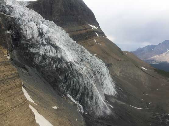
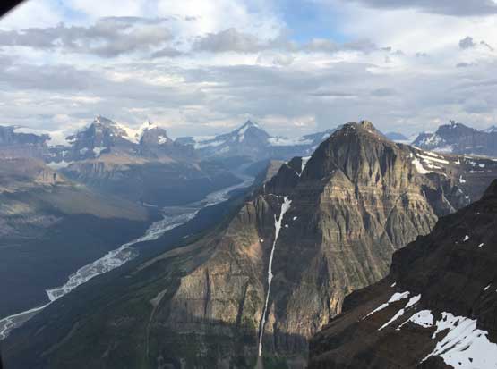
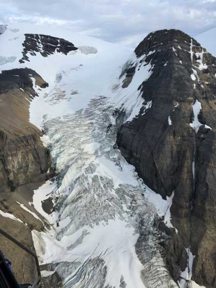
The thunderstorms had stopped overnight and we woke up at 5:30 am just after it’s bright enough to not need headlamps. I’m not a huge fan of starting in dark unless the route is obvious, and we figured there’s no particular reason to start super early on Tusk Peak anyway. The ascent of the dry Tusk Glacier looked steep but actually not. The slope angle was mostly 25-30 degrees that we could easily walk on crampons. We picked a rising traverse line out towards climber’s right passing a few deep, but not big crevasses and eventually pulled the rope out and merged onto snow after gaining ~200 m elevation. We had taken a lot of beta photo of this glacier from both the helicopter ride and higher up on Mt. Clemenceau so we knew where exactly to go. A steep, rightward traversing ramp wasn’t super obvious but that did give us the least amount of crevasses to deal with. The snow was unfortunately isothermal on this traversing ramp. We only had to probe carefully for one short stretch and didn’t have to step across any sketchy snow bridges, and in short time we were cramponing up firm snow towards the steep couloir underneath Tusk/Irvine col.
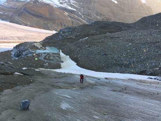
Oakley starting up the lower dry glacier.
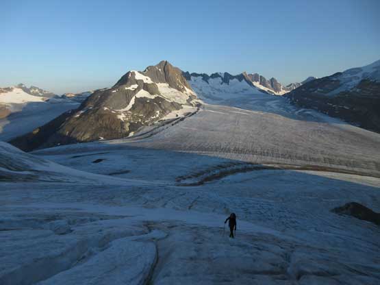
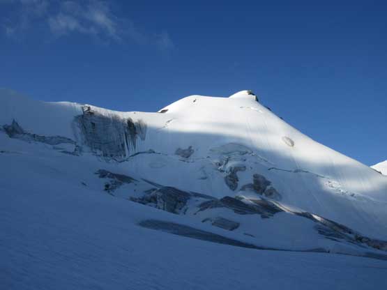
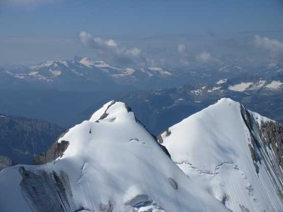
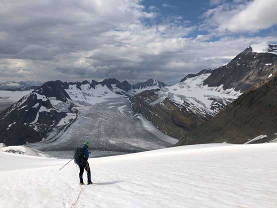
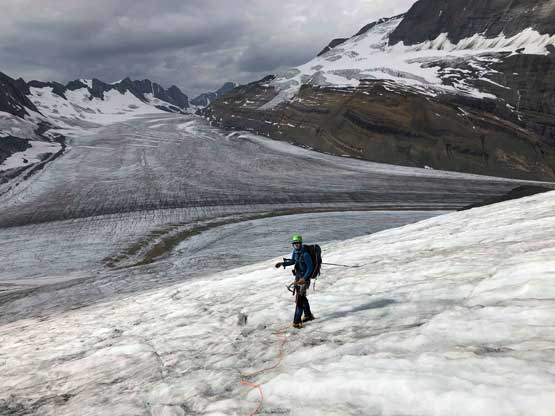
Oakley still on ice with Tusk Glacier and part of Clemenceau Icefield behind
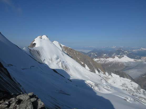
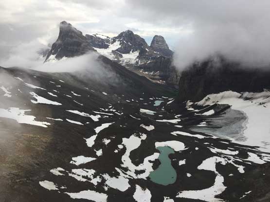
A closer look at Reconnaissance Ridge, my objective for the next day
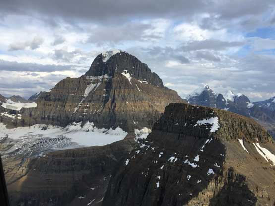
Negotiating around huge crevasses
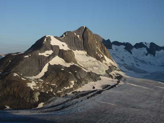
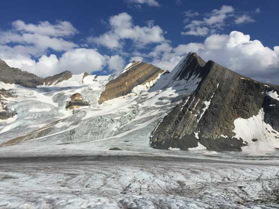
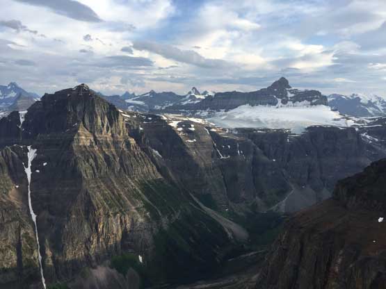
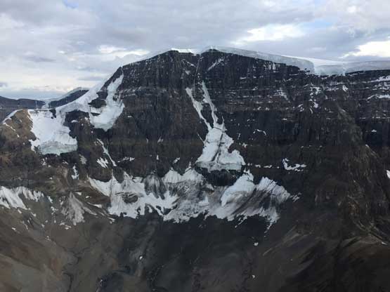
Mt. Chettan
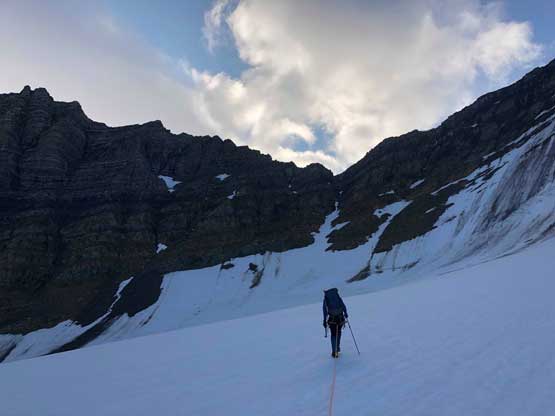
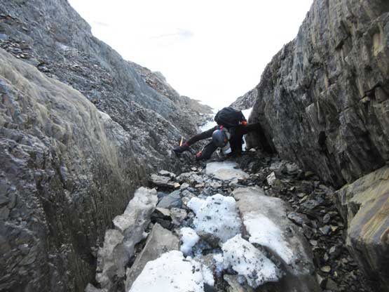
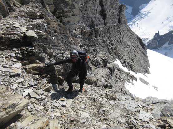
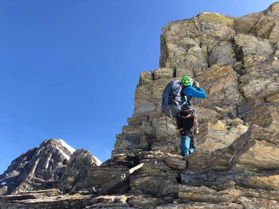
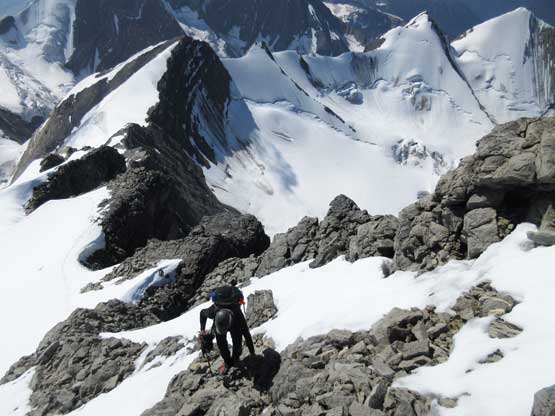
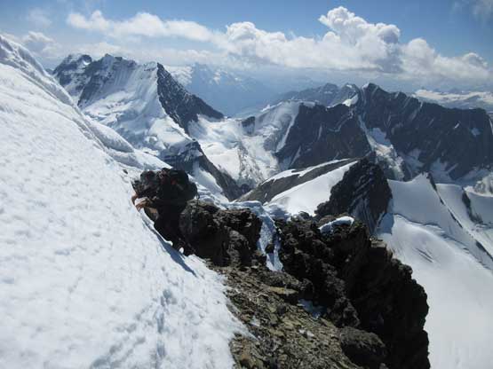
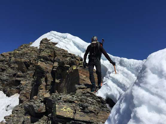
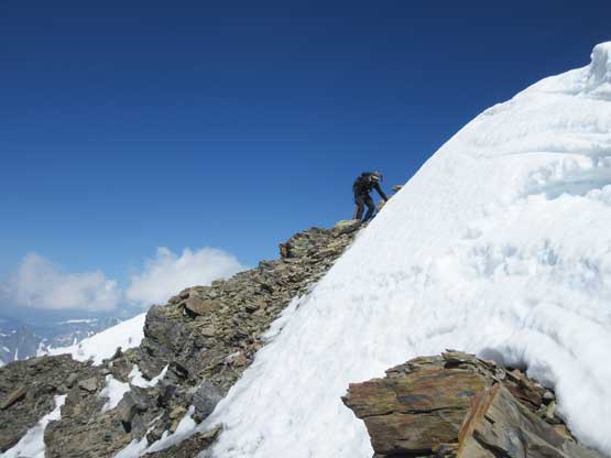
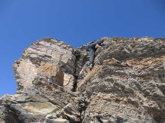
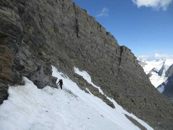
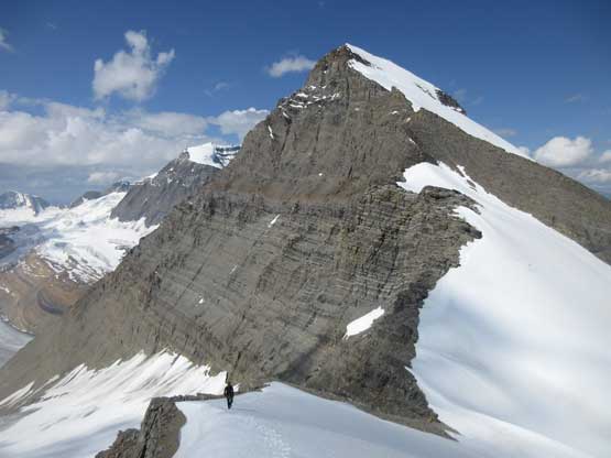
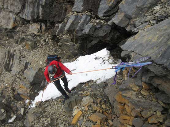
Me approach the steep gully leading to Tusk/Irvine col. Photo by Oakley W.
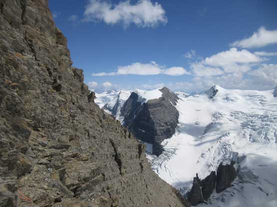
The ascent to the col appeared shitty and it sure was. The bergschrund at the bottom imposed no problem and then we had some easy 40-degree snow climbing but the snow ran out in short time. There were at least three wet and down-sloping 4th class steps in the middle of this gully that felt downright sketchy (I hate using crampons on rocks) but thankfully we did pass two solid rappel stations on the sides. We kept the crampons all the way to Tusk/Irvine col and the upper gully had mostly just class 2-3 scrambling, albeit on nothing but Rockies choss. The col offered our first head-on view of Mt. Shackleton and provided a natural spot to take our first long break of the day.
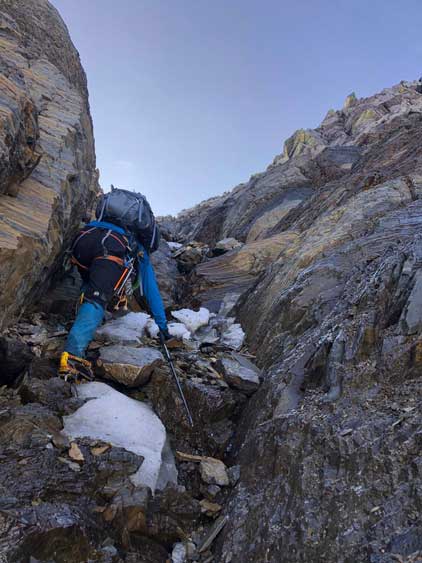
Oakley climbing steep snow into the couloir
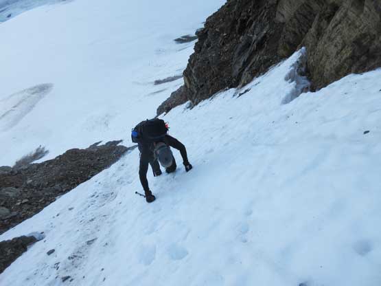
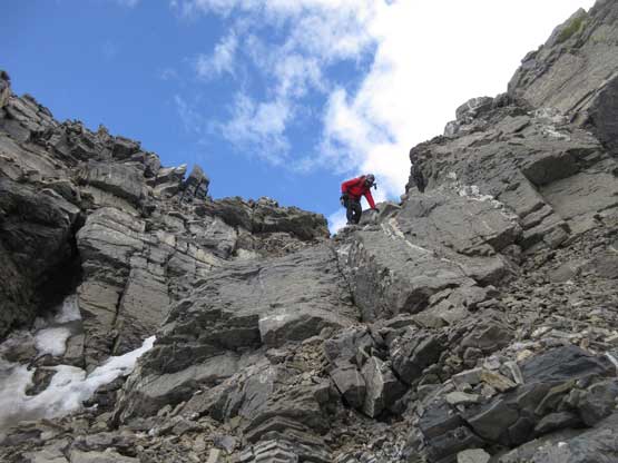
Oakley climbing up the first 4th class step. It was not pleasant
Me continuing up the shitty terrain. Photo by Oakley W.

Lots and lots of down-sloping choss. Photo by Oakley W.
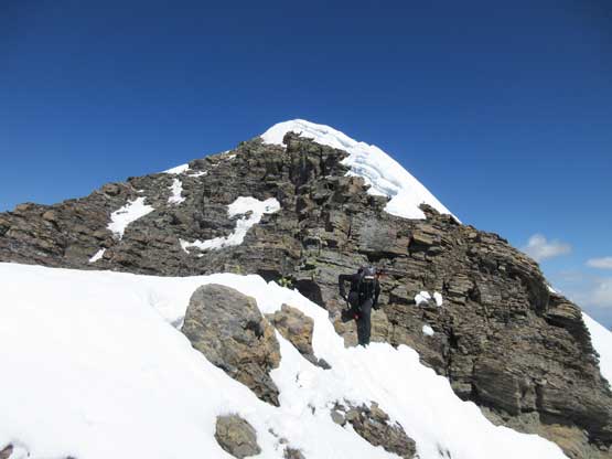
Gaining the col now, looking back towards Mt. Chettan
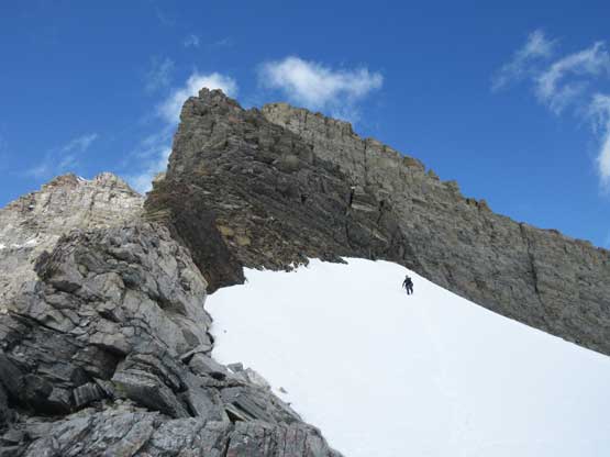
Oakley climbing above the col. We wanted to find a flat spot to take a break
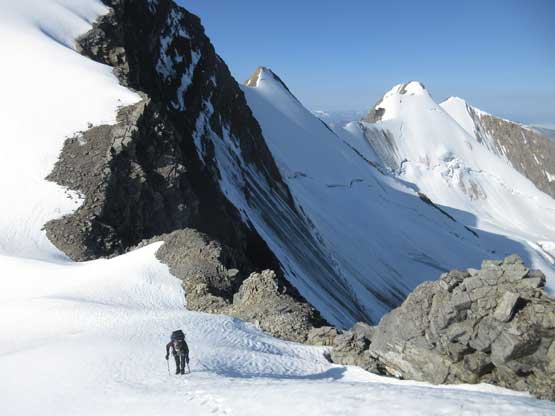
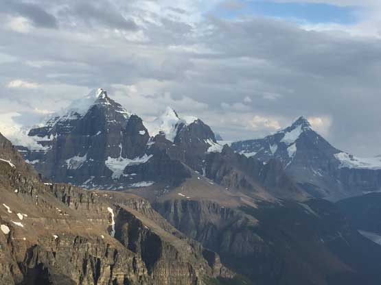
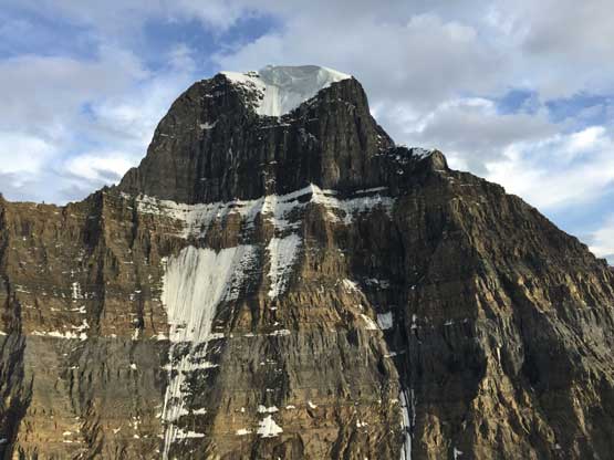
Our first view of Mt. Shackleton. This is one reason to come here…
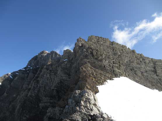
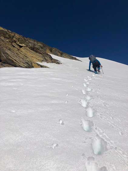
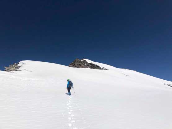
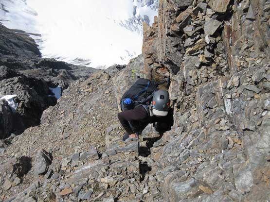
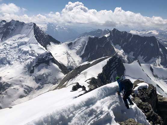
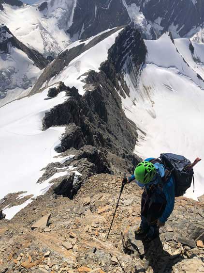
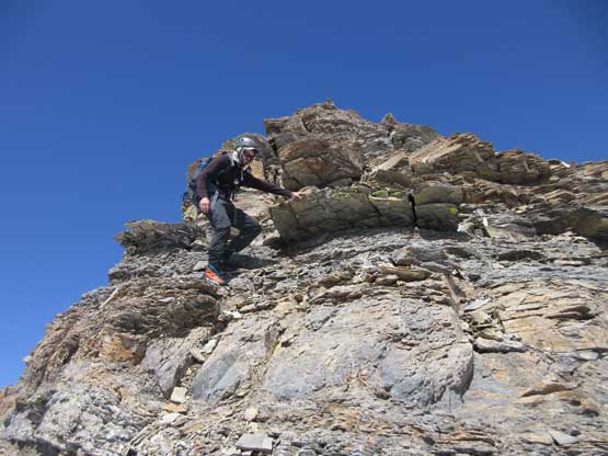
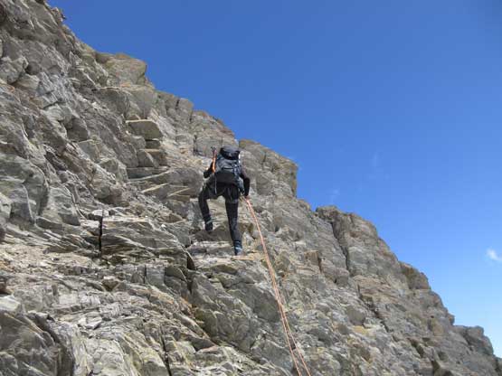
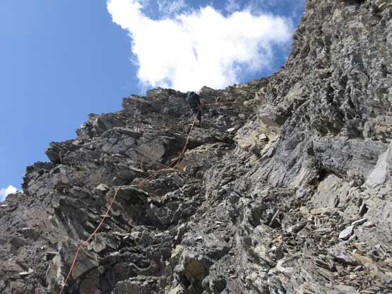
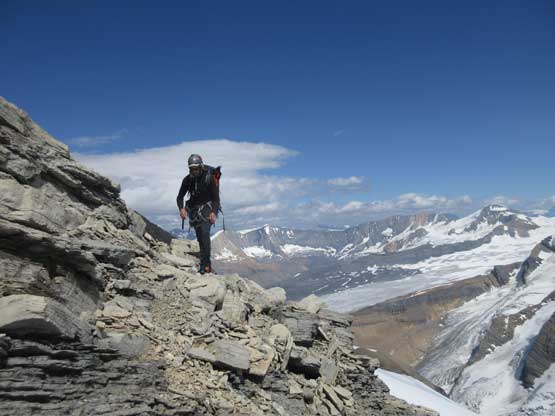
Upwards we started by traversing/ascending snow to the right of the ridge crest that involved a lot of knee deep post-holing. The post-holing was tedious but not unrealistic so we kept going on snow, until seeing the crux rock band ahead. My original plan was to do the snow bypass by losing 150 m elevation to the right but that route looked shitty and had some steep snow and crevasses to deal with. That would be fine in the right conditions but it’s south-east facing and had been baked under the sun for hours with no overnight freeze in the last two nights whatsoever. The rock step didn’t look too bad so why not. The scrambling along the ridge soon became worse than appeared because the rocks were mostly down-sloping dinner plates that broke easily upon touching. The scrambling was mostly exposed class 3-4 up until the last 15 meters but required extreme care. We took the rope out at the last rock step and meanwhile I swapped my mountaineering boots for rock shoes. Oakley was a much better rock climber but I was the one hauling rock shoes so I should lead. There’s one fixed piton to clip in halfway up but even with that extra bit of security I couldn’t make the 5.8 move over that overhanging lip. I probably can do it without a pack but not wanting to risk a fall I lowered myself by grabbing the sling I clipped into that piton, and went around on ledges down and out to climber’s right. I put in a size 1 cam and got up a few tricky low 5th class moves then done, but there came more problems. The rope was seriously dragged that I could not pull it up at all. After lots of cursing and frustration I simply detached myself from the rope and informed Oakley that he had to toss the opposite end directly upwards to me by wrapping the end around a rock. The first toss wasn’t even close but he got the second try perfectly done. With a top rope belay Oakley managed to mangle up that 5.8 lip with a heavy pack and on mountaineering boots. Impressive!
The snow wasn’t too bad at this time of the day yet
Looking ahead to the crux rock band. Route-finding is the key

Oakley transitioning from snow onto rock
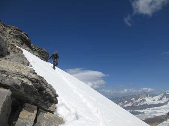
Looking back at an unavoidable steep snow traverse
Oakley picking his way up. I picked a slightly different line
Pretending to be happy. Actually not…
Talking about exposure. Breaking a hold isn’t an option.
The ridge scrambling was exposed
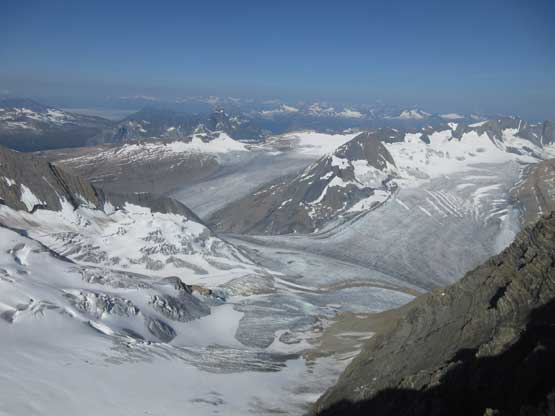
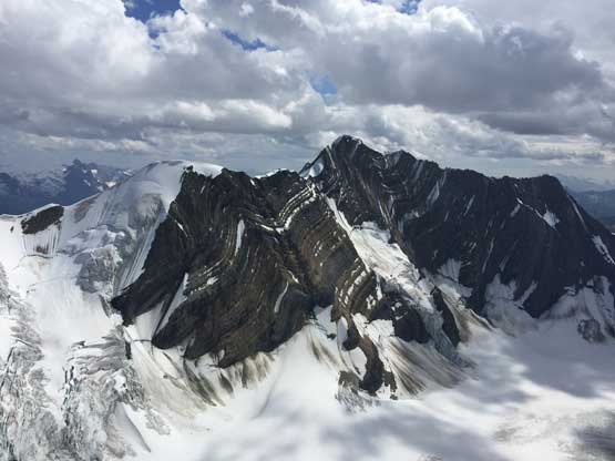
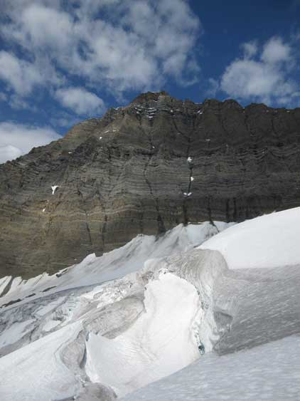
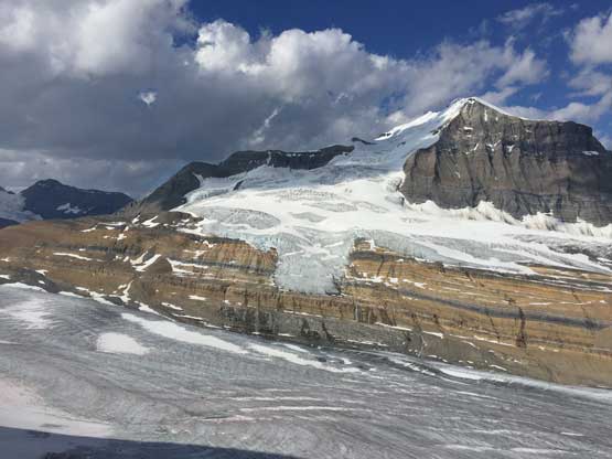
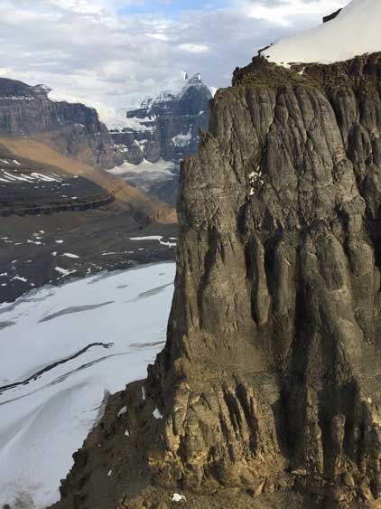
This is looking back down at Clemenceau Icefield. I like the layers of glaciers here
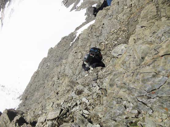
Me studying the crux pitch. Photo by Oakley W.
Partway up the pitch, looking down at Oakley belaying me.
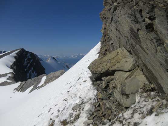
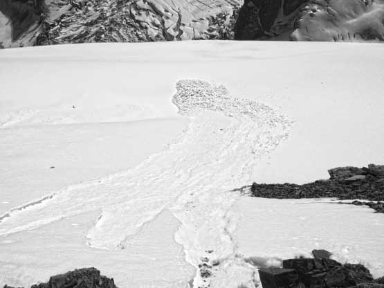
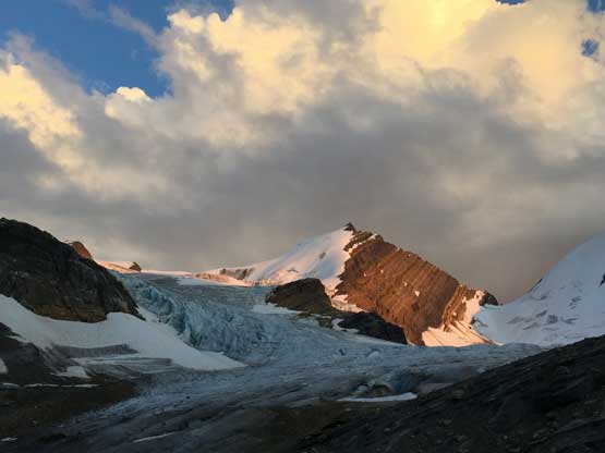
We made a call do ditch rope, rock gears and harnesses because we were tired of carrying them. I thought the difficulties were over but apparently not. Tusk Peak is one of the few remaining 11,000ers that didn’t have very detailed beta and nobody had overly emphasized on the difficulties above the crux rock band. A few steep steps had to be bypassed on snow, climber’s right side and the post-holing was more than knee deep at times. The rock always turned out harder than appeared due to the down-sloping nature. I started to think we might have made a mistake by leaving the gears behind as the final ascent onto the summit looked like it would definitely involve some 4th class. With my rock shoes I’d be more comfortable on those down-sloping shit but too bad I left them behind as well. I almost convinced Oakley that we had to go back and grab the gears but we were both too tired to afford another 200 m of elevation gain. I said fuck it and let’s just scramble the tower and how bad could that be. It turned out that the worrisome was unnecessary. Other than one short 4th class step the rest was no harder than 3rd class with careful route-finding, but we did pass a rappelling station so a rope would still help, just not absolutely necessary. Meanwhile we triggered a shit ton of avalanches on the steep SE Face by disloging choss down onto the snow. One basketball would trigger a size 2 wet avalanches. I liked tumbling rocks and we triggered most of the wet snow down the face. The snow was downright shitty and we had to avoid snow for all costs on descent. Wearing a beacon in August seemed wrong but not in this year…
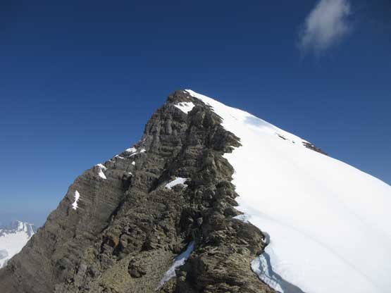
The upper south ridge of Tusk Peak. Looked easy but nope
This is looking over Mt. Chettan and Mt. Shipton when the lighting was still good
Oakley climbing up snow slopes with Mt. Shackleton behind
Me post-holing. Photo by Oakley W.
Me continuing post-holing up the endless slog. Photo by Oakley W.
Transitioning back onto rock now.
The first several avalanches that we triggered by simply knocking rocks down…
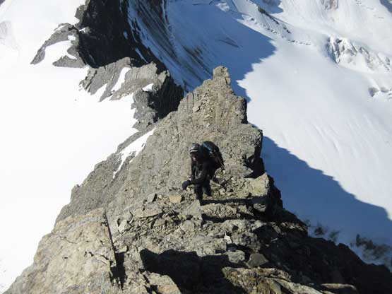
Oakley climbing up a 4th class step on the upper ridge
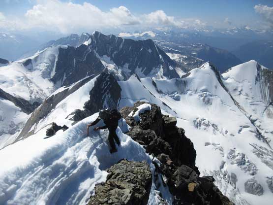
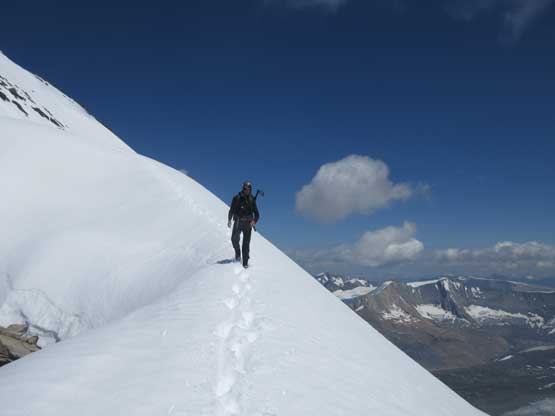
The summit ridge would be an easy stroll in dry conditions but provided another few steps of challenge to us. It appeared to be snowy and corniced and we wondered if we could make the summit or not. Given the avalanches we just triggered there’s no way would we step onto the snow on the SE side, but the ledge on the SW side wasn’t continuous. Thankfully the snowy step on the SW side was short, but steep and exposed. There were two spots that we had to get onto snow and both were sketchy, but shortly after that we were standing on the summit of Tusk Peak, 11,000ers 55/58 and only three more to go! We did take a long summit break despite the worsening snow conditions.

Me ascending onto the summit ridge. Photo by Oakley W.
Oakley negotiating the first snow step on the ridge
The second snow step on the ridge.
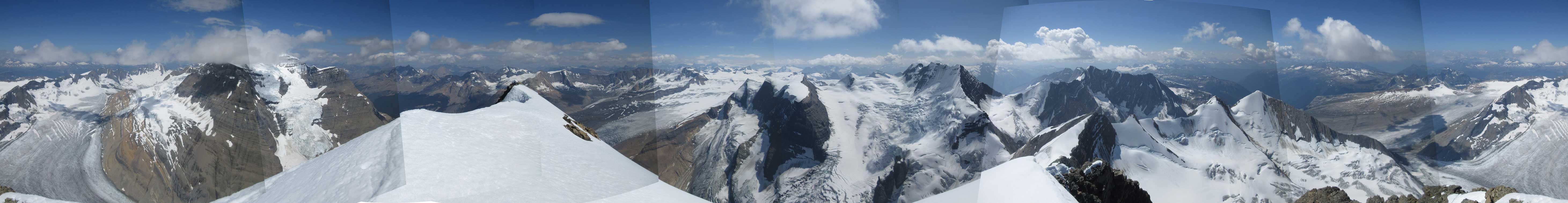
Summit Panorama from Tusk Peak. Click to view large size.
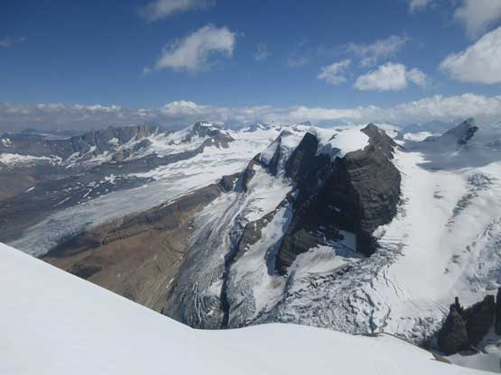
The massive south face of Mt. Clemenceau with summit engulfed in clouds
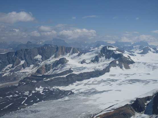
This is looking at Apex Mountain and Chaba Icefield

A closer look down onto Duplicate Icefalls

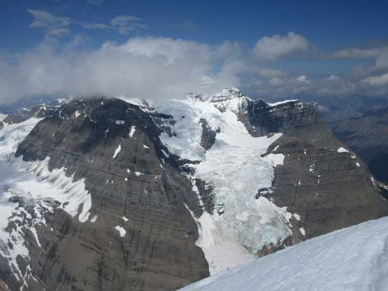
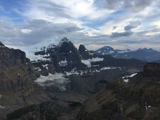
The north face of Mt. Shackleton
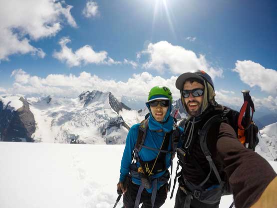
Oakley and I on the summit of Tusk Peak. Photo by Oakley W.
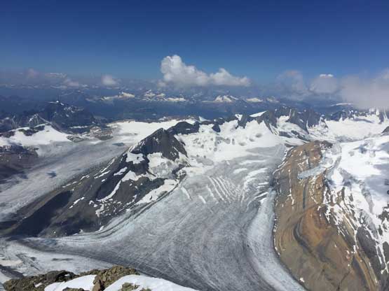
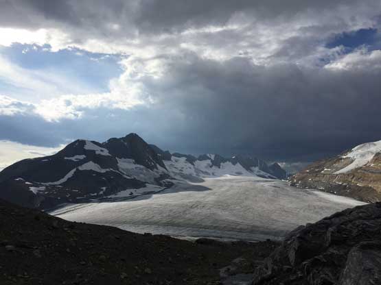
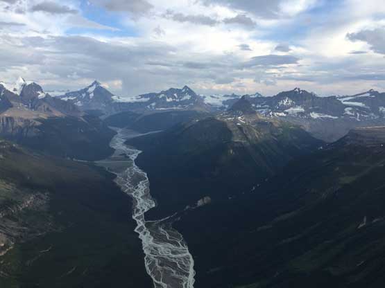
Tusk Glacier and Clemenceau Icefield
Reversing the two steps on the summit ridge wasn’t as hard as we thought and the down-climb of the long 3rd class stretch wasn’t too bad neither. The post-holing had become even worse on the flat sections and before committing to the steeper bypasses we would toss as much rocks down as we could to trigger all of the wet snow. We did trigger at least a few size 2 slides on the tracks we just ascended a few hours earlier so that was quite freaky. It turned out that we didn’t have to step onto steep snow by down-climbing some 4th class choss on the ridge crest. The crux zone required at least three rappels but after three raps using existing stations we were both too tired to down-climb exposed shit. I noticed a chicken head rock on the climber’s right side, checked it and made an anchor to extend our rappel. The 4th rappel got us onto snow. The steep traverse underneath the crux zone wasn’t avoidable and we were glad we didn’t trigger anything there. The grade of the snow under the crux zone wasn’t steep anymore and in another while we were back to Tusk/Irvine col. Despite the tiredness I had to slog up Mt. Irvine because it’s right there. Oakley wasn’t very keen but followed up nonetheless. The views were pretty good and we were both glad we didn’t lazy it out.
Oakley starting down the ridge
Me traversing back across the sketchy snow step. Photo by Oakley W.
More about the summit ridge and some unavoidable snow
Lots of snow-to-rock and rock-to-snow transitions
Time to down-climb choss. Photo by Oakley W.
Carefully down-climbing the long stretch of 3rd class
Very long reach to down-climb that 4th class step
Oakley on an aesthetic snow arete
Duplicate Mountain
Me descending with Mt. Shackleton behind
A closer look at Mt. Shackleton
A sideways look towards Duplicate Mtn. from near the crux
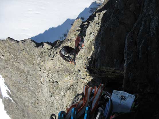
Oakley on one of the 4 rappels we did to get off the crux rock band
This was the 3rd rappel on the crux band
Traversing unavoidable snow beneath the crux rock band.
More descending on snow.

Onto rock now.

One last photo of Mt. Shackleton
Oakley with Chaba Icefield peaks behind
As you can see we had to hop between snow and rock for many, many times
Ascending Mt. Irvine now with Tusk Peak behind
North Face of Pic Tordu from the summit of Mt. Irvine
Me descending Mt. Irvine. Photo by Oakley W.
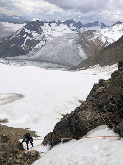
The descent of the couloir underneath Tusk/Irvine col started by some down-scrambling (on crampons), and then two rappels. The first rappel didn’t quite reach the second station with Oakley’s 50 m rope so we had to do a bit of down-climbing. The second rappel got us onto continuous snow and then we had an easy down-climb back to the bergschrund. The roping-up transition was awkward on a sloping slope like this but given the sketchy snow conditions we just had to play it safe. Some of our tracks in the morning had melted out on the glacier such that I had to use GPS to navigate, but for most sections we could just follow our own tracks. Lower down we went a little bit further down on ice before making that horizontal traverse back to our camp, as this avoided a few step-across over open crevasses. We arrived back to camp with a couple hours till sunset so the evening routing was pretty relaxed. That night we got poured on again by thunderstorms and the lightnings were again, seemed close.
Oakley descending into the upper gully
The first rappel we did in the gully.
Me on the second rappel in the gully. Photo by Oakley W.
After the rappels we had to down-climb steep, but easy snow
Back onto the glacier now.
West Face of Tusk Peak with Tusk Glacier’s crevasses below
Lost the tracks here. Me checking my phone again. Photo by Oakley W.
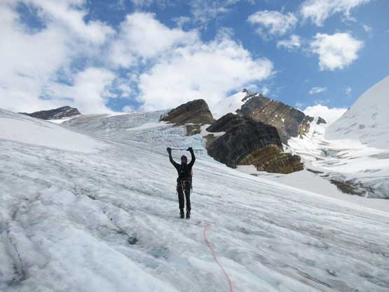
Oakley doing some victory poses
Me on the lower Tusk Glacier. Still not quite home free yet…
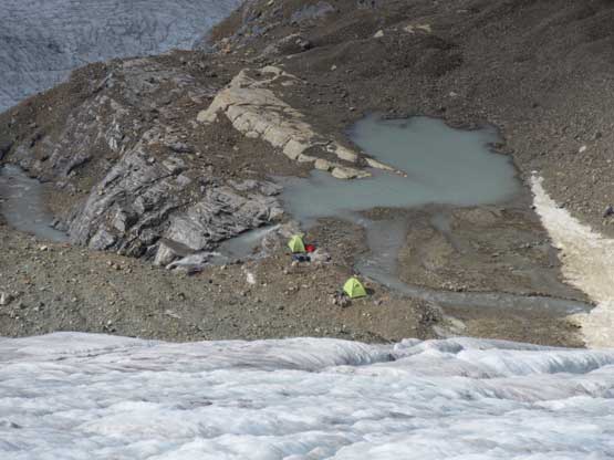
Could see our tents at the basecamp

Finally back to our camp.
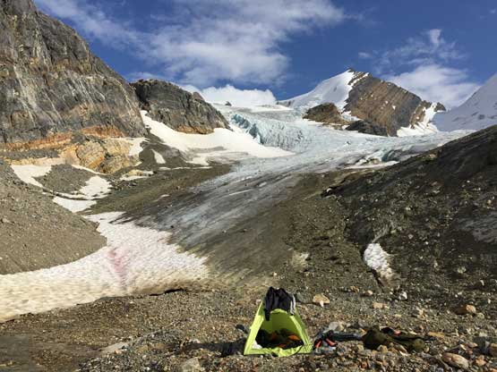
Oakley’s tent with Tusk Glacier behind
Me and Mt. Clemenceau.
Oakley at camp
Looking at Mt. Shipton
On the 4th day the plan was to lazy out at camp but after a while we started to get bored. Given the conditions we wouldn’t be able to climb anything on snow anymore so Mt. Shipton even Mt. Chettan was out. The only summit doable was Reconnaissance Ridge and even that peak looked a bit sketchy towards the very top. At 3:30 pm I made a call to scramble Reconnaissance Ridge but Oakley opted to rest at camp. The scramble turned out to be an exposed 3rd class near the top with very shitty rocks.
Tusk Peak from Reconnaissance Ridge.
Mt. Clemenceau from Reconnaissance Ridge
Plodding back across Tusk Glacier. Looking at Mt. Irvine, Mt. Chettan and Mt. Shipton
Tusk Peak and Tusk Glacier

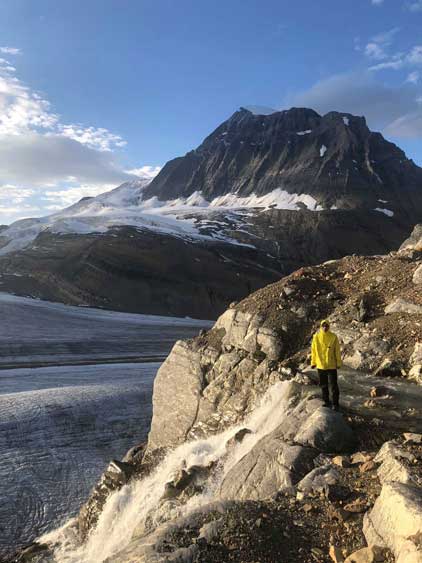
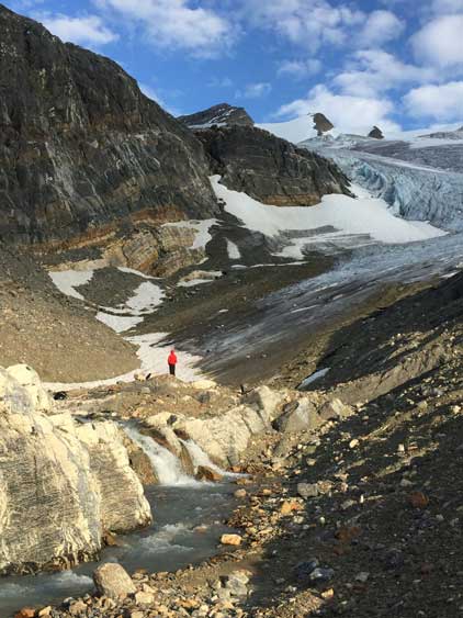
This is the set of waterfalls that drains the lake we camped at
Mt. Chettan on evening glow
The planned helicopter pick-up was before noon on Friday (Day 5) so we slept in till 9 am, had a leisure breakfast and packed things up. There wasn’t enough time for us to do anything on the last day so we just waited. Oakley received a message via inReach at 11:30 am that the heli had arrived at Fortress Lake but in another half an hour we had no sight of the heli. Oakley texted back to his boss and sure there was a problem. Ralph forgot to pick us up and a young pilot came to the campsite instead of Ralph himself. The young pilot were not allowed to fly into unknown locations and the new plan was to pick us up at 7 pm. This was not good because the weather was supposed to turn shit in the afternoon and remain shit for at least the next three days. I did have extra food but Oakley had zero extra food to stay for even one extra day. What a shit show… We were both very angry about the mess so we texted back saying we had no food and if Ralph couldn’t pick us up in the evening then our only “alternative plan” was to press SOS to initiate a rescue. I have learnt from international travelling/climbing friends that sometimes you must push people in a pressurized way and this came in practice. The weather did hold off for us but was apparently very shitty in the Alberta side of the divide, but Ralph did come at 7:30 pm to pick us up. Oakley had to be dropped off at Fortress Lake for work and it was already pouring at the lake. The flying back to Cline River was scenic and very dramatic. Awesome weather as we flew by Mt. Alberta but the last leg down Cline River was done right in an intense lightning storm…
The day started from bluebird but gradually became overcast
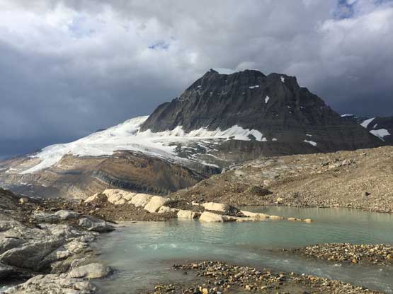
Mt. Clemenceau and our tarn. It was threatening to rain
Flying by the steep icefalls on Mt. Clemenceau’s south face
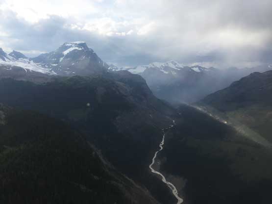
Looking down Clemenceau Creek valley with Mt. Bras Croche on left
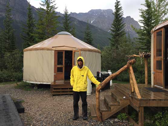
Me at Fortress Lake campsite
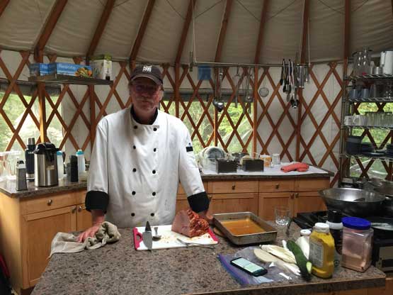
The cook gave me a big sandwich. Thanks!
Me at Fortress Lake. Fortress Mountain behind that I ascended in 2013
Another photo of me at Fortress Lake
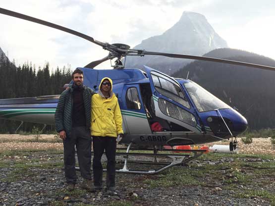
Oakley and I with the helicopter.
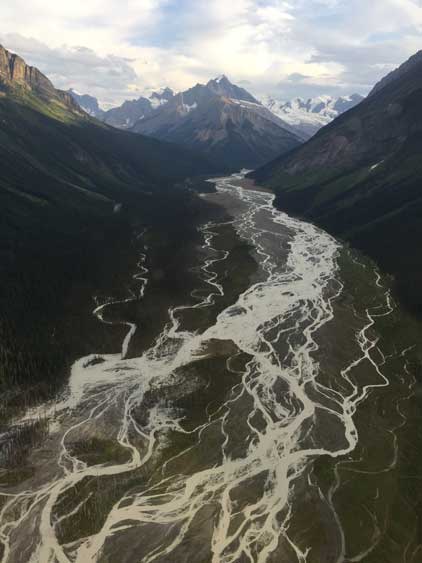
Flying over the very braided Chaba River

Flying beside the complicated massif of Mt. Quincy
Looking into the upper Athabasca River valley
Sundial Mountain on right
The headwaters of Athabasca River
The Twins and Mt. Columbia
Flying towards the west face of Mt. Alberta
Flying past the north face of Mt. Alberta
We flew really close to the lower step on Mt. Alberta’s NE Ridge
North Face of Twins Tower and the “Black Hole” from near Woolley Shoulder
Steep icefalls coming from Stutfield NE Peak

Stutfield Glacier
East Face of Mt. Kitchener
A full show of Athabasca Glacier. The tourists must be looking at us now…
The classic shots of Mt. Athabasca and Mt. Andromeda
Icefield Parkway and Parker Ridge underneath us
The massif of Cirrus Mountain ahead
The weather quickly collapsed as we flew into David Thompson Country
It was pouring at the landing site and the few minutes of transition into my truck had got my gears (and myself) all thoroughly soaked. A quick check in forecast showed no improvement in the next two days but Jasper was the only area without rain in the following day, so I made a decision to drive north instead of going south. The traffic gong show on Highway 1 still had impact on me. I figured there’s less risks on Highway 5 because most hordes travel on Highway 1 between BC and Alberta. I found a parking lot in the middle of Jasper townsite to sleep in my truck, and then had a big breakfast in A&W the next morning. I paid a visit to Ben’s place just to say hi and exchange some stories over the year. I don’t think I can make to the Rockies again in this year so I would have to wait at least another year to see Ben, so good to catch up with friends. The weather was overcast so I abandoned my plan to scramble up Cinquefoil Mtn., and started driving home. The weather was surprisingly clear at Mt. Robson so I joined the tourists.
The drive southwards down North Thompson Corridor had me seeing darker and darker clouds looming above but past Barrier all I could see was mostly sunny skies. There was an intense thunderstorms warming for all of southern interior BC for that afternoon but the actually weather just didn’t reflect that. I made a spontaneous decision to hike up two of the small hills nearby, Gibraltar Rock and Rockface Mountain and maybe do some storm watching. It turned out that the storm didn’t arrive until very late in the evening. It was already dark and after a stop in Kamloops for dinner I resumed the drive. I was tired but wanted to make it back home that night, but had to pull out at Abbotsford to sleep in my truck. It was only 30 min from home but I just couldn’t do it… The next morning I had a leisure start and drove back home, and that concluded another successful 11,000ers mission.
