Ipsoot Mountain
June 8, 2021
2576m
Pemberton, BC
Ipsoot Mountain is a large and tall glaciated massif directly to the west of Pemberton and is visible from a lot of summits in the vicinity of Pemberton. There are quite a few ways to access but ever since Simon published his trip report on ClubTread the SW approach from Branch 550 of Rutherford Creek FSR had become the standard route. This route can be done easily in a day and is suitable for skis, snowshoes or foot travel in summer. I had wanted to ascend this peak for at least 5 years but my original plan was always to link a bunch of summits into one loop traverse, but in the end I decided to follow the trend and just did it in a day. I decided to take some variation of Simon’s route to optimize a few sections and it turned out reasonably well.
Matt suggested to do one of those “P600m” objectives in Pemberton area on this past Tuesday despite the not-so-great weather forecast. I double-checked the forecast and felt rather meh, but then Elise was instantly game. A few hours later I decided to pull the trigger mostly because of peer pressure but I did see the potential of a brief clearing window in the morning. It was just not guaranteed. I also did not know how this could be squeezed in as a before-work trip but since we were going to leave North Vancouver at 3:30 am I figured it’s worth a try, so I did not cancel the work. As always to go north meant I had to wake up earlier than everyone else. I only got about 2 hours of sleep and woke up at 2:40 am. Thankfully Matt offered to drive so I could take some rest breaks while commuting from North Vancouver to Pemberton. The Rutherford FSR was as smooth as one could expect for a logging road in SW BC but the Branch 550 was definitely in a 4×4 shape. There were numerous water bars and the grade was very steep. Matt’s new GMC Yukon bottomed out at least three times and at 1050 m elevation we decided to turn around and park. This meant an additional 300 m of elevation again and a few kilometers of distance must be plodded on foot.
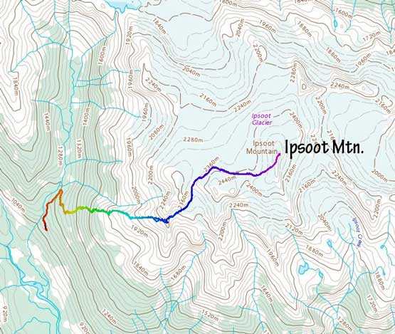
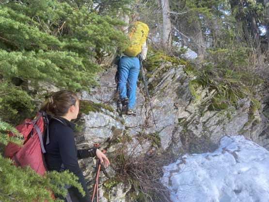
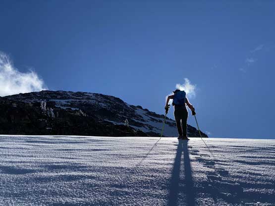
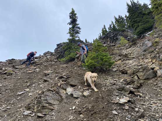
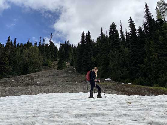
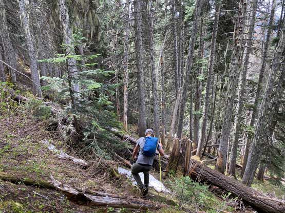
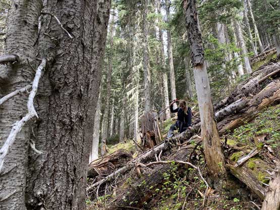
As always I would prefer to dispatch the distance on a road/trail on trail shoes while carrying mountaineering boots but everyone else opted to use only one pair of footwear. The road’s grade was indeed very steep that I could feel the calves’ burning in no time. It was not very clear where we should leave the road to bail into the steep forest and we ended up plodding almost to the highest end. I spent a few minutes swapping footwear while double-checking the maps. The plan was to trend climber’s left to the base of a large opening area shown in the satellite images. I did not know whether that’s scree or slabs so the decision had to be made after seeing that section. The bushwhacking from the cut-block to the base of this aforementioned area was much easier than expected. The area proved to be mostly mud and scree, so the new decision was to ascend directly up the middle of this choss path to avoid more bushwhacking. The going was not as easy as we had hoped for, but also not terrible. There was some hands-on scrambling needed in a few spots but the going never became too exposed. This variation successfully led us bypassing most of the bushwhacking lower down and into the continuous snow higher up. There was one tricky bluff to scramble over once the snow became continuous. We picked a direct line that involved a couple climbing moves because none of us was in the mood to search around at that point. We then took the first break in the cold but 5 minutes after that we marched into sunshine.


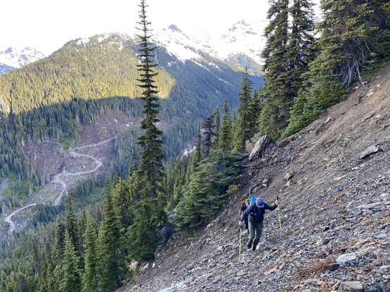

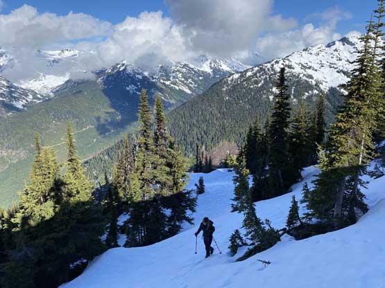
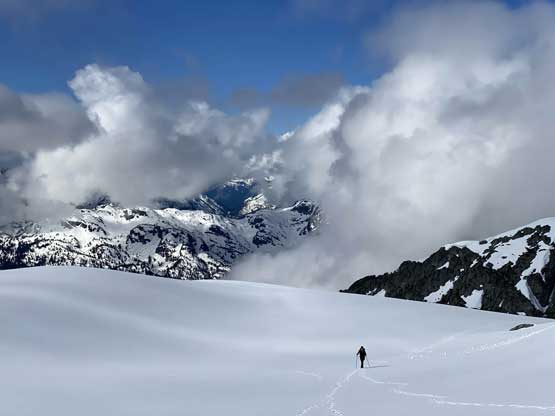
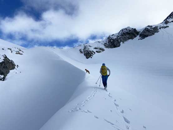
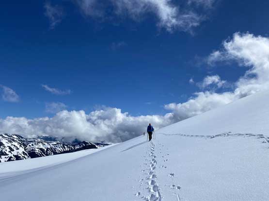
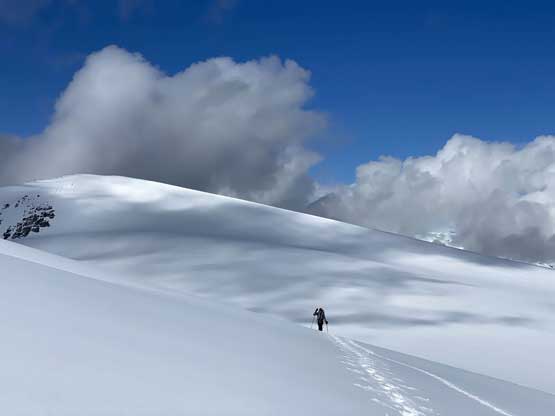
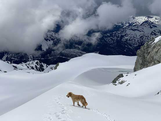
Matt then led us ascending a few more rolls in the forest before coming out of the woods at around 1900 m elevation. From here we trended slightly climber’s right aiming for a high shoulder as that’s my plan to bypass the steep scramble directly ahead of us. Once topping out on that shoulder all we saw was cliffs and cornices on the opposite side, but right next to the rock face there was indeed a path/ledge that offered a passage. We did have to lose around 30 m elevation (mostly by one long glissade) and the elevation loss was unavoidable no matter what route to take. At this point we had encountered increasingly deep fresh snow to about 20+ cm on isolated spots. The post-holing had taken over and certainly slowed us down a bit. The traverse across this south-side bowl towards, then up a wind scoop to the lowest col displaced ahead was very foreshortened and once there we took the next break regaining some strength. The col was a very cold and windy place that we all had to don all layers that we had brought up.
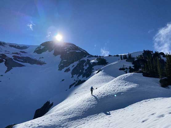
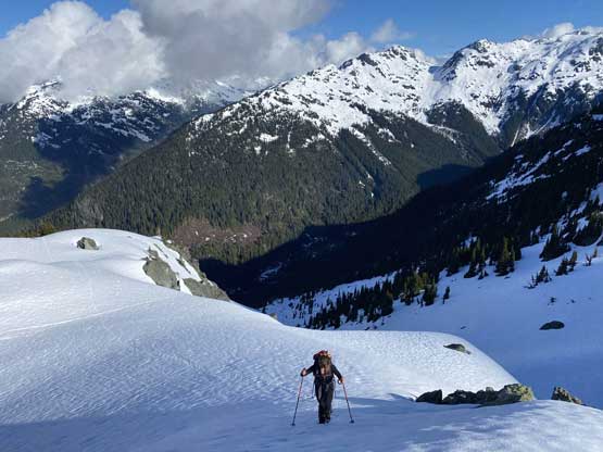
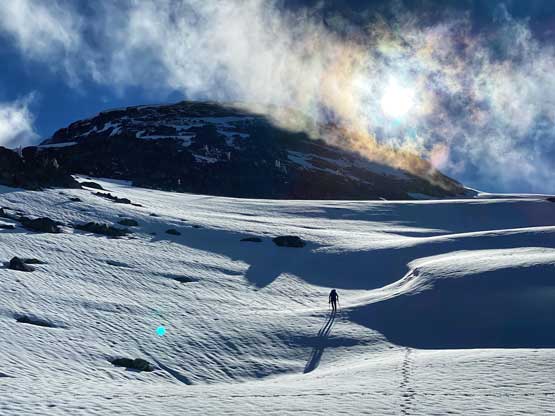
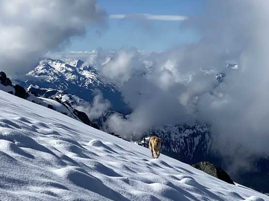


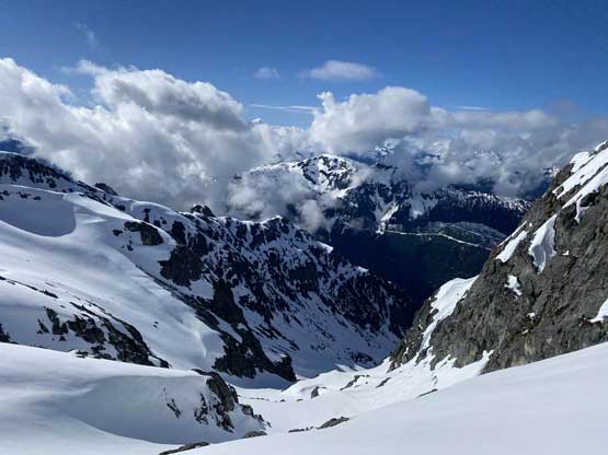
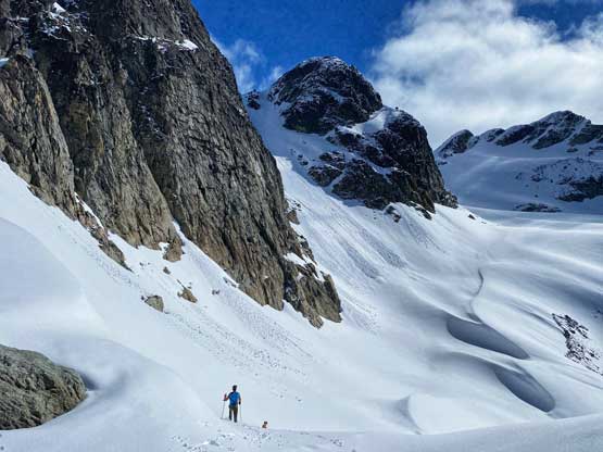


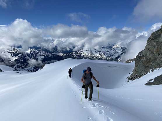
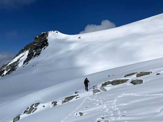
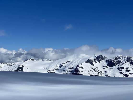
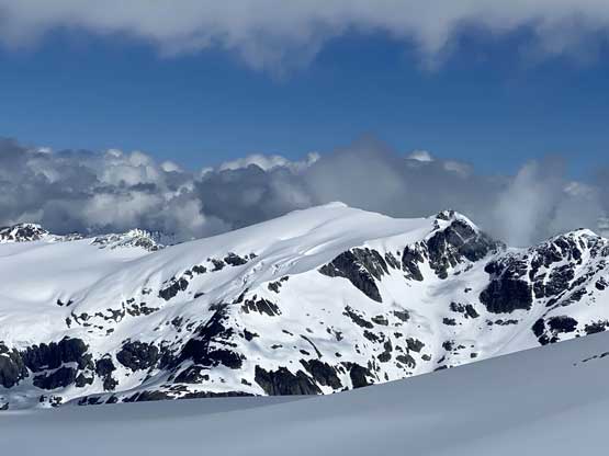
It was tempting to ascend the bump/ridge directly to the east of us but GPS would not lie. Ascending that bump would mean to lose all of the hard won elevation on the opposite side, so we traversed north onto the Ipsoot Glacier to bypass the bump. Matt took over the lead and plodded a line that’s a little higher than I had planned, but it also worked out nicely with very minimal elevation loss. The plod across Ipsoot Glacier towards the summit block was very foreshortened but such was as expected. We got some great lighting while plodding across this glacier but the weather had turned overcast when we made the summit.


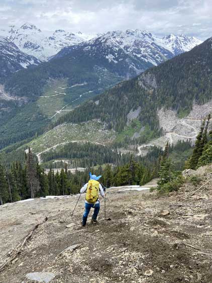
We took a long break on the summit but the weather did not show much sign of improving, so we reluctantly retraced our steps back down onto the glacier. We then plodded back across the glacier and then the south side bowl for as fast as we could, then enjoyed a series of glissades to descend into the treeline zone. We were still linking up glissades even at the treeline section but boot-skiing also worked well. Descending the steep snow-covered forest wasn’t as bad as I thought such that ice axe and crampons stayed in our packs for the whole day. That choss zone was also not too bad on the descent because we could just surf the loose layer. The rest of the descent back to the logging road was rather uneventful following Matt’s lead. We were surprised to see a truck driven to the highest driveable end and even more surprisingly, Matt had recognized the driver from his mountain biking community.


Our round trip time was 6 hours 50 minutes and that’s a tad faster than most trip reports indicated, especially considering that we didn’t even drive that high. Negotiating those water bars on the descent proved a little challenging for the GMC but we did get down with no mishap. I unfortunately had to cancel the first hour of work because it’s obvious that I wouldn’t get back to White Rock by 4:30 pm. We got back to North Vancouver at 4 pm but the drive from there to White Rock took me 1 hours 40 minutes thank to the traffic gong show. There’s one major accident on Highway 99.
