Mount Stuart
September 28, 2016
2870m
Leavenworth / Wenatchee Mountains, WA
The gigantic granite massif called Mt. Stuart sticks out of the Wenatchee Mountains and the topographic relief dwarfs everything nearby including the world-class Enchantment area, thus by no doubt Mt. Stuart is the most sought-after objective, the crown jewel of the Central Cascades. It’s also known as the second highest non-volcanic peak in the entire Washington state. For all these reasons it boasts about a dozen routes including the complete N. Ridge (IV, 5.9) listed in the Fifty Classic Climbs of North America. The W. Ridge which goes at II, 5.4 is usually taken by intermediate climbers but for folks lacking technical experience, the climber’s descent route, namely the Cascadian Couloir on the south side does offer a scramble route to reach this lofty summit (class 2+). When snow free this is mostly just a scree plod, albeit a long grunt considering the approach and the shear amount of elevation gain. In these days the Cascadian Couloir has become the most popular route on this mountain and is exactly the one I would take.
The most direct approach to access the south side of Mt. Stuart is by Longs Pass starting from Teanaway Trailhead and to get this started, I had to drive a long ways around from I-90 corridor with the last 10 miles on a dirt road. Folks on a Facebook group did help me confirm that the road was drivable in a small car but still, it’s almost 5 hours each way considering the possible delays in the border crossings. Vlad joined me at the last minute but we together only had one day. To make this trip happen I volunteered to put down an entire “all-nighter” drive and by 10 pm on Tuesday night we managed to leave Vancouver. The border crossing took about 20 minutes and then it’s a cruise sailing down south along I-5 and then I-405 to Bellevue. Turning onto I-90 I had no problem making to Cle Elum and then it’s the Teanaway Road. We took the north fork on a critical junction and then the road transitioned to gravel. Some careful work later we did manage to park at the trail-head by 3 am so we did earn about 3 hours of sleep.
Mt. Stuart ascent route via Cascadian Couloir. GPX DL
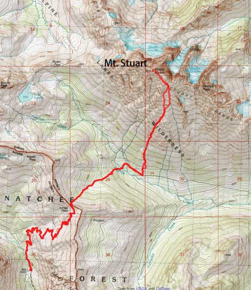
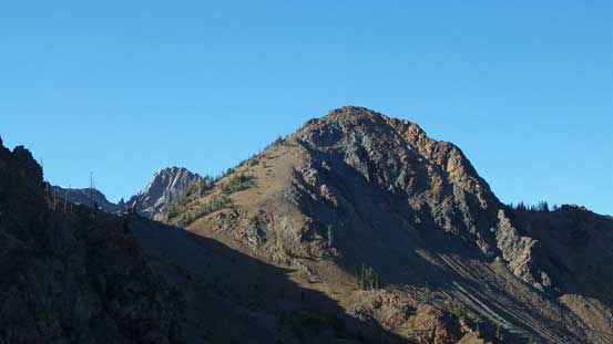
The morning was cool and peaceful but the sky had unexpectedly turned overcast. Given the bomber weather forecast we all questioned what the heck was actually going on. Oh well, up we went anyway… The trail was very well signed and in short time we passed the first turn-off. Taking the right hand fork we started to gain elevation fairly rapidly. The endless switchbacks brought us up to the sub-alpine in no time and then it’s time to watch some neat alpenglow on the surrounding walls. Marching upwards we arrived at the second junction and this time we took the right fork again (left fork would go to Lake Ingalls), and some more switchbacks later we arrived at Longs Pass.
Alpenglow on the nearby walls. I don’t think that peak has a name though.
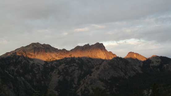
The peak right of center is Esmeralds Peak
From Longs Pass, the south face of Mt. Stuart looms impressively in front
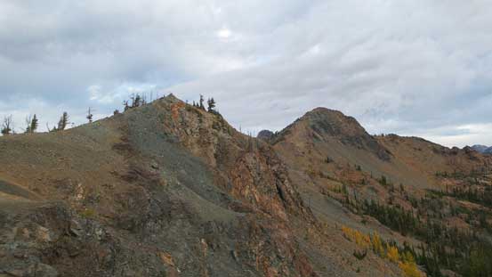
Ridges extending from Longs Pass.

More about the morning colours on the horizon

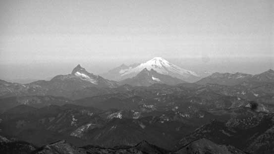
The mighty Mt. Rainier with the Emmons Glacier directly in sight.
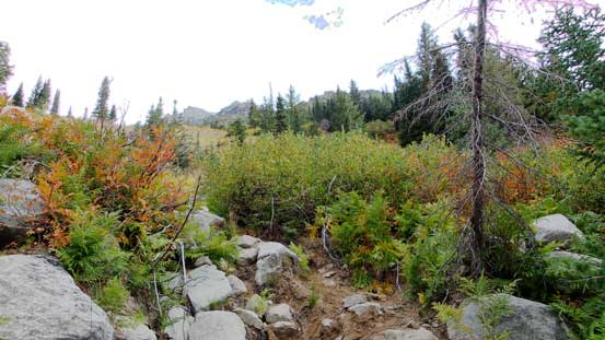
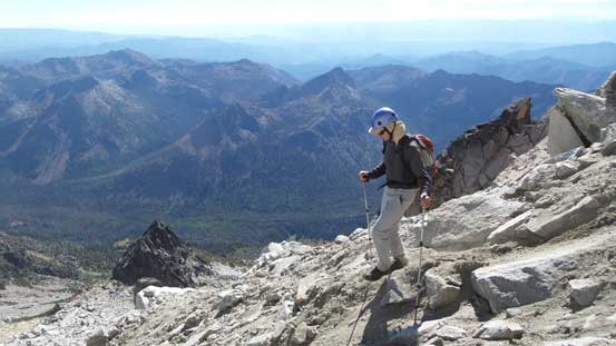
Ditching sneakers and don mountaineering boots we soon started the steep descent down into the upper Ingalls Creek valley. During this section we’d lose most, if not all of the hard-won elevation we just gained (more than 500 m). The initial bits involved some scrambling on loose terrain but there’s always a path showing the way. Into the woods we had no problem following the trail all the way down into the valley. Ingalls Creek was easily crossed on a well-placed log and then we passed a campground. We picked up the trail on the other side and then followed it further down for a few hundred meters. Upon arriving at a large open area (marked by a cairn) it’s time to head up.

Dropping down from Longs Pass

Looking back. It’s going to be quite a grunt on the way back…

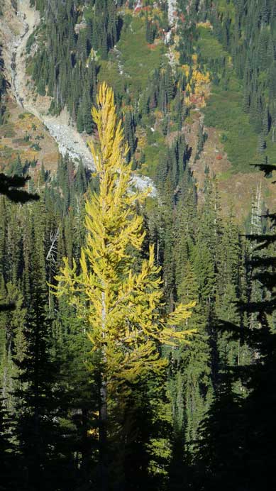
The larches were on!
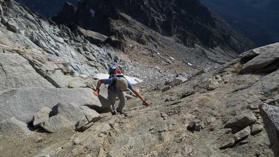
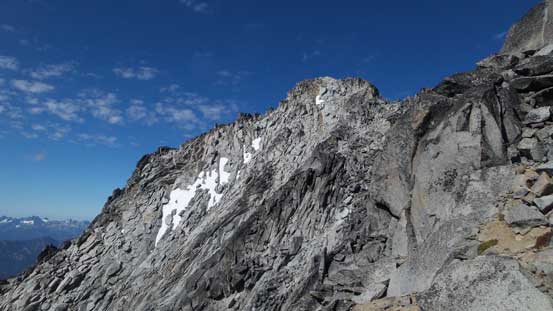
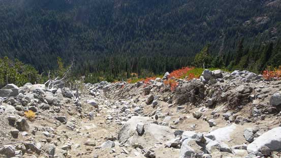
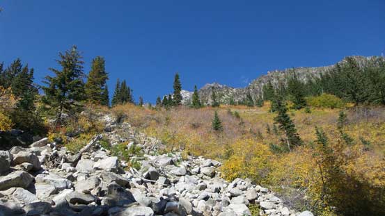
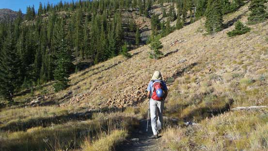
From here all the way to near the false summit would be nothing but a long plod, for a total of 1500 m or so. The forest was put behind in short time and then the terrain funnelled into a water course gully feature. We stayed in the middle of the gully for most of the way although there were paths on the sides occasionally too. Exiting this feature we entered the stretch of Cascadian Couloir. This part was not nearly as steep as appeared and went at class 2 only. For a couple spots we detoured to the climber’s left side and other times we stayed right in the middle of the fall line. The ground wasn’t nearly as loose as advertised on other sources but that might due to the fact I came from the Rockies. Exiting the couloir we lost the path and went for climber’s left side and that dumped us into the middle of a boulder field. The chucks of those granite soon became huge and then I led us traversing further to the left, and then it’s another long section of plod to the base of the false summit.
Going up again. We’d soon break out of the trees

Following this water course gully up.
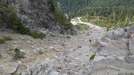
Entering the Cascadian Couloir now, looking down

Looking up from midway up the Couloir

Already higher than Longs Pass now. The pass is right at the center of this shot
Looking sideways the terrain is still quite steep overall

Mt. Rainier always catches one’s eyes

Exiting the Cascadian Couloir now. It’s still a long plod to hit the false summit traverse

Vlad opting for a harder step

Gaining height rapidly..
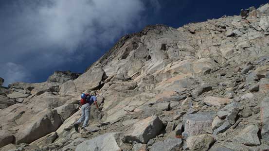
Vlad picking his way.
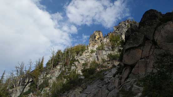
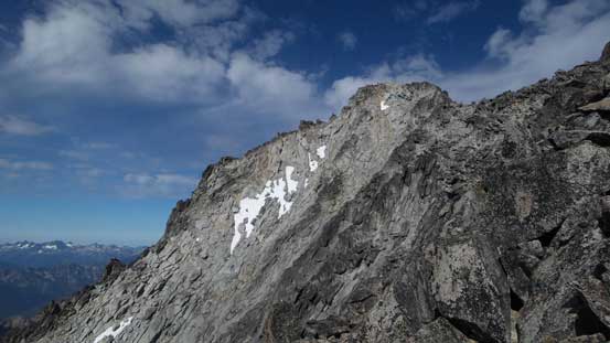
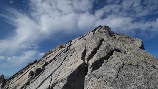
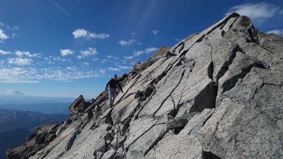
The terrain steepened near the false summit but the route-finding was generally easy. There were paths and cairns leading the way and we crested the left hand side skyline ridge at the correct position. There’s no need to ascend the false summit and instead we dropped a bit on the opposite side and then traversed across some ledges (again, marked by cairns). A few harder spots could be easily bypassed but we just went straight across. I ascended onto the ridge crest earlier than necessary in search for more fun scrambling. Near the summit a short class 3 step was ascended and then it’s a fun traverse across the final slabby stretch to reach the true apex.
Ascending the last few meters to the shoulder below false summit
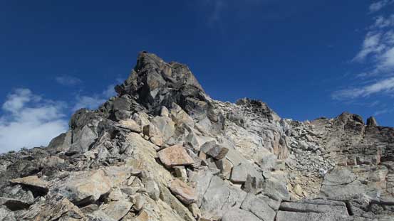
As you can see, we didn’t need to ascend the false summit itself.
The true summit appears in front now

Looking down at the attached Sherpa Peak. It’s apparently not an easy peak to ascend…

We didn’t have to down-climb this challenging step, but it’s fun so why not..

I opted to hit the ridge crest earlier than necessary for more fun scrambling

It’s a shear drop on the other side.

Looking back towards the false summit.

Vlad attacking the next step
It’s the final traverse to the true summit
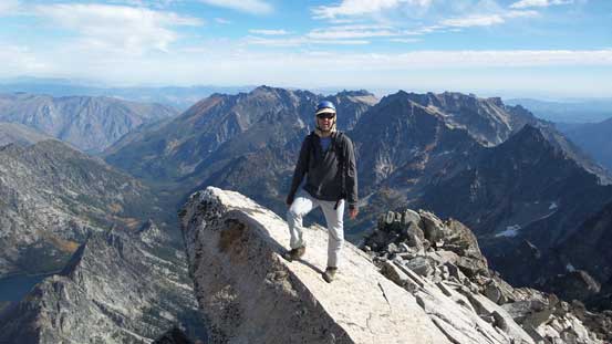
Vlad on top of that signature slab
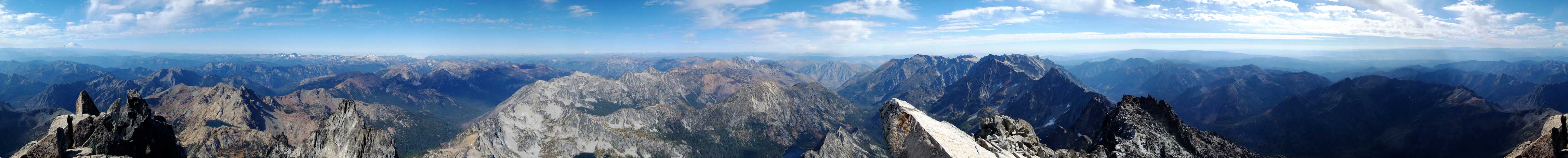
Summit Panorama from Mt. Stuart. Click to view large size.

Looking towards Leavenworth area, Cashmere Mountain at center

In the foreground is part of Jack Ridge which extends northwards all the way from Mt. Stuart

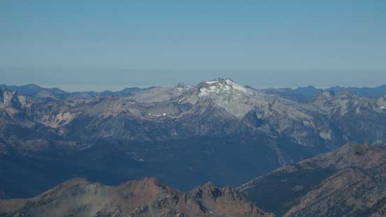
A closer look at Glacier Peak – the most remote volcano in the Washington’s Cascades
Mt. Baker with the “Matterhorn of the Cascades” – Sloan Peak, and Mt. Pugh in front.

Baring Mountain and Gunn Peak by US-2 corridor

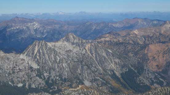
Peaks in the core area of Alpine Lakes – Summit Chief Mountain, Chimney Rock et al.
Mt. Daniel is that glaciated massif, also in Alpine Lakes area

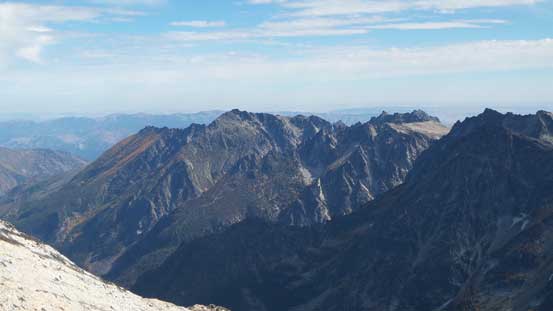
A sea of peaks all below us. Too lazy to figure out their names..
Cannon Mountain et al. in the Enchantments
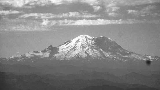
A zoomed-in view of Mt. Rainier
Eightmile Mountain in the foreground
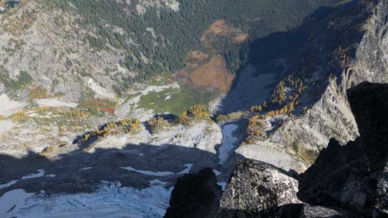
Looking steeply down the north face of Mt. Stuart

Stuart Glacier way below

Lake Stuart
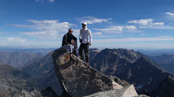
Vlad and myself on the summit of Mt. Stuart

Another panorama shot from the summit. Click to view large size.
We stayed on the summit for about 1 hour but then it’s time to get moving. After reversing the very top part of the summit ridge we all took Vlad’s route which traversed below the ridge crest. From the top it’s also easier to spot those cairns so easier to find the path with the least amount of resistance. Up and over the saddle below the false summit and then into the “funnel” we found a pretty good path staying mostly on loose dirt and that got us down in no time. This path descended way to the skier’s left side so once making sense we left it and traversed to the entrance of Cascadian Couloir. The descent down that couloir was mostly uneventful albeit tedious at times.
Time to head down

Vlad negotiating the summit ridge

Another look at the Enchantments
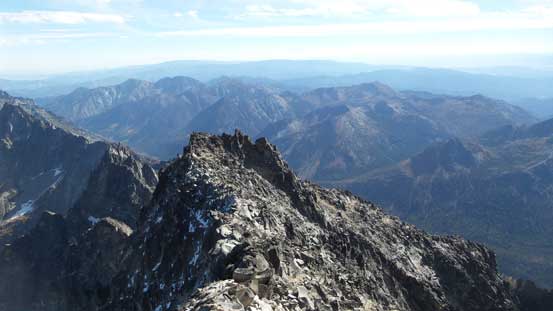
The false summit ahead
Looking back towards the true summit

Vlad descending

That’s the typical terrain we’d descend.
Down, down…

Looking sideways across. Sherpa Peak on bottom right

Looking back..

A lone larch

Descending Cascadian Couloir

Down the couloir now, looking back

Descending that water course gully
It’s never ending…
Into the vegetation now, looking back..

Almost down to the Ingalls Creek valley now..
It felt like a long process to get down into the valley floor. Picking up the trail we took another break for some food and water (there’s a neat creek to fill up our water bottles), before committing to the next section which none of us was looking forward to. The 500-m grunt didn’t feel as long as I thought it’d be. The larches were on their show and the view of Mt. Stuart kept improving the further we went. Once cresting the Longs Pass we took another break and I did my usual switch of footwear back to the sneakers.
Another lone larch..

Plodding back up towards Longs Pass
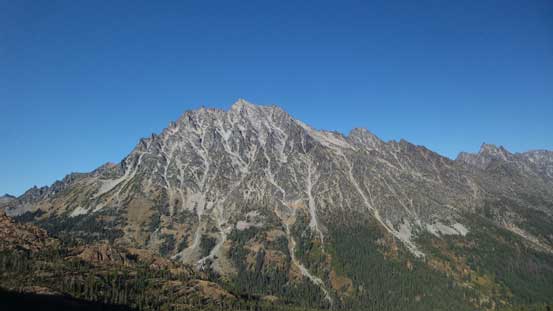
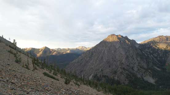
Afternoon view of Mt. Stuart’s south face

Longs Pass now.
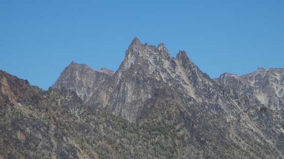
Argonaut Peak doesn’t look easy to ascend neither…
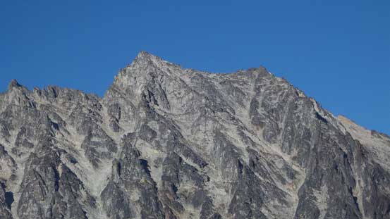
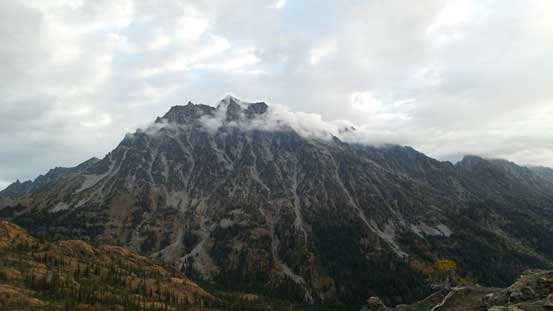
A zoomed-in view of the summit of Mt. Stuart.
This is an unnamed peak looking north. Ingalls Peak pokes behind to the left
Down the trail it’s just a simple game of putting one foot in front of another. Lots of people were still going up which showed the popularity of this area. I have to say that the Americans do great job building and maintaining their trails. The switchbacks were well built so that and the grade was steep enough for efficient travelling, and yet not too overly steep to put more pressure on our knees. Back to the parking lot our round trip time was 10.5 hours.

Very neat scenery here. The rainshadow side surely offers some different views!

To be honest the vegetation here looks more like the Rockies..
Descending the trail.
I was not particularly looking forward to the long drive back home but I had to face it. It was cool to see the surrounding mountains in daylight time as I had previously never been to Snoqualmie Pass or anywhere beyond, but then the darkness fell and it’s a tiring game to get us back before midnight.
