Excelsior Mountain
October 6, 2012
2744m
Jasper – Skyline Trail, AB
I had my eyes on the Jasper Skyline north section traverse (Excelsior, Center, Amber, Tekarra) since I snowshoed up Signal Mountain back in February. Signal Mountain is rather a bump on the north end of the range. This Thanksgiving long weekend seemed like a perfect time to try this “experimental” traverse. There’s very limited route beta for these peaks, and in fact, I couldn’t find any trip report for Excelsior Mountain nor Center Mountain. Soloing all three days didn’t sound very appealing to me so I decided to take my mom on the trip. She hadn’t done a hike since June so I wouldn’t let mom join me up this traverse as I had to speed things up if I wanted to success. The parking lot is pretty close to Maligne Canyon so she could always find something to do.
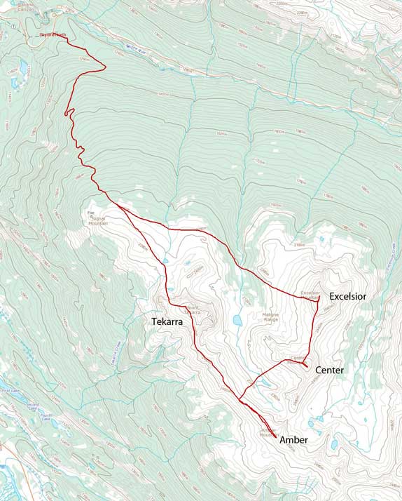
Scramble routes for Excelsior, Center, Amber and Tekarra
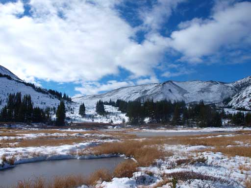
The 5:30 alarm couldn’t wake me up in the morning, as it was too cold.. I re-set my alarm to 6:30 but still couldn’t get up in time.. Anyway, I finally started the trudge at 7:30am. If I could get up earlier, the day would be more enjoyable, but now, I had to rush throughout the day. For those of you planning on Jasper Skyline, make sure you get mentally prepared for the initial 2 hours trudging up Signal Mountain road. You had almost zero view along the way, and the road just went on forever.. I encountered snow from about 300 m vertical meters up. Thankfully the snow was only about 10-15 cm deep. If I had to start post-holing at this stage, I definitely wouldn’t make it… But the snow did slow me down a bit. The Skyline trail became harder and harder to follow as I progressed through. I lost the trail for a few times in some large meadows, but I managed to re-gain the trail soon. The clouds were lifting up now and that was really encouraging. The trail hugs around treeline traversing below Signal Mountain, and circumvents the northeast ridge extension of Mount Tekarra to its back side.
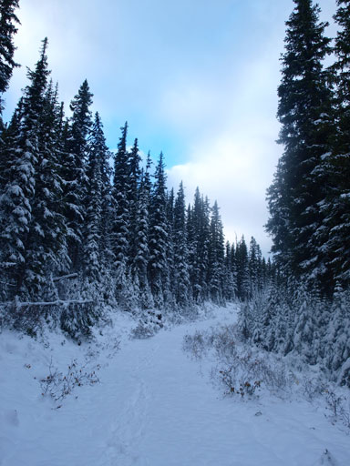
Typical view from the boring approach trail/road

Pyramid Mountain seen from Skyline Trail
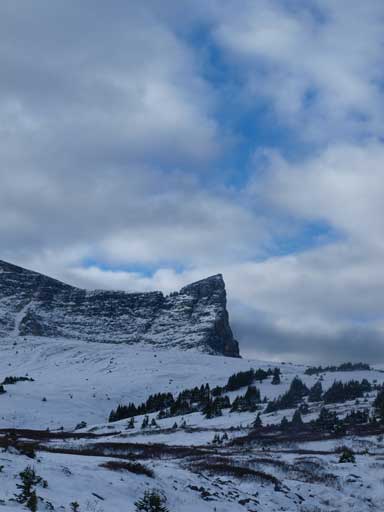
An outlier of Mount Tekarra

The new snow was still not thick enough to completely cover the trail.

Looking towards Signal Mountain. It’s almost winter here..
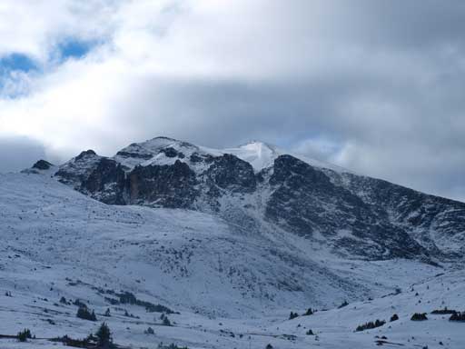
Mount Tekarra. My descent route is the right gully of the obvious two.
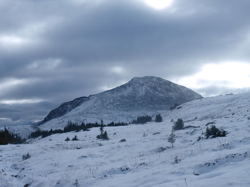
Now, here comes Excelsior Mountain
What was appearing to be very close, Excelsior Mountain, seemed to be very far away now, because there was apparently a significant amount of elevation loss to get down to campground Tekarra… Well, I didn’t pay attention to the contour lines on the map, so I wasn’t mentally prepared for this part. At least it was down-hill so the hiking was relatively fast, and I soon made down to the campground. It’s 15 km one way to get here from parking lot.
Excelsior Mountain appears to be quite far away now due to the elevation loss to the campground
Zoomed-in view of Mount Tekarra. Not sure if this is the summit or not
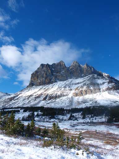
Mount Tekarra
The Skyline Trail goes this way. It will go up the ridge and then traverse left.

Another view of Mount Tekarra from near the campground
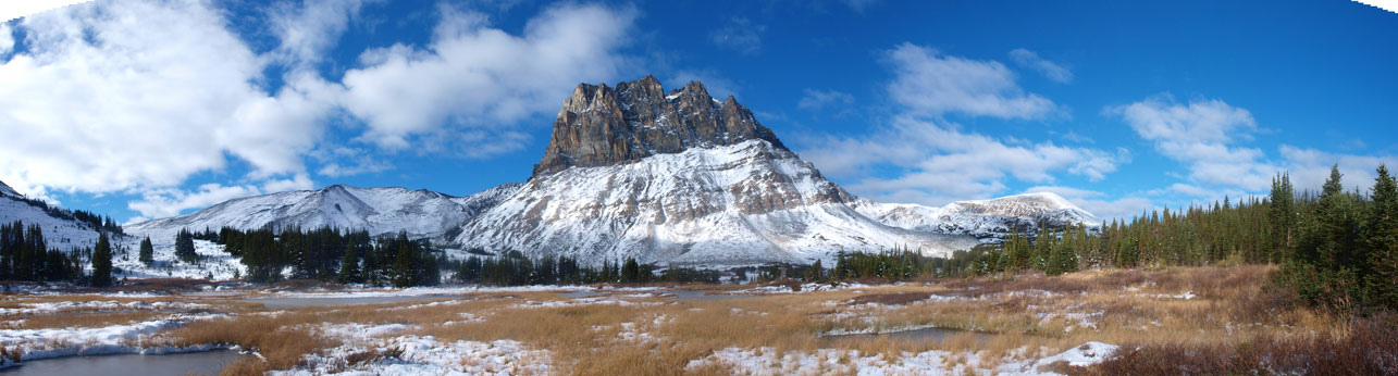
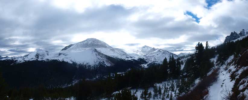
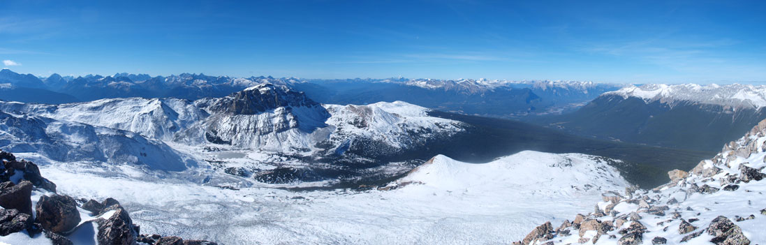
Panorama from near the Tekarra Campground.
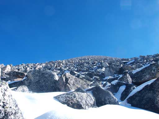
Excelsior Mountain was the big slope directly ahead of me, and looked to be straightforward.. Really? Not with snow on… After re-filling my water bottle at a nearby stream I crossed the stream and bushwhacked straight up the slope, only to find I actually topped out on a small hill… Damn, I had to lose some elevation then.. But anyway, I dropped down to the creek bed again, and now I could ascend straight up. I soon broke through the treeline, and now what… A giant slope of snow covered boulder field. What looked like to be a giant rubble slope turned out to be quartzite boulder field as I got closer… This could be fun in dry condition, but when wet, the scrambling could get very tricky. I had to hands-down regularly to prevent me from slipping. Slipping and falling on these boulders could result in serious injury so I had to be careful. The slope went on forever, and it felt like eternity.
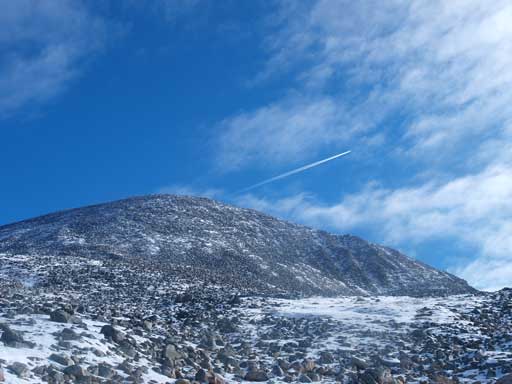
The upper slope of Excelsior Mountain, a giant boulder field
Typical terrain for 500 vertical meters.. Oh Man…

Looking back at Mount Tekarra. I had to get higher than it.

The summit is finally in sight! Still had to be very careful not twisting my ankles on this type of terrain.
I suggest you to constantly look back at Mt. Tekarra, not just because of the view, but also it gives you a good perspective of how far you still have to go. You gotta get higher than Tekarra. The slope itself is very very foreshortened. It took me 6 hours to get up Excelsior from parking lot, which was much slower than anticipated… A big WOW moment was waiting for me at the summit. This is quite a lofty summit as I was looking down at most nearby peaks except for the distant giants like Edith Cavell.

Summit Panorama. Click to view large size.
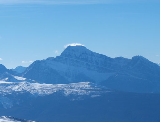
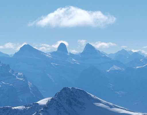
Mount Edith Cavell

Mount Fraser and part of The Ramparts
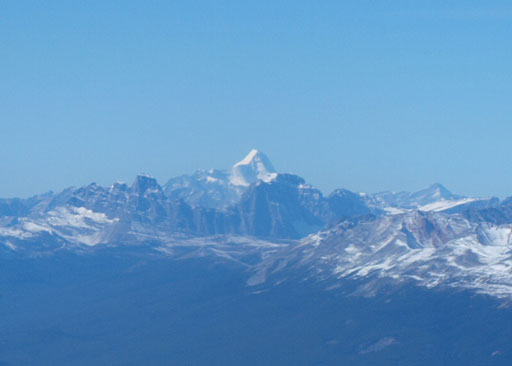
Mount Robson
The Maligne Lake giants – Warren, Charlton, Unwin
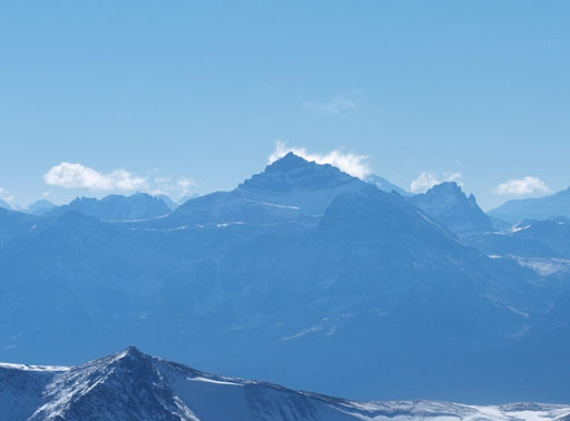
Mount Kerkeslin
Christie, Brussels, and Lowell
Mount Fryatt

Mount Edith Cavell on left, Trident Range on right
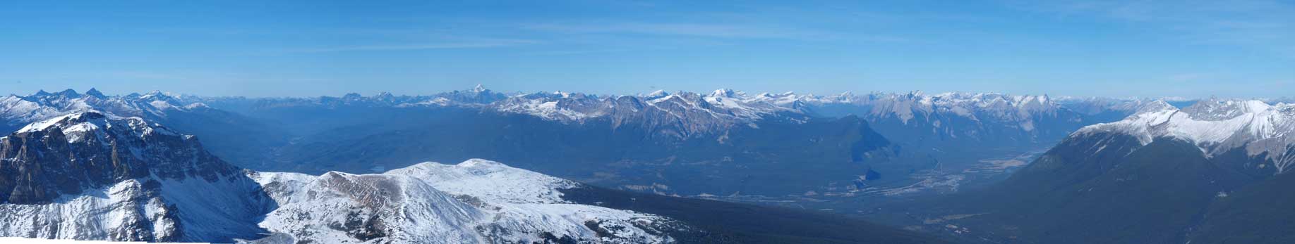
Panorama of Victoria Cross Range across Athabasca Valley. Mount Robson is visible.
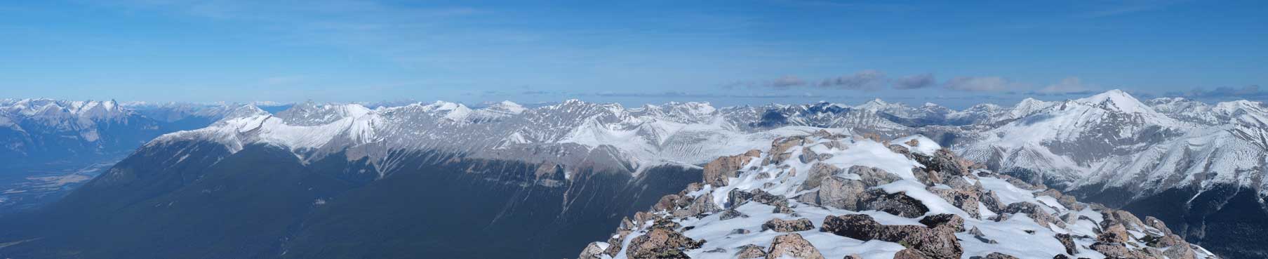
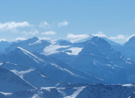
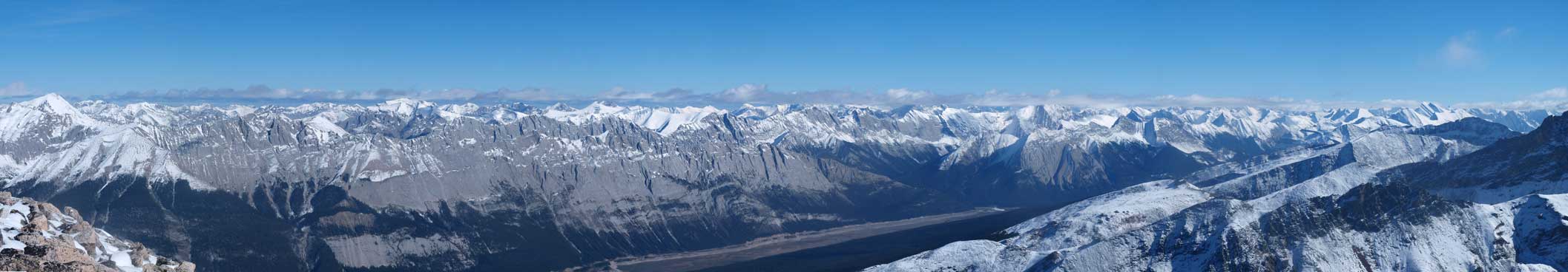
Colin Range Panorama
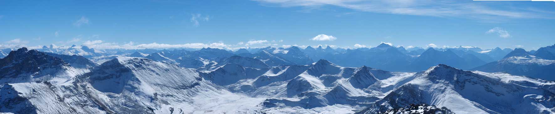
Queen Elizabeth Range Panorama
Looking south. You can see Charlton, Unwin, Kerkeslin, Christie, Brussels, and Fryatt

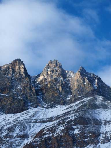
Geological survey party had been up here!

The connecting ridge to Center Mountain, my next objective.
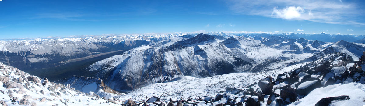
Panorama looking north. This is the valley that I came from.
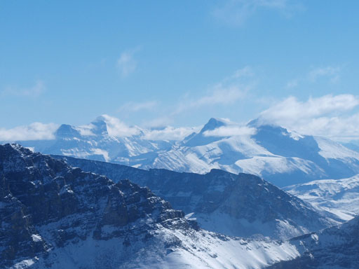
Panorama of the south side. The Watchtower (highest on Skyline area) at center.
I didn’t do the necessary summit stay as I was quite behind schedule. I really had to speed up a bit. I quickly made my way down the west ridge towards my next objective, Center Mountain.
