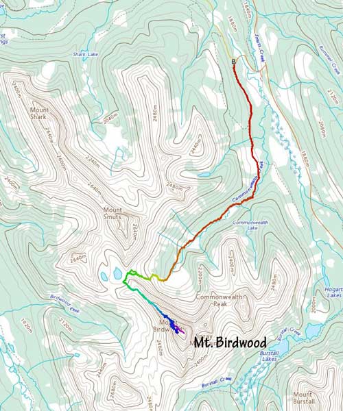
Mount Birdwood
August 13, 2021
3097m
Kananaskis Country, AB
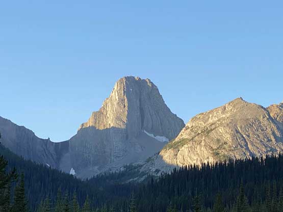
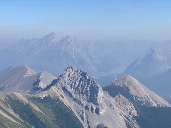
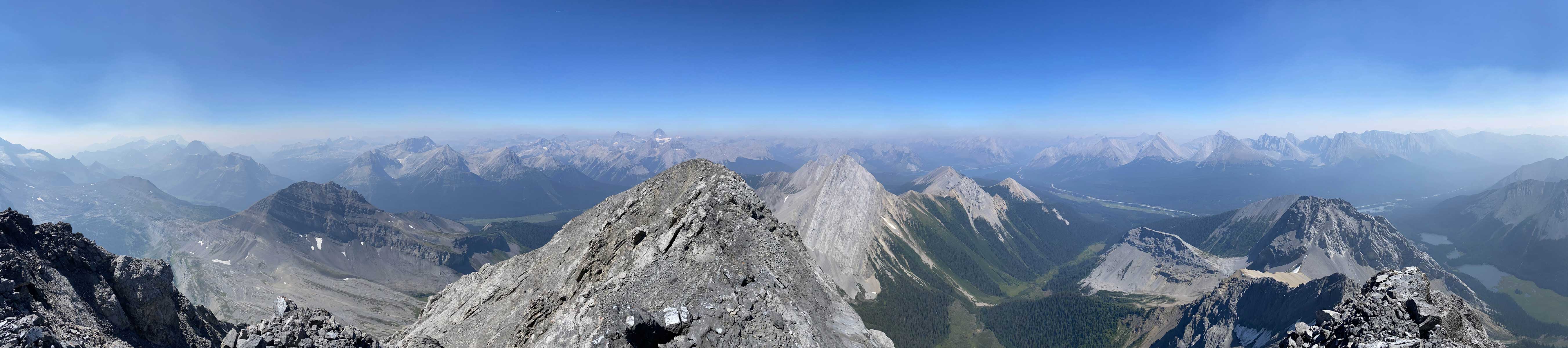
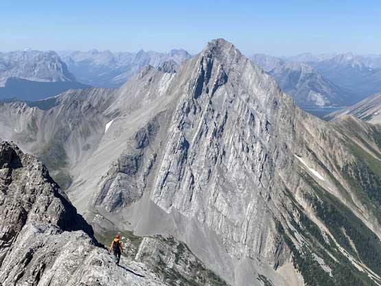
Mt. Birdwood is one of the most iconic peaks in Kananaskis Country especially when viewed from north-west around the vicinity of “Smutwood Peak”. These days the beauty of this area had caught attention to much more beyond the immediate Canadian Rockies community and the nearby “Smutwood Peak” had become an Instagram hotspot. Those who frequent social media these days all know the classical picture of Mt. Birdwood’s NW Ridge taken from “Smutwood Peak” and hikers come from all over the continent to grab that shot. Back when I did “Smutwood Peak” in February 2013 on snowshoes this made-up name (given by Andrew Nugara) had just started to appear on the internet. And a couple months before that I scrambled Mt. Smuts, at the time considered as the hardest scramble in Alan Kane’s Scrambles in the Canadian Rockies book. This status had changed in the 3rd edition of his book as Kane had added a few harder peaks. For Mt. Birdwood, the Lizzie’s Ridge (5.7) on the SE side used to be the more popular way but nowadays the “standard route” seems to have shifted to the NW Ridge (5.4) from Smuts Pass, as it’s easier, more aesthetic and had gained more exposure through trip reports and social media.
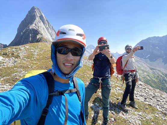
I had been looking for an oppourtunity to come back to the Rockies to climb this mountain but in the last several years I was too busy with the 11,000ers. This year when Oakley, Yanick and I decided to team up for something I knew instantly that Mt. Birdwood had to be down. Our primary objective was Mt. Louis via Kain Route and once that’s done on Wednesday, we immediately decided on Mt. Birdwood on Friday with one rest day in between. I again, slept in Yanick’s home and drove Yanick to the Casino just outside the boundary of Kananaskis Country at 5 am to meet up with Oakley. We then all piled into Oakley’s full sized truck and within an hour we were at the trail-head of Smuts Pass. There were already several cars parked and we later realized that a total of 30 ish people had gone up “Smutwood Peak” on this same day, and that was not even on a weekend.
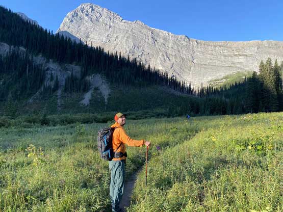
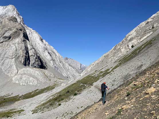
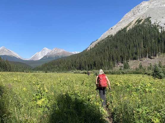
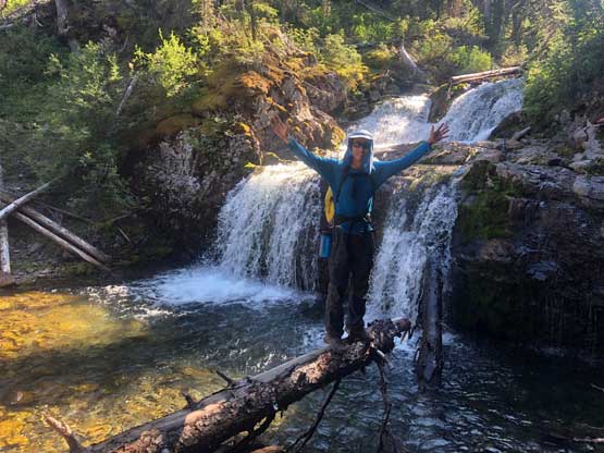
The morning was surprisingly chilly with temperature showing only 4 degrees but we knew it’s going to become hot as soon as the sun’s out. The first 2.5 km was a boring walk down a deactivated logging road and in fact, it could have been more pleasant if we had bikes. Unfortunately I do not own a bike nor do I have a way to store and transport it. The trail was no longer bikeable as soon as we reached the end of the old road and immediately after that we came to a small set of waterfalls. From here onward the trail was a bit overgrown and the bushes were wet thank to the morning dew, but the direction was easy to follow. We marched across a long stretch of flat meadows/swamp area before reaching that steep and unrelenting 300-m grunt onto Smuts Pass. To our surprise the trail on this steep section was still well-defined even on the scree. At the pass we met a group-of-8 who just came down from “Smutwood Peak” after watching sunrise from the top, and that explained the two extra vehicles at the parking lot when we arrived.

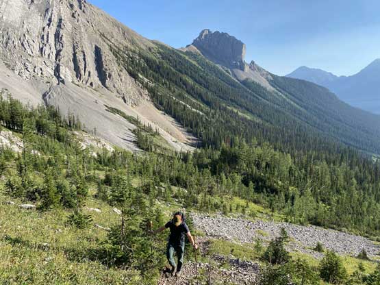
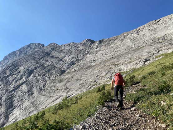
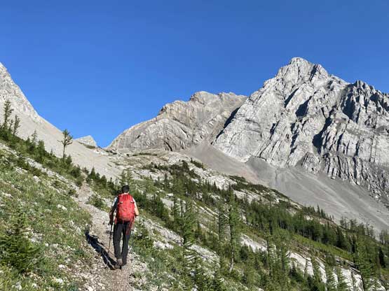
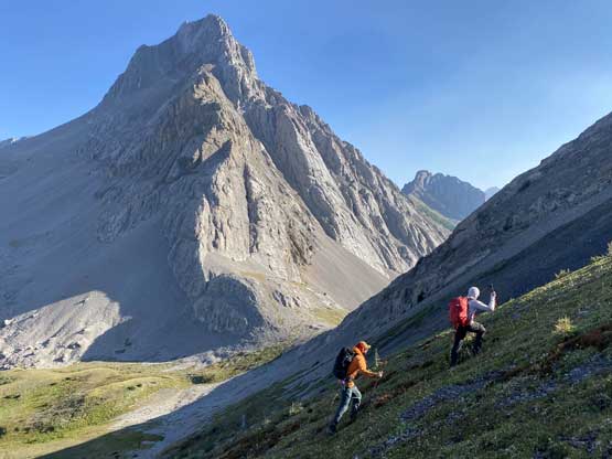
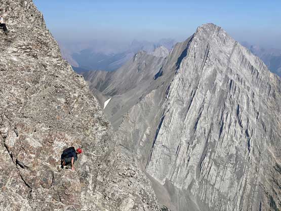
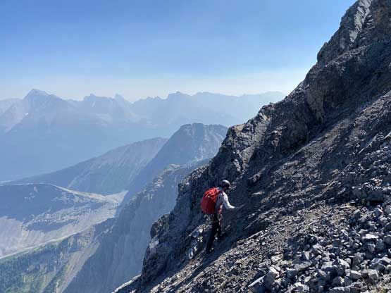
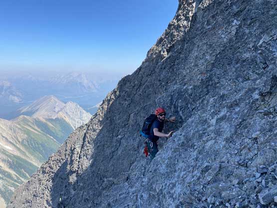
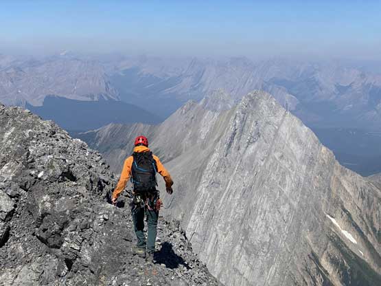
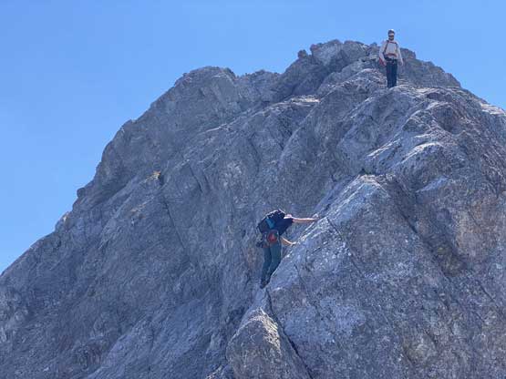
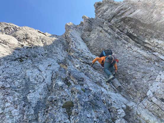
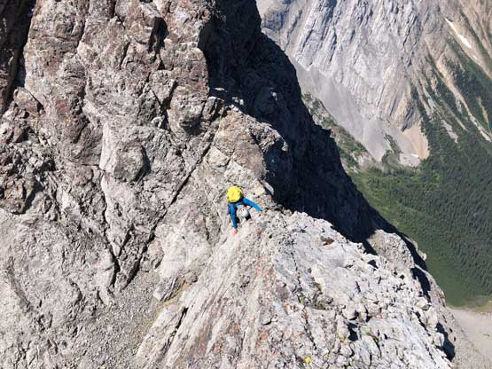
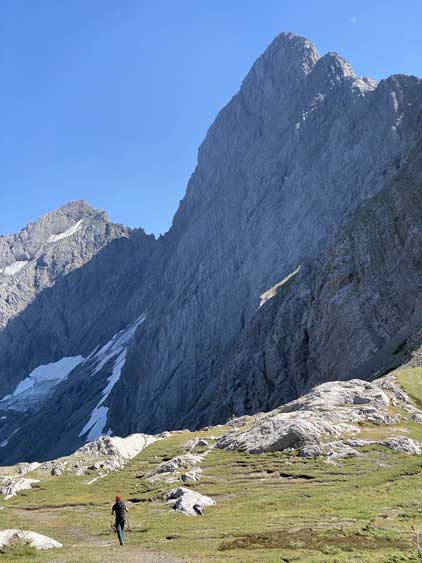
Instead of tackling the ridge of Mt. Birdwood directly from the pass we followed the path/trail for a short ways towards Birdwood/Smutwood pass and as soon as “making sense” we left the trail and grunted another 200 or so meters towards a subsidiary bump on Mt. Birdwood’s NW Ridge. When I did “Smutwood Peak” on snowshoes I also came to this spot just for more views. We did a long break ditching a bunch of gears just before hopping onto the NW Ridge proper. I swapped trail-runners for mountaineering boots, ditched one pole but carried the other pole and also carried my rock shoes. The lower half of the NW Ridge was just a scramble, sometimes loose and exposed but never exceeded “class 3” by any definition. The spice did not pick up until we arrived at a notch and from here onward the terrain would become unrelentingly difficult, more because of the loose rocks and unprotectable nature.


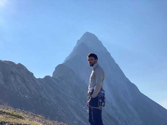
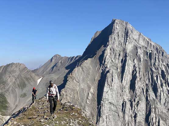


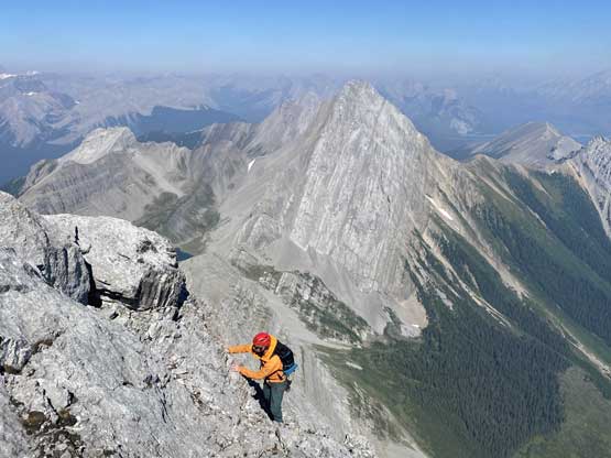
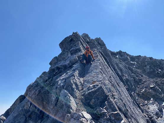
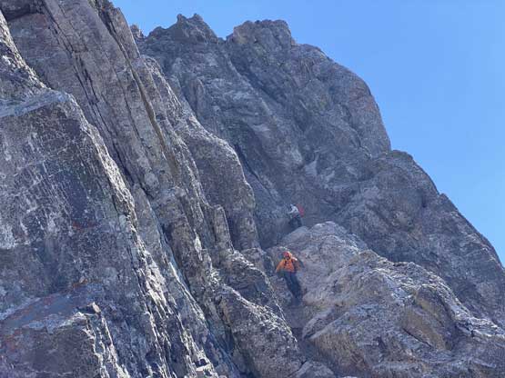
The down-climb into the notch was not easy. There’s one massive rock flake and had I pulled on that flake the down-climb would be much easier, but I just couldn’t commit to trust that. Instead, I wedged myself into the off-width between that flank and the wall and that was a tad awkward. To climb out of the notch we all opted to just scramble the ridge, which was extremely exposed but with more solid rocks (5.4). After this first crux zone we had a section of easier terrain but the second crux zone showed up in no time. It’s very obvious that attacking the ridge directly was not an option and the only possibility was to traverse a loose ledge out towards climber’s right until seeing a feasible line to climb back onto the ridge. This “feasible line” was not difficult to spot, but required a lot of care due to loose rocks. The climbing was again, no harder than 5.4 but the rock quality and the exposure meant we had to be 100% in our element. Yanick discovered a rusty anchor on a spot that was not where we topped out. He went down to inspect it and said it was not a great one so there’s a good chance we all had to down-climb this pitch, which none of us was happy about.

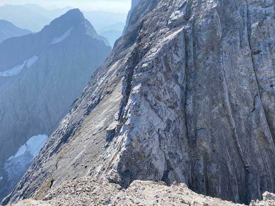

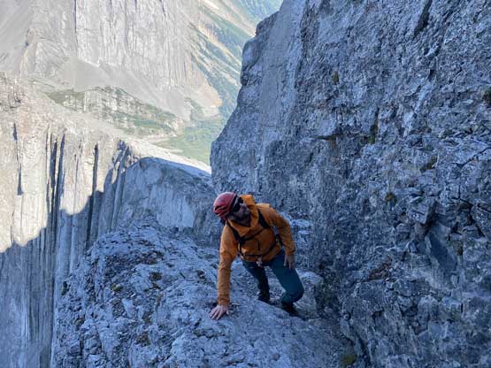

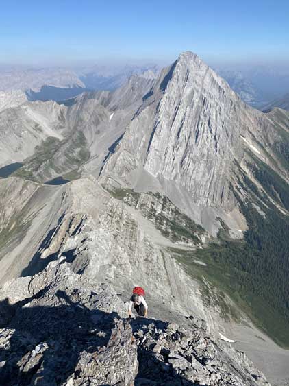
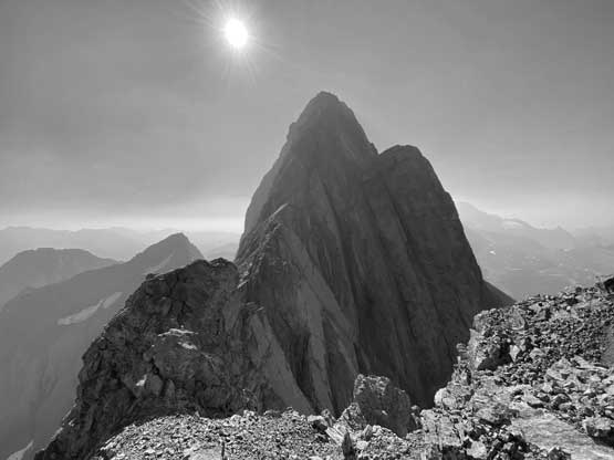
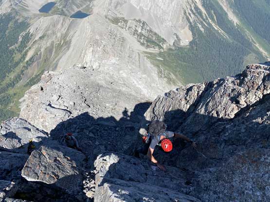
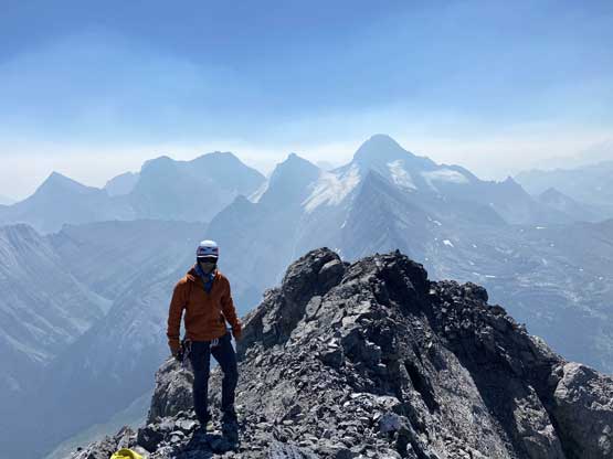
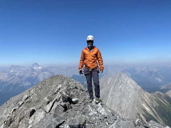
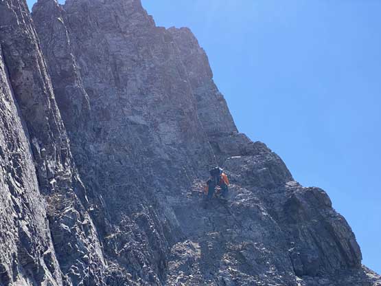
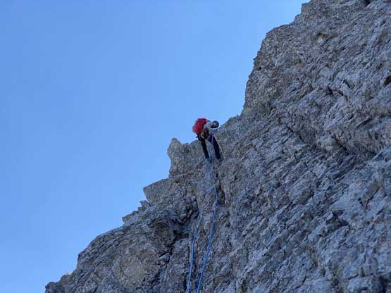
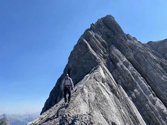
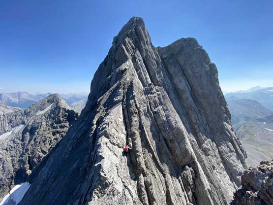
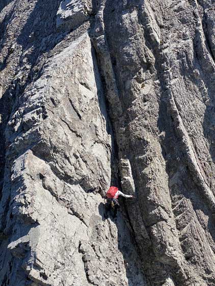
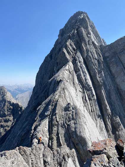
The exposure and the looseness of the terrain never seemed to ease on this ridge but the climbing difficulty did ease a bit after this second crux zone. Occasionally we had to detour a short ways to either the left or the right side of the ridge but never for a notable distance. There were a few slabby climbing stretches but those were all on solid rocks and I felt comfortable on the rock shoes. Soon enough the ridge narrowed down to another knife edge and the terrain ahead appeared rotten. Oakley decided to wait at just below this knife-edge while Yanick and I carried on. We weren’t far from the summit at this point, but there’s no sign that the going would become any easier or safer, and our prediction was true. There was still one or two cruxy zones higher up. One spot required a short detour to the right just like the second crux lower down, and the other involved a pitch of 5.4 ish climbing on very shitty rock with severe exposure. There were anchors above both of these spots but none of the anchors looked bomber. We were also disappointed by a couple false summits. The true summit was on the far side of the ridge and the traverse there required more balancing over knife-edge ridges. The celebration was short as the descent would not be much easier.
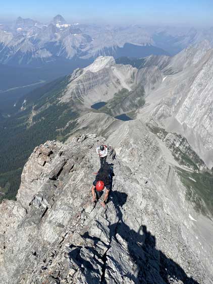


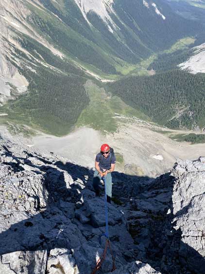
I thought we for sure needed to rappel almost every crux spot but once there we just decided to down-climb until we no longer felt comfortable. I was wearing rock shoes the whole way since the notch, and although uncomfortable on the feet, they definitely boosted my confidence on rocks, especially these grippy limestone. I could rely more on friction on very small, but solid holds instead of the loose and questionable ledges. In short time we were down to where Oakley was waiting and the three of us continued down-climbing. There’s one section where I didn’t even remember the difficulty that Yanick spotted a bomber pinch point to build a rappel station. Oakley and I each carried a 35-m rope so we rappelled and made a full stretch of the rope. After this rappel we had to traverse a shitty ledge to get back onto the ridge crest, and then we had to resume down-climbing. Yanick led us down that second crux section through a slanted chimney that none of us used on the ascent, and I really had trouble to fit myself and the pack into that chimney. As you all know I like to carry massive packs and this 50-L pack was a real no-fit for that section, but I somehow managed to turn around and down-climb the wall on climber’s left side using small holds and that solved the last couple meters. This was just the very top part of this crux zone so we still had a long and committing down-climb ahead, and we did that one at a time thank to rockfall potential.

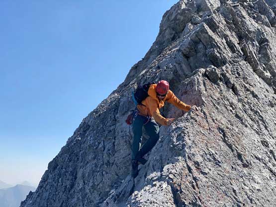
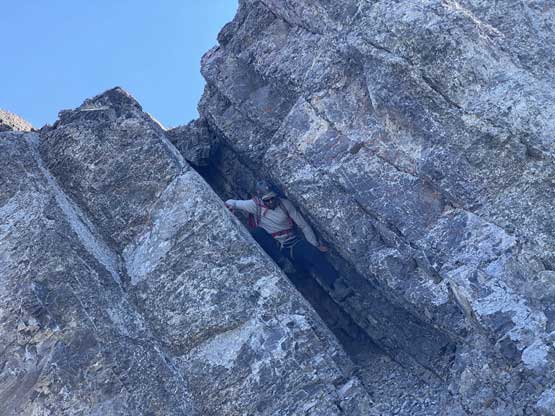
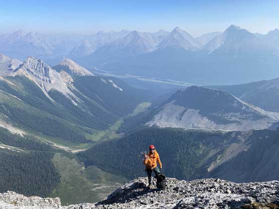
The next and the final obstacle was the notch. Yanick and Oakley opted to use the beta and down-climb the chimney on skier’s left side of the ridge but I just down-climbed that exposed ridge where we all come up from, as I thought it’s easier to deal with the moves that I already knew. On the re-climb of the notch I used several small holes on the outside of that big flake and gingerly made my way up without pulling hard on that flake, and this helped me avoiding any vertical pull-up or off-width kind of moves, which I kinda sucked at. Once everyone’s back on the safe side of the north I swapped rock shoes back to the mountaineering boots as my feet were really hurt at this point. The lower ridge was harder than I remembered and still required a lot of careful down-scrambling, but nothing worth-noting. At the gear dump I swapped mountaineering boots back to trail-runners and the run down to Smuts Pass was pretty fast and fun. The rest of the hike-out was much less fun and rather felt like a death march due to the heat. We passed several parties returning from “Smutwood Peak” and some of them were really struggling.


Our round trip time was under 11 hours which was kind of as expected. The climb was harder and more dangerous than any of us expected, but the fact we were able to solo the entire climb sans one rappel meant it wasn’t a long day overall. In terms of the climbing I would say it’s more of a peak-bagger’s route, meaning it has route-finding challenges, sustained looseness and exposure, but no real difficult climbing. I would not be surprised if a competent scrambler could get this done without a rope but it’s also significantly harder than say, the nearby Mt. Smuts. Overall not a recommended route from the quality perspective, but it is the easiest way to tag this beautiful summit, so make your own choice.
The smoke blew in obscuring any view the next day and I was also starting to feel sick. I evaluated the options and checked all sorts of forecasts and made a hard decision to leave the Rockies to head home. Over two days I made back home fighting some severe illness. I had to do a hotel stay in Chase as I thought I couldn’t sleep at all had I car-camped. The smoke was so terrible that by the time I got out of the room in the morning all cars were covered in a layer of ash, and then I was very lucky to not get stuck in the interior. The Coquihalla Highway was closed literally two hours after I drove through in the afternoon as fires were burning down to the road. There were two massive accidents on the highway including one camper completely burnt to ash and that was scary to watch.
Meanwhile on Saturday Yanick and Oakley, along with their friend Joe, took the bus to Lake O’Hara and the next day they climbed Hungabee Mtn. Unfortunately Yanick took a fall on the descent and died instantly. It’s been a few days after I got the news from Oakley and I’m still in shock. This was a very tragic loss to the Rockies climbing community. Yanick was a great climber, partner and mentor and would be missed forever.
