Stewart Peak
October 19, 2021
2238m
Chilliwack, BC
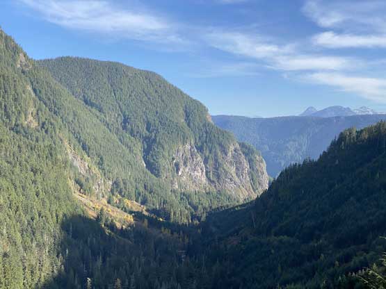
Stewart Peak is a small-ish but rugged summit that locates in the “middle zone” of Cheam Range. The access is from Airplane Creek FSR and the scramble is well documented in Matt Gunn’s Scrambles in SW British Columbia. Adventurous parties could take the SW Ridge for a more challenging scramble but the standard route, the SE Face/Slopes is a straightforward class 2-3 ascent. Folks who made the effort to come up this far usually prefer to combine a scramble of Stewart Peak with the nearby The Still, “Baby Munday North” and/or Knight Peak. The access road is very rough and the trail isn’t that pleasant neither, so it’s better to make the most use of a single foray. I had come up this way previously for a climb of the true summit of Baby Munday Peak. This time, in shoulder season conditions Elise, Ben and I checked off Knight Peak, the north summit of Baby Munday Peak and Stewart Peak leaving only The Still behind as my last summit in Cheam Range. This trip report also includes the portion of “Baby Munday North” as I do not want to count that sub-summit as a separate peak despite its inclusion in Matt Gunn’s book.
From Baby Munday/Knight col we ascended a short stretch of tedious rubble slopes to merge onto the snow couloir that eventually led us to the high col between Baby Munday’s north and central summits. This snow couloir was pretty steep but the snow condition allowed for some easy step-kicking. There were a few spots that I wished to have strapped crampons on, but those were all short-lived. From the high col we wrapped around to the “back” side and found the scramble route to gain the north summit. Thank to the fresh snow the scrambling had a few challenging steps but nothing’s really worth noting. The scramble was short and fun that in no time we were on the summit of “Baby Munday North”. The view of the true summit of Baby Munday Peak was incredible from this little peaklet.

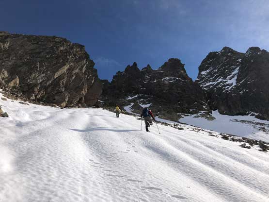


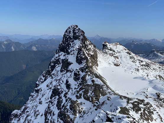


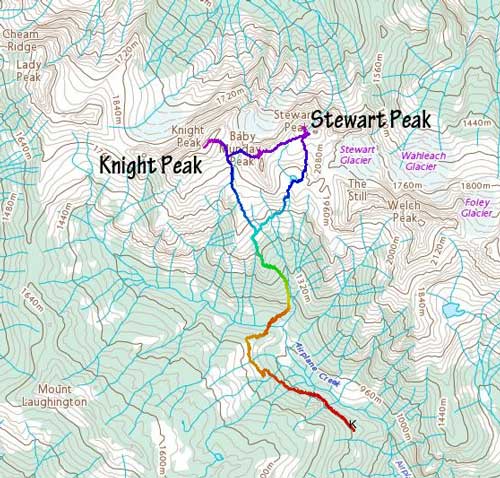
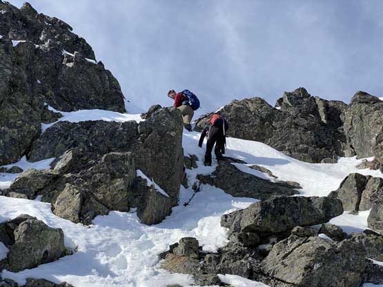
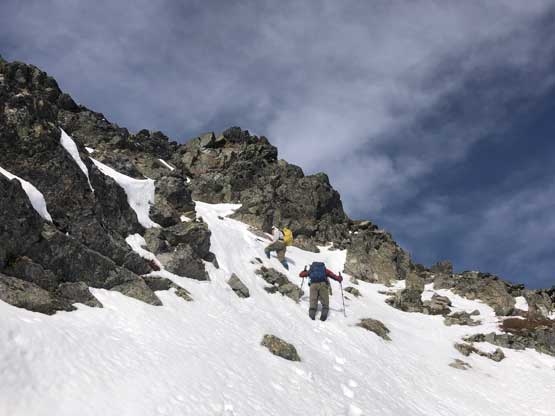
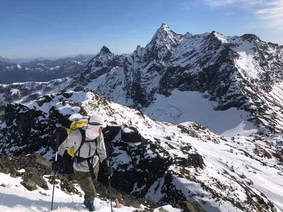
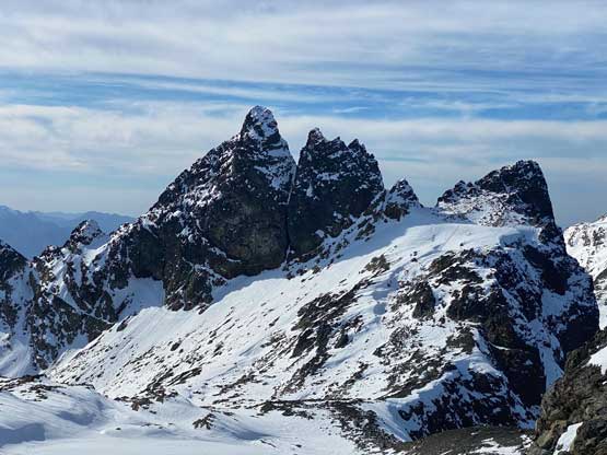
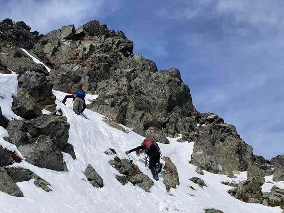
After taking enough photos we gingerly down-climbed from this peaklet and carried on the traverse towards the base of Stewart Peak. We linked a few short but fun glissades including one ride that was surprisingly icy. Stewart Peak looked imposing from most angles but I knew there supposed to have an “easy” route on the backside. We plodded across a small glacier then scrambled some snow-covered boulder fields to the base of the SE slopes. I could not spot a route as “easy” as most people made it sound, but that was because we had snow on the route. Nonetheless I led the way charging up the slopes. I opted to link up several stretches of steep snow instead of dealing with snow-covered rock scramble. A few spots had short, but 50-degree snow climbing and some treacherous wallowing. None of us brought an ice axe on this trip, but the snow conditions allowed us a passage to the summit of Stewart Peak.

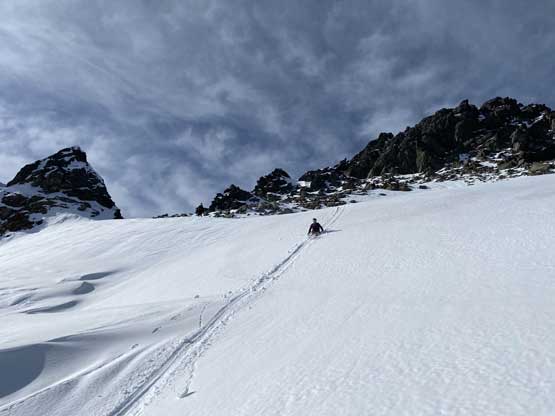
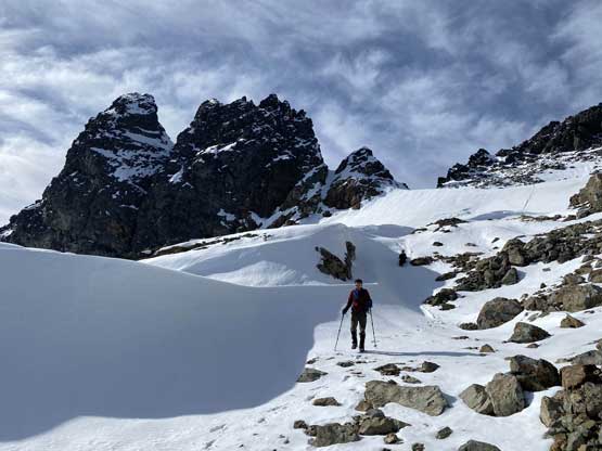


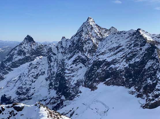


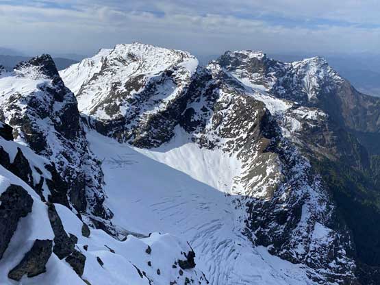


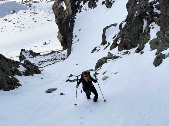
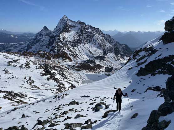
The summit wasn’t very spacious and there’s a cool breeze of wind so we didn’t linger too long up there. I briefly thought about to investigate some alternate routes but decided to just go with the known. The down-climbing wasn’t too bad. We then plunged down that small glacier into the broad valley between Stewart Peak and The Still. Ben had used this valley to approach and descend from The Still so we knew where exactly to aim for in order to close this loop. The descent towards a frozen tarn was unpleasant due to the fresh snow covering all the boulders and sometimes we broke through weak spots and post-holed passed our knees. There’s a helicopter flying around us for at least 15 minutes. At the time we had no idea what was going on, but later someone else said they were likely there to look for a recent plane crash. The tarn wasn’t completely frozen to walk across so we had to post-hole our way around the south shore and then hop across the lake’s outflow.


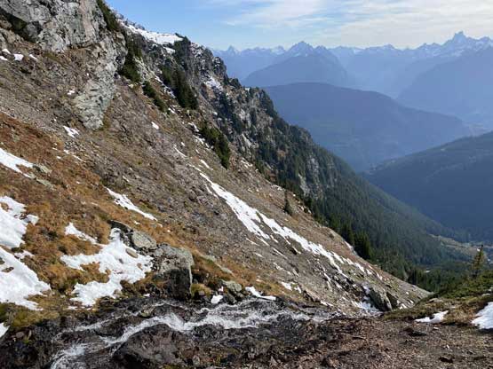
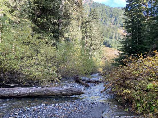
From there we descended the slippery dirt and scree slope directly beside the outflow creek for at least 100 vertical meters before making a decision to cut skier’s right to find the flagged path. We indeed found the unofficial trail and that eventually brought us back to the trail junction with Knight Peak’s access. The trail was very narrow at places. We then followed the trail to descend into the insanely steep forest but at least the forested descent was only 600 m, which was pretty tame for SW BC’s standard. Once back to the Airplane Creek crossing I spent a few minutes to swap footwear back to the trail runners. The rest of the return along the overgrown FSR was still wet even though there had been a full day of dry weather by this point.

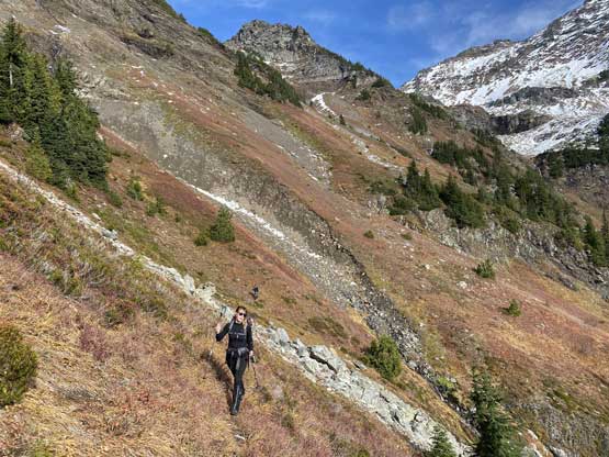


Our round trip time was just over 8 hours on a steady pace and we still had a few more hours of daylight time as spare. In retrospect I could have also added The Still into this trip but this is such a beautiful area that I would not mind a revisit. The access is not very pleasant, but also not a terribly long one. While driving down the rough Airplane Creek FSR I managed to not scrap the bottom of my truck at all, including negotiating that crux ditch about halfway down. The drive back across Foley FSR was ironically slower because of the never-ending pot-holes.
