Ember Mountain
May 21-22, 2022
2256m
Sloquet Creek / Garibaldi Provincial Park, BC
The “Fire Spires” on Terrarosa Glacier consist of a handful rugged towers but the highest one, Ember Mountain boasts a gentle slope from the south side. This group of peaks locates in a very remote area in the south-east corner of Garibaldi Provincial Park. Ascents of any of the Fire Spires are rarely heard these days. The access was used to be from the north from Fire Lake but the status of that road was unknown and one would definitely expect additional wash-outs from the apocalyptic storms in November 2021. The other access was from North Sloquet Creek but again, the bridge crossing that creek was pulled and the road had long turned into an overgrown mess and the elevation is too low for substantial snow coverage even in winter/spring. Then in May 2021 Matt Juhasz resolved the mystery by drawing an entirely-experimental route from the south-east side of Mt. Glendinning, by a direct attack of the insanely steep forested bluff above Sloquet Creek main-line FSR. I had also been looking at this aspect but I seriously doubted the feasibility of that steep forest. Matt then went for a gamble and succeeded in grabbing Ember Mtn. as a day-trip and since then, at least one party had followed. I can totally see this becoming the new-standard route which I would call the “Juhasz Route”. This is the most efficient way to get into the Fire Spires but needs a thick snowpack covering the bushes from 1000 m elevation onward to treeline so I don’t know what to expect in summer time.
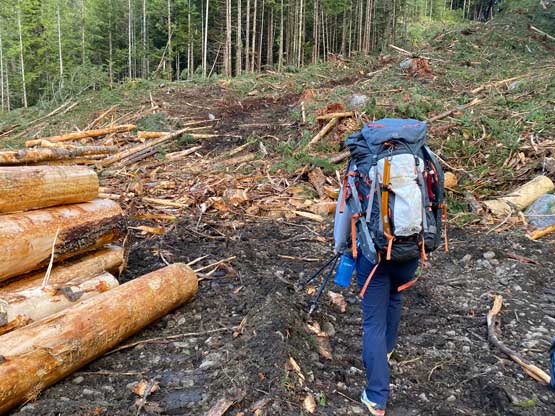
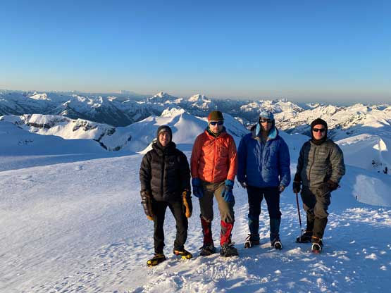
Asides from doubting the feasibility of Matt’s route the other reason I didn’t join Matt was because I wanted to overnight in the area and climb a few peaks in a single batch, including but not limited to Mt. Glendinning and Ashes Peak. Through the whole spring of 2022 I had been watching for a prime window but the trigger was not pulled until the Victoria Day long weekend. Four of us, Alex, myself, Phil and Francis were able to manage both Saturday and Sunday while Vlad and Chris could only manage Sunday so we would go in two separate teams with the overnight team setting up the tracks a day earlier. Instead of waking up at an ungodly hour the four of us managed to leave Vancouver on Friday evening at around 8 pm. The plan was to drive to at least Sloquet Hot Springs and hopefully the “trail-head” where Matt’s GPS track started. The road condition on Lillooet West FSR and Sloquet FSR was better than expected such that I was able to cruise down at over 50 km/h average in my Tacoma. We made to the hot springs at around 12:30 am. I was expecting a barrier at the seasonal closure sign immediately after the hot springs (as told by the other party in April 2022) but that was no longer there, so we drove an additional 3 km to Matt’s starting point. We soon understood the reason as they were actively logging the area so any “closure to motorized vehicles” do not apply to them as they are generating revenue for the province… I was exhausted and tempted to just sleep inside the truck, but everyone else was doing proper car-camping so I might as well sleep properly in Alex’s tent. I had lent out a bunch of gears to Phil/Francis including tent, down pants, aluminum ice axe, -18 C sleeping bag and sleeping pad so I had to set up that tent as well.
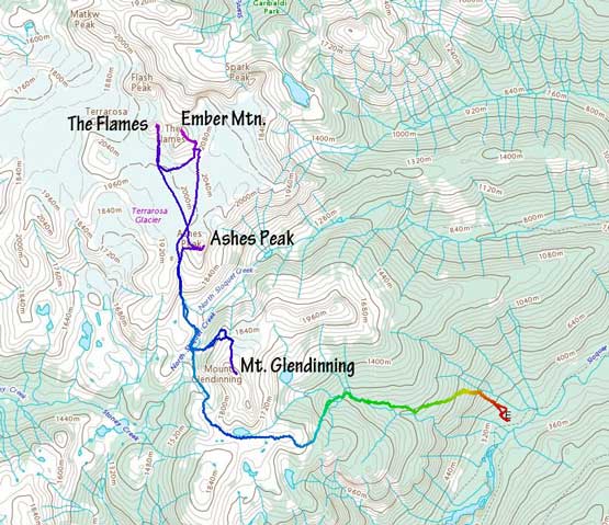
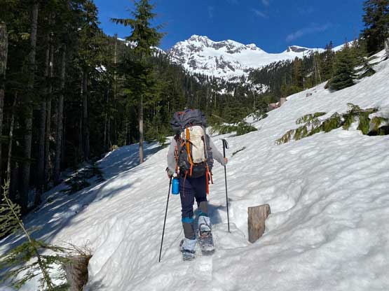
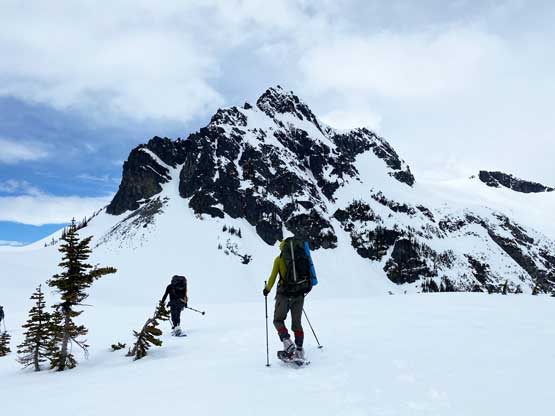
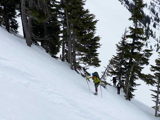
The plan was to wake up at 6 am but at 4 am logging trucks came to wake us up. I thought we were seriously screwed but Francis went out to talk to the guy and they actually allowed us to camp/park in their work zone. What a pleasant surprise. I still do not get why they were logging at 4 am on a long weekend Saturday but I guess they needed money really badly…. The consistent noise meant we could no longer sleep so by 5 am we might as well just get up and go. The lowest 100 m was messed up by the logging so we just walked on the newly-built roads. We did not walk to the very end as one machine was working to push the road even further and we didn’t want to directly encounter that guy (who wasn’t the person Francis talked to earlier). We bailed into the forest on climber’s left and soon started to just follow Matt’s GPS track. The route was obvious as we were ascending a rib feature for a while until directly underneath some imposing bluffs. The bluffs forced us to ascend a traversing line towards climber’s left and at the end of this traverse we scrambled through the “keyhole gully” that was mostly 3rd class on tree roots. That was the critical point of the “Juhasz Route” as this gully offers the only possible break through the forested bluffs. Once above the gully we maintained a diagonal bearing out to climber’s left. The terrain forced us to shoot straight the hell up but the GPS track told us to traverse left, so this next section needed some high concentration on route-finding and substantial bushwhacking. After about 500 m elevation gain from the truck we came to the upper edge of the first cut-block and soon after, the second cut-block (all from heli-logging). Instead of following the GPS track through the second cut-block I led us hugging the upper edge while staying in the old growth forest. This proved to be mostly free of bushwhacking. At the edge of the third cut-block above 950 m we suddenly encountered snow. We boot-packed across to the left (west) side of this third cut-block, made a short detour to load up our water bottles and strapped the snowshoes on, and this was just under 1000 m elevation.


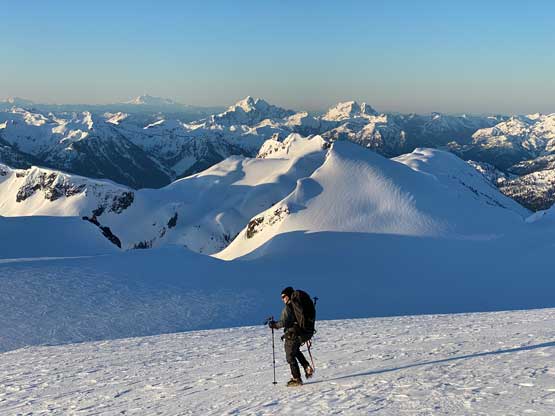
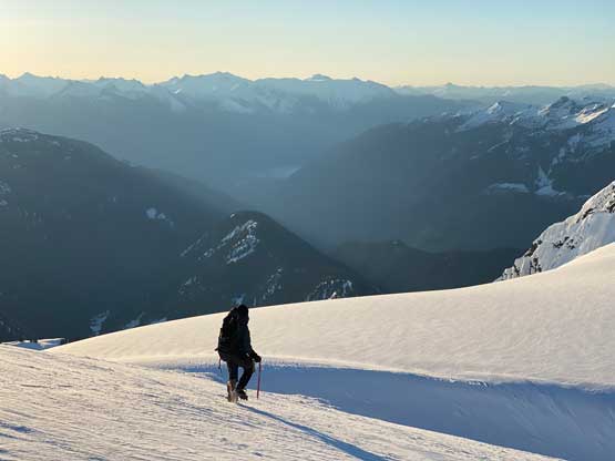
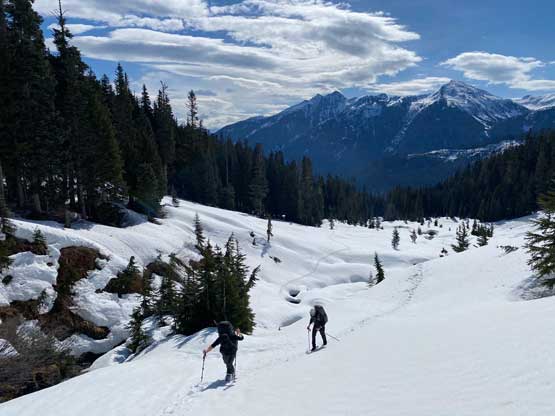
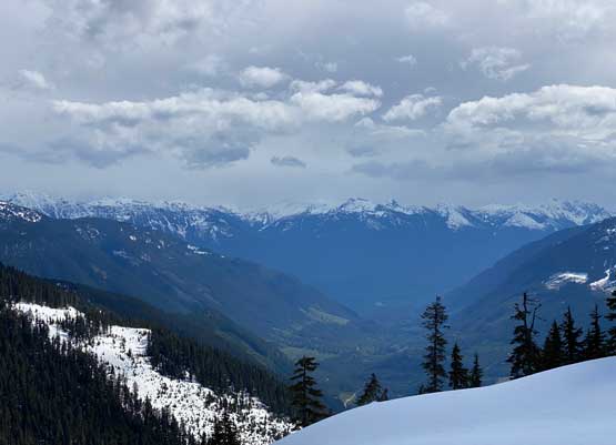
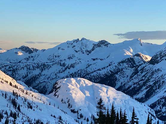
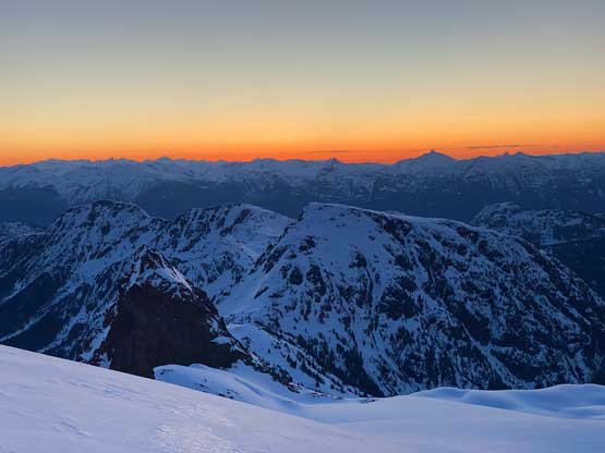
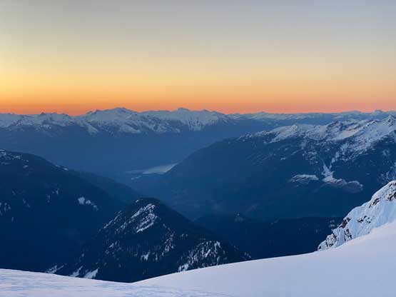
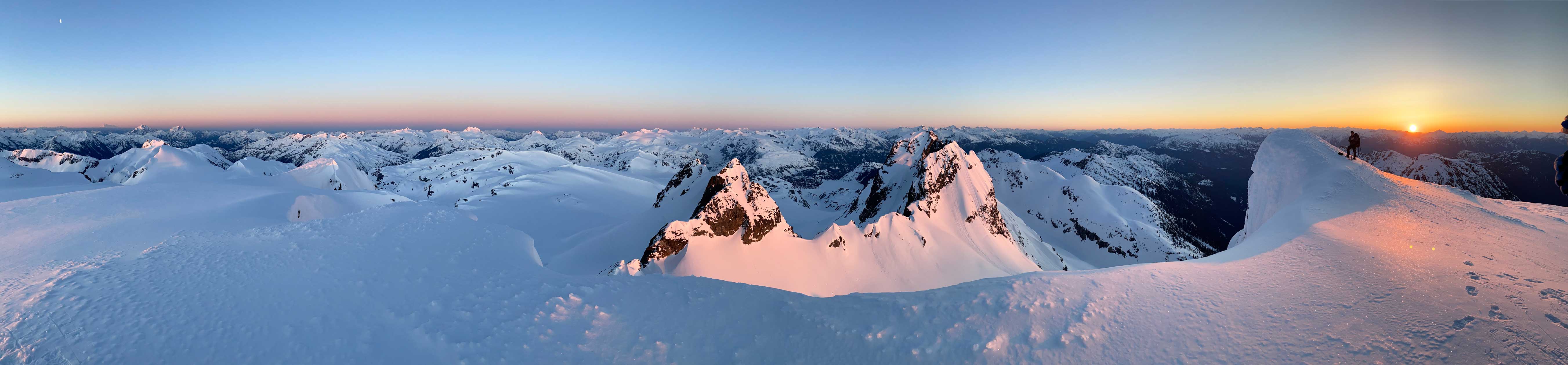
We were three weeks later into the season than Matt’s time in 2021 but the snowline was very similar and I actually think our snowline was slightly lower than Matt’s. This just shows how bad the weather had been in this spring, such that there was not a single 2-day weather window in about 2 months. It was then an easy fair to plod up the valley for a couple kilometers to around 1150 m elevation where we crossed the creek a couple times on snow bridges in order to stay on simpler terrain. This whole zone would be a shit show of alders once the snowline crept higher. At 1200 m we turned left into a smaller drainage that seemed like a mini-canyon and at the opposite end we came to another bowl of opening. This time Francis led us directly into Matt’s descent chute, the crux of this approach. For the next few hundred meters of elevation gain we would simply put one foot in front of another up this 35+ degrees chute. The snow condition was mostly firm but a day later on the descent we would have some different stories to tell. The snow had started to turn into mush when we started the grunt from the end of the chute onto the SE shoulder of Mt. Glendinning at 1550 m elevation so this section took a while. Meanwhile some weather was rolling in rapidly from the east side. The views were started to open up so I quickly snapped some zoomed-in photos before losing visibility.


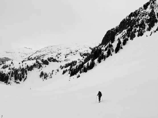
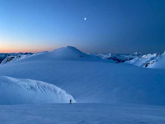
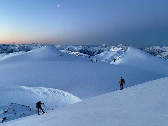
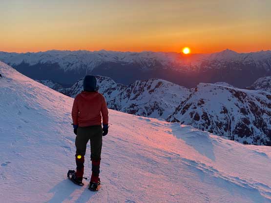
The next stage was a cruise-sailing to Mt. Glendinning’s south col at 1750 m with only minor micro-terrain to content with, but as expected the weather system moved in and we lost the visibility. We had to deal with flat light conditions and light flurries. From the south col we had to drop over 150 m elevation while contouring around the west flanks of Mt. Glendinning and this section was trickier than expected. We more-or-less stuck to Matt’s GPS track as we couldn’t see much ahead. There’s one steep but short traverse in the descending stage and then a long and steep side-hill traverse was required to ascend onto Glendinning/Ashes saddle. A few spots in this final traverse surely put our snowshoeing skills in test but the weather was slowly improving at least. We found a neat wind scoop at the saddle to drop our packs and spent the next hour setting up tents and relaxing. We left for Mt. Glendinning at 2 pm and made back two hours later. I then took a nap in the sleeping bag (-32 C rating) as there’s literally nothing else to do. I woke up about an hour before sunset, cooked dinner, did some photography and went back into the tent. The alarm was set at 3 am and the plan was to watch sunrise from Ember Mountain summit.


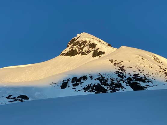

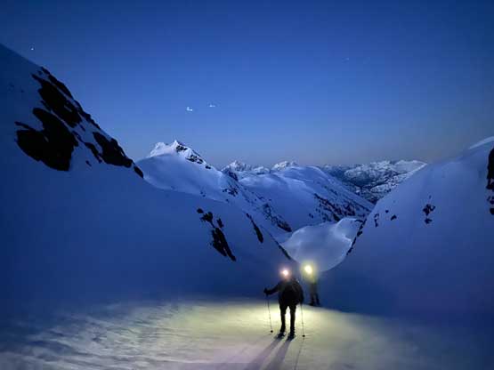
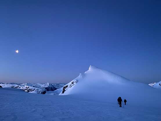
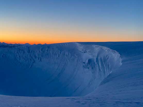
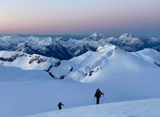
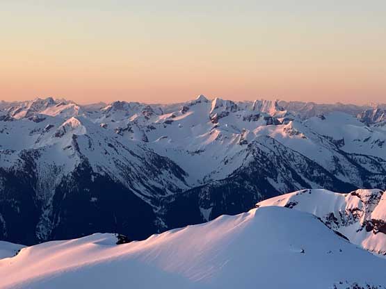
In the pitch dark we descended slightly onto the frozen lake immediately below our camp and plodded across the lake. The far (north) end of the lake had a bit of micro-terrain that wasn’t very obvious in the dark. We ended up traversing a bit farther than needed but we did find an efficient way to traverse into the foreshortened gully that would eventually lead us onto Terrarosa Glacier. Through this gully we ascended 300 m elevation on firm and crusty snow and then we popped out onto the icefield still in pitch dark. The plod across the icefield towards Ember Mountain’s SE slopes was longer than it looked. The ascent of Ember Mtn. was also trickier than expected with one steep roll that was on the edge of the capability of our snowshoes. The slope angle was approaching 40 degrees on a couple rolls and the conditions were rather icy. We made the summit about 15 minutes before sunrise so we got a full show from alpenglow to the golden glow. Two of us even caught cell phone reception on this remote summit and I updated my peakbagger app…


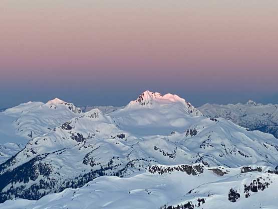


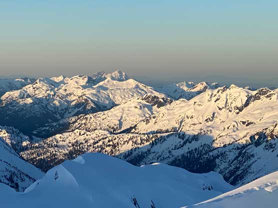


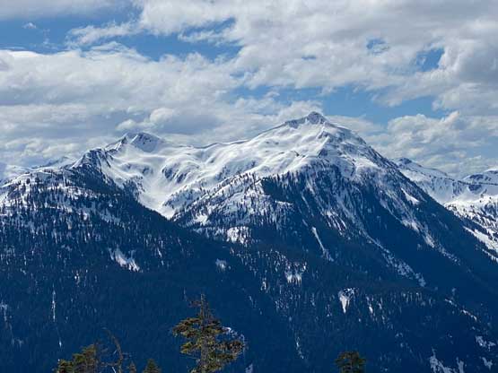
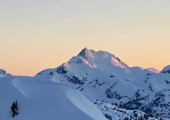
After having enough of the views we leisurely descended. Three of us opted to swap footwear to crampons. At this point I was still hoping for Matkw Peak so I led us away from our tracks contouring around the south side of Ember Mountain to the SW side, until I saw the south side of The Flames up-close. I already had a good view of the upper portion of The Flames (East/True summit) from the summit of Ember Mountain and now with the view of the lower route I determined that it’s possible to climb it while entirely staying on snow. Subsequently I changed my mind from doing Matkw Peak (which looked rather boring) to The Flames. The others weren’t keen so I borrowed a second ice axe from Francis and swapped crampons with Phil. My Petzl Irvis Hybrid weren’t ideal for steep front-pointing but Phil had brought a pair of steel crampons. The trip then continued with a solo climb of The Flames, followed by an ascent of Ashes Peak, and then a long and tiring descent and drive home.