Queen Mountain
August 19, 2019
1863m
Bonners Ferry, ID
Queen Mountain is a small, but prominent hill that barely pokes above treeline on the summit plateau on the northern tip of Idaho Panhandle. Other than the locals and prominent peak-baggers I doubt this peak sees much traffic because there’s literally nothing worth recommending about the hike. The logging road is drivable to the end by most vehicles and from there, the summit only requires 250 m elevation gain. Adam and I did it in the morning of our second day of this past peak-bagging road trip. Earlier in the trip we had ascended Northwest Peak and the plan of this day was Queen Mtn. in the morning and Scotchman Peak in the afternoon.
We drove up the roads in the previous evening. There were two options that we didn’t realize until we were there. Following the direction given by Google Map app we took the right (east) branch on the way up, and later took the left (west) branch on the descent which was longer, but smoother. The car-camping at trail-head was uneventful although signs warned us about grizzlies in the area.
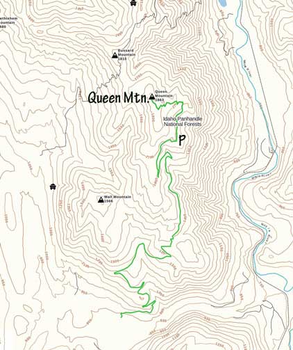
Queen Mountain hiking route. GPX DL
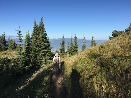
The next morning we woke up at sunrise and cooked some Indian breakfast. The first section of the hike was following the deactivated portion of the road to near Queen Lake. From the lake we picked up the trail ascending easily to the large “summit plateau”. We traversed the plateau to the northern end to make sure we did tag the highest point. There were fairly decent views down into Kootenai River valley despite the lowly nature of this peak.
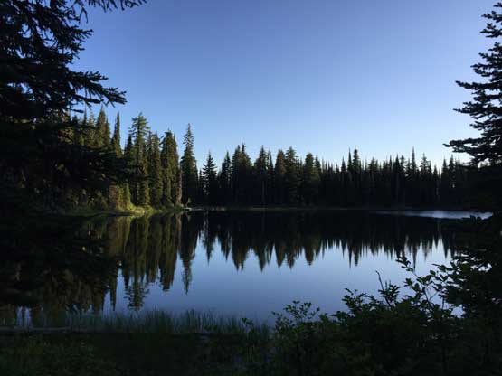
Queen Lake in the morning
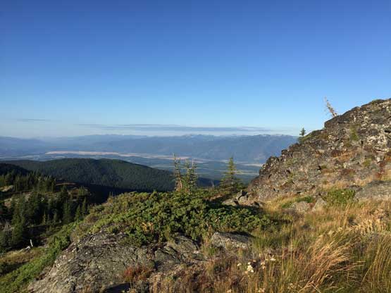
The views opened up near the summit
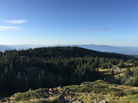
This is looking south across the broad hill on Queen Mtn.

Partial Summit Panorama from Queen Mountain. Click to view large size.
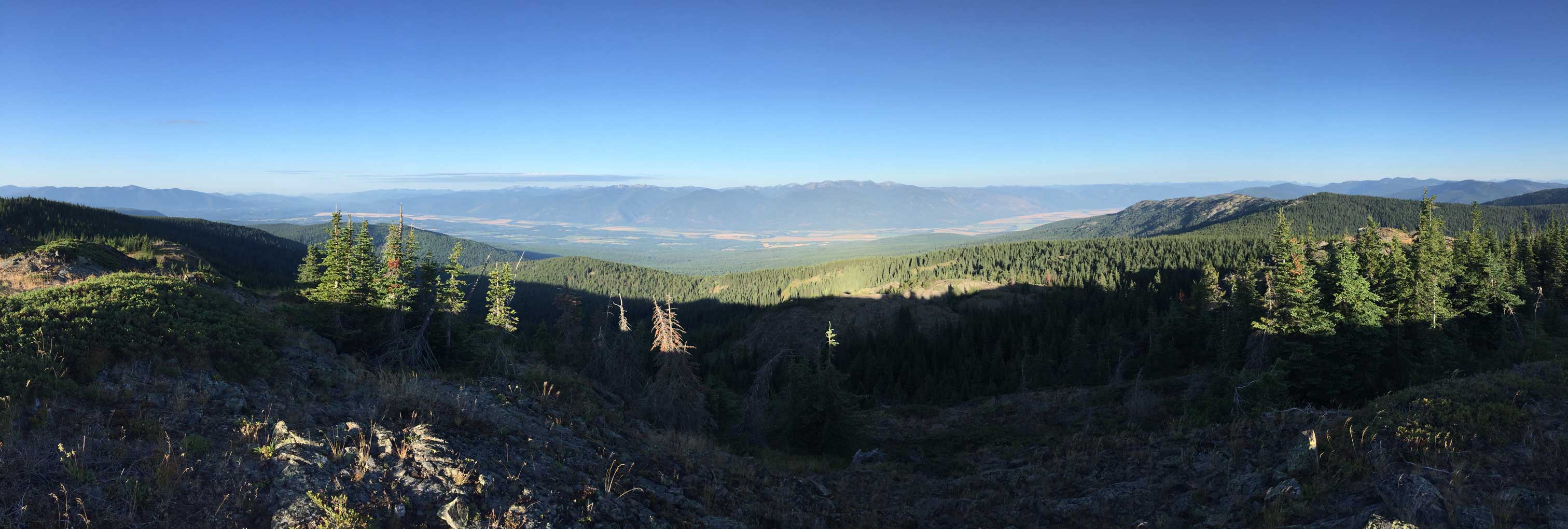
Partial Summit Panorama from Queen Mountain. Click to view large size.
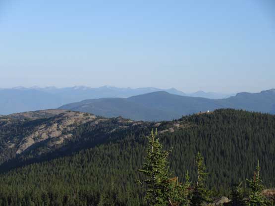
Looking over Bussard Mtn. towards peaks in Canada

The southern Selkirks across Kootenai River valley
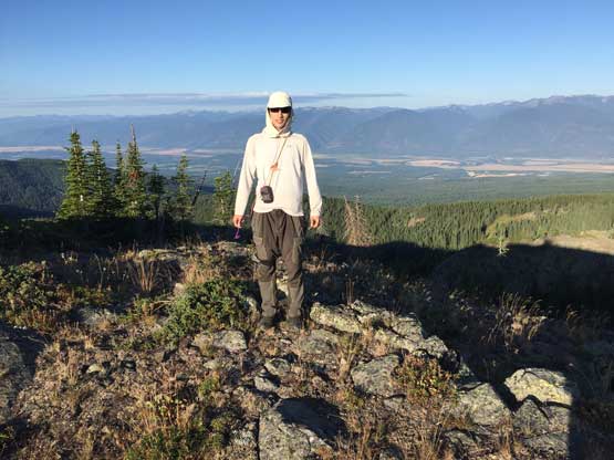
Me on the summit of Queen Mountain, my first peak in Idaho
The descent was uneventful and we were back to the parking lot in no time. On the drive down we opted to take the west branch and the reason was that we were interested in Wall Mountain as well, but after getting there we realized the spur roads were all chocked with alders, and none of us was in the mood of bushwhacking, so we drove down to Bonner’s Ferry.
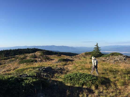
Adam hiking down the summit plateau
Picking up the trail

As much as the trail hike went
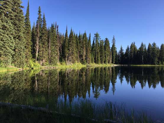
One last look at Queen Lake
After a quick stop in gas station we resumed the drive southwards towards Scotchman Peak‘s trail-head.
